
Highland Council wards 1999 to 2007
Encyclopedia
 |
| Highland council area Shown as one of the council areas of Scotland |
| 1995 to 1999 Highland Council wards 1995 to 1999 The first set of Highland Council wards was first used for Highland Council election purposes in 1995, for the first general election of the council... |
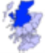
| 1999 to 2007 |
| 2007 |
The second set of Highland Council wards, 80 in number, became effective for election purposes in 1999, for the second general election
General election
In a parliamentary political system, a general election is an election in which all or most members of a given political body are chosen. The term is usually used to refer to elections held for a nation's primary legislative body, as distinguished from by-elections and local elections.The term...
of the Highland Council, and were used also for the third general election in 2003. These wards replaced 72 older wards, and were themselves replaced by a set of 22 wards for the fourth general election in 2007.
The Highland Council (Comhairle na Gaidhealtachd in Gaelic) had become a local government authority in 1996, when the two-tier system of regions and districts
Regions and districts of Scotland
The local government areas of Scotland were redefined by the Local Government Act 1973 and redefined again by the Local Government etc Act 1994....
was abolished and the Highland region became a unitary council area, under the Local Government etc (Scotland) Act 1994. The first Highland Council election, however, was one year earlier, in 1995. Until 1996 councillors shadowed the regional and district councils and planned for the transfer of powers and responsibilities. Elections to the council are normally on a four-year cycle, all wards being contestable at each election.
For the periods 1995 to 1999 and 1999 to 2007, each ward elected one councillor
Councillor
A councillor or councilor is a member of a local government council, such as a city council.Often in the United States, the title is councilman or councilwoman.-United Kingdom:...
by the first past the post system. In 2007, this arrangement was replaced with one of multi-member wards, each electing three or four councillors by the single transferable vote
Single transferable vote
The single transferable vote is a voting system designed to achieve proportional representation through preferential voting. Under STV, an elector's vote is initially allocated to his or her most preferred candidate, and then, after candidates have been either elected or eliminated, any surplus or...
system, to produce a form of proportional representation
Proportional representation
Proportional representation is a concept in voting systems used to elect an assembly or council. PR means that the number of seats won by a party or group of candidates is proportionate to the number of votes received. For example, under a PR voting system if 30% of voters support a particular...
.
The wards used form 1995 to 1999 had been subdivisions of eight council management areas, with councillors elected from each area forming an area committee
Area committee
Many large local government councils in the United Kingdom have a system of area committees, with responsibility for services in a particular part of the area covered by the council....
. The wards created in 1999, however, were not exactly subdivisions of the management areas, management area boundaries were not adjusted to take accoont of new ward boundaries and, therefore, area committees ceased to be exactly representative of areas for which they were named and for which they took decisions.
In 2007, the management areas were replaced with three new corporate management areas, each consisting of a whole number of the new multi-member wards.
Lists of wards, 1999 to 2007
Wards are listed by management area to which linked for area committee purposes.Badenoch and Strathspey wards
There were five wards related to the Badenoch and StrathspeyBadenoch and Strathspey
Badenoch and Strathspey as a local government district 1975 to 1996Badenoch and Strathspey is a local government ward of the Highland council area and a ward management area of the Highland Council in Scotland...
management area:
| Ward | Description |
|---|---|
| Badenoch East | Included parts of the villages of Aviemore Aviemore Aviemore is a town and tourist resort, situated within the Cairngorms National Park in the Highlands of Scotland. It is in the Badenoch and Strathspey committee area, within the Highland council area. The town is popular for skiing and other winter sports, and for hill-walking in the Cairngorm... and Kingussie Kingussie Kingussie is a small town in the Highland region of Scotland. It is one settlement in the Highland Council ward of Badenoch and Strathspey, and is the capital of the district of Badenoch. It lies beside the A9 road, although the old route of the A9 serves as the town's main street... |
| Badenoch West | Included the village of Newtonmore Newtonmore Newtonmore is a village in the Highland council area of Scotland. It has a population of about 1000. The village is only a few miles from a location that is claimed to be the exact geographical centre of Scotland... and part of the village of Kingussie Kingussie Kingussie is a small town in the Highland region of Scotland. It is one settlement in the Highland Council ward of Badenoch and Strathspey, and is the capital of the district of Badenoch. It lies beside the A9 road, although the old route of the A9 serves as the town's main street... |
| Grantown on Spey | Included the town of Grantown on Spey |
| Strathspey North East | A rural area around the town of Grantown on Spey |
| Strathspey South | Included part of the village of Aviemore Aviemore Aviemore is a town and tourist resort, situated within the Cairngorms National Park in the Highlands of Scotland. It is in the Badenoch and Strathspey committee area, within the Highland council area. The town is popular for skiing and other winter sports, and for hill-walking in the Cairngorm... |
Caithness wards
There were 10 wards related to the CaithnessCaithness
Caithness is a registration county, lieutenancy area and historic local government area of Scotland. The name was used also for the earldom of Caithness and the Caithness constituency of the Parliament of the United Kingdom . Boundaries are not identical in all contexts, but the Caithness area is...
management area:
| Ward | Description |
|---|---|
| Caithness Central | Included the village of Halkirk Halkirk Halkirk is a village on the River Thurso in Caithness, in the Highland council area of Scotland. From Halkirk the B874 road runs towards Thurso in the north and towards Georgemas in the east... |
| Caithness North East | Included the villages of Dunnet Dunnet Dunnet ) is a village in Caithness, in the Highland area of Scotland. It is within the Parish of Dunnet.The village centres on the A836–B855 road junction. The A836 leads towards John o' Groats in the east and toward Thurso and Tongue in the west... and John o' Groats John o' Groats John o' Groats is a village in the Highland council area of Scotland. Part of the county of Caithness, John o' Groats is popular with tourists because it is usually regarded as the most northerly settlement of mainland Great Britain, although this is not a claim made by the inhabitants... |
| Caithness North West | Included the village of Castletown |
| Caithness South East | Included the village of Lybster Lybster Lybster is a village on the east coast of Caithness in northern Scotland.It was once a big herring fishing port, but has declined in recent years, due to problems in the industry.... |
| Pultneytown | Included the Pultneytown area of the town of Wick |
| Thurso Central | Part of the town of Thurso Thurso -Facilities:Offices of the Highland Council are located in the town, as is the main campus of North Highland College, formerly Thurso College. This is one of several partner colleges which constitute the UHI Millennium Institute, and offers several certificate, diploma and degree courses from... |
| Thurso East | Part of the town of Thurso |
| Thurso West | Part of the town of Thurso |
| Wick | Included part of the town of Wick and a more rural area to the north |
| Wick West | Included part of the town of Wick |
Inverness wards
The management area included Loch NessLoch Ness
Loch Ness is a large, deep, freshwater loch in the Scottish Highlands extending for approximately southwest of Inverness. Its surface is above sea level. Loch Ness is best known for the alleged sightings of the cryptozoological Loch Ness Monster, also known affectionately as "Nessie"...
, Strathglass
River Glass
River Glass may refer to different rivers in the British Isles:* River Glass, Isle of Man, a tributary of the River Dhoo* River Glass, Strathglass, a tributary of the River Beauly, which flows into the Beauly Firth near the town of Beauly in the Highland council area of Scotland* An alternative...
and the former royal burgh
Royal burgh
A royal burgh was a type of Scottish burgh which had been founded by, or subsequently granted, a royal charter. Although abolished in 1975, the term is still used in many of the former burghs....
of Inverness
Inverness
Inverness is a city in the Scottish Highlands. It is the administrative centre for the Highland council area, and is regarded as the capital of the Highlands of Scotland...
.
Inverness was granted city status
City status in the United Kingdom
City status in the United Kingdom is granted by the British monarch to a select group of communities. The holding of city status gives a settlement no special rights other than that of calling itself a "city". Nonetheless, this appellation carries its own prestige and, consequently, competitions...
in 2001 and the Highland Council then used the 'city' title in reference to the Inverness management area. Letters patent
Letters patent
Letters patent are a type of legal instrument in the form of a published written order issued by a monarch or president, generally granting an office, right, monopoly, title, or status to a person or corporation...
refer, however, to the 'Town of Inverness' and, although there is a former 'royal burgh' which had defined boundaries, there is no 'town' with such boundaries.
'Urban Inverness', below, refers to the area centred on the former royal burgh and generally urban in character during the 1999 to 2007 period.
There were 23 wards related to the management area:
| Ward | Description |
|---|---|
| Ardersier, Croy and Petty | A rural area to the east of urban Inverness Included Fort George Fort George, Highland Fort George , is a large 18th century fortress near Ardersier, to the north-east of Inverness in the Highland council area of Scotland. It was built to pacify the Scottish Highlands in the aftermath of the Jacobite rising of 1745, replacing an earlier Fort George built with the same aim after the... , Inverness Airport Inverness Airport Inverness Airport is an international airport situated at Dalcross, north east of the city of Inverness in Highland, Scotland. The airport is the main gateway for travellers to the north of Scotland with a wide range of scheduled services throughout the United Kingdom and Ireland, and limited... , and the village of Ardersier Ardersier Ardersier is a small former fishing village in the Scottish Highlands, on the Moray Firth, east of Inverness, near Fort George, and Nairn . Its name is an anglicisation of the Gaelic "Àird nan Saor", or "Headland of the joiners", one local legend being that carpenters working on the construction... . |
| Ballifeary | The Ballifeary and Bught Bught The Bught is an area of the Scottish city of Inverness.It is situated between the River Ness and the Caledonian Canal in the west of the city. It is a recreational area and contains the sports ground Bught Park, Inverness Sports Centre & Aquadome, Inverness Ice Rink, Whin Park and the Ness Islands... areas of western urban Inverness. |
| Balloch | The Balloch Balloch, Highland Balloch is a residential village located 4 miles east of the city of Inverness, Scotland.Many children living in the area attend Culloden Academy. Balloch also has a local shop which is currently having an extension constructed. There is a village hall, a bowling club, a village trust and a .Like... and southern Culloden areas to the east of urban Inverness. |
| Beauly and Strathglass | A rural area to the far west of the management area. Included Strathglass River Glass River Glass may refer to different rivers in the British Isles:* River Glass, Isle of Man, a tributary of the River Dhoo* River Glass, Strathglass, a tributary of the River Beauly, which flows into the Beauly Firth near the town of Beauly in the Highland council area of Scotland* An alternative... and Glen Affric Glen Affric right|300px|thumb|Glen AffricGlen Affric is a glen south-west of the village of Cannich in the Highland region of Scotland, some to the west of Loch Ness. The River Affric runs along its length, passing through Loch Affric and Loch Beinn a' Mheadhoin .It used to be part of the lands of the Clan... , and the villages of Beauly Beauly Beauly is a town of the Scottish county of Inverness-shire, on the River Beauly, 10 miles west of Inverness by the Far North railway line. Its population was 855 in 1901... and Cannich Cannich Cannich is a village at the southern end of Strathglass, in the Highlands of Scotland, about west of the city of Inverness... . |
| Canal | The Dalneigh Dalneigh Dalneigh is an area in the city of Inverness in Scotland. Located in the west of the city, it lies between the River Ness and the Caledonian Canal. The name is derived from the Gaelic word Dail an Eich, meaning 'Field of the horse'... and Muirtown areas of western urban Inverness. |
| Culduthel | The Culduthel and Castle Heather areas in southern urban Inverness, and the rural Slackbuie area further south. |
| Culloden | The Seafield and northern Culloden area to the east of urban Inverness. |
| Crown | The Crown Crown, Inverness Crown is an area situated beside the city centre of Inverness, the capital city of the Scottish Highlands. In general, the area's housing dates back to the Victorian or Edwardian era.... area in central urban Inverness. |
| Drumossie | The urban Cradlehall area east of Inverness, and the rural Drumossie district to its south. Included the villages of Daviot Daviot, Highland Daviot is a village in the Highland council area of Scotland. It is about south east of the city of Inverness, next to the A9, the main road to Inverness.... , Moy, and Tomatin Tomatin Tomatin is a small village on the River Findhorn in Strathdearn in the Scottish Highlands about south of the city of Inverness. The name derives from the Scottish Gaelic name Tom-Ah-Tin . The river Findhorn rises at Coignafearn, a large game estate near Tomatin, and then passes through Tomatin... . |
| Hilton | The New Hilton area in southern urban Inverness. |
| Inshes | The Culcabock and Drakies Drakies Drakies is a small housing estate on the outskirts of Inverness, Scotland, lying immediately south of the former Inverness-shire village of Culcabock. Both these areas are now suburbs of the city of Inverness.... areas in eastern urban Inverness, and the Inshes Inshes Inshes is a small residential area in the east of Inverness, Scotland. Inverness is the capital of the Highlands and is one of the fastest growing cities in Europe. Some parts of Inshes were built a few decades ago but most of it was built after 2003. A few houses are still being constructed and... and Milton of Leys areas to their south. |
| Inverness Central | The City Centre, Haugh, and Longman Longman, Inverness The Longman is an area in the city of Inverness, in Scotland. Located north of the city centre, it is bounded by the Moray Firth and River Ness and is home to the largest industrial estate in the city.... areas of central and northern urban Inverness. |
| Inverness West | The Kinmylies Kinmylies Kinmylies is an area in the west end of the city of Inverness in the Scottish Highlands. The area sits between the side of the hill Creag Phadraig ; and the Caledonian Canal. The local football team was Caledonian F.C... , Leachkin, and Torvean areas of western urban Inverness, and the rural area to the south-west. Included the villages of Dochgarroch and Lochend. |
| Kirkhill | The Clachnaharry area in north-western urban Inverness and the rural Aird Aird, Inverness The Aird is an area of the County of Inverness, to the west of the City of Inverness. It is situated to the south of the River Beauly and the Beauly Firth, and to the north of Glenurquhart and the northern end of Loch Ness.... district to the west. Included the villages of Kirkhill and Kiltarlity. |
| Lochardil | The Drummond and Lochardil areas in southern urban Inverness. |
| Loch Ness East | A rural area to the east of Loch Ness Loch Ness Loch Ness is a large, deep, freshwater loch in the Scottish Highlands extending for approximately southwest of Inverness. Its surface is above sea level. Loch Ness is best known for the alleged sightings of the cryptozoological Loch Ness Monster, also known affectionately as "Nessie"... . Included the villages of Dores and Foyers. |
| Loch Ness West | A rural Glen Urquhart and Glen Moriston areas to the west of Loch Ness. Included the villages of Drumnadrochit Drumnadrochit Drumnadrochit is a village inthe Highland local government council area of Scotland, lying on the west shore of Loch Ness, at the foot of Glen Urquhart.-History:... and Fort Augustus Fort Augustus Fort Augustus is a settlement in the Scottish Highlands, at the south west end of Loch Ness. The village has a population of around 646 ; its economy is heavily reliant on tourism.... . |
| Merkinch | The South Kessock South Kessock South Kessock is an area of the city of Inverness in Scotland.It is to the north of Merkinch and is also known, somewhat disparagingly, as the Ferry. Prior to the construction of the Kessock Bridge, the Kessock Ferry sailed between North Kessock and here.South Kessock has featured in two novels by... and northern Merkinch Merkinch Merkinch is an area of the city of Inverness in the Scottish Highlands. One of the Inverness's oldest areas, it is located in the north-west of the city, flanked by the Caledonian Canal to the west and the River Ness to the east.Originally, Merkinch was home to Inverness's shipbuilding industry... areas in north-western urban Inverness. |
| Milton | The Milton and Old Hilton areas of southern urban Inverness. |
| Muirtown | The Carse and southern Merkinch areas of western urban Inverness. |
| Raigmore | The Raigmore area in eastern urban Inverness. |
| Scorguie | The Scorguie Scorguie Scorguie is an area in the north west of Inverness located in the Scottish Highlands. It sits between Kinmylies and Clachnaharry and is situated beside the Caledonian Canal at the Muirtown Locks.... area in the western urban Inverness. |
| Westhill and Smithton | The Westhill and Smithton areas east of urban Inverness. |
Lochaber wards
There were eight wards related the LochaberLochaber
District of Lochaber 1975 to 1996Highland council area shown as one of the council areas of ScotlandLochaber is one of the 16 ward management areas of the Highland Council of Scotland and one of eight former local government districts of the two-tier Highland region...
management area:
| Ward | Description |
|---|---|
| Ardnamurchan and Morvern | Included the Ardnamurchan Ardnamurchan Ardnamurchan is a peninsula in Lochaber, Highland, Scotland, noted for being very unspoilt and undisturbed. Its remoteness is accentuated by the main access route being a single track road for much of its length.-Geography:... and Morvern Morvern Morvern is a peninsula in south west Lochaber, on the west coast of Scotland. The name is derived from the Gaelic A' Mhorbhairne . The highest point is the summit of the Corbett Creach Bheinn which reaches in elevation.... peninsulas and the village of Acharacle Acharacle Acharacle is a township in Ardnamurchan, Lochaber, in the Scottish council area of Highland. The name comes from the Gaelic Ath Thorguil or Torquil's ford, following a battle in 1120 at a nearby ford across the River Shiel between the Celtic-Norse warrior Somerled and the Norse invader Torquil... |
| Caol | Caol Caol Caol is a village near Fort William, in the Highland council area of Scotland. It is about 2.5 km north of Fort William town centre, on the shore of Loch Linnhe, and within the parish of Kilmallie.... area of Fort William |
| Claggan and Glen Spean | Included the village of Spean Bridge Spean Bridge Spean Bridge is a village, in the Highland region of Scotland.The village takes its name from the Highbridge over the River Spean on General Wade's military road between Fort William and Fort Augustus, and not from Telford's bridge of 1819 which carries the A82 over the river at the heart of the... |
| Fort William North | Part of Fort William |
| Fort William South | Part of Fort William and a more rural area to the south |
| Glencoe | Included the village of Kinlochleven Kinlochleven Kinlochleven is a village in Lochaber, in the Scottish Highlands and lies at the eastern end of Loch Leven, a sea loch cutting into the western Scottish Highlands. To the north lie the Mamores ridge; to the south lie the mountains flanking Glen Coe... |
| Kilmallie and Invergary | Included Loch Lochy Loch Lochy Loch Lochy is a large freshwater loch in Lochaber, Highland, Scotland. With a mean depth of , it is the third deepest loch of Scotland.-Geography:... |
| Mallaig and Small Isles | Included the town of Mallaig Mallaig Mallaig ; is a port in Lochaber, on the west coast of the Highlands of Scotland. The local railway station, Mallaig, is the terminus of the West Highland railway line , completed in 1901, and the town is linked to Fort William by the A830 road – the "Road to the Isles".The village of Mallaig... and the Small Isles Small Isles The Small Isles are a small archipelago of islands in the Inner Hebrides, off the west coast of Scotland. They lie south of Skye and north of Mull and Ardnamurchan – the most westerly point of mainland Scotland.The four main islands are Canna, Rùm, Eigg and Muck... |
Nairn wards
The NairnNairn (boundaries)
Nairn was a general purpose county of Scotland, with the burgh of Nairn as the county town, until 1975, when, under the Local Government Act 1973, the county area became one of the eight districts of the two-tier Highland region...
management area was mostly rural.
Ward boundaries radiated from the town of Nairn (a former burgh
Burgh
A burgh was an autonomous corporate entity in Scotland and Northern England, usually a town. This type of administrative division existed from the 12th century, when King David I created the first royal burghs. Burgh status was broadly analogous to borough status, found in the rest of the United...
), dividing the town between all four wards:
| Ward | Description |
|---|---|
| Nairn Alltan | The north-western part of the town and an area further west |
| Nairn Auldearn | The south-eastern part of the town, and the rural southern area of the management area Included the villages of Auldearn Auldearn Auldearn is a village situated east of the River Nairn, just outside Nairn in the Highland council area of Scotland. It takes its name from William the Lyon's castle of Eren , built there in the 12th century.... and Piperhill |
| Nairn Cawdor | The Tradespark area in the south-west of the town, and the rural area further south-west Included the village of Cawdor Cawdor Cawdor is a village and parish in Nairnshire, Highland council area, Scotland. The village is situated 5 miles south south west of Nairn, and 12 miles from Inverness.-History:The village is the location of Cawdor Castle, the seat of the Earl Cawdor.... |
| Nairn Ninian | The central Fishertown and Town Centre areas of the town, and a rural area to the east |
Ross and Cromarty wards
There were 18 wards related to the Ross and CromartyRoss and Cromarty
Ross and Cromarty is a variously defined area in the Highlands and Islands of Scotland. There is a registration county and a lieutenancy area in current use...
management area:
| Ward | Description |
|---|---|
| Alness and Ardross | Included the town of Alness Alness Alness is a town and civil parish in Ross and Cromarty, Highland, Scotland. It lies near the Cromarty Firth, with the town of Invergordon to the east and the village of Evanton to the south west... and the village of Ardross Ardross, Highland Ardross Rural area in the Highland region of Scotland, north of the nearest city, Inverness... |
| Avoch and Fortrose | Part of the Black Isle Black Isle The Black Isle is an eastern area of the Highland local government council area of Scotland, within the county of Ross and Cromarty. The name nearly always includes the article "the".... , with coastline along the Moray Firth Moray Firth The Moray Firth is a roughly triangular inlet of the North Sea, north and east of Inverness, which is in the Highland council area of north of Scotland... Includes the villages of Avoch Avoch Avoch is a harbour-village located on the south-east coast of the Black Isle, on the Moray Firth.Ormond Castle or Avoch Castle was a stronghold built on the site and served as a royal castle to William the Lion; passed on to the Morays of Petty then Archibald the Grim, Lord of Galloway, upon his... and Fortrose Fortrose Fortrose is a burgh in the Scottish Highlands, located on the Moray Firth, approximately ten kilometres north east of Inverness. The town is known for its ruined 13th century cathedral, and as the home of the Brahan Seer. In the Middle Ages it was the seat of the bishopric of Ross... |
| Black Isle North | Part of the Black Isle Black Isle The Black Isle is an eastern area of the Highland local government council area of Scotland, within the county of Ross and Cromarty. The name nearly always includes the article "the".... , with coastline along the Cromarty Firth Cromarty Firth The Cromarty Firth of Cromarty') is an arm of the North Sea in Scotland. It is the middle of the three sea lochs at the head of the Moray Firth: to the north lies the Dornoch Firth, and to the south the Beauly Firth.... Includes the village of Cromarty Cromarty The Royal Burgh of Cromarty is a burgh in Ross and Cromarty, Highland, Scotland.-History:It was previously the county town of the former county of Cromartyshire... |
| Conon and Maryburgh | Included the village of Conon Bridge Conon Bridge Conon Bridge is a small village in the Highland region of Scotland. The current Gaelic name is likely a neologism: the bridge wasn't built until the early 19th century and some early gravestones show the name sgudal or scuddle... |
| Dingwall North | Includes part of the town of Dingwall Dingwall Dingwall is a town and former royal burgh in the Highland council area of Scotland. It has a population of 5,026. It was formerly an east-coast harbor but now lies inland. Dingwall Castle was once the biggest castle north of Stirling. On the town's present-day outskirts lies Tulloch Castle, parts... |
| Dingwall South | Included part of the town of Dingwall Dingwall Dingwall is a town and former royal burgh in the Highland council area of Scotland. It has a population of 5,026. It was formerly an east-coast harbor but now lies inland. Dingwall Castle was once the biggest castle north of Stirling. On the town's present-day outskirts lies Tulloch Castle, parts... |
| Ferindonald | Had coastline on the north side of the Cromarty Firth Cromarty Firth The Cromarty Firth of Cromarty') is an arm of the North Sea in Scotland. It is the middle of the three sea lochs at the head of the Moray Firth: to the north lies the Dornoch Firth, and to the south the Beauly Firth.... , between Dingwall Dingwall Dingwall is a town and former royal burgh in the Highland council area of Scotland. It has a population of 5,026. It was formerly an east-coast harbor but now lies inland. Dingwall Castle was once the biggest castle north of Stirling. On the town's present-day outskirts lies Tulloch Castle, parts... and Alness Alness Alness is a town and civil parish in Ross and Cromarty, Highland, Scotland. It lies near the Cromarty Firth, with the town of Invergordon to the east and the village of Evanton to the south west... |
| Gairloch | Included the village of Gairloch Gairloch Gairloch is a village, civil parish and community on the shores of Loch Gairloch on the northwest coast of Scotland. A popular tourist destination in the summer months, Gairloch has a golf course, a small museum, several hotels, a community centre, a leisure centre with sports facilities, a local... |
| Invergordon | Includes the town of Invergordon Invergordon Invergordon is a town and port in Easter Ross, in Ross and Cromarty, Highland, Scotland.-History:The town is well known for the Invergordon Mutiny of 1931. More recently it was also known for the repair of oil rigs which used to be lined up in the Cromarty Firth on which the town is situated... |
| Knockbain and Killearnan | Part of the Black Isle Black Isle The Black Isle is an eastern area of the Highland local government council area of Scotland, within the county of Ross and Cromarty. The name nearly always includes the article "the".... , with coastline along the Beauly Firth Beauly Firth The Beauly Firth is a firth in northern Scotland. It is effectively a continuation of the Moray Firth westward, and is bounded at one end by Beauly and at the other by Inverness . The Kessock Ferry has crossed at the eastern end since the 15th Century... and the Moray Firth Moray Firth The Moray Firth is a roughly triangular inlet of the North Sea, north and east of Inverness, which is in the Highland council area of north of Scotland... Included the village of Munlochy Munlochy Munlochy is a small village, in northern Scotland, lying at the head of Munlochy Bay . There are few early records of a settlement, but it seems likely that Munlochy expanded in the 1760s due to quarry workers extracting stone nearby to build Fort George on the far side of the Moray Firth.-GM... and North Kessock North Kessock North Kessock is a village on the Black Isle north of Inverness.-Description:... |
| Lochbroom | Included the town of Ullapool Ullapool Ullapool is a small town of around 1,300 inhabitants in Ross and Cromarty, Highland, Scotland. Despite its small size, it is the largest settlement for many miles around, and is a major tourist destination of Scotland. The North Atlantic Drift passes by Ullapool, bringing moderate temperatures... |
| Lochcarron | Included the village of Lochcarron Lochcarron Lochcarron is a village, community and civil parish in the Wester Ross area of Highland, Scotland. It has a population of 923.-Local Information:... |
| Muir of Ord | Included the village of Muir of Ord Muir of Ord Muir of Ord is a village in Highland, Scotland. It is situated near the western boundary of the Black Isle, about 20 km west of the city of Inverness, and 10 km south of Dingwall... |
| Rosskeen and Saltburn | Had coastline on the north side of the Cromarty Firth Cromarty Firth The Cromarty Firth of Cromarty') is an arm of the North Sea in Scotland. It is the middle of the three sea lochs at the head of the Moray Firth: to the north lies the Dornoch Firth, and to the south the Beauly Firth.... , east of Alness Alness Alness is a town and civil parish in Ross and Cromarty, Highland, Scotland. It lies near the Cromarty Firth, with the town of Invergordon to the east and the village of Evanton to the south west... |
| Seaboard | Included the Seaboard Villages Seaboard Villages The Seaboard Villages are three contiguous coastal villages, situated about 10 km southeast of the town of Tain in Easter Ross, Scotland. They face east onto the Moray Firth.Namely :*Hilton of Cadboll - which has the pier... |
| Strathpeffer and Strathconon | Included the village of Strathpeffer Strathpeffer Strathpeffer is a village and former spa town in Ross and Cromarty, Highland, Scotland, with a population of 1,469.-Geography:It lies in a glen 5 miles west of Dingwall, with varying elevation from 200 to 400 feet above sea level... and upper Strathconon |
| Tain East | Included part of the town of Tain Tain Tain is a royal burgh and post town in the committee area of Ross and Cromarty, in the Highland area of Scotland.-Etymology:... |
| Tain West | Included part of the town of Tain Tain Tain is a royal burgh and post town in the committee area of Ross and Cromarty, in the Highland area of Scotland.-Etymology:... |
Skye and Lochalsh wards
The Skye and LochalshSkye and Lochalsh
Skye and Lochalsh is one of eight former local government districts of the two-tier Highland region of Scotland. The main offices of the Skye and Lochalsh district council were in Portree, on the Isle of Skye.-History:...
management area included the islands of Skye
Skye
Skye or the Isle of Skye is the largest and most northerly island in the Inner Hebrides of Scotland. The island's peninsulas radiate out from a mountainous centre dominated by the Cuillin hills...
, Raasay
Raasay
Raasay is an island between the Isle of Skye and the mainland of Scotland. It is separated from Skye by the Sound of Raasay and from Applecross by the Inner Sound. It is most famous for being the birthplace of the poet Sorley MacLean, an important figure in the Scottish literary renaissance...
and Scalpay
Scalpay, Inner Hebrides
Scalpay is an island in the Inner Hebrides of Scotland.Separated from the east coast of Skye by Loch na Cairidh, Scalpay rises to at Mullach na Càrn. It has an area of almost ten sq. miles....
, the village of Kyle of Lochalsh
Kyle of Lochalsh
Kyle of Lochalsh is a village on the northwest coast of Scotland, 63 miles west of Inverness. It is located at the entrance to Loch Alsh, opposite the village of Kyleakin on the Isle of Skye...
on the mainland, and a rural area to the east of Kyle of Lochalsh. There were six wards related to the Skye and Lochalsh area:
| Ward | Description |
|---|---|
| Kinlochshiel | A mainland area, east of the village of Kyle of Lochalsh |
| Kyle and Sleat | Included the villages of Kyle of Lochalsh, on the mainland, and Kyleakin Kyleakin The village of Kyleakin is situated on the east coast of the Isle of Skye in the Inner Hebrides, along the strait of Kyle Akin opposite the northwest Scottish mainland town of Kyle of Lochalsh... , on the Isle of Skye, and the Sleat Sleat Sleat is a peninsula on the island of Skye in the Highland council area of Scotland, known as "the garden of Skye". It is the home of the clan MacDonald of Sleat... peninsular of the Isle of Skye |
| Portree | Included the town of Portree Portree Portree is the largest town on Skye in the Inner Hebrides of Scotland. It is the location for the only secondary school on the Island, Portree High school. Public transport services are limited to buses.... , on the Isle of Skye |
| Skye Central | Included the town of Broadford Broadford, Isle of Skye Broadford , together with nearby Harrapool, is the second-largest settlement on the Isle of Skye, Scotland, lying on the SW corner of Broadford Bay, on the A87 between Portree and the Skye Bridge.... , one the Isle of Skye, and the islands of Raasay and Scalpay |
| Skye West | Included the village of Dunvegan Dunvegan Dunvegan is a town on the Isle of Skye in Scotland. It is famous for Dunvegan Castle, seat of the chief of Clan MacLeod... , on the Isle of Skye |
| Snizort and Trotternish | Trotternish Trotternish Trotternish or Tròndairnis is the northernmost peninsula of the Isle of Skye, in Scotland.One of its more well-known features is the Trotternish landslip, a massive landslide that runs almost the full length of the peninsula, some... peninsular, north of Portree Portree Portree is the largest town on Skye in the Inner Hebrides of Scotland. It is the location for the only secondary school on the Island, Portree High school. Public transport services are limited to buses.... , on the Isle of Skye Included the village of Uig Uig, Skye The village of Uig lies at the head of the sheltered inlet of Uig Bay on the west coast of the Trotternish peninsula on the Isle of Skye, Scotland. Uig is situated partly on the raised beach around the head of the bay and partly on the steep slopes behind it... |
Sutherland wards
There were six wards related to the SutherlandSutherland
Sutherland is a registration county, lieutenancy area and historic administrative county of Scotland. It is now within the Highland local government area. In Gaelic the area is referred to according to its traditional areas: Dùthaich 'IcAoidh , Asainte , and Cataibh...
management area:
| Ward | Towns and villages |
|---|---|
| Brora | Included the town of Brora Brora Brora is a village in the east of Sutherland, in the Highland area of Scotland. The village is situated where the A9 road and the Far North Line bridge the River Brora... |
| Dornoch Firth | Areas both sides of the Dornoch Firth Dornoch Firth The Dornoch Firth is a firth on the east coast of Highland, in northern Scotland. It forms part of the boundary between Ross and Cromarty, to the south, and Sutherland, to the north.... Included the town of Dornoch Dornoch Dornoch is a town and seaside resort, and former Royal burgh in the Highlands of Scotland. It lies on the north shore of the Dornoch Firth, near to where it opens into the Moray Firth to the east... |
| Golspie and Rogart | Included the villages of Golspie Golspie Golspie is a coastal village in Sutherland, Highland, Scotland. It has a population of around 1,650 people. It is located picturesquely on the shores of the North Sea in the shadow of Ben Bhraggie .... and Rogart Rogart Rogart was originally a scattered crofting village, until the opening of the Rogart railway station at Pittentrail 1.5 miles to the southeast, is a newer industrialised village that grew around the arrival of the railway in 1886, with the older village remaining at the original location... |
| Sutherland Central | Included the town of Lairg Lairg Lairg is a village in Sutherland, Highland, Scotland. It has a population of about 700and is situated at the south-eastern end of Lairg is a village in [[Sutherland]], [[Highland |Highland]], [[Scotland]]... |
| Sutherland North West | Included the villages of Durness Durness Durness is a huge but remote parish in the northwestern Highlands of Scotland, encompassing all the land between the Moine to the East and the Gualin to the West... and Lochinver Lochinver Lochinver is a village on the coast in the Assynt district of Sutherland, Highland, Scotland. A few miles northeast is Loch Assynt which is the source of the River Inver which flows into Loch Inver at the village. There are 200 or so lochans in the area which makes the place very popular with... |
| Tongue and Farr | Included the villages of Tongue, Farr Farr, Highland Farr is a Parish in the county of Sutherland in the Scottish council area of the Highland. The parish also includes a small hamlet named Farr... , Bettyhill Bettyhill Bettyhill is a village on the north coast of Scotland.Bettyhill lies on the A836 road west of Thurso and from Tongue. And 5 miles from the village of Skerray Its former fishing port was called Navermouth... and Reay Reay Reay is a village which has grown around Sandside Bay on the north coast of the Highland council area of Scotland. It is within the historic Parish of Reay and the historic county of Caithness.... |