
Highland Council wards 1995 to 1999
Encyclopedia
 |
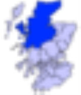
| Highland council area Shown as one of the council areas of Scotland |
| 1995 to 1999 |
| 1999 to 2007 Highland Council wards 1999 to 2007 The second set of Highland Council wards, 80 in number, became effective for election purposes in 1999, for the second general election of the Highland Council, and were used also for the third general election in 2003... |
| 2007 |
The first set of Highland Council wards was first used for Highland Council election purposes in 1995, for the first general election
General election
In a parliamentary political system, a general election is an election in which all or most members of a given political body are chosen. The term is usually used to refer to elections held for a nation's primary legislative body, as distinguished from by-elections and local elections.The term...
of the council. They were replaced with 80 new wards for the second general election in 1999.
The Highland Council (Comhairle na Gaidhealtachd in Gaelic) had become a local government authority in 1996, when the two-tier system of regions and districts
Regions and districts of Scotland
The local government areas of Scotland were redefined by the Local Government Act 1973 and redefined again by the Local Government etc Act 1994....
was abolished and the Highland region became a unitary council area, under the Local Government etc (Scotland) Act 1994. The first Highland Council election, however, was one year earlier, in 1995. Until 1996 councillors shadowed the regional and district councils and planned for the transfer of powers and responsibilities. Elections to the council are normally on a four-year cycle, all wards being contestable at each election.
For the periods 1995 to 1999 each ward elected one councillor
Councillor
A councillor or councilor is a member of a local government council, such as a city council.Often in the United States, the title is councilman or councilwoman.-United Kingdom:...
by the first past the post system. The first past the post system continued in use when new wards were introduced in 1999, but the increased number of wards meant an increase in the number of councillors.
The wards used form 1995 to 1999 were subdivisions of eight council management areas, with councillors elected from each area forming an area committee
Area committee
Many large local government councils in the United Kingdom have a system of area committees, with responsibility for services in a particular part of the area covered by the council....
. The wards created in 1999, however, were not exactly subdivisions of the management areas, management area boundaries were not adjusted to take account of new ward boundaries and, therefore, area committees ceased to be exactly representative of areas for which they were named and for which they took decisions.
Lists of wards, 1995 to 1999
Wards are listed by management area, and are numbered as well as named.Badenoch and Strathspey wards
The Badenoch and StrathspeyBadenoch and Strathspey
Badenoch and Strathspey as a local government district 1975 to 1996Badenoch and Strathspey is a local government ward of the Highland council area and a ward management area of the Highland Council in Scotland...
management area consisted of five wards:
| No | Ward | Name term references |
|---|---|---|
| 61 | Aviemore | Aviemore Aviemore Aviemore is a town and tourist resort, situated within the Cairngorms National Park in the Highlands of Scotland. It is in the Badenoch and Strathspey committee area, within the Highland council area. The town is popular for skiing and other winter sports, and for hill-walking in the Cairngorm... |
| 62 | Carrbridge and Nethybridge | Carrbridge Carrbridge Carrbridge is a village in Badenoch and Strathspey in the Scottish Highlands. It lies off the A9 road on the A938 road, west of Skye of Curr, southeast of Findhom Bridge, near Bogroy.It has the oldest stone bridge in the Highlands and nearby ancient pine forest contains the Landmark Forest... and Nethybridge |
| 63 | Dulnain Bridge | Dulnain Bridge Dulnain Bridge Dulnain Bridge is a village in Strathspey, next to the meeting of the River Dulnain and the River Spey, three miles south-west of Grantown-on-Spey, in the Scottish Highlands and the Highland council area.-History:... |
| 64 | Grantown | Grantown-on-Spey Grantown-on-Spey Grantown-on-Spey is a town in the Highland Council Area in Scotland.It was founded in 1765 as a planned settlement on a low plateau at Freuchie beside the river Spey at the northern edge of the Cairngorm mountains, about 20 miles South East of Inverness .It is the main town in what was the... |
| 60 | Kingussie and Kincraig | Kingussie Kingussie Kingussie is a small town in the Highland region of Scotland. It is one settlement in the Highland Council ward of Badenoch and Strathspey, and is the capital of the district of Badenoch. It lies beside the A9 road, although the old route of the A9 serves as the town's main street... and Kincraig Kincraig Kincraig is a village located north of Kingussie and south of Aviemore in Highland, Scotland. The village lies at the side of the former A9 road and 100 metres away from the current A9... |
Caithness wards
The CaithnessCaithness
Caithness is a registration county, lieutenancy area and historic local government area of Scotland. The name was used also for the earldom of Caithness and the Caithness constituency of the Parliament of the United Kingdom . Boundaries are not identical in all contexts, but the Caithness area is...
management area consisted of eight wards:
| No | Ward | Name term references |
|---|---|---|
| 7 | Central Caithness | Caithness |
| 5 | North East Caithness | |
| 4 | Pulteney | Pulteney area of Wick Wick, Highland Wick is an estuary town and a royal burgh in the north of the Highland council area of Scotland. Historically, it is one of two burghs within the county of Caithness, of which Wick was the county town. The town straddles the River Wick and extends along both sides of Wick Bay... |
| 6 | South East Caithness | Caithness |
| 2 | Thurso East | Thurso Thurso -Facilities:Offices of the Highland Council are located in the town, as is the main campus of North Highland College, formerly Thurso College. This is one of several partner colleges which constitute the UHI Millennium Institute, and offers several certificate, diploma and degree courses from... |
| 1 | Thurso West | |
| 8 | West Caithness | Caithness |
| 9 | Wick | Wick Wick, Highland Wick is an estuary town and a royal burgh in the north of the Highland council area of Scotland. Historically, it is one of two burghs within the county of Caithness, of which Wick was the county town. The town straddles the River Wick and extends along both sides of Wick Bay... |
Inverness wards
The InvernessInverness
Inverness is a city in the Scottish Highlands. It is the administrative centre for the Highland council area, and is regarded as the capital of the Highlands of Scotland...
management area included Loch Ness
Loch Ness
Loch Ness is a large, deep, freshwater loch in the Scottish Highlands extending for approximately southwest of Inverness. Its surface is above sea level. Loch Ness is best known for the alleged sightings of the cryptozoological Loch Ness Monster, also known affectionately as "Nessie"...
, Strathglass
River Glass
River Glass may refer to different rivers in the British Isles:* River Glass, Isle of Man, a tributary of the River Dhoo* River Glass, Strathglass, a tributary of the River Beauly, which flows into the Beauly Firth near the town of Beauly in the Highland council area of Scotland* An alternative...
and the town of Inverness.
The management area consisted of 20 wards:
| No | Ward | Name term references |
|---|---|---|
| 46 | Alt Na Sgitheach | Alt Na Sgitheach |
| 53 | Ardersier | Ardersier Ardersier Ardersier is a small former fishing village in the Scottish Highlands, on the Moray Firth, east of Inverness, near Fort George, and Nairn . Its name is an anglicisation of the Gaelic "Àird nan Saor", or "Headland of the joiners", one local legend being that carpenters working on the construction... |
| 39 | Beauly | Beauly Beauly Beauly is a town of the Scottish county of Inverness-shire, on the River Beauly, 10 miles west of Inverness by the Far North railway line. Its population was 855 in 1901... |
| 49 | Canal | A section of the Caledonian Canal Caledonian Canal The Caledonian Canal is a canal in Scotland that connects the Scottish east coast at Inverness with the west coast at Corpach near Fort William. It was constructed in the early nineteenth century by engineer Thomas Telford, and is a sister canal of the Göta Canal in Sweden, also constructed by... , running between Loch Ness Loch Ness Loch Ness is a large, deep, freshwater loch in the Scottish Highlands extending for approximately southwest of Inverness. Its surface is above sea level. Loch Ness is best known for the alleged sightings of the cryptozoological Loch Ness Monster, also known affectionately as "Nessie"... and the Moray Firth Moray Firth The Moray Firth is a roughly triangular inlet of the North Sea, north and east of Inverness, which is in the Highland council area of north of Scotland... and thus through the town of Inverness |
| 44 | Columba | Columba |
| 52 | Culloden | Culloden |
| 45 | Drommond | Drommond |
| 38 | Drumnadrochit | Drumnadrochit Drumnadrochit Drumnadrochit is a village inthe Highland local government council area of Scotland, lying on the west shore of Loch Ness, at the foot of Glen Urquhart.-History:... |
| 36 | East Loch Ness | Loch Ness Loch Ness Loch Ness is a large, deep, freshwater loch in the Scottish Highlands extending for approximately southwest of Inverness. Its surface is above sea level. Loch Ness is best known for the alleged sightings of the cryptozoological Loch Ness Monster, also known affectionately as "Nessie"... |
| 37 | Fort Augustus | Fort Augustus Fort Augustus Fort Augustus is a settlement in the Scottish Highlands, at the south west end of Loch Ness. The village has a population of around 646 ; its economy is heavily reliant on tourism.... |
| 47 | Hilton | Hilton Hilton, Inverness Hilton is a former village located adjacent to Inverness, Highland, Scotland, and treated as part of Inverness. As the City has no boundaries, a formal annexation has never happened... |
| 51 | Inshes | Inshes Inshes Inshes is a small residential area in the east of Inverness, Scotland. Inverness is the capital of the Highlands and is one of the fastest growing cities in Europe. Some parts of Inshes were built a few decades ago but most of it was built after 2003. A few houses are still being constructed and... |
| 40 | Kirkhill | Kirkhill |
| 42 | Merkinch | Merkinch Merkinch Merkinch is an area of the city of Inverness in the Scottish Highlands. One of the Inverness's oldest areas, it is located in the north-west of the city, flanked by the Caledonian Canal to the west and the River Ness to the east.Originally, Merkinch was home to Inverness's shipbuilding industry... |
| 43 | Muirtown | Muirtown |
| 48 | Old Edinburgh | Old Edinburgh |
| 50 | Raigmore | Raigmore Raigmore Raigmore is an area in the east of the city of Inverness, in the Highland council area of Scotland. The name is from the Gaelic for "the large fortified dwelling".... |
| 41 | Scorguie | Scorguie Scorguie Scorguie is an area in the north west of Inverness located in the Scottish Highlands. It sits between Kinmylies and Clachnaharry and is situated beside the Caledonian Canal at the Muirtown Locks.... |
| 35 | Milton | Milton |
| 35 | Strathnairn and Strathdearn | Strathnairn Strathnairn Strathnairn lies 8 miles South West of Inverness and borders the Monadhliath Mountains. The Strath's borders reach to the north where Clava cairn and the Culloden Battlefield lie, following the River Nairn south through Daviot, Farr, Brin, Croachy, and finally ending near Dunmaglass.... and Strathdearn |
Lochaber wards
The LochaberLochaber
District of Lochaber 1975 to 1996Highland council area shown as one of the council areas of ScotlandLochaber is one of the 16 ward management areas of the Highland Council of Scotland and one of eight former local government districts of the two-tier Highland region...
management area consisted of eight wards:
| No | Ward | Name term references |
|---|---|---|
| 66 | Ardnamurchan and Morvern | Ardnamurchan Ardnamurchan Ardnamurchan is a peninsula in Lochaber, Highland, Scotland, noted for being very unspoilt and undisturbed. Its remoteness is accentuated by the main access route being a single track road for much of its length.-Geography:... and Morvern Morvern Morvern is a peninsula in south west Lochaber, on the west coast of Scotland. The name is derived from the Gaelic A' Mhorbhairne . The highest point is the summit of the Corbett Creach Bheinn which reaches in elevation.... |
| 68 | Caol | Caol Caol Caol is a village near Fort William, in the Highland council area of Scotland. It is about 2.5 km north of Fort William town centre, on the shore of Loch Linnhe, and within the parish of Kilmallie.... |
| 70 | Claggan and Glen Spean | Claggan and Glen Spean |
| 71 | Fort William South | Fort William |
| 72 | Glencoe and Nether Lochaber | Glencoe and Nether Lochaber Nether Lochaber Nether Lochaber in Lochaber, Highland, Scotland, is the modern name for the Parish of 'Ballachulish and Onich'. This Parish was formed, in 1911, out of the Quoad Sacra Parish of 'Ballachulish and Corran of Ardgour' which itself was formed, in 1829, out of the Parish of 'Kilmallie' when the Thomas... |
| 67 | Kilmallie and Invergarry | Kilmallie and Invergarry Invergarry Invergarry is a village in the Highlands of Scotland. It is in the Great Glen, near where the River Garry flows into Loch Oich.Near the centre of the village is the junction between the A82 road and the A87 road which branches off to the west towards Skye.The ruined Invergarry Castle is situated... |
| 65 | Mallaig and the Small Isles | Mallaig Mallaig Mallaig ; is a port in Lochaber, on the west coast of the Highlands of Scotland. The local railway station, Mallaig, is the terminus of the West Highland railway line , completed in 1901, and the town is linked to Fort William by the A830 road – the "Road to the Isles".The village of Mallaig... and the Small Isles Small Isles The Small Isles are a small archipelago of islands in the Inner Hebrides, off the west coast of Scotland. They lie south of Skye and north of Mull and Ardnamurchan – the most westerly point of mainland Scotland.The four main islands are Canna, Rùm, Eigg and Muck... |
| 69 | North Fort William and Inverlochy | Fort William and Inverlochy |
Nairn wards
The NairnNairn
Nairn is a town and former burgh in the Highland council area of Scotland. It is an ancient fishing port and market town around east of Inverness...
management area included the town of Nairn but was mostly rural.
It consisted of five wards:
| No | Ward | Name term references |
|---|---|---|
| 56 | Auldearn | Auldearn Auldearn Auldearn is a village situated east of the River Nairn, just outside Nairn in the Highland council area of Scotland. It takes its name from William the Lyon's castle of Eren , built there in the 12th century.... |
| 57 | Cawdor | Cawdor Cawdor Cawdor is a village and parish in Nairnshire, Highland council area, Scotland. The village is situated 5 miles south south west of Nairn, and 12 miles from Inverness.-History:The village is the location of Cawdor Castle, the seat of the Earl Cawdor.... |
| 54 | East Nairn | Nairn |
| 58 | North Nairn | |
| 58 | West Nairn |
Ross and Cromarty wards
The Ross and CromartyRoss and Cromarty
Ross and Cromarty is a variously defined area in the Highlands and Islands of Scotland. There is a registration county and a lieutenancy area in current use...
management area consisted of 13 wards:
| No | Ward | Name term references |
|---|---|---|
| 27 | Alness and Ardross | Alness Alness Alness is a town and civil parish in Ross and Cromarty, Highland, Scotland. It lies near the Cromarty Firth, with the town of Invergordon to the east and the village of Evanton to the south west... and Ardross Ardross, Highland Ardross Rural area in the Highland region of Scotland, north of the nearest city, Inverness... |
| 25 | Black Isle East | Black Isle Black Isle The Black Isle is an eastern area of the Highland local government council area of Scotland, within the county of Ross and Cromarty. The name nearly always includes the article "the".... |
| 26 | Black Isle West | |
| 29 | Dingwall | Dingwall Dingwall Dingwall is a town and former royal burgh in the Highland council area of Scotland. It has a population of 5,026. It was formerly an east-coast harbor but now lies inland. Dingwall Castle was once the biggest castle north of Stirling. On the town's present-day outskirts lies Tulloch Castle, parts... |
| 23 | Fearn | Hill of Fearn Hill of Fearn Hill of Fearn is a small village near Tain in Easter Ross, in the Scottish council area of Highland.-Geography:The village is on the B9165 road, between the A9 trunk road and the smaller hamlet of Fearn to the southeast. The parish church of Fearn Abbey stands a few minutes walk to the south-east... |
| 33 | Gairloch and Garve | Gairloch Gairloch Gairloch is a village, civil parish and community on the shores of Loch Gairloch on the northwest coast of Scotland. A popular tourist destination in the summer months, Gairloch has a golf course, a small museum, several hotels, a community centre, a leisure centre with sports facilities, a local... and Garve Garve Garve is a village on the Black Water river, in Ross-shire, and is in the Highland Council area of Scotland. It is situated 5 miles northwest of Contin, on the A835, the main road to Ullapool on the west coast, close to where the A832 branches off towards Achnasheen.The village is served by the... |
| 24 | Invergordon | Invergordon Invergordon Invergordon is a town and port in Easter Ross, in Ross and Cromarty, Highland, Scotland.-History:The town is well known for the Invergordon Mutiny of 1931. More recently it was also known for the repair of oil rigs which used to be lined up in the Cromarty Firth on which the town is situated... |
| 22 | Tain | Tain Tain Tain is a royal burgh and post town in the committee area of Ross and Cromarty, in the Highland area of Scotland.-Etymology:... |
| 28 | Ferindonald | Ferindonald Ferindonald Ferindonald or Ferrindonald is a crofting township, located on the east coast of the Sleat peninsula, lying on the A851 road, in the Isle of Skye, Scottish Highlands and is in the Scottish council area of Highland.... |
| 32 | Lochbroom | Lochbroom |
| 34 | Lochcarron | Lochcarron Lochcarron Lochcarron is a village, community and civil parish in the Wester Ross area of Highland, Scotland. It has a population of 923.-Local Information:... |
| 31 | Maryburgh | Maryburgh Maryburgh Maryburgh is a village in the Highland council area of Scotland, 2 miles south of Dingwall.It is situated on the northern bank of the River Conon... |
| 30 | Ord and Connon | Muir of Ord Muir of Ord Muir of Ord is a village in Highland, Scotland. It is situated near the western boundary of the Black Isle, about 20 km west of the city of Inverness, and 10 km south of Dingwall... , Conon Bridge Conon Bridge Conon Bridge is a small village in the Highland region of Scotland. The current Gaelic name is likely a neologism: the bridge wasn't built until the early 19th century and some early gravestones show the name sgudal or scuddle... and the River Conon River Conon The River Conon is a river in the Highlands of Scotland. It begins at Loch Luichart, and flows in a south-easterly direction to be joined by the River Meig at Scatwell before passing through Loch Achonachie... |
Skye and Lochalsh wards
The Skye and LochalshSkye and Lochalsh
Skye and Lochalsh is one of eight former local government districts of the two-tier Highland region of Scotland. The main offices of the Skye and Lochalsh district council were in Portree, on the Isle of Skye.-History:...
management area included the islands of Skye
Skye
Skye or the Isle of Skye is the largest and most northerly island in the Inner Hebrides of Scotland. The island's peninsulas radiate out from a mountainous centre dominated by the Cuillin hills...
, Raasay
Raasay
Raasay is an island between the Isle of Skye and the mainland of Scotland. It is separated from Skye by the Sound of Raasay and from Applecross by the Inner Sound. It is most famous for being the birthplace of the poet Sorley MacLean, an important figure in the Scottish literary renaissance...
and Scalpay
Scalpay, Inner Hebrides
Scalpay is an island in the Inner Hebrides of Scotland.Separated from the east coast of Skye by Loch na Cairidh, Scalpay rises to at Mullach na Càrn. It has an area of almost ten sq. miles....
, the village of Kyle of Lochalsh
Kyle of Lochalsh
Kyle of Lochalsh is a village on the northwest coast of Scotland, 63 miles west of Inverness. It is located at the entrance to Loch Alsh, opposite the village of Kyleakin on the Isle of Skye...
on the mainland, and a rural area to the east of Kyle of Lochalsh. It consisted of six wards:
| No | Ward | Name term references |
|---|---|---|
| 18 | Broadford | Broadford, Isle of Skye Broadford, Isle of Skye Broadford , together with nearby Harrapool, is the second-largest settlement on the Isle of Skye, Scotland, lying on the SW corner of Broadford Bay, on the A87 between Portree and the Skye Bridge.... |
| 21 | Dunvegan | Dunvegan Dunvegan Dunvegan is a town on the Isle of Skye in Scotland. It is famous for Dunvegan Castle, seat of the chief of Clan MacLeod... |
| 17 | Kyle and Sleat | Kyle Kyle Kyle may refer to:* KYLE, a Fox network affiliate* Kyle , a Scottish masculine given name * Kyle , a surname of Scottish origin* Kyle, Ayrshire, Scotland* Kyle, Indiana, United States... and Sleat Sleat Sleat is a peninsula on the island of Skye in the Highland council area of Scotland, known as "the garden of Skye". It is the home of the clan MacDonald of Sleat... |
| 16 | Lochalsh | Lochalsh |
| 19 | Portree | Portree Portree Portree is the largest town on Skye in the Inner Hebrides of Scotland. It is the location for the only secondary school on the Island, Portree High school. Public transport services are limited to buses.... |
| 20 | Staffin | Staffin Staffin Staffin is a village , lying at the head of Staffin Bay on the northeast coast of the Trotternish peninsula of the island of Skye. It is located on the A855 road about north of Portree. Nearby is the rock formation of the Quirang and Staffin Island lies just offshore... |
Sutherland wards
The SutherlandSutherland
Sutherland is a registration county, lieutenancy area and historic administrative county of Scotland. It is now within the Highland local government area. In Gaelic the area is referred to according to its traditional areas: Dùthaich 'IcAoidh , Asainte , and Cataibh...
management area consisted of seven wards:
| No | Ward | Name term references |
|---|---|---|
| 10 | Ardgay and Bonar Bridge | Ardgay Ardgay Ardgay is a small Scottish village on the north west shore of the Dornoch Firth, Sutherland and lies at the entrance to Strathcarron, the valley of the River Carron. In the Highland Council area Ardgay is in Ward 1, the North, West and Central Sutherland ward.Ardgay is served by the Ardgay... and Bonar Bridge Bonar Bridge Bonar Bridge is a village on the north bank of the Kyle of Sutherland, in the Parish of Creich in the Highland council area of Scotland.The Kyle of Sutherland is a river estuary of the Rivers Oykel, Cassley, Shin and Carron that all enter the Kyle above the bridge at Bonar.The estuary and the... |
| 15 | Brora and Kildonan | Brora Brora Brora is a village in the east of Sutherland, in the Highland area of Scotland. The village is situated where the A9 road and the Far North Line bridge the River Brora... and Kildonan |
| 11 | Central Sutherland | Sutherland |
| 9 | Dornoch | Dornoch Dornoch Dornoch is a town and seaside resort, and former Royal burgh in the Highlands of Scotland. It lies on the north shore of the Dornoch Firth, near to where it opens into the Moray Firth to the east... |
| 14 | Golspie | Golspie Golspie Golspie is a coastal village in Sutherland, Highland, Scotland. It has a population of around 1,650 people. It is located picturesquely on the shores of the North Sea in the shadow of Ben Bhraggie .... |
| 12 | North West Sutherland | Sutherland |
| 13 | Tongue and Farr | Tongue Tongue The tongue is a muscular hydrostat on the floors of the mouths of most vertebrates which manipulates food for mastication. It is the primary organ of taste , as much of the upper surface of the tongue is covered in papillae and taste buds. It is sensitive and kept moist by saliva, and is richly... and Farr Farr, Highland Farr is a Parish in the county of Sutherland in the Scottish council area of the Highland. The parish also includes a small hamlet named Farr... |