
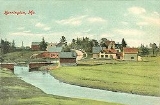
Harrington, Maine
Encyclopedia
Harrington is a town in Washington County
, Maine
, United States
. The population was 882 at the 2000 census. Harrington is an old seafaring and shipbuilding village.
granted in 1762 by the Massachusetts General Court
to an association of petitioners. First settled about 1765, it had a population of 177 on June 17, 1797 when incorporated as Harrington.
Farmer
s grew wheat
and potato
es in the town's sandy loam. Harrington developed a considerable trade in lumber
, and by 1859 contained two sawmill
s, three shingle
mills and two lath
mills. There was a gristmill
, two brickyards, a tannery
, and eighteen shipbuilders
. In 1886, industries also included a sail
maker, and a boot
and shoe
manufacturer.
, the town has a total area of 52.9 square miles (137 km²), of which, 21.2 square miles (54.9 km²) of it is land and 31.7 square miles (82.1 km²) of it (59.97%) is water. The town is at the head of Narraguagus Bay
, and situated beside Harrington Bay
and Pleasant Bay
on the Gulf of Maine
. It is drained by Curtis Creek, Mill River
and the Harrington River
.
Harrington is crossed by U.S. Route 1
and U.S. Route 1A. It borders the towns of Milbridge
to the west, Cherryfield
to the northwest, Columbia
to the north, and Addison
to the east.
of 2000, there were 882 people, 364 households, and 256 families residing in the town. The population density
was 41.7 people per square mile (16.1/km²). There were 563 housing units at an average density of 26.6 per square mile (10.3/km²). The racial makeup of the town was 98.07% White, 0.11% Native American, 0.57% from other races
, and 1.25% from two or more races. Hispanic or Latino of any race were 1.70% of the population.
There were 364 households out of which 29.1% had children under the age of 18 living with them, 57.4% were married couples
living together, 9.1% had a female householder with no husband present, and 29.4% were non-families. 22.5% of all households were made up of individuals and 10.2% had someone living alone who was 65 years of age or older. The average household size was 2.41 and the average family size was 2.79.
In the town the population was spread out with 21.5% under the age of 18, 7.3% from 18 to 24, 26.5% from 25 to 44, 28.3% from 45 to 64, and 16.3% who were 65 years of age or older. The median age was 42 years. For every 100 females there were 91.7 males. For every 100 females age 18 and over, there were 91.7 males.
The median income for a household in the town was $26,579, and the median income for a family was $29,211. Males had a median income of $24,038 versus $16,447 for females. The per capita income
for the town was $13,224. About 14.9% of families and 19.2% of the population were below the poverty line, including 31.9% of those under age 18 and 9.1% of those age 65 or over.
Washington County, Maine
Washington County is a county located in the U.S. state of Maine. In 2010, its population was 32,856. Its county seat is Machias.Sometimes referred to as "Sunrise County" because it is the easternmost county in the United States, and it is often where the rising sun first shines on the 48...
, Maine
Maine
Maine is a state in the New England region of the northeastern United States, bordered by the Atlantic Ocean to the east and south, New Hampshire to the west, and the Canadian provinces of Quebec to the northwest and New Brunswick to the northeast. Maine is both the northernmost and easternmost...
, United States
United States
The United States of America is a federal constitutional republic comprising fifty states and a federal district...
. The population was 882 at the 2000 census. Harrington is an old seafaring and shipbuilding village.
History
Originally called Plantation Number 5, it was one of six townships east of Union RiverUnion River (Maine)
The Union River is a river that runs through Ellsworth, Maine. In the colonial era, it was known as the Mount Desert River.The river forms at the north end of Graham Lake at the confluence of the river's East and West branches , on the border of the towns of Mariaville and Waltham...
granted in 1762 by the Massachusetts General Court
Massachusetts General Court
The Massachusetts General Court is the state legislature of the Commonwealth of Massachusetts. The name "General Court" is a hold-over from the Colonial Era, when this body also sat in judgment of judicial appeals cases...
to an association of petitioners. First settled about 1765, it had a population of 177 on June 17, 1797 when incorporated as Harrington.
Farmer
Farmer
A farmer is a person engaged in agriculture, who raises living organisms for food or raw materials, generally including livestock husbandry and growing crops, such as produce and grain...
s grew wheat
Wheat
Wheat is a cereal grain, originally from the Levant region of the Near East, but now cultivated worldwide. In 2007 world production of wheat was 607 million tons, making it the third most-produced cereal after maize and rice...
and potato
Potato
The potato is a starchy, tuberous crop from the perennial Solanum tuberosum of the Solanaceae family . The word potato may refer to the plant itself as well as the edible tuber. In the region of the Andes, there are some other closely related cultivated potato species...
es in the town's sandy loam. Harrington developed a considerable trade in lumber
Lumber
Lumber or timber is wood in any of its stages from felling through readiness for use as structural material for construction, or wood pulp for paper production....
, and by 1859 contained two sawmill
Sawmill
A sawmill is a facility where logs are cut into boards.-Sawmill process:A sawmill's basic operation is much like those of hundreds of years ago; a log enters on one end and dimensional lumber exits on the other end....
s, three shingle
Roof shingle
Roof shingles are a roof covering consisting of individual overlapping elements. These elements are typically flat rectangular shapes laid in rows from the bottom edge of the roof up, with each successive higher row overlapping the joints in the row below...
mills and two lath
Lath
A lath is a thin, narrow strip of some straight-grained wood or other material, including metal or gypsum. A lattice, or lattice-work, is a criss-crossed or interlaced arrangement of laths, or the pattern made by such an arrangement...
mills. There was a gristmill
Gristmill
The terms gristmill or grist mill can refer either to a building in which grain is ground into flour, or to the grinding mechanism itself.- Early history :...
, two brickyards, a tannery
Tanning
Tanning is the making of leather from the skins of animals which does not easily decompose. Traditionally, tanning used tannin, an acidic chemical compound from which the tanning process draws its name . Coloring may occur during tanning...
, and eighteen shipbuilders
Shipbuilding
Shipbuilding is the construction of ships and floating vessels. It normally takes place in a specialized facility known as a shipyard. Shipbuilders, also called shipwrights, follow a specialized occupation that traces its roots to before recorded history.Shipbuilding and ship repairs, both...
. In 1886, industries also included a sail
Sail
A sail is any type of surface intended to move a vessel, vehicle or rotor by being placed in a wind—in essence a propulsion wing. Sails are used in sailing.-History of sails:...
maker, and a boot
Boot
A boot is a type of footwear but they are not shoes. Most boots mainly cover the foot and the ankle and extend up the leg, sometimes as far as the knee or even the hip. Most boots have a heel that is clearly distinguishable from the rest of the sole, even if the two are made of one piece....
and shoe
Shoemaking
Shoemaking is the process of making footwear. Originally, shoes were made one at a time by hand. Traditional handicraft shoemaking has now been largely superseded in volume of shoes produced by industrial mass production of footwear, but not necessarily in quality, attention to detail, or...
manufacturer.
Geography
According to the United States Census BureauUnited States Census Bureau
The United States Census Bureau is the government agency that is responsible for the United States Census. It also gathers other national demographic and economic data...
, the town has a total area of 52.9 square miles (137 km²), of which, 21.2 square miles (54.9 km²) of it is land and 31.7 square miles (82.1 km²) of it (59.97%) is water. The town is at the head of Narraguagus Bay
Narraguagus Bay
Narraguagus Bay is a bay in Washington County, Maine.Located at the mouth of the Narraguagus River between the towns of Harrington and Milbridge, it is separated from Harrington Bay to the northeast by Fastet Island and Pleasant Bay to the east by Dyer Island.The bay extends roughly 4.5 mi. ...
, and situated beside Harrington Bay
Harrington Bay
Harrington Bay is a bay in Washington County, Maine.Located between the towns of Harrington and Milbridge, it is separated from Pleasant Bay on the east by Ripley Neck, and from Narraguagus Bay on the west and south by Fastet Island and Dyer Island....
and Pleasant Bay
Pleasant Bay (Maine)
Pleasant Bay is a bay in Washington County, Maine at the mouth of the Pleasant River.Located between the towns of Addison and Harrington, on the east it is bordered by Cape Spit and on the west it is separated from Harrington Bay by Ripley Neck, and from Narraguagus Bay by Dyer Island.The bay...
on the Gulf of Maine
Gulf of Maine
The Gulf of Maine is a large gulf of the Atlantic Ocean on the east coast of North America.It is delineated by Cape Cod at the eastern tip of Massachusetts in the southwest and Cape Sable at the southern tip of Nova Scotia in the northeast. It includes the entire coastlines of the U.S...
. It is drained by Curtis Creek, Mill River
Mill River (Harrington Bay)
The Mill River is a short river in Washington County, Maine. From its source in Cherryfield, the river runs southeast to Flat Bay and its confluence with the Harrington River. Its lower length forms the border between the towns of Milbridge and Harrington....
and the Harrington River
Harrington River
The Harrington River is a river in Washington County, Maine. It empties into Harrington Bay in Harrington, Maine.-References:**...
.
Harrington is crossed by U.S. Route 1
U.S. Route 1 in Maine
In the U.S. state of Maine, U.S. Route 1 is a major north–south state highway serving the eastern part of the state. It parallels the Atlantic Ocean from New Hampshire north through Portland, Brunswick, and Belfast to Calais, and then the St. Croix River and the rest of the Canadian border...
and U.S. Route 1A. It borders the towns of Milbridge
Milbridge, Maine
Milbridge is a town in Washington County, Maine, United States at the mouth of the Narraguagus River. The population was 1,279 at the 2000 census.-Geography:...
to the west, Cherryfield
Cherryfield, Maine
Cherryfield is a town in Washington County, Maine, United States on the Narraguagus River. It was named for the wild cherries that once peppered the banks of the river. The population was 1,157 at the 2000 census. The town bills itself as the "Blueberry Capital of the World"...
to the northwest, Columbia
Columbia, Maine
Columbia is a town in Washington County, Maine, United States. The population was 459 at the 2000 census.-Geography:According to the United States Census Bureau, the town has a total area of . of it is land and of it is water.-Demographics:...
to the north, and Addison
Addison, Maine
Addison is a town in Washington County, Maine, United States. The town was named after English author Joseph Addison. The population was 1,209 according to the 2000 census.-Geography:...
to the east.
Demographics
As of the censusCensus
A census is the procedure of systematically acquiring and recording information about the members of a given population. It is a regularly occurring and official count of a particular population. The term is used mostly in connection with national population and housing censuses; other common...
of 2000, there were 882 people, 364 households, and 256 families residing in the town. The population density
Population density
Population density is a measurement of population per unit area or unit volume. It is frequently applied to living organisms, and particularly to humans...
was 41.7 people per square mile (16.1/km²). There were 563 housing units at an average density of 26.6 per square mile (10.3/km²). The racial makeup of the town was 98.07% White, 0.11% Native American, 0.57% from other races
Race (United States Census)
Race and ethnicity in the United States Census, as defined by the Federal Office of Management and Budget and the United States Census Bureau, are self-identification data items in which residents choose the race or races with which they most closely identify, and indicate whether or not they are...
, and 1.25% from two or more races. Hispanic or Latino of any race were 1.70% of the population.
There were 364 households out of which 29.1% had children under the age of 18 living with them, 57.4% were married couples
Marriage
Marriage is a social union or legal contract between people that creates kinship. It is an institution in which interpersonal relationships, usually intimate and sexual, are acknowledged in a variety of ways, depending on the culture or subculture in which it is found...
living together, 9.1% had a female householder with no husband present, and 29.4% were non-families. 22.5% of all households were made up of individuals and 10.2% had someone living alone who was 65 years of age or older. The average household size was 2.41 and the average family size was 2.79.
In the town the population was spread out with 21.5% under the age of 18, 7.3% from 18 to 24, 26.5% from 25 to 44, 28.3% from 45 to 64, and 16.3% who were 65 years of age or older. The median age was 42 years. For every 100 females there were 91.7 males. For every 100 females age 18 and over, there were 91.7 males.
The median income for a household in the town was $26,579, and the median income for a family was $29,211. Males had a median income of $24,038 versus $16,447 for females. The per capita income
Per capita income
Per capita income or income per person is a measure of mean income within an economic aggregate, such as a country or city. It is calculated by taking a measure of all sources of income in the aggregate and dividing it by the total population...
for the town was $13,224. About 14.9% of families and 19.2% of the population were below the poverty line, including 31.9% of those under age 18 and 9.1% of those age 65 or over.