

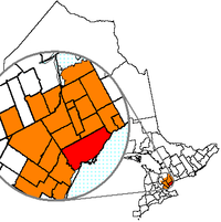
Greater Toronto Area
Encyclopedia
The Greater Toronto Area (GTA) is the largest metropolitan area in Canada, with a 2006 census
Canada 2006 Census
The Canada 2006 Census was a detailed enumeration of the Canadian population. Census day was May 16, 2006. The next census following will be the 2011 Census. Canada's total population enumerated by the 2006 census was 31,612,897...
population of 5.5 million. The Greater Toronto Area is usually defined as the central city of Toronto
Toronto
Toronto is the provincial capital of Ontario and the largest city in Canada. It is located in Southern Ontario on the northwestern shore of Lake Ontario. A relatively modern city, Toronto's history dates back to the late-18th century, when its land was first purchased by the British monarchy from...
, along with four regional municipalities surrounding it: Durham, Halton, Peel, and York. The area is at the centre of the Golden Horseshoe
Golden Horseshoe
The Golden Horseshoe is a densely populated and industrialized region centred around the Greater Toronto Area at the western end of Lake Ontario in Southern Ontario, Canada, with outer boundaries stretching south to Lake Erie and north to Georgian Bay. Most of it is also part of the Quebec City...
urban agglomeration, which contains approximately one-fourth of the population of Canada.
Economically, the Greater Toronto Area is responsible for generating one-fifth of the gross domestic product of Canada and home to nearly 40 per cent of Canadian corporate headquarters. The region's GDP is higher than the province of Quebec
Quebec
Quebec or is a province in east-central Canada. It is the only Canadian province with a predominantly French-speaking population and the only one whose sole official language is French at the provincial level....
, being worth $323 billion. While Toronto remains central to the largest of the business centres, including the five largest banks of Canada, cities and towns outside of Toronto have increasingly become home to several industries. Some sectors also based outside of Toronto in the Greater Toronto Area include automotive manufacturing, wholesale and retail, software production, information technology, telecommunications, sports, education, agriculture, mining, construction, and engineering. The backbone of transportation in the area is Highway 401, the busiest roadway in North America and among the busiest in the world. The area is also home to five public research universities and six community colleges.
The Greater Toronto Area is different from the Census Metropolitan Area of Toronto, which covers a smaller region. As of early 21st century, the regional span of the Greater Toronto Area has been extended to include the city of Hamilton, Ontario
Hamilton, Ontario
Hamilton is a port city in the Canadian province of Ontario. Conceived by George Hamilton when he purchased the Durand farm shortly after the War of 1812, Hamilton has become the centre of a densely populated and industrialized region at the west end of Lake Ontario known as the Golden Horseshoe...
and its surrounding region, to form the Greater Toronto and Hamilton Area
Greater Toronto and Hamilton Area
The Greater Toronto and Hamilton Area is composed of the metropolitan areas of the Canadian cities of Toronto and Hamilton, Ontario. The GTHA includes the census metropolitan areas of Toronto, Hamilton and Oshawa....
, an urban area which has a total population ranked among the top-50 in the world.
The GTA is the largest metropolitan area in the Canadian side of the Great Lakes Peninsula
Southern Ontario
Southern Ontario is a region of the province of Ontario, Canada that lies south of the French River and Algonquin Park. Depending on the inclusion of the Parry Sound and Muskoka districts, its surface area would cover between 14 to 15% of the province. It is the southernmost region of...
. Toronto is the largest city of the Canadian side of the Great Lakes.
Etymology
The term Greater Toronto has been used in writing as early as the 1900s, although at the time, the term only referred to the former City of Toronto and its immediate townships and villages, which became Metropolitan TorontoMetropolitan Toronto
The Municipality of Metropolitan Toronto was a senior level of municipal government in the Toronto, Ontario, Canada area from 1954 to 1998. It was created out of York County and was a precursor to the later concept of a regional municipality, being formed of smaller municipalities but having more...
in 1954 and became the current city of Toronto in 1998. The usage of the term involving the four regional municipalities came into formal use in the mid-1980s, after it was used in a widely discussed report on municipal governance restructuring in the region and was later made official as a provincial planning area. However it did not come into everyday usage until the mid- to late 1990s. In 2006, the term began to be supplanted in the field of spatial planning as provincial policy increasingly began to refer to either the "Greater Toronto and Hamilton
Hamilton, Ontario
Hamilton is a port city in the Canadian province of Ontario. Conceived by George Hamilton when he purchased the Durand farm shortly after the War of 1812, Hamilton has become the centre of a densely populated and industrialized region at the west end of Lake Ontario known as the Golden Horseshoe...
Area" (GTHA) or the still-broader "Greater Golden Horseshoe
Golden Horseshoe
The Golden Horseshoe is a densely populated and industrialized region centred around the Greater Toronto Area at the western end of Lake Ontario in Southern Ontario, Canada, with outer boundaries stretching south to Lake Erie and north to Georgian Bay. Most of it is also part of the Quebec City...
". The latter includes communities like Barrie
Barrie
Barrie may refer to:* Barrie, city in Ontario, Canada* Barrie , Canadian federal electoral district* Barrie , provincial electoral district* Barrie—Simcoe—Bradford, former Canadian electoral district...
, Guelph
Guelph
Guelph is a city in Ontario, Canada.Guelph may also refer to:* Guelph , consisting of the City of Guelph, Ontario* Guelph , as the above* University of Guelph, in the same city...
and the Niagara Region. The GTA continues, however, to be in official use elsewhere in the Government of Ontario, such as the Ministry of Finance
Ministry of Finance (Ontario)
The Ministry of Finance is a portfolio in the Executive Council of Ontario commonly known as the cabinet. The Finance Minister is responsible for managing the fiscal, financial and related regulatory affairs of the Canadian province of Ontario...
.
Census metropolitan area
Oshawa
Oshawa is a city in Ontario, Canada, on the Lake Ontario shoreline. It lies in Southern Ontario approximately 60 kilometres east of downtown Toronto. It is commonly viewed as the eastern anchor of both the Greater Toronto Area and the Golden Horseshoe. It is now commonly referred to as the most...
, which is the centre of its own CMA, or Burlington
Burlington, Ontario
Burlington , is a city located in Halton Region at the western end of Lake Ontario. Burlington is part of the Greater Toronto Area, and is also included in the Hamilton Census Metropolitan Area. Physically, Burlington lies between the north shore of Lake Ontario and the Niagara Escarpment...
, which is included in the Hamilton CMA are both deemed part of the Greater Toronto Area. Other municipalities, such as New Tecumseth
New Tecumseth, Ontario
New Tecumseth is a town in south-central Ontario, in the County of Simcoe. While it is not officially a part of the Greater Toronto Area, it is counted, in terms of the census, as being a part of the Toronto Census Metropolitan Area.-Communities:...
in southern Simcoe County and Mono Township
Mono, Ontario
The Town of Mono is situated in south-central Ontario, Canada, at the south-east corner of County of Dufferin, just north of Caledon and northeast of Orangeville. It stretches from Highway 9 along its southern border to Highway 89 along its northern border. Its border to the west is with the...
in Dufferin County are included in the Toronto CMA but not in the GTA. These different border configurations result in the GTA's population being higher than the Toronto CMA by nearly one-half million people, often leading to confusion amongst people when trying to sort out the urban population of Toronto.
Other nearby urban areas, such as Hamilton
Hamilton, Ontario
Hamilton is a port city in the Canadian province of Ontario. Conceived by George Hamilton when he purchased the Durand farm shortly after the War of 1812, Hamilton has become the centre of a densely populated and industrialized region at the west end of Lake Ontario known as the Golden Horseshoe...
, Barrie
Barrie
Barrie may refer to:* Barrie, city in Ontario, Canada* Barrie , Canadian federal electoral district* Barrie , provincial electoral district* Barrie—Simcoe—Bradford, former Canadian electoral district...
or St. Catharines-Niagara and Kitchener-Waterloo
Regional Municipality of Waterloo
The Regional Municipality of Waterloo is a regional municipality located in Southern Ontario, Canada. It consists of the cities of Kitchener, Cambridge, and Waterloo, and the townships of Wellesley, Woolwich, Wilmot, and North Dumfries. It is often referred to as the Region of Waterloo or just...
are not part of the GTA or the Toronto CMA, but form their own CMAs that are in fairly close proximity to the GTA. Ultimately, all the aforementioned places are part of the Golden Horseshoe
Golden Horseshoe
The Golden Horseshoe is a densely populated and industrialized region centred around the Greater Toronto Area at the western end of Lake Ontario in Southern Ontario, Canada, with outer boundaries stretching south to Lake Erie and north to Georgian Bay. Most of it is also part of the Quebec City...
metropolitan region, an urban agglomeration, which is the seventh most populous in North America. When the Hamilton, Oshawa and Toronto CMAs are agglomerated with Brock and Scugog, they have a population of 6,170,072. It is part of the Great Lakes Megalopolis
Great Lakes Megalopolis
The Great Lakes Megalopolis consists of the group of North American metropolitan areas which surround the Great Lakes region mainly within the Midwestern United States, the Southern Ontario area of Canada, along with large parts of Pennsylvania, New York, and Quebec...
, containing an estimated 54 million people.
Extended area
The term "Greater Toronto and Hamilton Area" (GTHA) refers to the usual GTA plus the former Wentworth CountyWentworth County, Ontario
Wentworth County, area , is a historic county in the Canadian province of Ontario.It was created in 1816 as part of the Gore District in what was then Upper Canada and later Canada West...
, including the city of Hamilton
Hamilton, Ontario
Hamilton is a port city in the Canadian province of Ontario. Conceived by George Hamilton when he purchased the Durand farm shortly after the War of 1812, Hamilton has become the centre of a densely populated and industrialized region at the west end of Lake Ontario known as the Golden Horseshoe...
.
Before 1900
The Greater Toronto Area was home to a number of First NationsFirst Nations
First Nations is a term that collectively refers to various Aboriginal peoples in Canada who are neither Inuit nor Métis. There are currently over 630 recognised First Nations governments or bands spread across Canada, roughly half of which are in the provinces of Ontario and British Columbia. The...
groups who lived on the shore of Lake Ontario
Lake Ontario
Lake Ontario is one of the five Great Lakes of North America. It is bounded on the north and southwest by the Canadian province of Ontario, and on the south by the American state of New York. Ontario, Canada's most populous province, was named for the lake. In the Wyandot language, ontarío means...
long before the first Europeans arrived in the region. At various times the Neutral
Neutral Nation
The Neutrals, also known as the Attawandaron, were an Iroquoian nation of North American native people who lived near the shores of Lake Ontario and Lake Erie.-Territory:...
, Seneca, Mohawk and Huron nations were living in the vicinity of the region. The Mississaugas
Mississaugas
The Mississaugas are a subtribe of the Anishinaabe-speaking First Nations people located in southern Ontario, Canada. They are closely related to the Ojibwa...
arrived in the late seventeenth or early eighteenth century, driving out the occupying Iroquois
Iroquois
The Iroquois , also known as the Haudenosaunee or the "People of the Longhouse", are an association of several tribes of indigenous people of North America...
. While it is unclear to who was the first European to reach the Toronto area, there is no question that it occurred in the 17th century.
The area would later become very crucial for its series of trails and water routes that led from northern and western Canada to the Gulf of Mexico. Known as the "Toronto Passage
Toronto Carrying-Place Trail
The Toronto Carrying-Place Trail, also known as the Humber Portage and the Toronto Passage, was a major portage route in Ontario, Canada, linking Lake Ontario with Lake Simcoe and the northern Great Lakes...
", it followed the Humber River
Humber River (Ontario)
The Humber River is one of two major rivers on either side of Toronto, Ontario, Canada, the other being the Don River to the east. It was designated a Canadian Heritage River on September 24, 1999....
, as an important overland shortcut between Lake Ontario, Lake Simcoe
Lake Simcoe
Lake Simcoe is a lake in Southern Ontario, Canada, the fourth-largest lake wholly in the province, after Lake Nipigon, Lac Seul, and Lake Nipissing. At the time of the first European contact in the 17th century the lake was called Ouentironk by the Huron natives...
and the upper Great Lakes
Great Lakes
The Great Lakes are a collection of freshwater lakes located in northeastern North America, on the Canada – United States border. Consisting of Lakes Superior, Michigan, Huron, Erie, and Ontario, they form the largest group of freshwater lakes on Earth by total surface, coming in second by volume...
. For this reason area became a hot spot for French fur traders. The French would later establish two trading forts, Magasin Royale
Magasin Royale
Magasin Royale was the name given to a trading station under the purview of the King of France. It also applied specifically to two trading stores built along the Humber River by French fur traders in 18th century Toronto....
in the 1720s, although abandoned within the decade and Fort Rouillé
Fort Rouillé
Fort Rouillé or Fort Toronto was a French trading post located in Toronto, Ontario, Canada, that was established around 1750 but abandoned in 1759. The fort site is now part of the public lands of Exhibition Place...
in the 1750s, which would later be burnt down and abandoned in 1759 by the French garrison, who were retreating from invading British forces
Seven Years' War
The Seven Years' War was a global military war between 1756 and 1763, involving most of the great powers of the time and affecting Europe, North America, Central America, the West African coast, India, and the Philippines...
.
United Empire Loyalists
The name United Empire Loyalists is an honorific given after the fact to those American Loyalists who resettled in British North America and other British Colonies as an act of fealty to King George III after the British defeat in the American Revolutionary War and prior to the Treaty of Paris...
arriving after the American Revolution, when various individuals petitioned the Crown for land in and around the Toronto area. In 1787, the British negotiated the purchase
Toronto Purchase
The Toronto Purchase was an agreement between the British crown and the Mississaugas of New Credit in 1787. The Mississaugas of New Credit exchanged 250,808 acres of land in what became York County The Toronto Purchase was an agreement between the British crown and the Mississaugas of New Credit...
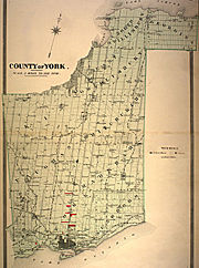
of more than a quarter million acres (1,000 km²) of land in the area of Toronto with the Mississaugas of New Credit. York County
York County, Ontario
York County is a historic county in Upper Canada, Canada West, and the Canadian province of Ontario.York County was created in 1792 and was part of the jurisdiction of Home District of Upper Canada...
, would later be created by Governor John Graves Simcoe
John Graves Simcoe
John Graves Simcoe was a British army officer and the first Lieutenant Governor of Upper Canada from 1791–1796. Then frontier, this was modern-day southern Ontario and the watersheds of Georgian Bay and Lake Superior...
in 1792, which would at its largest size, comprise all of what is now Halton Region, Toronto, Peel Region, York Region and parts of the current Durham Regional Municipality. The Town of York
York, Upper Canada
York was the name of Old Toronto between 1793 and 1834. It was the second capital of Upper Canada.- History :The town was established in 1793 by Governor John Graves Simcoe, with a new 'Fort York' on the site of the last French 'Fort Toronto'...
(present day Toronto) would later be attacked by American forces in the War of 1812
War of 1812
The War of 1812 was a military conflict fought between the forces of the United States of America and those of the British Empire. The Americans declared war in 1812 for several reasons, including trade restrictions because of Britain's ongoing war with France, impressment of American merchant...
in what is now known as the Battle of York
Battle of York
The Battle of York was a battle of the War of 1812 fought on 27 April 1813, at York, Upper Canada . An American force supported by a naval flotilla landed on the lake shore to the west, defeated the defending British force and captured the town and dockyard...
, in 1813. In 1816, Wentworth County and Halton County were created from York County. York County would later serve as the setting for the beginnings of the Upper Canada Rebellion
Upper Canada Rebellion
The Upper Canada Rebellion was, along with the Lower Canada Rebellion in Lower Canada, a rebellion against the British colonial government in 1837 and 1838. Collectively they are also known as the Rebellions of 1837.-Issues:...
with William Lyon Mackenzie
William Lyon Mackenzie
William Lyon Mackenzie was a Scottish born American and Canadian journalist, politician, and rebellion leader. He served as the first mayor of Toronto, Upper Canada and was an important leader during the 1837 Upper Canada Rebellion.-Background and early years in Scotland, 1795–1820:Mackenzie was...
's armed march from Holland Landing
Holland Landing, Ontario
Holland Landing is a village in the town of East Gwillimbury, located in the northern part of the Regional Municipality of York, in south-central Ontario, Canada. Its major road is Yonge Street and the village has bus service by GO Transit and York Region Transit...
towards York Township on Yonge Street, eventually leading up to the battle at Montgomery's Tavern. In 1851, Ontario County and Peel County were separated from York.
Since 1900
The idea towards a streamlined local government to control local infrastructure was made as early as 1907 by member of federal Parliament, and founder of the Toronto Globe, William Findlay Maclean, who called for the expansion of the government of the former City of Toronto in order to create a Greater Toronto. The idea for a single government municipality would not be seriously explored until the late 1940s when planners decided that the city needed to incorporate its immediate suburbs. However due to strong opposition from suburban politicians, a compromise was struck which resulted in the creation of Metropolitan TorontoMetropolitan Toronto
The Municipality of Metropolitan Toronto was a senior level of municipal government in the Toronto, Ontario, Canada area from 1954 to 1998. It was created out of York County and was a precursor to the later concept of a regional municipality, being formed of smaller municipalities but having more...
. In 1953, the portion of York County south of Steeles Avenue
Steeles Avenue
Steeles Avenue is an east-west street that forms the northern city limit of Toronto and the southern limit of York Region, Ontario, Canada. It stretches across the western Greater Toronto Area from Milborough Townline in Halton Region east to the Scarborough-Pickering limit. It runs for within...
, a concession road and township boundary, was severed from the county and incorporated as the Municipality of Metropolitan Toronto. With the concession of Metro Toronto, the offices of York County were moved from Toronto to Newmarket.
Originally, the membership in Metropolitan Toronto included the former City of Toronto and five townships: East York
East York
East York can refer to:*East York, Pennsylvania, United States*East York, Ontario, Canada...
, Etobicoke, North York, Scarborough
Scarborough, Ontario
Scarborough is a dissolved municipality within the city of Toronto, Ontario, Canada. Geographically, it comprises the eastern part of Toronto. It is bordered on the south by Lake Ontario, on the west by Victoria Park Avenue, on the north by Steeles Avenue East, and on the east by the Rouge River...
and York
York, Ontario
York is a dissolved municipality in Toronto, Ontario, Canada. Geographically, it is located northwest of Old Toronto, southwest of North York and east of Etobicoke, where it is bounded by the Humber River. Formerly a separate city, it was one of six municipalities that amalgamated in 1998 to form...
; as well as seven villages and towns, which became amalgamated into their surrounding townships in 1967. The early Metro Toronto government debated over the annexation of surrounding townships of Markham, Pickering and Vaughan. The first Metro Toronto Chairman, Frederick Goldwin Gardiner planned on the conversion of these townships into boroughs of the Metro Toronto government. In 1971, the remaining areas of York County was replaced by the Ontario government with the Regional Municipality of York. In 1980, North York would be incorporated into a city, with York following suit in 1983 and Etobicoke and Scarborough in 1984, although still part of the Metropolitan Toronto Municipal Government.
In 1992, the Ontario government passed legislation requiring Metropolitan Toronto to include the rest of the Greater Toronto Area into its planning. Despite this however, there was fear that different parts of the municipal system were working against one another and because of this, Bob Rae
Bob Rae
Robert Keith "Bob" Rae, PC, OC, OOnt, QC, MP is a Canadian politician. He is the Member of Parliament for Toronto Centre and interim leader of the Liberal Party of Canada....
, then the Premier of Ontario
Premier of Ontario
The Premier of Ontario is the first Minister of the Crown for the Canadian province of Ontario. The Premier is appointed as the province's head of government by the Lieutenant Governor of Ontario, and presides over the Executive council, or Cabinet. The Executive Council Act The Premier of Ontario...
, appointed Anne Golden
Anne Golden
Anne Golden, CM is a Canadian administrator.She received her BA in history from University College, University of Toronto in 1962. She received an MA from Columbia University and a Ph.D in American history from the University of Toronto....
to head a GTA task force to govern the region's quality of life, competitiveness and governance. During this time, the Metro Toronto government advocated to the task force the creation of a new GTA authority, which would be made up of 21 of the 30 existing municipalities in the GTA at the time. The proposal from Metro Toronto would have resulted in 15 new municipalities. The City of Mississauga argued that consolidation should only take place in such a way that the new municipalities would have a population between 400,000 to 800,000. The Town of Markham had similarly advocated municipal consolidation in York Region, although it was opposed to complete consolidation into a single municipality. Municipal consolidation faced stiff opposition however from smaller communities such as Ajax, Milton, and the borough of East York. The incoming government of Mike Harris
Mike Harris
Michael Deane "Mike" Harris was the 22nd Premier of Ontario from June 26, 1995 to April 15, 2002. He is most noted for the "Common Sense Revolution", his Progressive Conservative government's program of deficit reduction in combination with lower taxes and cuts to government...
would later act on the recommendation of the task force with the elimination of Metro Toronto, consolidating the remaining municipalities into the new City of Toronto. The task force's recommendations towards a GTA-tier municipality however were not acted upon by the Harris government, as it similarly resembled the former Metro Toronto government.
Geography

Lake Ontario
Lake Ontario is one of the five Great Lakes of North America. It is bounded on the north and southwest by the Canadian province of Ontario, and on the south by the American state of New York. Ontario, Canada's most populous province, was named for the lake. In the Wyandot language, ontarío means...
to the south, Kawartha lakes to the east, the Niagara Escarpment
Niagara Escarpment
The Niagara Escarpment is a long escarpment, or cuesta, in the United States and Canada that runs westward from New York State, through Ontario, Michigan, Wisconsin and Illinois...
to the west, and Lake Simcoe
Lake Simcoe
Lake Simcoe is a lake in Southern Ontario, Canada, the fourth-largest lake wholly in the province, after Lake Nipigon, Lac Seul, and Lake Nipissing. At the time of the first European contact in the 17th century the lake was called Ouentironk by the Huron natives...
to the north. The region creates a natural ecosystem known as the Greater Toronto Bioregion
Greater Toronto Bioregion
The Greater Toronto Bioregion represents a unique ecosystem that co-exists with the urban sprawl of the Greater Toronto Area. It is also part of the Oak Ridges Moraine system....
.
Vast parts of the region remain farmland and forests, making it one of the distinctive features of the geography of the GTA. Most of the urban areas in the GTA holds large urban forest. For the most part designated as parkland, the ravines are largely undeveloped. Rouge Park
Rouge Park
Rouge Park will become an urban national park located along the border of Toronto and Pickering, Ontario, Canada. It will be Canada's first national park within a municipality....
is also one of the largest nature park within a core of a metropolitan area. Much of these areas also constitute the Toronto ravine system
Toronto ravine system
The Toronto ravine system is one of the most distinctive features of the geography of Toronto, Ontario, Canada. It is a network of deep ravines that form a large urban forest that runs throughout much of the city...
, and a number of conservation areas in the region which are managed by Toronto and Region Conservation Authority
Toronto and Region Conservation Authority
Toronto and Region Conservation Authority or Office de protection de la nature de Toronto et de la région is one of 36 conservation authorities in Ontario, Canada...
.
In 2005, the Government of Ontario also passed legislation to prevent urban development and sprawl on environmentally-sensitive land in the Greater Toronto Area, known as the Greenbelt
Greenbelt (Golden Horseshoe)
The Greenbelt is a permanently protected area of green space, farmland, forests, wetlands, and watersheds, located in Southern Ontario, Canada. It surrounds a significant portion of Canada's most populated and fastest-growing area - The Golden Horseshoe....
, many of these areas including protected sections of the Oak Ridges Moraine
Oak Ridges Moraine
The Oak Ridges Moraine is an ecologically important geological landform in the Mixedwood Plains of south-central Ontario, Canada. The moraine covers a geographic area of between Caledon and Rice Lake, near Peterborough...
, Rouge Park and the Niagara Escarpment. Nevertheless, low-density suburban developments continue to be built, some on or near ecologically sensitive and protected areas. The provincial government has recently attempted to address this issue through the "Places to Grow" legislation passed in 2005, which emphasizes higher-density growth in existing urban centres over the next 25 years.
Economy
The Greater Toronto Area is a commercial, distribution, financial and economic centre, being the third largest financial centre in North America. The region as a whole generates about a fifth of the GDP of Canada, and is home to 40% of Canada's business headquarters. The economies of the municipalities in Greater Toronto themselves are largely intertwined with one another. The work force is made up of approximately 2.9 million people and more than 100,000 companies The Greater Toronto Area currently produces nearly 20% of the entire nation's GDP with $323 Billion, and from 1992 to 2002, experienced an average GDP growth rate of 4.0% and a job creation rate of 2.4% (compared to the national average GDP growth rate of 3% and job creation rate of 1.6%). The Greater Toronto Area also is home to 40% of Canadian business headquarters. Currently, over 51% of the labour force in the Greater Toronto Area is employed in the service sector, with 19% in the manufacturing, 17% of the labour force employed in wholesale & retail trade, 8% of the labour force involved in transportation, communication &utilities, and 5% of the workforce is involved in construction. Despite the fact that the service industry makes up only 51% of Greater Toronto's workforce, over 72% of the region's GDP is generated by service industries.The largest industry in the Greater Toronto Area is the financial services in the province, accounting for an estimated 25% of the region's GDP. Notably, the five largest banks in Canada all have their operational headquarters located in Toronto's Financial District
Financial District, Toronto
The Financial District is a business district in Toronto, Ontario, Canada, within the downtown core. It was originally planned as New Town in 1796 as an extension of the Town of York . It is the main financial district in Toronto, and is the financial heart of Canada...
. Toronto is also where the headquarters of to the Toronto Stock Exchange
Toronto Stock Exchange
Toronto Stock Exchange is the largest stock exchange in Canada, the third largest in North America and the seventh largest in the world by market capitalisation. Based in Canada's largest city, Toronto, it is owned by and operated as a subsidiary of the TMX Group for the trading of senior equities...
and the Standard and Poor TSX Composite Index
S&P/TSX Composite Index
The S&P/TSX Composite Index is an index of the stock prices of the largest companies on the Toronto Stock Exchange as measured by market capitalization. The Toronto Stock Exchange listed companies in this index comprise about 70% of market capitalization for all Canadian-based companies listed on...
are located, with offices of the TSX Venture Exchange
TSX Venture Exchange
The TSX Venture Exchange is a stock exchange in Canada. It is headquartered in Calgary, Alberta and has offices in Toronto, Vancouver, and Montreal. All trading through the Exchange is done electronically, so the Exchange does not have a "trading floor"...
also located in Toronto. The TMX Group, the owners and operators of TSX Exchanges as well as the Montreal Exchange
Montreal Exchange
The Montreal Exchange or MX is a derivatives exchange, located in Montreal, that trades futures contracts and options on equities, indices, currencies, ETFs, energy and interest rates. Since 1965, it has been located in the Tour de la Bourse , Montreal's third-tallest building...
are also headquartered in Toronto. The TSX and the TSX Venture Exchange represent 3,369 companies, including more than half of the world’s publicly traded mining companies.
Markham also attracted the highest concentration of high tech companies in Canada, and because of it, has positioned itself as Canada's High-Tech Capital. The Greater Toronto Area is currently the second largest automotive centre in North America (after Detroit). Currently, General Motors
General Motors Canada
General Motors of Canada Limited is General Motors' Canadian division. Its national headquarters office, Canadian Regional Engineering Centre, and main manufacturing plants are located in Oshawa, Ontario. GM Canada is 100% owned by GM.As of Apr...
, Ford
Ford Motor Company of Canada
Ford Motor Company of Canada, Limited was founded in 1904 for the purpose of manufacturing and selling Ford automobiles in Canada and the British Empire. The Ford Motor Company in Detroit transferred the patent and selling rights to the Walkerville Wagon Company, in order to avoid the tariff rates...
and Chrysler
Chrysler Canada
Chrysler Canada Incorporated is Chrysler's Canadian subsidiary. Incorporated in 1925, the Chrysler Corporation of Canada gained complete control of a Maxwell-Chalmers plant in Windsor Ontario that had been used to manufacture some Chrysler models in the previous year...
run six assembly plants in the area, with Honda and Toyota
Toyota Motor Manufacturing Canada
Toyota Motor Manufacturing Canada Inc. is a Canadian automotive manufacturer and is a wholly owned subsidiary of Toyota Motor Corporation...
having assembly plants just outside of the GTA. General Motors, Ford, Honda, KIA, Mazda, Suzuki, Nissan, Volkswagen, Toyota, Hyundai, Aston Martin, Jaguar, Land Rover, Subaru, Volvo, BMW, and Mitsubishi have chosen the Greater Toronto Area for their Canadian headquarters. Magna International
Magna International
Magna International Inc. , is an automotive supplier headquartered in Aurora, Ontario, Canada. It is Canada's largest automobile parts manufacturer, and one of the country's largest companies. It owns the Magna Steyr automobile production company of Austria....
, the world's most diversified car supplier, also has its headquarters located in Aurora. The entire automobile industry within the region accounts for roughly 10% of the region's GDP.
Agriculture

Floriculture
Floriculture, or flower farming, is a discipline of horticulture concerned with the cultivation of flowering and ornamental plants for gardens and for floristry, comprising the floral industry...
, nursery, vegetable, fruit, sheep and goats.
The most numerous farms types however in the GTA is miscellaneous specialty farms (including horse and pony, sheep and lamb, and other livestock specialty), followed by cattle, grain and oilseed, dairy and field crop farms. Although the output of dairy production has dropped with farms from within the GTA, dairy has remained the most productive sector in the agricultural industry by annual gross farm receipts. Despite the decreased amount of farmland around the region, farm capital value increased from $5.2 billion in 1996 to $6.1 billion in 2001, making the average farm capital value in the GTA continued to be the highest in the province.
Transportation
GO Transit
GO Transit is an inter-regional public transit system in Southern Ontario, Canada. It primarily serves the Greater Toronto and Hamilton Area conurbation, with operations extending to several communities beyond the GTHA proper in the Greater Golden Horseshoe...
, which recently merged with Metrolinx, is the Ontario's only intra-regional public transit service, linking the communities in the GTA and the cities of Hamilton. Implementation of a 'Presto card' by Metrolinx is currently under way, which would create a common means for all fare payments and allow for seamless connection between these and other transit operators.
Public transit operators in the GTA include Brampton Transit
Brampton Transit
Brampton Transit is public transport bus operator for the City of Brampton in the Regional Municipality of Peel, and within the Greater Toronto Area in Ontario, Canada. Brampton Transit began operations in 1974....
, Burlington Transit
Burlington Transit
Burlington Transit is the public transport provider in the city of Burlington, Ontario, Canada. Services began in September 1975, after the city had been served by neighbouring systems including Hamilton Street Railway , and former subsidiary Canada Coach Lines, as well as "local" services to and...
, Durham Region Transit
Durham Region Transit
Durham Region Transit is the regional public transit operator in Durham Region, east of Toronto, Ontario, Canada. Its headquarters are at 605 Rossland Rd East in Whitby, Ontario, and there are regional centres in Ajax, Whitby, and Oshawa.-Overview:...
, GO Transit
GO Transit
GO Transit is an inter-regional public transit system in Southern Ontario, Canada. It primarily serves the Greater Toronto and Hamilton Area conurbation, with operations extending to several communities beyond the GTHA proper in the Greater Golden Horseshoe...
, Milton Transit
Milton Transit
Milton Transit is the public transit system in the Town of Milton, Ontario, Canada. Milton is in Halton Regional Municipality, part of the Greater Toronto Area....
, MiWay (serving Mississauga), Oakville Transit
Oakville Transit
Oakville Transit is the public transportation provider in Oakville, Ontario, Canada since 1972. It is a department of the town, and a member of the Canadian Urban Transit Association. It offers the typical conventional bus service, and a para-transit service, called care-A-van, for those unable to...
, Toronto Transit Commission
Toronto Transit Commission
-Island Ferry:The ferry service to the Toronto Islands was operated by the TTC from 1927 until 1962, when it was transferred to the Metro Parks and Culture department. Since 1998, the ferry service is run by Toronto Parks and Recreation.-Gray Coach:...
, and York Region Transit
York Region Transit
York Region Transit is the public transit operator in York Region, Ontario, Canada. Its headquarters are in Richmond Hill, at 50 High Tech Road....
.
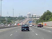
The GTA also has the largest and busiest freeway network in Canada, consisting of the King's Highways and supplemented by municipal expressways. One of the most principal highways in the GTA, Highway 401 is also longest in Ontario and is also one of the busiest highways in the world. Notably, a segment of the highway passing through the GTA holds the distinction of being the North America's busiest highway. The GTA is laced with a number of limited-access highways
Limited-access road
A limited-access road known by various terms worldwide, including limited-access highway, dual-carriageway and expressway, is a highway or arterial road for high-speed traffic which has many or most characteristics of a controlled-access highway , including limited or no access to adjacent...
, including the 400-series highways
400-series highways
The 400-series highways are a network of controlled-access highways throughout the southern portion of the Canadian province of Ontario, forming a special subset of the provincial highway system. They are analogous to the Interstate Highway System in the United States or the British Motorway...
. These include:
-
 Highway 400 – York Region, Toronto
 -
 Highway 401 – Durham Region, Toronto, Peel Region, Halton Region
 -
 Highway 403 – Peel Region, Halton Region
 -
 Highway 404 – York Region, Toronto
 - 407 ETR – Durham Region, Peel Region, York Region, Halton Region
-
 Highway 409 – Toronto, Peel Region
-
 Highway 410 – Peel Region
 -
 Highway 427 – York Region, Toronto, Peel Region
 -
 Queen Elizabeth WayQueen Elizabeth WayThe Queen Elizabeth Way, commonly abbreviated as the QEW, is a 400-Series highway in the Canadian province of Ontario. The freeway links Buffalo, New York and the Niagara Peninsula with Toronto. It begins at the Peace Bridge in Fort Erie and travels around the western shore of Lake Ontario, ending...
– Peel Region, Halton Region, Toronto - Gardiner ExpresswayGardiner ExpresswayThe Frederick G. Gardiner Expressway, colloquially referred to as "the Gardiner", is a municipal expressway in the Canadian province of Ontario, connecting downtown Toronto with its western suburbs...
– Toronto - Don Valley ParkwayDon Valley ParkwayThe Don Valley Parkway is a controlled-access six-lane municipal expressway in Toronto connecting the Gardiner Expressway in downtown Toronto with Ontario Highway 401, the Macdonald–Cartier Freeway. North of Highway 401, it continues as Ontario Highway 404. The parkway runs through...
– Toronto - William R. Allen RoadAllen RoadWilliam R. Allen Road, known more commonly as Allen Road, The Allen Expressway or simply The Allen and formerly as the Spadina Expressway, is a short expressway/freeway in Toronto, Ontario, which runs from Kennard Avenue in the north, to Eglinton Avenue West in the south...
– Toronto
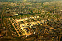
Toronto Pearson International Airport
Toronto Pearson International Airport is an international airport serving Toronto, Ontario, Canada; its metropolitan area; and the Golden Horseshoe, an urban agglomeration that is home to 8.1 million people – approximately 25% of Canada's population...
in Mississauga, which is Canada's largest and busiest airport. It processed nearly 32 million passengers in 2010. Toronto Pearson International Airport is operated by the Greater Toronto Airports Authority
Greater Toronto Airports Authority
The Greater Toronto Airports Authority operates Toronto Pearson International Airport in Mississauga, Ontario, west of Toronto, Ontario, Canada. The GTAA operates Canada's largest airport facility with a traffic of 31.0 million passengers in 2006. The authority's headquarters are on the airport...
(GTAA), and could potentially be asked to help observe in the operations of the other airports in the area, but has yet to be asked to do so. John C. Munro Hamilton International Airport in nearby Hamilton
Hamilton, Ontario
Hamilton is a port city in the Canadian province of Ontario. Conceived by George Hamilton when he purchased the Durand farm shortly after the War of 1812, Hamilton has become the centre of a densely populated and industrialized region at the west end of Lake Ontario known as the Golden Horseshoe...
also handles international flights handles some discount flights and charters and acts as an alternate to Pearson. Billy Bishop Toronto City Airport on Toronto Island
Toronto Islands
The Toronto Islands are a chain of small islands in the city of Toronto, Ontario. Comprising the only group of islands in the western part of Lake Ontario, the Toronto Islands are located just offshore from the city centre, and provide shelter for Toronto Harbour...
is used for civil aviation, air ambulance traffic and regional scheduled airlines. YTO is a multiple airport code that works for Pearson, City Centre, and Buttonville Municipal Airport (located in Markham). There are also a number of smaller airports which are scattered throughout the GTA.
The Greater Toronto Airport Authority has also placed a tentative proposal to develop a new airport in Pickering
Pickering Airport
Pickering Airport is a proposed international airport for the Greater Toronto Area, to be located in the city of Pickering, Ontario, Canada, 50 kilometres north-east of downtown Toronto, and 65 kilometres east of Toronto Pearson International Airport...
(which also spills over into Markham and Uxbridge). As the GTAA predicts that Toronto Pearson would be unable to indefinitely be the sole provider for the bulk of Toronto's commercial air traffic in the next 20 years, they believe that a new airport in Pickering would address the need for a regional/reliever airport east of Toronto Pearson, as well as complement the airport in Hamilton, Ontario. The GTAA also stated that the new airport would create more opportunities for economic development in the eastern region of the Greater Toronto Area.
Communication
The Greater Toronto Area is served by seven distinct area codes. Before 1993, the GTA used the 416 area code. In a 1993 zone split, Metropolitan TorontoMetropolitan Toronto
The Municipality of Metropolitan Toronto was a senior level of municipal government in the Toronto, Ontario, Canada area from 1954 to 1998. It was created out of York County and was a precursor to the later concept of a regional municipality, being formed of smaller municipalities but having more...
retained the 416 code, while the other municipalities of the Greater Toronto Area were assigned the new area code 905. This division by area code has become part of the local culture to the point where local media refer to something inside Toronto as "the 416" and outside of Toronto as "the 905". Though for the most part this was correct, it is not entirely true as some portions of Durham and York Regions use the 705 area code
Area code 705
Area codes 705 and 249 are telephone area codes that covers most of northeastern and central Ontario in Canada. 705 was initially created in 1957 by the North American Numbering Plan from portions of the area covered by area codes 613 and 519...
. Furthermore, there are areas, such as the Regional Municipality of Niagara, Ontario
Regional Municipality of Niagara, Ontario
The Regional Municipality of Niagara , also known as the Niagara Region, or, colloquially, "Regional Niagara", is a regional municipality comprising twelve municipalities of Southern Ontario, Canada....
and Port Hope, Ontario
Port Hope, Ontario
Port Hope is a municipality in Southern Ontario, Canada, about east of Toronto and about west of Kingston. It is located at the mouth of the Ganaraska River on the north shore of Lake Ontario, in the west end of Northumberland County...
that use the 905 area code, but are not part of the GTA. The unincorporated community of Acton
Acton, Ontario
Acton is a community located in the Town of Halton Hills, in Halton Region, Ontario, Canada.Acton is located on Highway 7 and the former Highway 25. Acton is served by GO Transit bus service on the Georgetown line corridor.-History:Acton was first named Danville when Settler Wheeler Green opened...
(located in Halton Hills), is the only community in the GTA which is covered under the area codes 519 and 226, the area code which covers most of Southwestern Ontario
Southwestern Ontario
Southwestern Ontario is a subregion of Southern Ontario in the Canadian province of Ontario, centred on the city of London. It extends north to south from the Bruce Peninsula on Lake Huron to the Lake Erie shoreline, and east to south-west roughly from Guelph to Windsor. The region had a population...
.
To meet the increased demand for phone numbers, two overlay area codes were introduced in 2001. Area code 647 (supplementing the 416 area code) was introduced in March 2001 and area code 289 (supplementing the 905 area code) was introduced in July 2001. Some individuals within the 905 area code region may have to dial long distance to reach each other; although residents of Mississauga and Hamilton share the same area code (905), an individual from Toronto, for example, would have to dial "1" to reach Hamilton, but not to reach Mississauga. Ten-digit telephone dialling, including the area code for local calls, is required throughout the GTA. In March 2013, two additional area codes will be introduced to the GTA: area code 437 in Toronto, and area code 365 in the area currently served by 905 and 289.
Government
The Greater Toronto Area is currently represented by 47 Members of Parliament in the Canadian House of Commons, including former party leader, the deceased Jack LaytonJack Layton
John Gilbert "Jack" Layton, PC was a Canadian social democratic politician and the Leader of the Official Opposition. He was the leader of the New Democratic Party from 2003 to 2011, and previously sat on Toronto City Council, serving at times during that period as acting mayor and deputy mayor of...
of the New Democratic Party
New Democratic Party
The New Democratic Party , commonly referred to as the NDP, is a federal social-democratic political party in Canada. The interim leader of the NDP is Nycole Turmel who was appointed to the position due to the illness of Jack Layton, who died on August 22, 2011. The provincial wings of the NDP in...
and former party leader Michael Ignatieff
Michael Ignatieff
Michael Grant Ignatieff is a Canadian author, academic and former politician. He was the leader of the Liberal Party of Canada and Leader of the Official Opposition from 2008 until 2011...
of the Liberal Party
Liberal Party of Canada
The Liberal Party of Canada , colloquially known as the Grits, is the oldest federally registered party in Canada. In the conventional political spectrum, the party sits between the centre and the centre-left. Historically the Liberal Party has positioned itself to the left of the Conservative...
. 46 Members of Provincial Parliament also represent the GTA in the Ontario Legislature
Legislative Assembly of Ontario
The Legislative Assembly of Ontario , is the legislature of the Canadian province of Ontario, and is the second largest provincial legislature of Canada...
. Five Senators from Ontario have also designated themselves as representatives of certain areas in the GTA in the Canadian Senate.
Federal politics
Federally, the ConservativesConservative Party of Canada
The Conservative Party of Canada , is a political party in Canada which was formed by the merger of the Canadian Alliance and the Progressive Conservative Party of Canada in 2003. It is positioned on the right of the Canadian political spectrum...
, Liberals, and the New Democrats all hold several electoral districts
Electoral district (Canada)
An electoral district in Canada, also known as a constituency or a riding, is a geographical constituency upon which Canada's representative democracy is based...
in the GTA. The City of Toronto has often been supportive of the Liberal party, which had in the past shut out the Conservative Party from any of the constituents within the city for the past 6 elections. Traditionally, Liberal support is strongest in Downtown Toronto
Downtown Toronto
Downtown Toronto is the central business district of Toronto, Ontario, Canada. It is approximately bounded by Bloor Street to the north, Lake Ontario to the south, the Don River to the east, and Bathurst Street to the west...
, while Conservative support is stronger in the surrounding communities outside Toronto. The NDP also has a strong base within the GTA.
In the most recent election, this trend turned around completely, where the political leanings of Toronto began to shift to mirror the surround communities that had been more likely to lean towards the Conservative party in their voting patterns.
The election of 2011 indicated the at the Liberal support, based on votes in the GTA, had collapsed from 43.7% to 19.8%, giving the Liberals only 14.9% of the local seats in the House of Commons. However, the support of the Conservatives and NDP increased accordingly, with the Conservatives increasing their vote share from 31.5% to 48.7% (and capturing 68.1% of the GTA seats) and the NDP increasing from 14.6% to 30.2% of the vote and 17% of the local Federal ridings.
| Federal Elections in the GTA | 2000 Canadian federal election, 2000 The 2000 Canadian federal election was held on November 27, 2000, to elect 301 Members of Parliament of the Canadian House of Commons of the 37th Parliament of Canada.... |
2004 Canadian federal election, 2004 The Canadian federal election, 2004 , was held on June 28, 2004 to elect members of the Canadian House of Commons of the 38th Parliament of Canada. The Liberal government of Prime Minister Paul Martin lost its majority, but was able to form a minority government after the elections... |
2006 Canadian federal election, 2006 The 2006 Canadian federal election was held on January 23, 2006, to elect members of the Canadian House of Commons of the 39th Parliament of Canada. The Conservative Party of Canada won the greatest number of seats: 40.3% of seats, or 124 out of 308, up from 99 seats in 2004, and 36.3% of votes:... |
2008 Canadian federal election, 2008 The 2008 Canadian federal election was held on Tuesday, October 14, 2008 to elect members to the Canadian House of Commons of the 40th Canadian Parliament after the previous parliament had been dissolved by the Governor General on September 7, 2008... |
2011 | ||
|---|---|---|---|---|---|---|---|
| Liberal Liberal Party of Canada The Liberal Party of Canada , colloquially known as the Grits, is the oldest federally registered party in Canada. In the conventional political spectrum, the party sits between the centre and the centre-left. Historically the Liberal Party has positioned itself to the left of the Conservative... |
Seats: | 44 | 40 | 36 | 32 | 7 |
Vote: | 57.4 | 51.3 | 47.3 | 43.7 | 19.8 |
Conservative Conservative Party of Canada The Conservative Party of Canada , is a political party in Canada which was formed by the merger of the Canadian Alliance and the Progressive Conservative Party of Canada in 2003. It is positioned on the right of the Canadian political spectrum... |
Seats: | - | 6 | 8 | 13 | 32 |
Vote: | - | 27.8 | 31.7 | 31.5 | 48.7 |
New Democrat New Democratic Party The New Democratic Party , commonly referred to as the NDP, is a federal social-democratic political party in Canada. The interim leader of the NDP is Nycole Turmel who was appointed to the position due to the illness of Jack Layton, who died on August 22, 2011. The provincial wings of the NDP in... |
Seats: | 0 | 1 | 3 | 2 | 8 |
Vote: | 7.2 | 15.4 | 16 | 14.6 | 30.2 |
Green Green Party of Canada The Green Party of Canada is a Canadian federal political party founded in 1983 with 10,000–12,000 registered members as of October 2008. The Greens advance a broad multi-issue political platform that reflects its core values of ecological wisdom, social justice, grassroots democracy and... |
Seats: | 0 | 0 | 0 | 0 | 0 |
Vote: | 0.8 | 4.2 | 4.5 | 7.1 | Canadian Alliance Canadian Alliance The Canadian Alliance , formally the Canadian Reform Conservative Alliance , was a Canadian conservative political party that existed from 2000 to 2003. The party was the successor to the Reform Party of Canada and inherited its position as the Official Opposition in the House of Commons and held... |
Seats: | 0 | - | - | - | - |
Vote: | 19.2 | - | - | - | - |
Progressive Conservatives Progressive Conservative Party of Canada The Progressive Conservative Party of Canada was a Canadian political party with a centre-right stance on economic issues and, after the 1970s, a centrist stance on social issues.... |
Seats: | 0 | - | - | - | - |
Vote: | 14.3 | - | - | - | - |
| Total seats: | - | - | 44 | 47 | 47 | 47 | 47 |
Provincial politics
On the provincial level of government, the Conservatives, Liberals, and the New Democrats all hold electoral districts in the GTA. McGuintyDalton McGuinty
Dalton James Patrick McGuinty, Jr., MPP is a Canadian lawyer, politician and, since October 23, 2003, the 24th and current Premier of the Canadian province of Ontario....
's Ontario Liberal Party
Ontario Liberal Party
The Ontario Liberal Party is a provincial political party in the province of Ontario, Canada. It has formed the Government of Ontario since the provincial election of 2003. The party is ideologically aligned with the Liberal Party of Canada but the two parties are organizationally independent and...
has enjoyed strong support from the region in the past three elections, with the Liberals currently holding 33 of the 44 available seats in the GTA. The Progressive Conservative Party of Ontario
Progressive Conservative Party of Ontario
The Progressive Conservative Party of Ontario , is a right-of-centre political party in Ontario, Canada. The party was known for many years as "Ontario's natural governing party." It has ruled the province for 80 of the years since Confederation, including an uninterrupted run from 1943 to 1985...
has not been elected in a Toronto riding since 1999. The surrounding municipalities of Toronto however have in the past supported the Progressive Conservative
Progressive Conservative Party of Ontario
The Progressive Conservative Party of Ontario , is a right-of-centre political party in Ontario, Canada. The party was known for many years as "Ontario's natural governing party." It has ruled the province for 80 of the years since Confederation, including an uninterrupted run from 1943 to 1985...
party, with the election of Harris's government in the 1990s' largely attributed to his support base in the suburban "905" region. During his time in office, many provincial services were transferred to the municipal governments, which caused great financial strain on Toronto.
Municipal Politics
Currently 244 politicians govern the Greater Toronto Area below the provincial and federal levels, holding offices in cities, towns, and regional municipalities. Unusual for a large North American urban agglomeration, the GTA has very few agencies with powers that can cross boundaries.Attempts to create an interregional organization have been made, such as the Province of Ontario's Office of the Greater Toronto Area (OGTA) in 1988 and the Greater Toronto Services Board
Greater Toronto Services Board
Greater Toronto Services Board was created in 1998 under the Greater Toronto Services Act by the province of Ontario and began sessions in 1999. It was created following the amalgamation of the City of Toronto. In some ways it was seen as a replacement for Metro Toronto Council and regional...
(GTSB) in 1998, but have failed due to a lack of real authority in these agencies.
Consequently there are few interregional public authorities: Metrolinx, an agency of the provincial government, manages the GTA-wide GO Transit
GO Transit
GO Transit is an inter-regional public transit system in Southern Ontario, Canada. It primarily serves the Greater Toronto and Hamilton Area conurbation, with operations extending to several communities beyond the GTHA proper in the Greater Golden Horseshoe...
system, while the Toronto and Region Conservation Authority
Toronto and Region Conservation Authority
Toronto and Region Conservation Authority or Office de protection de la nature de Toronto et de la région is one of 36 conservation authorities in Ontario, Canada...
, manages watersheds and natural areas. Notably, there is no organization with broad powers as in other Canadian cities, such as the Communauté métropolitaine de Montréal, and Metro Vancouver.
Demographics
According to the latest census data from 2006Canada 2006 Census
The Canada 2006 Census was a detailed enumeration of the Canadian population. Census day was May 16, 2006. The next census following will be the 2011 Census. Canada's total population enumerated by the 2006 census was 31,612,897...
from Statistics Canada
Statistics Canada
Statistics Canada is the Canadian federal government agency commissioned with producing statistics to help better understand Canada, its population, resources, economy, society, and culture. Its headquarters is in Ottawa....
, the population of this area is 5,555,912. Population growth studies have projected the City of Toronto's population in 2031 to be 3,000,000 and the Greater Toronto Area's population to be 7,450,000, while the Ontario Ministry of Finance states that it could reach 7.7 million by 2025. Statistics Canada
Statistics Canada
Statistics Canada is the Canadian federal government agency commissioned with producing statistics to help better understand Canada, its population, resources, economy, society, and culture. Its headquarters is in Ottawa....
identified in 2001 that four major urban regions in Canada exhibited a cluster pattern of concentrated population growth among which included the Greater Golden Horseshoe Census Region
Golden Horseshoe
The Golden Horseshoe is a densely populated and industrialized region centred around the Greater Toronto Area at the western end of Lake Ontario in Southern Ontario, Canada, with outer boundaries stretching south to Lake Erie and north to Georgian Bay. Most of it is also part of the Quebec City...
, which includes all of the Greater Toronto Area (which includes Oshawa), as well as other Southern Ontario
Southern Ontario
Southern Ontario is a region of the province of Ontario, Canada that lies south of the French River and Algonquin Park. Depending on the inclusion of the Parry Sound and Muskoka districts, its surface area would cover between 14 to 15% of the province. It is the southernmost region of...
cities including Niagara, Hamilton, Guelph, Kitchener-Waterloo and Barrie. Combined, the Greater Golden Horseshoe has a population of 8,116,000 in 2006, containing approximately 25% of Canada's population.
The Toronto CMA also has the largest proportions of foreign-born residents (46%) as a share of the total population out of all metropolitan areas in the Organization for Economic Co-operation and Development
Organisation for Economic Co-operation and Development
The Organisation for Economic Co-operation and Development is an international economic organisation of 34 countries founded in 1961 to stimulate economic progress and world trade...
. The Toronto region is also unusually diverse over the composition of its ethnicities. The four largest foreign born populations of Toronto only constitute 15% of the total foreign-born population. This is opposed to the four largest foreign born populations of other metropolitan areas such as New York and London, where they make up 25% of their respective foreign-born populations.
Statistics Canada also found that there were 31,910 Aboriginal people
Aboriginal peoples in Canada
Aboriginal peoples in Canada comprise the First Nations, Inuit and Métis. The descriptors "Indian" and "Eskimo" have fallen into disuse in Canada and are commonly considered pejorative....
living in the Greater Toronto Area, which represented 2.7 per cent of all Aboriginal persons in Canada and 13.2 per cent of those in Ontario. The majority of which however are not registered with the Indian reserve
Indian reserve
In Canada, an Indian reserve is specified by the Indian Act as a "tract of land, the legal title to which is vested in Her Majesty, that has been set apart by Her Majesty for the use and benefit of a band." The Act also specifies that land reserved for the use and benefit of a band which is not...
s within the Greater Toronto Area, the Chippewas of Georgina Island First Nation
Chippewas of Georgina Island First Nation
frame|right|Map of [[York Regional Municipality, Ontario|York Region]] showing Fox, Snake, and Georgina islands.thumb|Georgina Island, Lake Simcoe, Ontario...
and the Mississaugas of Scugog Island.
| Name | Total area (km²) | Population | Density |
|---|---|---|---|
| Province of Ontario | 1,076,395 km² | 13,425,124 | 13.8 / km² |
| City of Toronto | 630 km² | 2,503,281 | 3,972/ km² |
| Regional Municipality of Durham | 2,523.15 km² | 561,258 | 222.4/ km² |
| Regional Municipality of Peel | 1,241.99 km² | 1,159,405 | 933.2/ km² |
| Regional Municipality of York | 1,761.84 km² | 892,712 | 506.7/ km² |
| Regional Municipality of Halton | 967.17 km² | 439,526 | 454.45/ km² |
| Greater Toronto Area | 7124.15 km² | 5,555,912 | 779.9/ km² |
| Language | Toronto | Ontario | Canada |
|---|---|---|---|
| English | 56.2% | 69.8% | 58.4% |
| Italian | 3.8% | 2.5% | 1.5% |
| Unspecified Chinese | 3.5% | 1.8% | 1.5% |
| Cantonese Cantonese Cantonese is a dialect spoken primarily in south China.Cantonese may also refer to:* Yue Chinese, the Chinese language that includes Cantonese* Cantonese cuisine, the cuisine of Guangdong province... |
3.4% | 1.5% | 1.2% |
| Punjabi Punjabi language Punjabi is an Indo-Aryan language spoken by inhabitants of the historical Punjab region . For Sikhs, the Punjabi language stands as the official language in which all ceremonies take place. In Pakistan, Punjabi is the most widely spoken language... |
2.7% | 1.3% | 1.2% |
| Tagalog Tagalog language Tagalog is an Austronesian language spoken as a first language by a third of the population of the Philippines and as a second language by most of the rest. It is the first language of the Philippine region IV and of Metro Manila... |
2.2% | 1.1% | 0.9% |
| Portuguese | 2.2% | 1.4% | 0.7% |
| Spanish | 2.2% | 1.4% | 1.2% |
| Urdu | 2.1% | 1.0% | 0.5% |
| Tamil Tamil language Tamil is a Dravidian language spoken predominantly by Tamil people of the Indian subcontinent. It has official status in the Indian state of Tamil Nadu and in the Indian union territory of Pondicherry. Tamil is also an official language of Sri Lanka and Singapore... |
1.9% | 0.9% | 0.4% |
| Polish | 1.6% | 1.2% | 0.7% |
| French | 1.4% | 4.4% | 22.3% |
| Russian | 1.3% | 0.7% | 0.4% |
| Persian Persian language Persian is an Iranian language within the Indo-Iranian branch of the Indo-European languages. It is primarily spoken in Iran, Afghanistan, Tajikistan and countries which historically came under Persian influence... |
1.3% | 0.7% | 0.4% |
| Mandarin | 1.3% | 0.6% | 0.6% |
| Arabic | 1.2% | 1.0% | 0.9% |
| Gujarati Gujarati language Gujarati is an Indo-Aryan language, and part of the greater Indo-European language family. It is derived from a language called Old Gujarati which is the ancestor language of the modern Gujarati and Rajasthani languages... |
1.1% | 0.5% | 0.3% |
Education
Education in the Greater Toronto Area is currently managed by the provincial Ministry of Education (Ontario)Ministry of Education (Ontario)
The Ministry of Education is the agency of the Ontario government in the Canadian province of Ontario responsible for government policy, funding, curriculum planning and direction in all levels of public education, including elementary and secondary schools.This Ministry is responsible for...
, who manages preschool, elementary and secondary education, while the provincial Ministry of Training, Colleges and Universities is responsible for administration of laws relating to postsecondary education and skills training. There are currently 12 school boards located in the GTA, each region operating a secular English school board and English Catholic school board. The entire GTA is also under the jurisdiction of a secular French school board and a French Catholic school board. The Peel Region's Catholic school board also holds jurisdiction over Dufferin County, which is outside of the GTA.
| School boards in the Greater Toronto Area | ||||||||
|---|---|---|---|---|---|---|---|---|
| Region | Durham Region | Halton Region | Peel Region | City of Toronto | York Region | |||
| English Secular | Durham District School Board Durham District School Board The Durham District School Board is a public school board in Ontario, Canada. The DDSB serves most of the Regional Municipality of Durham, except for schools within the Municipality of Clarington, which belongs to the Kawartha Pine Ridge District School Board... |
Halton District School Board Halton District School Board The Halton District School Board serves public school students throughout Halton Region, including the municipalities of Burlington, Halton Hills, Milton and Oakville. Its administration area is to the southwest of the city of Toronto. In 2006-2007, it served almost 50,000 students, excluding... |
Peel District School Board Peel District School Board Peel District School Board is a Canadian public board of education for the Peel Regional Municipality, headquartered in the HJA Brown Education Centre in Mississauga... |
Toronto District School Board Toronto District School Board Toronto District School Board, also known by the acronym TDSB, is the English-language public school board for Toronto, Ontario, Canada... |
York Region District School Board York Region District School Board The York Region District School Board, also known as YRDSB, is the English-language public school board for York Regional Municipality located in Ontario, Canada. The York Region District School Board is currently the province's third largest school board, with an enrollment of over 115,000 students... |
|||
| English Catholic | Durham Catholic District School Board Durham Catholic District School Board The Durham Catholic District School Board is a publicly-funded Catholic school board located in Durham Region, east of Toronto, Ontario. There are 44 elementary schools, and 7 secondary schools. Also within the Board are one Adult Education Centre in Ajax, and one Continuing Education Centre in... |
Halton Catholic District School Board Halton Catholic District School Board The Halton Catholic District School Board has its headquarters in Burlington, Ontario, Canada.The Halton Catholic District School Board is the Catholic English, English language school board for the region.-History:... |
Dufferin-Peel Catholic District School Board Dufferin-Peel Catholic District School Board The Dufferin-Peel Catholic District School Board is one of the largest school boards in Ontario, Canada. It oversees 148 school facilities throughout Peel Region and Dufferin County... |
Toronto Catholic District School Board Toronto Catholic District School Board The Toronto Catholic District School Board is the publicly-funded Catholic school board for Toronto, Ontario, Canada, headquartered in North York. It is one of the two English boards of education in the City of Toronto, serving the former municipalities of Scarborough, North York, York, East York,... |
York Catholic District School Board York Catholic District School Board The York Catholic District School Board is the publicly funded English-language Catholic school district authority for the Regional Municipality of York in Ontario, Canada. Its head office is in Aurora.... |
|||
| Secular French | Conseil scolaire de district du Centre-Sud-Ouest Conseil scolaire de district du Centre-Sud-Ouest The Conseil scolaire Viamonde manages the French-language Public Schools in the central south-western region of Ontario. The area in which this school board operates covers 68,180 km2 of Ontario... |
|||||||
| French Catholic | Conseil scolaire de district catholique Centre-Sud Conseil scolaire de district catholique Centre-Sud Conseil scolaire de district catholique Centre-Sud is the Roman Catholic separate, French language school board for the South-Central region of Ontario. It is headquartered in North York, Toronto, Ontario, Canada... |
|||||||
Post-secondary education
The Greater Toronto Area is home to five publicly-funded universities, many of which are well known and respected throughout the world. There also are eleven private religious universities spread throughout the GTA. The five public degree-granting institutions are:- OCAD University (Toronto)
- Ryerson UniversityRyerson UniversityRyerson University is a public research university located in downtown Toronto, Ontario, Canada. Its urban campus is adjacent to Yonge-Dundas Square located at the busiest intersection in Downtown Toronto. The majority of its buildings are in the blocks northeast of the square in Toronto's Garden...
(Toronto) - University of TorontoUniversity of TorontoThe University of Toronto is a public research university in Toronto, Ontario, Canada, situated on the grounds that surround Queen's Park. It was founded by royal charter in 1827 as King's College, the first institution of higher learning in Upper Canada...
(Toronto)- University of Toronto ScarboroughUniversity of Toronto ScarboroughThe University of Toronto Scarborough is a satellite campus of the University of Toronto. Based in the Scarborough district of Toronto, Ontario, Canada, the campus is set upon suburban parkland in the residential neighbourhood of Highland Creek...
(Toronto) - University of Toronto MississaugaUniversity of Toronto MississaugaThe University of Toronto Mississauga is a satellite campus of the University of Toronto, located in Mississauga, Ontario, Canada. The university is set upon a park-like campus on the valley of the Credit River, approximately 33 kilometres west of Downtown Toronto...
(Mississauga)
- University of Toronto Scarborough
- University of Ontario Institute of TechnologyUniversity of Ontario Institute of TechnologyThe University of Ontario Institute of Technology is located in Oshawa, Ontario, Canada. The university shares its campus with Durham College. The university was founded in 2002 and accepted its first students in 2003, making it one of Canada's newest universities...
(Oshawa) - York UniversityYork UniversityYork University is a public research university in Toronto, Ontario, Canada. It is Canada's third-largest university, Ontario's second-largest graduate school, and Canada's leading interdisciplinary university....
(Toronto)
Three universities based outside of the GTA operate satellite campuses within the GTA, including McMaster University
McMaster University
McMaster University is a public research university whose main campus is located in Hamilton, Ontario, Canada. The main campus is located on of land in the residential neighbourhood of Westdale, adjacent to Hamilton's Royal Botanical Gardens...
, Trent University
Trent University
Trent University is a liberal arts and science-oriented institution located along the Otonabee River in Peterborough, Ontario, Canada.The enabling legislation is the Trent University Act, 1962-63. The University was founded through the efforts of a citizens' committee interested in creating a...
, and the University of Guelph
University of Guelph
The University of Guelph, also known as U of G, is a comprehensive public research university in Guelph, Ontario, Canada. It was established in 1964 after the amalgamation of Ontario Agricultural College, the Macdonald Institute, and the Ontario Veterinary College...
. The Ron Joyce Centre, located in Burlington is a 4.5 acre (0.01821087 km²) site mainly used by the McMaster's DeGroote School of Business
DeGroote School of Business
The DeGroote School of Business is one of six faculties at McMaster University in Hamilton, Ontario, Canada. The School of Business was founded in 1952 but was renamed in 1992 in honour of successful Canadian entrepreneur and philanthropist Michael G. DeGroote. The DeGroote school offers ...
. Trent University also operates a satellite campus in Oshawa, known as Trent in Oshawa. Guelph's Humber Campus
University of Guelph-Humber
The University of Guelph-Humber is a university-college partnership between the University of Guelph and Humber College. It was established in 2002. It is located on Humber's North Campus in Toronto, Ontario, Canada...
is located in Etobicoke, Toronto.
The Greater Toronto Area is also home to six publicly funded colleges, which have campuses spread in and around Greater Toronto. There are also a number of private career colleges spread throughout the Greater Toronto. The six publicly funded colleges are:
- Centennial College (Toronto)
- Durham CollegeDurham CollegeDurham College of Applied Arts and Technology is located in the Durham Region with campuses in Oshawa, Ontario, Canada and Whitby and additional locations in Uxbridge, Port Hope, Port Perry and Beaverton...
(Brock, Cobourg, Port Hope, Scugog, Oshawa, Uxbridge) - George Brown CollegeGeorge Brown CollegeGeorge Brown College is a public, fully accredited college of applied arts and technology with three full campuses in downtown Toronto, Ontario...
(Toronto) - Humber CollegeHumber CollegeHumber College Institute of Technology & Advanced Learning is a polytechnic college in Toronto, Ontario, Canada. Humber offers more than 150 programs including: bachelor’s degree, diploma, certificate, post-graduate certificate and apprenticeship programs, across 40 fields of study. Humber serves...
(Toronto) - Seneca CollegeSeneca CollegeSeneca College of Applied Arts and Technology is a Canadian public college in the greater Toronto area. Seneca College is currently Canada's largest college with approximately 108,000 students.-History:...
(King, Markham, Newmarket, Toronto) - Sheridan CollegeSheridan CollegeSheridan College Institute of Technology and Advanced Learning is a diploma and degree granting Canadian polytechnic institute with approximately 15,000 full time students and 35,000 continuing education students...
(Brampton, Mississauga, Oakville)
See also
- Golden HorseshoeGolden HorseshoeThe Golden Horseshoe is a densely populated and industrialized region centred around the Greater Toronto Area at the western end of Lake Ontario in Southern Ontario, Canada, with outer boundaries stretching south to Lake Erie and north to Georgian Bay. Most of it is also part of the Quebec City...
- Great Lakes MegalopolisGreat Lakes MegalopolisThe Great Lakes Megalopolis consists of the group of North American metropolitan areas which surround the Great Lakes region mainly within the Midwestern United States, the Southern Ontario area of Canada, along with large parts of Pennsylvania, New York, and Quebec...
- Greater Toronto and Hamilton AreaGreater Toronto and Hamilton AreaThe Greater Toronto and Hamilton Area is composed of the metropolitan areas of the Canadian cities of Toronto and Hamilton, Ontario. The GTHA includes the census metropolitan areas of Toronto, Hamilton and Oshawa....
- Greater Toronto Hockey LeagueGreater Toronto Hockey LeagueThe Greater Toronto Hockey League , formerly known as the "Metro Toronto Hockey League", is a minor level ice hockey organization based out of the Toronto region of Ontario. The league was founded in 1911 as the Beaches Hockey League by Fred C. Waghorne, Sr., and it is the largest minor hockey...
- Greening Greater TorontoGreening Greater TorontoGreening Greater Toronto, is an organization of over 120 civic leaders from business, NGOs, and government joined together to develop a regional environmental vision to achieve the goal of making the Greater Toronto Area the greenest city-region in North America...
- Metrolinx
- Toronto Region Research AllianceToronto Region Research AllianceThe Toronto Region Research Alliance is a regional economic development organization promoting increased investment in research and innovation to further economic prosperity...