

Climate of Northern Ireland
Encyclopedia
Northern Ireland
Northern Ireland is one of the four countries of the United Kingdom. Situated in the north-east of the island of Ireland, it shares a border with the Republic of Ireland to the south and west...
is an oceanic climate
Oceanic climate
An oceanic climate, also called marine west coast climate, maritime climate, Cascadian climate and British climate for Köppen climate classification Cfb and subtropical highland for Köppen Cfb or Cwb, is a type of climate typically found along the west coasts at the middle latitudes of some of the...
, or temperate
Temperate
In geography, temperate or tepid latitudes of the globe lie between the tropics and the polar circles. The changes in these regions between summer and winter are generally relatively moderate, rather than extreme hot or cold...
maritime climate. It is classified as Cfb on the Köppen climate classification
Köppen climate classification
The Köppen climate classification is one of the most widely used climate classification systems. It was first published by Crimea German climatologist Wladimir Köppen in 1884, with several later modifications by Köppen himself, notably in 1918 and 1936...
system. Northern Ireland has a latitude
Latitude
In geography, the latitude of a location on the Earth is the angular distance of that location south or north of the Equator. The latitude is an angle, and is usually measured in degrees . The equator has a latitude of 0°, the North pole has a latitude of 90° north , and the South pole has a...
between 54°N and 56°N and winters are much milder and wetter than many other cities on this latitude, such as Moscow
Moscow
Moscow is the capital, the most populous city, and the most populous federal subject of Russia. The city is a major political, economic, cultural, scientific, religious, financial, educational, and transportation centre of Russia and the continent...
, Omsk
Omsk
-History:The wooden fort of Omsk was erected in 1716 to protect the expanding Russian frontier along the Ishim and the Irtysh rivers against the Kyrgyz nomads of the Steppes...
or Novosibirsk
Novosibirsk
Novosibirsk is the third-largest city in Russia, after Moscow and Saint Petersburg, and the largest city of Siberia, with a population of 1,473,737 . It is the administrative center of Novosibirsk Oblast as well as of the Siberian Federal District...
. However, summers are generally cooler and wetter than other cities along a similar latitude. These climatic differences are because of the prevailing westerly winds from the Gulf Stream
Gulf Stream
The Gulf Stream, together with its northern extension towards Europe, the North Atlantic Drift, is a powerful, warm, and swift Atlantic ocean current that originates at the tip of Florida, and follows the eastern coastlines of the United States and Newfoundland before crossing the Atlantic Ocean...
, a warm Atlantic
Atlantic Ocean
The Atlantic Ocean is the second-largest of the world's oceanic divisions. With a total area of about , it covers approximately 20% of the Earth's surface and about 26% of its water surface area...
ocean current
Ocean current
An ocean current is a continuous, directed movement of ocean water generated by the forces acting upon this mean flow, such as breaking waves, wind, Coriolis effect, cabbeling, temperature and salinity differences and tides caused by the gravitational pull of the Moon and the Sun...
. The influence of the Gulf Stream also ensures the coastline of Northern Ireland remains ice-free throughout the winter—unlike for example the Sea of Okhotsk
Sea of Okhotsk
The Sea of Okhotsk is a marginal sea of the western Pacific Ocean, lying between the Kamchatka Peninsula on the east, the Kuril Islands on the southeast, the island of Hokkaidō to the far south, the island of Sakhalin along the west, and a long stretch of eastern Siberian coast along the west and...
and the Labrador Sea
Labrador Sea
The Labrador Sea is an arm of the North Atlantic Ocean between the Labrador Peninsula and Greenland. The sea is flanked by continental shelves to the southwest, northwest, and northeast. It connects to the north with Baffin Bay through the Davis Strait...
which are at a similar latitude. The climate in Northern Ireland does not experience extreme weather, with tornadoes and similar weather features being rare.
Temperature
Northern Ireland is in the north-west of the British isles and sees milder winters and cooler summers than areas further east and south. The Gulf StreamGulf Stream
The Gulf Stream, together with its northern extension towards Europe, the North Atlantic Drift, is a powerful, warm, and swift Atlantic ocean current that originates at the tip of Florida, and follows the eastern coastlines of the United States and Newfoundland before crossing the Atlantic Ocean...
(specifically the North Atlantic Current
North Atlantic Current
The North Atlantic Current is a powerful warm ocean current that continues the Gulf Stream northeast. West of Ireland it splits in two; one branch, the Canary Current, goes south, while the other continues north along the coast of northwestern Europe...
) moderates the climate of Northern Ireland, ensuring neither extreme heat in summer, nor extreme cold in winter. The lowest-ever recorded temperature in Northern Ireland was on 1 January 1979, when -17.5 °C was recorded at Magherally, near Banbridge
Banbridge
Banbridge is a town in County Down, Northern Ireland. It lies on the River Bann and the A1 road. It was named after a bridge built over the Bann in 1712. The town grew as a coaching stop on the road from Belfast to Dublin and thrived from Irish linen manufacturing...
, County Down
County Down
-Cities:*Belfast *Newry -Large towns:*Dundonald*Newtownards*Bangor-Medium towns:...
. In winter, the average maximum temperature is between 6.7 and 7.5 °C (44.1 and 45.5 °F), while the average minimum temperature is between 1.2 and 2 °C (34.2 and 35.6 °F). In summer, the average maximum temperature is between 16.5 and 18.4 °C (61.7 and 65.1 °F), while the average minimum temperature is between 8.3 and 10.6 °C (46.9 and 51.1 °F). The highest-ever recorded temperature was at Knockarevan, near Belleek
Belleek
Belleek may refer to:* Belleek, County Fermanagh, a village in County Fermanagh, Northern Ireland, famous for its pottery.**Belleek Pottery Ltd, the village's major industry...
, County Fermanagh
County Fermanagh
Fermanagh District Council is the only one of the 26 district councils in Northern Ireland that contains all of the county it is named after. The district council also contains a small section of County Tyrone in the Dromore and Kilskeery road areas....
on 30 June 1976, where 30.8 °C (87.4 °F) was recorded. This record was later equalled at Shaw's Bridge, Belfast
Belfast
Belfast is the capital of and largest city in Northern Ireland. By population, it is the 14th biggest city in the United Kingdom and second biggest on the island of Ireland . It is the seat of the devolved government and legislative Northern Ireland Assembly...
on 12 July 1983.
The annual mean temperature for different areas in Northern Ireland also varies. In the mountainous regions, the average mean is under 7 °C (44.6 °F). In most of lowland Northern Ireland the annual average is around 9 °C (48.2 °F), but around Portrush
Portrush
Portrush is a small seaside resort town in County Antrim, Northern Ireland, on the County Londonderry border. The main part of the old town, including the railway station as well as most hotels, restaurants and bars, is built on a mile–long peninsula, Ramore Head, pointing north-northwest....
on the north Antrim
County Antrim
County Antrim is one of six counties that form Northern Ireland, situated in the north-east of the island of Ireland. Adjoined to the north-east shore of Lough Neagh, the county covers an area of 2,844 km², with a population of approximately 616,000...
coast and Bangor
Bangor, County Down
Bangor is a large town in County Down, Northern Ireland. It is a seaside resort on the southern side of Belfast Lough and within the Belfast Metropolitan Area. Bangor Marina is one of the largest in Ireland, and holds Blue Flag status...
on the north Down
County Down
-Cities:*Belfast *Newry -Large towns:*Dundonald*Newtownards*Bangor-Medium towns:...
coast, the average mean temperature is around 10 °C (50 °F).
Rainfall
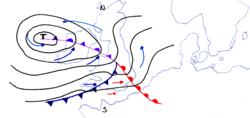
Rainfall in Northern Ireland normally comes from Atlantic frontal systems which travel north-east over Northern Ireland, bringing cloud and rain. The west is normally wetter than the east, with up to 2000 millimetres (78.7 in) in the west, and only 825 millimetres (32.5 in) around the Lough NeaghLough Neagh
Lough Neagh, sometimes Loch Neagh, is a large freshwater lake in Northern Ireland. Its name comes .-Geography:With an area of , it is the largest lake in the British Isles and ranks among the forty largest lakes of Europe. Located twenty miles to the west of Belfast, it is approximately twenty...
basin and the far south-east, including towns such as Kilkeel
Kilkeel
Kilkeel is a small town in County Down, Northern Ireland. It is the main fishing port on the Down coast, and its harbour houses one of the largest fishing fleets in Ireland. It had a population of 6,338 people according to the 2001 Census...
and Newcastle
Newcastle, County Down
Newcastle is a small town in County Down, Northern Ireland. It had a population of 7,444 people recorded in the 2001 Census. The seaside resort lies on the Irish Sea coast at the base of Slieve Donard, one of the Mourne Mountains, and is known for its sandy beach and the Royal County Down Golf Club...
. Mountainous areas such as the Sperrins
Sperrins
The Sperrins or Sperrin Mountains are a range of mountains in Northern Ireland and one of the largest upland areas in Ireland. The range stretches the counties of Tyrone and Londonderry from south of Strabane eastwards to Maghera and north towards Limavady...
, Glens of Antrim
Glens of Antrim
The Glens of Antrim , known locally as simply The Glens, is a region of County Antrim, Northern Ireland. It comprises nine glens , that radiate from the Antrim Plateau to the coast. The Glens are an area of outstanding natural beauty and are a major tourist attraction in north Antrim...
and the Mourne Mountains are wetter than the surrounding lowland. Spring is the driest season. October, November, December and January are the wettest months, with each of these months receiving on average over 100 millimetres (3.9 in) of rainfall. Parts of north-western Northern Ireland receive over 200 days of rainfall over 1 millimetre (0.0393700787401575 in), but in the sheltered south-east, rain occurs under 160 days a year. The highest-ever rainfall recorded in one day was on 31 October 1968 at Tollymore Forest, County Down
County Down
-Cities:*Belfast *Newry -Large towns:*Dundonald*Newtownards*Bangor-Medium towns:...
; 158.9 millimetres (6.3 in) of rain was recorded on that day.
Snowfall
Cold conditions are rare in Northern Ireland with snowfall quite uncommon in the lowlands and on the coast. However, it falls regularly on the hills and mountains in the winter. Snow falls around 2 or 3 times a year on the eastern seaboard, while in the mountainous regions it can fall over 30 days a year. Snow does not normally lie on the ground outside of the winter months of December, January and February; the Lough Neagh area, the BannRiver Bann
The River Bann is the longest river in Northern Ireland, the total length being 80 miles . The river winds its way from the south east corner of Northern Ireland to the north west coast, pausing in the middle to widen into the enormous Lough Neagh...
valley, around Lough Foyle
Lough Foyle
Lough Foyle, sometimes Loch Foyle , is the estuary of the River Foyle in Ulster. It starts where the Foyle leaves Derry. It separates the Inishowen Peninsula in County Donegal, Republic of Ireland from County Londonderry in Northern Ireland.-Transport:...
and eastern County Down have fewer than 6 days of lying snow every year. Snowfall is variable, and some winters see no snowfall. The winters of 1962/63, 1981/82 and 2009/2010 saw very heavy snowfall. Drifting can occur with strong winds; this can affect busy routes including the Glenshane Pass
Glenshane Pass
The Glenshane Pass is a major mountain pass cutting through the Sperrin Mountains in County Londonderry, Northern Ireland. It is in the townland of Glenshane on the main Derry to Belfast route, the A6.-Features:It is a Special Area of Conservation...
which is on the A6 road
A6 road (Northern Ireland)
The A6 road in Northern Ireland runs from the Belfast to Derry, via Antrim. Mostly single carriageway, there is a short dual carriageway section forming the Toome bypass. Towards Derry, there is also a short section of dual carriageway at Altnagelvin. This is one of Northern Ireland's most...
, the main route between the two largest cities in Northern Ireland, Belfast
Belfast
Belfast is the capital of and largest city in Northern Ireland. By population, it is the 14th biggest city in the United Kingdom and second biggest on the island of Ireland . It is the seat of the devolved government and legislative Northern Ireland Assembly...
and Derry
Derry
Derry or Londonderry is the second-biggest city in Northern Ireland and the fourth-biggest city on the island of Ireland. The name Derry is an anglicisation of the Irish name Doire or Doire Cholmcille meaning "oak-wood of Colmcille"...
. The A1 road
A1 road (Northern Ireland)
The A1 is a major route in Northern Ireland. It runs from Belfast via Lisburn and Banbridge to the border with the Republic of Ireland south of Newry, from where the road continues to Dublin, becoming the N1 road and M1 motorway...
connecting the capital cities of Northern Ireland and the Republic of Ireland
Republic of Ireland
Ireland , described as the Republic of Ireland , is a sovereign state in Europe occupying approximately five-sixths of the island of the same name. Its capital is Dublin. Ireland, which had a population of 4.58 million in 2011, is a constitutional republic governed as a parliamentary democracy,...
, Belfast and Dublin, has also suffered similar disruption.
Thunderstorms
Thunderstorms are quite rare in Northern Ireland compared to England and Wales, with most places only having on average 3 days of thunder every year. Thunder is most frequent in Northern Ireland in the south-west region, including County FermanaghCounty Fermanagh
Fermanagh District Council is the only one of the 26 district councils in Northern Ireland that contains all of the county it is named after. The district council also contains a small section of County Tyrone in the Dromore and Kilskeery road areas....
and parts of western County Tyrone
County Tyrone
Historically Tyrone stretched as far north as Lough Foyle, and comprised part of modern day County Londonderry east of the River Foyle. The majority of County Londonderry was carved out of Tyrone between 1610-1620 when that land went to the Guilds of London to set up profit making schemes based on...
. However, thunder still usually occurs in this area fewer than 6 times a year.
Sunshine
The east of Northern Ireland, which is sheltered from Atlantic frontal systems, is sunnier than the west. The sunniest region, the Ards PeninsulaArds Peninsula
The Ards Peninsula is a peninsula in County Down, Northern Ireland which separates Strangford Lough from the North Channel of the Irish Sea, on Ireland's northeast coast. A number of towns and villages are located on the peninsula, such as the seaside town of Donaghadee, with the surrounding area...
, receives up to 1,500 hours of sunshine every year. Further west, the hours of sunshine decreases, and the forested mountainous north-west receives on average under 1,100 hours of sunshine. The average recording of sunshine for the whole country is 1219.7 hours. December is the dullest month with 31.8 hours sunshine, which equates to just over one hour per day. May is the sunniest month and receives 175.9 hours of sunshine—this is because of its long days and fine weather.
Wind
Northern Ireland lies in the path of low pressure systems moving north-east across the United Kingdom from the Atlantic. As well as rain, these frontal system can bring strong winds. GaleGale
A gale is a very strong wind. There are conflicting definitions of how strong a wind must be to be considered a gale. The U.S. government's National Weather Service defines a gale as 34–47 knots of sustained surface winds. Forecasters typically issue gale warnings when winds of this strength are...
s are not as common in Northern Ireland as they are in the more exposed Hebrides
Hebrides
The Hebrides comprise a widespread and diverse archipelago off the west coast of Scotland. There are two main groups: the Inner and Outer Hebrides. These islands have a long history of occupation dating back to the Mesolithic and the culture of the residents has been affected by the successive...
in Scotland
Scotland
Scotland is a country that is part of the United Kingdom. Occupying the northern third of the island of Great Britain, it shares a border with England to the south and is bounded by the North Sea to the east, the Atlantic Ocean to the north and west, and the North Channel and Irish Sea to the...
, or the far south-west of England. Gales occur around 15 days a year on the Antrim and Down coast, but occur inland on average fewer than 5 times a year. In the hills and mountains, wind speed is higher than in the lowlands. The east coast sometimes experiences cold winds in the winter, which come from the Siberian High
Siberian High
The Siberian High is a massive collection of cold or very cold dry air that accumulates on the Eurasian terrain for much of the year. It reaches its greatest size and strength in the winter, when the air temperature near the center of the high-pressure cell or anticyclone is often lower than...
.
Frost
Air frostFrost
Frost is the solid deposition of water vapor from saturated air. It is formed when solid surfaces are cooled to below the dew point of the adjacent air as well as below the freezing point of water. Frost crystals' size differ depending on time and water vapour available. Frost is also usually...
occurs frequently in the winter, with most areas seeing over 40 days of air frost every year. Air frost occurs on average 10.2 days every January, the month in which air frost occurs most frequently. Along the coast, air frost occurs less regularly. In the Sperrins
Sperrins
The Sperrins or Sperrin Mountains are a range of mountains in Northern Ireland and one of the largest upland areas in Ireland. The range stretches the counties of Tyrone and Londonderry from south of Strabane eastwards to Maghera and north towards Limavady...
and the Glens of Antrim
Glens of Antrim
The Glens of Antrim , known locally as simply The Glens, is a region of County Antrim, Northern Ireland. It comprises nine glens , that radiate from the Antrim Plateau to the coast. The Glens are an area of outstanding natural beauty and are a major tourist attraction in north Antrim...
air frost occurs around 80 days of year. The pattern is similar with ground frost, with on average around 100 days of ground frost in the lowlands and over 140 in the mountains.