

Calabozos
Encyclopedia
Calabozos is a Holocene
caldera
in central Chile
's Maule Region
(7th Region). Part of the Chilean Andes
' volcanic segment, it is considered a member of the Southern Volcanic Zone (SVZ), one of the three distinct volcanic belts of South America. This most active section of the Andes runs along central Chile's western edge, and includes more than 70 of Chile's stratovolcano
es and volcanic fields. Calabozos lies in an extremely remote area of poorly glaciated mountains.
Calabozos and the majority of the Andean volcanoes formed from the subduction
of the oceanic Nazca Plate
under the continental South American continental lithosphere
. The caldera is in a transitional region between thick and thin lithosphere, and is probably supplied by a pool of andesitic
and rhyolitic
magma. It sits on a historic bed of volcanic and plutonic sedimentary rock
(rock formed within the Earth) that in turn sits on top of a layer of merged sedimentary and metamorphic rock
.
Calabozos is responsible for the huge Loma Seca Tuff
, a body of material 200 cubic kilometres (48 cu mi) to 500 cubic kilometres (120 cu mi) in volume. It accumulated over at least three eruptive periods, beginning 800,000 years ago (0.8 mya) and lasting until 150,000 years ago (0.15 mya).
The caldera's dimensions are 26 kilometres (16 mi) by 14 kilometres (8.7 mi), and it has an elevation
of 3508 metres (11,509 ft). Activity from the caldera has produced many other stratovolcanoes to form a complex volcano
.
, near Curicó and Talca, on the western Andes. This is an area of poorly glaciated mountains that is not permanently populated. There are no roads, and it is only accessible via horse or on foot.
Calabozos is part of the South Volcanic Zone, which runs along the western edge of central Chile and extends south, jumping the border to continue its course in Argentina. This range includes at least nine caldera complexes
, more than 70 of Chile's stratovolcanoes and volcanic fields that have been active in the Quaternary
, and hundreds of minor eruptive centers. The South Volcanic Zone is the most volcanically active region in Chile, and produces around one eruption per year. Its largest historical eruption was at Quizapu Crater, located 15 kilometres (9 mi) to 20 kilometres (12 mi) from the north side of Cerro Azul's summit, and its most active volcanoes are Llaima
and Villarrica
.
Calabozos is a ring-shaped caldera
26 kilometres (16 mi) by 14 kilometres (9 mi) wide, with an elevation of 3508 metres (11,509 ft). Volcanoes have been formed by eruptions in the crater. The largest, which is on the southern rim of the caldera, is the Holocene Cerro del Medio complex with an elevation of 3508 metres (11,509 ft). It is made mainly of andesite and dacite, and has a volume of 20 cubic kilometres (5 cu mi) to 25 cubic kilometres (6 cu mi). On the southwestern edge several eruptions have created the Descabezado Chico volcano (elevation: 3250 metres (10,663 ft)) which consists of four overlapping volcanic crater
s. The last eruption occurred during Holocene time, and produced a dacitic
lava flow (2.5 cubic kilometre (0.599781896510717 cu mi) in volume) that extends for 30 kilometres (19 mi). Cerro Colorado, with an elevation of 2928 metres (9,606 ft), forms another cone in the complex.
Towards the center of the caldera, hot spring
s including Cajon Loz Calabozos and Baños de Llolli are present. The springs are as old as 0.3 mya, and may have formed directly after Calabozos's second eruption as a result of uplift
caused by re-occurring activity in the caldera. The vents occur in two clusters, Colorado and Puesto Calabozos, and are located along the margin of a fault at the southwestern edge of the caldera. Hildreth et al. (1983) evaluated that Calabozos could potentially be useful for the harvesting of geothermal energy.
of the eastern edge of the Nazca Plate
under the western edge of the South American Plate
occurs about 160 kilometres (99 mi) west of Peru and Chile, at a rate of 9 to 11 centimetres (4 in) per year at 30 degrees south latitude. This subduction process has resulted in the formation of the Peru–Chile Trench, an oceanic trench
in the Pacific Ocean
. It also produced the Andean Volcanic Belt
and the rest of the Andes.
Calabozos is one of 44 Holocene epoch
volcanoes located in central Chile and Argentina. It is included within the Southern Volcanic Zone, the most active section of the Chilean Andes. The date of its last known eruption is not known with precision, though it took place during the Holocene.
Through K-Ar dating, geologist Robert Edward Drake established the age of 66 events in central Chile, and divided them into groups based on the time of their origin. In a paper published in 1976, he described the location of each group and the west-east-trending movement of volcanism in the range.
To the west of the Chilean Andes are an early group of eruptions, dated from the Oligocene
and the Early Miocene
(33.3–20.2 mya). The scale of the eruptive events that produced these features remains unclear. Further east, in the actual range, are huge numbers of eruptions. Between 15.3 and 6.4 mya, widespread volcanism took place, followed by extensive folding
; this process then repeated itself from 18.4 to 13.7 mya during the Miocene. Beginning 6.4 mya the Chilean Andes were quiet, though whether or not this quiet period took place throughout all of the Andes remains unknown. Central Chilean volcanoes became active once again around 2.5 mya, and have erupted almost continuously since.
and rhyolitic magma that sits just under its caldera. The caldera is underlain by a layer of volcaniclastic sedimentary rock
from the Mesozoic
era coalesced with intrusive and volcanic rocks of Tertiary
age, over a layer of Precambrian
-Triassic
sedimentary and metamorphic rock formed from later pluton
s (magma intrusions). Under its northeast edge, Calabozos is cut by a north-south trending segment of sedimentary rock that includes gypsiferous and carbonates
.
Calabozos is similar in age to Cerro Azul
and Descabezado Grande
, and its eruptions may correspond to past activity at both volcanoes. Eruption products of very similar composition (including mafic
andesite
, agglutinates, and dacite
) make up the volcanoes. There is also a similarity in size (all are between 40 and 70 cubic kilometers in volume).
The volcano appears to be part of a north-south trending group of rhyolitic, silicic
Quaternary volcanoes (including Puelche Volcanic Field, Laguna del Maule
, and Volcán Domuyo) that veers off the north-northeast direction of the rest of the Andes. The directional formation of this belt corresponds to the fold-and-thrust movement of the nearby Malargüe fault, which formed in the Tertiary
and remained active until the early Pliocene or late Miocene. This may suggest that Calabozos' activity is more dependent on local processes than subduction of the Nazca Plate.
ash was missing from the record, and concluded that erosion had probably disrupted deposition
of volcaniclastic rock.
While the volcanic history of the area extends back far further, the earliest fully recognizable events in the region are recorded in the pyroclastic
Campanario Formation. This sequence appears to begin at Laguna de la Invernada and ranges from 15 to 6 mya. Remnants of magma intrusions as young as 7 mya can be found at the lake (Laguna de la Invernada).
The most recent volcanic phase began about 4 mya, producing largely andesitic eruptions. A series of eruptions built up a broad plateau
of lava, and extended over the area where Calabozos now lies. Locally, this plateau was composed of mafic andesite with olivine
, which over time gathered to form 300 metres (984.3 ft) to 500 metres (1,640.4 ft) thick layers. Nearby volcanoes sit on top of two mya lavas that formed during this period, while the Loma Seca Tuff lies atop andesitic deposits from Descabezado Grande.
and rhyolite
are the primary constituents of lava
while its southern neighbors are composed of more mafic
andesite and basalt
. It is mainly basaltic andesite
and rhyodacite
that make up Calabozos, forming a calcalkilic
suite rich with potassium
. Its lavas are dotted with phenocryst
s, which vary from 2 to 25 percent of their mass. These phenocrysts are typically made of plagioclase
, but also contain clinopyroxene, orthopyroxene, ilmenite
, apatite
, and titanomagnetite.
Vegetation is rare in the area. The 1932 eruption of Cerro Azul
's Quizapu Crater reduced much of the land to a pumice desert. Above 1200 metres (3,937 ft), vegetation becomes even more sparse.
 During the late Pleistocene
, Calabozos erupted tuff
composed primarily of rhyodacite
and dacite
. Three distinct eruptions have taken place within the last million years. The sheets of remaining ash
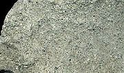
left over from all of the eruptions together range from 200 cubic kilometres (48 cu mi) to 500 cubic kilometres (120 cu mi) in volume and are known as the Loma Seca Tuff.
The first eruption, which took place 0.8 mya, was distinct from later eruptions in that its product lacks flattened lenticles (lens-shaped layers of mineral or rock embedded in rock). The tuff is dotted with predominantly plagioclase
phenocrysts, which make up between less than 5 to approximately 15 percent of each particle's mass. After being erupted, the material settled in canyons, where it underwent glaciation. This carved cliffs which drop as much as 100 metres (328 ft). The tuff is limited to just a few kilometers around the complex.
Taking place 0.3 mya, the second eruption was the most extensive. It was probably between 250 cubic kilometres (60 cu mi) and 300 cubic kilometres (72 cu mi) in volume and extended past the reaches of the caldera, down the adjacent foothills. Beyond the caldera, the eruptive products are poor in phenocrysts (unlike those of the first eruption). They are instead rich in lithic material, which makes up as much as 10 percent of the rock in parts (50 percent at the base of the caldera). As the first of the ash was deposited, it accumulated in layers that formed quickly and resisted erosion, but only partially melded together. However, except for these basal layers and thin zones where the ash was devitrified (loses the properties of a glass and becomes brittle), the entire sheet is melded together. Inside Calabozos, the ash resisted welding and contains more phenocrysts. Instead, erosion ate away at it, in the form of acid leaching, and broke down much of its pumice
content. Still, the rock layer here contains five to 30 percent phenocrysts, and has high levels of devitrification
and lithic content.
The differences between these two deposits can be accounted for by a few factors, including time of eruption and placement. The material inside the caldera must be younger and erupted from a pool of magma that had larger crystals. Its extensive erosion can be explained by the presence of hydrothermal vents, and its high levels of lithics probably originate from either being exposed to the rocks after they were erupted, lying adjacent to them while they underwent subsidence
, or is a result of long, slow formation. Any of these reasons would also effectively account for the poor mixing of the lavas.
Activity continued for approximately 150,000 years in the form of quiet andesitic eruptions, as glaciation took place. About 0.15 mya (150,000 years ago), a third and final ash flow was erupted. With a volume of 175 cubic kilometres (42 cu mi) to 250 cubic kilometres (60 cu mi), it was smaller than the second eruption, but acted similarly, and had much more densely-welded tuff. The ash was thickest at 300 metres (984 ft), at Loma Seca, and the top of the deposit has undergone erosion. It is densely-welded in crevasses, but not at thin 50 metres (164 ft) layers, where much of the material is barely welded or not welded at all.
The first layers of the last deposit were alternating belts of light and dark-colored material, and were densely-welded. They appear to have been erupted in pulses, and continue for hundreds of meters. Deposition was continuous except for one interruption, which can be seen at proximity to the caldera, where the layers are replaced by thin, nonwelded sheets of lava. Another zone of nonwelded material, about 20 metres (66 ft) and near Cajon Los Calabozos, underwent no erosion, suggesting that activity stopped, then began again.
High in fiamme
, the third tuff layer differs from the second in that it has even higher phenocryst content, but poor lithics. In the fiamme, phenocrysts constitute between 5 and 15 percent of the rock, increasing to 25 to 30 percent near the caldera. In the younger emplacements, clinopyroxene is evident along with an increase in mafic
content.
, Llaima, and Villarrica. Villarrica and Llaima together have more than 80 reported episodes of volcanism since 1558, and at least 40 South Volcanic Zone volcanoes have had Holocene-age eruptions.
Its remoteness means that Calabozos poses little threat to humans, but if necessary relief efforts could be orchestrated. The Volcanic Disaster Assistance Program (VDAP) formed in response to the famous eruption of Nevado del Ruiz
in Colombia
and saved lives following the 1991 eruption of Mount Hudson
in Chile by organizing evacuations. The team's stated aim is to "reduce eruption-caused fatalities and economic losses in developing countries". Made up of various USGS offices such as the Cascades Volcano Observatory
(CVO), responsible for monitoring Mount St. Helens
, the team has equipment to monitor any volcano, allowing the timely prediction of volcanic eruptions and the evacuation of nearby homes.
Holocene
The Holocene is a geological epoch which began at the end of the Pleistocene and continues to the present. The Holocene is part of the Quaternary period. Its name comes from the Greek words and , meaning "entirely recent"...
caldera
Caldera
A caldera is a cauldron-like volcanic feature usually formed by the collapse of land following a volcanic eruption, such as the one at Yellowstone National Park in the US. They are sometimes confused with volcanic craters...
in central Chile
Chile
Chile ,officially the Republic of Chile , is a country in South America occupying a long, narrow coastal strip between the Andes mountains to the east and the Pacific Ocean to the west. It borders Peru to the north, Bolivia to the northeast, Argentina to the east, and the Drake Passage in the far...
's Maule Region
Maule Region
The VII Maule Region is one of Chile's 15 first order administrative divisions. Its capital is Talca. The region takes its name from the Maule River which, running westward from the Andes, bisects the region and spans a basin of about 20,600 km2...
(7th Region). Part of the Chilean Andes
Andes
The Andes is the world's longest continental mountain range. It is a continual range of highlands along the western coast of South America. This range is about long, about to wide , and of an average height of about .Along its length, the Andes is split into several ranges, which are separated...
' volcanic segment, it is considered a member of the Southern Volcanic Zone (SVZ), one of the three distinct volcanic belts of South America. This most active section of the Andes runs along central Chile's western edge, and includes more than 70 of Chile's stratovolcano
Stratovolcano
A stratovolcano, also known as a composite volcano, is a tall, conical volcano built up by many layers of hardened lava, tephra, pumice, and volcanic ash. Unlike shield volcanoes, stratovolcanoes are characterized by a steep profile and periodic, explosive eruptions...
es and volcanic fields. Calabozos lies in an extremely remote area of poorly glaciated mountains.
Calabozos and the majority of the Andean volcanoes formed from the subduction
Subduction
In geology, subduction is the process that takes place at convergent boundaries by which one tectonic plate moves under another tectonic plate, sinking into the Earth's mantle, as the plates converge. These 3D regions of mantle downwellings are known as "Subduction Zones"...
of the oceanic Nazca Plate
Nazca Plate
]The Nazca Plate, named after the Nazca region of southern Peru, is an oceanic tectonic plate in the eastern Pacific Ocean basin off the west coast of South America. The ongoing subduction along the Peru-Chile Trench of the Nazca Plate under the South American Plate is largely responsible for the...
under the continental South American continental lithosphere
South American Plate
The South American Plate is a continental tectonic plate which includes the continent of South America and also a sizeable region of the Atlantic Ocean seabed extending eastward to the Mid-Atlantic Ridge....
. The caldera is in a transitional region between thick and thin lithosphere, and is probably supplied by a pool of andesitic
Andesite
Andesite is an extrusive igneous, volcanic rock, of intermediate composition, with aphanitic to porphyritic texture. In a general sense, it is the intermediate type between basalt and dacite. The mineral assemblage is typically dominated by plagioclase plus pyroxene and/or hornblende. Magnetite,...
and rhyolitic
Rhyolite
This page is about a volcanic rock. For the ghost town see Rhyolite, Nevada, and for the satellite system, see Rhyolite/Aquacade.Rhyolite is an igneous, volcanic rock, of felsic composition . It may have any texture from glassy to aphanitic to porphyritic...
magma. It sits on a historic bed of volcanic and plutonic sedimentary rock
Sedimentary rock
Sedimentary rock are types of rock that are formed by the deposition of material at the Earth's surface and within bodies of water. Sedimentation is the collective name for processes that cause mineral and/or organic particles to settle and accumulate or minerals to precipitate from a solution....
(rock formed within the Earth) that in turn sits on top of a layer of merged sedimentary and metamorphic rock
Metamorphic rock
Metamorphic rock is the transformation of an existing rock type, the protolith, in a process called metamorphism, which means "change in form". The protolith is subjected to heat and pressure causing profound physical and/or chemical change...
.
Calabozos is responsible for the huge Loma Seca Tuff
Tuff
Tuff is a type of rock consisting of consolidated volcanic ash ejected from vents during a volcanic eruption. Tuff is sometimes called tufa, particularly when used as construction material, although tufa also refers to a quite different rock. Rock that contains greater than 50% tuff is considered...
, a body of material 200 cubic kilometres (48 cu mi) to 500 cubic kilometres (120 cu mi) in volume. It accumulated over at least three eruptive periods, beginning 800,000 years ago (0.8 mya) and lasting until 150,000 years ago (0.15 mya).
The caldera's dimensions are 26 kilometres (16 mi) by 14 kilometres (8.7 mi), and it has an elevation
Elevation
The elevation of a geographic location is its height above a fixed reference point, most commonly a reference geoid, a mathematical model of the Earth's sea level as an equipotential gravitational surface ....
of 3508 metres (11,509 ft). Activity from the caldera has produced many other stratovolcanoes to form a complex volcano
Complex volcano
A complex volcano, also called a compound volcano, is a volcano with more than one feature. They form because changes of their eruptive characteristics or the location of multiple vents in an area...
.
Geography and structure
Calabozos lies in central Chile's Maule RegionMaule Region
The VII Maule Region is one of Chile's 15 first order administrative divisions. Its capital is Talca. The region takes its name from the Maule River which, running westward from the Andes, bisects the region and spans a basin of about 20,600 km2...
, near Curicó and Talca, on the western Andes. This is an area of poorly glaciated mountains that is not permanently populated. There are no roads, and it is only accessible via horse or on foot.
Calabozos is part of the South Volcanic Zone, which runs along the western edge of central Chile and extends south, jumping the border to continue its course in Argentina. This range includes at least nine caldera complexes
Volcanic field
A volcanic field is an area of the Earth's crust that is prone to localized volcanic activity. They usually contain 10 to 100 volcanoes, such as cinder cones and are usually in clusters. Lava flows may also occur...
, more than 70 of Chile's stratovolcanoes and volcanic fields that have been active in the Quaternary
Quaternary
The Quaternary Period is the most recent of the three periods of the Cenozoic Era in the geologic time scale of the ICS. It follows the Neogene Period, spanning 2.588 ± 0.005 million years ago to the present...
, and hundreds of minor eruptive centers. The South Volcanic Zone is the most volcanically active region in Chile, and produces around one eruption per year. Its largest historical eruption was at Quizapu Crater, located 15 kilometres (9 mi) to 20 kilometres (12 mi) from the north side of Cerro Azul's summit, and its most active volcanoes are Llaima
Llaima
Llaima Volcano is one of the largest and most active volcanoes in Chile. It is situated 82 km northeast of Temuco and 663 km southeast of Santiago, within the borders of Conguillío National Park.-Geography:...
and Villarrica
Villarrica (volcano)
Villarrica is one of Chile's most active volcanoes, rising above the lake and town of the same name. The volcano is also known as Rucapillán, a Mapuche word meaning "House of the Pillán". It is the westernmost of three large stratovolcanoes that trend perpendicular to the Andean chain along the...
.
Calabozos is a ring-shaped caldera
Caldera
A caldera is a cauldron-like volcanic feature usually formed by the collapse of land following a volcanic eruption, such as the one at Yellowstone National Park in the US. They are sometimes confused with volcanic craters...
26 kilometres (16 mi) by 14 kilometres (9 mi) wide, with an elevation of 3508 metres (11,509 ft). Volcanoes have been formed by eruptions in the crater. The largest, which is on the southern rim of the caldera, is the Holocene Cerro del Medio complex with an elevation of 3508 metres (11,509 ft). It is made mainly of andesite and dacite, and has a volume of 20 cubic kilometres (5 cu mi) to 25 cubic kilometres (6 cu mi). On the southwestern edge several eruptions have created the Descabezado Chico volcano (elevation: 3250 metres (10,663 ft)) which consists of four overlapping volcanic crater
Volcanic crater
A volcanic crater is a circular depression in the ground caused by volcanic activity. It is typically a basin, circular in form within which occurs a vent from which magma erupts as gases, lava, and ejecta. A crater can be of large dimensions, and sometimes of great depth...
s. The last eruption occurred during Holocene time, and produced a dacitic
Dacite
Dacite is an igneous, volcanic rock. It has an aphanitic to porphyritic texture and is intermediate in composition between andesite and rhyolite. The relative proportions of feldspars and quartz in dacite, and in many other volcanic rocks, are illustrated in the QAPF diagram...
lava flow (2.5 cubic kilometre (0.599781896510717 cu mi) in volume) that extends for 30 kilometres (19 mi). Cerro Colorado, with an elevation of 2928 metres (9,606 ft), forms another cone in the complex.
Towards the center of the caldera, hot spring
Hot spring
A hot spring is a spring that is produced by the emergence of geothermally heated groundwater from the Earth's crust. There are geothermal hot springs in many locations all over the crust of the earth.-Definitions:...
s including Cajon Loz Calabozos and Baños de Llolli are present. The springs are as old as 0.3 mya, and may have formed directly after Calabozos's second eruption as a result of uplift
Tectonic uplift
Tectonic uplift is a geological process most often caused by plate tectonics which increases elevation. The opposite of uplift is subsidence, which results in a decrease in elevation. Uplift may be orogenic or isostatic.-Orogenic uplift:...
caused by re-occurring activity in the caldera. The vents occur in two clusters, Colorado and Puesto Calabozos, and are located along the margin of a fault at the southwestern edge of the caldera. Hildreth et al. (1983) evaluated that Calabozos could potentially be useful for the harvesting of geothermal energy.
Geology
SubductionSubduction
In geology, subduction is the process that takes place at convergent boundaries by which one tectonic plate moves under another tectonic plate, sinking into the Earth's mantle, as the plates converge. These 3D regions of mantle downwellings are known as "Subduction Zones"...
of the eastern edge of the Nazca Plate
Nazca Plate
]The Nazca Plate, named after the Nazca region of southern Peru, is an oceanic tectonic plate in the eastern Pacific Ocean basin off the west coast of South America. The ongoing subduction along the Peru-Chile Trench of the Nazca Plate under the South American Plate is largely responsible for the...
under the western edge of the South American Plate
South American Plate
The South American Plate is a continental tectonic plate which includes the continent of South America and also a sizeable region of the Atlantic Ocean seabed extending eastward to the Mid-Atlantic Ridge....
occurs about 160 kilometres (99 mi) west of Peru and Chile, at a rate of 9 to 11 centimetres (4 in) per year at 30 degrees south latitude. This subduction process has resulted in the formation of the Peru–Chile Trench, an oceanic trench
Oceanic trench
The oceanic trenches are hemispheric-scale long but narrow topographic depressions of the sea floor. They are also the deepest parts of the ocean floor....
in the Pacific Ocean
Pacific Ocean
The Pacific Ocean is the largest of the Earth's oceanic divisions. It extends from the Arctic in the north to the Southern Ocean in the south, bounded by Asia and Australia in the west, and the Americas in the east.At 165.2 million square kilometres in area, this largest division of the World...
. It also produced the Andean Volcanic Belt
Andean Volcanic Belt
The Andean Volcanic Belt is a major volcanic belt along the Andean cordillera in Colombia, Bolivia, Peru, Ecuador, Chile and Argentina. It formed as a result of subduction of the Nazca Plate and Antarctic Plate underneath the South American Plate. The belt is subdivided into four main volcanic...
and the rest of the Andes.
Calabozos is one of 44 Holocene epoch
Geologic time scale
The geologic time scale provides a system of chronologic measurement relating stratigraphy to time that is used by geologists, paleontologists and other earth scientists to describe the timing and relationships between events that have occurred during the history of the Earth...
volcanoes located in central Chile and Argentina. It is included within the Southern Volcanic Zone, the most active section of the Chilean Andes. The date of its last known eruption is not known with precision, though it took place during the Holocene.
Through K-Ar dating, geologist Robert Edward Drake established the age of 66 events in central Chile, and divided them into groups based on the time of their origin. In a paper published in 1976, he described the location of each group and the west-east-trending movement of volcanism in the range.
To the west of the Chilean Andes are an early group of eruptions, dated from the Oligocene
Oligocene
The Oligocene is a geologic epoch of the Paleogene Period and extends from about 34 million to 23 million years before the present . As with other older geologic periods, the rock beds that define the period are well identified but the exact dates of the start and end of the period are slightly...
and the Early Miocene
Miocene
The Miocene is a geological epoch of the Neogene Period and extends from about . The Miocene was named by Sir Charles Lyell. Its name comes from the Greek words and and means "less recent" because it has 18% fewer modern sea invertebrates than the Pliocene. The Miocene follows the Oligocene...
(33.3–20.2 mya). The scale of the eruptive events that produced these features remains unclear. Further east, in the actual range, are huge numbers of eruptions. Between 15.3 and 6.4 mya, widespread volcanism took place, followed by extensive folding
Fold (geology)
The term fold is used in geology when one or a stack of originally flat and planar surfaces, such as sedimentary strata, are bent or curved as a result of permanent deformation. Synsedimentary folds are those due to slumping of sedimentary material before it is lithified. Folds in rocks vary in...
; this process then repeated itself from 18.4 to 13.7 mya during the Miocene. Beginning 6.4 mya the Chilean Andes were quiet, though whether or not this quiet period took place throughout all of the Andes remains unknown. Central Chilean volcanoes became active once again around 2.5 mya, and have erupted almost continuously since.
Local
Calabozos lies in an area between thick and thin continental crust, and its eruptions are probably fed from a pool of andesiticAndesite
Andesite is an extrusive igneous, volcanic rock, of intermediate composition, with aphanitic to porphyritic texture. In a general sense, it is the intermediate type between basalt and dacite. The mineral assemblage is typically dominated by plagioclase plus pyroxene and/or hornblende. Magnetite,...
and rhyolitic magma that sits just under its caldera. The caldera is underlain by a layer of volcaniclastic sedimentary rock
Sedimentary rock
Sedimentary rock are types of rock that are formed by the deposition of material at the Earth's surface and within bodies of water. Sedimentation is the collective name for processes that cause mineral and/or organic particles to settle and accumulate or minerals to precipitate from a solution....
from the Mesozoic
Mesozoic
The Mesozoic era is an interval of geological time from about 250 million years ago to about 65 million years ago. It is often referred to as the age of reptiles because reptiles, namely dinosaurs, were the dominant terrestrial and marine vertebrates of the time...
era coalesced with intrusive and volcanic rocks of Tertiary
Tertiary
The Tertiary is a deprecated term for a geologic period 65 million to 2.6 million years ago. The Tertiary covered the time span between the superseded Secondary period and the Quaternary...
age, over a layer of Precambrian
Precambrian
The Precambrian is the name which describes the large span of time in Earth's history before the current Phanerozoic Eon, and is a Supereon divided into several eons of the geologic time scale...
-Triassic
Triassic
The Triassic is a geologic period and system that extends from about 250 to 200 Mya . As the first period of the Mesozoic Era, the Triassic follows the Permian and is followed by the Jurassic. Both the start and end of the Triassic are marked by major extinction events...
sedimentary and metamorphic rock formed from later pluton
Pluton
A pluton in geology is a body of intrusive igneous rock that crystallized from magma slowly cooling below the surface of the Earth. Plutons include batholiths, dikes, sills, laccoliths, lopoliths, and other igneous bodies...
s (magma intrusions). Under its northeast edge, Calabozos is cut by a north-south trending segment of sedimentary rock that includes gypsiferous and carbonates
Carbonate rock
Carbonate rocks are a class of sedimentary rocks composed primarily of carbonate minerals. The two major types are limestone, which is composed of calcite or aragonite and dolostone, which is composed of the mineral dolomite .Calcite can be either dissolved by groundwater or precipitated by...
.
Calabozos is similar in age to Cerro Azul
Cerro Azul (Chile volcano)
Cerro Azul , sometimes referred to as Quizapu, is an active stratovolcano in the Maule Region of central Chile, immediately south of Descabezado Grande. Part of the South Volcanic Zone of the Andes, its summit is above sea level, and is capped by a summit crater that is wide and opens to the north...
and Descabezado Grande
Descabezado Grande
Descabezado Grande is a stratovolcano located in the Maule Region of central Chile. It is capped by a ice-filled caldera and named for its flat-topped form, as descabezado means "headless" in Spanish...
, and its eruptions may correspond to past activity at both volcanoes. Eruption products of very similar composition (including mafic
Mafic
Mafic is an adjective describing a silicate mineral or rock that is rich in magnesium and iron; the term is a portmanteau of the words "magnesium" and "ferric". Most mafic minerals are dark in color and the relative density is greater than 3. Common rock-forming mafic minerals include olivine,...
andesite
Andesite
Andesite is an extrusive igneous, volcanic rock, of intermediate composition, with aphanitic to porphyritic texture. In a general sense, it is the intermediate type between basalt and dacite. The mineral assemblage is typically dominated by plagioclase plus pyroxene and/or hornblende. Magnetite,...
, agglutinates, and dacite
Dacite
Dacite is an igneous, volcanic rock. It has an aphanitic to porphyritic texture and is intermediate in composition between andesite and rhyolite. The relative proportions of feldspars and quartz in dacite, and in many other volcanic rocks, are illustrated in the QAPF diagram...
) make up the volcanoes. There is also a similarity in size (all are between 40 and 70 cubic kilometers in volume).
The volcano appears to be part of a north-south trending group of rhyolitic, silicic
Silicic
Silicic is a term used to describe magma or igneous rock rich in silica. The amount of silica that constitutes a silicic rock is usually put at at least 65 percent. Granite and rhyolite are typical silicic rocks....
Quaternary volcanoes (including Puelche Volcanic Field, Laguna del Maule
Laguna del Maule (volcano)
Laguna del Maule Volcanic Complex is a caldera measuring 15 km by 25 km over which sit several small stratovolcanoes, lava domes, and pyroclastic cones. Within the caldera is Laguna del Maule, which gives origin to the Maule River....
, and Volcán Domuyo) that veers off the north-northeast direction of the rest of the Andes. The directional formation of this belt corresponds to the fold-and-thrust movement of the nearby Malargüe fault, which formed in the Tertiary
Tertiary
The Tertiary is a deprecated term for a geologic period 65 million to 2.6 million years ago. The Tertiary covered the time span between the superseded Secondary period and the Quaternary...
and remained active until the early Pliocene or late Miocene. This may suggest that Calabozos' activity is more dependent on local processes than subduction of the Nazca Plate.
Geologic record
In comparison to the well-preserved rocks of the dry, central part of the Andes, the record that defines the southern sector is poorly preserved. Remnants of Miocene and Quaternary eruptions within the central part are clearly preserved in the rock record. Ash flow sheets constitute as much as 40 percent of the area's total erupted material, suggesting that pyroclastic eruptions were rather important during this time. By examining the eruption rate of individual volcanoes, Hildreth et al. concluded that similar amounts of ash-flow volcanism took place in the southern sector as well. Their study established that in particular silicicSilicic
Silicic is a term used to describe magma or igneous rock rich in silica. The amount of silica that constitutes a silicic rock is usually put at at least 65 percent. Granite and rhyolite are typical silicic rocks....
ash was missing from the record, and concluded that erosion had probably disrupted deposition
Deposition (geology)
Deposition is the geological process by which material is added to a landform or land mass. Fluids such as wind and water, as well as sediment flowing via gravity, transport previously eroded sediment, which, at the loss of enough kinetic energy in the fluid, is deposited, building up layers of...
of volcaniclastic rock.
While the volcanic history of the area extends back far further, the earliest fully recognizable events in the region are recorded in the pyroclastic
Pyroclastic rock
Pyroclastic rocks or pyroclastics are clastic rocks composed solely or primarily of volcanic materials. Where the volcanic material has been transported and reworked through mechanical action, such as by wind or water, these rocks are termed volcaniclastic...
Campanario Formation. This sequence appears to begin at Laguna de la Invernada and ranges from 15 to 6 mya. Remnants of magma intrusions as young as 7 mya can be found at the lake (Laguna de la Invernada).
The most recent volcanic phase began about 4 mya, producing largely andesitic eruptions. A series of eruptions built up a broad plateau
Plateau
In geology and earth science, a plateau , also called a high plain or tableland, is an area of highland, usually consisting of relatively flat terrain. A highly eroded plateau is called a dissected plateau...
of lava, and extended over the area where Calabozos now lies. Locally, this plateau was composed of mafic andesite with olivine
Olivine
The mineral olivine is a magnesium iron silicate with the formula 2SiO4. It is a common mineral in the Earth's subsurface but weathers quickly on the surface....
, which over time gathered to form 300 metres (984.3 ft) to 500 metres (1,640.4 ft) thick layers. Nearby volcanoes sit on top of two mya lavas that formed during this period, while the Loma Seca Tuff lies atop andesitic deposits from Descabezado Grande.
Composition
Calabozos lies between two different types of volcanism—to its north, andesiteAndesite
Andesite is an extrusive igneous, volcanic rock, of intermediate composition, with aphanitic to porphyritic texture. In a general sense, it is the intermediate type between basalt and dacite. The mineral assemblage is typically dominated by plagioclase plus pyroxene and/or hornblende. Magnetite,...
and rhyolite
Rhyolite
This page is about a volcanic rock. For the ghost town see Rhyolite, Nevada, and for the satellite system, see Rhyolite/Aquacade.Rhyolite is an igneous, volcanic rock, of felsic composition . It may have any texture from glassy to aphanitic to porphyritic...
are the primary constituents of lava
Lava
Lava refers both to molten rock expelled by a volcano during an eruption and the resulting rock after solidification and cooling. This molten rock is formed in the interior of some planets, including Earth, and some of their satellites. When first erupted from a volcanic vent, lava is a liquid at...
while its southern neighbors are composed of more mafic
Mafic
Mafic is an adjective describing a silicate mineral or rock that is rich in magnesium and iron; the term is a portmanteau of the words "magnesium" and "ferric". Most mafic minerals are dark in color and the relative density is greater than 3. Common rock-forming mafic minerals include olivine,...
andesite and basalt
Basalt
Basalt is a common extrusive volcanic rock. It is usually grey to black and fine-grained due to rapid cooling of lava at the surface of a planet. It may be porphyritic containing larger crystals in a fine matrix, or vesicular, or frothy scoria. Unweathered basalt is black or grey...
. It is mainly basaltic andesite
Basaltic andesite
Basaltic andesite is a black volcanic rock containing about 55% silica. Minerals in basaltic andesite include olivine, augite and plagioclase. Basaltic andesite can be found in volcanoes around the world, including in Central America and the Andes of South America. Basaltic andesite is common in...
and rhyodacite
Rhyodacite
Rhyodacite is an extrusive volcanic rock intermediate in composition between dacite and rhyolite. It is the extrusive equivalent of granodiorite. Phenocrysts of sodium rich plagioclase, sanidine, quartz, and biotite or hornblende are typically set in an aphanitic to glassy light to intermediate...
that make up Calabozos, forming a calcalkilic
Calc-alkaline
The calc-alkaline magma series is one of two main magma series in igneous rocks, the other magma series being the tholeiitic. A magma series is a series of compositions that describes the evolution of a mafic magma, which is high in magnesium and iron and produces basalt or gabbro, as it...
suite rich with potassium
Potassium
Potassium is the chemical element with the symbol K and atomic number 19. Elemental potassium is a soft silvery-white alkali metal that oxidizes rapidly in air and is very reactive with water, generating sufficient heat to ignite the hydrogen emitted in the reaction.Potassium and sodium are...
. Its lavas are dotted with phenocryst
Phenocryst
thumb|right|300px|[[Granite]]s often have large [[feldspar|feldspatic]] phenocrysts. This granite, from the [[Switzerland|Swiss]] side of the [[Mont Blanc]] massif, has large white [[plagioclase]] phenocrysts, [[triclinic]] [[mineral]]s that give [[trapezium|trapezoid]] shapes when cut through)...
s, which vary from 2 to 25 percent of their mass. These phenocrysts are typically made of plagioclase
Plagioclase
Plagioclase is an important series of tectosilicate minerals within the feldspar family. Rather than referring to a particular mineral with a specific chemical composition, plagioclase is a solid solution series, more properly known as the plagioclase feldspar series...
, but also contain clinopyroxene, orthopyroxene, ilmenite
Ilmenite
Ilmenite is a weakly magnetic titanium-iron oxide mineral which is iron-black or steel-gray. It is a crystalline iron titanium oxide . It crystallizes in the trigonal system, and it has the same crystal structure as corundum and hematite....
, apatite
Apatite
Apatite is a group of phosphate minerals, usually referring to hydroxylapatite, fluorapatite, chlorapatite and bromapatite, named for high concentrations of OH−, F−, Cl− or Br− ions, respectively, in the crystal...
, and titanomagnetite.
Climate and vegetation
The area's rainfall averages 134 centimetres (53 in) annually, varying from 50 centimetres (20 in) at its lowest to 225 centimetres (89 in) at its highest. Precipitation between May and August (primarily snow) is normally 20 to 35 centimetres, dropping to below one centimetre during summer. Temperature is also variable, typically registering 25 degrees Celsius during the summer, but dropping below freezing at high elevations (above 2500 metres (8,202.1 ft)).Vegetation is rare in the area. The 1932 eruption of Cerro Azul
Cerro Azul (Chile volcano)
Cerro Azul , sometimes referred to as Quizapu, is an active stratovolcano in the Maule Region of central Chile, immediately south of Descabezado Grande. Part of the South Volcanic Zone of the Andes, its summit is above sea level, and is capped by a summit crater that is wide and opens to the north...
's Quizapu Crater reduced much of the land to a pumice desert. Above 1200 metres (3,937 ft), vegetation becomes even more sparse.
Eruptive history
Pleistocene
The Pleistocene is the epoch from 2,588,000 to 11,700 years BP that spans the world's recent period of repeated glaciations. The name pleistocene is derived from the Greek and ....
, Calabozos erupted tuff
Tuff
Tuff is a type of rock consisting of consolidated volcanic ash ejected from vents during a volcanic eruption. Tuff is sometimes called tufa, particularly when used as construction material, although tufa also refers to a quite different rock. Rock that contains greater than 50% tuff is considered...
composed primarily of rhyodacite
Rhyodacite
Rhyodacite is an extrusive volcanic rock intermediate in composition between dacite and rhyolite. It is the extrusive equivalent of granodiorite. Phenocrysts of sodium rich plagioclase, sanidine, quartz, and biotite or hornblende are typically set in an aphanitic to glassy light to intermediate...
and dacite
Dacite
Dacite is an igneous, volcanic rock. It has an aphanitic to porphyritic texture and is intermediate in composition between andesite and rhyolite. The relative proportions of feldspars and quartz in dacite, and in many other volcanic rocks, are illustrated in the QAPF diagram...
. Three distinct eruptions have taken place within the last million years. The sheets of remaining ash
Volcanic ash
Volcanic ash consists of small tephra, which are bits of pulverized rock and glass created by volcanic eruptions, less than in diameter. There are three mechanisms of volcanic ash formation: gas release under decompression causing magmatic eruptions; thermal contraction from chilling on contact...
left over from all of the eruptions together range from 200 cubic kilometres (48 cu mi) to 500 cubic kilometres (120 cu mi) in volume and are known as the Loma Seca Tuff.
The first eruption, which took place 0.8 mya, was distinct from later eruptions in that its product lacks flattened lenticles (lens-shaped layers of mineral or rock embedded in rock). The tuff is dotted with predominantly plagioclase
Plagioclase
Plagioclase is an important series of tectosilicate minerals within the feldspar family. Rather than referring to a particular mineral with a specific chemical composition, plagioclase is a solid solution series, more properly known as the plagioclase feldspar series...
phenocrysts, which make up between less than 5 to approximately 15 percent of each particle's mass. After being erupted, the material settled in canyons, where it underwent glaciation. This carved cliffs which drop as much as 100 metres (328 ft). The tuff is limited to just a few kilometers around the complex.
Taking place 0.3 mya, the second eruption was the most extensive. It was probably between 250 cubic kilometres (60 cu mi) and 300 cubic kilometres (72 cu mi) in volume and extended past the reaches of the caldera, down the adjacent foothills. Beyond the caldera, the eruptive products are poor in phenocrysts (unlike those of the first eruption). They are instead rich in lithic material, which makes up as much as 10 percent of the rock in parts (50 percent at the base of the caldera). As the first of the ash was deposited, it accumulated in layers that formed quickly and resisted erosion, but only partially melded together. However, except for these basal layers and thin zones where the ash was devitrified (loses the properties of a glass and becomes brittle), the entire sheet is melded together. Inside Calabozos, the ash resisted welding and contains more phenocrysts. Instead, erosion ate away at it, in the form of acid leaching, and broke down much of its pumice
Pumice
Pumice is a textural term for a volcanic rock that is a solidified frothy lava typically created when super-heated, highly pressurized rock is violently ejected from a volcano. It can be formed when lava and water are mixed. This unusual formation is due to the simultaneous actions of rapid...
content. Still, the rock layer here contains five to 30 percent phenocrysts, and has high levels of devitrification
Devitrification
Devitrification is the opposite of vitrification, i.e., the process of crystallization in a formerly crystal-free glass. The term is derived from the Latin vitreus, meaning glassy and transparent.-Devitrification in glass art:...
and lithic content.
The differences between these two deposits can be accounted for by a few factors, including time of eruption and placement. The material inside the caldera must be younger and erupted from a pool of magma that had larger crystals. Its extensive erosion can be explained by the presence of hydrothermal vents, and its high levels of lithics probably originate from either being exposed to the rocks after they were erupted, lying adjacent to them while they underwent subsidence
Subsidence
Subsidence is the motion of a surface as it shifts downward relative to a datum such as sea-level. The opposite of subsidence is uplift, which results in an increase in elevation...
, or is a result of long, slow formation. Any of these reasons would also effectively account for the poor mixing of the lavas.
Activity continued for approximately 150,000 years in the form of quiet andesitic eruptions, as glaciation took place. About 0.15 mya (150,000 years ago), a third and final ash flow was erupted. With a volume of 175 cubic kilometres (42 cu mi) to 250 cubic kilometres (60 cu mi), it was smaller than the second eruption, but acted similarly, and had much more densely-welded tuff. The ash was thickest at 300 metres (984 ft), at Loma Seca, and the top of the deposit has undergone erosion. It is densely-welded in crevasses, but not at thin 50 metres (164 ft) layers, where much of the material is barely welded or not welded at all.
The first layers of the last deposit were alternating belts of light and dark-colored material, and were densely-welded. They appear to have been erupted in pulses, and continue for hundreds of meters. Deposition was continuous except for one interruption, which can be seen at proximity to the caldera, where the layers are replaced by thin, nonwelded sheets of lava. Another zone of nonwelded material, about 20 metres (66 ft) and near Cajon Los Calabozos, underwent no erosion, suggesting that activity stopped, then began again.
High in fiamme
Fiamme
Fiamme are lens-shapes, usually mm to cm in size, seen on surfaces of some volcaniclastic rocks. They can occur in welded pyroclastic fall deposits and in ignimbrites, which are the deposits of pumiceous pyroclastic density currents. The name fiamme comes from the Italian word for flames,...
, the third tuff layer differs from the second in that it has even higher phenocryst content, but poor lithics. In the fiamme, phenocrysts constitute between 5 and 15 percent of the rock, increasing to 25 to 30 percent near the caldera. In the younger emplacements, clinopyroxene is evident along with an increase in mafic
Mafic
Mafic is an adjective describing a silicate mineral or rock that is rich in magnesium and iron; the term is a portmanteau of the words "magnesium" and "ferric". Most mafic minerals are dark in color and the relative density is greater than 3. Common rock-forming mafic minerals include olivine,...
content.
Threats and preparedness
Calabozos is in the South Volcanic Zone, which contains potentially deadly and active volcanoes such as Mount HudsonMount Hudson
Mount Hudson is a stratovolcano in southern Chile, and the site of one of the largest eruptions in the twentieth century. The mountain itself is covered by a glacier. There is a caldera at the summit from an ancient eruption; modern volcanic activity comes from inside the caldera...
, Llaima, and Villarrica. Villarrica and Llaima together have more than 80 reported episodes of volcanism since 1558, and at least 40 South Volcanic Zone volcanoes have had Holocene-age eruptions.
Its remoteness means that Calabozos poses little threat to humans, but if necessary relief efforts could be orchestrated. The Volcanic Disaster Assistance Program (VDAP) formed in response to the famous eruption of Nevado del Ruiz
Nevado del Ruiz
The Nevado del Ruiz, also known as La Mesa de Herveo or Kumanday in the language of the local pre-Columbian indigenous people, is a volcano located on the border of the departments of Caldas and Tolima in Colombia, about west of the capital city Bogotá. It is a stratovolcano, composed of many...
in Colombia
Colombia
Colombia, officially the Republic of Colombia , is a unitary constitutional republic comprising thirty-two departments. The country is located in northwestern South America, bordered to the east by Venezuela and Brazil; to the south by Ecuador and Peru; to the north by the Caribbean Sea; to the...
and saved lives following the 1991 eruption of Mount Hudson
Mount Hudson
Mount Hudson is a stratovolcano in southern Chile, and the site of one of the largest eruptions in the twentieth century. The mountain itself is covered by a glacier. There is a caldera at the summit from an ancient eruption; modern volcanic activity comes from inside the caldera...
in Chile by organizing evacuations. The team's stated aim is to "reduce eruption-caused fatalities and economic losses in developing countries". Made up of various USGS offices such as the Cascades Volcano Observatory
Cascades Volcano Observatory
The David A. Johnston Cascades Volcano Observatory is the volcano observatory that monitors volcanoes in the Cascade Range. It is part of the United States Geological Survey, a scientific agency of the United States government. It is located in Vancouver, Washington in the Portland, Oregon...
(CVO), responsible for monitoring Mount St. Helens
Mount St. Helens
Mount St. Helens is an active stratovolcano located in Skamania County, Washington, in the Pacific Northwest region of the United States. It is south of Seattle, Washington and northeast of Portland, Oregon. Mount St. Helens takes its English name from the British diplomat Lord St Helens, a...
, the team has equipment to monitor any volcano, allowing the timely prediction of volcanic eruptions and the evacuation of nearby homes.