
Cabot, Bristol
Encyclopedia
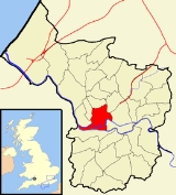
Cabot is a council ward that covers the centre
of Bristol
. It gets its name from the Cabot Tower
- a memorial tower on Brandon Hill that was built to commemorate John Cabot's
voyage and "discovery" of North America.
.jpg)
, the City Centre and the University of Bristol
. Cabot has at least 17 churches, a cathedral, a synagogue, four museums, three hospitals, two theatres, two concert halls, and art galleries and cinemas.
Cabot includes: Spike Island
, Baltic Wharf, Redcliffe Hill
, Queen Square
, Baldwin St, the City Centre, the Old City, Broadmead
, Canon's Marsh, Brandon Hill
, Park St, Bristol University, Kingsdown, Dove St, the east side of Whiteladies Road
, the south side of Cotham Hill and Cotham Brow, and the west side of Stokes Croft.
The area that comprises Brandon Hill, Park St, the Triangle, and the area between Park Row and the Hippodrome has been promoted under the name "The West End". Spike Island is the land between the Floating Harbour and the river Avon; from the digging of the "New Cut" until the Bathurst locks were sealed up it was literally an island.
, South West England, is the area south of the central ring road
and north of the Floating Harbour
, bordered north by St Pauls
and Easton
, east by Temple Meads
and Redcliffe
, and west by Clifton
and Canon's Marsh. It is contained entirely within the Council ward of Cabot.
 Canon's Marsh is an inner city
area of Bristol
, England
, of approximately one square kilometre. Canon's Marsh is situated on the north side of Floating Harbour
, immediately to the west of the River Frome
spur (St Augustine's Reach) of the harbour. Canon's Marsh borders Hotwells
to the west, Clifton
to the north, and the city centre
to the north east. Canon's Marsh was a shipbuilding
area until the last yard closed in 1904, incorporating two of Teast's
Docks, and including J&W Peters shipyard.
Canon's Wharf was once one of the busiest quays in the docks, with its own branch of the Bristol Harbour Railway, cranes and a goods shed
. The area was also the location of the city gas works. With the decline of industry throughout the 20th century Canon's Marsh was cleared to make way for urban renewal
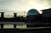
. Due to pollution, however, the gas works remained derelict for several years. The area is now the location of At-Bristol
, the South West offices of Lloyds TSB
bank, a campus of City of Bristol College
and several bars, restaurants, apartment buildings and offices. renewal continues with the construction of several mixed use buildings.
, located to the north of the city centre
and south of Cotham
. It lies within the Cabot council ward.
ward.
New Cut
of the River Avon to the south, from the dock entrance to the west to Bathurst Basin
in the east.
. It contains the main precinct of the University of Bristol
, Bristol Grammar School
and the BBC
Bristol studios.
Cabot ward: had a resident population
of 9,604. The population of Cabot is generally young, student/professional and in rented accommodation. The ward is in the Parliamentary constituency of Bristol West (held by Stephen Williams
), and has two City Councillors: Mark Wright
and Alex Woodman. As of 2009/10, Cabot had the highest crime rate per resident of any ward in the city, more than double the offences per head of any other ward.
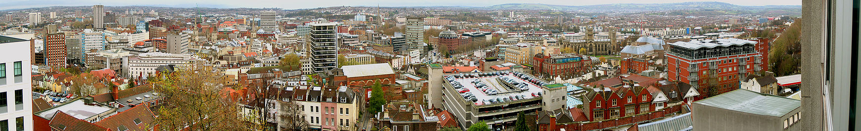
Bristol city centre
Bristol city centre is the commercial, cultural and business centre of Bristol, England. It is the area south of the central ring road and north of the Floating Harbour, bounded north by St Pauls and Easton, east by Temple Meads and Redcliffe, and west by Clifton and Canon's Marsh...
of Bristol
Bristol
Bristol is a city, unitary authority area and ceremonial county in South West England, with an estimated population of 433,100 for the unitary authority in 2009, and a surrounding Larger Urban Zone with an estimated 1,070,000 residents in 2007...
. It gets its name from the Cabot Tower
Cabot Tower (Bristol)
Cabot Tower is a tower in Bristol, England, situated in a public park on Brandon Hill, between the city centre, Clifton and Hotwells. It was constructed in memory of John Cabot, 400 years after he set sail in the Matthew from Bristol and landed in what was later to become Canada. The foundation...
- a memorial tower on Brandon Hill that was built to commemorate John Cabot's
John Cabot
John Cabot was an Italian navigator and explorer whose 1497 discovery of parts of North America is commonly held to have been the first European encounter with the continent of North America since the Norse Vikings in the eleventh century...
voyage and "discovery" of North America.
Areas
This ward contains the whole of the medieval city and many of the oldest surviving buildings. Cabot includes Bristol's DocksBristol Harbour
Bristol Harbour is the harbour in the city of Bristol, England. The harbour covers an area of . It has existed since the 13th century but was developed into its current form in the early 19th century by installing lock gates on a tidal stretch of the River Avon in the centre of the city and...
, the City Centre and the University of Bristol
University of Bristol
The University of Bristol is a public research university located in Bristol, United Kingdom. One of the so-called "red brick" universities, it received its Royal Charter in 1909, although its predecessor institution, University College, Bristol, had been in existence since 1876.The University is...
. Cabot has at least 17 churches, a cathedral, a synagogue, four museums, three hospitals, two theatres, two concert halls, and art galleries and cinemas.
Cabot includes: Spike Island
Spike Island, Bristol
Spike Island is an area of the English port city of Bristol, adjoining the city centre. It comprises the strip of land between the Floating Harbour to the north and the tidal New Cut of the River Avon to the south, from the dock entrance to the west to Bathurst Basin in the east...
, Baltic Wharf, Redcliffe Hill
Redcliffe, Bristol
Redcliffe, also known as Redcliff, is a district of the English port city of Bristol, adjoining the city centre. It is bounded by the loop of the Floating Harbour to the west, north and east, the New Cut of the River Avon to the south...
, Queen Square
Queen Square, Bristol
Queen Square is a garden square in the centre of Bristol, England. It was originally a fashionable residential address, but now most of the buildings are in office use....
, Baldwin St, the City Centre, the Old City, Broadmead
Broadmead
Broadmead is a street in the central area of Bristol, England, which has given its name to the principal shopping district of the city.- History :The name of the street was first recorded in 1383 as Brodemede...
, Canon's Marsh, Brandon Hill
Brandon Hill, Bristol
Brandon Hill, also known as St Brandon's Hill, is a hill close to Bristol city centre, between the districts of Clifton and Hotwells, in south west England....
, Park St, Bristol University, Kingsdown, Dove St, the east side of Whiteladies Road
Whiteladies Road
Whiteladies Road is a main road in Bristol, England. It runs north from the Victoria Rooms to Durdham Down, and separates Clifton on the west side from Redland on the east...
, the south side of Cotham Hill and Cotham Brow, and the west side of Stokes Croft.
The area that comprises Brandon Hill, Park St, the Triangle, and the area between Park Row and the Hippodrome has been promoted under the name "The West End". Spike Island is the land between the Floating Harbour and the river Avon; from the digging of the "New Cut" until the Bathurst locks were sealed up it was literally an island.
Bristol city centre
The central area of the city of BristolBristol
Bristol is a city, unitary authority area and ceremonial county in South West England, with an estimated population of 433,100 for the unitary authority in 2009, and a surrounding Larger Urban Zone with an estimated 1,070,000 residents in 2007...
, South West England, is the area south of the central ring road
Ring road
A ring road, orbital motorway, beltway, circumferential highway, or loop highway is a road that encircles a town or city...
and north of the Floating Harbour
Bristol Harbour
Bristol Harbour is the harbour in the city of Bristol, England. The harbour covers an area of . It has existed since the 13th century but was developed into its current form in the early 19th century by installing lock gates on a tidal stretch of the River Avon in the centre of the city and...
, bordered north by St Pauls
St Pauls, Bristol
St Pauls is an inner suburb of Bristol, England, situated just north east of the city centre and west of the M32. It is bounded by the A38, the B4051 and the A4032 roads...
and Easton
Easton, Bristol
Easton is both the name of a council ward in the city of Bristol in the United Kingdom, and an inner city area that lies partly within that ward. The Easton ward also contains the Whitehall and Netham areas of the city. Notable places within the ward include Lawrence Hill and Stapleton Road railway...
, east by Temple Meads
Bristol Temple Meads railway station
Bristol Temple Meads railway station is the oldest and largest railway station in Bristol, England. It is an important transport hub for public transport in Bristol, with bus services to various parts of the city and surrounding districts, and a ferry service to the city centre in addition to the...
and Redcliffe
St Mary Redcliffe
St. Mary Redcliffe is an Anglican parish church located in the Redcliffe district of the English port city of Bristol, close to the city centre. Constructed from the 12th to the 15th centuries, the church is a Grade 1 listed building, St...
, and west by Clifton
Clifton, Bristol
Clifton is a suburb of the City of Bristol in England, and the name of both one of the city's thirty-five council wards. The Clifton ward also includes the areas of Cliftonwood and Hotwells...
and Canon's Marsh. It is contained entirely within the Council ward of Cabot.
Canon's Marsh
Inner city
The inner city is the central area of a major city or metropolis. In the United States, Canada, United Kingdom and Ireland, the term is often applied to the lower-income residential districts in the city centre and nearby areas...
area of Bristol
Bristol
Bristol is a city, unitary authority area and ceremonial county in South West England, with an estimated population of 433,100 for the unitary authority in 2009, and a surrounding Larger Urban Zone with an estimated 1,070,000 residents in 2007...
, England
England
England is a country that is part of the United Kingdom. It shares land borders with Scotland to the north and Wales to the west; the Irish Sea is to the north west, the Celtic Sea to the south west, with the North Sea to the east and the English Channel to the south separating it from continental...
, of approximately one square kilometre. Canon's Marsh is situated on the north side of Floating Harbour
Bristol Harbour
Bristol Harbour is the harbour in the city of Bristol, England. The harbour covers an area of . It has existed since the 13th century but was developed into its current form in the early 19th century by installing lock gates on a tidal stretch of the River Avon in the centre of the city and...
, immediately to the west of the River Frome
River Frome, Bristol
The River Frome is a river, approximately long, which rises in Dodington Park, South Gloucestershire, and flows in a south westerly direction through Bristol, joining the former course of the river Avon in Bristol's Floating Harbour. The mean flow at Frenchay is The name Frome is shared with...
spur (St Augustine's Reach) of the harbour. Canon's Marsh borders Hotwells
Hotwells
Hotwells is a district of the English port city of Bristol. It is located to the south of and below the high ground of Clifton, and directly to the north of the Floating Harbour. The southern entrance to the Avon Gorge, which connects those docks to the sea, lies at the western end of Hotwells. The...
to the west, Clifton
Clifton, Bristol
Clifton is a suburb of the City of Bristol in England, and the name of both one of the city's thirty-five council wards. The Clifton ward also includes the areas of Cliftonwood and Hotwells...
to the north, and the city centre
Bristol city centre
Bristol city centre is the commercial, cultural and business centre of Bristol, England. It is the area south of the central ring road and north of the Floating Harbour, bounded north by St Pauls and Easton, east by Temple Meads and Redcliffe, and west by Clifton and Canon's Marsh...
to the north east. Canon's Marsh was a shipbuilding
Shipbuilding
Shipbuilding is the construction of ships and floating vessels. It normally takes place in a specialized facility known as a shipyard. Shipbuilders, also called shipwrights, follow a specialized occupation that traces its roots to before recorded history.Shipbuilding and ship repairs, both...
area until the last yard closed in 1904, incorporating two of Teast's
Sydenham Teast
Sydenham Teast was a shipbuilder and shipowner based in Bristol, England, during the 18th and 19th centuries. Amongst Teast's businesses was whaling, and an ivory and wood trade between England and Africa...
Docks, and including J&W Peters shipyard.
Canon's Wharf was once one of the busiest quays in the docks, with its own branch of the Bristol Harbour Railway, cranes and a goods shed
Goods shed
A goods shed is a railway building designed for storing goods before or after carriage in a train.A typical goods shed will have a track running through it to allow goods wagons to be unloaded under cover, although sometimes they were built alongside a track with possibly just a canopy over the door...
. The area was also the location of the city gas works. With the decline of industry throughout the 20th century Canon's Marsh was cleared to make way for urban renewal
Urban renewal
Urban renewal is a program of land redevelopment in areas of moderate to high density urban land use. Renewal has had both successes and failures. Its modern incarnation began in the late 19th century in developed nations and experienced an intense phase in the late 1940s – under the rubric of...
. Due to pollution, however, the gas works remained derelict for several years. The area is now the location of At-Bristol
At-Bristol
At-Bristol is a public science and technology "exploration" and education centre and charity in Bristol, England.As a visitor attraction, At-Bristol has hundreds of hands-on exhibits, and a Planetarium with seasonal shows for the over fives, and a 'Little Stars' show for children aged five and under...
, the South West offices of Lloyds TSB
Lloyds TSB
Lloyds TSB Bank Plc is a retail bank in the United Kingdom. It was established in 1995 by the merger of Lloyds Bank, established in Birmingham, England in 1765 and traditionally considered one of the Big Four clearing banks, with the TSB Group which traces its origins to 1810...
bank, a campus of City of Bristol College
City of Bristol College
City of Bristol College is one of the largest further education colleges in the UK. Based in Bristol, the College continues to gain national recognition for its work with adults, young people and employers.- Awards :* LSIS Beacon status...
and several bars, restaurants, apartment buildings and offices. renewal continues with the construction of several mixed use buildings.
Kingsdown
Kingsdown is a mainly residential area of BristolBristol
Bristol is a city, unitary authority area and ceremonial county in South West England, with an estimated population of 433,100 for the unitary authority in 2009, and a surrounding Larger Urban Zone with an estimated 1,070,000 residents in 2007...
, located to the north of the city centre
Bristol city centre
Bristol city centre is the commercial, cultural and business centre of Bristol, England. It is the area south of the central ring road and north of the Floating Harbour, bounded north by St Pauls and Easton, east by Temple Meads and Redcliffe, and west by Clifton and Canon's Marsh...
and south of Cotham
Cotham, Bristol
Cotham is the name of both a council ward of the city of Bristol in the United Kingdom, and a suburb of the city that falls within that ward. The ward comprises the Cotham suburb, and a small portion of Redland, which is another Bristol suburb.-Cotham:...
. It lies within the Cabot council ward.
Redcliffe
A small portion of the Redcliffe area lies within the Cabot ward. Most of it however lies in the Lawrence HillLawrence Hill, Bristol
Lawrence Hill is an electoral ward of Bristol, United Kingdom. It takes its name from a small area just to the east of the city centre, and includes the districts of Barton Hill, St Philips Marsh and Redcliffe, Temple Meads and parts of Easton and the Broadmead shopping area.-History:It is the most...
ward.
Spike Island
Spike Island is the narrow strip of land between the Floating Harbour to the north and the tidalTide
Tides are the rise and fall of sea levels caused by the combined effects of the gravitational forces exerted by the moon and the sun and the rotation of the Earth....
New Cut
New Cut (Bristol)
The New Cut is an artificial waterway which was constructed between 1804 and 1809 to divert the tidal river Avon through south and east Bristol, England. This was part of the process of constructing Bristol's Floating Harbour, under the supervision of engineer William Jessop...
of the River Avon to the south, from the dock entrance to the west to Bathurst Basin
Bathurst Basin
Bathurst Basin is a small triangular basin adjoining the main harbour of the city of Bristol, England. The basin gets its name from Bristol MP Charles Bathurst....
in the east.
Tyndalls Park
Tyndalls Park is an area to the east of CliftonClifton, Bristol
Clifton is a suburb of the City of Bristol in England, and the name of both one of the city's thirty-five council wards. The Clifton ward also includes the areas of Cliftonwood and Hotwells...
. It contains the main precinct of the University of Bristol
University of Bristol
The University of Bristol is a public research university located in Bristol, United Kingdom. One of the so-called "red brick" universities, it received its Royal Charter in 1909, although its predecessor institution, University College, Bristol, had been in existence since 1876.The University is...
, Bristol Grammar School
Bristol Grammar School
Bristol Grammar School is a co-educational independent school in Clifton, Bristol, England. The school was founded in 1532 by two brothers, Robert and Nicholas Thorne....
and the BBC
BBC
The British Broadcasting Corporation is a British public service broadcaster. Its headquarters is at Broadcasting House in the City of Westminster, London. It is the largest broadcaster in the world, with about 23,000 staff...
Bristol studios.
Statistics
In the 2001 CensusUnited Kingdom Census 2001
A nationwide census, known as Census 2001, was conducted in the United Kingdom on Sunday, 29 April 2001. This was the 20th UK Census and recorded a resident population of 58,789,194....
Cabot ward: had a resident population
Population
A population is all the organisms that both belong to the same group or species and live in the same geographical area. The area that is used to define a sexual population is such that inter-breeding is possible between any pair within the area and more probable than cross-breeding with individuals...
of 9,604. The population of Cabot is generally young, student/professional and in rented accommodation. The ward is in the Parliamentary constituency of Bristol West (held by Stephen Williams
Stephen Williams (politician)
Stephen Roy Williams is a British Liberal Democrat politician who was first elected as the Member of Parliament for Bristol West in the 2005 general election, being re-elected with an increased majority in May 2010...
), and has two City Councillors: Mark Wright
Mark Wright (politician)
Dr Mark Wright is a software engineer and Executive Councillor responsible for Housing, Service Improvement and IT on Bristol City Council in Bristol, England . He has been councillor for Cabot ward since 2005, and was re-elected in 2009.-Background:...
and Alex Woodman. As of 2009/10, Cabot had the highest crime rate per resident of any ward in the city, more than double the offences per head of any other ward.