
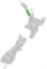
Auckland Region
Encyclopedia
| Auckland Region | |
| Country: | New Zealand New Zealand New Zealand is an island country in the south-western Pacific Ocean comprising two main landmasses and numerous smaller islands. The country is situated some east of Australia across the Tasman Sea, and roughly south of the Pacific island nations of New Caledonia, Fiji, and Tonga... |
 |
|
| Regional Council Regions of New Zealand The region is the top tier of local government in New Zealand. There are 16 regions of New Zealand. Eleven are governed by an elected regional council, while five are governed by territorial authorities which also perform the functions of a regional council and thus are known as unitary authorities... |
|
|---|---|
| Name: | Auckland Council Auckland Council The Auckland Council is the council for the Auckland Region in New Zealand. It began operating on 1 November 2010, combining the functions of the existing regional council and the region's seven previous city and district councils into one "super council" or "super city" governed by a mayor, 20... |
| Mayor: | Len Brown Len Brown Len Brown is the Mayor of Auckland in New Zealand and the head of the Auckland Council. He won the 2010 Auckland mayoral election on 9 October 2010 and was sworn in as Mayor of Auckland on 1 November 2010, being the first to hold that title for the amalgamated Auckland 'Super City'... |
| Population: | |
| Land Area: | 4894 km² (1,889.6 sq mi) |
| Website: | aucklandcouncil.govt.nz |
| Cities and towns | |
| Cities: | Auckland |
| Towns: | Orewa, Helensville, Warkworth, Wellsford, Pukekohe, Waiuku, Clevedon, Maraetai, Muriwai, Piha, Coatesville, Kumeu, Drury |
The Auckland Region was one of the sixteen regions
Regions of New Zealand
The region is the top tier of local government in New Zealand. There are 16 regions of New Zealand. Eleven are governed by an elected regional council, while five are governed by territorial authorities which also perform the functions of a regional council and thus are known as unitary authorities...
of New Zealand
New Zealand
New Zealand is an island country in the south-western Pacific Ocean comprising two main landmasses and numerous smaller islands. The country is situated some east of Australia across the Tasman Sea, and roughly south of the Pacific island nations of New Caledonia, Fiji, and Tonga...
, named for the city of Auckland
Auckland
The Auckland metropolitan area , in the North Island of New Zealand, is the largest and most populous urban area in the country with residents, percent of the country's population. Auckland also has the largest Polynesian population of any city in the world...
, the country's largest urban area. With one third of the nation's residents, it was by far the biggest population and economy of any region of New Zealand, but the second-smallest land area.
On 1 November 2010, the Auckland Region became a unitary authority
Unitary authority
A unitary authority is a type of local authority that has a single tier and is responsible for all local government functions within its area or performs additional functions which elsewhere in the relevant country are usually performed by national government or a higher level of sub-national...
controlled by the Auckland Council
Auckland Council
The Auckland Council is the council for the Auckland Region in New Zealand. It began operating on 1 November 2010, combining the functions of the existing regional council and the region's seven previous city and district councils into one "super council" or "super city" governed by a mayor, 20...
, replacing the previous regional council and seven local councils. In the process, an area in its southeastern corner was transferred to the neighbouring Waikato Region. The name "Auckland Region" remains present in casual usage.
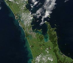
Geography
Kaipara Harbour
Kaipara Harbour is a large enclosed harbour estuary complex on the north western side of the North Island of New Zealand. The northern part of the harbour is administered by the Kaipara District and the southern part is administered by the Rodney District...
in the north across the southern stretches of the North Auckland Peninsula
North Auckland Peninsula
The North Auckland Peninsula, frequently referred to simply as the Northland Peninsula, is located in the far north of the North Island of New Zealand. The peninsula is easily confused with, though not the same as Northland Region, which occupies the top 80% of the peninsula...
, past the Waitakere Ranges
Waitakere Ranges
The Waitakere Ranges are a chain of hills in the Auckland metropolitan area, generally running approximately 25 km from north to south, 25 km west of central Auckland, New Zealand. The maximum elevation within the ranges is 474 m...
and the isthmus
Isthmus
An isthmus is a narrow strip of land connecting two larger land areas usually with waterforms on either side.Canals are often built through isthmuses where they may be particularly advantageous to create a shortcut for marine transportation...
of Auckland and across the low-lying land surrounding the Manukau Harbour
Manukau Harbour
Manukau Harbour is the second largest natural harbour in New Zealand by area. It is located to the southwest of the Auckland isthmus, and is an arm of the Tasman Sea.-Geography:...
. The region ends within a few kilometres of the mouth of the Waikato River
Waikato River
The Waikato River is the longest river in New Zealand. In the North Island, it runs for 425 kilometres from the eastern slopes of Mount Ruapehu, joining the Tongariro River system and emptying into Lake Taupo, New Zealand's largest lake. It drains Taupo at the lake's northeastern edge, creates the...
. It is bordered in the north by the Northland Region, and in the south by the Waikato Region. It also includes the islands of the Hauraki Gulf
Hauraki Gulf
The Hauraki Gulf is a coastal feature of the North Island of New Zealand. It has a total area of 4000 km², and lies between the Auckland Region, the Hauraki Plains, the Coromandel Peninsula and Great Barrier Island...
.
The Hunua Ranges
Hunua Ranges
The Hunua Ranges form a block of hilly country to the southeast of Auckland in New Zealand's North Island. They cover some 250 square kilometres , containing 178 km² of parkland, and rise to 688 metres at Kohukohunui...
and the adjacent coastline along the Firth of Thames were part of the region until the Auckland Council was formed in late 2010, when they were transferred to the neighbouring Waikato Region.
In land area it is smaller than all the other regions and unitary authorities
Unitary authority
A unitary authority is a type of local authority that has a single tier and is responsible for all local government functions within its area or performs additional functions which elsewhere in the relevant country are usually performed by national government or a higher level of sub-national...
except Nelson
Nelson, New Zealand
Nelson is a city on the eastern shores of Tasman Bay, and is the economic and cultural centre of the Nelson-Tasman region. Established in 1841, it is the second oldest settled city in New Zealand and the oldest in the South Island....
. Its highest point is the summit of Little Barrier Island, at 722 metres.
Territorial waters
The Pacific OceanPacific Ocean
The Pacific Ocean is the largest of the Earth's oceanic divisions. It extends from the Arctic in the north to the Southern Ocean in the south, bounded by Asia and Australia in the west, and the Americas in the east.At 165.2 million square kilometres in area, this largest division of the World...
and Tasman Sea
Tasman Sea
The Tasman Sea is the large body of water between Australia and New Zealand, approximately across. It extends 2,800 km from north to south. It is a south-western segment of the South Pacific Ocean. The sea was named after the Dutch explorer Abel Janszoon Tasman, the first recorded European...
form the coastline around the Auckland region. The east coast is lapped by the waters of the Hauraki Gulf, an arm of the Pacific sheltered by a considerable number of small and large islands, notably Great Barrier Island
Great Barrier Island
Great Barrier Island is a large island of New Zealand, situated to the north-east of central Auckland in the outer Hauraki Gulf. With an area of it is the fourth-largest island of New Zealand's main chain of islands, with its highest point, Mount Hobson, rising...
in the northeast. An arm of the Gulf, the Waitemata Harbour
Waitemata Harbour
The quite famous Waitemata Harbour is the main access by sea to Auckland, New Zealand. For this reason it is often referred to as Auckland Harbour, despite the fact that it is only one of two harbours surrounding the city, and is crossed by the Auckland Harbour Bridge. The Waitemata forms the north...
, forms the main harbour of Auckland city, and also accommodates New Zealand's largest port. The mainland coastline is 1613 kilometres (1,002.3 mi) long. Much of the coastal marine area comprises sensitive tidal inlets and estuaries and semi-enclosed Waitemata, Manukau and Kaipara Harbours.
To the west lie two large natural harbours, the Kaipara and the Manukau. Both of these have treacherous entrances and are little used by shipping. The Kaipara Harbour (of which the southern half is in the Auckland region) is one of the world's largest natural harbours, covering an area of 530 square kilometres (204.6 sq mi). The Manukau Harbour, located in the southwest part of the region, has a small port at Onehunga
Onehunga
Onehunga is a suburb of Auckland City, New Zealand and the location of the Port of Onehunga, the city's small port on the Manukau Harbour. It is eight kilometres south of the city centre, close to the volcanic cone of One Tree Hill, Maungakiekie....
, but also suffers from difficult navigation – especially when the predominant southwesterly wind is blowing. Auckland Airport is located on the edge of the Manukau Harbour.
The region is blessed with many fine beaches, especially on the Tasman coast south of the Kaipara. These include Muriwai
Muriwai
Muriwai, also called Muriwai Beach, is a coastal community located on the west coast of North Island, New Zealand. It is also home to a large colony of gannets.- Location :...
and Piha
Piha
Piha is a northern New Zealand coastal settlement with a population of about 600. It is one of the most popular beaches in the area and a major day-trip destination for Aucklanders throughout the year, although especially so in summer.-Location:...
beaches.
Geology
The Auckland Region is built on a basement of greywackeGreywacke
Greywacke or Graywacke is a variety of sandstone generally characterized by its hardness, dark color, and poorly sorted angular grains of quartz, feldspar, and small rock fragments or lithic fragments set in a compact, clay-fine matrix. It is a texturally immature sedimentary rock generally found...
rocks that form many of the islands in the Hauraki Gulf, the Hunua Ranges, and land south of Port Waikato
Port Waikato
Port Waikato is on the south bank of the Waikato River at its outflow into the Tasman Sea, in northern New Zealand. Now a small town with a population of under 300, it was an important port during the New Zealand Land Wars of the 19th century...
. The Waitakere Ranges in the west are the remains of a large andesitic volcano, and Great Barrier Island was formed by the northern end of the Coromandel Volcanic Zone. The main isthmus and North Shore are composed of Waitemata sandstone and mudstone, and portions of the Northland Allochthon extend as far south as Albany
Albany, New Zealand
Albany is a northern suburb of Auckland, one of the several cities in northern New Zealand. The name derives from Alba and its Latinisation. It is located to the north of the Waitemata Harbour, 15 kilometres northwest of the Auckland city centre. The suburb is in the Albany ward, one of the...
. Little Barrier Island was formed by a relatively isolated andesitic volcano, active around 1 to 3 million years ago.
The Manukau and South Kaipara Harbours are protected by the recent sand dune deposits of the Awhitu and South Kaipara Peninsulas. Recent basaltic volcanic activity has produced many volcanic cones throughout the Auckland Region, including the iconic Rangitoto Island
Rangitoto Island
Rangitoto Island is a volcanic island in the Hauraki Gulf near Auckland, New Zealand. The 5.5 km wide island is an iconic and widely visible landmark of Auckland with its distinctive symmetrical shield volcano cone rising 260 metres high over the Hauraki Gulf...
.
Volcanic field
Much of Auckland's urban area lies on top of the dormant Auckland Volcanic FieldAuckland Volcanic Field
The Auckland volcanic field is a monogenetic volcanic field in the North Island of New Zealand. Basaltic in nature, it underlies much of the metropolitan area of Auckland....
. The region is dotted by 49 volcanoes of varying age with the oldest being in the region of 150,000 years old. The most recent eruption occurred approximately 600 years ago, ending a few hundred years of activity during which Rangitoto Island was formed.
Each volcanic eruption has tended to be bigger than the previous, with Rangitoto making up almost 60% of the entire volume of erupted material. All of the volcanoes are relatively small, most being less than 150 metres (492.1 ft) in height.
A large number of the Auckland volcanoes have been levelled or strongly altered – in small part due to historical Māori use of the cones as fortified pā
Pa (Maori)
The word pā can refer to any Māori village or settlement, but in traditional use it referred to hillforts fortified with palisades and defensive terraces and also to fortified villages. They first came into being about 1450. They are located mainly in the North Island north of lake Taupo...
or for terraced fields, but for most part having been quarried relatively recently for roading and construction materials (mainly scoria
Scoria
Scoria is a volcanic rock containing many holes or vesicles. It is most generally dark in color , and basaltic or andesitic in composition. Scoria is relatively low in mass as a result of its numerous macroscopic ellipsoidal vesicles, but in contrast to pumice, all scoria has a specific gravity...
). However measures are now in place to preserve many of the remaining volcanoes as landmarks and parks.
People
Europe
Europe is, by convention, one of the world's seven continents. Comprising the westernmost peninsula of Eurasia, Europe is generally 'divided' from Asia to its east by the watershed divides of the Ural and Caucasus Mountains, the Ural River, the Caspian and Black Seas, and the waterways connecting...
an population, 24.3 percent of the total Māori population, 66.7 percent of the total Pacific Peoples population, 63.7 percent of the total Asian
Asian people
Asian people or Asiatic people is a term with multiple meanings that refers to people who descend from a portion of Asia's population.- Central Asia :...
population and 54.7 percent of the total population in the 'Other' ethnic groups category. These statistics highlight the ethnic diversity of the Auckland Region, especially in comparison to the rest of New Zealand
New Zealand
New Zealand is an island country in the south-western Pacific Ocean comprising two main landmasses and numerous smaller islands. The country is situated some east of Australia across the Tasman Sea, and roughly south of the Pacific island nations of New Caledonia, Fiji, and Tonga...
.
The region encompasses the cities of the Auckland metropolitan area
Auckland
The Auckland metropolitan area , in the North Island of New Zealand, is the largest and most populous urban area in the country with residents, percent of the country's population. Auckland also has the largest Polynesian population of any city in the world...
, smaller towns, rural areas, and the islands of the Hauraki Gulf
Hauraki Gulf
The Hauraki Gulf is a coastal feature of the North Island of New Zealand. It has a total area of 4000 km², and lies between the Auckland Region, the Hauraki Plains, the Coromandel Peninsula and Great Barrier Island...
.
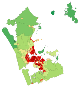
Auckland Council
The Auckland CouncilAuckland Council
The Auckland Council is the council for the Auckland Region in New Zealand. It began operating on 1 November 2010, combining the functions of the existing regional council and the region's seven previous city and district councils into one "super council" or "super city" governed by a mayor, 20...
is the local authority with jurisdiction over the Auckland Region. From 1989 to 2010 the region was under the jurisdiction of the Auckland Regional Council
Auckland Regional Council
The Auckland Regional Council was the regional council of the Auckland Region. Its predecessor the Auckland Regional Authority was formed in 1963 and became the ARC in 1989...
(successor of the Auckland Regional Authority) and seven territorial local authorities
Territorial authorities of New Zealand
Territorial authorities are the second tier of local government in New Zealand, below regional councils. There are 67 territorial authorities: 13 city councils, 53 district councils, and the Chatham Islands Council...
(which in turn replaced many smaller councils and boroughs). The Auckland Regional Council had fairly limited controls over the metropolitan area, focusing on environmental protection, public transport funding, and management of regional parks and coastal areas, while governance of other matters such as subdivision, infrastructure, services and land use was devolved to the territorial local authorities. The Auckland Council is a unitary authority exercising power over all these matters.
Health boards
Three District Health Boards (DHBs) cover the greater Auckland region. They are Waitemata Health, Auckland District Health Board, and Counties Manukau Health.Transport
Transport in the Auckland Region is predominantly via motor vehicle, with much of New Zealand's motorway-grade roads being located in the region. However, there is also a commuter rail system linking the city centre with Waitakere and Manukau, and a relatively extensive bus system. However, even in the more urbanised parts of the region, public transport uptake is still low (though rising again since the 2000s) compared to many other western cities. Despite this, a significant part of all New Zealand public transport boardings take place in Auckland (see 'Statistics' section below).Statistics
| Criterion (2007–2008) | In Auckland Region | In New Zealand | % in Auckland Region |
|---|---|---|---|
| Population | 1,432,200 | 4,268,500 | 34 |
| Land area (km2) | 5600 | 275,400 | 2 |
| Imports (gross tonne) | 14.1 million | 79.2 million | 18 |
| Exports (gross tonne) | 8.3 million | 73.4 million | 11 |
| Gross domestic product (GDP) ($) | 42,200 million | 155,400 million | 27 |
| Passenger transport – bus – boardings | 43,165,200 | 92,777,200 | 47 |
| Passenger transport – rail – boardings | 6,794,100 | 18,346,600 | 37 |
| Passenger transport – ferry – boardings | 4,374,600 | 4,695,000 | 93 |
| Vehicle kilometres travelled | 12,200 million | 40,200 million | 30 |
| Fatalities (transport system) | 81 | 366 | 15 |
| State highways, all types (km) | 335 | 10,906 | 3 |
| State highways, motorways (km) | 106 | 172 | 62 |