

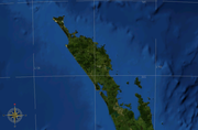
North Auckland Peninsula
Encyclopedia
North Island
The North Island is one of the two main islands of New Zealand, separated from the much less populous South Island by Cook Strait. The island is in area, making it the world's 14th-largest island...
of New Zealand
New Zealand
New Zealand is an island country in the south-western Pacific Ocean comprising two main landmasses and numerous smaller islands. The country is situated some east of Australia across the Tasman Sea, and roughly south of the Pacific island nations of New Caledonia, Fiji, and Tonga...
. The peninsula is easily confused with, though not the same as Northland Region, which occupies the top 80% of the peninsula. The remaining section of the peninsula is administratively part of the Auckland Region
Auckland Region
The Auckland Region was one of the sixteen regions of New Zealand, named for the city of Auckland, the country's largest urban area. With one third of the nation's residents, it was by far the biggest population and economy of any region of New Zealand, but the second-smallest land area.On 1...
.
The exact length of the peninsula is difficult to ascertain, as it is possible to name several southerly extremities of it. The Northland Region begins at a narrowing of the peninsula close to the town of Wellsford, where the peninsula reaches a minimum width of just 15 kilometres.
There are two points further south, however, where the island's width is considerably narrower. These are both within the metropolitan area of the conurbation
Conurbation
A conurbation is a region comprising a number of cities, large towns, and other urban areas that, through population growth and physical expansion, have merged to form one continuous urban and industrially developed area...
known as Auckland
Auckland
The Auckland metropolitan area , in the North Island of New Zealand, is the largest and most populous urban area in the country with residents, percent of the country's population. Auckland also has the largest Polynesian population of any city in the world...
. In the west of the city, the Whau River
Whau River
The Whau River is an estuarial arm of the southwestern Waitemata Harbour within the Auckland metropolitan area in New Zealand. It flows north for 5.7 kilometres from its origin at the confluence of the Avondale Stream and Whau Stream to its mouth between the Te Atatu peninsula and the long, thin...
, an estuarial arm of the Waitemata Harbour
Waitemata Harbour
The quite famous Waitemata Harbour is the main access by sea to Auckland, New Zealand. For this reason it is often referred to as Auckland Harbour, despite the fact that it is only one of two harbours surrounding the city, and is crossed by the Auckland Harbour Bridge. The Waitemata forms the north...
comes within two kilometres of the waters of the Manukau Harbour
Manukau Harbour
Manukau Harbour is the second largest natural harbour in New Zealand by area. It is located to the southwest of the Auckland isthmus, and is an arm of the Tasman Sea.-Geography:...
on the west coast. A few kilometres to the southeast is the Otahuhu isthmus. Here an arm of the Hauraki Gulf on the east coast comes just 1200 metres from the Manukau's waters. This would put the majority of Auckland city on the peninsula.
Although this third isthmus is perhaps the most logical point to consider as the start of the peninsula, few New Zealanders would agree that Auckland is on the North Auckland Peninsula, preferring to think of the whole area between the Otahuhu and Whau necks as The Auckland Isthmus.
If this is accepted, then the peninsula stretches northwest for 285 kilometres from the Whau, reaching a maximum width of 85 kilometres. It has a convoluted coastline, with many smaller peninsulas branching off it. The last 100 kilometres of its length are the Aupouri Peninsula
Aupouri Peninsula
The Aupouri Peninsula is a tombolo at the northern tip of the North Island of New Zealand. It projects between the Tasman Sea to the west and the Pacific Ocean to the east...
- a peninsula on a peninsula - with the island narrowing to only some 10 kilometres in width for this final northern part of the island.
At its northern end, the Aupouri Peninsula reaches a number of capes each of which is claimed by some people to be the North Island's northernmost point: Cape Maria van Diemen
Cape Maria van Diemen
Cape Maria van Diemen is the westernmost point of the North Island of New Zealand. Being close to the northern tip of the Aupouri Peninsula, many people in New Zealand also incorrectly believe it to be the northernmost point...
, Cape Reinga
Cape Reinga
Cape Reinga is the northwesternmost tip of the Aupouri Peninsula, at the northern end of the North Island of New Zealand. Cape Reinga is located over 100 km north of the nearest small town of Kaitaia. State Highway 1 extends all the way to the Cape, but until 2010 was unsealed gravel road for the...
, North Cape
North Cape, New Zealand
North Cape is located at the northern end of the North Auckland Peninsula in the North Island of New Zealand . It is the northeastern tip of the Aupouri Peninsula and lies 30 km east of Cape Reinga. The name is sometimes used to refer just to the cape which is known in Māori as Otou and which...
, and the Surville Cliffs
Surville Cliffs
The Surville Cliffs are the northernmost point of the mainland of New Zealand. They are situated on the North Cape of the North Island, 30 kilometres to the east of Cape Reinga , and three kilometres more northerly...
. The honour actually goes to the latter of these, the cliffs being at a latitude of 34° 23' 47" South.
The North Auckland Peninsula features the massive gash of the Kaipara Harbour
Kaipara Harbour
Kaipara Harbour is a large enclosed harbour estuary complex on the north western side of the North Island of New Zealand. The northern part of the harbour is administered by the Kaipara District and the southern part is administered by the Rodney District...
part way up its western (Tasman Sea
Tasman Sea
The Tasman Sea is the large body of water between Australia and New Zealand, approximately across. It extends 2,800 km from north to south. It is a south-western segment of the South Pacific Ocean. The sea was named after the Dutch explorer Abel Janszoon Tasman, the first recorded European...
) shore. This harbour is one of the largest natural harbours in the world, stretching some 65 kilometres in a north-south direction. Further north is a smaller natural harbour, the Hokianga
Hokianga
Hokianga is an area surrounding the Hokianga Harbour, also known as The Hokianga River, a long estuarine drowned valley on the west coast in the north of the North Island of New Zealand....
, which is of historic and cultural significance within New Zealand, especially to the native Māori people. Another historically significant site on the North Auckland Peninsula is Waitangi
Waitangi
Waitangi is the name of various places, towns, and settlements in New Zealand. The two most notable of these are:* Waitangi, Northland* Waitangi, Chatham Islands...
and the surrounding Bay of Islands
Bay of Islands
The Bay of Islands is an area in the Northland Region of the North Island of New Zealand. Located 60 km north-west of Whangarei, it is close to the northern tip of the country....
. This was a major settlement in early colonial New Zealand, and was the site of the Treaty of Waitangi
Treaty of Waitangi
The Treaty of Waitangi is a treaty first signed on 6 February 1840 by representatives of the British Crown and various Māori chiefs from the North Island of New Zealand....
, which is seen as the founding document of New Zealand's nationhood.
The largest settlement on the peninsula (other than parts of the Auckland conurbation) is Whangarei
Whangarei
Whangarei, pronounced , is the northernmost city in New Zealand and the regional capital of Northland Region. Although commonly classified as a city, it is officially part of the Whangarei District, administered by the Whangarei District Council a local body created in 1989 to administer both the...
, on a natural harbour opening on the Pacific Ocean
Pacific Ocean
The Pacific Ocean is the largest of the Earth's oceanic divisions. It extends from the Arctic in the north to the Southern Ocean in the south, bounded by Asia and Australia in the west, and the Americas in the east.At 165.2 million square kilometres in area, this largest division of the World...
close to the peninsula's widest point.
See also
- Auckland RegionAuckland RegionThe Auckland Region was one of the sixteen regions of New Zealand, named for the city of Auckland, the country's largest urban area. With one third of the nation's residents, it was by far the biggest population and economy of any region of New Zealand, but the second-smallest land area.On 1...
- Northland Region