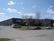
Airport Business Area, Saskatoon
Encyclopedia
Industrial park
An industrial park is an area zoned and planned for the purpose of industrial development...
located in the North Industrial SDA
North Industrial SDA, Saskatoon
North Industrial Suburban Development Area is located in the province's hub city; Saskatoon, Saskatchewan, Canada. Lower provincial corporate tax rates, no more provincial capital tax, and industrial lease and purchase rates which have stabilized very competitively with neighboring provinces have...
Suburban Development Area of Saskatoon
Saskatoon
Saskatoon is a city in central Saskatchewan, Canada, on the South Saskatchewan River. Residents of the city of Saskatoon are called Saskatonians. The city is surrounded by the Rural Municipality of Corman Park No. 344....
, Saskatchewan
Saskatchewan
Saskatchewan is a prairie province in Canada, which has an area of . Saskatchewan is bordered on the west by Alberta, on the north by the Northwest Territories, on the east by Manitoba, and on the south by the U.S. states of Montana and North Dakota....
. Industrial parks are usually located close to transport
Transport
Transport or transportation is the movement of people, cattle, animals and goods from one location to another. Modes of transport include air, rail, road, water, cable, pipeline, and space. The field can be divided into infrastructure, vehicles, and operations...
facilities, especially where more than one transport modalities
Intermodal freight transport
Intermodal freight transport involves the transportation of freight in an intermodal container or vehicle, using multiple modes of transportation , without any handling of the freight itself when changing modes. The method reduces cargo handling, and so improves security, reduces damages and...
coincide. The Idylwyld Drive North, Sk Hwy 11 Louis Riel Trail
Saskatchewan Highway 11
Highway 11 is a major north-south highway in Saskatchewan, Canada that connects the province's three largest cities: Regina, Saskatoon and Prince Albert. It is a structural pavement major arterial highway which is approximately long. It is also known as the Louis Riel Trail after the 19th century...
, and Sk Hwy 12
Saskatchewan Highway 12
Highway 12 is a major highway in the Canadian province of Saskatchewan. It begins in Saskatoon at the intersection of Idylwyld Drive and 22nd Street, initially running north on Idylwyld concurrently with Highway 11. Just outside Saskatoon's northern city limits, Highway 11 branches off and Highway...
concurrency are all accessed directly from the Airport Business Area. The Saskatoon John G. Diefenbaker International Airport is north of the Airport Business Area. Circle Drive marks the southern boundary, with access to SK Hwy 14
Saskatchewan Highway 14
Highway 14 is a highway in the Canadian province of Saskatchewan. It runs from the intersection of Idylwyld Drive and 22nd Street in downtown Saskatoon, westward to the Albertan border where it becomes Highway 13. It is approximately 261 km long.Prior to the 1970's, Highway 14 ran the width...
and Sk Hwy 16, the Yellowhead Trans Canada
Saskatchewan Highway 16
Highway 16 is a provincial paved highway in the Canadian province of Saskatchewan. It is the Saskatchewan section of the Yellowhead Highway, and also the Trans-Canada Highway Yellowhead section. The main purpose of this highway is to connect Saskatchewan with Canadian cities such as Edmonton and...
.
Geography
Rural municipality
A rural municipality, often abbreviated RM, is a form of municipality in the Canadian provinces of Manitoba and Saskatchewan, perhaps best comparable to counties or townships in the western United States...
of Corman Park
Corman Park No. 344, Saskatchewan
The area's German Canadian population is much higher proportionately than the national or provincial averages: 43.4% .-Government of the RM:...
between 1965-1969. The Airport Business subdivision is several major trucking routes. The Idylwyld Drive North, Sk Hwy 11 Louis Riel Trail
Saskatchewan Highway 11
Highway 11 is a major north-south highway in Saskatchewan, Canada that connects the province's three largest cities: Regina, Saskatoon and Prince Albert. It is a structural pavement major arterial highway which is approximately long. It is also known as the Louis Riel Trail after the 19th century...
to Prince Albert
Prince Albert, Saskatchewan
Prince Albert is the third-largest city in Saskatchewan, Canada. It is situated in the centre of the province on the banks of the North Saskatchewan River. The city is known as the "Gateway to the North" because it is the last major centre along the route to the resources of northern Saskatchewan...
via Warman
Warman, Saskatchewan
-History:The town of Warman was born when the Canadian National Railway running from Humboldt to North Battleford intersected with the Canadian Pacific Railway running from Regina to Prince Albert. This took place in the fall of 1904....
, and Sk Hwy 12
Saskatchewan Highway 12
Highway 12 is a major highway in the Canadian province of Saskatchewan. It begins in Saskatoon at the intersection of Idylwyld Drive and 22nd Street, initially running north on Idylwyld concurrently with Highway 11. Just outside Saskatoon's northern city limits, Highway 11 branches off and Highway...
to Blaine Lake via Martensville
Martensville, Saskatchewan
Martensville is a city located in Saskatchewan, Canada, just north of Saskatoon, and south west of Clarkboro Ferry which crosses the South Saskatchewan River. Martensville is one of the fastest growing communities in Saskatchewan, with the population growing 25% between 1996 and 2001. It is...
concurrency mark the eastern boundary. Circle Drive marks the southern boundary, with access to SK Hwy 1`4
Saskatchewan Highway 14
Highway 14 is a highway in the Canadian province of Saskatchewan. It runs from the intersection of Idylwyld Drive and 22nd Street in downtown Saskatoon, westward to the Albertan border where it becomes Highway 13. It is approximately 261 km long.Prior to the 1970's, Highway 14 ran the width...
and Sk Hwy 16, the Yellowhead Trans Canada
Saskatchewan Highway 16
Highway 16 is a provincial paved highway in the Canadian province of Saskatchewan. It is the Saskatchewan section of the Yellowhead Highway, and also the Trans-Canada Highway Yellowhead section. The main purpose of this highway is to connect Saskatchewan with Canadian cities such as Edmonton and...
. It is a main thoroughfare through the city connecting Regina
Regina, Saskatchewan
Regina is the capital city of the Canadian province of Saskatchewan. The city is the second-largest in the province and a cultural and commercial centre for southern Saskatchewan. It is governed by Regina City Council. Regina is the cathedral city of the Roman Catholic and Romanian Orthodox...
, Saskatoon
Saskatoon
Saskatoon is a city in central Saskatchewan, Canada, on the South Saskatchewan River. Residents of the city of Saskatoon are called Saskatonians. The city is surrounded by the Rural Municipality of Corman Park No. 344....
and Prince Albert, Saskatchewan
Prince Albert, Saskatchewan
Prince Albert is the third-largest city in Saskatchewan, Canada. It is situated in the centre of the province on the banks of the North Saskatchewan River. The city is known as the "Gateway to the North" because it is the last major centre along the route to the resources of northern Saskatchewan...
. It also connects west Saskatoon with the bedroom communities of Warman
Warman, Saskatchewan
-History:The town of Warman was born when the Canadian National Railway running from Humboldt to North Battleford intersected with the Canadian Pacific Railway running from Regina to Prince Albert. This took place in the fall of 1904....
and Martensville
Martensville, Saskatchewan
Martensville is a city located in Saskatchewan, Canada, just north of Saskatoon, and south west of Clarkboro Ferry which crosses the South Saskatchewan River. Martensville is one of the fastest growing communities in Saskatchewan, with the population growing 25% between 1996 and 2001. It is...
.
McNab Park - Airport Industrial - Larkhaven
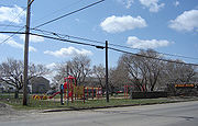
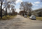
Until the early 2000s, the Airport Business Area consisted of three separate districts:McNab Park, a small residential community that served as military housing
Barracks
Barracks are specialised buildings for permanent military accommodation; the word may apply to separate housing blocks or to complete complexes. Their main object is to separate soldiers from the civilian population and reinforce discipline, training and esprit de corps. They were sometimes called...
until the 1960s when Saskatoon's airport ceased to double as an air base;
Airport Industrial, a business/commercial park
Commercial district
A commercial district or commercial zone is any part of a city or town in which the primary land use is commercial activities , as opposed to a residential neighbourhood, an industrial zone, or other types of neighbourhoods...
that developed east of the airport and east of McNab Park beginning in the 1970s;
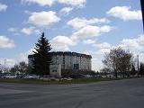
Lark Haven (alternately spelled Larkhaven), another business park that developed south of McNab Park in the early 1980s. As of 2009, McNab Park continues to be a residential area. however the city plans to remove the housing the convert the area into business park in the future. The Airport Business Area also includes a newly plotted, but as of 2008 undeveloped business park west of the Lark Haven section and east of the Hampton Village
Hampton Village, Saskatoon
-External links:****- References :*Bill Barry, Geographic Names of Saskatchewan...
.
An oddity to the area is Lark Place. This street has been shown on maps as a street that crossed at the intersection of Circle Drive
Circle Drive
Circle Drive is a major road constructed as a ring road in Saskatoon, Saskatchewan, Canada. The northeastern portion of the road is part of the Yellowhead Highway.-History:...
and Airport Drive since Saskatoon's early years. Despite it still appearing on maps, Lark Place is considered a paper street
Paper street
A paper street is a road or street that appears on maps but does not exist in reality. Paper streets generally occur when city planners or subdivision developers lay out and dedicate streets that are never built...
.
Economy
In the Airport Business Area subdivision are 3374 full time employees and 841 part time employees.
Future plans