
1903 Atlantic hurricane season
Encyclopedia
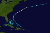
The 1903 Atlantic hurricane season ran through summer and early fall of 1903. The season was average, with ten tropical storms, seven hurricanes, and one major hurricane.
as a Category 1 hurricane, and hit eastern Jamaica
as a Category 3. It maintained its strength until it hit the northeastern coast of Yucatán
. The storm moved across the Gulf of Mexico
and hit Tamaulipas
on August 15. The storm caused extensive devastation across the Caribbean. On Martinique, several hundred houses lost their roofs, many boats were wrecked in the harbor and crops were heavily damaged. Jamaica and the Cayman Islands were hardest hit. The northern shore of Jamaica was devastated. Port Antonio
, Manchioneal and Port Maria
were all largely destroyed with great loss of life and several other towns were heavily damaged. Newspaper accounts talk of a "tidal wave that rose some 20 feet." This implies that the storm surge
along Jamaica's northern coast may have reached 20 feet. Numerous ships were also wrecked along the coast. At the Cayman Islands, gusts were clocked as high as 120 mph. More than 200 houses and seven of eight churches on Grand Cayman were destroyed or heavily damaged. Of the 23 ships in the harbor, only the Governor Blake survived. Most of the crews on board those ships were reported killed but loss of life on shore was minimal. The storm also caused heavy damage on the Yucatán Peninsula and the Tampico area with many ships being sunk or driven ashore. Loss of life in Mexico went unrecorded. Cuba also reported damage. In all, the storm is believed to have killed at least 183 people and wrought damage well into the millions.
with 85 mph winds. It weakened to a tropical storm as it crossed the Florida peninsula and moved back over the Gulf of Mexico. The storm regained hurricane strength and struck Florida again south of Panama City
. The Bahamas saw significant crop damage but damage to property was not severe. In Florida, several ships were wrecked. Nine people were killed when the British steamer Inchulva was grounded near Delray Beach and broken apart by heavy waves. Damage in peninsular Florida was about $670,000. Jupiter, Florida
recorded a sustained wind of 84 mph, which could mean the storm was actually stronger at its first landfall. Damage from the storm's second landfall was comparatively minimal and no loss of life was reported in the Panama City area thanks in part to timely warnings.
, is the second most recent Atlantic hurricane to strike the state
of New Jersey
. The fourth hurricane of the season, the cyclone was first observed on September 12 about 550 miles (885 km) northeast of Antigua
. It moved quickly westward, then later turned to the north-northwest, steadily strengthening to reach a peak intensity of 100 mph (155 km/h). The hurricane weakened slightly before striking near Atlantic City, New Jersey
on September 16 with winds of 80 mph (130 km/h). It weakened over Pennsylvania
and became an extratropical cyclone
over western New York
on September 17.
Rough surf and moderate winds from the hurricane capsized several ships along the East Coast of the United States
; 30 people were left missing and presumed killed from a shipwreck in Chincoteague, Virginia
. In New Jersey
, the passage of the hurricane caused heavy damage, particularly near the coast. Dozens of buildings were damaged or destroyed, and damage across the state totaled $8 million (1903 USD, $180 million 2006 USD). On Long Island
, President
Theodore Roosevelt
directly experienced the effects of the hurricane while on a yacht. The life of the president was briefly threatened due to the rough conditions, though none on board of the yacht suffered any problems from the hurricane.
, it swerved sharply eastward, eventually dissipating over colder waters several hundred miles northeast of Bermuda.
and passed just east of the island on September 28, raking it with hurricane force winds. The high winds uprooted trees, damaged homes and destroyed crops. A landslide occurred, shearing off a portion of the cliff at Deep Bay. The resulting earth trembling and noise created from the slide resembled an earthquake (Beware the Hurricane, Tucker). After striking Bermuda, the storm continued northeast and became extratropical in the north Atlantic.
24 hours before it reached hurricane strength. Over the next three days, the storm turns north and then curved back to the east, strengthening as it went. It peaked with 100 mph winds as it moved east-southeast across the open Atlantic (a very unusual motion). The hurricane weakened back to a Category 1 and performed a small, clockwise loop, turning back east as it continued to weaken. The hurricane weakened to a tropical storm and became extratropical on October 10. No effects on land are known.
Hurricane One
The season started in late July when a tropical storm formed just offshore of Hispanola. The storm moved northwestward, reached hurricane strength, and went out to sea without affecting land masses.Hurricane Two
The second storm formed in the tropical Atlantic in early August. It hit MartiniqueMartinique
Martinique is an island in the eastern Caribbean Sea, with a land area of . Like Guadeloupe, it is an overseas region of France, consisting of a single overseas department. To the northwest lies Dominica, to the south St Lucia, and to the southeast Barbados...
as a Category 1 hurricane, and hit eastern Jamaica
Jamaica
Jamaica is an island nation of the Greater Antilles, in length, up to in width and 10,990 square kilometres in area. It is situated in the Caribbean Sea, about south of Cuba, and west of Hispaniola, the island harbouring the nation-states Haiti and the Dominican Republic...
as a Category 3. It maintained its strength until it hit the northeastern coast of Yucatán
Yucatán
Yucatán officially Estado Libre y Soberano de Yucatán is one of the 31 states which, with the Federal District, comprise the 32 Federal Entities of Mexico. It is divided in 106 municipalities and its capital city is Mérida....
. The storm moved across the Gulf of Mexico
Gulf of Mexico
The Gulf of Mexico is a partially landlocked ocean basin largely surrounded by the North American continent and the island of Cuba. It is bounded on the northeast, north and northwest by the Gulf Coast of the United States, on the southwest and south by Mexico, and on the southeast by Cuba. In...
and hit Tamaulipas
Tamaulipas
Tamaulipas officially Estado Libre y Soberano de Tamaulipas is one of the 31 states which, with the Federal District, comprise the 32 Federal Entities of Mexico. It is divided in 43 municipalities and its capital city is Ciudad Victoria. The capital city was named after Guadalupe Victoria, the...
on August 15. The storm caused extensive devastation across the Caribbean. On Martinique, several hundred houses lost their roofs, many boats were wrecked in the harbor and crops were heavily damaged. Jamaica and the Cayman Islands were hardest hit. The northern shore of Jamaica was devastated. Port Antonio
Port Antonio
Port Antonio is the capital of the parish of Portland on the northeastern coast of Jamaica, about 60 miles from Kingston. It had a population of 12,285 in 1982 and 13,246 in 1991...
, Manchioneal and Port Maria
Port Maria
Port Maria is the capital town of the Jamaican parish of Saint Mary. It has a population of approximately 7,500 people and is the seat of the Saint Mary Parish Council. The Mayor of Port Maria is Richard Creary...
were all largely destroyed with great loss of life and several other towns were heavily damaged. Newspaper accounts talk of a "tidal wave that rose some 20 feet." This implies that the storm surge
Storm surge
A storm surge is an offshore rise of water associated with a low pressure weather system, typically tropical cyclones and strong extratropical cyclones. Storm surges are caused primarily by high winds pushing on the ocean's surface. The wind causes the water to pile up higher than the ordinary sea...
along Jamaica's northern coast may have reached 20 feet. Numerous ships were also wrecked along the coast. At the Cayman Islands, gusts were clocked as high as 120 mph. More than 200 houses and seven of eight churches on Grand Cayman were destroyed or heavily damaged. Of the 23 ships in the harbor, only the Governor Blake survived. Most of the crews on board those ships were reported killed but loss of life on shore was minimal. The storm also caused heavy damage on the Yucatán Peninsula and the Tampico area with many ships being sunk or driven ashore. Loss of life in Mexico went unrecorded. Cuba also reported damage. In all, the storm is believed to have killed at least 183 people and wrought damage well into the millions.
Hurricane Three
The tropics were quiet until early September when a tropical storm formed over the Bahamas. It strengthened to hurricane strength, and moved inland near Fort Lauderdale, FloridaFort Lauderdale, Florida
Fort Lauderdale is a city in the U.S. state of Florida, on the Atlantic coast. It is the county seat of Broward County. As of the 2010 census, the city had a population of 165,521. It is a principal city of the South Florida metropolitan area, which was home to 5,564,635 people at the 2010...
with 85 mph winds. It weakened to a tropical storm as it crossed the Florida peninsula and moved back over the Gulf of Mexico. The storm regained hurricane strength and struck Florida again south of Panama City
Panama City, Florida
-Personal income:The median income for a household in the city was $31,572, and the median income for a family was $40,890. Males had a median income of $30,401 versus $21,431 for females. The per capita income for the city was $17,830...
. The Bahamas saw significant crop damage but damage to property was not severe. In Florida, several ships were wrecked. Nine people were killed when the British steamer Inchulva was grounded near Delray Beach and broken apart by heavy waves. Damage in peninsular Florida was about $670,000. Jupiter, Florida
Jupiter, Florida
Jupiter is a town located in Palm Beach County, Florida. As of the 2000 census, the town had a total population of 39,328. The estimate population for 2009 is 50,606. As of 2006, the population had grown to 50,028, according to the University of Florida, Bureau of Economic and Business Research....
recorded a sustained wind of 84 mph, which could mean the storm was actually stronger at its first landfall. Damage from the storm's second landfall was comparatively minimal and no loss of life was reported in the Panama City area thanks in part to timely warnings.
Hurricane Four
The 1903 Vagabond Hurricane, as dubbed by The Press of Atlantic CityThe Press of Atlantic City
The Press of Atlantic City is a daily newspaper based in Pleasantville, New Jersey. It is the primary newspaper for most of southeastern New Jersey and the Jersey Shore, publishing regional editions for Atlantic County, Cumberland County, Cape May County, and southern Ocean County...
, is the second most recent Atlantic hurricane to strike the state
U.S. state
A U.S. state is any one of the 50 federated states of the United States of America that share sovereignty with the federal government. Because of this shared sovereignty, an American is a citizen both of the federal entity and of his or her state of domicile. Four states use the official title of...
of New Jersey
New Jersey
New Jersey is a state in the Northeastern and Middle Atlantic regions of the United States. , its population was 8,791,894. It is bordered on the north and east by the state of New York, on the southeast and south by the Atlantic Ocean, on the west by Pennsylvania and on the southwest by Delaware...
. The fourth hurricane of the season, the cyclone was first observed on September 12 about 550 miles (885 km) northeast of Antigua
Antigua
Antigua , also known as Waladli, is an island in the West Indies, in the Leeward Islands in the Caribbean region, the main island of the country of Antigua and Barbuda. Antigua means "ancient" in Spanish and was named by Christopher Columbus after an icon in Seville Cathedral, Santa Maria de la...
. It moved quickly westward, then later turned to the north-northwest, steadily strengthening to reach a peak intensity of 100 mph (155 km/h). The hurricane weakened slightly before striking near Atlantic City, New Jersey
Atlantic City, New Jersey
Atlantic City is a city in Atlantic County, New Jersey, United States, and a nationally renowned resort city for gambling, shopping and fine dining. The city also served as the inspiration for the American version of the board game Monopoly. Atlantic City is located on Absecon Island on the coast...
on September 16 with winds of 80 mph (130 km/h). It weakened over Pennsylvania
Pennsylvania
The Commonwealth of Pennsylvania is a U.S. state that is located in the Northeastern and Mid-Atlantic regions of the United States. The state borders Delaware and Maryland to the south, West Virginia to the southwest, Ohio to the west, New York and Ontario, Canada, to the north, and New Jersey to...
and became an extratropical cyclone
Extratropical cyclone
Extratropical cyclones, sometimes called mid-latitude cyclones or wave cyclones, are a group of cyclones defined as synoptic scale low pressure weather systems that occur in the middle latitudes of the Earth having neither tropical nor polar characteristics, and are connected with fronts and...
over western New York
New York
New York is a state in the Northeastern region of the United States. It is the nation's third most populous state. New York is bordered by New Jersey and Pennsylvania to the south, and by Connecticut, Massachusetts and Vermont to the east...
on September 17.
Rough surf and moderate winds from the hurricane capsized several ships along the East Coast of the United States
East Coast of the United States
The East Coast of the United States, also known as the Eastern Seaboard, refers to the easternmost coastal states in the United States, which touch the Atlantic Ocean and stretch up to Canada. The term includes the U.S...
; 30 people were left missing and presumed killed from a shipwreck in Chincoteague, Virginia
Chincoteague, Virginia
Chincoteague is a town on Chincoteague Island in Accomack County, Virginia, United States. The population was 4,317 at the 2000 census. The town is perhaps best known for the Chincoteague Ponies, although these are not actually on the island of Chincoteague but on nearby Assateague Island...
. In New Jersey
New Jersey
New Jersey is a state in the Northeastern and Middle Atlantic regions of the United States. , its population was 8,791,894. It is bordered on the north and east by the state of New York, on the southeast and south by the Atlantic Ocean, on the west by Pennsylvania and on the southwest by Delaware...
, the passage of the hurricane caused heavy damage, particularly near the coast. Dozens of buildings were damaged or destroyed, and damage across the state totaled $8 million (1903 USD, $180 million 2006 USD). On Long Island
Long Island
Long Island is an island located in the southeast part of the U.S. state of New York, just east of Manhattan. Stretching northeast into the Atlantic Ocean, Long Island contains four counties, two of which are boroughs of New York City , and two of which are mainly suburban...
, President
President of the United States
The President of the United States of America is the head of state and head of government of the United States. The president leads the executive branch of the federal government and is the commander-in-chief of the United States Armed Forces....
Theodore Roosevelt
Theodore Roosevelt
Theodore "Teddy" Roosevelt was the 26th President of the United States . He is noted for his exuberant personality, range of interests and achievements, and his leadership of the Progressive Movement, as well as his "cowboy" persona and robust masculinity...
directly experienced the effects of the hurricane while on a yacht. The life of the president was briefly threatened due to the rough conditions, though none on board of the yacht suffered any problems from the hurricane.
Tropical Storm Five
The fifth storm of the season formed over the Turks and Caicos Islands in mid September and moved almost due north. Three days after formation, the storm strengthened into a tropical storm. It peaked with winds of 60 mph on September 24. When the storm was a few hundred miles east-southeast of the Outer BanksOuter Banks
The Outer Banks is a 200-mile long string of narrow barrier islands off the coast of North Carolina, beginning in the southeastern corner of Virginia Beach on the east coast of the United States....
, it swerved sharply eastward, eventually dissipating over colder waters several hundred miles northeast of Bermuda.
Hurricane Six
The sixth storm formed southeast of BermudaBermuda
Bermuda is a British overseas territory in the North Atlantic Ocean. Located off the east coast of the United States, its nearest landmass is Cape Hatteras, North Carolina, about to the west-northwest. It is about south of Halifax, Nova Scotia, Canada, and northeast of Miami, Florida...
and passed just east of the island on September 28, raking it with hurricane force winds. The high winds uprooted trees, damaged homes and destroyed crops. A landslide occurred, shearing off a portion of the cliff at Deep Bay. The resulting earth trembling and noise created from the slide resembled an earthquake (Beware the Hurricane, Tucker). After striking Bermuda, the storm continued northeast and became extratropical in the north Atlantic.
Hurricane Seven
The seventh storm of the season was first discovered a couple hundred miles east of the Leeward IslandsLeeward Islands
The Leeward Islands are a group of islands in the West Indies. They are the northern islands of the Lesser Antilles chain. As a group they start east of Puerto Rico and reach southward to Dominica. They are situated where the northeastern Caribbean Sea meets the western Atlantic Ocean...
24 hours before it reached hurricane strength. Over the next three days, the storm turns north and then curved back to the east, strengthening as it went. It peaked with 100 mph winds as it moved east-southeast across the open Atlantic (a very unusual motion). The hurricane weakened back to a Category 1 and performed a small, clockwise loop, turning back east as it continued to weaken. The hurricane weakened to a tropical storm and became extratropical on October 10. No effects on land are known.
Tropical Storm Eight
The eighth storm of the season formed not far northeast of the Bahamas and moved mostly northward throughout its entire existence. It did attain winds of nearly hurricane force but dissipated over open water between Bermuda and the Outer Banks.Tropical Storm Nine
On October 21, Tropical Storm Nine also formed near the Bahamas and moved out to sea.Hurricane Ten
The final storm started in the tropical Atlantic in early November, reached hurricane strength midway between the Bahamas and the Azores Islands, and became extratropical in the north Atlantic.See also
- List of tropical cyclones
- List of Atlantic hurricane seasons