

West Virginia Route 817
Encyclopedia
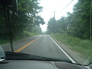
West Virginia Route 817 follows the former path of U.S. Route 35
along the Kanawha River
from St. Albans
, West Virginia
to near Fraziers Bottom
, West Virginia
and resumes again between near Southside
to near Henderson
. As such it is actually two separate roads, connected by the 12 mile "gap" in US 35, which will, when US 35 is finished, become WV 817 as well, making the eventual route of the road from St. Albans to Henderson. The route was first signed on October 10, 2008, the day when a new section of US 35 opened to replace this stretch of road. It was extended from Winfield
to the current end of the four-lane US 35 near Fraziers Bottom on June 15, 2009 when the section of US 35 that replaced it was opened. The separate section was added on November 1, 2010, when another section of US 35 opened. While US 35 formerly ended at U.S. Route 60
, its new path ends at Interstate 64
.
at Point Pleasant
, a new bridge (the Silver Memorial Bridge
) was built to carry U.S. Route 35
across the Ohio River
. The new bridge was built slightly downstream, now south of the mouth of the Kanawha River
. With the new location, West Virginia moved US 35 from the northern bank of the Kanawha River to southern bank, replacing old WV 17. The old path on the northern side of the Kanawha was numbered as West Virginia Route 62.
With its new designation at US 35, this highway became the primary travel route between Charleston
and Point Pleasant
, and continuing in to Ohio
, Columbus
and Dayton
. Travel on the route continued to build, overwhelming the original 2-lane corridor. The state began planning to construct a replacement 4-lane route, but insufficient funding continually prevented the project. As the state looked to develop land near Buffalo
, the old 2-lane US 35 and its slow access to Interstate 64
became a major issue, further increasing the need for a new highway.
When the new U.S. Route 35
highway was finally opened from Interstate 64
to West Virginia Route 34 on October 10, 2008, West Virginia Division of Highways renamed the old highway in its entirety as West Virginia Route 817. This number is in homage of the original West Virginia 17 that was on the route until 1969. When the next section was opened, the old US 35 became WV 817 as well. This number actually represents a change of plans from 2002, when WVDOH planned to keep US 35 on the route from Interstate 64
to U.S. Route 60
.
U.S. Route 35
U.S. Route 35 is a north–south United States highway that runs northwest-southeast for approximately from northern Indiana to the western suburbs of Charleston, West Virginia. The highway's northern terminus is in Michigan City, Indiana, at U.S. Route 20. Its southern terminus is in Scott...
along the Kanawha River
Kanawha River
The Kanawha River is a tributary of the Ohio River, approximately 97 mi long, in the U.S. state of West Virginia. The largest inland waterway in West Virginia, it has formed a significant industrial region of the state since the middle of the 19th century.It is formed at the town of Gauley...
from St. Albans
St. Albans, West Virginia
St. Albans is a city in Kanawha County, West Virginia, United States, at the confluence of the Kanawha and Coal Rivers. The population was 11,044 at the 2010 census.St. Albans was laid out in 1816...
, West Virginia
West Virginia
West Virginia is a state in the Appalachian and Southeastern regions of the United States, bordered by Virginia to the southeast, Kentucky to the southwest, Ohio to the northwest, Pennsylvania to the northeast and Maryland to the east...
to near Fraziers Bottom
Fraziers Bottom, West Virginia
Fraziers Bottom is an unincorporated community in Putnam County, West Virginia, United States. The community was named after a family of Fraziers who settled the area in the late 18th century after migrating there from Virginia. The area was attractive as there was abundant and fertile bottom land...
, West Virginia
West Virginia
West Virginia is a state in the Appalachian and Southeastern regions of the United States, bordered by Virginia to the southeast, Kentucky to the southwest, Ohio to the northwest, Pennsylvania to the northeast and Maryland to the east...
and resumes again between near Southside
Southside, West Virginia
Southside is an unincorporated community in Mason County, West Virginia, United States. Southside is located near the Kanawha River south of Leon. It is served by U.S. Route 35....
to near Henderson
Henderson, West Virginia
Henderson is a town in Mason County, West Virginia, United States, at the confluence of the Ohio and Kanawha Rivers. The population was 325 at the 2000 census. It is part of the Point Pleasant, WV–OH Micropolitan Statistical Area...
. As such it is actually two separate roads, connected by the 12 mile "gap" in US 35, which will, when US 35 is finished, become WV 817 as well, making the eventual route of the road from St. Albans to Henderson. The route was first signed on October 10, 2008, the day when a new section of US 35 opened to replace this stretch of road. It was extended from Winfield
Winfield, West Virginia
Winfield is a town in Putnam County, West Virginia, along the Kanawha River. The population was 2,301 at the 2010 census. It is the county seat of Putnam County....
to the current end of the four-lane US 35 near Fraziers Bottom on June 15, 2009 when the section of US 35 that replaced it was opened. The separate section was added on November 1, 2010, when another section of US 35 opened. While US 35 formerly ended at U.S. Route 60
U.S. Route 60
U.S. Route 60 is an east–west United States highway, running from the Atlantic Ocean on the east coast in Virginia to western Arizona. Despite the final "0" in its number, indicating a transcontinental designation, the 1926 route formerly ended in Springfield, Missouri, at its intersection...
, its new path ends at Interstate 64
Interstate 64
Interstate 64 is an Interstate Highway in the Midwestern and Southeastern United States. Its western terminus is at I-70, U.S. 40, and U.S. 61 in Wentzville, Missouri. Its eastern terminus is at an interchange with I-264 and I-664 at Bowers Hill in Chesapeake, Virginia. As I-64 is concurrent with...
.
History
Prior to 1969, the route that is now WV 817 was numbered as the original West Virginia Route 17. Following the collapse of the Silver BridgeSilver Bridge
The Silver Bridge collapsed in 1967, killing 46 people. The terms Silver Bridge or Silverbridge may also refer to:* Silver Memorial Bridge, the replacement for the above bridge, opened in 1969....
at Point Pleasant
Point Pleasant, West Virginia
Point Pleasant is a city in Mason County, West Virginia, United States, at the confluence of the Ohio and Kanawha rivers. The population was 4,637 at the 2000 census...
, a new bridge (the Silver Memorial Bridge
Silver Memorial Bridge
The Silver Memorial Bridge is a cantilever bridge which spans the Ohio River between Gallipolis, Ohio and Henderson, West Virginia. The bridge was completed in 1969, shortly after the Silver Bridge disaster, although it is located about 1 mile downstream of the original...
) was built to carry U.S. Route 35
U.S. Route 35
U.S. Route 35 is a north–south United States highway that runs northwest-southeast for approximately from northern Indiana to the western suburbs of Charleston, West Virginia. The highway's northern terminus is in Michigan City, Indiana, at U.S. Route 20. Its southern terminus is in Scott...
across the Ohio River
Ohio River
The Ohio River is the largest tributary, by volume, of the Mississippi River. At the confluence, the Ohio is even bigger than the Mississippi and, thus, is hydrologically the main stream of the whole river system, including the Allegheny River further upstream...
. The new bridge was built slightly downstream, now south of the mouth of the Kanawha River
Kanawha River
The Kanawha River is a tributary of the Ohio River, approximately 97 mi long, in the U.S. state of West Virginia. The largest inland waterway in West Virginia, it has formed a significant industrial region of the state since the middle of the 19th century.It is formed at the town of Gauley...
. With the new location, West Virginia moved US 35 from the northern bank of the Kanawha River to southern bank, replacing old WV 17. The old path on the northern side of the Kanawha was numbered as West Virginia Route 62.
With its new designation at US 35, this highway became the primary travel route between Charleston
Charleston, West Virginia
Charleston is the capital and largest city of the U.S. state of West Virginia. It is located at the confluence of the Elk and Kanawha Rivers in Kanawha County. As of the 2010 census, it has a population of 51,400, and its metropolitan area 304,214. It is the county seat of Kanawha County.Early...
and Point Pleasant
Point Pleasant, West Virginia
Point Pleasant is a city in Mason County, West Virginia, United States, at the confluence of the Ohio and Kanawha rivers. The population was 4,637 at the 2000 census...
, and continuing in to Ohio
Ohio
Ohio is a Midwestern state in the United States. The 34th largest state by area in the U.S.,it is the 7th‑most populous with over 11.5 million residents, containing several major American cities and seven metropolitan areas with populations of 500,000 or more.The state's capital is Columbus...
, Columbus
Columbus, Ohio
Columbus is the capital of and the largest city in the U.S. state of Ohio. The broader metropolitan area encompasses several counties and is the third largest in Ohio behind those of Cleveland and Cincinnati. Columbus is the third largest city in the American Midwest, and the fifteenth largest city...
and Dayton
Dayton, Ohio
Dayton is the 6th largest city in the U.S. state of Ohio and the county seat of Montgomery County, the fifth most populous county in the state. The population was 141,527 at the 2010 census. The Dayton Metropolitan Statistical Area had a population of 841,502 in the 2010 census...
. Travel on the route continued to build, overwhelming the original 2-lane corridor. The state began planning to construct a replacement 4-lane route, but insufficient funding continually prevented the project. As the state looked to develop land near Buffalo
Buffalo, West Virginia
Buffalo is a town in Putnam County, West Virginia, along the Kanawha River. The population was 1,236 at the 2010 census.-Geography:Buffalo is located at .According to the United States Census Bureau, the town has a total area of...
, the old 2-lane US 35 and its slow access to Interstate 64
Interstate 64
Interstate 64 is an Interstate Highway in the Midwestern and Southeastern United States. Its western terminus is at I-70, U.S. 40, and U.S. 61 in Wentzville, Missouri. Its eastern terminus is at an interchange with I-264 and I-664 at Bowers Hill in Chesapeake, Virginia. As I-64 is concurrent with...
became a major issue, further increasing the need for a new highway.
When the new U.S. Route 35
U.S. Route 35
U.S. Route 35 is a north–south United States highway that runs northwest-southeast for approximately from northern Indiana to the western suburbs of Charleston, West Virginia. The highway's northern terminus is in Michigan City, Indiana, at U.S. Route 20. Its southern terminus is in Scott...
highway was finally opened from Interstate 64
Interstate 64
Interstate 64 is an Interstate Highway in the Midwestern and Southeastern United States. Its western terminus is at I-70, U.S. 40, and U.S. 61 in Wentzville, Missouri. Its eastern terminus is at an interchange with I-264 and I-664 at Bowers Hill in Chesapeake, Virginia. As I-64 is concurrent with...
to West Virginia Route 34 on October 10, 2008, West Virginia Division of Highways renamed the old highway in its entirety as West Virginia Route 817. This number is in homage of the original West Virginia 17 that was on the route until 1969. When the next section was opened, the old US 35 became WV 817 as well. This number actually represents a change of plans from 2002, when WVDOH planned to keep US 35 on the route from Interstate 64
Interstate 64
Interstate 64 is an Interstate Highway in the Midwestern and Southeastern United States. Its western terminus is at I-70, U.S. 40, and U.S. 61 in Wentzville, Missouri. Its eastern terminus is at an interchange with I-264 and I-664 at Bowers Hill in Chesapeake, Virginia. As I-64 is concurrent with...
to U.S. Route 60
U.S. Route 60
U.S. Route 60 is an east–west United States highway, running from the Atlantic Ocean on the east coast in Virginia to western Arizona. Despite the final "0" in its number, indicating a transcontinental designation, the 1926 route formerly ended in Springfield, Missouri, at its intersection...
.
Future
It is expected that WV 817 will continue to be extended along the route of the current US 35 as more of its 4-lane replacement opens.