
Wakefield, New Hampshire
Encyclopedia
Wakefield is a town
in Carroll County
, New Hampshire
, United States. The population was 5,078 at the 2010 census. The town includes the villages of Wakefield Corner (the original town center), East Wakefield
, North Wakefield, Sanbornville
, Union
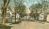
, Woodman and Province Lake. Wakefield Corner, popular with tourists, is a picturesque hilltop village of antique buildings.
and Somersworth
, the town was granted in 1749 by the Masonian Proprietors. It was called East Town before being incorporated as Wakefield in 1774 by Governor John Wentworth
. Wakefield
, in Yorkshire, England, is near Wentworth Castle
, the home of the Wentworth ancestors. It developed as an important sledge and stage
stop between the seacoast
and the White Mountains
. The Wakefield Inn, built in 1804 beside the principal trade route
through Wakefield Corner, remains operating today.
Although the soil was considered "stubborn," farmer
s made it productive. Lumber
became a chief product, and by 1859 there were five sawmill
s, five gristmill
s, and ten shingle
, clapboard
and planing mills. Shoemaking
was another local industry. When the Portsmouth, Great Falls & Conway Railroad arrived in 1871, the center of Wakefield shifted from Wakefield Corner to Sanbornville, which today remains the retail district of town.
, the town has a total area of 44.7 square miles (115.8 km²), of which 39.5 square miles (102.3 km²) is land and 5.3 square miles (13.7 km²) is water, comprising 11.72% of the town. Wakefield is drained by the Pine
and Branch
rivers. Province Lake
is in the northeast corner of the town, Pine River Pond
, Belleau Lake, Stump Pond (Balch Pond)
and Sandy Pond in the center, and Lovell Lake
, Union Meadows, Lake Ivanhoe, Great East Lake
and Horn Pond in the south. Four of these lakes, Province, Balch, Great East, and Horn Pond span the Maine
border. The highest point in Wakefield is the summit of Long Mountain, at 1110 feet (338.3 m) above sea level
, along the town's western border.
Five named villages are within the town limits: Sanbornville, Wakefield village proper, East Wakefield, North Wakefield and Union. Sanbornville, the primary settlement in the town, lies at the west end of Lovell Lake, next to the lake's outlet. The village is at the intersection of New Hampshire Routes 109
and 153
. Route 16
bypasses the village to the west. Wakefield village occupies a hill just north of Sanbornville on Route 153. The village of Union occupies the southernmost corner of the town, at the intersection of Route 153 and Route 16 (at the northern end of the Spaulding Turnpike
). East Wakefield is on Route 153, containing the land east of Pine River Pond and north to the Effingham
town line. North Wakefield lies along Route 16 on the west side of Pine River Pond near the town line with Ossipee
.
of 2000, there were 4,252 people, 1,685 households, and 1,213 families residing in the town. The population density
was 108.1 people per square mile (41.8/km²). There were 3,331 housing units at an average density of 84.7 per square mile (32.7/km²). The racial makeup of the town was 98.21% White, 0.09% African American, 0.45% Native American, 0.19% Asian, 0.19% from other races
, and 0.87% from two or more races. Hispanic or Latino of any race were 0.56% of the population.
There were 1,685 households out of which 31.0% had children under the age of 18 living with them, 60.1% were married couples
living together, 8.0% had a female householder with no husband present, and 28.0% were non-families. 21.8% of all households were made up of individuals and 10.3% had someone living alone who was 65 years of age or older. The average household size was 2.52 and the average family size was 2.92.
In the town the population was spread out with 25.7% under the age of 18, 5.2% from 18 to 24, 28.4% from 25 to 44, 25.7% from 45 to 64, and 15.0% who were 65 years of age or older. The median age was 40 years. For every 100 females there were 97.9 males. For every 100 females age 18 and over, there were 95.2 males.
The median income for a household in the town was $42,500, and the median income for a family was $45,774. Males had a median income of $35,804 versus $24,898 for females. The per capita income
for the town was $21,507. About 5.1% of families and 7.1% of the population were below the poverty line, including 8.9% of those under age 18 and 5.8% of those age 65 or over.
New England town
The New England town is the basic unit of local government in each of the six New England states. Without a direct counterpart in most other U.S. states, New England towns are conceptually similar to civil townships in other states, but are incorporated, possessing powers like cities in other...
in Carroll County
Carroll County, New Hampshire
-Demographics:As of the census of 2000, there were 43,666 people, 18,351 households, and 12,313 families residing in the county. The population density was 18/km² . There were 34,750 housing units at an average density of 14/km²...
, New Hampshire
New Hampshire
New Hampshire is a state in the New England region of the northeastern United States of America. The state was named after the southern English county of Hampshire. It is bordered by Massachusetts to the south, Vermont to the west, Maine and the Atlantic Ocean to the east, and the Canadian...
, United States. The population was 5,078 at the 2010 census. The town includes the villages of Wakefield Corner (the original town center), East Wakefield
East Wakefield, New Hampshire
East Wakefield is an unincorporated village in the town of Wakefield in Carroll County, New Hampshire. It is located in the eastern part of Wakefield along New Hampshire Route 153, northeast of Wakefield village and directly south of Pine River Pond....
, North Wakefield, Sanbornville
Sanbornville, New Hampshire
Sanbornville is a census-designated place in the town of Wakefield in Carroll County, New Hampshire. It had a population of 1,056 at the 2010 census....
, Union
Union, New Hampshire
Union is a village and census-designated place in the town of Wakefield in Carroll County, New Hampshire. It had a population of 204 at the 2010 census....
, Woodman and Province Lake. Wakefield Corner, popular with tourists, is a picturesque hilltop village of antique buildings.
History
Settled by colonists from DoverDover, New Hampshire
Dover is a city in Strafford County, New Hampshire, in the United States of America. The population was 29,987 at the 2010 census, the largest in the New Hampshire Seacoast region...
and Somersworth
Somersworth, New Hampshire
As of the census of 2000, there were 11,477 people, 4,687 households, and 3,079 families residing in the city. The population density was 1,173.4 people per square mile . There were 4,841 housing units at an average density of 494.9 per square mile...
, the town was granted in 1749 by the Masonian Proprietors. It was called East Town before being incorporated as Wakefield in 1774 by Governor John Wentworth
John Wentworth (governor)
Sir John Wentworth, 1st Baronet was the British colonial governor of New Hampshire at the time of the American Revolution. He was later also Lieutenant-Governor of Nova Scotia.-Early life:...
. Wakefield
Wakefield
Wakefield is the main settlement and administrative centre of the City of Wakefield, a metropolitan district of West Yorkshire, England. Located by the River Calder on the eastern edge of the Pennines, the urban area is and had a population of 76,886 in 2001....
, in Yorkshire, England, is near Wentworth Castle
Wentworth Castle
Wentworth Castle is a stately home and estate near Barnsley in South Yorkshire. It was originally the seat of the Earls of Strafford. An older house existed on the estate, then called Stainborough, when it was purchased by Thomas Wentworth, Lord Raby , in 1711...
, the home of the Wentworth ancestors. It developed as an important sledge and stage
Stagecoach
A stagecoach is a type of covered wagon for passengers and goods, strongly sprung and drawn by four horses, usually four-in-hand. Widely used before the introduction of railway transport, it made regular trips between stages or stations, which were places of rest provided for stagecoach travelers...
stop between the seacoast
Seacoast Region (New Hampshire)
The Seacoast Region is the southeast area of the U.S. state of New Hampshire. The region stretches 18 miles along the Atlantic Ocean from New Hampshire's border with Salisbury, Massachusetts to the Piscataqua River and New Hampshire's border with Kittery, Maine. The shoreline is generally very...
and the White Mountains
White Mountains (New Hampshire)
The White Mountains are a mountain range covering about a quarter of the state of New Hampshire and a small portion of western Maine in the United States. Part of the Appalachian Mountains, they are considered the most rugged mountains in New England...
. The Wakefield Inn, built in 1804 beside the principal trade route
Trade route
A trade route is a logistical network identified as a series of pathways and stoppages used for the commercial transport of cargo. Allowing goods to reach distant markets, a single trade route contains long distance arteries which may further be connected to several smaller networks of commercial...
through Wakefield Corner, remains operating today.
Although the soil was considered "stubborn," farmer
Farmer
A farmer is a person engaged in agriculture, who raises living organisms for food or raw materials, generally including livestock husbandry and growing crops, such as produce and grain...
s made it productive. Lumber
Lumber
Lumber or timber is wood in any of its stages from felling through readiness for use as structural material for construction, or wood pulp for paper production....
became a chief product, and by 1859 there were five sawmill
Sawmill
A sawmill is a facility where logs are cut into boards.-Sawmill process:A sawmill's basic operation is much like those of hundreds of years ago; a log enters on one end and dimensional lumber exits on the other end....
s, five gristmill
Gristmill
The terms gristmill or grist mill can refer either to a building in which grain is ground into flour, or to the grinding mechanism itself.- Early history :...
s, and ten shingle
Roof shingle
Roof shingles are a roof covering consisting of individual overlapping elements. These elements are typically flat rectangular shapes laid in rows from the bottom edge of the roof up, with each successive higher row overlapping the joints in the row below...
, clapboard
Clapboard (architecture)
Clapboard, also known as bevel siding or lap siding or weather-board , is a board used typically for exterior horizontal siding that has one edge thicker than the other and where the board above laps over the one below...
and planing mills. Shoemaking
Shoemaking
Shoemaking is the process of making footwear. Originally, shoes were made one at a time by hand. Traditional handicraft shoemaking has now been largely superseded in volume of shoes produced by industrial mass production of footwear, but not necessarily in quality, attention to detail, or...
was another local industry. When the Portsmouth, Great Falls & Conway Railroad arrived in 1871, the center of Wakefield shifted from Wakefield Corner to Sanbornville, which today remains the retail district of town.
Geography
According to the United States Census BureauUnited States Census Bureau
The United States Census Bureau is the government agency that is responsible for the United States Census. It also gathers other national demographic and economic data...
, the town has a total area of 44.7 square miles (115.8 km²), of which 39.5 square miles (102.3 km²) is land and 5.3 square miles (13.7 km²) is water, comprising 11.72% of the town. Wakefield is drained by the Pine
Pine River (New Hampshire)
The Pine River is a 19.2 mile long river located in eastern New Hampshire in the United States. It is a tributary of Ossipee Lake, part of the Saco River watershed leading to the Atlantic Ocean.- Course :...
and Branch
Branch River (New Hampshire)
The Branch River is an 11.9 mile long river located in eastern New Hampshire in the United States. It is a tributary of the Salmon Falls River, part of the Piscataqua River watershed leading to the Atlantic Ocean....
rivers. Province Lake
Province Lake
Province Lake is a water body located on the border between New Hampshire and Maine in the United States. Approximately of the lake lie in the towns of Effingham and Wakefield, New Hampshire, with the remainder in Parsonsfield, Maine...
is in the northeast corner of the town, Pine River Pond
Pine River Pond
Pine River Pond is a lake located in Carroll County in eastern New Hampshire, United States, in the town of Wakefield. Its outlet is the Pine River, which flows northwest to Ossipee Lake....
, Belleau Lake, Stump Pond (Balch Pond)
Stump Pond (Balch Pond)
Stump Pond is a water body located on the New Hampshire-Maine border, in the towns of Wakefield, New Hampshire and Acton and Newfield, Maine. The water body is known as Stump Pond in New Hampshire and Balch Pond in Maine. Water flows from the eastern end of Balch Pond into the Little Ossipee...
and Sandy Pond in the center, and Lovell Lake
Lovell Lake
Lovell Lake is a water body located in Carroll County in eastern New Hampshire, United States, in the town of Wakefield. The outlet of the lake, located at the village of Sanbornville, is the Branch River, a tributary of the Salmon Falls River....
, Union Meadows, Lake Ivanhoe, Great East Lake
Great East Lake
Great East Lake is an water body located in Carroll County and York County in the United States. The lake is shared by the towns of Wakefield and Acton . The lake is the headwaters of the Salmon Falls River, a tributary of the Piscataqua River.The widest part of the lake is in New Hampshire...
and Horn Pond in the south. Four of these lakes, Province, Balch, Great East, and Horn Pond span the Maine
Maine
Maine is a state in the New England region of the northeastern United States, bordered by the Atlantic Ocean to the east and south, New Hampshire to the west, and the Canadian provinces of Quebec to the northwest and New Brunswick to the northeast. Maine is both the northernmost and easternmost...
border. The highest point in Wakefield is the summit of Long Mountain, at 1110 feet (338.3 m) above sea level
Sea level
Mean sea level is a measure of the average height of the ocean's surface ; used as a standard in reckoning land elevation...
, along the town's western border.
Five named villages are within the town limits: Sanbornville, Wakefield village proper, East Wakefield, North Wakefield and Union. Sanbornville, the primary settlement in the town, lies at the west end of Lovell Lake, next to the lake's outlet. The village is at the intersection of New Hampshire Routes 109
New Hampshire Route 109
New Hampshire Route 109 is a long north–south highway in Carroll County, New Hampshire. It runs southeast from Sandwich to the Maine border....
and 153
New Hampshire Route 153
New Hampshire Route 153 is a long secondary north–south highway in Strafford and Carroll counties in the eastern portion of the U.S. state of New Hampshire. The road runs from Farmington north to Conway....
. Route 16
New Hampshire Route 16
New Hampshire Route 16 is a long north–south highway in the U.S. state of New Hampshire. Much of its length is close to the border with Maine. NH 16 is the main route from the Seacoast region north to the Lakes Region and the White Mountains. The section from Portsmouth to Milton is a...
bypasses the village to the west. Wakefield village occupies a hill just north of Sanbornville on Route 153. The village of Union occupies the southernmost corner of the town, at the intersection of Route 153 and Route 16 (at the northern end of the Spaulding Turnpike
Spaulding Turnpike
The Spaulding Turnpike is a toll road in New Hampshire, USA, running from Interstate 95 in Portsmouth northwest to Milton. The turnpike roughly parallels the Maine border, and in the mid-1990s New Hampshire Route 16 was re-signed onto the turnpike...
). East Wakefield is on Route 153, containing the land east of Pine River Pond and north to the Effingham
Effingham, New Hampshire
Effingham is a town in Carroll County, New Hampshire, United States. As of the 2010 census, the town population was 1,465. Effingham includes the villages of Effingham Falls, Effingham , Center Effingham , and South Effingham...
town line. North Wakefield lies along Route 16 on the west side of Pine River Pond near the town line with Ossipee
Ossipee, New Hampshire
Ossipee is a town in Carroll County, New Hampshire, United States. The population was 4,345 at the 2010 census. It is the county seat of Carroll County...
.
Demographics
As of the censusCensus
A census is the procedure of systematically acquiring and recording information about the members of a given population. It is a regularly occurring and official count of a particular population. The term is used mostly in connection with national population and housing censuses; other common...
of 2000, there were 4,252 people, 1,685 households, and 1,213 families residing in the town. The population density
Population density
Population density is a measurement of population per unit area or unit volume. It is frequently applied to living organisms, and particularly to humans...
was 108.1 people per square mile (41.8/km²). There were 3,331 housing units at an average density of 84.7 per square mile (32.7/km²). The racial makeup of the town was 98.21% White, 0.09% African American, 0.45% Native American, 0.19% Asian, 0.19% from other races
Race (United States Census)
Race and ethnicity in the United States Census, as defined by the Federal Office of Management and Budget and the United States Census Bureau, are self-identification data items in which residents choose the race or races with which they most closely identify, and indicate whether or not they are...
, and 0.87% from two or more races. Hispanic or Latino of any race were 0.56% of the population.
There were 1,685 households out of which 31.0% had children under the age of 18 living with them, 60.1% were married couples
Marriage
Marriage is a social union or legal contract between people that creates kinship. It is an institution in which interpersonal relationships, usually intimate and sexual, are acknowledged in a variety of ways, depending on the culture or subculture in which it is found...
living together, 8.0% had a female householder with no husband present, and 28.0% were non-families. 21.8% of all households were made up of individuals and 10.3% had someone living alone who was 65 years of age or older. The average household size was 2.52 and the average family size was 2.92.
In the town the population was spread out with 25.7% under the age of 18, 5.2% from 18 to 24, 28.4% from 25 to 44, 25.7% from 45 to 64, and 15.0% who were 65 years of age or older. The median age was 40 years. For every 100 females there were 97.9 males. For every 100 females age 18 and over, there were 95.2 males.
The median income for a household in the town was $42,500, and the median income for a family was $45,774. Males had a median income of $35,804 versus $24,898 for females. The per capita income
Per capita income
Per capita income or income per person is a measure of mean income within an economic aggregate, such as a country or city. It is calculated by taking a measure of all sources of income in the aggregate and dividing it by the total population...
for the town was $21,507. About 5.1% of families and 7.1% of the population were below the poverty line, including 8.9% of those under age 18 and 5.8% of those age 65 or over.
Notable inhabitants
- Joshua G. HallJoshua G. HallJoshua Gilman Hall was a U.S. Representative from New Hampshire.Born in Wakefield, New Hampshire, Hall attended Gilmanton Academy, and in 1851 was graduated from Dartmouth College in Hanover...
, congressman - Harry LibbeyHarry LibbeyHarrison 'Harry' Libbey was a U.S. Representative from Virginia.Born in Wakefield, New Hampshire, Libbey attended the common schools.He moved to Virginia and settled in Hampton in 1863....
, congressman - Freddy MeyerFreddy MeyerFrederick Meyer IV is an American professional ice hockey defenseman who currently plays for Modo Hockey of the Swedish Elitserien.- Playing career :Meyer was signed by the Philadelphia Flyers on May 21, 2003 to an entry level contract...
, hockey player - William Nathaniel RogersWilliam Nathaniel RogersWilliam Nathaniel Rogers was a U.S. Representative from New Hampshire.Born in Sanbornville, New Hampshire, Rogers attended the public schools, Brewster Free Academy in Wolfeboro, and Dartmouth College in Hanover. He was graduated from the law department of the University of Maine at Orono in 1916...
, congressman