
Upper Mount Bethel Township, Pennsylvania
Encyclopedia
Upper Mount Bethel Township is a township
in Northampton County
, Pennsylvania
, United States
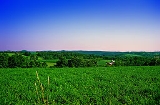
. Upper Mount Bethel Township is located in the Lehigh Valley
region of the state. It is part of Pennsylvania's Slate
Belt.
The population of Upper Mount Bethel Township was 6,706 at the 2010 census.
, the township has a total area of 44.3 square miles (114.7 km²). 43.4 square miles (112.4 km²) of it is land and 0.9 square miles (2.3 km²) of it (2.01%) is water. It is drained by the Delaware River
, which forms its eastern boundary separating it from New Jersey
. Its natural northwest boundary is Blue Mountain
. Its villages include Centerville, Five Points, Hartzells Ferry, Johnsonville, Mount Bethel, North Bangor, and Slateford. Its numbered routes are 191
, 512
, and 611
.
of 2000, there were 6,063 people, 2,363 households, and 1,732 families residing in the township. The population density
was 139.7 people per square mile (54.0/km²). There were 2,574 housing units at an average density of 59.3/sq mi (22.9/km²). The racial makeup of the township was 97.89% White, 0.69% African American, 0.13% Native American, 0.49% Asian, 0.21% from other races
, and 0.58% from two or more races. Hispanic or Latino of any race were 1.39% of the population.
There were 2,363 households out of which 28.8% had children under the age of 18 living with them, 63.4% were married couples
living together, 6.1% had a female householder with no husband present, and 26.7% were non-families. 21.7% of all households were made up of individuals and 8.9% had someone living alone who was 65 years of age or older. The average household size was 2.56 and the average family size was 2.96.
In the township the population was spread out with 22.8% under the age of 18, 6.2% from 18 to 24, 28.3% from 25 to 44, 26.8% from 45 to 64, and 15.9% who were 65 years of age or older. The median age was 41 years. For every 100 females there were 100.8 males. For every 100 females age 18 and over, there were 100.6 males.
The median income for a household in the township was $45,617, and the median income for a family was $54,692. Males had a median income of $38,914 versus $23,906 for females. The per capita income
for the township was $21,116. About 4.6% of families and 6.3% of the population were below the poverty line, including 3.3% of those under age 18 and 15.7% of those age 65 or over.
.
Township (Pennsylvania)
A township in the Commonwealth of Pennsylvania, a state of the United States of America, is one of four types of municipalities in the state . Townships were established based on convenient geographical boundaries and vary in size from six to forty square miles...
in Northampton County
Northampton County, Pennsylvania
As of the 2010 census, the county was 86.3% White, 5.0% Black or African American, 0.2% Native American or Alaskan Native, 2.4% Asian, 0.0% Native Hawaiian, 2.2% were two or more races, and 3.8% were some other race. 10.5% of the population were of Hispanic or Latino ancestry.As of the census of...
, Pennsylvania
Pennsylvania
The Commonwealth of Pennsylvania is a U.S. state that is located in the Northeastern and Mid-Atlantic regions of the United States. The state borders Delaware and Maryland to the south, West Virginia to the southwest, Ohio to the west, New York and Ontario, Canada, to the north, and New Jersey to...
, United States
United States
The United States of America is a federal constitutional republic comprising fifty states and a federal district...
. Upper Mount Bethel Township is located in the Lehigh Valley
Lehigh Valley
The Lehigh Valley, known officially by the United States Census Bureau as the Allentown-Bethlehem-Easton, PA-NJ metropolitan area and referred to locally as The Valley and A-B-E, is a metropolitan region consisting of Lehigh, Northampton, Berks, and Carbon counties in eastern Pennsylvania and...
region of the state. It is part of Pennsylvania's Slate
Slate
Slate is a fine-grained, foliated, homogeneous metamorphic rock derived from an original shale-type sedimentary rock composed of clay or volcanic ash through low-grade regional metamorphism. The result is a foliated rock in which the foliation may not correspond to the original sedimentary layering...
Belt.
The population of Upper Mount Bethel Township was 6,706 at the 2010 census.
Geography
According to the United States Census BureauUnited States Census Bureau
The United States Census Bureau is the government agency that is responsible for the United States Census. It also gathers other national demographic and economic data...
, the township has a total area of 44.3 square miles (114.7 km²). 43.4 square miles (112.4 km²) of it is land and 0.9 square miles (2.3 km²) of it (2.01%) is water. It is drained by the Delaware River
Delaware River
The Delaware River is a major river on the Atlantic coast of the United States.A Dutch expedition led by Henry Hudson in 1609 first mapped the river. The river was christened the South River in the New Netherland colony that followed, in contrast to the North River, as the Hudson River was then...
, which forms its eastern boundary separating it from New Jersey
New Jersey
New Jersey is a state in the Northeastern and Middle Atlantic regions of the United States. , its population was 8,791,894. It is bordered on the north and east by the state of New York, on the southeast and south by the Atlantic Ocean, on the west by Pennsylvania and on the southwest by Delaware...
. Its natural northwest boundary is Blue Mountain
Blue Mountain (Pennsylvania)
Blue Mountain is a ridge that forms the eastern edge of the Appalachian mountain range in the U.S. state of Pennsylvania. It cuts across the eastern half of the state from New Jersey to Maryland, providing a distinct boundary between a number of Pennsylvania's geographical and cultural regions...
. Its villages include Centerville, Five Points, Hartzells Ferry, Johnsonville, Mount Bethel, North Bangor, and Slateford. Its numbered routes are 191
Pennsylvania Route 191
Pennsylvania Route 191 is a -long state highway in the U.S. state of Pennsylvania. The route, a major non-freeway corridor connecting the Lehigh Valley to The Poconos in eastern Pennsylvania, is designated from U.S...
, 512
Pennsylvania Route 512
Pennsylvania Route 512 is a long state route in eastern Pennsylvania. The southern terminus is at U.S. Route 22 north of Bethlehem. The northern terminus is at Pennsylvania Route 611 in Upper Mount Bethel Township.-Route description:...
, and 611
Pennsylvania Route 611
Pennsylvania Route 611 is a major state highway in Pennsylvania, United States, running from Interstate 95 south of downtown Philadelphia north to Interstate 380 in Coolbaugh Township, Pennsylvania in The Poconos....
.
Neighboring municipalities
- Washington TownshipWashington Township, Northampton County, PennsylvaniaWashington Township is a township in Northampton County, Pennsylvania, United States. Washington Township is located in the Lehigh Valley region of the state...
(southwest) - East BangorEast Bangor, PennsylvaniaEast Bangor is a borough in Northampton County, Pennsylvania, United States, and is located in the Lehigh Valley region of the state. It is part of Pennsylvania's Slate Belt .The population of East Bangor was 1,172 at the 2010 census.-Geography:...
(southwest) - Lower Mount Bethel Township (south)
- Belvidere, New JerseyBelvidere, New JerseyBelvidere is a Town in Warren County, New Jersey, United States. As of the 2010 United States Census, the town population was 2,681. It is the county seat of Warren County....
(southeast) - White Township, New JerseyWhite Township, New Jersey-Demographics:As of the census of 2000, there were 4,245 people, 1,668 households, and 1,179 families residing in the township. The population density was 155.1 people per square mile . There were 1,770 housing units at an average density of 64.7 per square mile...
(east) - Knowlton Township, New JerseyKnowlton Township, New Jersey- Local government :The Knowlton Township Committee consists of Mayor Frank Van Horn , Deputy Mayor Ronald Farber , Theresa Capriccio , René Mathez and Scott Odorizzi ....
(east) - PortlandPortland, PennsylvaniaPortland is a borough in Northampton County, Pennsylvania, United States. Portland is located in the Lehigh Valley region of the state. It is part of Pennsylvania's Slate Belt.The population of Portland was 579 at the 2000 census.-Geography:...
(east) - Delaware Water Gap, Monroe CountyDelaware Water Gap, PennsylvaniaDelaware Water Gap is a borough in Monroe County, Pennsylvania, United States. It is located adjacent to the Delaware Water Gap, the pass through which the Lackawanna Corridor and Interstate 80 run across the Pennsylvania-New Jersey border along the Delaware River.The population of Delaware Water...
(north) - Stroud Township, Monroe County (north)
- Hamilton Township, Monroe CountyHamilton Township, Monroe County, PennsylvaniaHamilton Township is a township in Monroe County, Pennsylvania, United States. The population was 8,235 at the 2000 census.-Geography:According to the United States Census Bureau, the township has a total area of , of which, of it is land and of it is water...
(northwest)
Demographics
As of the censusCensus
A census is the procedure of systematically acquiring and recording information about the members of a given population. It is a regularly occurring and official count of a particular population. The term is used mostly in connection with national population and housing censuses; other common...
of 2000, there were 6,063 people, 2,363 households, and 1,732 families residing in the township. The population density
Population density
Population density is a measurement of population per unit area or unit volume. It is frequently applied to living organisms, and particularly to humans...
was 139.7 people per square mile (54.0/km²). There were 2,574 housing units at an average density of 59.3/sq mi (22.9/km²). The racial makeup of the township was 97.89% White, 0.69% African American, 0.13% Native American, 0.49% Asian, 0.21% from other races
Race (United States Census)
Race and ethnicity in the United States Census, as defined by the Federal Office of Management and Budget and the United States Census Bureau, are self-identification data items in which residents choose the race or races with which they most closely identify, and indicate whether or not they are...
, and 0.58% from two or more races. Hispanic or Latino of any race were 1.39% of the population.
There were 2,363 households out of which 28.8% had children under the age of 18 living with them, 63.4% were married couples
Marriage
Marriage is a social union or legal contract between people that creates kinship. It is an institution in which interpersonal relationships, usually intimate and sexual, are acknowledged in a variety of ways, depending on the culture or subculture in which it is found...
living together, 6.1% had a female householder with no husband present, and 26.7% were non-families. 21.7% of all households were made up of individuals and 8.9% had someone living alone who was 65 years of age or older. The average household size was 2.56 and the average family size was 2.96.
In the township the population was spread out with 22.8% under the age of 18, 6.2% from 18 to 24, 28.3% from 25 to 44, 26.8% from 45 to 64, and 15.9% who were 65 years of age or older. The median age was 41 years. For every 100 females there were 100.8 males. For every 100 females age 18 and over, there were 100.6 males.
The median income for a household in the township was $45,617, and the median income for a family was $54,692. Males had a median income of $38,914 versus $23,906 for females. The per capita income
Per capita income
Per capita income or income per person is a measure of mean income within an economic aggregate, such as a country or city. It is calculated by taking a measure of all sources of income in the aggregate and dividing it by the total population...
for the township was $21,116. About 4.6% of families and 6.3% of the population were below the poverty line, including 3.3% of those under age 18 and 15.7% of those age 65 or over.
Public education
The township is served by the Bangor Area School District and is the home to Bangor Area High SchoolBangor Area High School
Bangor Area High School is a four-year public high school located in Upper Mount Bethel Township, Pennsylvania, in the United States. It is the only high school in the Bangor Area School District. Its colors are maroon and white and its mascot is the Slater....
.