
Union County, Oregon
Encyclopedia
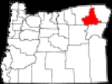
Union County is a county located in the U.S. state
of Oregon
. It is included in the 8 county definition of Eastern Oregon
. The county is named for
the town of Union
, which is located within its boundaries; in 2010, the county population was 25,748. The county seat
is La Grande
.
. The northern end of the Grande Ronde Valley
was the first part to be settled. During the 1860s, population growth in eastern Oregon prompted the State Legislature to split Umatilla
and Baker
Counties from Wasco County in 1862. Further settlement in the Grande Ronde Valley led to the division of Baker County to create Union County on October 14, 1864. The county doubled in population between 1880 and 1890.
The choice of a county seat
resulted in competition, based on geography and on economic and population growth, between La Grande
and the city of Union
. The county seat alternated between Union and La Grande until it permanently came to rest at La Grande in 1905. Between 1875 and 1913, adjustments were made between Union County's borders and the borders of Baker, Umatilla, and Wallowa
Counties.
now owns 47% of the land in the county.
which is currently represented by Greg Smith
. It is also located in Oregon State Senate District 29
, represented by David Nelson
. Both Smith and Nelson are registered Republicans
.
.
in Union County belong to the Republican Party
. In the 2008 presidential election
, 60.2 percent of Union County voters voted for Republican John McCain
, while 38.63 percent voted for Democrat
Barack Obama
and 3.22 percent of voters either voted for a Third Party
candidate or wrote in
a candidate. These numbers show a slight shift towards the Democratic candidate when compared to the 2004 presidential election
, when 65.7% of Union Country voters voted for George W. Bush
, 32.8% voted for John Kerry
, and 1.5% of voters either voted for a Third Party
candidate or wrote in a candidate
.
, the county has a total area of 2039 square miles (5,281 km²), of which 2037 square miles (5,275.8 km²) is land and 2 square miles (5.2 km²) (0.10%) is water.
of 2000, there were 24,530 people, 9,740 households, and 6,516 families residing in the county. The population density
was 12 people per square mile (5/km²). There were 10,603 housing units at an average density of 5 per square mile (2/km²). The racial makeup of the county was 94.29% White
, 0.51% Black
or African American
, 0.85% Native American
, 0.85% Asian
, 0.62% Pacific Islander
, 1.22% from other races
, and 1.67% from two or more races. 2.45% of the population were Hispanic
or Latino
of any race. 20.2% were of German, 15.5% American
, 12.2% English
and 10.5% Irish
ancestry according to Census 2000.
There were 9,740 households out of which 30.00% had children under the age of 18 living with them, 55.10% were married couples
living together, 8.50% had a female householder with no husband present, and 33.10% were non-families. 26.10% of all households were made up of individuals and 10.80% had someone living alone who was 65 years of age or older. The average household size was 2.45 and the average family size was 2.94.
In the county, the population was spread out with 24.60% under the age of 18, 12.10% from 18 to 24, 23.50% from 25 to 44, 25.00% from 45 to 64, and 14.70% who were 65 years of age or older. The median age was 38 years. For every 100 females there were 95.10 males. For every 100 females age 18 and over, there were 92.40 males.
The median income for a household in the county was $33,738, and the median income for a family was $40,520. Males had a median income of $33,028 versus $21,740 for females. The per capita income
for the county was $16,907. About 8.50% of families and 13.80% of the population were below the poverty line, including 13.60% of those under age 18 and 9.50% of those age 65 or over.
U.S. state
A U.S. state is any one of the 50 federated states of the United States of America that share sovereignty with the federal government. Because of this shared sovereignty, an American is a citizen both of the federal entity and of his or her state of domicile. Four states use the official title of...
of Oregon
Oregon
Oregon is a state in the Pacific Northwest region of the United States. It is located on the Pacific coast, with Washington to the north, California to the south, Nevada on the southeast and Idaho to the east. The Columbia and Snake rivers delineate much of Oregon's northern and eastern...
. It is included in the 8 county definition of Eastern Oregon
Eastern Oregon
Eastern Oregon is the eastern part of the U.S. state of Oregon. It is not an officially recognized geographic entity, thus the boundaries of the region vary according to context. It is sometimes understood to include only the eight easternmost counties in the state; in other contexts, it includes...
. The county is named for
Oregon Geographic Names
Oregon Geographic Names is an authoritative compilation of the origin and meaning of place names in the U.S. state of Oregon. , the book is in its seventh edition and is compiled and edited by Lewis L. McArthur, who took over from his father, Lewis A. McArthur, as of the fourth edition...
the town of Union
Union, Oregon
Union is a city in Union County, Oregon, United States. The population was 1,926 at the 2000 census.- History :Union was platted on November 11, 1864 along the Oregon Trail. The name references the Union states, or Northern States, of the American Civil War....
, which is located within its boundaries; in 2010, the county population was 25,748. The county seat
County seat
A county seat is an administrative center, or seat of government, for a county or civil parish. The term is primarily used in the United States....
is La Grande
La Grande, Oregon
-Demographics:As of the census of 2000, there were 12,327 people, 5,124 households, and 2,982 families residing in the city. The population density was 2,833.5 people per square mile . There were 5,483 housing units at an average density of 1,260.3 per square mile...
.
History
Union County was originally part of Wasco CountyWasco County, Oregon
Wasco County is a county located in the U.S. state of Oregon. The county is named for a local tribe of Native Americans, the Wasco, a Chinook tribe who lived on the south side of the Columbia River. In 2010, its population was 25,213...
. The northern end of the Grande Ronde Valley
Grande Ronde Valley
The Grande Ronde Valley is a valley in Union County in northeastern Oregon, United States. It is surrounded by the Blue Mountains, and is drained by the Grande Ronde River. La Grande is its largest community. The valley is long, north to south, from Pumpkin Ridge to Pyles Canyon, and wide, east...
was the first part to be settled. During the 1860s, population growth in eastern Oregon prompted the State Legislature to split Umatilla
Umatilla County, Oregon
Umatilla County is a county located in the U.S. state of Oregon. It is included in the 8 county definition of Eastern Oregon. The county is named for the Umatilla River. In 2010, its population was 75,889...
and Baker
Baker County, Oregon
Baker County is a county located in the U.S. state of Oregon. It is included in the 8 county definition of Eastern Oregon. It is named for Edward Dickinson Baker, a senator from Oregon who was killed at Ball's Bluff, a battle of the Civil War in Virginia in 1861. It was split from the eastern part...
Counties from Wasco County in 1862. Further settlement in the Grande Ronde Valley led to the division of Baker County to create Union County on October 14, 1864. The county doubled in population between 1880 and 1890.
The choice of a county seat
County seat
A county seat is an administrative center, or seat of government, for a county or civil parish. The term is primarily used in the United States....
resulted in competition, based on geography and on economic and population growth, between La Grande
La Grande, Oregon
-Demographics:As of the census of 2000, there were 12,327 people, 5,124 households, and 2,982 families residing in the city. The population density was 2,833.5 people per square mile . There were 5,483 housing units at an average density of 1,260.3 per square mile...
and the city of Union
Union, Oregon
Union is a city in Union County, Oregon, United States. The population was 1,926 at the 2000 census.- History :Union was platted on November 11, 1864 along the Oregon Trail. The name references the Union states, or Northern States, of the American Civil War....
. The county seat alternated between Union and La Grande until it permanently came to rest at La Grande in 1905. Between 1875 and 1913, adjustments were made between Union County's borders and the borders of Baker, Umatilla, and Wallowa
Wallowa County, Oregon
Wallowa County is a county located in the U.S. state of Oregon. It is included in the 8 county definition of Eastern Oregon. According to Oregon Geographic Names, the origins of the county's name are uncertain, with the most likely explanation being that it is derived from the Nez Perce term for a...
Counties.
Economy
The initial economic interest in the Union County was mining. However, most of the mines were in the area annexed by Baker County in 1901. Since then, farming (wheat, fruit, vegetables, mint, and grass seed), cattle and sheep raising, and timber harvesting have been the primary economic base. Nearby mountains and streams offer hunting, fishing, skiing, and camping, all of which attract vacationers. The Forest ServiceUnited States Forest Service
The United States Forest Service is an agency of the United States Department of Agriculture that administers the nation's 155 national forests and 20 national grasslands, which encompass...
now owns 47% of the land in the county.
State Legislature
Union County is located in Oregon State House District 57Oregon House of Representatives
The Oregon House of Representatives is the lower house of the Oregon Legislative Assembly. There are 60 members of the House, representing 60 districts across the state, each with a population of 57,000. The House meets at the Oregon State Capitol in Salem....
which is currently represented by Greg Smith
Greg Smith (Oregon politician)
Greg V. Smith is an American politician in the US state of Oregon. He is a member of the Oregon House of Representatives, serving District 57. He resides in Heppner with his wife Sherri and their five kids.- Educational background :...
. It is also located in Oregon State Senate District 29
Oregon State Senate
The Oregon State Senate is the upper house of the state-wide legislature for the U.S. state of Oregon. Along with the lower chamber Oregon House of Representatives it makes up the Oregon Legislative Assembly. There are 30 members of the State Senate, representing 30 districts across the state,...
, represented by David Nelson
David Nelson (Oregon politician)
David Nelson is a Republican politician from the U.S. state of Oregon, serving his third term in the Oregon State Senate. He lives in Pendleton, and represents District 29....
. Both Smith and Nelson are registered Republicans
Oregon Republican Party
The Oregon Republican Party is the state affiliate of the United States Republican Party in Oregon, headquartered in Lake Oswego. The first state party convention was held in Salem on April 21, 1859, and its first nominee for Congress, Portland attorney David Logan...
.
Board of Commissioners
Union County is represented and governed by three County Commissioners. The Union County Board of Commissioners is currently made up of Steve McClure, William Rosholt, and Mark Davidson. Steve McClure was selected to fill a vacant term then elected to his first full term in 1990. He is currently serving his fourth term. William Rosolt was elected for his first term in 2010 and Mark Davidson was elected for his first term in 2008. All three current Union County Commissioners are members of the Republican PartyOregon Republican Party
The Oregon Republican Party is the state affiliate of the United States Republican Party in Oregon, headquartered in Lake Oswego. The first state party convention was held in Salem on April 21, 1859, and its first nominee for Congress, Portland attorney David Logan...
.
Make-up of Union County voters
Like all counties in eastern Oregon, the majority of registered voters who are part of a political partyPolitical party
A political party is a political organization that typically seeks to influence government policy, usually by nominating their own candidates and trying to seat them in political office. Parties participate in electoral campaigns, educational outreach or protest actions...
in Union County belong to the Republican Party
Republican Party (United States)
The Republican Party is one of the two major contemporary political parties in the United States, along with the Democratic Party. Founded by anti-slavery expansion activists in 1854, it is often called the GOP . The party's platform generally reflects American conservatism in the U.S...
. In the 2008 presidential election
United States presidential election, 2008
The United States presidential election of 2008 was the 56th quadrennial presidential election. It was held on November 4, 2008. Democrat Barack Obama, then the junior United States Senator from Illinois, defeated Republican John McCain, the senior U.S. Senator from Arizona. Obama received 365...
, 60.2 percent of Union County voters voted for Republican John McCain
John McCain
John Sidney McCain III is the senior United States Senator from Arizona. He was the Republican nominee for president in the 2008 United States election....
, while 38.63 percent voted for Democrat
Democratic Party (United States)
The Democratic Party is one of two major contemporary political parties in the United States, along with the Republican Party. The party's socially liberal and progressive platform is largely considered center-left in the U.S. political spectrum. The party has the lengthiest record of continuous...
Barack Obama
Barack Obama
Barack Hussein Obama II is the 44th and current President of the United States. He is the first African American to hold the office. Obama previously served as a United States Senator from Illinois, from January 2005 until he resigned following his victory in the 2008 presidential election.Born in...
and 3.22 percent of voters either voted for a Third Party
Third party (politics)
In a two-party system of politics, the term third party is sometimes applied to a party other than the two dominant ones. While technically the term is limited to the third largest party or third oldest party, it is common, though innumerate, shorthand for any smaller party.For instance, in the...
candidate or wrote in
Write-in candidate
A write-in candidate is a candidate in an election whose name does not appear on the ballot, but for whom voters may vote nonetheless by writing in the person's name. Some states and local jurisdictions allow a voter to affix a sticker with a write-in candidate's name on it to the ballot in lieu...
a candidate. These numbers show a slight shift towards the Democratic candidate when compared to the 2004 presidential election
United States presidential election, 2004
The United States presidential election of 2004 was the United States' 55th quadrennial presidential election. It was held on Tuesday, November 2, 2004. Republican Party candidate and incumbent President George W. Bush defeated Democratic Party candidate John Kerry, the then-junior U.S. Senator...
, when 65.7% of Union Country voters voted for George W. Bush
George W. Bush
George Walker Bush is an American politician who served as the 43rd President of the United States, from 2001 to 2009. Before that, he was the 46th Governor of Texas, having served from 1995 to 2000....
, 32.8% voted for John Kerry
John Kerry
John Forbes Kerry is the senior United States Senator from Massachusetts, the 10th most senior U.S. Senator and chairman of the Senate Foreign Relations Committee. He was the presidential nominee of the Democratic Party in the 2004 presidential election, but lost to former President George W...
, and 1.5% of voters either voted for a Third Party
Third party (politics)
In a two-party system of politics, the term third party is sometimes applied to a party other than the two dominant ones. While technically the term is limited to the third largest party or third oldest party, it is common, though innumerate, shorthand for any smaller party.For instance, in the...
candidate or wrote in a candidate
Write-in candidate
A write-in candidate is a candidate in an election whose name does not appear on the ballot, but for whom voters may vote nonetheless by writing in the person's name. Some states and local jurisdictions allow a voter to affix a sticker with a write-in candidate's name on it to the ballot in lieu...
.
Geography
According to the U.S. Census BureauUnited States Census Bureau
The United States Census Bureau is the government agency that is responsible for the United States Census. It also gathers other national demographic and economic data...
, the county has a total area of 2039 square miles (5,281 km²), of which 2037 square miles (5,275.8 km²) is land and 2 square miles (5.2 km²) (0.10%) is water.
Adjacent counties
- Umatila CountyUmatilla County, OregonUmatilla County is a county located in the U.S. state of Oregon. It is included in the 8 county definition of Eastern Oregon. The county is named for the Umatilla River. In 2010, its population was 75,889...
- (west) - Wallowa CountyWallowa County, OregonWallowa County is a county located in the U.S. state of Oregon. It is included in the 8 county definition of Eastern Oregon. According to Oregon Geographic Names, the origins of the county's name are uncertain, with the most likely explanation being that it is derived from the Nez Perce term for a...
- (east) - Baker CountyBaker County, OregonBaker County is a county located in the U.S. state of Oregon. It is included in the 8 county definition of Eastern Oregon. It is named for Edward Dickinson Baker, a senator from Oregon who was killed at Ball's Bluff, a battle of the Civil War in Virginia in 1861. It was split from the eastern part...
- (south) - Grant CountyGrant County, OregonGrant County is a county located in the U.S. state of Oregon. It is included in the 8 county definition of Eastern Oregon. In 2010, its population was 7,445. It is named for President Ulysses S. Grant, who served as an army officer in the Oregon Territory, and at the time of the county's creation...
- (southwest)
National protected areas
- Umatilla National ForestUmatilla National ForestThe Umatilla National Forest, in the Blue Mountains of northeast Oregon and southeast Washington, covers an area of 1.4 million acres . In descending order of land area the forest is located in parts of Umatilla, Grant, Columbia, Morrow, Wallowa, Union, Garfield, Asotin, Wheeler, and Walla Walla...
(part) - Wallowa National ForestWallowa National ForestWallowa National Forest was first established as the Wallowa Forest Reserve in Oregon on May 6, 1905 with . On March 1, 1907 it was combined with the Chenismus Forest Reserve to create Imnaha National Forest, which was then renamed Wallowa on July 1, 1908. In 1954 it was administratively combined...
(part) - Whitman National ForestWhitman National ForestWhitman National Forest was established in Oregon on July 1, 1908 with from part of Blue Mountains National Forest. On June 20, 1920 part of Minam National Forest was added. In 1954 it was administratively combined with Wallowa National Forest to make Wallowa–Whitman National Forest...
(part)
Demographics
As of the censusCensus
A census is the procedure of systematically acquiring and recording information about the members of a given population. It is a regularly occurring and official count of a particular population. The term is used mostly in connection with national population and housing censuses; other common...
of 2000, there were 24,530 people, 9,740 households, and 6,516 families residing in the county. The population density
Population density
Population density is a measurement of population per unit area or unit volume. It is frequently applied to living organisms, and particularly to humans...
was 12 people per square mile (5/km²). There were 10,603 housing units at an average density of 5 per square mile (2/km²). The racial makeup of the county was 94.29% White
Race (United States Census)
Race and ethnicity in the United States Census, as defined by the Federal Office of Management and Budget and the United States Census Bureau, are self-identification data items in which residents choose the race or races with which they most closely identify, and indicate whether or not they are...
, 0.51% Black
Race (United States Census)
Race and ethnicity in the United States Census, as defined by the Federal Office of Management and Budget and the United States Census Bureau, are self-identification data items in which residents choose the race or races with which they most closely identify, and indicate whether or not they are...
or African American
Race (United States Census)
Race and ethnicity in the United States Census, as defined by the Federal Office of Management and Budget and the United States Census Bureau, are self-identification data items in which residents choose the race or races with which they most closely identify, and indicate whether or not they are...
, 0.85% Native American
Race (United States Census)
Race and ethnicity in the United States Census, as defined by the Federal Office of Management and Budget and the United States Census Bureau, are self-identification data items in which residents choose the race or races with which they most closely identify, and indicate whether or not they are...
, 0.85% Asian
Race (United States Census)
Race and ethnicity in the United States Census, as defined by the Federal Office of Management and Budget and the United States Census Bureau, are self-identification data items in which residents choose the race or races with which they most closely identify, and indicate whether or not they are...
, 0.62% Pacific Islander
Race (United States Census)
Race and ethnicity in the United States Census, as defined by the Federal Office of Management and Budget and the United States Census Bureau, are self-identification data items in which residents choose the race or races with which they most closely identify, and indicate whether or not they are...
, 1.22% from other races
Race (United States Census)
Race and ethnicity in the United States Census, as defined by the Federal Office of Management and Budget and the United States Census Bureau, are self-identification data items in which residents choose the race or races with which they most closely identify, and indicate whether or not they are...
, and 1.67% from two or more races. 2.45% of the population were Hispanic
Race (United States Census)
Race and ethnicity in the United States Census, as defined by the Federal Office of Management and Budget and the United States Census Bureau, are self-identification data items in which residents choose the race or races with which they most closely identify, and indicate whether or not they are...
or Latino
Race (United States Census)
Race and ethnicity in the United States Census, as defined by the Federal Office of Management and Budget and the United States Census Bureau, are self-identification data items in which residents choose the race or races with which they most closely identify, and indicate whether or not they are...
of any race. 20.2% were of German, 15.5% American
United States
The United States of America is a federal constitutional republic comprising fifty states and a federal district...
, 12.2% English
English people
The English are a nation and ethnic group native to England, who speak English. The English identity is of early mediaeval origin, when they were known in Old English as the Anglecynn. England is now a country of the United Kingdom, and the majority of English people in England are British Citizens...
and 10.5% Irish
Irish people
The Irish people are an ethnic group who originate in Ireland, an island in northwestern Europe. Ireland has been populated for around 9,000 years , with the Irish people's earliest ancestors recorded having legends of being descended from groups such as the Nemedians, Fomorians, Fir Bolg, Tuatha...
ancestry according to Census 2000.
There were 9,740 households out of which 30.00% had children under the age of 18 living with them, 55.10% were married couples
Marriage
Marriage is a social union or legal contract between people that creates kinship. It is an institution in which interpersonal relationships, usually intimate and sexual, are acknowledged in a variety of ways, depending on the culture or subculture in which it is found...
living together, 8.50% had a female householder with no husband present, and 33.10% were non-families. 26.10% of all households were made up of individuals and 10.80% had someone living alone who was 65 years of age or older. The average household size was 2.45 and the average family size was 2.94.
In the county, the population was spread out with 24.60% under the age of 18, 12.10% from 18 to 24, 23.50% from 25 to 44, 25.00% from 45 to 64, and 14.70% who were 65 years of age or older. The median age was 38 years. For every 100 females there were 95.10 males. For every 100 females age 18 and over, there were 92.40 males.
The median income for a household in the county was $33,738, and the median income for a family was $40,520. Males had a median income of $33,028 versus $21,740 for females. The per capita income
Per capita income
Per capita income or income per person is a measure of mean income within an economic aggregate, such as a country or city. It is calculated by taking a measure of all sources of income in the aggregate and dividing it by the total population...
for the county was $16,907. About 8.50% of families and 13.80% of the population were below the poverty line, including 13.60% of those under age 18 and 9.50% of those age 65 or over.
Incorporated cities
|
La Grande, Oregon -Demographics:As of the census of 2000, there were 12,327 people, 5,124 households, and 2,982 families residing in the city. The population density was 2,833.5 people per square mile . There were 5,483 housing units at an average density of 1,260.3 per square mile... North Powder, Oregon North Powder is a city in Union County, Oregon, United States. The population was 489 at the 2000 census.-History:North Powder was platted in 1885 or 1886 along the Oregon Railway and Navigation Company rail line, having been a stage stop before then.... Summerville, Oregon Summerville is a city in Union County, Oregon, United States. The population was 117 at the 2000 census.-History:Summerville was platted on September 20, 1873 along Ruckles Road by William H. Patten. Patten had a freight depot along Ruckles Road, only the second road over the Blue Mountains, which... Union, Oregon Union is a city in Union County, Oregon, United States. The population was 1,926 at the 2000 census.- History :Union was platted on November 11, 1864 along the Oregon Trail. The name references the Union states, or Northern States, of the American Civil War.... |
Unincorporated communities
|
Orodell, Oregon Orodell, also known as Oro Dell, is an unincorporated historic locale in Union County, Oregon, United States, on the Grande Ronde River at the northwest edge of La Grande. It is considered a ghost town... Perry, Oregon Perry is an unincorporated community in Union County, Oregon, United States. It is located five miles west of La Grande on the Grande Ronde River and Interstate 84... Pondosa, Oregon Pondosa is an unincorporated community in Union County, Oregon, United States. Pondosa has an elevation of 3261 feet .The town came into being in 1927, when the four Stoddard brothers of La Grande bought land in the area. They moved the sawmill operations of the Grande Ronde Lumber Company in... Starkey, Oregon Starkey is an unincorporated community in Union County, Oregon, United States, about 26 miles southwest of La Grande. It is about two miles south of Oregon Route 244 in the Blue Mountains.... Telocaset, Oregon Telocaset is an unincorporated community in Union County, Oregon, United States. It was a stagecoach station whose name comes from the Nez Perce word meaning "a thing at the top" or "put on top". The Nez Perce pronounced the word taule-karset.... |