
Maryland Route 7
Encyclopedia
Maryland Route 7 is a collection of state highway
s in the U.S. state
of Maryland
. These highways are sections of old alignment of U.S. Route 40
(US 40) between Baltimore and Elkton
that were bypassed when US 40 was moved to Pulaski Highway, a four-lane divided highway, in the late 1930s and early 1940s. MD 7 has five disjoint sections of mainline highway that pass through Baltimore
, Harford
, and Cecil
counties.
and southern Harford County
.
(Golden Ring Road) and expands to a five-lane road with center turn lane before meeting I-695
(Baltimore Beltway) at Exit 34. MD 7 continues east past The Centre at Golden Ring
shopping center, crossing Stemmers Run before its intersection with Rossville Boulevard in Rossville
. The state highway reduces to two lanes and continues northeast through residential subdivisions on the westbound side and industrial facilities on the eastbound side of the highway.
MD 7 expands to a five-lane highway with center turn lane as it approaches Campbell Boulevard in White Marsh
. The state highway passes between a pair of shopping centers before crossing White Marsh Run. MD 7 continues northeast between industrial parks, intersecting Industrial Park Road (unsigned MD 7J) before reducing to two lanes and crossing MD 43
(White Marsh Boulevard). Westbound MD 43 is accessed via a ramp east of the overpass. The state highway crosses Honeygo Run and passes through a mix of forest and residential subdivisions, intersecting Cowenton Avenue and Joppa Road before crossing Big Gunpowder Falls
. MD 7 passes by several farms and intersects Bradshaw Road in the hamlet of Bradshaw
before crossing Little Gunpowder Falls
and entering Harford County.
MD 7 heads east through forest and scattered residential subdivisions through Joppa
, where the highway intersects Old Mountain Road and MD 152
(Mountain Road). The state highway crosses Winters Run and intersects Edgewood Road and MD 24
(Vietnam Veterans Memorial Highway) in Edgewood
. MD 7 crosses Haha Branch and meets Abingdon Road in Abingdon
, which is home to the Nelson-Reardon-Kennard House
. The state highway intersects MD 136
(Calvary Road) in between crossings of Bynum Run and James Run. MD 7 temporarily expands to a four-lane divided highway as it passes through the commercial area of Riverside, where the highway meets MD 543
(Creswell Road). The state highway passes through forest with isolated residential subdivisions, one of which is served by Holly Oak Circle, which meets MD 7 at a roundabout
.
MD 7's name changes to Old Philadelphia Road as it crosses Grays Run. Beyond Stepney Road, the state highway curves to the southeast to cross over CSX
's Philadelphia Subdivision, passing between industrial parks before reaching its eastern terminus at US 40 (Pulaski Highway) on the western edge of Aberdeen. Old Philadelphia Road continues east as MD 159
before becoming a county highway that serves an industrial area, intersects MD 715
(Short Lane), and passes the historic home Poplar Hill
before meeting US 40 again just west of downtown Aberdeen. The old alignment of US 40 continues on the south side of the Amtrak Northeast Corridor as municipally-maintained Post Road, which eventually becomes a segment of MD 132
northeast to Oakington, where the highway crosses the railroad tracks to meet US 40.
!County
!Location
!Mile
!Destinations
!Notes
|-
|rowspan=7|Baltimore
|rowspan=4|Rosedale
|0.00
|
|Western terminus
|-
|0.04
|Old Philadelphia Road west
|Unsigned MD 7BA
|-
|2.25
|
|
|-
|2.52
|
|I-695 Exit 34
|-
|Rossville
|2.93
|Rossville Boulevard – Essex
, Fullerton
|
|-
|rowspan=2|White Marsh
|6.43
|Industrial Park Road east / Nottingham Drive west
|Industrial Park Road is unsigned MD 7J and receives a exit ramp from eastbound MD 43
|-
|6.62
|
|Entrance ramp to westbound MD 43 only
|-
|colspan=2|
|11.51
|colspan=2 align=center|Bridge over Little Gunpowder Falls
|-
|rowspan=6|Harford
|Joppa
|13.56
|
|
|-
|Edgewood
|16.03
|
|
|-
|Abingdon
|18.79
|
|
|-
|rowspan=2|Riverside
|19.76
|
|
|-
|21.70
|Holly Oak Circle north
|Roundabout
|-
|Aberdeen
|22.83
|
|Eastern terminus
between intersects with US 40.
, passing through a residential area about four blocks from the waterfront through Congress Street, where the highway begins to approach the waterfront. Immediately after passing under the Amtrak Susquehanna River Bridge
, the state highway turns west onto Otsego Street. The highway reaches its northern terminus at a five-way intersection with Otsego Street, MD 155 (Ohio Street), and US 40 (Pulaski Highway), which crosses the Susquehanna River a short distance to the east on the Thomas J. Hatem Memorial Bridge
.
in Harford County
.
{| class=wikitable
!Mile
!Destinations
!Notes
|-
|0.00
|
|Southern terminus
|-
|1.46
|Union Avenue south / Revolution Street east
|MD 7A turns north onto Union Avenue; Union Avenue south is unsigned MD 490
|-
|2.12
|Water Street north
|MD 7A turns west onto Otsego Street
|-
|2.66
|
|Northern terminus
in Perryville. The state highway heads east, passing under both railtoad tracks of the wye
of Norfolk Southern Railway
's Columbia & Port Deposit line with the Amtrak Northeast Corridor, within which is the Perryville
MARC
station. Maintenance transfers from the town of Perryville to the state at MD 222
(Aiken Avenue). MD 7 heads east over Mill Creek, past MD 327
(Ikea Way), and leaves the town limits after an intersection with Coudon Boulevard, which leads to US 40. The state highway continues east as Principio Furnace Road through farmland, passing the historic home Woodlands
and Furnace Bay Golf Course. MD 7 passes the remains of Principio Furnace
and crosses Principio Creek before reaching its eastern terminus at US 40.
.
{| class=wikitable
!Location
!Mile
!Destinations
!Notes
|-
|rowspan=4|Perryville
|0.00
|Entrance to Perry Point VA Medical Center
|Western terminus
|-
|0.45
|
|
|-
|0.84
|
|
|-
|1.09
|Coudon Boulevard to
|
|-
|
|3.56
|
|Eastern terminus
east to US 40 west of Elkton
.
(Baltimore Street) splits to the southeast and crosses the tracks to pass through Charlestown, while MD 7 begins to closely parallel the tracks. The state highway receives the other end of MD 267 (Bladen Street) as it curves away from the railroad. MD 7 crosses Broad Creek and Stony Run before passing under the Amtrak Northeast Corridor.
MD 7 crosses North East Creek
and enters the town of North East, where the highway is known as Cecil Avenue. The state highway intersects MD 272
, which follows a one-way pair
, Main Street southbound and Mauldin Avenue northbound. MD 7 leaves the town and passes through a forested area with scattered residences. The state highway passes through an S-curve in which it crosses to the north side of the Amtrak Northeast Corridor. On the north side of the bridge is a stub of old alignment, MD 7H. MD 7 continues east, passing Old Elk Neck Road before turning north (leaving a small stub roadway to the east) and reaching its eastern terminus at US 40. The roadway continues beyond the intersection as MD 279 (Elkton Newark Road).
.
{| class=wikitable
!Location
!Mile
!Destinations
!Notes
|-
|
|0.00
|
|Western terminus
|-
|rowspan=2|Charlestown
|1.23
|
|
|-
|2.55
|
|
|-
|rowspan=2|North East
|4.87
| – Elk Neck State Park
|
|-
|4.94
|
|
|-
|
|7.35
|MD 7H
|Old alignment of MD 7
|-
|Elkton
|9.73
|, Newark, DE
|Eastern terminus
. At MD 213
(Bridge Street), MD 7 becomes one-way eastbound and heads through downtown Elkton. Westbound traffic can follow High Street, which passes by Union Hospital, around the downtown area. Within downtown, MD 7 intersects MD 268
(North Street) and passes by the Mitchell House
and the Cecil County Circuit Courthouse
. The state highway becomes two-way again at South Street. East of downtown, Main Street continues east as MD 281
while MD 7 turns southeast onto Delaware Avenue. The state highway crosses Big Elk Creek
and passes through a residential area before reaching its eastern terminus at US 40 (Pulaski Highway) about 2 miles (3.2 km) west of the Delaware state line. The ramp from westbound US 40 to westbound MD 7 is unsigned MD 7E.
in Cecil County
.
{| class=wikitable
!Mile
!Destinations
!Notes
|-
|0.00
|Road end
|Western terminus
|-
|0.33
|Landing Lane south to
|
|-
|0.66
|
|MD 7 continues one-way eastbound from this intersection
|-
|0.86
|
|
|-
|1.06
|South Street
|MD 7 becomes two-way at this intersection
|-
|1.26
|
|MD 7 turns south onto Delaware Avenue
|-
|2.51
| – Glasgow, DE
|Eastern terminus
State highway
State highway, state road or state route can refer to one of three related concepts, two of them related to a state or provincial government in a country that is divided into states or provinces :#A...
s in the U.S. state
U.S. state
A U.S. state is any one of the 50 federated states of the United States of America that share sovereignty with the federal government. Because of this shared sovereignty, an American is a citizen both of the federal entity and of his or her state of domicile. Four states use the official title of...
of Maryland
Maryland
Maryland is a U.S. state located in the Mid Atlantic region of the United States, bordering Virginia, West Virginia, and the District of Columbia to its south and west; Pennsylvania to its north; and Delaware to its east...
. These highways are sections of old alignment of U.S. Route 40
U.S. Route 40 in Maryland
U.S. Route 40 in the U.S. state of Maryland runs from western Maryland to Cecil County in the state's northeastern corner. With a total length of over , it is the longest numbered highway in Maryland. Almost half of the road overlaps with Interstate 68 or Interstate 70, while the old alignment...
(US 40) between Baltimore and Elkton
Elkton, Maryland
The town of Elkton is the county seat of Cecil County, Maryland, United States. The population was 11,893 as of the 2000 census and 14,842 according to current July 2008 census estimates. It is the county seat of Cecil County...
that were bypassed when US 40 was moved to Pulaski Highway, a four-lane divided highway, in the late 1930s and early 1940s. MD 7 has five disjoint sections of mainline highway that pass through Baltimore
Baltimore County, Maryland
Baltimore County is a county located in the northern part of the US state of Maryland. In 2010, its population was 805,029. It is part of the Baltimore-Washington Metropolitan Area. Its county seat is Towson. The name of the county was derived from the barony of the Proprietor of the Maryland...
, Harford
Harford County, Maryland
Harford County is a county in the U.S. state of Maryland. In 2010, its population was 244,826. Its county seat is Bel Air. Harford County forms part of the Baltimore-Washington Metropolitan Area.-History:...
, and Cecil
Cecil County, Maryland
Cecil County is a county located in the U.S. state of Maryland. It is part of the Delaware Valley. It was named for Cæcilius Calvert, 2nd Baron Baltimore , who was the first Proprietary Governor of the colony of Maryland from 1632 until his death in 1675. The county seat is Elkton. The newspaper...
counties.
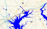
Baltimore–Aberdeen
MD 7 runs 22.83 miles (36.7 km) from US 40 just east of Baltimore to US 40 in Aberdeen, passing through much of eastern Baltimore CountyBaltimore County, Maryland
Baltimore County is a county located in the northern part of the US state of Maryland. In 2010, its population was 805,029. It is part of the Baltimore-Washington Metropolitan Area. Its county seat is Towson. The name of the county was derived from the barony of the Proprietor of the Maryland...
and southern Harford County
Harford County, Maryland
Harford County is a county in the U.S. state of Maryland. In 2010, its population was 244,826. Its county seat is Bel Air. Harford County forms part of the Baltimore-Washington Metropolitan Area.-History:...
.
Route description
MD 7 begins at an intersection with US 40 (Pulaski Highway) in Rosedale just east of the Baltimore city line. The state highway heads north 0.04 mile (0.0643736 km) to an intersection with Old Philadelphia Road, which is unsigned MD 7BA, then turns east onto Philadelphia Road. MD 7 heads northeast as a two-lane street through a residential neighborhood with scattered businesses and industrial properties as well as a crossing of Redhouse Creek. The state highway intersects MD 588Maryland Route 588
Maryland Route 588 is a state highway in the U.S. state of Maryland. The state highway runs from MD 7 in Rosedale north to the end of state maintenance in Overlea. MD 588 was constructed in the mid-1930s.-Route description:...
(Golden Ring Road) and expands to a five-lane road with center turn lane before meeting I-695
Interstate 695 (Maryland)
Interstate 695 is a -long full beltway Interstate Highway extending around Baltimore, Maryland, USA. I-695 is officially designated the McKeldin Beltway, but is colloquially referred to as either the Baltimore Beltway or 695...
(Baltimore Beltway) at Exit 34. MD 7 continues east past The Centre at Golden Ring
The Centre at Golden Ring
Golden Ring Mall, formerly owned by Simon Properties, was a shopping mall located in eastern Baltimore County, Maryland. It was located at U.S. Route 40 and Interstate 695, and was at its peak when it opened in 1974. The grand opening, a resplendent affair, was set amid the fine artwork and...
shopping center, crossing Stemmers Run before its intersection with Rossville Boulevard in Rossville
Rossville, Maryland
Rossville is an unincorporated community and a census-designated place in Baltimore County, Maryland, United States. The population was 11,515 at the 2000 census.-Geography:Rossville is located at ....
. The state highway reduces to two lanes and continues northeast through residential subdivisions on the westbound side and industrial facilities on the eastbound side of the highway.
MD 7 expands to a five-lane highway with center turn lane as it approaches Campbell Boulevard in White Marsh
White Marsh, Maryland
White Marsh is an unincorporated community and a census-designated place in Baltimore County, Maryland, United States. The population was 8,485 at the 2000 census.- History :...
. The state highway passes between a pair of shopping centers before crossing White Marsh Run. MD 7 continues northeast between industrial parks, intersecting Industrial Park Road (unsigned MD 7J) before reducing to two lanes and crossing MD 43
Maryland Route 43
Maryland Route 43 is a state highway in the U.S. state of Maryland. Known as White Marsh Boulevard, the state highway runs from Interstate 695 near Parkville east to MD 150 in Middle River...
(White Marsh Boulevard). Westbound MD 43 is accessed via a ramp east of the overpass. The state highway crosses Honeygo Run and passes through a mix of forest and residential subdivisions, intersecting Cowenton Avenue and Joppa Road before crossing Big Gunpowder Falls
Gunpowder River
The Gunpowder River is a tidal inlet on the western side of Chesapeake Bay in Maryland, United States. It is formed by the joining of two freshwater rivers, Gunpowder Falls and Little Gunpowder Falls.-Gunpowder Falls:The Big Gunpowder, long, begins in the extreme southern part of Pennsylvania's...
. MD 7 passes by several farms and intersects Bradshaw Road in the hamlet of Bradshaw
Bradshaw, Maryland
Bradshaw is an unincorporated community in Baltimore County, Maryland, United States. southeast of Kingsville.-External links:* * * *...
before crossing Little Gunpowder Falls
Gunpowder River
The Gunpowder River is a tidal inlet on the western side of Chesapeake Bay in Maryland, United States. It is formed by the joining of two freshwater rivers, Gunpowder Falls and Little Gunpowder Falls.-Gunpowder Falls:The Big Gunpowder, long, begins in the extreme southern part of Pennsylvania's...
and entering Harford County.
MD 7 heads east through forest and scattered residential subdivisions through Joppa
Joppa, Maryland
Joppa, Maryland in Harford County, Maryland is now a planning region for the county, but there was originally a town at the center called Joppa. Joppa was founded as a British colonial settlement in the early 18th century, and takes its name from the biblical town of Joppa .The town of Joppa on...
, where the highway intersects Old Mountain Road and MD 152
Maryland Route 152
Maryland Route 152 is a state highway in the U.S. state of Maryland. The state highway runs from an entrance to Aberdeen Proving Ground in Magnolia north to MD 146 near Taylor. MD 152 parallels the western edge of Harford County, connecting the communities of Joppatowne and Fallston with...
(Mountain Road). The state highway crosses Winters Run and intersects Edgewood Road and MD 24
Maryland Route 24
Maryland Route 24 is a state highway in the U.S. state of Maryland. The state highway runs from an entrance to Aberdeen Proving Ground in Edgewood north to the Pennsylvania state line near Fawn Grove, Pennsylvania. MD 24 is the main north–south highway of Harford County...
(Vietnam Veterans Memorial Highway) in Edgewood
Edgewood, Maryland
Edgewood is a census-designated place in Harford County, Maryland, United States. The population was 23,378 at the 2000 census.-History:Pooles Island Light was listed on the National Register of Historic Places in 1997.-Geography:...
. MD 7 crosses Haha Branch and meets Abingdon Road in Abingdon
Abingdon, Maryland
Abingdon is an unincorporated community in Harford County, Maryland, United States. It lies 25 miles northeast of Baltimore, near the Bush River.- History :Abingdon was named after Abingdon, England....
, which is home to the Nelson-Reardon-Kennard House
Nelson-Reardon-Kennard House
The Nelson-Reardon-Kennard House is a historic home located at Abingdon, Harford County, Maryland, United States. It is a two-part frame house, with a five-bay, two-story front section built about 1785 and a three-bay, one-room rear service wing. The front porch dates to 1888...
. The state highway intersects MD 136
Maryland Route 136
Maryland Route 136 is a state highway in the U.S. state of Maryland. The state highway runs from MD 7 near Abingdon north to MD 23 in Norrisville. MD 136 is an L-shaped route that connects the communities of Creswell, Churchville, Dublin, and Whiteford in eastern Harford County with each other...
(Calvary Road) in between crossings of Bynum Run and James Run. MD 7 temporarily expands to a four-lane divided highway as it passes through the commercial area of Riverside, where the highway meets MD 543
Maryland Route 543
Maryland Route 543 is a state highway in the U.S. state of Maryland. The state highway runs from U.S. Route 40 in Riverside north to MD 165 in Pylesville. MD 543 is a north–south highway through central Harford County that connects the communities of Creswell, Fountain Green, Hickory and...
(Creswell Road). The state highway passes through forest with isolated residential subdivisions, one of which is served by Holly Oak Circle, which meets MD 7 at a roundabout
Roundabout
A roundabout is the name for a road junction in which traffic moves in one direction around a central island. The word dates from the early 20th century. Roundabouts are common in many countries around the world...
.
MD 7's name changes to Old Philadelphia Road as it crosses Grays Run. Beyond Stepney Road, the state highway curves to the southeast to cross over CSX
CSX Transportation
CSX Transportation operates a Class I railroad in the United States known as the CSX Railroad. It is the main subsidiary of the CSX Corporation. The company is headquartered in Jacksonville, Florida, and owns approximately 21,000 route miles...
's Philadelphia Subdivision, passing between industrial parks before reaching its eastern terminus at US 40 (Pulaski Highway) on the western edge of Aberdeen. Old Philadelphia Road continues east as MD 159
Maryland Route 159
Maryland Route 159 is a state highway in the U.S. state of Maryland. Known for most of its length as Perryman Road, the state highway runs from a dead end at the Bush River near Perryman north to U.S. Route 40 and MD 7 in Aberdeen. The northernmost part of MD 159 was constructed in the early...
before becoming a county highway that serves an industrial area, intersects MD 715
Maryland Route 715
Maryland Route 715 is a state highway in the U.S. state of Maryland. Known as Short Lane, the state highway runs from U.S. Route 40 in Aberdeen east to an entrance to Aberdeen Proving Ground. MD 715 was constructed during World War II as a military access project...
(Short Lane), and passes the historic home Poplar Hill
Poplar Hill (Aberdeen, Maryland)
Poplar Hill is a historic home located at Aberdeen, Harford County, Maryland. It is a -story, gambrel-roofed frame house, built in the mid-18th century. A late-19th-century one-bay, two-story, gable-roofed wing is attached....
before meeting US 40 again just west of downtown Aberdeen. The old alignment of US 40 continues on the south side of the Amtrak Northeast Corridor as municipally-maintained Post Road, which eventually becomes a segment of MD 132
Maryland Route 132
Maryland Route 132 is a collection of state highways in the U.S. state of Maryland. These four highways are sections of old alignment of and connecting roads with MD 22 in Aberdeen. MD 132 is an east–west highway within Aberdeen that connects neighborhoods east and west of U.S. Route 40 ...
northeast to Oakington, where the highway crosses the railroad tracks to meet US 40.
Junction list
{|class=wikitable!County
!Location
!Mile
!Destinations
!Notes
|-
|rowspan=7|Baltimore
Baltimore County, Maryland
Baltimore County is a county located in the northern part of the US state of Maryland. In 2010, its population was 805,029. It is part of the Baltimore-Washington Metropolitan Area. Its county seat is Towson. The name of the county was derived from the barony of the Proprietor of the Maryland...
|rowspan=4|Rosedale
Rosedale, Maryland
Rosedale is an unincorporated community and a census-designated place in Baltimore County, Maryland, United States. The population was 19,199 at the 2000 census.- History :...
|0.00
|
|Western terminus
|-
|0.04
|Old Philadelphia Road west
|Unsigned MD 7BA
|-
|2.25
|
|
|-
|2.52
|
|I-695 Exit 34
|-
|Rossville
Rossville, Maryland
Rossville is an unincorporated community and a census-designated place in Baltimore County, Maryland, United States. The population was 11,515 at the 2000 census.-Geography:Rossville is located at ....
|2.93
|Rossville Boulevard – Essex
Essex, Maryland
-Demographics:As of the census of 2000, there were 39,078 people, 15,952 households, and 10,336 families residing in the CDP. The population density was 4,104.1 people per square mile . There were 16,997 housing units at an average density of 1,785.1 per square mile...
, Fullerton
Fullerton, Maryland
Fullerton is an unincorporated community in Baltimore County, Maryland, United States.There was a major fire at an empty building owned by the Schmidt Baking Company on Fitch Lane in Fullerton in April 2008.-References:...
|
|-
|rowspan=2|White Marsh
White Marsh, Maryland
White Marsh is an unincorporated community and a census-designated place in Baltimore County, Maryland, United States. The population was 8,485 at the 2000 census.- History :...
|6.43
|Industrial Park Road east / Nottingham Drive west
|Industrial Park Road is unsigned MD 7J and receives a exit ramp from eastbound MD 43
|-
|6.62
|
|Entrance ramp to westbound MD 43 only
|-
|colspan=2|
|11.51
|colspan=2 align=center|Bridge over Little Gunpowder Falls
Gunpowder River
The Gunpowder River is a tidal inlet on the western side of Chesapeake Bay in Maryland, United States. It is formed by the joining of two freshwater rivers, Gunpowder Falls and Little Gunpowder Falls.-Gunpowder Falls:The Big Gunpowder, long, begins in the extreme southern part of Pennsylvania's...
|-
|rowspan=6|Harford
Harford County, Maryland
Harford County is a county in the U.S. state of Maryland. In 2010, its population was 244,826. Its county seat is Bel Air. Harford County forms part of the Baltimore-Washington Metropolitan Area.-History:...
|Joppa
Joppa, Maryland
Joppa, Maryland in Harford County, Maryland is now a planning region for the county, but there was originally a town at the center called Joppa. Joppa was founded as a British colonial settlement in the early 18th century, and takes its name from the biblical town of Joppa .The town of Joppa on...
|13.56
|
|
|-
|Edgewood
Edgewood, Maryland
Edgewood is a census-designated place in Harford County, Maryland, United States. The population was 23,378 at the 2000 census.-History:Pooles Island Light was listed on the National Register of Historic Places in 1997.-Geography:...
|16.03
|
|
|-
|Abingdon
Abingdon, Maryland
Abingdon is an unincorporated community in Harford County, Maryland, United States. It lies 25 miles northeast of Baltimore, near the Bush River.- History :Abingdon was named after Abingdon, England....
|18.79
|
|
|-
|rowspan=2|Riverside
|19.76
|
|
|-
|21.70
|Holly Oak Circle north
|Roundabout
Roundabout
A roundabout is the name for a road junction in which traffic moves in one direction around a central island. The word dates from the early 20th century. Roundabouts are common in many countries around the world...
|-
|Aberdeen
Aberdeen, Maryland
As of the census of 2000, there were 13,842 people, 5,475 households, and 3,712 families residing in the city. The population density was 2,166.2 people per square mile . There were 5,894 housing units at an average density of 922.4 per square mile...
|22.83
|
|Eastern terminus
Auxiliary routes
MD 7 has two auxiliary routes:- MD 7BA is the unsigned designation for Old Philadelphia Road, a 0.18 mile (0.2896812 km) section of old alignment of MD 7 at its western terminus. MD 7BA continues the alignment of MD 7 west, reducing to one lane westbound until it merges with westbound US 40 just east of the Baltimore city line.
- MD 7J is the unsigned designation for Industrial Park Road, a highway that connects MD 7 with an exit ramp from eastbound MD 43 in White Marsh.
Havre de Grace
MD 7A runs 2.66 miles (4.3 km) through Havre de GraceHavre de Grace, Maryland
Havre de Grace is a city in Harford County, Maryland, United States. Located at the mouth of the Susquehanna River and the head of the Chesapeake Bay, Havre de Grace is named after the port city of Le Havre, France, which was first named Le Havre de Grâce, meaning in French "Harbor of Grace." As...
between intersects with US 40.
Route description
MD 7 begins at an intersection with US 40 just west of Havre de Grace. The state highway heads northeast as two-lane Revolution Street, crossing the Amtrak Northeast Corridor and passing through an industrial area before entering a residential area upon entering the city limits. MD 7 veers east to enter the street grid at Bloomsbury Avenue. The state highway turns north onto Union Street, which heads south as unsigned MD 490, adjacent to Harford Memorial Hospital. MD 7 heads through the Havre de Grace Historic DistrictHavre de Grace Historic District
Havre de Grace Historic District is a national historic district at Havre de Grace, Harford County, Maryland, United States. It is an urban district of approximately a thousand buildings and includes the central business district and most of the residential neighborhoods radiating out of it...
, passing through a residential area about four blocks from the waterfront through Congress Street, where the highway begins to approach the waterfront. Immediately after passing under the Amtrak Susquehanna River Bridge
Amtrak Susquehanna River Bridge
The Amtrak Susquehanna River Bridge is a Howe deck truss structure which carries two tracks of Amtrak's Northeast Corridor line across the Susquehanna River between Havre de Grace and Perryville, Maryland.- History :...
, the state highway turns west onto Otsego Street. The highway reaches its northern terminus at a five-way intersection with Otsego Street, MD 155 (Ohio Street), and US 40 (Pulaski Highway), which crosses the Susquehanna River a short distance to the east on the Thomas J. Hatem Memorial Bridge
Thomas J. Hatem Memorial Bridge
The Thomas J. Hatem Memorial Bridge is a bridge carrying the traffic across the Susquehanna River on U.S. Route 40 between Havre de Grace and Perryville via Garrett Island in northeast Maryland. It is the oldest of the eight toll facilities operated and maintained by the Maryland Transportation...
.
Junction list
The entire route is in Havre de GraceHavre de Grace, Maryland
Havre de Grace is a city in Harford County, Maryland, United States. Located at the mouth of the Susquehanna River and the head of the Chesapeake Bay, Havre de Grace is named after the port city of Le Havre, France, which was first named Le Havre de Grâce, meaning in French "Harbor of Grace." As...
in Harford County
Harford County, Maryland
Harford County is a county in the U.S. state of Maryland. In 2010, its population was 244,826. Its county seat is Bel Air. Harford County forms part of the Baltimore-Washington Metropolitan Area.-History:...
.
{| class=wikitable
!Mile
!Destinations
!Notes
|-
|0.00
|
|Southern terminus
|-
|1.46
|Union Avenue south / Revolution Street east
|MD 7A turns north onto Union Avenue; Union Avenue south is unsigned MD 490
|-
|2.12
|Water Street north
|MD 7A turns west onto Otsego Street
|-
|2.66
|
|Northern terminus
Perryville
MD 7B runs 3.56 miles (5.7 km) from Perry Point VA Medical Center in Perryville to US 40 east of Perryville.Route description
MD 7 begins at the entrance to the Perry Point VA Medical Center just north and east of the Amtrak Susquehanna River Bridge adjacent to Rodgers TavernRodgers Tavern
Rodgers Tavern, also known as Stevenson's Tavern, is a historic hotel located at Perryville, Cecil County, Maryland, United States. It is a mid-18th century, two-story stone structure with a basement. All rooms have corner fireplaces. In the 1880s the house was divided into two halves, east and west...
in Perryville. The state highway heads east, passing under both railtoad tracks of the wye
Wye (railroad)
A wye or triangular junction, in rail terminology, is a triangular shaped arrangement of rail tracks with a switch or set of points at each corner. In mainline railroads, this can be used at a rail junction, where three rail lines join, in order to allow trains to pass from any line to any other...
of Norfolk Southern Railway
Norfolk Southern Railway
The Norfolk Southern Railway is a Class I railroad in the United States, owned by the Norfolk Southern Corporation. With headquarters in Norfolk, Virginia, the company operates 21,500 route miles in 22 eastern states, the District of Columbia and the province of Ontario, Canada...
's Columbia & Port Deposit line with the Amtrak Northeast Corridor, within which is the Perryville
Perryville (MARC station)
Perryville is a passenger rail station on the MARC Penn Line and along the southern part of the Northeast Corridor however, Amtrak does not service the station. A single Amtrak train—Regional #151—stops at Perryville to board MARC ticket holders. The station is also the northernmost in the MARC...
MARC
MARC Train
MARC , known prior to 1984 as Maryland Rail Commuter Service, is a regional rail system comprising three lines in the Baltimore-Washington Metropolitan Area. MARC is administered by the Maryland Transit Administration , a Maryland Department of Transportation agency, and is operated under contract...
station. Maintenance transfers from the town of Perryville to the state at MD 222
Maryland Route 222
Maryland Route 222 is a state highway in the U.S. state of Maryland. The state highway runs from MD 7 in Perryville north to U.S. Route 1 near Conowingo. MD 222 parallels the Susquehanna River in western Cecil County, connecting Perryville and Conowingo with Port...
(Aiken Avenue). MD 7 heads east over Mill Creek, past MD 327
Maryland Route 327
Maryland Route 327 is a state highway in the U.S. state of Maryland. Known as Ikea Way, the state highway runs from MD 7 east to Marion Tapp Parkway and Firestone Road within Perryville...
(Ikea Way), and leaves the town limits after an intersection with Coudon Boulevard, which leads to US 40. The state highway continues east as Principio Furnace Road through farmland, passing the historic home Woodlands
Woodlands (Perryville, Maryland)
Woodlands is a historic home located at Perryville, Cecil County, Maryland, United States. It appears to have been constructed in two principal periods: the original -story section built between 1810 and 1820 of stuccoed stone and a -story rear kitchen wing; and two bays of stuccoed brick, with...
and Furnace Bay Golf Course. MD 7 passes the remains of Principio Furnace
Principio Furnace
Principio Furnace and village, Cecil County, Maryland, 4 mi/6.4 km NE of Havre de Grace, MD. The Principio Iron Works, part of the larger Principio Company, were started here in 1719 by Joseph Farmer with capital from England and an ironmaster, John England, who made it one of the most...
and crosses Principio Creek before reaching its eastern terminus at US 40.
Junction list
The entire route is in Cecil CountyCecil County, Maryland
Cecil County is a county located in the U.S. state of Maryland. It is part of the Delaware Valley. It was named for Cæcilius Calvert, 2nd Baron Baltimore , who was the first Proprietary Governor of the colony of Maryland from 1632 until his death in 1675. The county seat is Elkton. The newspaper...
.
{| class=wikitable
!Location
!Mile
!Destinations
!Notes
|-
|rowspan=4|Perryville
Perryville, Maryland
Perryville is a town in Cecil County, Maryland, United States. The population was 3,672 at the 2000 census. The town is located off Interstate 95, on the north side of the mouth of the Susquehanna River.-History:...
|0.00
|Entrance to Perry Point VA Medical Center
|Western terminus
|-
|0.45
|
|
|-
|0.84
|
|
|-
|1.09
|Coudon Boulevard to
|
|-
|
|3.56
|
|Eastern terminus
Charlestown–Elkton
MD 7C runs 9.73 miles (15.7 km) from US 40 west of CharlestownCharlestown, Maryland
Charlestown is a town in Cecil County, Maryland, United States. The population was 1,019 at the 2000 census.-History:It is the location of Charlestown Historic District and Indian Queen Tavern and Black's Store, both listed on the National Register of Historic Places in 1975.-Geography:Charlestown...
east to US 40 west of Elkton
Elkton, Maryland
The town of Elkton is the county seat of Cecil County, Maryland, United States. The population was 11,893 as of the 2000 census and 14,842 according to current July 2008 census estimates. It is the county seat of Cecil County...
.
Route description
MD 7 begins at US 40 (Pulaski Highway) northwest of Charlestown, about 1/2 mi east of the terminus of MD 7B. The state highway heads southeast as two-lane Philadelphia Road in a forested area between a pair of quarries. As MD 7 approaches the Amtrak Northeast Corridor, MD 267Maryland Route 267
Maryland Route 267 is a state highway in the U.S. state of Maryland. The state highway runs through Charlestown between two intersections with MD 7 in southwestern Cecil County...
(Baltimore Street) splits to the southeast and crosses the tracks to pass through Charlestown, while MD 7 begins to closely parallel the tracks. The state highway receives the other end of MD 267 (Bladen Street) as it curves away from the railroad. MD 7 crosses Broad Creek and Stony Run before passing under the Amtrak Northeast Corridor.
MD 7 crosses North East Creek
North East River
The North East River is the northernmost arm of Chesapeake Bay in Maryland, the United States. Entirely tidal, it extends for from the town of North East, southwest past Charlestown to the main body of Chesapeake Bay between Carpenter Point and Red Point. The river is fed by North East Creek and...
and enters the town of North East, where the highway is known as Cecil Avenue. The state highway intersects MD 272
Maryland Route 272
Maryland Route 272 is a state highway in the U.S. state of Maryland. The state highway runs from Turkey Point within Elk Neck State Park north through North East to the Pennsylvania state line near Calvert, where the highway continues as Pennsylvania Route 272...
, which follows a one-way pair
One-way pair
A one-way pair, one-way couple, or just couplet is a pair of parallel, usually one-way streets that carry opposite directions of a signed route or major traffic flow, or sometimes opposite directions of a bus or streetcar route....
, Main Street southbound and Mauldin Avenue northbound. MD 7 leaves the town and passes through a forested area with scattered residences. The state highway passes through an S-curve in which it crosses to the north side of the Amtrak Northeast Corridor. On the north side of the bridge is a stub of old alignment, MD 7H. MD 7 continues east, passing Old Elk Neck Road before turning north (leaving a small stub roadway to the east) and reaching its eastern terminus at US 40. The roadway continues beyond the intersection as MD 279 (Elkton Newark Road).
Junction list
The entire route is in Cecil CountyCecil County, Maryland
Cecil County is a county located in the U.S. state of Maryland. It is part of the Delaware Valley. It was named for Cæcilius Calvert, 2nd Baron Baltimore , who was the first Proprietary Governor of the colony of Maryland from 1632 until his death in 1675. The county seat is Elkton. The newspaper...
.
{| class=wikitable
!Location
!Mile
!Destinations
!Notes
|-
|
|0.00
|
|Western terminus
|-
|rowspan=2|Charlestown
Charlestown, Maryland
Charlestown is a town in Cecil County, Maryland, United States. The population was 1,019 at the 2000 census.-History:It is the location of Charlestown Historic District and Indian Queen Tavern and Black's Store, both listed on the National Register of Historic Places in 1975.-Geography:Charlestown...
|1.23
|
|
|-
|2.55
|
|
|-
|rowspan=2|North East
North East, Maryland
North East is a town in Cecil County, Maryland, United States. The population was 2,733 at the 2000 census.-History:The Turkey Point Light Station was listed on the National Register of Historic Places in 2002...
|4.87
| – Elk Neck State Park
Elk Neck State Park
Elk Neck State Park is a park in Cecil County, Maryland. It is eight miles south of the town of North East on MD 272, and is nearest to exit 100 on I-95. The North East River, Elk River, and Chesapeake Bay form the Elk Neck Peninsula, on the southern tip of which the park rests...
|
|-
|4.94
|
|
|-
|
|7.35
|MD 7H
|Old alignment of MD 7
|-
|Elkton
Elkton, Maryland
The town of Elkton is the county seat of Cecil County, Maryland, United States. The population was 11,893 as of the 2000 census and 14,842 according to current July 2008 census estimates. It is the county seat of Cecil County...
|9.73
|, Newark, DE
Newark, Delaware
Newark is an American city in New Castle County, Delaware, west-southwest of Wilmington. According to the 2010 Census, the population of the city is 31,454. Newark is the home of the University of Delaware.- History :...
|Eastern terminus
Auxiliary route
MD 7H is the unsigned designation for an unnamed 0.12 mile (0.1931208 km) section of old alignment of MD 7 on the north side of the Bacon Hill crossing of the Amtrak Northeast Corridor.Elkton
MD 7D runs 2.55 miles (4.1 km) from a dead end near Landing Lane east to US 40 within Elkton.Route description
MD 7 begins at a dead end adjacent to US 40's crossing of the Amtrak Northeast Corridor in Elkton. The state highway heads east as two-lane municipally-maintained Main Street through a mixed residential-industrial area where the state highway intersects Landing Lane, which provides a connection to US 40 (Pulaski Highway) and leads to Elk LandingElk Landing
Elk Landing is the name of a historic home located at Elkton, Cecil County, Maryland. The house at Elk Landing was listed on the National Register of Historic Places in 1984....
. At MD 213
Maryland Route 213
Maryland Route 213 is a state highway located on the Eastern Shore of Maryland in the United States. The route runs from Maryland Route 662 in Wye Mills, Queen Anne's County north to the Pennsylvania border in Cecil County, where it continues into that state as Pennsylvania Route 841...
(Bridge Street), MD 7 becomes one-way eastbound and heads through downtown Elkton. Westbound traffic can follow High Street, which passes by Union Hospital, around the downtown area. Within downtown, MD 7 intersects MD 268
Maryland Route 268
Maryland Route 268 is a state highway in the U.S. state of Maryland. Known as North Street, the state highway runs from MD 7 north to MD 279 within Elkton. MD 268, the old alignment of MD 279 within Elkton, was designated in 1967 after MD 279 bypassed Elkton.-Route description:MD 268 begins an...
(North Street) and passes by the Mitchell House
Mitchell House (Elkton, Maryland)
Mitchell House is a historic home located at Elkton, Cecil County, Maryland. It is a -story, side passage townhouse built between 1769 and 1781, by Dr. Abraham Mitchell, a physician from Lancaster County, Pennsylvania...
and the Cecil County Circuit Courthouse
Cecil County Circuit Courthouse
The Cecil County Circuit Courthouse is located at The courthouse houses the chambers and courtrooms for the 3 judges of the Circuit Court for Cecil County, as well as the clerk's offices, jurors' assembly room, the law libray and masters' offices.-History:...
. The state highway becomes two-way again at South Street. East of downtown, Main Street continues east as MD 281
Maryland Route 281
Maryland Route 281 is a state highway in the U.S. state of Maryland. Known for most of its length as Red Hill Road, the state highway runs from MD 7 east to the Delaware state line within Elkton. MD 281 and its continuation in Delaware were originally blazed in the 18th century as part of the...
while MD 7 turns southeast onto Delaware Avenue. The state highway crosses Big Elk Creek
Elk River (Maryland)
The Elk River is a tributary of the Chesapeake Bay on the Delmarva Peninsula. It is about long, and as the most northeastern extension of the Chesapeake Bay estuary, serves as one entrance to the Chesapeake and Delaware Canal. It is located in Cecil County, Maryland, with its headwaters extending...
and passes through a residential area before reaching its eastern terminus at US 40 (Pulaski Highway) about 2 miles (3.2 km) west of the Delaware state line. The ramp from westbound US 40 to westbound MD 7 is unsigned MD 7E.
Junction list
The entire route is in ElktonElkton, Maryland
The town of Elkton is the county seat of Cecil County, Maryland, United States. The population was 11,893 as of the 2000 census and 14,842 according to current July 2008 census estimates. It is the county seat of Cecil County...
in Cecil County
Cecil County, Maryland
Cecil County is a county located in the U.S. state of Maryland. It is part of the Delaware Valley. It was named for Cæcilius Calvert, 2nd Baron Baltimore , who was the first Proprietary Governor of the colony of Maryland from 1632 until his death in 1675. The county seat is Elkton. The newspaper...
.
{| class=wikitable
!Mile
!Destinations
!Notes
|-
|0.00
|Road end
|Western terminus
|-
|0.33
|Landing Lane south to
|
|-
|0.66
|
|MD 7 continues one-way eastbound from this intersection
|-
|0.86
|
|
|-
|1.06
|South Street
|MD 7 becomes two-way at this intersection
|-
|1.26
|
|MD 7 turns south onto Delaware Avenue
|-
|2.51
| – Glasgow, DE
Glasgow, Delaware
Glasgow is a census-designated place in New Castle County, Delaware, United States. The population was 12,840 at the 2000 census.-Geography:Glasgow is located at ....
|Eastern terminus