

Trails in Omaha
Encyclopedia
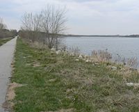
Trail
A trail is a path with a rough beaten or dirt/stone surface used for travel. Trails may be for use only by walkers and in some places are the main access route to remote settlements...
s as well as unpaved trails and paths for recreation
Recreation
Recreation is an activity of leisure, leisure being discretionary time. The "need to do something for recreation" is an essential element of human biology and psychology. Recreational activities are often done for enjoyment, amusement, or pleasure and are considered to be "fun"...
al usage throughout the city
Omaha, Nebraska
Omaha is the largest city in the state of Nebraska, United States, and is the county seat of Douglas County. It is located in the Midwestern United States on the Missouri River, about 20 miles north of the mouth of the Platte River...
. Popular among bicyclists, runners
Running
Running is a means of terrestrial locomotion allowing humans and other animals to move rapidly on foot. It is simply defined in athletics terms as a gait in which at regular points during the running cycle both feet are off the ground...
, hikers and recreational walker
Pedestrian
A pedestrian is a person traveling on foot, whether walking or running. In some communities, those traveling using roller skates or skateboards are also considered to be pedestrians. In modern times, the term mostly refers to someone walking on a road or footpath, but this was not the case...
s, these trails are included in comprehensive plans for the city of Omaha, the Omaha metro area, Douglas County
Douglas County, Nebraska
-Demographics:As of the census of 2000, there were 463,585 people, 182,194 households, and 115,146 families residing in the county. The population density was 1,401 people per square mile . There were 192,672 housing units at an average density of 582 per square mile...
, and long-distance coordinated plans between the municipalities of southeast Nebraska
Nebraska
Nebraska is a state on the Great Plains of the Midwestern United States. The state's capital is Lincoln and its largest city is Omaha, on the Missouri River....
.
History
In 1887 the Omaha Bicycling Club was responsible for expanding Athletic Park at North 20th and Lake Streets to include a bicycle racing track, and there were other early trails throughout the city. However, Omaha was completely devoid of trails for several years during the 20th century leading up to early 1989. That year the city began developing the Keystone trail, and since then the city of Omaha has developed approximately 67 miles (107.8 km) of paved recreational trails, and another 35 miles (56.3 km) of trails are scheduled for completion within the next eight years.On September 28, 2008 the trails in Omaha were connected to trails in Council Bluffs, Iowa by way of the new Bob Kerrey Pedestrian Bridge. A 15- to 20 feet (6.1 m) wide "S"-shaped bridge spans more than 3000 ft (914.4 m) across the Missouri River
Missouri River
The Missouri River flows through the central United States, and is a tributary of the Mississippi River. It is the longest river in North America and drains the third largest area, though only the thirteenth largest by discharge. The Missouri's watershed encompasses most of the American Great...
, connecting Omaha's Riverfront Trail with Playland Park in Council Bluffs.
Benefits of the trails
A recent study focused on the benefits of Omaha's trails found that respondents generally perceive the trails to be economic benefits, with almost two-thirds of those surveyed reporting the trails would increase the selling price of their home. There is no widespread concern for safetySafety
Safety is the state of being "safe" , the condition of being protected against physical, social, spiritual, financial, political, emotional, occupational, psychological, educational or other types or consequences of failure, damage, error, accidents, harm or any other event which could be...
issues on the trails, as trespass
Trespass
Trespass is an area of tort law broadly divided into three groups: trespass to the person, trespass to chattels and trespass to land.Trespass to the person, historically involved six separate trespasses: threats, assault, battery, wounding, mayhem, and maiming...
ing, theft
Theft
In common usage, theft is the illegal taking of another person's property without that person's permission or consent. The word is also used as an informal shorthand term for some crimes against property, such as burglary, embezzlement, larceny, looting, robbery, shoplifting and fraud...
and vandalism
Vandalism
Vandalism is the behaviour attributed originally to the Vandals, by the Romans, in respect of culture: ruthless destruction or spoiling of anything beautiful or venerable...
by trail users are relatively infrequent events. A large majority of residents living along the trails think there is a positive relationship between the trails and neighborhood quality of life
Quality of life
The term quality of life is used to evaluate the general well-being of individuals and societies. The term is used in a wide range of contexts, including the fields of international development, healthcare, and politics. Quality of life should not be confused with the concept of standard of...
.
Future development
There are many plans for the trails in Omaha. A local organization is calling for more east-west connecting trails, as the majority of the city east of 72nd Street has few trails of note. There are also plans to connect Omaha to the MoPac TrailMoPac Trail
The MoPac Trail is a rail trail in Nebraska. It is a bicycling, equestrian and walking trail built on an abandoned Missouri Pacific Railroad corridor which runs for 26 miles from Lincoln, Nebraska to Wabash, Nebraska.-History:...
running east from Lincoln
Lincoln, Nebraska
The City of Lincoln is the capital and the second-most populous city of the US state of Nebraska. Lincoln is also the county seat of Lancaster County and the home of the University of Nebraska. Lincoln's 2010 Census population was 258,379....
on a system called the Mo-Pac East Trail. Currently extending northeast towards over the Platte River
Platte River
The Platte River is a major river in the state of Nebraska and is about long. Measured to its farthest source via its tributary the North Platte River, it flows for over . The Platte River is a tributary of the Missouri River, which in turn is a tributary of the Mississippi River which flows to...
on the Lied Platte River Trail Bridge near South Bend
South Bend, Nebraska
South Bend is a village in Cass County, Nebraska, United States. The population was 86 at the 2000 census. As you approach the town on Nebraska Highway 66, a sign announces "South Bend Next 4 Exits"--a reference to the four streets that lead in from the highway. The main landmark is a pedestrian...
, the trail will eventually connect with the 144th Street Trail.
The trails are also included in a plan called the Quad State Trail Project. This plan envisions linking numerous cities in Nebraska
Nebraska
Nebraska is a state on the Great Plains of the Midwestern United States. The state's capital is Lincoln and its largest city is Omaha, on the Missouri River....
, Iowa
Iowa
Iowa is a state located in the Midwestern United States, an area often referred to as the "American Heartland". It derives its name from the Ioway people, one of the many American Indian tribes that occupied the state at the time of European exploration. Iowa was a part of the French colony of New...
, Kansas
Kansas
Kansas is a US state located in the Midwestern United States. It is named after the Kansas River which flows through it, which in turn was named after the Kansa Native American tribe, which inhabited the area. The tribe's name is often said to mean "people of the wind" or "people of the south...
and Missouri
Missouri
Missouri is a US state located in the Midwestern United States, bordered by Iowa, Illinois, Kentucky, Tennessee, Arkansas, Oklahoma, Kansas and Nebraska. With a 2010 population of 5,988,927, Missouri is the 18th most populous state in the nation and the fifth most populous in the Midwest. It...
, including connecting Omaha to St. Louis
St. Louis, Missouri
St. Louis is an independent city on the eastern border of Missouri, United States. With a population of 319,294, it was the 58th-largest U.S. city at the 2010 U.S. Census. The Greater St...
, Kansas City
Kansas City, Missouri
Kansas City, Missouri is the largest city in the U.S. state of Missouri and is the anchor city of the Kansas City Metropolitan Area, the second largest metropolitan area in Missouri. It encompasses in parts of Jackson, Clay, Cass, and Platte counties...
, Topeka
Topeka, Kansas
Topeka |Kansa]]: Tó Pee Kuh) is the capital city of the U.S. state of Kansas and the county seat of Shawnee County. It is situated along the Kansas River in the central part of Shawnee County, located in northeast Kansas, in the Central United States. As of the 2010 census, the city population was...
and Lincoln via 700 miles (1,126.5 km) of trails, 450 of which already exist.
Trails
| Trails in Omaha alphabetical order | |
|---|---|
| Name | Notes |
| 144th Street Trail | Begins at Standing Bear Lake Standing Bear Lake Standing Bear Lake, also known as Dam Site 16, is a park located at 6404 North 132nd street in West Omaha, Nebraska.The park has a lake with boating in the summertime, and ice skating in the winter... near Ida Street and connects with the Mopac Trail MoPac Trail The MoPac Trail is a rail trail in Nebraska. It is a bicycling, equestrian and walking trail built on an abandoned Missouri Pacific Railroad corridor which runs for 26 miles from Lincoln, Nebraska to Wabash, Nebraska.-History:... at Hwy. 50 and Hwy. 370 Nebraska Highway 370 Nebrask Highway 370 is an east–west state highway in Nebraska that is in length. It begins at U.S. Route 6 and Nebraska Highway 31 in Gretna, Nebraska and ends at the Missouri River where it becomes Iowa Highway 370. It is the main east–west road in Sarpy County, Nebraska, which... . |
| American Discovery Trail American Discovery Trail The American Discovery Trail is a coast-to-coast hiking and biking trail across the mid-tier of the United States. It starts on the Delmarva Peninsula on the Atlantic Ocean and ends on the northern California coast on the Pacific Ocean, and is signed on over of trail. This includes the doubled... |
The ADT enters Omaha via the South Omaha Bridge and follows the Omaha Riverfront South Trail to Haworth Park Haworth Park Haworth Park are a rugby league team based in Kingston upon Hull, East Riding of Yorkshire, England. They play in the Yorkshire Premier division of the Rugby League Conference with their A-team taking part in the Yorkshire & Humber Merit League.-History:... in Bellevue Bellevue, Nebraska Bellevue is a city in Sarpy County, Nebraska, United States. The population was 50,137 at the 2010 census. Eight miles south of Omaha, Bellevue is part of the Omaha-Council Bluffs metropolitan area. Originally settled in the 1830s, It was the first state capitol. Bellevue was incorporated in... . There it connects to the Keystone Bellevue Loop, Papio, West Papio, and 144th Street Trails. |
| Big Papio Trail | Follows the Papillion Creek Papillion Creek Papillion Creek is a tributary of the Missouri River in Nebraska. Its watershed lies in Washington, Douglas and Sarpy counties, including parts of the city of Omaha. The main branch of Papillion Creek is known as Big Papillion Creek... 10 miles (16.1 km) to intersect with Keystone Trail. |
| Field Club Trail | 1.72 miles (2.8 km) trail from Leavenworth Avenue to Vinton Street through the Field Club Field Club Field Club is a neighborhood located in Midtown Omaha, Nebraska. Roughly bounded by Pacific Street, 32nd Avenue, Center St., and 36th Street, the neighborhood was placed on the National Register of Historic Places as a historic district on November 15, 2000. Field Club is the location of dozens of... neighborhood. |
| Fontenelle Forest Nature Center | 26 miles (41.8 km) of trails through oak savanna Oak savanna An oak savanna is a type of savanna, or lightly forested grassland, where oaks are the dominant tree species. These savannas were maintained historically through wildfires set by lightning, grazing, low precipitation, poor soil, and/or fires set by Native Americans... , prairie Prairie Prairies are considered part of the temperate grasslands, savannas, and shrublands biome by ecologists, based on similar temperate climates, moderate rainfall, and grasses, herbs, and shrubs, rather than trees, as the dominant vegetation type... , and wetland Wetland A wetland is an area of land whose soil is saturated with water either permanently or seasonally. Wetlands are categorised by their characteristic vegetation, which is adapted to these unique soil conditions.... s at 1111 North Bellevue Boulevard in Bellevue. |
| Keystone Trail | Runs south-north from North 90th and Fort Streets past the College of Saint Mary College of Saint Mary College of Saint Mary is a Catholic women's college located in Omaha, Nebraska. , there were 820 undergraduates and 243 graduate students.The academic programs at Saint Mary are primarily career-focused, with majors offered in fields such as medical technology, business administration, and nursing.... , connecting with the West Papio trail near South 36th Street and ending at Highway 75 U.S. Route 75 U.S. Route 75 is a north–south U.S. Highway. The highway's northern terminus is in Kittson County, Minnesota, at the Canadian border, where it continues as Manitoba Highway 75 on the other side of a closed border crossing. Its southern terminus is at Interstate 30 and Interstate 45 in Dallas,... in Bellevue Bellevue, Nebraska Bellevue is a city in Sarpy County, Nebraska, United States. The population was 50,137 at the 2010 census. Eight miles south of Omaha, Bellevue is part of the Omaha-Council Bluffs metropolitan area. Originally settled in the 1830s, It was the first state capitol. Bellevue was incorporated in... . The trail then loops northward towards Haworth Park Haworth Park Haworth Park are a rugby league team based in Kingston upon Hull, East Riding of Yorkshire, England. They play in the Yorkshire Premier division of the Rugby League Conference with their A-team taking part in the Yorkshire & Humber Merit League.-History:... in Bellevue. |
| Lewis and Clark National Historic Trail Lewis and Clark National Historic Trail The Lewis and Clark National Historic Trail is a route across the United States commemorating the Lewis and Clark Expedition of 1804 to 1806. It is part of the National Trails System of the United States... |
Headquartered at 601 Riverfront Drive on the Missouri River Missouri River The Missouri River flows through the central United States, and is a tributary of the Mississippi River. It is the longest river in North America and drains the third largest area, though only the thirteenth largest by discharge. The Missouri's watershed encompasses most of the American Great... in NoDo Nodo Nodo may refer to:*NASA Orbital Debris Observatory, a telescope and astronomical survey operated by NASA from 1995 to 2002*NoDo, an area of downtown Omaha, Nebraska*No-Do, late 20th century Spanish newsreels*NoDo, the first update to Windows Phone 7... , this trail extends 3700 miles (5,954.6 km) through several western states Western United States .The Western United States, commonly referred to as the American West or simply "the West," traditionally refers to the region comprising the westernmost states of the United States. Because the U.S. expanded westward after its founding, the meaning of the West has evolved over time... . |
| Military Road Trail | Runs east-west from the intersection of North 90th Street and Sorenson Parkway Sorenson Parkway The Sorensen Parkway is a modern link in the boulevard system in Omaha, Nebraska. The Parkway flows west from North 30th Street to North 90th Street, and has been viewed as the northern boundary that defines the area called North Omaha.-About:... to North 126th Street in Irvington Irvington, Nebraska Irvington is an unincorporated community located just outside the northwest city limits of Omaha, Nebraska. According to the 2009 estimate by the United States Census Bureau Irvington's population was 451, making it the smallest village in the Greater Omaha Metropolitan area, according to the... . |
| Newport Landing Trail | Surrounds the Newport Landing housing development near Bennington Bennington, Nebraska Bennington is a city in Douglas County, Nebraska, United States. The population was 937 at the 2000 census.-Geography:Bennington is located at .According to the United States Census Bureau, the city has a total area of , all land.... . |
| Neale Woods Nature Center | 554 acres (2.2 km²) of floodplain and upland woodlands and restored prairie north of Omaha. |
| Omaha Riverfront North Trail | Runs south-north from the Omaha Public Power District Omaha Public Power District Omaha Public Power District, or OPPD, is a public electric utility in the State of Nebraska. It is one of the largest publicly owned electric utilities in the United States, serving more than 340,000 customers in 13 southeast Nebraska counties. OPPD was formed in 1946 as a political subdivision of... plant at the northern end of Florence Boulevard Florence Boulevard Florence Boulevard, originally known as the Prettiest Mile in Omaha Boulevard, is a boulevard-type north-south street in the north Omaha, Nebraska. With the start of construction in 1892, Florence Boulevard was the first roadway in Omaha's boulevard system designed by Horace Cleveland... underneath the Mormon Bridge Mormon Bridge (Omaha) The Mormon Bridge are two truss bridges that cross the Missouri River connecting Pottawattamie County, Iowa with Florence in the north end of Omaha, Nebraska via Interstate 680 .-About:... to end at Dodge Park Dodge Park N.P. Dodge Memorial Park, or simply Dodge Park, is a recreational area located at 11001 John J. Pershing Drive in North Omaha, Nebraska. Located on the Missouri River, the park is a haven for fishing, water skiing, and boating, as well as hiking throughout its riparian forests. Baseball fields,... . |
| Omaha Riverfront South Trail | Runs north-south from Miller’s Landing Park near Abbott Drive where the River City Star River City Star The River City Star is a passenger excursion riverboat that sails on the Missouri River in the United States between Omaha, Nebraska, and Council Bluffs, Iowa. The boat is docked at Miller's Landing in the NoDo area of Downtown Omaha and is registered in Nebraska for taxes and alcohol licensing... riverboat docks. It flows along the Missouri River Missouri River The Missouri River flows through the central United States, and is a tributary of the Mississippi River. It is the longest river in North America and drains the third largest area, though only the thirteenth largest by discharge. The Missouri's watershed encompasses most of the American Great... , passing by The Gallup Organization The Gallup Organization The Gallup Organization, is primarily a research-based performance-management consulting company. Some of Gallup's key practice areas are - Employee Engagement, Customer Engagement and Well-Being. Gallup has over 40 offices in 27 countries. World headquarters are in Washington, D.C. Operational... ’s operational headquarters, the National Park Service National Park Service The National Park Service is the U.S. federal agency that manages all national parks, many national monuments, and other conservation and historical properties with various title designations... Midwestern headquarters, Rick’s Boatyard Café, the Riverfront Condos, and Omaha Qwest Center and Arena. |
| Q Street Bike Path | Runs east-west from Millard Avenue to South 168th Street, connecting to the 144th Street Trail along the way. |
| Sorenson Parkway Trail | Runs east-west from North 30th Street to North 90th Street along Sorenson Parkway Sorenson Parkway The Sorensen Parkway is a modern link in the boulevard system in Omaha, Nebraska. The Parkway flows west from North 30th Street to North 90th Street, and has been viewed as the northern boundary that defines the area called North Omaha.-About:... . |
| Standing Bear Lake Trail | A loop trail around Standing Bear Lake Standing Bear Lake Standing Bear Lake, also known as Dam Site 16, is a park located at 6404 North 132nd street in West Omaha, Nebraska.The park has a lake with boating in the summertime, and ice skating in the winter... . |
| Swanson Park | Located in Bellevue Bellevue, Nebraska Bellevue is a city in Sarpy County, Nebraska, United States. The population was 50,137 at the 2010 census. Eight miles south of Omaha, Bellevue is part of the Omaha-Council Bluffs metropolitan area. Originally settled in the 1830s, It was the first state capitol. Bellevue was incorporated in... at Cornhusker Road between 25th and 36th Streets, this mountain bike Mountain bike A mountain bike or mountain bicycle is a bicycle created for off-road cycling. This activity includes traversing of rocks and washouts, and steep declines,... trail includes 6 miles (9.7 km) of singletrack. |
| Tranquility Park | Omaha's first approved off road trail system in a city park is located at 12550 West Maple Road. |
| Turner Boulevard | A 1.4 miles (2.3 km) in-town trail that links the Field Club Trail at Pacific Street to Turner Park near Farnam Street via several midtown neighborhoods. The trail runs through Leavenworth Park, Bend Park, Dewey Park and terminates at Turner Park. |
| Walnut Creek Trail | A trail around the lake at the Walnut Creek Recreation Area under management of the Papio-Missouri River Natural Resource District, it connects with the West Papio Trail. |
| Walnut Grove Trail | In a small park near South 153rd and Q Streets, this trail connects to both the Zorinsky Lake Trail and the Q Street bike path. |
| Wehrspann Lake Trail | Located in the Chalco Hills Recreation Area Chalco Hills Recreation Area Chalco Hills Recreation Area is located in northwestern Sarpy County, Nebraska, and approximately west of downtown Omaha. Chalco Hills consists of of which is covered by Wehrspann Lake, an artificial reservoir. The recreation area was opened in 1988 as part of Papio-Missouri River Natural... , this trail includes Wehrspann Lake and the headquarters for the Papio-Missouri River Natural Resource District, and ties into the 144th Street Trail |
| Westin Hills Trail | Runs east-west from North 144th to North 156th Street, starting near the intersection of West Maple Road and Fort Street. Connects the 144th Street Trail to the West Papio Trail. |
| West Papio North Trail | Runs north-south from North 156th and West Maple Road, continuing south to Oakbrook Meadows Park. There the trail tees, going west to Zorinsky Lake, and east to the 144th Street Trail. |
| West Papio South Trail | Starting on West Lincoln Street near Highway 85 Nebraska Highway 85 Nebraska Highway 85 is a highway in Nebraska. It is a highway in the Omaha Metro Area. It has a southern terminus at Nebraska Highway 370 in Papillion. Its northern terminus is at U.S. Highway 275 and Nebraska Highway 92 on the border of Omaha and Ralston. It is a four lane highway for its... /Washington Street, the trail runs west-east to connect with the Keystone Trail. |
| Zorinsky Lake Trail | Located at South 168th Street south of Center Street. |
External links
- Omaha Bike Map
- OmahaTrails.com
- Parks and trails in Omaha - University of Nebraska at Omaha website.
- Omaha Area Trail Map.
- Midwest Cycling Community website.
- Trails Have Our Respect (THOR) website.