
Tonkin Highway
Encyclopedia
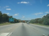
Tonkin Highway, at 45 kilometres (28 mi), is a limited access dual carriageway in Perth, Western Australia
, connecting Reid Highway
in the north with Thomas Road in the south. Mostly a 4 lane highway, some sections of the highway are to a 4 to 6 lane freeway standard; the remainder of the highway has been designed to allow for sections that are not to freeway standard to be upgraded later if required. Some intersections briefly increase the highway's capacity from 4 to 6 lanes. Tonkin Highway's speed limit varies from 80 to 100 km/h.
One of only four limited access roads to cross the Swan River (the other three being Kwinana Freeway
, Graham Farmer Freeway
and Reid Highway
), Tonkin Highway is one of two connecting access roads for Perth Airport
(the other being Great Eastern Highway
). It is also an important heavy vehicle route for the Perth metropolitan area, connecting Perth's northeastern and southeastern suburbs with Welshpool
, a major industrial area for the city.
by Gordon Stephenson
and Alastair Hepburn. The road reservation was formally gazetted in the 1963 Metropolitan Region Scheme
.
Like most Perth arterial road projects it has been built in stages. It was first named the Beechboro-Gosnells Highway, the name coming from the two suburbs it was originally planned to link. The highway's first construction stage was from Welshpool Road to Hardey Road, and it opened in 1980. The second stage south from Welshpool Road to Albany Highway
was completed in 1981. Stage 3 was a north-of-the-river section from Railway Parade to Morley Drive completed in 1984. Stage 4 linked Hardey Road and Great Eastern Highway
, and included the construction of four bridges over the Forrestfield railway marshalling yards, the first bridges in Australia to be constructed using the incremental launch technique. On opening of this stage in 1985, the Beechboro-Gosnells Highway was renamed Tonkin Highway in honour of former West Australian premier John Tonkin
.
In 1988, the northern and southern sections were linked with the opening of the Redcliffe Bridge
. Following minor extensions northwards, Tonkin Highway spent a decade remaining largely unchanged, linking Reid Highway
in Malaga
with Albany Highway
in Gosnells
. Then in 2003, a new southern extension was commenced, and it was completed through to Thomas Road on 16 December 2005. The new extension improves links with the localities of Kwinana
, Armadale
, Rockingham
and Byford
. It also provides a new important freight route, relieving Nicholson Road, Albany Highway
and South Western Highway
of large quantities of heavy vehicle traffic.
with flyover ramps the Tonkin/Leach intersection and the Tonkin/Roe intersection.
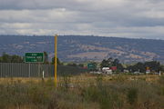 Tonkin Highway reaches past the edge of suburbia at its southern extent. Planning provides for it to be extended when required. In the south, the planned route takes it through many undeveloped or semi-rural areas such as Mundijong
, Cardup & Jarrahdale
. South of Mundijong, the planned route deviates east so as to terminate at South Western Highway
near Jarrahdale Road. In the future, the major junction with Roe Highway could possibly be upgraded to a parclo
, cloverleaf
or modified stack interchange
if required, though such a proposal is unfunded and a low priority at present.
Planning is also in place for a future extension north. Such an extension would bring it to Beach Road/Marshall Road, and then link up with a similarly planned extension of Hepburn Avenue where it would be the highway's northern terminus. This could eventually see the Tonkin Highway terminating at Hepburn Avenue. If Hepburn Avenue is built to the same limited access dual carriageway standard as Tonkin HIghway, it would greatly improve access to new urban areas such as Darch
, Landsdale
and Madeley
. However such as proposal of the Tonkin Highway is still in early planning stages and currently there are no plans to warrant the construction.
Perth, Western Australia
Perth is the capital and largest city of the Australian state of Western Australia and the fourth most populous city in Australia. The Perth metropolitan area has an estimated population of almost 1,700,000....
, connecting Reid Highway
Reid Highway
Reid Highway is a major arterial highway in Perth, Western Australia. It is allocated Route 3, and runs between Marmion Avenue, North Beach, and West Swan Road, West Swan, a distance of...
in the north with Thomas Road in the south. Mostly a 4 lane highway, some sections of the highway are to a 4 to 6 lane freeway standard; the remainder of the highway has been designed to allow for sections that are not to freeway standard to be upgraded later if required. Some intersections briefly increase the highway's capacity from 4 to 6 lanes. Tonkin Highway's speed limit varies from 80 to 100 km/h.
One of only four limited access roads to cross the Swan River (the other three being Kwinana Freeway
Kwinana Freeway
The Kwinana Freeway is a major arterial road in Perth, Western Australia, linking Perth with the southern suburbs and then further on towards Mandurah, a distance of . It has a speed limit of , except in central Perth and south of Lakes Road . Like all Western Australian freeways, the minimum...
, Graham Farmer Freeway
Graham Farmer Freeway
The Graham Farmer Freeway is a major part of the metropolitan road infrastructure in Perth, Western Australia. It is long and links Rivervale and East Perth with West Perth, bypassing Perth's central business district...
and Reid Highway
Reid Highway
Reid Highway is a major arterial highway in Perth, Western Australia. It is allocated Route 3, and runs between Marmion Avenue, North Beach, and West Swan Road, West Swan, a distance of...
), Tonkin Highway is one of two connecting access roads for Perth Airport
Perth Airport
Perth Airport is an Australian domestic and international airport serving Perth, the capital and largest city of Western Australia. The airport itself is located in the suburb of Perth Airport....
(the other being Great Eastern Highway
Great Eastern Highway
The Great Eastern Highway is a major road between the Western Australian cities of Perth and Kalgoorlie. It is a key route for vehicles accessing the eastern wheatbelt and the eastern goldfields...
). It is also an important heavy vehicle route for the Perth metropolitan area, connecting Perth's northeastern and southeastern suburbs with Welshpool
Welshpool, Western Australia
Welshpool is an inner southeastern suburb of Perth, located mostly within the City of Canning. The area is considered to be one of the main industrial areas of Perth, along with Kewdale, Kwinana, Henderson, Malaga, O'Connor, Canning Vale and Osborne Park....
, a major industrial area for the city.
History
A proposal for a highway along a similar alignment was first proposed in 1955, as part of a network of arterial roads under a metropolitan-wide plan produced for the Western Australian governmentGovernment of Western Australia
The formation of the Government of Western Australia is prescribed in its Constitution, which dates from 1890, although it has been amended many times since then...
by Gordon Stephenson
Gordon Stephenson
Gordon Stephenson was a British-born town planner and architect. He is best known for his role in shaping the modern growth and development of Perth, Western Australia.-Early career:...
and Alastair Hepburn. The road reservation was formally gazetted in the 1963 Metropolitan Region Scheme
Metropolitan Region Scheme
The Metropolitan Region Scheme is the legal land plan covering urban planning throughout the Perth Metropolitan Region. It classifies land into broad zones and reservations and is administered by the Western Australian Planning Commission....
.
Like most Perth arterial road projects it has been built in stages. It was first named the Beechboro-Gosnells Highway, the name coming from the two suburbs it was originally planned to link. The highway's first construction stage was from Welshpool Road to Hardey Road, and it opened in 1980. The second stage south from Welshpool Road to Albany Highway
Albany Highway
Albany Highway is a generally northwest-southeast highway in the south of Western Australia which links the state's capital Perth with its oldest settlement, Albany. The highway is approximately in length, is designated State Route 30 and separates Western Australia's Great Southern region from...
was completed in 1981. Stage 3 was a north-of-the-river section from Railway Parade to Morley Drive completed in 1984. Stage 4 linked Hardey Road and Great Eastern Highway
Great Eastern Highway
The Great Eastern Highway is a major road between the Western Australian cities of Perth and Kalgoorlie. It is a key route for vehicles accessing the eastern wheatbelt and the eastern goldfields...
, and included the construction of four bridges over the Forrestfield railway marshalling yards, the first bridges in Australia to be constructed using the incremental launch technique. On opening of this stage in 1985, the Beechboro-Gosnells Highway was renamed Tonkin Highway in honour of former West Australian premier John Tonkin
John Tonkin
John Trezise Tonkin AC , popularly known as "Honest John", was the 20th Premier of Western Australia , taking power after the almost 12 year term of Liberal Sir David Brand....
.
In 1988, the northern and southern sections were linked with the opening of the Redcliffe Bridge
Redcliffe Bridge
Redcliffe Bridge is a traffic bridge which carries Tonkin Highway across the Swan River in the Perth, Western Australia suburb of Redcliffe. Designed by Maunsell & Partners and built by Thiess,construction of the bridge started in 1986...
. Following minor extensions northwards, Tonkin Highway spent a decade remaining largely unchanged, linking Reid Highway
Reid Highway
Reid Highway is a major arterial highway in Perth, Western Australia. It is allocated Route 3, and runs between Marmion Avenue, North Beach, and West Swan Road, West Swan, a distance of...
in Malaga
Malaga, Western Australia
Malaga is a suburb of Perth, Western Australia, approximately 11 kilometres north of it. It is located in the City of Swan. The suburb is thought to be named after either the Spanish city of Málaga, or the Aboriginal word malaga which means ironstone. The name was approved in 1969.Malaga is an...
with Albany Highway
Albany Highway
Albany Highway is a generally northwest-southeast highway in the south of Western Australia which links the state's capital Perth with its oldest settlement, Albany. The highway is approximately in length, is designated State Route 30 and separates Western Australia's Great Southern region from...
in Gosnells
Gosnells, Western Australia
The City of Gosnells is a Local Government Area in the southeastern suburbs of the Western Australian capital city of Perth, located northwest of Armadale and about southeast of Perth's central business district...
. Then in 2003, a new southern extension was commenced, and it was completed through to Thomas Road on 16 December 2005. The new extension improves links with the localities of Kwinana
Kwinana, Western Australia
The Town of Kwinana is a Local Government Area of Western Australia. It covers an area of approximately 118 square kilometres in metropolitan Perth, and lies about 38 km south of Perth's central business district, via the Kwinana Freeway...
, Armadale
Armadale, Western Australia
Armadale is a suburb within the City of Armadale, located on the south-eastern edge of Perth's metropolitan area. The major junction of the South Western and Albany Highways, which connect Perth with the South West and Great Southern regions of Western Australia respectively, is located within the...
, Rockingham
Rockingham, Western Australia
Rockingham is a suburb and primary centre in Western Australia south-west of the Perth city centre and south of Fremantle. It has a beachside location at Mangles Bay, the southern extremity of Cockburn Sound. To its north stretches the maritime and resource-industry installations of Kwinana and...
and Byford
Byford, Western Australia
Byford is a suburb on the southeastern edge of Perth, Australia, originally founded as the townsite of Beenup in 1906.Beenup took its name from the railway siding there, a corruption of the Aboriginal name of nearby Beenyup Brook...
. It also provides a new important freight route, relieving Nicholson Road, Albany Highway
Albany Highway
Albany Highway is a generally northwest-southeast highway in the south of Western Australia which links the state's capital Perth with its oldest settlement, Albany. The highway is approximately in length, is designated State Route 30 and separates Western Australia's Great Southern region from...
and South Western Highway
South Western Highway
South Western Highway is a highway in the South West region of Western Australia connecting Perth's southeast with Walpole. It is a part of the National Highway 1 network for most of its length...
of large quantities of heavy vehicle traffic.
New freeway intersections
In 2009 the Westralia Airports Corporation (WAC) and Main Roads Western Australia (MRWA,) in conjunction with Infrastructure Australia (IA), announced a $584 million upgrade of the Tonkin Highway to freeway standard between Great Eastern Highway and Roe Highway. The upgrade features three lanes in each direction, a diamond interchange at Horrie Miller Drive (international terminal access) in addition to a parcloParclo interchange
A partial cloverleaf interchange or parclo is a modification of a cloverleaf interchange. The parclo interchange was developed by the Ontario Ministry of Transportation as a replacement for the cloverleaf on 400-Series Highways, removing the dangerous weaving patterns and allowing for more...
with flyover ramps the Tonkin/Leach intersection and the Tonkin/Roe intersection.
Extensions
Mundijong, Western Australia
Mundijong is an outer suburb of the Western Australian capital city of Perth. Originally named Jarrahdale Junction, it was at the junction of the Rockingham-Jarrahdale line and the government line from Perth to Bunbury which was built in 1893...
, Cardup & Jarrahdale
Jarrahdale, Western Australia
Jarrahdale is a small historic town located 50 km south-east of Perth, Western Australia in the Darling Range. Jarrahdale is a descriptive name, derived from its situation in some of Western Australia's best Jarrah forest...
. South of Mundijong, the planned route deviates east so as to terminate at South Western Highway
South Western Highway
South Western Highway is a highway in the South West region of Western Australia connecting Perth's southeast with Walpole. It is a part of the National Highway 1 network for most of its length...
near Jarrahdale Road. In the future, the major junction with Roe Highway could possibly be upgraded to a parclo
Parclo interchange
A partial cloverleaf interchange or parclo is a modification of a cloverleaf interchange. The parclo interchange was developed by the Ontario Ministry of Transportation as a replacement for the cloverleaf on 400-Series Highways, removing the dangerous weaving patterns and allowing for more...
, cloverleaf
Cloverleaf interchange
A cloverleaf interchange is a two-level interchange in which left turns, reverse direction in left-driving regions, are handled by ramp roads...
or modified stack interchange
Stack interchange
A stack interchange is a free-flowing grade separated junction between two roads.In countries where one drives on the right, left turns are handled by semi-directional flyover/under ramps...
if required, though such a proposal is unfunded and a low priority at present.
Planning is also in place for a future extension north. Such an extension would bring it to Beach Road/Marshall Road, and then link up with a similarly planned extension of Hepburn Avenue where it would be the highway's northern terminus. This could eventually see the Tonkin Highway terminating at Hepburn Avenue. If Hepburn Avenue is built to the same limited access dual carriageway standard as Tonkin HIghway, it would greatly improve access to new urban areas such as Darch
Darch, Western Australia
Darch is a suburb of Perth, Western Australia, located within the City of Wanneroo approximately north of Perth's central business district. Previously part of Landsdale, much of the suburb was rural in character until the late 1990s. It was named after an early settler family in the area, with...
, Landsdale
Landsdale, Western Australia
Landsdale is a northern suburb of Perth, Western Australia located within the local government area of the City of Wanneroo. It is mixed use, with residential, commercial and light manufacturing areas.-History:...
and Madeley
Madeley, Western Australia
Madeley is a suburb of Perth, the capital city of Western Australia, and is located north of Perth's central business district. Its Local Government Area is the City of Wanneroo. Previously part of Landsdale, much of the suburb was rural in character until the 1990s, with market gardening a common...
. However such as proposal of the Tonkin Highway is still in early planning stages and currently there are no plans to warrant the construction.
Junctions
| Allocation | Junction | Suburb |
|---|---|---|
 |
Reid Highway Reid Highway Reid Highway is a major arterial highway in Perth, Western Australia. It is allocated Route 3, and runs between Marmion Avenue, North Beach, and West Swan Road, West Swan, a distance of... East |
Malaga Malaga, Western Australia Malaga is a suburb of Perth, Western Australia, approximately 11 kilometres north of it. It is located in the City of Swan. The suburb is thought to be named after either the Spanish city of Málaga, or the Aboriginal word malaga which means ironstone. The name was approved in 1969.Malaga is an... , Noranda Noranda, Western Australia Noranda is a suburb of Perth, Western Australia, located mainly within the City of Bayswater and the area north of Widgee Road in the City of Swan. The suburb is a middle- to upper-middle class area with some affluent pockets... and Beechboro Beechboro, Western Australia Beechboro is a suburb of Perth, Western Australia, located within the City of Swan.-History:The name Beechboro reflects the history of the first European owner of land in the area. In 1892 Henry Brockman subdivided land in the area. The Brockman Family were well established landowners in the Swan... |
| Benara Road | Noranda Noranda, Western Australia Noranda is a suburb of Perth, Western Australia, located mainly within the City of Bayswater and the area north of Widgee Road in the City of Swan. The suburb is a middle- to upper-middle class area with some affluent pockets... and Morley Morley, Western Australia Morley is a suburb of Perth, Western Australia, situated approximately northeast of Perth's central business district within the City of Bayswater local government area. It contains the Centro Galleria, Perth's second-largest commercial shopping centre, constructed in 1994. The Morley bus station... |
|
 |
Morley Drive/Morley Drive East | Morley Morley, Western Australia Morley is a suburb of Perth, Western Australia, situated approximately northeast of Perth's central business district within the City of Bayswater local government area. It contains the Centro Galleria, Perth's second-largest commercial shopping centre, constructed in 1994. The Morley bus station... |
| Collier Road | Bayswater Bayswater, Western Australia The City of Bayswater is a Local Government Area in the inner northeastern suburbs of the Western Australian capital city of Perth, about northeast of Perth's central business district. The City covers an area of and has a estimated population of 61,865 as at June 2010.-History:The Bayswater Road... |
|
 |
Guildford Road | Bayswater Bayswater, Western Australia The City of Bayswater is a Local Government Area in the inner northeastern suburbs of the Western Australian capital city of Perth, about northeast of Perth's central business district. The City covers an area of and has a estimated population of 61,865 as at June 2010.-History:The Bayswater Road... |
  |
Great Eastern Highway Great Eastern Highway The Great Eastern Highway is a major road between the Western Australian cities of Perth and Kalgoorlie. It is a key route for vehicles accessing the eastern wheatbelt and the eastern goldfields... Brearley Avenue |
Redcliffe Redcliffe, Western Australia Redcliffe is a suburb of Perth and is located within the City of Belmont local government area.The story of its name is ambiguous: while some claim it was named after steep red clay deposits that lined the banks of the Swan River when settlers first arrived, others claim that it was named after the... |
 |
Leach Highway Leach Highway Leach Highway is a major dual carriageway arterial road in Perth, Western Australia, which varies between 4 and 6 lanes wide. The speed limit is either 70 or 80 km/h. It is located south of the Swan River and links Fremantle with Kewdale, a distance of .... |
Cloverdale Cloverdale, Western Australia Cloverdale is a suburb of Perth, the capital city of Western Australia, and is located east of Perth's central business district in the City of Belmont.-History:... and Kewdale Kewdale, Western Australia Kewdale is a suburb of Perth, Western Australia, located within the City of Belmont. Kew Street was one of the first roads in this district, hence the naming of the suburb.... |
| Kewdale Road/Horrie Miller Drive | Perth Airport Perth Airport Perth Airport is an Australian domestic and international airport serving Perth, the capital and largest city of Western Australia. The airport itself is located in the suburb of Perth Airport.... and Kewdale Kewdale, Western Australia Kewdale is a suburb of Perth, Western Australia, located within the City of Belmont. Kew Street was one of the first roads in this district, hence the naming of the suburb.... |
|
 |
Abernethy Road | Kewdale Kewdale, Western Australia Kewdale is a suburb of Perth, Western Australia, located within the City of Belmont. Kew Street was one of the first roads in this district, hence the naming of the suburb.... |
| |
Roe Highway Roe Highway Roe Highway is a limited access dual carriageway in Western Australia. It links Great Northern Highway and Middle Swan Road with Kwinana Freeway. It is one of the key heavy vehicle routes in the Perth metropolitan area. Aside from intersections, the speed limit is 100 km/h for most of its length... |
Kewdale Kewdale, Western Australia Kewdale is a suburb of Perth, Western Australia, located within the City of Belmont. Kew Street was one of the first roads in this district, hence the naming of the suburb.... and Forrestfield Forrestfield, Western Australia Forrestfield is a suburb of the Shire of Kalamunda in Western Australia. It lies 15 km to the southeast of Perth at the base of the Darling Scarp and the Southern border of the International Airport. There is authority to suggest it is named after Western Australia's first premier, John Forrest... |
| Hale Road | Forrestfield Forrestfield, Western Australia Forrestfield is a suburb of the Shire of Kalamunda in Western Australia. It lies 15 km to the southeast of Perth at the base of the Darling Scarp and the Southern border of the International Airport. There is authority to suggest it is named after Western Australia's first premier, John Forrest... |
|
 |
Welshpool Road | Wattle Grove Wattle Grove, Western Australia Wattle Grove is a suburb of Perth, Western Australia, located within the Shire of Kalamunda.-Description:Wattle Grove is approximately 3/4 Semi Rural, and 1/4 Urban Development... |
| Kelvin Road | Maddington Maddington, Western Australia Maddington is a suburb 20 kilometres southeast of the central business district of Perth, the capital of Western Australia, within the City of Gosnells local government area... and Orange Grove Orange Grove, Western Australia Orange Grove is a suburb of Perth, Western Australia, located within the City of Gosnells.In 2006, the local primary school, Orange Grove Primary School, became the first school in Western Australia to produce a podcast, with its show entitled Podkids Australia.Despite the name, Bickley Dam is... |
|
| Gosnells Road East & West | Maddington Maddington, Western Australia Maddington is a suburb 20 kilometres southeast of the central business district of Perth, the capital of Western Australia, within the City of Gosnells local government area... , Orange Grove Orange Grove, Western Australia Orange Grove is a suburb of Perth, Western Australia, located within the City of Gosnells.In 2006, the local primary school, Orange Grove Primary School, became the first school in Western Australia to produce a podcast, with its show entitled Podkids Australia.Despite the name, Bickley Dam is... and Martin Martin, Western Australia Martin is a suburb of Perth, Western Australia, located within the City of Gosnells. It was named in 1974 after a pioneer family of the Gosnells district, and in particular Edward Victor Martin who had served for 37 years on the council.... |
|
| Mills Road West/East | Martin Martin, Western Australia Martin is a suburb of Perth, Western Australia, located within the City of Gosnells. It was named in 1974 after a pioneer family of the Gosnells district, and in particular Edward Victor Martin who had served for 37 years on the council.... and Gosnells Gosnells, Western Australia The City of Gosnells is a Local Government Area in the southeastern suburbs of the Western Australian capital city of Perth, located northwest of Armadale and about southeast of Perth's central business district... |
|
 |
Albany Highway Albany Highway Albany Highway is a generally northwest-southeast highway in the south of Western Australia which links the state's capital Perth with its oldest settlement, Albany. The highway is approximately in length, is designated State Route 30 and separates Western Australia's Great Southern region from... |
Gosnells Gosnells, Western Australia The City of Gosnells is a Local Government Area in the southeastern suburbs of the Western Australian capital city of Perth, located northwest of Armadale and about southeast of Perth's central business district... , Champion Lakes Champion Lakes, Western Australia Champion Lakes is a suburb of Perth, Western Australia, located within the City of Armadale.The suburb was originally part of Westfield, but was renamed along with the proposal for a large water-based recreation facility to be constructed in the area.... and Kelmscott Kelmscott, Western Australia Kelmscott is a southeastern suburb of Perth, Western Australia. Its Local Government Area is the City of Armadale, and it is located southeast of Perth along Albany Highway.... |
| Corfield Street | Gosnells Gosnells, Western Australia The City of Gosnells is a Local Government Area in the southeastern suburbs of the Western Australian capital city of Perth, located northwest of Armadale and about southeast of Perth's central business district... & Champion Lakes Champion Lakes, Western Australia Champion Lakes is a suburb of Perth, Western Australia, located within the City of Armadale.The suburb was originally part of Westfield, but was renamed along with the proposal for a large water-based recreation facility to be constructed in the area.... |
|
| Champion Drive | Champion Lakes Champion Lakes, Western Australia Champion Lakes is a suburb of Perth, Western Australia, located within the City of Armadale.The suburb was originally part of Westfield, but was renamed along with the proposal for a large water-based recreation facility to be constructed in the area.... |
|
 |
Ranford Road | Champion Lakes Champion Lakes, Western Australia Champion Lakes is a suburb of Perth, Western Australia, located within the City of Armadale.The suburb was originally part of Westfield, but was renamed along with the proposal for a large water-based recreation facility to be constructed in the area.... , Forrestdale Forrestdale, Western Australia Forrestdale is a suburb of Perth, Western Australia, located within the City of Armadale.- Natural history :Forrestdale is home to Forrestdale Lake, a nature reserve important for waterbirds, many of which breed there. It usually fills in winter and dries out in summer... and Southern River Southern River, Western Australia Southern River is a suburb of Perth, Western Australia, located within the City of Gosnells.It was originally a rural area with chicken farms for egg production, horse breeding properties and boarding kennels for cats and dogs... |
 |
Armadale Road Armadale Road, Perth Armadale Road is a major road in the south and south east of the Perth Metropolitan Area. It serves three purposes: firstly, providing a main route from Armadale to Fremantle; secondly, connecting Armadale to the Kwinana Freeway; and thirdly, since 2005, connecting it to the Tonkin Highway which... |
Forrestdale Forrestdale, Western Australia Forrestdale is a suburb of Perth, Western Australia, located within the City of Armadale.- Natural history :Forrestdale is home to Forrestdale Lake, a nature reserve important for waterbirds, many of which breed there. It usually fills in winter and dries out in summer... |
| Forrest Road | Forrestdale Forrestdale, Western Australia Forrestdale is a suburb of Perth, Western Australia, located within the City of Armadale.- Natural history :Forrestdale is home to Forrestdale Lake, a nature reserve important for waterbirds, many of which breed there. It usually fills in winter and dries out in summer... and Brookdale Brookdale, Western Australia Brookdale is a suburb of Perth, Western Australia, located within the City of Armadale. Formerly part of the suburb of Wungong, Brookdale was gazetted in 1997.... |
|
| Rowley Road | Forrestdale Forrestdale, Western Australia Forrestdale is a suburb of Perth, Western Australia, located within the City of Armadale.- Natural history :Forrestdale is home to Forrestdale Lake, a nature reserve important for waterbirds, many of which breed there. It usually fills in winter and dries out in summer... , Brookdale Brookdale, Western Australia Brookdale is a suburb of Perth, Western Australia, located within the City of Armadale. Formerly part of the suburb of Wungong, Brookdale was gazetted in 1997.... and Oakford Oakford, Western Australia Oakford is an outer suburb of Perth, Western Australia, within the Shire of Serpentine-Jarrahdale. The suburb was named in 1982, taking its name from a townsite briefly declared in the area in 1926.... |
|
 |
Thomas Road | Oakford Oakford, Western Australia Oakford is an outer suburb of Perth, Western Australia, within the Shire of Serpentine-Jarrahdale. The suburb was named in 1982, taking its name from a townsite briefly declared in the area in 1926.... and Darling Downs Darling Downs, Western Australia Darling Downs is an outer southeastern suburb of Perth, Western Australia, within the Shire of Serpentine-Jarrahdale. The name, referring to the suburb's proximity to the Darling Scarp, was first used as an estate name in 1977, and adopted as a suburb name in 1997.... |
See also
- Highways in AustraliaHighways in AustraliaThis is a list of highways in Australia, listed alphabetically along with each highway's route number and location. Note that some highways service more than one state or territory.-Route numbering systems:...
- Highways in Western Australia
- Freeways in AustraliaFreeways in AustraliaThis is a list of freeways and motorways in Australia, sorted by states and territories and their corresponding routes. This list includes toll roads such as the CityLink freeway system in Melbourne. This list has over 70 entries...
- Freeways in Western Australia