
.gif)
State Road 528 (Florida)
Encyclopedia
State Road 528 the Martin Andersen Beachline Expressway (formerly known as the Martin Andersen Bee Line Expressway or simply The Bee Line), is a 53.5 miles (86.1 km) long state highway
in the U.S. state
of Florida
. It is a mostly-toll
ed expressway connecting Interstate 4
in southwest Orlando with Cape Canaveral
. It passes close to the tourist areas of Orlando, including SeaWorld
and Universal Orlando, and serves the north entrance to Orlando International Airport
. Near its east end, it passes over the Intracoastal Waterway
on the Emory L. Bennett Causeway, and ends at State Road A1A
and State Road 401
near Port Canaveral
.
Martin Andersen, a retired publisher, used his influence to get the original stretch of road (from State Road 520
to Orlando International Airport) built in the 1960s. The road is owned and maintained by Florida's Turnpike Enterprise
(FTE), Orlando-Orange County Expressway Authority
(OOCEA) and the Florida Department of Transportation
(FDOT). The entire Beachline is compatible with the SunPass
and E-Pass electronic toll collection
transponders on both mainline plazas and interchange tolls.
near the airport, is known as the Beachline West Expressway and is FTE-owned. The section of the expressway is most famous for providing the link for tourists between Orlando International Airport and Orlando area attractions such as SeaWorld
and Universal Orlando, and Walt Disney World via I-4. The Beachline begins at an interchange with I-4 (exit 72), and heads east, with interchanges with the tourist driven International Drive
, Orangewood Blvd, John Young Parkway, and then jogs north to a massive interchange with Florida's Turnpike
and Orange Blossom Trail (exit 4). The section of the Beachline Expressway from Exit 0 to Exit 4 remains a "free movement". The expressway continues east to the Beachline West barrier toll and then to SR 482 (McCoy Road/Sand Lake Road) (exit 8), ending FTE maintenance at the northwest edge of the Airport.
OOCEA maintenance begins at the northwest corner of the airport, with an Airport barrier toll following a free movement section between exits 8-9 (Tradeport Drive/Conway Road), followed two airport access interchanges with SR 436 and Goldenrod Road. The last of the Beachline's free movement sections is between SR 436 and with SR 15 just east of the airport. Three miles east of the airport, it intersects with the GreeneWay, heading out of Orlando, with the road straightening out as a beeline for the rest of its journey in Orange County. From the GreeneWay to Interstate 95
, the Beachline Expressway travels through mostly uninhabited marshlands. It intersects with a barrier toll just east of the GreeneWay, and has interchanges with International Corporate Park Boulevard, Dallas Boulevard and SR 520, the last interchange before the Orange County
/Brevard County
line, ending OOCEA maintenance and tolls.
FDOT maintenance begins at the east end of the SR 520 interchange, crossing the St. Johns River
into Brevard County, and just east of the Brevard County line, the road veers southeast at the interchange with SR 407. It then enters the Space Coast development area before the interchange with I-95. It continues east, with interchanges with SR 501/SR 524 and US 1
before crossing over the Intracoastal Waterway
on the Emory L. Bennett Causeway, followed by interchanges with SR 3 and Banana River Drive before ending at A1A
and State Road 401
near Port Canaveral
.
Tolls on the east-pointing ramps at SR 520 are collected by FDOT, and 25 cents of the $1.25 OOCEA barrier toll east of the airport also goes to FDOT. There are no toll roads in Brevard County so technically the 25 cents is only for use of the FDOT road section in Orange County. Nonetheless, most road maps show the Brevard County section from the Orange County line to Interstate 95
to be a toll road because it is impossible to travel over it without incurring a toll elsewhere. The TOLL 528 shield is also used on this stretch of road as well as on exit signs along I-95.
with the McCoy Jetport (now Orlando International Airport) and State Road 15
(Narcoossee Road). It ran along Sand Lake Road (now State Road 482
) from I-4 east to Orange Blossom Trail (U.S. Highway 17/92/441 - SR 500/600 (Orange Avenue), where it turned south to reach Landstreet Road. Landstreet Road took SR 528 to State Road 527) at Taft, where SR 528 turned back north to McCoy Road. McCoy Road led east past the north entrance to the Jetport to SR 15; part of this is now SR 482, while part of McCoy Road from about one mile (1.6 km) east of SR 527 now serves as a frontage road
to the Beachline.
An interchange
at SR 528 and Kirkman Road (State Road 435
) was built ca. 1958 to serve the new Martin Company complex (now Lockheed Martin
) just to the south of that junction. At that time, the area was basically empty, and the land was a part of the extensive Martin-owned Orlando Central Park.
west of Cocoa northeast and east across U.S. Highway 1, the Indian River Lagoon
, Merritt Island and the Banana River
, was dedicated on October 11, 1963 as a two-lane toll bridge
and road. It was assigned the SR 528 number over its whole length. At the same time, the present State Road 401
north of SR 528 was also built. In 2003, construction was started on replacing the eastbound bridge over the Indian River Lagoon
. It is now finished. The westbound bridge over the Indian River Lagoon
will be replaced between 2013 and 2018. The causeway was named in honor of Emory L. Bennett
, recipient of the Medal of Honor
for his actions during the Korean War
, and is part of the Indian River Lagoon Scenic Highway
.
, helped form the Central Florida Development Commission to ensure that Orlando would prosper, with one its goals being developing an "adequate road system". With the completion of Florida's Turnpike
and Interstate 4
in 1963 and 1965, Orlando had freeway connections to the northwest, southwest, southeast and northeast, but lacked such a connection to the Kennedy Space Center
to the east.
A bill creating the Orlando-Orange County Expressway Authority
(OOCEA) was signed into law in 1963, which, unlike the State Road Department (SRD), could raise money for new roads using tolls
. Its immediate goal was to build a road to the Kennedy Space Center, but the law was written with the intent of a larger expressway network.
The OOCEA wanted to build a freeway all the way from I-4 to Cape Canaveral, but ran into several problems. It had issues with raising money for the road, with traffic projections falling short of necessary to pay for the large bond issue required. It also did not have the authority to build in Brevard County, and many Brevard residents opposed the roads, as it would draw business away from the Cape Canaveral area to Orlando.
The setbacks resulted in a much shorter expressway route running from State Road 15
(Narcoosee Road) east of the McCoy Jetport east to State Road 520
in east Orange County. This was known as the Bithlo Cutoff, as it allowed traffic from southern Orlando to reach SR 520 without going north and east to Bithlo. West of SR 15, the existing SR 528 was to carry traffic to I-4. A new alignment would be built between Orange Blossom Trail and Orange Avenue, directly connecting Sand Lake Road to McCoy Road, and McCoy Road east from Daetwyler Drive (the Jetport entrance) to SR 15 would be widened as a divided
surface road. Additionally, to handle traffic from downtown Orlando, SR 15 (Hoffner Avenue) between Conway Road and Goldenrod Road would be rebuilt. Concurrently, the SRD was extending Lake Barton Road (now State Road 436
- Semoran Boulevard) south to the Jetport, where it would meet the Bee Line, which opened in 1969.
In November 1964, the OOCEA and SRD signed an agreement where the OOCEA would build the road, and then turn it over to the SRD, which would operate and maintain it, giving toll revenue
to the OOCEA. Construction of the $6.8 million project began in early 1966, with groundbreaking
at the location of the present Dallas Boulevard interchange (exit 24). The 17.4-mile (28.0 km) road was dedicated on July 14, 1967 at the 35-cent toll plaza, just east of SR 15 (28.4500°N 81.2525°W), and the remaining section (Orange Blossom Trail to Orange Avenue) opened 9 days later. The OOCEA board had voted to name it after Martin Andersen in December 1966, and in 1967 the Florida Legislature
passed this designation into law.
) to the Orsino Causeway
. Enabling legislation was signed into law in July 1967. However, inflation
caused problems with that plan. In December 1968, bonds were sold for a joint project - FTA would build from McCoy Jetport west to the Turnpike (at the existing Orlando-South interchange with Orange Blossom Trail), and Orange and Brevard Counties would fund the extension from SR 520 east to the Bennett and Orsino Causeways, in addition to a four-laning on the Bennett Causeway.
An interchange
at State Road 15
replaced an at-grade crossing ca. 1971.
The FTA planned to build from the Turnpike east past the Jetport to SR 15, upgrading the existing SR 528 (McCoy Road) with frontage road
s from west of the Jetport to SR 15. An interchange
would be provided with the new State Road 436
, planned to open in 1969. However, Governor Claude Kirk insisted that the new road continue west past the Turnpike to Interstate 4, and so the FTA did not have enough money to upgrade the road past the Jetport. (The FTA merged into the new Florida Department of Transportation
(FDOT) in 1969.) The piece from west of the Jetport to the Turnpike opened in late July 1973, and the rest of the road to I-4 opened in December. The road had one 15-cent toll booth (28.4448°N 81.3818°W), lying between the Turnpike and Jetport. The rest of the road to I-4 was free; initially there were no interchange
s except at International Drive
, just east of I-4, but overpasses were built at roughly one-mile intervals which would eventually provide exits for Orangewood Blvd. and John Young Parkway
.
At the same time, construction had begun on the eastern section, originally known as the Central Florida Expressway, by December 1971. The road ran east from SR 520 past a 20-cent toll booth (28.453°N 80.960°W) to the St. Johns River
, where it crossed into Brevard County. Shortly after crossing, it split, with a two-lane spur (State Road 407
) heading northeast, interchanging with Interstate 95, and ending at State Road 405
west of the Orsino Causeway for access to the central part of the Kennedy Space Center
. The main line headed southeast from the split and then east across I-95 to join the Bennett Causeway approach just west of U.S. Highway 1. The Causeway was widened, with a new eastbound side added, ca. 1970-71, and the extension of the Bee Line to connect with the two causeways opened February 16, 1974. The former Bennett Causeway approach west of the new road became State Road 524
.
surface road. It had two major intersections - Daetwyler Drive (the Jetport entrance) and Semoran Boulevard (State Road 436
), and a number of minor access points. Adding to the need for an upgrade was the Greater Orlando Aviation Authority
's plans for expanding the Jetport (which became Orlando International Airport
once the expansion was complete in September 1981).
To help pay for the upgrade, the OOCEA raised tolls at the Bee Line toll plaza (east of SR 15) from 35 cents to 50 cents effective May 1, 1980. Bonds were sold in January 1981, and the finished SR 436/Airport interchange
was dedicated on January 21, 1983. The 25-cent toll plaza (28.4514°N 81.3201°W) just west of the Airport interchange opened July 2, 1983.
s on the section west of the Turnpike have since been used by junctions with Orangewood Boulevard and Universal Boulevard, John Young Parkway
, and Consulate Drive (for access between the west and Orange Blossom Trail and the Turnpike). East of SR 15, similar connections have been built with International Corporate Park Boulevard and Dallas Boulevard.
The interchange with State Road 417
(the Eastern Beltway) opened June 26, 1990, resulting in the toll booth east of SR 15 being moved several miles east.
With the startup of the Disney Cruise Line
from Port Canaveral
in 1998, Disney started running bus
es along the Bee Line for tourists going between Walt Disney World and the port.
SR 528 east of State Road 436
was designated the Kennedy Space Center Highway in 1998 by the Florida Legislature
.
The 20-cent FDOT toll booth east of SR 520 was rounded up to 25 cents in July 1996 to improve efficiency. After an agreement signed May 8, 1998 by the OOCEA and FDOT, it was removed May 11, and replaced with an additional 25 cents at the $1 (originally 35-cent) OOCEA toll east of SR 417. The extra 25 cents goes to FDOT, as traffic that exits at State Road 520
now has to pay an extra quarter—the 25-cent ramp tolls pointing eastward at the SR 520 interchange were added August 19, 1999.
The last at-grade interchange on the original Bee Line alignment, a connection on the westbound side to a derelict portion of the McCoy Road frontage, was finally eliminated in 2002 as part of the Goldenrod Road extension project. The break in the frontage allowing eastbound traffic to cross over to McCoy Road at that point had been closed about a decade before during a resurfacing project. At that point, the Bee Line became completely limited-access from Interstate 4 to State Road 401
.
In 2003, a new interchange was completed at George J. King Blvd at Port Canaveral, extending the freeway beyond SR 401. While SR 528 officially ends at SR 401, signage continues it along State Road A1A
to the new interchange at the city limits of Cape Canaveral.
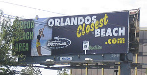 The name of the entire road, except between U.S. Highway 1 and State Road 3
(where it is the Emory L. Bennett Causeway), was officially designated as the Martin Andersen Beachline Expressway by the 2005 Florida Legislature. This was done after lobbying
by Brevard County, which wanted the shortest route to the Atlantic Ocean
from the Orlando area designated as such. An organization representing businesses on the Space Coast
has put up billboard
s calling it "Orlando's closest beach".
During 2006 construction began on a redesigned interchange with State Road 436 at the entrance to Orlando International Airport
. It was completed in early 2008. A new flyover ramp was built from the Beachline westbound into the airport, eliminating the weaving of cars entering and leaving the airport from/to the Beachline. The mainline toll plazas east and west of the airport remain subject to traffic congestion because of the high percentage of tourists at those plazas who must pay with cash since they don't have access to SunPass
, E-Pass or other acceptable electronic toll collection
transponders.
The interchange at Exit 13 (Florida State Road 15) was reconstructed between September 2007 and July 2009, which expanded the interchange ramps and replaced the old bridges with wider ones, and did not eliminate free movement that exists between that exit and Exit 11 (Florida State Road 436).
In May 2007, Florida's Turnpike Enterprise began Phase I of a project to widen the Beachline West. It encompasses the reconstruction of the mainline toll plaza located near Milepost 5, which is now complete. The new mainline toll plaza features two electronic (E-pass/SunPass) at-speed express lanes in each direction in the middle of the roadway (with capability to add another when the roadway proper is widened), and four staffed lanes in each direction to accommodate cash customers. The OOCEA had a similar reconstruction of the Beachline main toll plaza just east of the Greeneway between January 2008 and July 2009.
In 2011, an accident involving an exploding fuel truck destroyed the overpass at Florida State Road 3. Traffic was forced to exit the highway around the damage. The overpass was replaced, high priority, within 30 days, for $2.2 million.
Sightseers wishing to view the final launch of the Space Shuttle Discovery
in 2011, caused a 40 miles backup from Cape Canaveral.
In June 2008, a $49 million project to widen the Beachline from the Turnpike to McCoy Road to four lanes in each direction begun. Improvements include widening the existing bridge structures at US 441, Landstreet Road, CSX Transportation
, CSX Taft Yard, Orange Avenue and McCoy Road, with a new bridge being constructed for the access ramp over CSX.
State highway
State highway, state road or state route can refer to one of three related concepts, two of them related to a state or provincial government in a country that is divided into states or provinces :#A...
in the U.S. state
U.S. state
A U.S. state is any one of the 50 federated states of the United States of America that share sovereignty with the federal government. Because of this shared sovereignty, an American is a citizen both of the federal entity and of his or her state of domicile. Four states use the official title of...
of Florida
Florida
Florida is a state in the southeastern United States, located on the nation's Atlantic and Gulf coasts. It is bordered to the west by the Gulf of Mexico, to the north by Alabama and Georgia and to the east by the Atlantic Ocean. With a population of 18,801,310 as measured by the 2010 census, it...
. It is a mostly-toll
Toll road
A toll road is a privately or publicly built road for which a driver pays a toll for use. Structures for which tolls are charged include toll bridges and toll tunnels. Non-toll roads are financed using other sources of revenue, most typically fuel tax or general tax funds...
ed expressway connecting Interstate 4
Interstate 4
Interstate 4 is a intrastate Highway located entirely within the state of Florida, United States. It goes from Interstate 275 in Tampa, Florida to Interstate 95 at Daytona Beach, Florida . It also has the Florida Department of Transportation designation of State Road 400, but only a small...
in southwest Orlando with Cape Canaveral
Cape Canaveral
Cape Canaveral, from the Spanish Cabo Cañaveral, is a headland in Brevard County, Florida, United States, near the center of the state's Atlantic coast. Known as Cape Kennedy from 1963 to 1973, it lies east of Merritt Island, separated from it by the Banana River.It is part of a region known as the...
. It passes close to the tourist areas of Orlando, including SeaWorld
SeaWorld
SeaWorld is a United States chain of marine mammal parks, oceanariums, and animal theme parks owned by SeaWorld Parks & Entertainment. The parks feature captive orca, sea lion, and dolphin shows and zoological displays featuring various other marine animals. There are operations in Orlando,...
and Universal Orlando, and serves the north entrance to Orlando International Airport
Orlando International Airport
Orlando International Airport is a major international airport located southeast of the central business district of Orlando. It is the second busiest airport in Florida, after Miami International Airport...
. Near its east end, it passes over the Intracoastal Waterway
Intracoastal Waterway
The Intracoastal Waterway is a 3,000-mile waterway along the Atlantic and Gulf coasts of the United States. Some lengths consist of natural inlets, salt-water rivers, bays, and sounds; others are artificial canals...
on the Emory L. Bennett Causeway, and ends at State Road A1A
State Road A1A (Florida)
State Road A1A is a Florida State Road that runs mostly along the Atlantic Ocean, with sections from Key West at the southern tip of Florida, to Callahan, just south of Georgia. It is the main road through most oceanfront towns. SR A1A is designated the A1A Scenic and Historic Coastal Highway, a...
and State Road 401
State Road 401 (Florida)
One of the shortest signed roads in the State of Florida, State Road 401 is a four lane highway providing access to the south gate of Cape Canaveral Air Force Station near Cape Canaveral. Its southern terminus is a trumpet interchange with the Martin Andersen Beachline Expressway and SR A1A...
near Port Canaveral
Port Canaveral
Port Canaveral is a cruise, cargo and naval port in Brevard County, Florida, United States. It is one of the busiest cruise ports in the world with nearly 2.8 million multi-day cruise passengers passing through during 2010. As a deep water cargo port, it has a high volume of traffic. Over of bulk...
.
Martin Andersen, a retired publisher, used his influence to get the original stretch of road (from State Road 520
State Road 520 (Florida)
Florida State Road 520 is a east–west state highway in central Florida, United States, connecting with SR 50 in the Orlando area with SR A1A in Cocoa Beach.-Route description:...
to Orlando International Airport) built in the 1960s. The road is owned and maintained by Florida's Turnpike Enterprise
Florida's Turnpike Enterprise
Florida's Turnpike Enterprise is a business unit of the Florida Department of Transportation , employing private sector business practices to operate its 460-mile system of limited-access toll highways for the benefit of Florida's traveling public...
(FTE), Orlando-Orange County Expressway Authority
Orlando-Orange County Expressway Authority
The Orlando-Orange County Expressway Authority is an expressway authority responsible for construction, maintenance and operation of toll roads in Orange County, Florida, United States, which includes the city of Orlando. It was founded in 1963 for the purpose of building the Bee Line Expressway,...
(OOCEA) and the Florida Department of Transportation
Florida Department of Transportation
The Florida Department of Transportation is a decentralized agency charged with the establishment, maintenance, and regulation of public transportation in the state of Florida. The department was formed in 1969. It absorbed the powers of the Florida State Road Department...
(FDOT). The entire Beachline is compatible with the SunPass
SunPass
SunPass is an electronic toll collection system in use by the State of Florida and was originally created by the Florida Department of Transportation's Florida's Turnpike...
and E-Pass electronic toll collection
Electronic toll collection
Electronic toll collection , an adaptation of military "identification friend or foe" technology, aims to eliminate the delay on toll roads by collecting tolls electronically. It is thus a technological implementation of a road pricing concept...
transponders on both mainline plazas and interchange tolls.
Route description
The westernmost eight miles (13 km) of the Beachline Expressway, from I-4 to State Road 482State Road 482 (Florida)
State Road 482 , named Sand Lake Road and McCoy Road, is an east–west state highway in south Orlando, Florida, United States. It is a surface road, but has a complicated interchange with State Road 435 just north of the entrance to Lockheed Martin.-Route description:Sand Lake Road begins at...
near the airport, is known as the Beachline West Expressway and is FTE-owned. The section of the expressway is most famous for providing the link for tourists between Orlando International Airport and Orlando area attractions such as SeaWorld
SeaWorld
SeaWorld is a United States chain of marine mammal parks, oceanariums, and animal theme parks owned by SeaWorld Parks & Entertainment. The parks feature captive orca, sea lion, and dolphin shows and zoological displays featuring various other marine animals. There are operations in Orlando,...
and Universal Orlando, and Walt Disney World via I-4. The Beachline begins at an interchange with I-4 (exit 72), and heads east, with interchanges with the tourist driven International Drive
International Drive
International Drive is the main tourist strip of Orlando, Florida, located several miles southwest of proper Downtown Orlando in the southernmost limits of the city...
, Orangewood Blvd, John Young Parkway, and then jogs north to a massive interchange with Florida's Turnpike
Florida's Turnpike
Florida's Turnpike , designated as the Ronald Reagan Turnpike, and originally known as the Sunshine State Parkway is a north–south toll road that runs through 11 counties in the Florida peninsula, from U.S...
and Orange Blossom Trail (exit 4). The section of the Beachline Expressway from Exit 0 to Exit 4 remains a "free movement". The expressway continues east to the Beachline West barrier toll and then to SR 482 (McCoy Road/Sand Lake Road) (exit 8), ending FTE maintenance at the northwest edge of the Airport.
OOCEA maintenance begins at the northwest corner of the airport, with an Airport barrier toll following a free movement section between exits 8-9 (Tradeport Drive/Conway Road), followed two airport access interchanges with SR 436 and Goldenrod Road. The last of the Beachline's free movement sections is between SR 436 and with SR 15 just east of the airport. Three miles east of the airport, it intersects with the GreeneWay, heading out of Orlando, with the road straightening out as a beeline for the rest of its journey in Orange County. From the GreeneWay to Interstate 95
Interstate 95 in Florida
Interstate 95 is the main Interstate Highway on the east coast of the United States; it serves the Atlantic coast of Florida. It begins at a partial interchange with U.S. Highway 1 just south of downtown Miami, and heads north past Daytona Beach and Jacksonville to the Georgia state line at the St...
, the Beachline Expressway travels through mostly uninhabited marshlands. It intersects with a barrier toll just east of the GreeneWay, and has interchanges with International Corporate Park Boulevard, Dallas Boulevard and SR 520, the last interchange before the Orange County
Orange County, Florida
Orange County is a county located in the U.S. state of Florida and is part of the Orlando-Kissimmee-Sanford Metropolitan Statistical Area . As of 2010 U.S. Census, the county had a population of 1,145,956....
/Brevard County
Brevard County, Florida
Brevard County is a county located in the U.S. state of Florida, along the coast of the Atlantic Ocean. As of 2007 U.S. Census Bureau estimates, the population is 536,521, making it the 10th most populous county in the state. Influenced by the presence of the John F. Kennedy Space Center, Brevard...
line, ending OOCEA maintenance and tolls.
FDOT maintenance begins at the east end of the SR 520 interchange, crossing the St. Johns River
St. Johns River
The St. Johns River is the longest river in the U.S. state of Florida and its most significant for commercial and recreational use. At long, it winds through or borders twelve counties, three of which are the state's largest. The drop in elevation from the headwaters to the mouth is less than ;...
into Brevard County, and just east of the Brevard County line, the road veers southeast at the interchange with SR 407. It then enters the Space Coast development area before the interchange with I-95. It continues east, with interchanges with SR 501/SR 524 and US 1
U.S. Route 1 in Florida
U.S. Route 1 in Florida runs along the state's east coast from Key West to its crossing of the St. Marys River into Georgia north of Boulogne, and south of Folkston. US 1 was designated through Florida when the U.S. Highway System was established in 1926.US 1 runs in the state of Florida, and...
before crossing over the Intracoastal Waterway
Intracoastal Waterway
The Intracoastal Waterway is a 3,000-mile waterway along the Atlantic and Gulf coasts of the United States. Some lengths consist of natural inlets, salt-water rivers, bays, and sounds; others are artificial canals...
on the Emory L. Bennett Causeway, followed by interchanges with SR 3 and Banana River Drive before ending at A1A
Florida State Road A1A
State Road A1A is a Florida State Road that runs mostly along the Atlantic Ocean, with sections from Key West at the southern tip of Florida, to Callahan, just south of Georgia. It is the main road through most oceanfront towns. SR A1A is designated the A1A Scenic and Historic Coastal Highway, a...
and State Road 401
State Road 401 (Florida)
One of the shortest signed roads in the State of Florida, State Road 401 is a four lane highway providing access to the south gate of Cape Canaveral Air Force Station near Cape Canaveral. Its southern terminus is a trumpet interchange with the Martin Andersen Beachline Expressway and SR A1A...
near Port Canaveral
Port Canaveral
Port Canaveral is a cruise, cargo and naval port in Brevard County, Florida, United States. It is one of the busiest cruise ports in the world with nearly 2.8 million multi-day cruise passengers passing through during 2010. As a deep water cargo port, it has a high volume of traffic. Over of bulk...
.
Tolls on the east-pointing ramps at SR 520 are collected by FDOT, and 25 cents of the $1.25 OOCEA barrier toll east of the airport also goes to FDOT. There are no toll roads in Brevard County so technically the 25 cents is only for use of the FDOT road section in Orange County. Nonetheless, most road maps show the Brevard County section from the Orange County line to Interstate 95
Interstate 95 in Florida
Interstate 95 is the main Interstate Highway on the east coast of the United States; it serves the Atlantic coast of Florida. It begins at a partial interchange with U.S. Highway 1 just south of downtown Miami, and heads north past Daytona Beach and Jacksonville to the Georgia state line at the St...
to be a toll road because it is impossible to travel over it without incurring a toll elsewhere. The TOLL 528 shield is also used on this stretch of road as well as on exit signs along I-95.
Orlando area
Prior to the construction of the Bee Line, State Road 528 was a surface road connecting Interstate 4Interstate 4
Interstate 4 is a intrastate Highway located entirely within the state of Florida, United States. It goes from Interstate 275 in Tampa, Florida to Interstate 95 at Daytona Beach, Florida . It also has the Florida Department of Transportation designation of State Road 400, but only a small...
with the McCoy Jetport (now Orlando International Airport) and State Road 15
State Road 15 (Florida)
State Road 15 is part of the Florida State Road System. It runs from SR 80/SR 880 at Belle Glade north along the east shore of Lake Okeechobee to Okeechobee. Then it runs north to SR 500 at Holopaw, and northwest along SR 500 to Ashton State Road 15 (commonly SR 15) is part of the Florida State...
(Narcoossee Road). It ran along Sand Lake Road (now State Road 482
State Road 482 (Florida)
State Road 482 , named Sand Lake Road and McCoy Road, is an east–west state highway in south Orlando, Florida, United States. It is a surface road, but has a complicated interchange with State Road 435 just north of the entrance to Lockheed Martin.-Route description:Sand Lake Road begins at...
) from I-4 east to Orange Blossom Trail (U.S. Highway 17/92/441 - SR 500/600 (Orange Avenue), where it turned south to reach Landstreet Road. Landstreet Road took SR 528 to State Road 527) at Taft, where SR 528 turned back north to McCoy Road. McCoy Road led east past the north entrance to the Jetport to SR 15; part of this is now SR 482, while part of McCoy Road from about one mile (1.6 km) east of SR 527 now serves as a frontage road
Frontage road
A frontage road is a non-limited access road running parallel to a higher-speed road, usually a freeway, and feeding it at appropriate points of access...
to the Beachline.
An interchange
Interchange (road)
In the field of road transport, an interchange is a road junction that typically uses grade separation, and one or more ramps, to permit traffic on at least one highway to pass through the junction without directly crossing any other traffic stream. It differs from a standard intersection, at which...
at SR 528 and Kirkman Road (State Road 435
State Road 435 (Florida)
State Road 435, signed as Kirkman Road along its entire route, is a state road in Florida, existing entirely within Orange County. Kirkman road is a major arterial on the west side of Orlando, and bounds the east side of Universal Orlando Resort. It also connects on its south end into a Lockheed...
) was built ca. 1958 to serve the new Martin Company complex (now Lockheed Martin
Lockheed Martin
Lockheed Martin is an American global aerospace, defense, security, and advanced technology company with worldwide interests. It was formed by the merger of Lockheed Corporation with Martin Marietta in March 1995. It is headquartered in Bethesda, Maryland, in the Washington Metropolitan Area....
) just to the south of that junction. At that time, the area was basically empty, and the land was a part of the extensive Martin-owned Orlando Central Park.
Bennett Causeway
The Emory L. Bennett Causeway and approaches, running from State Road 520State Road 520 (Florida)
Florida State Road 520 is a east–west state highway in central Florida, United States, connecting with SR 50 in the Orlando area with SR A1A in Cocoa Beach.-Route description:...
west of Cocoa northeast and east across U.S. Highway 1, the Indian River Lagoon
Indian River Lagoon
The Indian River Lagoon is a grouping of three lagoons: Mosquito Lagoon, Banana River, and the Indian River, on the Atlantic Coast of Florida. It was originally named Rio de Ais after the Ais Indian tribe, who lived along the east coast of Florida....
, Merritt Island and the Banana River
Banana River
The Banana River is a lagoon that lies between Cape Canaveral and Merritt Island in Brevard County, Florida in the United States. It is part of the Indian River Lagoon system, and connects at its south end to the Indian River; it is the only part of the lagoon system not in the Intracoastal...
, was dedicated on October 11, 1963 as a two-lane toll bridge
Toll bridge
A toll bridge is a bridge over which traffic may pass upon payment of a toll, or fee.- History :The practice of collecting tolls on bridges probably harks back to the days of ferry crossings where people paid a fee to be ferried across stretches of water. As boats became impractical to carry large...
and road. It was assigned the SR 528 number over its whole length. At the same time, the present State Road 401
State Road 401 (Florida)
One of the shortest signed roads in the State of Florida, State Road 401 is a four lane highway providing access to the south gate of Cape Canaveral Air Force Station near Cape Canaveral. Its southern terminus is a trumpet interchange with the Martin Andersen Beachline Expressway and SR A1A...
north of SR 528 was also built. In 2003, construction was started on replacing the eastbound bridge over the Indian River Lagoon
Indian River Lagoon
The Indian River Lagoon is a grouping of three lagoons: Mosquito Lagoon, Banana River, and the Indian River, on the Atlantic Coast of Florida. It was originally named Rio de Ais after the Ais Indian tribe, who lived along the east coast of Florida....
. It is now finished. The westbound bridge over the Indian River Lagoon
Indian River Lagoon
The Indian River Lagoon is a grouping of three lagoons: Mosquito Lagoon, Banana River, and the Indian River, on the Atlantic Coast of Florida. It was originally named Rio de Ais after the Ais Indian tribe, who lived along the east coast of Florida....
will be replaced between 2013 and 2018. The causeway was named in honor of Emory L. Bennett
Emory L. Bennett
-External links:*...
, recipient of the Medal of Honor
Medal of Honor
The Medal of Honor is the highest military decoration awarded by the United States government. It is bestowed by the President, in the name of Congress, upon members of the United States Armed Forces who distinguish themselves through "conspicuous gallantry and intrepidity at the risk of his or her...
for his actions during the Korean War
Korean War
The Korean War was a conventional war between South Korea, supported by the United Nations, and North Korea, supported by the People's Republic of China , with military material aid from the Soviet Union...
, and is part of the Indian River Lagoon Scenic Highway
Indian River Lagoon Scenic Highway
The Indian River Lagoon Scenic Highway is a long scenic byway located in Florida. Basically, the Highway is actually a collection of several roads, mostly running north and south along either side of the Indian River Lagoon, connected by other roads running over the Lagoon...
.
SR 15 to SR 520
Martin Andersen, then owner of the Orlando SentinelOrlando Sentinel
The Orlando Sentinel is the primary newspaper of the Orlando, Florida region. It was founded in 1876. The Sentinel is owned by Tribune Company and is overseen by the Chicago Tribune. As of 2005, the Sentinel’s president and publisher was Kathleen Waltz; she announced her resignation in February 2008...
, helped form the Central Florida Development Commission to ensure that Orlando would prosper, with one its goals being developing an "adequate road system". With the completion of Florida's Turnpike
Florida's Turnpike
Florida's Turnpike , designated as the Ronald Reagan Turnpike, and originally known as the Sunshine State Parkway is a north–south toll road that runs through 11 counties in the Florida peninsula, from U.S...
and Interstate 4
Interstate 4
Interstate 4 is a intrastate Highway located entirely within the state of Florida, United States. It goes from Interstate 275 in Tampa, Florida to Interstate 95 at Daytona Beach, Florida . It also has the Florida Department of Transportation designation of State Road 400, but only a small...
in 1963 and 1965, Orlando had freeway connections to the northwest, southwest, southeast and northeast, but lacked such a connection to the Kennedy Space Center
Kennedy Space Center
The John F. Kennedy Space Center is the NASA installation that has been the launch site for every United States human space flight since 1968. Although such flights are currently on hiatus, KSC continues to manage and operate unmanned rocket launch facilities for America's civilian space program...
to the east.
A bill creating the Orlando-Orange County Expressway Authority
Orlando-Orange County Expressway Authority
The Orlando-Orange County Expressway Authority is an expressway authority responsible for construction, maintenance and operation of toll roads in Orange County, Florida, United States, which includes the city of Orlando. It was founded in 1963 for the purpose of building the Bee Line Expressway,...
(OOCEA) was signed into law in 1963, which, unlike the State Road Department (SRD), could raise money for new roads using tolls
Toll road
A toll road is a privately or publicly built road for which a driver pays a toll for use. Structures for which tolls are charged include toll bridges and toll tunnels. Non-toll roads are financed using other sources of revenue, most typically fuel tax or general tax funds...
. Its immediate goal was to build a road to the Kennedy Space Center, but the law was written with the intent of a larger expressway network.
The OOCEA wanted to build a freeway all the way from I-4 to Cape Canaveral, but ran into several problems. It had issues with raising money for the road, with traffic projections falling short of necessary to pay for the large bond issue required. It also did not have the authority to build in Brevard County, and many Brevard residents opposed the roads, as it would draw business away from the Cape Canaveral area to Orlando.
The setbacks resulted in a much shorter expressway route running from State Road 15
State Road 15 (Florida)
State Road 15 is part of the Florida State Road System. It runs from SR 80/SR 880 at Belle Glade north along the east shore of Lake Okeechobee to Okeechobee. Then it runs north to SR 500 at Holopaw, and northwest along SR 500 to Ashton State Road 15 (commonly SR 15) is part of the Florida State...
(Narcoosee Road) east of the McCoy Jetport east to State Road 520
State Road 520 (Florida)
Florida State Road 520 is a east–west state highway in central Florida, United States, connecting with SR 50 in the Orlando area with SR A1A in Cocoa Beach.-Route description:...
in east Orange County. This was known as the Bithlo Cutoff, as it allowed traffic from southern Orlando to reach SR 520 without going north and east to Bithlo. West of SR 15, the existing SR 528 was to carry traffic to I-4. A new alignment would be built between Orange Blossom Trail and Orange Avenue, directly connecting Sand Lake Road to McCoy Road, and McCoy Road east from Daetwyler Drive (the Jetport entrance) to SR 15 would be widened as a divided
Divided Highway
Divided Highway is a compilation album by American rock band The Doobie Brothers, released in 2003. . All tracks are taken from the albums Cycles and Brotherhood .-Track listing:...
surface road. Additionally, to handle traffic from downtown Orlando, SR 15 (Hoffner Avenue) between Conway Road and Goldenrod Road would be rebuilt. Concurrently, the SRD was extending Lake Barton Road (now State Road 436
State Road 436 (Florida)
State Road 436 , known as Semoran Boulevard for most of its length and East Altamonte Drive in Altamonte Springs, is a northwest-southeast beltway in the Orlando area running from US 441 in Apopka to the Beachline Expressway near Orlando International Airport...
- Semoran Boulevard) south to the Jetport, where it would meet the Bee Line, which opened in 1969.
In November 1964, the OOCEA and SRD signed an agreement where the OOCEA would build the road, and then turn it over to the SRD, which would operate and maintain it, giving toll revenue
Revenue
In business, revenue is income that a company receives from its normal business activities, usually from the sale of goods and services to customers. In many countries, such as the United Kingdom, revenue is referred to as turnover....
to the OOCEA. Construction of the $6.8 million project began in early 1966, with groundbreaking
Groundbreaking
Groundbreaking, also known as cutting, sod-cutting, turning the first sod or a sod-turning ceremony, is a traditional ceremony in many cultures that celebrates the first day of construction for a building or other project. Such ceremonies are often attended by dignitaries such as politicians and...
at the location of the present Dallas Boulevard interchange (exit 24). The 17.4-mile (28.0 km) road was dedicated on July 14, 1967 at the 35-cent toll plaza, just east of SR 15 (28.4500°N 81.2525°W), and the remaining section (Orange Blossom Trail to Orange Avenue) opened 9 days later. The OOCEA board had voted to name it after Martin Andersen in December 1966, and in 1967 the Florida Legislature
Florida Legislature
The Florida State Legislature is the term often used to refer to the two houses that act as the state legislature of the U.S. state of Florida. The Florida Constitution states that "The legislative power of the state shall be vested in a legislature of the State of Florida," composed of a Senate...
passed this designation into law.
I-4 to McCoy Jetport and SR 520 to the Bennett Causeway
In early 1967, the Florida State Turnpike Authority (FTA) announced plans for an expansion of the Turnpike system, including taking over the existing Bee Line and Bennett Causeway and forming a continuous route from the Turnpike to the Atlantic Ocean, with a spur (now State Road 407State Road 407 (Florida)
State Road 407 , known locally as Challenger Memorial Parkway, is a spur from SR 528 that links to SR 405. By utilizing the SR 407 to SR 405 route, travelers from Central Florida can access the Kennedy Space Center and the city of Titusville...
) to the Orsino Causeway
State Road 405 (Florida)
State Road 405 is a street making a sweeping arc in Titusville, Florida, and providing a major access route for the Kennedy Space Center on nearby Merritt Island...
. Enabling legislation was signed into law in July 1967. However, inflation
Inflation
In economics, inflation is a rise in the general level of prices of goods and services in an economy over a period of time.When the general price level rises, each unit of currency buys fewer goods and services. Consequently, inflation also reflects an erosion in the purchasing power of money – a...
caused problems with that plan. In December 1968, bonds were sold for a joint project - FTA would build from McCoy Jetport west to the Turnpike (at the existing Orlando-South interchange with Orange Blossom Trail), and Orange and Brevard Counties would fund the extension from SR 520 east to the Bennett and Orsino Causeways, in addition to a four-laning on the Bennett Causeway.
An interchange
Interchange (road)
In the field of road transport, an interchange is a road junction that typically uses grade separation, and one or more ramps, to permit traffic on at least one highway to pass through the junction without directly crossing any other traffic stream. It differs from a standard intersection, at which...
at State Road 15
State Road 15 (Florida)
State Road 15 is part of the Florida State Road System. It runs from SR 80/SR 880 at Belle Glade north along the east shore of Lake Okeechobee to Okeechobee. Then it runs north to SR 500 at Holopaw, and northwest along SR 500 to Ashton State Road 15 (commonly SR 15) is part of the Florida State...
replaced an at-grade crossing ca. 1971.
The FTA planned to build from the Turnpike east past the Jetport to SR 15, upgrading the existing SR 528 (McCoy Road) with frontage road
Frontage road
A frontage road is a non-limited access road running parallel to a higher-speed road, usually a freeway, and feeding it at appropriate points of access...
s from west of the Jetport to SR 15. An interchange
Interchange (road)
In the field of road transport, an interchange is a road junction that typically uses grade separation, and one or more ramps, to permit traffic on at least one highway to pass through the junction without directly crossing any other traffic stream. It differs from a standard intersection, at which...
would be provided with the new State Road 436
State Road 436 (Florida)
State Road 436 , known as Semoran Boulevard for most of its length and East Altamonte Drive in Altamonte Springs, is a northwest-southeast beltway in the Orlando area running from US 441 in Apopka to the Beachline Expressway near Orlando International Airport...
, planned to open in 1969. However, Governor Claude Kirk insisted that the new road continue west past the Turnpike to Interstate 4, and so the FTA did not have enough money to upgrade the road past the Jetport. (The FTA merged into the new Florida Department of Transportation
Florida Department of Transportation
The Florida Department of Transportation is a decentralized agency charged with the establishment, maintenance, and regulation of public transportation in the state of Florida. The department was formed in 1969. It absorbed the powers of the Florida State Road Department...
(FDOT) in 1969.) The piece from west of the Jetport to the Turnpike opened in late July 1973, and the rest of the road to I-4 opened in December. The road had one 15-cent toll booth (28.4448°N 81.3818°W), lying between the Turnpike and Jetport. The rest of the road to I-4 was free; initially there were no interchange
Interchange (road)
In the field of road transport, an interchange is a road junction that typically uses grade separation, and one or more ramps, to permit traffic on at least one highway to pass through the junction without directly crossing any other traffic stream. It differs from a standard intersection, at which...
s except at International Drive
International Drive
International Drive is the main tourist strip of Orlando, Florida, located several miles southwest of proper Downtown Orlando in the southernmost limits of the city...
, just east of I-4, but overpasses were built at roughly one-mile intervals which would eventually provide exits for Orangewood Blvd. and John Young Parkway
John Young Parkway
State Road 423, known for most of its length as John Young Parkway, and Lee Road east of Orange Blossom Trail, is a four- and six-lane surface road in the U.S. state of Florida. SR 423 is completely inside Orlando, Florida and runs from SR 408 north to U.S...
.
At the same time, construction had begun on the eastern section, originally known as the Central Florida Expressway, by December 1971. The road ran east from SR 520 past a 20-cent toll booth (28.453°N 80.960°W) to the St. Johns River
St. Johns River
The St. Johns River is the longest river in the U.S. state of Florida and its most significant for commercial and recreational use. At long, it winds through or borders twelve counties, three of which are the state's largest. The drop in elevation from the headwaters to the mouth is less than ;...
, where it crossed into Brevard County. Shortly after crossing, it split, with a two-lane spur (State Road 407
State Road 407 (Florida)
State Road 407 , known locally as Challenger Memorial Parkway, is a spur from SR 528 that links to SR 405. By utilizing the SR 407 to SR 405 route, travelers from Central Florida can access the Kennedy Space Center and the city of Titusville...
) heading northeast, interchanging with Interstate 95, and ending at State Road 405
State Road 405 (Florida)
State Road 405 is a street making a sweeping arc in Titusville, Florida, and providing a major access route for the Kennedy Space Center on nearby Merritt Island...
west of the Orsino Causeway for access to the central part of the Kennedy Space Center
Kennedy Space Center
The John F. Kennedy Space Center is the NASA installation that has been the launch site for every United States human space flight since 1968. Although such flights are currently on hiatus, KSC continues to manage and operate unmanned rocket launch facilities for America's civilian space program...
. The main line headed southeast from the split and then east across I-95 to join the Bennett Causeway approach just west of U.S. Highway 1. The Causeway was widened, with a new eastbound side added, ca. 1970-71, and the extension of the Bee Line to connect with the two causeways opened February 16, 1974. The former Bennett Causeway approach west of the new road became State Road 524
State Road 524 (Florida)
A part of the original alignment of the Bee Line Expressway, State Road 524 is a five-mile-long southwest-northeast street in Cocoa, Florida. It is signed east–west....
.
At the Orlando International Airport
While the sections west and east of the Jetport were freeways, the piece along McCoy Road, from west of the Jetport to SR 15, was a four-lane dividedDivided Highway
Divided Highway is a compilation album by American rock band The Doobie Brothers, released in 2003. . All tracks are taken from the albums Cycles and Brotherhood .-Track listing:...
surface road. It had two major intersections - Daetwyler Drive (the Jetport entrance) and Semoran Boulevard (State Road 436
State Road 436 (Florida)
State Road 436 , known as Semoran Boulevard for most of its length and East Altamonte Drive in Altamonte Springs, is a northwest-southeast beltway in the Orlando area running from US 441 in Apopka to the Beachline Expressway near Orlando International Airport...
), and a number of minor access points. Adding to the need for an upgrade was the Greater Orlando Aviation Authority
Greater Orlando Aviation Authority
Greater Orlando Aviation Authority operates Orlando International Airport and Orlando Executive Airport in Orlando, Florida. GOAA consists of a seven-member board: the mayor of the City of Orlando, Florida; the Chairman of the Board of County Commissioners; and five other members who are...
's plans for expanding the Jetport (which became Orlando International Airport
Orlando International Airport
Orlando International Airport is a major international airport located southeast of the central business district of Orlando. It is the second busiest airport in Florida, after Miami International Airport...
once the expansion was complete in September 1981).
To help pay for the upgrade, the OOCEA raised tolls at the Bee Line toll plaza (east of SR 15) from 35 cents to 50 cents effective May 1, 1980. Bonds were sold in January 1981, and the finished SR 436/Airport interchange
Interchange (road)
In the field of road transport, an interchange is a road junction that typically uses grade separation, and one or more ramps, to permit traffic on at least one highway to pass through the junction without directly crossing any other traffic stream. It differs from a standard intersection, at which...
was dedicated on January 21, 1983. The 25-cent toll plaza (28.4514°N 81.3201°W) just west of the Airport interchange opened July 2, 1983.
Later changes
The spaces left for interchangeInterchange (road)
In the field of road transport, an interchange is a road junction that typically uses grade separation, and one or more ramps, to permit traffic on at least one highway to pass through the junction without directly crossing any other traffic stream. It differs from a standard intersection, at which...
s on the section west of the Turnpike have since been used by junctions with Orangewood Boulevard and Universal Boulevard, John Young Parkway
John Young Parkway
State Road 423, known for most of its length as John Young Parkway, and Lee Road east of Orange Blossom Trail, is a four- and six-lane surface road in the U.S. state of Florida. SR 423 is completely inside Orlando, Florida and runs from SR 408 north to U.S...
, and Consulate Drive (for access between the west and Orange Blossom Trail and the Turnpike). East of SR 15, similar connections have been built with International Corporate Park Boulevard and Dallas Boulevard.
The interchange with State Road 417
State Road 417 (Florida)
State Road 417 , also known as the Central Florida GreeneWay, Southern Connector and Seminole Expressway , is a tolled freeway forming the eastern beltway around the city of Orlando, Florida, United States. It is owned and maintained by the Orlando-Orange County Expressway Authority and Florida's...
(the Eastern Beltway) opened June 26, 1990, resulting in the toll booth east of SR 15 being moved several miles east.
With the startup of the Disney Cruise Line
Disney Cruise Line
Disney Cruise Line is an American cruise line company owned and operated by Walt Disney Parks and Resorts, a division of The Walt Disney Company and is headquartered in Celebration, Florida. The business is run by President Karl Holz. Disney Cruise Line operates the Disney Cruise Line Terminal,...
from Port Canaveral
Port Canaveral
Port Canaveral is a cruise, cargo and naval port in Brevard County, Florida, United States. It is one of the busiest cruise ports in the world with nearly 2.8 million multi-day cruise passengers passing through during 2010. As a deep water cargo port, it has a high volume of traffic. Over of bulk...
in 1998, Disney started running bus
Bus
A bus is a road vehicle designed to carry passengers. Buses can have a capacity as high as 300 passengers. The most common type of bus is the single-decker bus, with larger loads carried by double-decker buses and articulated buses, and smaller loads carried by midibuses and minibuses; coaches are...
es along the Bee Line for tourists going between Walt Disney World and the port.
SR 528 east of State Road 436
State Road 436 (Florida)
State Road 436 , known as Semoran Boulevard for most of its length and East Altamonte Drive in Altamonte Springs, is a northwest-southeast beltway in the Orlando area running from US 441 in Apopka to the Beachline Expressway near Orlando International Airport...
was designated the Kennedy Space Center Highway in 1998 by the Florida Legislature
Florida Legislature
The Florida State Legislature is the term often used to refer to the two houses that act as the state legislature of the U.S. state of Florida. The Florida Constitution states that "The legislative power of the state shall be vested in a legislature of the State of Florida," composed of a Senate...
.
The 20-cent FDOT toll booth east of SR 520 was rounded up to 25 cents in July 1996 to improve efficiency. After an agreement signed May 8, 1998 by the OOCEA and FDOT, it was removed May 11, and replaced with an additional 25 cents at the $1 (originally 35-cent) OOCEA toll east of SR 417. The extra 25 cents goes to FDOT, as traffic that exits at State Road 520
State Road 520 (Florida)
Florida State Road 520 is a east–west state highway in central Florida, United States, connecting with SR 50 in the Orlando area with SR A1A in Cocoa Beach.-Route description:...
now has to pay an extra quarter—the 25-cent ramp tolls pointing eastward at the SR 520 interchange were added August 19, 1999.
The last at-grade interchange on the original Bee Line alignment, a connection on the westbound side to a derelict portion of the McCoy Road frontage, was finally eliminated in 2002 as part of the Goldenrod Road extension project. The break in the frontage allowing eastbound traffic to cross over to McCoy Road at that point had been closed about a decade before during a resurfacing project. At that point, the Bee Line became completely limited-access from Interstate 4 to State Road 401
State Road 401 (Florida)
One of the shortest signed roads in the State of Florida, State Road 401 is a four lane highway providing access to the south gate of Cape Canaveral Air Force Station near Cape Canaveral. Its southern terminus is a trumpet interchange with the Martin Andersen Beachline Expressway and SR A1A...
.
In 2003, a new interchange was completed at George J. King Blvd at Port Canaveral, extending the freeway beyond SR 401. While SR 528 officially ends at SR 401, signage continues it along State Road A1A
State Road A1A (Florida)
State Road A1A is a Florida State Road that runs mostly along the Atlantic Ocean, with sections from Key West at the southern tip of Florida, to Callahan, just south of Georgia. It is the main road through most oceanfront towns. SR A1A is designated the A1A Scenic and Historic Coastal Highway, a...
to the new interchange at the city limits of Cape Canaveral.
State Road 3 (Florida)
State Road 3, also known as North Courtenay Parkway, is a north–south road serving as the southern access for the Kennedy Space Center near Cape Canaveral, Florida. The shortest of the one-digit Florida State Roads, its southern terminus is an intersection with SR 520 on Merritt Island, east...
(where it is the Emory L. Bennett Causeway), was officially designated as the Martin Andersen Beachline Expressway by the 2005 Florida Legislature. This was done after lobbying
Lobbying
Lobbying is the act of attempting to influence decisions made by officials in the government, most often legislators or members of regulatory agencies. Lobbying is done by various people or groups, from private-sector individuals or corporations, fellow legislators or government officials, or...
by Brevard County, which wanted the shortest route to the Atlantic Ocean
Atlantic Ocean
The Atlantic Ocean is the second-largest of the world's oceanic divisions. With a total area of about , it covers approximately 20% of the Earth's surface and about 26% of its water surface area...
from the Orlando area designated as such. An organization representing businesses on the Space Coast
Space Coast
The Space Coast is a region in the U.S. state of Florida around Kennedy Space Center , where NASA launched space shuttles until the last one on July 8th, 2011 at 11:29am; and Cape Canaveral Air Force Station, site of unmanned civilian and military space launches...
has put up billboard
Billboard (advertising)
A billboard is a large outdoor advertising structure , typically found in high traffic areas such as alongside busy roads. Billboards present large advertisements to passing pedestrians and drivers...
s calling it "Orlando's closest beach".
During 2006 construction began on a redesigned interchange with State Road 436 at the entrance to Orlando International Airport
Orlando International Airport
Orlando International Airport is a major international airport located southeast of the central business district of Orlando. It is the second busiest airport in Florida, after Miami International Airport...
. It was completed in early 2008. A new flyover ramp was built from the Beachline westbound into the airport, eliminating the weaving of cars entering and leaving the airport from/to the Beachline. The mainline toll plazas east and west of the airport remain subject to traffic congestion because of the high percentage of tourists at those plazas who must pay with cash since they don't have access to SunPass
SunPass
SunPass is an electronic toll collection system in use by the State of Florida and was originally created by the Florida Department of Transportation's Florida's Turnpike...
, E-Pass or other acceptable electronic toll collection
Electronic toll collection
Electronic toll collection , an adaptation of military "identification friend or foe" technology, aims to eliminate the delay on toll roads by collecting tolls electronically. It is thus a technological implementation of a road pricing concept...
transponders.
The interchange at Exit 13 (Florida State Road 15) was reconstructed between September 2007 and July 2009, which expanded the interchange ramps and replaced the old bridges with wider ones, and did not eliminate free movement that exists between that exit and Exit 11 (Florida State Road 436).
In May 2007, Florida's Turnpike Enterprise began Phase I of a project to widen the Beachline West. It encompasses the reconstruction of the mainline toll plaza located near Milepost 5, which is now complete. The new mainline toll plaza features two electronic (E-pass/SunPass) at-speed express lanes in each direction in the middle of the roadway (with capability to add another when the roadway proper is widened), and four staffed lanes in each direction to accommodate cash customers. The OOCEA had a similar reconstruction of the Beachline main toll plaza just east of the Greeneway between January 2008 and July 2009.
In 2011, an accident involving an exploding fuel truck destroyed the overpass at Florida State Road 3. Traffic was forced to exit the highway around the damage. The overpass was replaced, high priority, within 30 days, for $2.2 million.
Sightseers wishing to view the final launch of the Space Shuttle Discovery
Space Shuttle Discovery
Space Shuttle Discovery is one of the retired orbiters of the Space Shuttle program of NASA, the space agency of the United States, and was operational from its maiden flight, STS-41-D on August 30, 1984, until its final landing during STS-133 on March 9, 2011...
in 2011, caused a 40 miles backup from Cape Canaveral.
Expansion
East of the GreeneWay, a new interchange just west of ICP Blvd (Avalon Park Blvd.) and a Beachline East toll plaza that would be constructed between Dallas Blvd. and SR 520 that would end the free movement section, are in the five year work plan.In June 2008, a $49 million project to widen the Beachline from the Turnpike to McCoy Road to four lanes in each direction begun. Improvements include widening the existing bridge structures at US 441, Landstreet Road, CSX Transportation
CSX Transportation
CSX Transportation operates a Class I railroad in the United States known as the CSX Railroad. It is the main subsidiary of the CSX Corporation. The company is headquartered in Jacksonville, Florida, and owns approximately 21,000 route miles...
, CSX Taft Yard, Orange Avenue and McCoy Road, with a new bridge being constructed for the access ramp over CSX.
Exit list
All tolls are assumed paying cash in a two-axle vehicle, such as a car.| County | Location | Mile | # Exit number An exit number is a number assigned to a road junction, usually an exit from a freeway. It is usually marked on the same sign as the destinations of the exit, as well as a sign in the gore.... |
Destination | Notes |
|---|---|---|---|---|---|
| Orange | Orlando Orlando, Florida Orlando is a city in the central region of the U.S. state of Florida. It is the county seat of Orange County, and the center of the Greater Orlando metropolitan area. According to the 2010 US Census, the city had a population of 238,300, making Orlando the 79th largest city in the United States... |
0.000 | |||
| 0.855 | 1 | International Drive International Drive International Drive is the main tourist strip of Orlando, Florida, located several miles southwest of proper Downtown Orlando in the southernmost limits of the city... |
|||
| 1.904 | 2 | Orangewood Boulevard; Universal Boulevard | |||
| 3.122 | 3 | split into 3A and 3B eastbound | |||
| 4.443 | 4 | ; Consulate Drive (State Road 91; State Road 500 State Road 500 (Florida) State Road 500 is a major state highway running through Florida as a mostly unsigned route under several US Highways. From Chiefland to Williston it is U.S. Highway 27 Alternate. From Williston to Ocala, it is U.S. Highway 27. From Ocala to Kissimmee, it is U.S. Highway 441. From Kissimmee to... ; State Road 600) |
|||
| Beachline West barrier toll ($0.75) | |||||
| 8.163 | 8 | ||||
| 9.225 | 9 | Tradeport Drive; Conway Road | |||
| Airport barrier toll ($1.00) | |||||
| 10.734 | 11 | - International Airport | split into 11A (SR 436) and 11B (Airport) westbound | ||
| 12.085 | 12 | Goldenrod Road Goldenrod Road Extension The Goldenrod Road Extension is a toll road in southeastern Orlando, Florida, United States, owned and operated by the Orlando-Orange County Expressway Authority . It is a four-lane surface road with several at-grade intersections... ; Heintzelman Boulevard |
|||
| 13.448 | 13 | ||||
| 15.536 | 16 | , Disney World | |||
| Beachline Main barrier toll ($1.50) | |||||
| 19.759 | 20 | International Corporate Park Boulevard | $1.25 westbound exit and eastbound entrance | ||
| 23.783 | 24 | Dallas Boulevard | eastbound exit and westbound entrance | ||
| 30.844 | 31 | $0.25 westbound exit and eastbound entrance | |||
| Brevard | 36.975 | 37 | eastbound exit and westbound entrance | ||
| 41.728 | 42 | split into 42A and 42B | |||
| 45.280 | 45 | split into 45A and 45B westbound | |||
| Cocoa Cocoa, Florida Cocoa is a city in Brevard County, Florida, United States. The population was 16,412 at the 2000 census. As of 2008, the estimated population according to the U.S. Census Bureau was 16,478. It is part of the Palm Bay–Melbourne–Titusville Metropolitan Statistical Area.-History:Cocoa was... |
45.956 | 46 | Western end of SR A1A concurrency/Emory L. Bennett Causeway begins | ||
| 48.842 | 49 | 37,500 vehicles daily east of SR 3, 51,000 vehicles daily west of SR 3 | |||
| 51.405 | 52 | Banana River Drive | |||
| 53.323 | - Cape Canaveral Air Force Station Cape Canaveral Air Force Station Cape Canaveral Air Force Station is an installation of the United States Air Force Space Command's 45th Space Wing, headquartered at nearby Patrick Air Force Base. Located on Cape Canaveral in the state of Florida, CCAFS is the primary launch head of America's Eastern Range with four launch pads... ; Port Canaveral Port Canaveral Port Canaveral is a cruise, cargo and naval port in Brevard County, Florida, United States. It is one of the busiest cruise ports in the world with nearly 2.8 million multi-day cruise passengers passing through during 2010. As a deep water cargo port, it has a high volume of traffic. Over of bulk... A cruise terminals; north cargo piers |
Eastern terminus, eastern end of SR A1A cocurrency | |||
| 53.499 | George J. King Boulevard | ||||