

South East Dorset conurbation
Encyclopedia
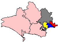
The South east Dorset conurbation (also known as the South Dorset conurbation, Poole-Bournemouth urban area and Bournemouth urban area) is a multi-centred conurbation
Conurbation
A conurbation is a region comprising a number of cities, large towns, and other urban areas that, through population growth and physical expansion, have merged to form one continuous urban and industrially developed area...
on the south coast of Dorset
Dorset
Dorset , is a county in South West England on the English Channel coast. The county town is Dorchester which is situated in the south. The Hampshire towns of Bournemouth and Christchurch joined the county with the reorganisation of local government in 1974...
in England
England
England is a country that is part of the United Kingdom. It shares land borders with Scotland to the north and Wales to the west; the Irish Sea is to the north west, the Celtic Sea to the south west, with the North Sea to the east and the English Channel to the south separating it from continental...
. The area is rapidly becoming an amalgamation with the area of South West Hampshire
Hampshire
Hampshire is a county on the southern coast of England in the United Kingdom. The county town of Hampshire is Winchester, a historic cathedral city that was once the capital of England. Hampshire is notable for housing the original birthplaces of the Royal Navy, British Army, and Royal Air Force...
immediately on the fringe of the newly formed New Forest National Park. The main population centres are Bournemouth
Bournemouth
Bournemouth is a large coastal resort town in the ceremonial county of Dorset, England. According to the 2001 Census the town has a population of 163,444, making it the largest settlement in Dorset. It is also the largest settlement between Southampton and Plymouth...
, Poole
Poole
Poole is a large coastal town and seaport in the county of Dorset, on the south coast of England. The town is east of Dorchester, and Bournemouth adjoins Poole to the east. The Borough of Poole was made a unitary authority in 1997, gaining administrative independence from Dorset County Council...
and Christchurch
Christchurch, Dorset
Christchurch is a borough and town in the county of Dorset on the south coast of England. The town adjoins Bournemouth in the west and the New Forest lies to the east. Historically in Hampshire, it joined Dorset with the reorganisation of local government in 1974 and is the most easterly borough in...
; however, the urbanised area spreads as far east as Barton on Sea
Barton on Sea
Barton on Sea is a coastal village situated in Hampshire, England. As a settlement, Barton has a history dating back to Anglo-Saxon times, although the modern village was largely built in the 20th century. It is effectively a suburb of New Milton...
in Hampshire. There are a number of satellite towns peripheral to these main urban centres. In clockwise rotation these include: Wareham
Wareham, Dorset
Wareham is an historic market town and, under the name Wareham Town, a civil parish, in the English county of Dorset. The town is situated on the River Frome eight miles southwest of Poole.-Situation and geography:...
, Upton
Upton, Dorset
Upton is a village in south east Dorset, England. It is the second largest village in Purbeck-Geography:The village is built around a road junction where the Blandford to Hamworthy road crosses the main Poole to Dorchester road. The Poole suburbs of Hamworthy and Turlin Moor adjoin the village to...
/Lytchett Minster
Lytchett Minster
Lytchett Minster is a small village in the English county of Dorset. Lytchett Minster is on the A35 road, the main route between the towns of Poole and Dorchester...
, Wimborne, Ferndown
Ferndown
Ferndown is a town and civil parish in the East Dorset district of Dorset in southern England, situated immediately to the north of unitary authorities of Poole and Bournemouth. The parish, which until 1972 was called Hampreston, includes the communities of Hampreston, Longham, Stapehill and...
, Verwood
Verwood
Verwood is a town and civil parish in Dorset, England. The town lies north of Bournemouth and north of Poole. The town has a population of 14,820 according to latest figures from Dorset County Council, making it the largest town in Dorset without an upper school in terms of population.-Early...
, Ringwood
Ringwood
Ringwood is a historic market town and civil parish in Hampshire, England, located on the River Avon, close to the New Forest and north of Bournemouth. It has a history dating back to Anglo-Saxon times, and has held a weekly market since the Middle Ages....
(Hampshire) and New Milton
New Milton
New Milton is a market town in south west Hampshire, England. The town has a high street and holds a market every Wednesday. Situated on the edge of the New Forest, the town is about 6 miles west of Lymington town centre and 12 miles east of Bournemouth town centre.-History:New Milton dates back...
(Hampshire). The urban area is generally surrounded by a green belt.
The 2001 census gave a population of 383,713 for the conurbation, defined by the Office for National Statistics
Office for National Statistics
The Office for National Statistics is the executive office of the UK Statistics Authority, a non-ministerial department which reports directly to the Parliament of the United Kingdom.- Overview :...
as the Bournemouth Urban Area, and divides into five parts: Bournemouth, Burton, Christchurch, New Milton/Barton on Sea, and Poole. The equivalent population according to the 1991 census was 358,321. The South West England
South West England
South West England is one of the regions of England defined by the Government of the United Kingdom for statistical and other purposes. It is the largest such region in area, covering and comprising Bristol, Gloucestershire, Somerset, Dorset, Wiltshire, Devon, Cornwall and the Isles of Scilly. ...
Regional Development Agency
Regional Development Agency
In the United Kingdom, a regional development agency is a non-departmental public body established for the purpose of development, primarily economic, of one of England's Government Office regions. There is one RDA for each of the NUTS level 1 regions of England...
and the Highways Agency
Highways Agency
The Highways Agency is an executive agency, part of the Department for Transport in England. It has responsibility for managing the core road network in England...
, which maintain's England's trunk road
Trunk road
A trunk road, trunk highway, or strategic road is a major road—usually connecting two or more cities, ports, airports, and other things.—which is the recommended route for long-distance and freight traffic...
s, define a larger South East Dorset Conurbation, with over 400,000 people. The term has also been applied to the Poole, Bournemouth and Christchurch boroughs, excluding the surrounding towns, for example, in their recent Joint Local Transport Plan
Local Transport Plan
Local transport plans, divided into full local transport plans and local implementation plans for transport are an important part of transport planning in England...
.
Nearby places
There are a number of nearby towns and villages that are only separated from the conurbation by narrow gaps. These include- BransgoreBransgoreBransgore is a village and parish within the New Forest District, Hampshire, UK. The village developed in the 19th century when a church and a school were built...
- Milford on SeaMilford on SeaMilford on Sea is a large village and civil parish located on the south coast of England in the county of Hampshire. With a population of approximately 4500, Milford has a variety of shops, restaurants and pubs in its high street, which borders the village green.-Overview:Milford on Sea is village...
- LymingtonLymingtonLymington is a port on the west bank of the Lymington River on the Solent, in the New Forest district of Hampshire, England. It is to the east of the South East Dorset conurbation, and faces Yarmouth on the Isle of Wight which is connected to it by a car ferry, operated by Wightlink. The town...
- RingwoodRingwoodRingwood is a historic market town and civil parish in Hampshire, England, located on the River Avon, close to the New Forest and north of Bournemouth. It has a history dating back to Anglo-Saxon times, and has held a weekly market since the Middle Ages....
- St IvesSt Ives, DorsetSt Ives is a village in the county of Dorset in the south of England. It lies close to the border between Dorset and Hampshire, near Ringwood, Verwood and Ferndown. The parish of St Leonards and St Ives has a population of 6,672 ; 41.6% are retired....
- St LeonardsSt Leonards, DorsetSt Leonards is a village in south east Dorset, England, situated on the A31 road in the north of the Bournemouth-Poole urban area, adjacent to St Ives and Ashley Heath...
- VerwoodVerwoodVerwood is a town and civil parish in Dorset, England. The town lies north of Bournemouth and north of Poole. The town has a population of 14,820 according to latest figures from Dorset County Council, making it the largest town in Dorset without an upper school in terms of population.-Early...
- West MoorsWest MoorsWest Moors is a village in East Dorset, England, on the northern fringe of the Poole-Bournemouth conurbation, just outside the larger settlements of Ferndown and Verwood...
- Wimborne MinsterWimborne MinsterWimborne Minster is a market town in the East Dorset district of Dorset in South West England, and the name of the Church of England church in that town...
Transport
The conurbation is served by a number of main roads. The M27 motorwayM27 motorway
The M27 is a motorway in Hampshire, England. It is long and runs west-east from Cadnam to Portsmouth. It was opened in stages between 1975 and 1983. It is however unfinished as an extension to the east was planned...
, which feeds the M3
M3 motorway
The M3 motorway runs in England for approximately from Sunbury-on-Thames, Surrey, to Southampton, Hampshire and forms an unsigned section European route E05. It is dual three lanes as far as Junction 8 near Basingstoke and then dual two lane until Junction 9 near Winchester and then dual three...
to London, ends on the eastern edge of the New Forest near Southampton
Southampton
Southampton is the largest city in the county of Hampshire on the south coast of England, and is situated south-west of London and north-west of Portsmouth. Southampton is a major port and the closest city to the New Forest...
, but extends west as the A31
A31 road
The A31 is a major trunk road in southern England that runs from Guildford in Surrey to Bere Regis in Dorset.-Route of road:The road begins in the centre of Guildford, meeting the A3 road before running south west along the Hog's Back. It continues past Farnham, Alton and New Alresford before...
trunk road
Trunk road
A trunk road, trunk highway, or strategic road is a major road—usually connecting two or more cities, ports, airports, and other things.—which is the recommended route for long-distance and freight traffic...
. The A31 serves as a bypass for the conurbation, north of Poole and Bournemouth but south of many of the satellite towns, and is dual carriageway for most of its length. To the west the A31 merges with the A35 at Bere Regis
Bere Regis
Bere Regis is a village in the Purbeck district of Dorset, England, situated north-west of Wareham.The village has one shop, a post office and two pubs, The Royal Oak and The Drax Arms. The parish church is St. John the Baptist Church...
where they continue west to Dorchester and Exeter
Exeter
Exeter is a historic city in Devon, England. It lies within the ceremonial county of Devon, of which it is the county town as well as the home of Devon County Council. Currently the administrative area has the status of a non-metropolitan district, and is therefore under the administration of the...
. The A35 runs through the centres of the main towns in the conurbation. The A338
A338 road
The A338 is a major trunk road in southern England, that runs from the junction with the A35 at Bournemouth in Dorset to the junction with the A420 at Besselsleigh in Oxfordshire, roughly long.-Route:...
is the main arterial route in Bournemouth, running as a dual carriageway from Bournemouth town centre to the A31, and as a single carriageway north to Salisbury. The A350 is Poole town centre's main artery, running north along Holes Bay to the A35, and as a single carriageway to Bath and Bristol
Bristol
Bristol is a city, unitary authority area and ceremonial county in South West England, with an estimated population of 433,100 for the unitary authority in 2009, and a surrounding Larger Urban Zone with an estimated 1,070,000 residents in 2007...
. The A337 runs east to Lymington and the New Forest.
The conurbation is served by the South Western Main Line
South Western Main Line
The South Western Main Line is a railway line between London Waterloo and Weymouth on the Dorset coast, in the south of England. It is a major railway which serves many important commuter areas, as well as the major settlements of Southampton and Bournemouth...
which runs from London
London
London is the capital city of :England and the :United Kingdom, the largest metropolitan area in the United Kingdom, and the largest urban zone in the European Union by most measures. Located on the River Thames, London has been a major settlement for two millennia, its history going back to its...
to Weymouth via Winchester
Winchester
Winchester is a historic cathedral city and former capital city of England. It is the county town of Hampshire, in South East England. The city lies at the heart of the wider City of Winchester, a local government district, and is located at the western end of the South Downs, along the course of...
, Southampton
Southampton
Southampton is the largest city in the county of Hampshire on the south coast of England, and is situated south-west of London and north-west of Portsmouth. Southampton is a major port and the closest city to the New Forest...
and Dorchester. There are stations at New Milton
New Milton railway station
New Milton railway station is a railway station serving the town of New Milton in Hampshire, England. The station also serves nearby places including Milford on Sea, Bashley, Ashley, Hordle and Barton on Sea.-History:...
, Hinton Admiral
Hinton Admiral railway station
Hinton Admiral railway station is a station serving the villages of Bransgore and Hinton and the town of Highcliffe on the Hampshire/Dorset border in southern England....
, Christchurch
Christchurch railway station
Christchurch railway station is a station serving the town of Christchurch in Dorset in England. The station is on the London Waterloo to line operated by South West Trains.-History:...
, Pokesdown
Pokesdown railway station
Pokesdown for Boscombe railway station is a railway station serving the Pokesdown, Boscombe and Southbourne areas of Bournemouth in Dorset, England...
, Bournemouth
Bournemouth railway station
Bournemouth railway station, originally known as Bournemouth East and then Bournemouth Central , is the main railway station serving the town of Bournemouth in Dorset, England. It is located on the South Western Main Line from London Waterloo to Weymouth...
, Branksome
Branksome railway station
Branksome railway station is a railway station serving the Branksome and Branksome Park areas of Poole in Dorset, England. It is located on the South Western Main Line from London Waterloo to Weymouth.-History:...
, Parkstone
Parkstone railway station
Parkstone railway station is a railway station serving the Parkstone area of Poole in Dorset. The platform sign used to say "Parkstone "....
, Poole
Poole railway station
thumb|right|Down stopping train in 1958Poole railway station is a railway station on the South Western Main Line serving the town of Poole in Dorset, England. The station is situated in the town centre next to Holes Bay...
, Hamworthy
Hamworthy railway station
Hamworthy railway station serves Hamworthy, an area of Poole in Dorset.-History:The station opened with the Southampton & Dorchester Railway, which later became part of the London and South Western Railway , in 1847 as Poole Junction...
and Holton Heath
Holton Heath railway station
Holton Heath railway station serves the area of Holton Heath in Wareham, Dorset, England. Located adjacent to the former Royal Navy Cordite Factory, Holton Heath that it was was opened during World War I to serve, the station did not open to the public until 1924.-History:Holton Heath has been...
. The Somerset and Dorset Joint Railway
Somerset and Dorset Joint Railway
The Somerset & Dorset Joint Railway – almost always referred to as "the S&D" – was an English railway line connecting Bath in north east Somerset and Bournemouth now in south east Dorset but then in Hampshire...
to Bath had its southern terminus here, until its closure in the Beeching Axe
Beeching Axe
The Beeching Axe or the Beeching Cuts are informal names for the British Government's attempt in the 1960s to reduce the cost of running British Railways, the nationalised railway system in the United Kingdom. The name is that of the main author of The Reshaping of British Railways, Dr Richard...
.
Bournemouth Airport
Bournemouth Airport
Bournemouth Airport is an airport located north-northeast of Bournemouth, in southern England...
is the conurbations closest airport and lies 5 miles north of the town centre. The airport is currently undertaking a £45million redevelopment and serves over 50 destinations worldwide; Ryanair
Ryanair
Ryanair is an Irish low-cost airline. Its head office is at Dublin Airport and its primary operational bases at Dublin Airport and London Stansted Airport....
, Thomson Airways
Thomson Airways
Thomson Airways is the world's largest charter airline, offering scheduled and charter flights from the UK to destinations across Europe, Africa, Asia and North America. The company commenced operations on 1 November 2008, following the merger and subsequent re-branding of Thomsonfly and First...
and Palmair
Palmair
Palmair was a British tour operator with its head office in the Space House in Bournemouth, United Kingdom. Palmair offered charter and scheduled flights on behalf of Bath Travel. Its main base was Bournemouth Airport...
operate frequent services. The Bournemouth Airport Shuttle Bus serves the airport from Bournemouth Square.