
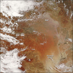
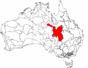
Simpson Desert
Encyclopedia
Northern Territory
The Northern Territory is a federal territory of Australia, occupying much of the centre of the mainland continent, as well as the central northern regions...
, South Australia
South Australia
South Australia is a state of Australia in the southern central part of the country. It covers some of the most arid parts of the continent; with a total land area of , it is the fourth largest of Australia's six states and two territories.South Australia shares borders with all of the mainland...
and Queensland
Queensland
Queensland is a state of Australia, occupying the north-eastern section of the mainland continent. It is bordered by the Northern Territory, South Australia and New South Wales to the west, south-west and south respectively. To the east, Queensland is bordered by the Coral Sea and Pacific Ocean...
in central Australia
Australia
Australia , officially the Commonwealth of Australia, is a country in the Southern Hemisphere comprising the mainland of the Australian continent, the island of Tasmania, and numerous smaller islands in the Indian and Pacific Oceans. It is the world's sixth-largest country by total area...
. It is the fourth largest Australian desert
Deserts of Australia
Deserts cover a large portion of the land in Australia. Most of the deserts lie in the central and north-western part of the country. The largest part of Australia is desert or semi-arid...
, with an area of 176,500 km² (68,100 sq mi).
The desert is underlain by the Great Artesian Basin
Great Artesian Basin
The Great Artesian Basin provides the only reliable source of freshwater through much of inland Australia. The basin is the largest and deepest artesian basin in the world, stretching over a total of , with temperatures measured ranging from 30°C to 100°C...
, one of the largest inland drainage areas in the world. Water from the basin rises to the surface at numerous natural springs, including Dalhousie Springs
Dalhousie Springs
Dalhousie Springs are collection of over 60 natural artesian springs located in Witjira National Park on the western fringe of the Simpson Desert, 180 kilometres northeast of Oodnadatta in northern South Australia. Spring water temperatures range from 38 to 43 degrees C. The water is highly...
, and at bores
Water well
A water well is an excavation or structure created in the ground by digging, driving, boring or drilling to access groundwater in underground aquifers. The well water is drawn by an electric submersible pump, a trash pump, a vertical turbine pump, a handpump or a mechanical pump...
drilled along stock routes, or during petroleum
Petroleum
Petroleum or crude oil is a naturally occurring, flammable liquid consisting of a complex mixture of hydrocarbons of various molecular weights and other liquid organic compounds, that are found in geologic formations beneath the Earth's surface. Petroleum is recovered mostly through oil drilling...
exploration. As a result of exploitation by such bores, the flow of water to springs has been steadily decreasing in recent years.
The Simpson Desert is an erg
Erg (landform)
An erg is a broad, flat area of desert covered with wind-swept sand with little or no vegetative cover. The term takes its name from the Arabic word ʿarq , meaning "dune field"...
which contains the world's longest parallel sand dunes. These north-south oriented dunes are static, held in position by vegetation. They vary in height from 3 metres in the west to around 30 metres on the eastern side. The largest and most famous dune, Nappanerica, or more popularly Big Red (named by Simpson Desert traveller Dennis Bartell), is 40 metres in height.
History
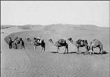
The explorer Charles SturtCharles Sturt
Captain Charles Napier Sturt was an English explorer of Australia, and part of the European Exploration of Australia. He led several expeditions into the interior of the continent, starting from both Sydney and later from Adelaide. His expeditions traced several of the westward-flowing rivers,...
, who visited the region from 1844–1846, was the first Europe
Europe
Europe is, by convention, one of the world's seven continents. Comprising the westernmost peninsula of Eurasia, Europe is generally 'divided' from Asia to its east by the watershed divides of the Ural and Caucasus Mountains, the Ural River, the Caspian and Black Seas, and the waterways connecting...
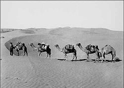
an to see the desert, but it was not until 1936 that Ted Colson became the first white person to cross it in its entirety. The name Simpson Desert was coined by Cecil Madigan
Cecil Madigan
Cecil Thomas Madigan was an Australian explorer and geologist born in Renmark, South Australia.After attending Prince Alfred College in Adelaide and the University of Adelaide, he won a Rhodes scholarship in 1911 to study geology at Magdalen College, Oxford.In 1911 he was invited by Sir Douglas...
, after Alfred Allen Simpson
Alfred Allen Simpson
This article is about the South Australian family of manufacturers. For the British legal historian and author Alfred William Brian Simpson see A. W. B...
, an Australian philanthropist, geographer, and president of the South Australian branch of the Royal Geographical Society of Australasia
Royal Geographical Society of Australasia
Royal Geographical Society of Australasia- On 22 June 1883, the Geographical Society of Australasia started at a meeting in Sydney . Branches were formed in Victoria and Queensland in the same year . In July 1885 the South Australian Branch started...
. In 2008, Belgian explorer Louis-Philippe Loncke
Louis-Philippe Loncke
Louis-Philippe Loncke, is a Belgian explorer, adventurer and motivational speaker. In 2008, he achieved the world first crossing on foot of the length of the Simpson desert, which was a North to South traverse passing through its geographical center....
became the first person to cross on foot and completely unsupported the length of the Simpson desert, which was North to South and passing through its geographical center.
In 1967, the Queensland Government established the Simpson Desert National Park
Simpson Desert National Park
Simpson Desert is the largest national park in Queensland, Australia, 1495 km west of Brisbane. The park covers an area of more than 10,00 km² in the Simpson Desert surrounding Poeppel Corner west of Birdsville and Bedourie in the southwest of the state.-Landforms:The main features of the...
.
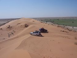
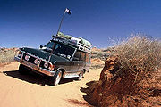
No maintained roads cross the desert. However, there are tracks that were created during seismic surveys in the search for gas and oil during the 1960s and 1970s. These include the French Line, the Rig Road, and the QAA Line. Such tracks are still navigable by well-equipped four-wheel-drive vehicles which must carry extra fuel and water. Towns providing access to the South Australian edge of the Simpson Desert include Innaminka
Innamincka, South Australia
Innamincka is a tiny settlement in north-east South Australia. It is 1065 km northeast of Adelaide and 459 km from Lyndhurst up the Strzelecki Track. It is situated on the banks of Cooper Creek in the state's Channel Country, and surrounded by the Strzelecki, Tirari and Sturt Stony...
to the south and Oodnadatta
Oodnadatta, South Australia
Oodnadatta, South Australia, is a small town surrounded by an area of with cattle stations in arid pastoral rangelands close to the Simpson Desert, north of Adelaide and 112 m above sea level. It can be reached by an unsealed road from Coober Pedy or via the unsealed Oodnadatta Track from...
to the southwest; and from the eastern (Queensland) side include Birdsville
Birdsville, Queensland
-External links:*...
, Bedourie
Bedourie, Queensland
Bedourie is a small town located in the Channel Country of western Queensland, Australia, lying on Eyre Creek. It is located 1600 kilometres west of the state capital, Brisbane, and 200 kilometres north of Birdsville. At the 2006 census, Bedourie and the surrounding area had a population of 142...
, Thargomindah
Thargomindah, Queensland
- External links:* * * *...
and Windorah
Windorah, Queensland
Windorah is one of three towns in the Barcoo in south-west Queensland, Australia. It is named after the local Aboriginal word for "Big Fish". At the 2006 census, Windorah had a population of 158....
. Last fuel on the western side is at the Mount Dare hotel and store. Before 1980, a section of the Commonwealth Railways Central Australian line
Adelaide-Darwin railway
The Adelaide–Darwin railway is a north-south transcontinental railway in Australia, between the cities of Adelaide, South Australia and Darwin, Northern Territory...
passed along the western side of the Simpson Desert.
The desert is popular with tourists, particularly in winter, and popular landmarks include the ruins and mound springs at Dalhousie Springs
Dalhousie Springs
Dalhousie Springs are collection of over 60 natural artesian springs located in Witjira National Park on the western fringe of the Simpson Desert, 180 kilometres northeast of Oodnadatta in northern South Australia. Spring water temperatures range from 38 to 43 degrees C. The water is highly...
, Purnie Bore wetlands, Approdinna Attora Knoll and Poeppel Corner (where Queensland, South Australia and Northern Territory meet). Because of the excessive heat and inadequately experienced drivers attempting to access the desert in the past, the Department of Environment and Natural Resources has decided since 2008-2009 to close the Simpson Desert during the summer — to save unprepared "adventurers" from themselves.
Some of the heaviest rain in decades occurred during 2009-2010, and has seen the Simpson Desert burst into life and colour. Rain inundated Queensland’s north-west and Gulf regions. In total, 17 million megalitres of water entered the State’s western river systems leading to Lake Eyre
Lake Eyre
Lake Eyre is the lowest point in Australia, at approximately below sea level, and, on the rare occasions that it fills, it is the largest lake in Australia and 18th largest in the world...
. In 2010, researchers uncovered the courses of ancient river systems under the desert.
Ecology
Ecoregion
An ecoregion , sometimes called a bioregion, is an ecologically and geographically defined area that is smaller than an ecozone and larger than an ecosystem. Ecoregions cover relatively large areas of land or water, and contain characteristic, geographically distinct assemblages of natural...
of the same name which consists of the Channel Country
Channel Country
The Channel Country is region of outback Australia located mostly in the state of Queensland but also in portions of South Australia, Northern Territory and New South Wales. The name comes from the numerous intertwined rivulets that cross the region, which cover 150,000 km²...
and the Simpson Strzelecki Dunefields bioregions of the Interim Biogeographic Regionalisation for Australia
Interim Biogeographic Regionalisation for Australia
The Interim Biogeographic Regionalisation for Australia is a biogeographic regionalisation of Australia developed by the Australian Government's Department of the Environment, Water, Heritage and the Arts...
(IBRA).
The flora of the Simpson Desert ecoregion is limited to drought-resistant shrubs and grasses especially Zygochloa paradoxa grass that holds the dunes together and the spinifex
Triodia (plant genus)
Triodia is a large genus of hummock-forming grass endemic to Australia; they are commonly known as spinifex, although they are not a part of the coastal genus Spinifex. There are currently 64 recognised species...
and other tough grasses of sides slopes and sandy desert floor between the dunes. The Channel Country section of the ecoregion lies to the northeast of the desert proper around the towns of Bedourie
Bedourie, Queensland
Bedourie is a small town located in the Channel Country of western Queensland, Australia, lying on Eyre Creek. It is located 1600 kilometres west of the state capital, Brisbane, and 200 kilometres north of Birdsville. At the 2006 census, Bedourie and the surrounding area had a population of 142...
and Windorah
Windorah, Queensland
Windorah is one of three towns in the Barcoo in south-west Queensland, Australia. It is named after the local Aboriginal word for "Big Fish". At the 2006 census, Windorah had a population of 158....
in Queensland
Queensland
Queensland is a state of Australia, occupying the north-eastern section of the mainland continent. It is bordered by the Northern Territory, South Australia and New South Wales to the west, south-west and south respectively. To the east, Queensland is bordered by the Coral Sea and Pacific Ocean...
, and consists of low hills covered with Mitchell grass
Astrebla
Astrebla is a small genus of xerophytic grasses endemic to Australia. They are commonly known as Mitchell Grass.Species in this genera are:*Astrebla elymoides; Hoop Mitchell Grass*Astrebla lappacea; Curly Mitchell Grass...
cut through with rivers lined with Coolabah
Eucalyptus coolabah
Eucalyptus coolabah is a eucalypt of riparian zones and is found throughout Australia from arid inland to coastal regions. The plant is commonly called coolibah or coolabah, the name being a loanword from the Indigenous Australian Yuwaaliyaay word, gulabaa.Propagation is dependent on periods of...
trees. The ecoregion also includes areas of rocky upland and seasonally wet clay and salt pans, particularly Lake Eyre, the centre of one of the largest inland drainage systems in the world, including the Georgina and Diamantina Rivers.
Wildlife adapted to this hot, dry environment and seasonal flooding includes the Water-holding Frog (Litoria platycephala) and a number of other reptiles that inhabit the desert grasses. Endemic mammals of the desert include the kowari
Kowari
The Kowari , also known as the Brush-tailed Marsupial Rat, Kayer Rat, Byrne's Crest-tailed Marsupial Rat, Bushy-tailed Marsupial Rat and Kawiri, is a small carnivorous marsupial native to the dry grasslands and deserts of central Australia...
(Dasycercus byrnei) while birds include the Grey Grasswren
Grey Grasswren
The Grey Grasswren is a species of bird in the Maluridae family.It is endemic to Australia.-References:* BirdLife International 2004. . Downloaded on 25 July 2007....
(Amytornis barbatus) and Eyrean Grasswren
Eyrean Grasswren
The Eyrean Grasswren is a species of bird in the Maluridae family.It is endemic to Australia.-References:* BirdLife International 2004. . Downloaded on 25 July 2007....
(Amytornis goyderi). Lake Eyre and the other seasonal wetlands are important habitats for fish and birds, especially as a breeding ground for waterbirds while the rivers are home to birds, bats and frogs. The seasonal wetlands of the ecoregion include Lake Eyre and the Coongie Lakes
Coongie Lakes
The Coongie Lakes form a complex and extensive freshwater wetland system in north-eastern South Australia which includes lakes, channels, billabongs, shallow floodplains, deltas, and interdune swamps. It lies on the floodplain of Cooper Creek, an ephemeral river flowing through a desert landscape...
as well as the swamps that emerge when Cooper Creek
Cooper Creek
Cooper Creek is one of the most famous and yet least visited rivers in Australia. It is sometimes known as the Barcoo River from one of its tributaries and is one of three major Queensland river systems that flow into the Lake Eyre Basin...
, Strzelecki Creek and the Diamantina River are in flood. The birds that use these wetlands include the Freckled Duck
Freckled Duck
The Freckled Duck is a moderately large, broad-bodied duck native to southern Australia. The duck is protected by law...
(Stictonetta naevosa), Musk Duck
Musk Duck
The Musk Duck is a highly aquatic, stiff-tailed duck native to southern Australia. It is the only living member of the genus Biziura. An extinct relative, the New Zealand Musk Duck or de Lautour's Duck , once occurred on New Zealand, but is only known from prehistoric subfossil bones...
(Biziura lobata), Silver Gull
Silver Gull
The Silver Gull also known simply as "seagull" in Australia, is the most common gull seen in Australia. It has been found throughout the continent, but particularly coastal areas. The South African Hartlaub's Gull and the New Zealand Red-billed Gull The Silver Gull (Chroicocephalus...
(Larus novaehollandiae), Australian Pelican
Australian Pelican
The Australian Pelican is a large water bird, widespread on the inland and coastal waters of Australia and New Guinea, also in Fiji, parts of Indonesia and as a vagrant to New Zealand.-Taxonomy:...
(Pelecanus conspicillatus), Great Egret
Great Egret
The Great Egret , also known as the Great White Egret or Common Egret, White Heron, or Great White Heron, is a large, widely-distributed egret. Distributed across most of the tropical and warmer temperate regions of the world, in southern Europe it is rather localized...
(Ardea alba), Glossy Ibis
Glossy Ibis
The Glossy Ibis is a wading bird in the ibis family Threskiornithidae.This is the most widespread ibis species, breeding in scattered sites in warm regions of Europe, Asia, Africa, Australia, and the Atlantic and Caribbean region of the Americas...
(Plegadis falcinellus), and Banded Stilt
Banded Stilt
The Banded Stilt is a nomadic stilt from Australia. It belongs to the monotypical genus Cladorhynchus. It gets its name from the red-brown breast band found on breeding adults, but this is mottled or entirely absent in non-breeding adults and juveniles. Its remaining plumage is pied and the eyes...
(Cladorhynchus leucocephalus). Finally the mound springs of the Great Artesian Basin are important habitat for a number of plants, fish, snails and other invertebrates.
Native vegetation is largely intact as the desert is uninhabitable so habitats are not threatened by agriculture but are damaged by introduced species, particularly rabbits and feral camels. The only human activitiy in the desert proper has been the construction of the gas pipelines, while the country on its fringes has been used for cattle grazing and contains towns such as Innamincka
Innamincka, South Australia
Innamincka is a tiny settlement in north-east South Australia. It is 1065 km northeast of Adelaide and 459 km from Lyndhurst up the Strzelecki Track. It is situated on the banks of Cooper Creek in the state's Channel Country, and surrounded by the Strzelecki, Tirari and Sturt Stony...
. Mound springs and other waterholes are vulnerable to overuse and damage. Protected areas of the ecoregion include the Simpson Desert
Simpson Desert National Park
Simpson Desert is the largest national park in Queensland, Australia, 1495 km west of Brisbane. The park covers an area of more than 10,00 km² in the Simpson Desert surrounding Poeppel Corner west of Birdsville and Bedourie in the southwest of the state.-Landforms:The main features of the...
, Goneaway
Goneaway National Park
Goneaway is a national park in Queensland, Australia, 1158 km west of Brisbane....
, Lochern
Lochern National Park
Lochern is a national park in Queensland, Australia, 1047 km west of Brisbane....
, Bladensburg
Bladensburg National Park
Bladensburg is a national park in Queensland, Australia, located 1152 km northwest of Brisbane, and just south of the town of Winton. The 84,900 hectares of national park were declared in 1984....
, Witjira
Witjira National Park
Witjira is a national park in South Australia , 987 km north of Adelaide. It is in the Simpson Desert, and one of the major features of the park is the Dalhousie Springs.-External links:*...
and Lake Eyre National Park
Lake Eyre National Park
Lake Eyre National Park is located in South Australia , 697 km north of Adelaide. It contains both the North and South sections of Lake Eyre as well as sections of the Tirari Desert....
s as well as the Simpson Desert Conservation Park
Simpson Desert Conservation Park
Simpson Desert Regional Reserve is located in South Australia, north of Port Augusta. In combination with Simpson Desert Regional Reserve and Witjira National Park, it forms a protected area representing one of the world's best examples of dunal desert...
, Innamincka Regional Reserve
Innamincka Regional Reserve
Innamincka Regional Reserve is located in South Australia.The 1.3 million hectares reserve was created in 1988, in particular to protect its important wetlands.It was in this area that the Burke and Wills expedition started and finished....
and Simpson Desert Regional Reserve
Simpson Desert Regional Reserve
-See also:*Simpson Desert*Simpson Desert Conservation Park*Simpson Desert Important Bird Area*Simpson Desert National Park-External links:* - Department for Environment and Heritage...
.
Morphology
Deserts of Australia
Deserts cover a large portion of the land in Australia. Most of the deserts lie in the central and north-western part of the country. The largest part of Australia is desert or semi-arid...
. Some of the ridges continue unbroken for up to 200 km. The height and the spacing between the ridges are directly related. Where there are 5-6 ridges in a kilometer, the height is around 15 meters but when there is one or two ridges per kilometer the height jumps to 35-38 meters. (Twidale, 1980) In cross section, the Lee side is the eastern slope with an incline of 34-38 degrees, while the Stoss side is the western slope with a incline of only 10-20 degrees. In cross section, the cross beds are planar with foresets alternating between east and west. The foresets have incline angles of 10-30 degrees. (Twidale, 1980)
Sediment
The sand is predominately made up of quartzQuartz
Quartz is the second-most-abundant mineral in the Earth's continental crust, after feldspar. It is made up of a continuous framework of SiO4 silicon–oxygen tetrahedra, with each oxygen being shared between two tetrahedra, giving an overall formula SiO2. There are many different varieties of quartz,...
grains. The grains are rounded and sub angular. They range size from 0.05mm to 1.2mm with 0.5mm being the average size for the crests and 0.3 being the average size on the dune flanks. The active crests have well sorted sand sediment but on the interdunes, the sediment is not as well sorted. (Twidale, 1980) The sediment varies in color from pink to brick red but by the rivers and playas the sediment color is light grey. The progression of the color from grey to red is due to the release of iron oxide
Iron oxide
Iron oxides are chemical compounds composed of iron and oxygen. All together, there are sixteen known iron oxides and oxyhydroxides.Iron oxides and oxide-hydroxides are widespread in nature, play an important role in many geological and biological processes, and are widely utilized by humans, e.g.,...
from the sediment when weathered. (Twidale, 1980)
See also
- Australasia ecozoneAustralasia ecozoneThe Australasian zone is an ecological region that is coincident, but not synonymous , with the geographic region of Australasia...
- Ecoregions of Australia
- List of deserts by area
- Simpson Desert Conservation ParkSimpson Desert Conservation ParkSimpson Desert Regional Reserve is located in South Australia, north of Port Augusta. In combination with Simpson Desert Regional Reserve and Witjira National Park, it forms a protected area representing one of the world's best examples of dunal desert...
- Simpson Desert Important Bird AreaSimpson Desert Important Bird AreaThe Simpson Desert Important Bird Area comprises some 22,848 km2 of land in the Simpson Desert region of south-western Queensland and north-eastern South Australia...
- Simpson Desert Regional ReserveSimpson Desert Regional Reserve-See also:*Simpson Desert*Simpson Desert Conservation Park*Simpson Desert Important Bird Area*Simpson Desert National Park-External links:* - Department for Environment and Heritage...
External links
- Aerial Video footage of the Simpson Desert
- Reading the Simpson Desert
- The Bibliography of Aeolian Research
- Into the Simpson Desert: audio blog at the National Museum of Australia