

Saskatchewan Highway 641
Encyclopedia
Saskatchewan Highway 641 is a highway in the province of Saskatchewan
, Canada
which begins at Highway 39
near Rouleau
, and travels north ending at Highway 15
at Semans. The highway intersects the Trans Canada Highway, Saskatchewan Highway 1
south of Pense
and east of Belle Plaine
, Highway 20
at Lumsden
, and Highway 22
at Earl Grey
. Local Improvement Districts were the precursors of rural municipalities
which initially established and maintained roads in their area. Early settlers helped to construct and maintain the route and would get paid road improvement wages from the local rural municipality
. The 8 kilometres (5 mi) concurrency
between Highway 20
and Highway 641 was constructed in 1927 following the removal of the Canadian National Railway line
between Lumsden
and Craven
. The remainder of the road followed Dominion land survey township and range lines.
and extends north 22.1 kilometres (13.7 mi) to the Trans Canada Highway Highway 1
intersection. The rural municipality
(RM) of Reburn number 130 office is located in Rouleau
and administers to a population of 245. This area is part of the Regina Plain landscape area of the Moist Mixed Grassland
ecoregion
featuring mainly cereal crops in the dark brown soils. The RM of Pense is located between the city
of Moose Jaw and the provincial capital city of Regina
. At km 24.6 Highway 641 enters the village Pense
. At km 25.4, it intersects Saskatchewan Highway 730
. Highway 730 connects to Regina, Saskatchewan east of this intersection. Lumsden is located at the km 55.9 intersection with Highway 11
in the Qu'Appelle Valley created by the Qu'Appelle River
.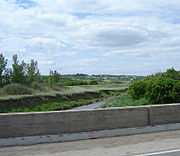 The town of Lumsden features the Lumsden Museum which is home to several restored heritage buildings. The Lumsden Trans Canada Trail Committee helped establish 20 kilometres (12.4 mi) of the Trans Canada trail. The trail has been groomed for walking, hiking, cycling, skiing, horseback riding, canoeing and snowmobiling. Craven
, the home of the Craven Country Jamboree, is located at the Highway 99
and Highway 20
junctions. Highway 641 continues north for 11.5 kilometres (7.1 mi) and then turns east 6.4 kilometres (4 mi) before again continuing northerly. This final stretch of the highway is part of the Strasbourg Plain landscape area of the Moist Mixed Grassland
ecoregion
featuring small trembling aspen (Populus tremuloides )
bluffs around the occasional slough. Earl Grey
is located at the intersection with Highway 22
. There are no localities located at the intersection with the secondary Highway 731
. Last Mountain House Provincial Park protects the heritage site of the Hudson Bay Company post Last Mountain House established in 1869. The terminus of Highway 641 is at the Saskatchewan Highway 15
intersection at Semans.
an hour or $ today a man and two horses could be employed at a rate of 65 cents an hour $ today, a horse drawn drag would earn 37.5 cents an hour $ today, and if a farmer owned a tractor, a tractor drawn drag could earn as much as 50 cents per hour $ today.
The Saskatchewan Highway Act was established in 1922, in compliance with the 1919 Canadian highway act. At the initial stages of the Saskatchewan Highway Act, 10 miles (16.1 km) of provincial highways were gravel and the rest were earth roads. The road allowances were laid out as a part of the Dominion Land survey system for homesteading. Travel along the Provincial Highway 641 before the 1940s would have been traveling on the square following the township road allowances, barbed wire fencing and the Canadian Northern rail line. As the surveyed township roads were the easiest to travel, the first highway
was designed on 90-degree, right-angle corners as the distance traversed the prairie along range roads and township roads.
There is a historical monument erected along the highway which states that the early railway was established along the east side of the Last Mountain Lake (Long Lake) in 1907, and constructed on the west side in 1911. The monument documents as well the "Lady of the Lake" sternwheeler which was used on Long Lake. Local historians clarify that the rail came to the east of the Lake in 1911, and to the west in 1912. The "Lady of the Lake" began as a sternwheeler, but was modified to a screw propeller. Also on the Lake the "S.S. Qu'Appelle", a luxurious steamer, towed a barge across the lake.
Lumsden was initially served by the Canadian National Railway CNR
, however the Canadian Pacific Railway CPR
was built through Craven in 1910. The new line brought freight to Lumsden infrequently and the elevator was torn down in 1927, and the CNR track removed the next year. The highway went through where the CNR bridge had been built. Highway 20 is marked on an early 1926 and 1955 maps, but highway 641 is unmarked - showing up as surveyed township and range roads only.
Saskatchewan
Saskatchewan is a prairie province in Canada, which has an area of . Saskatchewan is bordered on the west by Alberta, on the north by the Northwest Territories, on the east by Manitoba, and on the south by the U.S. states of Montana and North Dakota....
, Canada
Canada
Canada is a North American country consisting of ten provinces and three territories. Located in the northern part of the continent, it extends from the Atlantic Ocean in the east to the Pacific Ocean in the west, and northward into the Arctic Ocean...
which begins at Highway 39
Saskatchewan Highway 39
Highway 39 is a provincial paved undivided highway located in the southern portion of the Canadian province of Saskatchewan connecting North Portal and Moose Jaw in the north. This is a primary Saskatchewan highway maintained by the provincial and national governments providing a major trucking...
near Rouleau
Rouleau, Saskatchewan
-Location:-External links:*** Encyclopedia of Saskatchewan...
, and travels north ending at Highway 15
Saskatchewan Highway 15
Highway 15 is a highway in the Canadian province of Saskatchewan. It runs from Highway 4, 5 km south of Rosetown, to Highway 16 near Bredenbury. Highway 15 is about 444 km long. The Outlook Bridge caries Highway 15 across the South Saskatchewan River.Major communities that Highway 15 passes near...
at Semans. The highway intersects the Trans Canada Highway, Saskatchewan Highway 1
Saskatchewan Highway 1
Highway 1 is the Saskatchewan section of the Trans-Canada Highway mainland route. The total distance of the Trans-Canada Highway in Saskatchewan is . The highway traverses Saskatchewan from the western border with Alberta, from Highway 1, to Manitoba where it continues as Highway 1, PTH 1. The...
south of Pense
Pense, Saskatchewan
Pense is a village of 507 residents in the southern part of Saskatchewan, Canada. Heading west from Regina on the Trans Canada Highway, Pense is the first town with services...
and east of Belle Plaine
Belle Plaine, Saskatchewan
-See also:*Highway 642*Highway 1*Qu'Appelle River Dam*Saskferco-External links:*********...
, Highway 20
Saskatchewan Highway 20
Highway 20 is a major road intended for travel by the public between Highway 11 Lumsden to Highway 3 at Birch Hills. Saskatchewan's main roadways are located in the central/southern geographical land area of rolling prairie and grass land in a western Canadian prairie province. This highway is one...
at Lumsden
Lumsden, Saskatchewan
-History:Settlers first arrived in 1881 and the area came to be commonly known as Happy Hollow. When the Qu'Appelle, Long Lake and Saskatchewan Railway came through the community in 1889, the name was changed to Lumsden after Hugh Lumsden, a senior engineer with the railroad.The town has been...
, and Highway 22
Saskatchewan Highway 22
Highway 22 is a highway in the Canadian province of Saskatchewan connecting Highway 20 near Earl Grey to Provincial Road 478 Manitoba border near Esterhazy.-Communities along the route:*Bulyea*Earl Grey*Southey*Markinch*Cupar*Lipton*Fort San...
at Earl Grey
Earl Grey, Saskatchewan
-External links:* * *...
. Local Improvement Districts were the precursors of rural municipalities
Rural municipality
A rural municipality, often abbreviated RM, is a form of municipality in the Canadian provinces of Manitoba and Saskatchewan, perhaps best comparable to counties or townships in the western United States...
which initially established and maintained roads in their area. Early settlers helped to construct and maintain the route and would get paid road improvement wages from the local rural municipality
Rural municipality
A rural municipality, often abbreviated RM, is a form of municipality in the Canadian provinces of Manitoba and Saskatchewan, perhaps best comparable to counties or townships in the western United States...
. The 8 kilometres (5 mi) concurrency
Concurrency (road)
A concurrency, overlap, or coincidence in a road network is an instance of one physical road bearing two or more different highway, motorway, or other route numbers...
between Highway 20
Saskatchewan Highway 20
Highway 20 is a major road intended for travel by the public between Highway 11 Lumsden to Highway 3 at Birch Hills. Saskatchewan's main roadways are located in the central/southern geographical land area of rolling prairie and grass land in a western Canadian prairie province. This highway is one...
and Highway 641 was constructed in 1927 following the removal of the Canadian National Railway line
Canadian National Railway
The Canadian National Railway Company is a Canadian Class I railway headquartered in Montreal, Quebec. CN's slogan is "North America's Railroad"....
between Lumsden
Lumsden, Saskatchewan
-History:Settlers first arrived in 1881 and the area came to be commonly known as Happy Hollow. When the Qu'Appelle, Long Lake and Saskatchewan Railway came through the community in 1889, the name was changed to Lumsden after Hugh Lumsden, a senior engineer with the railroad.The town has been...
and Craven
Craven, Saskatchewan
Craven is a village in Saskatchewan. It is located northeast of Lumsden, Saskatchewan in the Qu'Appelle Valley. It lies between the rural municipalities of Longlaketon No. 219 and Lumsden No. 189....
. The remainder of the road followed Dominion land survey township and range lines.
Travel route
Highway 641 begins near RouleauRouleau, Saskatchewan
-Location:-External links:*** Encyclopedia of Saskatchewan...
and extends north 22.1 kilometres (13.7 mi) to the Trans Canada Highway Highway 1
Saskatchewan Highway 1
Highway 1 is the Saskatchewan section of the Trans-Canada Highway mainland route. The total distance of the Trans-Canada Highway in Saskatchewan is . The highway traverses Saskatchewan from the western border with Alberta, from Highway 1, to Manitoba where it continues as Highway 1, PTH 1. The...
intersection. The rural municipality
Rural municipality
A rural municipality, often abbreviated RM, is a form of municipality in the Canadian provinces of Manitoba and Saskatchewan, perhaps best comparable to counties or townships in the western United States...
(RM) of Reburn number 130 office is located in Rouleau
Rouleau, Saskatchewan
-Location:-External links:*** Encyclopedia of Saskatchewan...
and administers to a population of 245. This area is part of the Regina Plain landscape area of the Moist Mixed Grassland
Flora of Saskatchewan
The native flora of the Saskatchewan includes vascular plants, plus additional species of other plants and plant-like organisms such as algae, lichens and other fungi, and mosses...
ecoregion
Ecoregion
An ecoregion , sometimes called a bioregion, is an ecologically and geographically defined area that is smaller than an ecozone and larger than an ecosystem. Ecoregions cover relatively large areas of land or water, and contain characteristic, geographically distinct assemblages of natural...
featuring mainly cereal crops in the dark brown soils. The RM of Pense is located between the city
City
A city is a relatively large and permanent settlement. Although there is no agreement on how a city is distinguished from a town within general English language meanings, many cities have a particular administrative, legal, or historical status based on local law.For example, in the U.S...
of Moose Jaw and the provincial capital city of Regina
Regina, Saskatchewan
Regina is the capital city of the Canadian province of Saskatchewan. The city is the second-largest in the province and a cultural and commercial centre for southern Saskatchewan. It is governed by Regina City Council. Regina is the cathedral city of the Roman Catholic and Romanian Orthodox...
. At km 24.6 Highway 641 enters the village Pense
Pense, Saskatchewan
Pense is a village of 507 residents in the southern part of Saskatchewan, Canada. Heading west from Regina on the Trans Canada Highway, Pense is the first town with services...
. At km 25.4, it intersects Saskatchewan Highway 730
Saskatchewan Highway 730
Highway 730 is a highway in the Canadian province of Saskatchewan. It runs from Highway 641 until Regina, where it becomes Dewdney Avenue. Highway 730 is about 18 km long....
. Highway 730 connects to Regina, Saskatchewan east of this intersection. Lumsden is located at the km 55.9 intersection with Highway 11
Saskatchewan Highway 11
Highway 11 is a major north-south highway in Saskatchewan, Canada that connects the province's three largest cities: Regina, Saskatoon and Prince Albert. It is a structural pavement major arterial highway which is approximately long. It is also known as the Louis Riel Trail after the 19th century...
in the Qu'Appelle Valley created by the Qu'Appelle River
Qu'Appelle River
The Qu'Appelle River is a Canadian river that flows 430 km east from Lake Diefenbaker in southwestern Saskatchewan to join the Assiniboine River in Manitoba, just south of Lake of the Prairies, near the village of St. Lazare....
.
Craven, Saskatchewan
Craven is a village in Saskatchewan. It is located northeast of Lumsden, Saskatchewan in the Qu'Appelle Valley. It lies between the rural municipalities of Longlaketon No. 219 and Lumsden No. 189....
, the home of the Craven Country Jamboree, is located at the Highway 99
Saskatchewan Highway 99
Highway 99 is a highway in the Canadian province of Saskatchewan. It runs from Highway 20 near Craven to Highway 6 near Fairy Hill. Highway 99 is about 22 km long.According to MapArt, Highway 99 is entirely unpaved....
and Highway 20
Saskatchewan Highway 20
Highway 20 is a major road intended for travel by the public between Highway 11 Lumsden to Highway 3 at Birch Hills. Saskatchewan's main roadways are located in the central/southern geographical land area of rolling prairie and grass land in a western Canadian prairie province. This highway is one...
junctions. Highway 641 continues north for 11.5 kilometres (7.1 mi) and then turns east 6.4 kilometres (4 mi) before again continuing northerly. This final stretch of the highway is part of the Strasbourg Plain landscape area of the Moist Mixed Grassland
Flora of Saskatchewan
The native flora of the Saskatchewan includes vascular plants, plus additional species of other plants and plant-like organisms such as algae, lichens and other fungi, and mosses...
ecoregion
Ecoregion
An ecoregion , sometimes called a bioregion, is an ecologically and geographically defined area that is smaller than an ecozone and larger than an ecosystem. Ecoregions cover relatively large areas of land or water, and contain characteristic, geographically distinct assemblages of natural...
featuring small trembling aspen (Populus tremuloides )
Populus tremuloides
Populus tremuloides is a deciduous tree native to cooler areas of North America, commonly called quaking aspen, trembling aspen, American aspen, and Quakies,. The trees have tall trunks, up to 25 metres, with smooth pale bark, scarred with black. The glossy green leaves, dull beneath, become golden...
bluffs around the occasional slough. Earl Grey
Earl Grey, Saskatchewan
-External links:* * *...
is located at the intersection with Highway 22
Saskatchewan Highway 22
Highway 22 is a highway in the Canadian province of Saskatchewan connecting Highway 20 near Earl Grey to Provincial Road 478 Manitoba border near Esterhazy.-Communities along the route:*Bulyea*Earl Grey*Southey*Markinch*Cupar*Lipton*Fort San...
. There are no localities located at the intersection with the secondary Highway 731
Saskatchewan Highway 731
Highway 731 is a highway in the Canadian province of Saskatchewan. It runs from Highway 20 near Strasbourg to Highway 310 near Ituna. Highway 731 is about 118 km long.-History:...
. Last Mountain House Provincial Park protects the heritage site of the Hudson Bay Company post Last Mountain House established in 1869. The terminus of Highway 641 is at the Saskatchewan Highway 15
Saskatchewan Highway 15
Highway 15 is a highway in the Canadian province of Saskatchewan. It runs from Highway 4, 5 km south of Rosetown, to Highway 16 near Bredenbury. Highway 15 is about 444 km long. The Outlook Bridge caries Highway 15 across the South Saskatchewan River.Major communities that Highway 15 passes near...
intersection at Semans.
History
Between 1897 and 1909, municipal administration affairs were handled by Local Improvement District (LID) Number 165. The LID changed its boundaries on December 13, 1909, and on January 1, 1913, the LID was renamed Pense No. 160. During the 1940s work was undertaken on paving roadways, a man could earn 35 centsCanadian dollar
The Canadian dollar is the currency of Canada. As of 2007, the Canadian dollar is the 7th most traded currency in the world. It is abbreviated with the dollar sign $, or C$ to distinguish it from other dollar-denominated currencies...
an hour or $ today a man and two horses could be employed at a rate of 65 cents an hour $ today, a horse drawn drag would earn 37.5 cents an hour $ today, and if a farmer owned a tractor, a tractor drawn drag could earn as much as 50 cents per hour $ today.
The Saskatchewan Highway Act was established in 1922, in compliance with the 1919 Canadian highway act. At the initial stages of the Saskatchewan Highway Act, 10 miles (16.1 km) of provincial highways were gravel and the rest were earth roads. The road allowances were laid out as a part of the Dominion Land survey system for homesteading. Travel along the Provincial Highway 641 before the 1940s would have been traveling on the square following the township road allowances, barbed wire fencing and the Canadian Northern rail line. As the surveyed township roads were the easiest to travel, the first highway
Roads in Saskatchewan
Saskatchewan, the middle of Canada's three prairie provinces, has an area of and population of 990,212 , mostly living in the southern half of the province....
was designed on 90-degree, right-angle corners as the distance traversed the prairie along range roads and township roads.
There is a historical monument erected along the highway which states that the early railway was established along the east side of the Last Mountain Lake (Long Lake) in 1907, and constructed on the west side in 1911. The monument documents as well the "Lady of the Lake" sternwheeler which was used on Long Lake. Local historians clarify that the rail came to the east of the Lake in 1911, and to the west in 1912. The "Lady of the Lake" began as a sternwheeler, but was modified to a screw propeller. Also on the Lake the "S.S. Qu'Appelle", a luxurious steamer, towed a barge across the lake.
Lumsden was initially served by the Canadian National Railway CNR
Canadian National Railway
The Canadian National Railway Company is a Canadian Class I railway headquartered in Montreal, Quebec. CN's slogan is "North America's Railroad"....
, however the Canadian Pacific Railway CPR
Canadian Pacific Railway
The Canadian Pacific Railway , formerly also known as CP Rail between 1968 and 1996, is a historic Canadian Class I railway founded in 1881 and now operated by Canadian Pacific Railway Limited, which began operations as legal owner in a corporate restructuring in 2001...
was built through Craven in 1910. The new line brought freight to Lumsden infrequently and the elevator was torn down in 1927, and the CNR track removed the next year. The highway went through where the CNR bridge had been built. Highway 20 is marked on an early 1926 and 1955 maps, but highway 641 is unmarked - showing up as surveyed township and range roads only.