
Royal Hotel
Encyclopedia


Australia
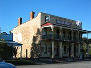
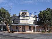
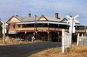
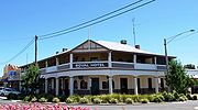
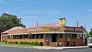
Royal Hotel is a common name for hotels in AustraliaAustralia
Australia , officially the Commonwealth of Australia, is a country in the Southern Hemisphere comprising the mainland of the Australian continent, the island of Tasmania, and numerous smaller islands in the Indian and Pacific Oceans. It is the world's sixth-largest country by total area...
. This name reflects the historical links of Australia
Australia
Australia , officially the Commonwealth of Australia, is a country in the Southern Hemisphere comprising the mainland of the Australian continent, the island of Tasmania, and numerous smaller islands in the Indian and Pacific Oceans. It is the world's sixth-largest country by total area...
to England
England
England is a country that is part of the United Kingdom. It shares land borders with Scotland to the north and Wales to the west; the Irish Sea is to the north west, the Celtic Sea to the south west, with the North Sea to the east and the English Channel to the south separating it from continental...
and the British Royal Family
British Royal Family
The British Royal Family is the group of close relatives of the monarch of the United Kingdom. The term is also commonly applied to the same group of people as the relations of the monarch in her or his role as sovereign of any of the other Commonwealth realms, thus sometimes at variance with...
. There is also a Royal Hotel in Monrovia
Monrovia
Monrovia is the capital city of the West African nation of Liberia. Located on the Atlantic Coast at Cape Mesurado, it lies geographically within Montserrado County, but is administered separately...
, Liberia
Liberia
Liberia , officially the Republic of Liberia, is a country in West Africa. It is bordered by Sierra Leone on the west, Guinea on the north and Côte d'Ivoire on the east. Liberia's coastline is composed of mostly mangrove forests while the more sparsely populated inland consists of forests that open...
.
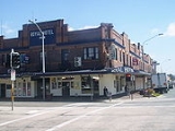
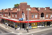
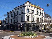
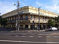
SydneySydneySydney is the most populous city in Australia and the state capital of New South Wales. Sydney is located on Australia's south-east coast of the Tasman Sea. As of June 2010, the greater metropolitan area had an approximate population of 4.6 million people...
- BondiBondi, New South WalesBondi is an eastern suburb of Sydney, in the state of New South Wales, Australia. Bondi is located seven kilometres east of the Sydney central business district, in the local government area of Waverley Council. The postcode is 2026.-Location:...
- CarltonCarlton, New South WalesCarlton is a suburb in southern Sydney, in the state of New South Wales, Australia. Carlton is located 15 kilometres south of the Sydney central business district and is part of the St George area. Carlton lies across the boundary of two local government areas, the Municipality of Kogarah and the...
- DarlingtonDarlington, New South WalesDarlington is a small, inner-city suburb of Sydney, in the state of New South Wales, Australia. Darlington is located about 3 kilometres south of the Sydney central business district and is part of the local government area of the City of Sydney and is part of the region of the Inner...
- GranvilleGranville, New South WalesGranville, is a suburb in western Sydney, Australia. Granville is located west of the Sydney central business district, in the local government area of the City of Parramatta. A small part in the north-west is located in the Local Government Area of the City of Holroyd.South Granville is a...
- PaddingtonPaddington, New South WalesPaddington is an inner-city, eastern suburb of Sydney, in the state of New South Wales, Australia. Paddington is located 3 kilometres east of the Sydney central business district and lies across the local government areas of the City of Sydney and the Municipality of Woollahra...
- RandwickRandwick, New South WalesRandwick is a suburb in south-eastern Sydney, in the state of New South Wales, Australia. Randwick is located 6 kilometres south-east of the Sydney central business district and is the administrative centre for the local government area of the City of Randwick...
- RydeRyde, New South WalesRyde is a suburb of Sydney, New South Wales, Australia. Ryde is located 13 km north-west of the Sydney central business district and 8 km east of Parramatta. Ryde is the administrative centre of the local government area of the City of Ryde and part of the Northern Suburbs area...
- SutherlandSutherland, New South WalesSutherland is a suburb in southern Sydney, in the state of New South Wales, Australia. Sutherland is located 26 kilometres south of the Sydney central business district and is the administrative centre for the local government area of the Sutherland Shire....
Regional NSW
- AdelongAdelong, New South WalesAdelong is a small town in the Riverina region of New South Wales, Australia and is a part of the Tumut Shire. The Adelong district has a population of about 1400, while Adelong itself has a population of 829 people....
- ArmidaleArmidale, New South WalesArmidale is a city in the Northern Tablelands, New South Wales, Australia. Armidale Dumaresq Shire had a population of 19,485 people according to the 2006 census. It is the administrative centre for the Northern Tablelands region...
- BerriganBerrigan, New South WalesBerrigan is a town located on the Riverina Highway in the Riverina region of New South Wales, Australia. Berrigan is in the Berrigan Shire Local Government Area and is the location of the Berrigan Shire Council offices...
- BinnawayBinnaway, New South WalesBinnaway is a small town located on the Castlereagh River in central New South Wales near the larger centre of Coonabarabran, which is about 35 kilometres to the north. In 2006, the town had a population of 495 people. The road linking these two towns closely follows the meandering Castlereagh River...
- BowralBowral, New South Wales-Attractions:Bowral is perhaps the best known of the towns and villages of the Southern Highlands, and in recent years has become the commercial centre of the Wingecarribee Shire. Bowral is known for its boutiques, antique stores, gourmet restaurants, and rich coffee culture.Bowral is home to the...
- BrewarrinaBrewarrina, New South WalesBrewarrina is a small town in North West New South Wales, Australia on the banks of the Barwon River in Brewarrina Shire. It is 98 km east of Bourke and west of Walgett on the Kamilaroi Highway, and 808 km from Sydney. Brewarrina has had its population decrease from 1,197 persons in...
- BungendoreBungendore, New South WalesBungendore is a town in the Southern Tablelands of New South Wales, Australia, in Palerang Council. It is on the Kings Highway near Lake George, the Molonglo River Valley and the Australian Capital Territory border. It has become a major tourist centre in recent years, popular with visitors from...
- CanowindraCanowindra, New South WalesCanowindra is an historic township located near Cowra in the central west of New South Wales, Australia in Cabonne Shire. Canowindra is on the Belubula River. The curving main street, Gaskill Street, is partly an urban conservation area. At the 2006 census, Canowindra had a population of 1,499...
- CondobolinCondobolin, New South WalesCondobolin is a town in the west of the Central West region of New South Wales, Australia, on the Lachlan River. At the 2006 census, Condobolin had a population of 2,847.- History :...
- CorowaCorowa, New South WalesCorowa is a town in the state of New South Wales in Australia. It is on the bank of the Murray River, the border between New South Wales and Victoria, opposite the Victorian town of Wahgunyah. Corowa is the administrative centre of Corowa Shire...
- DenmanDenman, New South WalesDenman is a small rural town in New South Wales, Australia, in Muswellbrook Shire. The town is located on the Golden Highway in the Upper Hunter Valley region, about 250 km north of Sydney...
- DungogDungog, New South WalesDungog is a country town on the Williams River in the upper Hunter Valley in New South Wales, Australia. Located in the middle of dairy and timber country, it is the centre of the Dungog Shire Local Government Area and at the 2006 census it had a population of 2,102 people. The area includes the...
- EustonEuston, New South WalesEuston is a small town on the banks of the Murray River, southern New South Wales, Australia in Balranald Shire. The twin town of Robinvale is on the other side of the river in the state of Victoria. At the 2006 census, Euston had a population of 462 people. Until the irrigation development at...
- Grong GrongGrong Grong, New South WalesGrong Grong is a small town in New South Wales, Australia on the Newell Highway, east of Narrandera in Narrandera Shire. At the 2006 census, Grong Grong had a population of 537 people....
Built 1923 - GuyraGuyra, New South Wales-References:...
- GundarooGundaroo, New South WalesGundaroo is a small village in the Southern Tablelands of New South Wales, Australia and in Yass Valley Council. It is situated to the east of the Yass River, about north of Sutton, about west of the Lake George range. At the 2006 census, Gundaroo had a population of 331.The explorers Charles...
- Built 1865, - ManduramaMandurama, New South WalesMandurama is a village in the Blayney Shire, New South Wales, Australia. The site of the village and surrounding areas was home to the Wiradjuri people prior to settlement, and the name "Mandurama" is derived from their word for 'water holes'...
- MerriwaMerriwa, New South WalesMerriwa is a town in the far west of the Hunter Valley in New South Wales, Australia, in Upper Hunter Shire. It is located on the Golden Highway, 273 kilometres northwest of Sydney and about half way between Newcastle and Dubbo...
- MirroolMirrool, New South WalesMirrool is a small village community at the very northern edge of the Riverina region of New South Wales, Australia. It is situated by road, about 16 kilometres east from Beckom and 19 kilometres west from Ariah Park...
- Built 1913-1916, opened 1917 - MoreeMoree, New South WalesMoree is a large town in Moree Plains Shire in northern New South Wales, Australia. It is located on the banks of the Mehi River in the centre of the rich black-soil plains....
- OrangeOrange, New South WalesOrange is a city in the Central West region of New South Wales, Australia. It is west of the state capital, Sydney, at an altitude of . Orange has an estimated population of 39,329 and the city is a major provincial centre....
- QueanbeyanQueanbeyan, New South WalesQueanbeyan is a regional centre in the Southern Tablelands in south-eastern New South Wales adjacent to the Australian Capital Territory. The city's mixed economy is based on light construction, high technology, manufacturing, service, retail and agriculture. It is the council seat of the...
- Built 1926 - QuirindiQuirindi, New South WalesQuirindi is a small town on the North West Slopes region of New South Wales, Australia, in Liverpool Plains Shire Local Government Area ....
- SconeScone, New South WalesScone is a town in the Upper Hunter Shire in the Hunter Valley region of New South Wales, Australia. At the 2006 census, Scone had a population of 4,624 people. It is located on the New England Highway north of Muswellbrook about 270 kilometres north of Sydney, and is part of the Hunter and Upper...
- SofalaSofala, New South WalesSofala is a village located approximately 250 km north-west of Sydney, New South Wales, within Bathurst Regional Council. It is located beside the Turon River. Sofala is just off the Bathurst-Ilford Road, with only local traffic through the town itself...
- Spring RidgeSpring Ridge, New South Wales-Transport:It is served by a station on the Binnaway- Werris Creek railway line.-Maps:*...
- SpringwoodSpringwood, New South WalesSpringwood is a town in the Blue Mountains, New South Wales, Australia. Springwood is located 72 kilometres west of Sydney in the local government area of the City of Blue Mountains. At the 2006 census, Springwood had a population of 8,210 people. It is largely Anglo-Celtic.Springwood is near the...
- South GraftonGrafton, New South WalesThe city of Grafton is the commercial hub of the Clarence River Valley. Established in 1851, Grafton features many historic buildings and tree-lined streets. Located approximately 630 kilometres north of Sydney and 340 km south of Brisbane, Grafton and the Clarence Valley can be reached...
- Tambar SpringsTambar Springs, New South WalesTambar Springs is a town in the North West Slopes region of New South Wales, Australia. The town is in the Gunnedah Shire Council Local Government area, north west of the state capital, Sydney. At the 2006 census, Tambar Springs and the surrounding area had a population of 201.Tambar Springs was...
- TareeTaree, New South WalesTaree is a city on the Mid North Coast, New South Wales, Australia. Taree and nearby Cundletown were settled in 1831 by William Wynter. Since then Taree has grown to a population of around 20,000 people and is the centre of a significant agricultural district. It is 16 km from the sea coast,...
- TinghaTingha, New South WalesTingha is a small town on the Northern Tablelands, New South Wales, Australia in Guyra Shire. It is 30 kilometres south of Inverell and 629 kilometres north-north-east of Sydney. Tingha is an Aboriginal word for ‘flat or level'.-History:...
- Warialda, New South WalesWarialda, New South WalesWarialda is a town in the Northwest Slopes region of New South Wales, Australia, in Gwydir Shire. Situated on the banks of the Warialda Creek, the town’s name means “Place of Wild Honey.” At the 2006 census, Warialda had a population of 1,206.- Transport :...
- Wee WaaWee Waa, New South WalesWee Waa is a town with a population of 1,689 people located on the north-western slopes of the New England region in New South Wales, Australia. The town is within Narrabri Shire local government area and is on the Namoi River. Wee Waa is 41 m north-west of Narrabri and 571 km...
- WeethalleWeethalleWeethalle is a town in the Central West region of New South Wales, Australia. The town is the Bland Shire Local government area and on the Mid-Western Highway, west of the state capital, Sydney, and north east of Griffith. At the 2006 census, Weethalle and the surrounding area had a population...
- West WyalongWest Wyalong, New South WalesWest Wyalong is a town in New South Wales, Australia which is the main town of the Bland Shire, located in the Central West region of New South Wales. It is located 467 km west of Sydney. It is located on the crossroads of the Newell Highway between Melbourne and Brisbane, and the Mid-Western...
- Built 1921 - YassYass, New South WalesYass is a town in the Southern Tablelands of New South Wales, Australia in Yass Valley Shire. The name appears to have been derived from an Aboriginal word, "Yarrh" , said to mean 'running water'....
- Built 1849
South Australia
- BalaklavaBalaklava, South AustraliaThe town of Balaklava is located in South Australia, 92 kilometres north of Adelaide in the Mid North region. It is on the banks of the Wakefield River, 25 kilometres east of Port Wakefield.-History:...
- Crystal BrookCrystal Brook, South AustraliaCrystal Brook is a town in South Australia, named after the spring-fed creek next to which it was founded. It is north of Adelaide and in 2006 had a population of 1,185.Crystal Brook is situated on Goyder's Line near the border of two climate systems...
- Kent TownKent Town, South AustraliaKent Town is an inner urban suburb of Adelaide, South Australia. It is located in the City of Norwood Payneham & St Peters.-History:The suburb was named after Dr Benjamin Archer Kent, who established a farm and flour mill on which the suburb now stands.....
- MoontaMoonta, South AustraliaMoonta is a town located on the Yorke Peninsula of South Australia, 165 kilometres north-northwest of the state capital of Adelaide. It is one of three towns known as the Copper Coast or "Little Cornwall" for their shared copper mining history....
- TorrensvilleTorrensville, South AustraliaTorrensville is a middle-class suburb, two kilometres west of the centre of Adelaide, South Australia. It was named after Irish-born colonial premier Robert Torrens....
Melbourne
- Clifton HillClifton Hill, VictoriaClifton Hill is a suburb of Melbourne, Victoria, Australia, 4 km north-east from Melbourne's central business district. The border between Clifton Hill and Fitzroy North is Queens Parade and Smith Street. Merri Creek defines the eastern border of Clifton Hill. Its Local Government Area is...
- EssendonEssendon, VictoriaEssendon is a suburb in Melbourne, Victoria, Australia, 10 km north-west from Melbourne's central business district. Its Local Government Area is the City of Moonee Valley...
- FootscrayFootscray, VictoriaFootscray is a suburb 5 km west of Melbourne, Victoria, Australia. Its Local Government Area is the City of Maribyrnong. At the 2006 Census, Footscray had a population of 11,401....
- RichmondRichmond, VictoriaRichmond is a suburb in Melbourne, Victoria, Australia, 3 km south-east from Melbourne's central business district. Its Local Government Area is the City of Yarra...
Regional Victoria
- Bacchus MarshBacchus Marsh, VictoriaBacchus Marsh is an urban centre and suburban locality in Victoria, Australia located approximately west of Melbourne and west of Melton. The population of the urban area is estimated at over 17,000 people, while the central locality is home to 5,566 people...
- BenallaBenalla, VictoriaBenalla is a city of just over 9,000 people located just off the Hume Freeway in north-eastern Victoria, Australia, about southwest of Wangaratta. Its Local Government Area is the Rural City of Benalla.- Overview :...
- DaylesfordDaylesford, VictoriaDaylesford is a town located in the Shire of Hepburn, Victoria, Australia. It is a former goldmining town about 115 kilometres north-west of Melbourne, in the foothills of the Great Dividing Range. At the 2006 census, Daylesford had a population of 3,073...
- DrouinDrouin, VictoriaDrouin is a major service town, located in West Gippsland, east of Melbourne. Its local government area is the Shire of Baw Baw. The town is supposedly named after a Frenchman who invented a chlorination process for the extraction of ore or an Aboriginal word meaning "north wind". New estate...
- DunollyDunolly, VictoriaDunolly is a town in Victoria, Australia, located on the Dunolly - Maryborough Road, in the Shire of Central Goldfields. At the 2006 census, Dunolly had a population of 969....
- HorshamHorsham, VictoriaHorsham is the largest city by population and regional centre of the Wimmera region of Victoria, Australia and is approximately north-west of Melbourne via the Western Highway. At the 2006 census, Horsham had a population of 14,125. Horsham is in the federal Division of Mallee...
- InglewoodInglewood, VictoriaInglewood is a town in Victoria, Australia, located on the Calder Highway, in the Shire of Loddon. At the 2006 census, Inglewood had a population of 834...
- KerangKerang, VictoriaKerang is a rural town on the Loddon River in northern Victoria in Australia. It is the commercial centre to an irrigation district based on livestock, horticulture, lucerne and grain. It is located north-west of Melbourne on the Murray Valley Highway a few kilometres north of its intersection...
- Koo Wee RupKoo Wee Rup, VictoriaKoo Wee Rup is a town in Victoria, Australia, 63 km south-east from Melbourne's central business district. Its Local Government Area is the Shire of Cardinia...
- KoondrookKoondrook, VictoriaKoondrook is a town situated on the Murray River, Victoria, Australia. The town is located in the Shire of Gannawarra Local government area, north west of the state capital, Melbourne. At the 2006 census, Koondrook had a population of 802.-History:...
- LochLoch, VictoriaLoch is a town in the South Gippsland region of Victoria, Australia which was established in 1876. The town was named in honour of the Governor of Victoria, Henry Loch....
- MeredithMeredith, VictoriaMeredith is a town in Victoria, Australia, located on the Midland Highway between Ballarat and Geelong.Meredith Post Office opened on 1 November 1854 and the railway came to the town with the opening of the Geelong-Ballarat line in 1862, with the local railway station opened soon after. Now only...
- MorningtonMornington, VictoriaMornington is a sea side town on the Mornington Peninsula, Victoria, Australia, located 57 km south-east of Melbourne's central business district. It is in the Local Government Area of the Shire of Mornington Peninsula....
- PortlandPortland, VictoriaThe city of Portland is the oldest European settlement in what is now the state of Victoria, Australia. It is the main urban centre of the Shire of Glenelg. It is located on Portland Bay.-History:...
- QueenscliffQueenscliff, VictoriaQueenscliff is a small town on the Bellarine Peninsula in southern Victoria, Australia, south of Swan Bay at the entrance to Port Phillip. It is the administrative centre for the Borough of Queenscliffe...
- RainbowRainbow, VictoriaRainbow is a town in north west Victoria, Australia, kilometres from Melbourne. The town is in the Shire of Hindmarsh and the nearest large towns are Warracknabeal, Dimboola and Nhill, all to the south...
- SunburySunbury, VictoriaSunbury is a regional city, located north-west of Melbourne's central business district, in the state of Victoria, Australia. Its Local Government Area is the City of Hume. At the 2006 Census, Sunbury had a population of 31,000...
- Sea LakeSea Lake, VictoriaSea Lake is a town in the Mallee district of north-west Victoria, Australia and is situated on the southern shores of Lake Tyrrell. The town is located on the Calder Highway, north-west of Melbourne, and west of Swan Hill. Sea Lake is in the heart of Australia's "wheat belt", and is the main...
- SeymourSeymour, VictoriaSeymour is a township in the Shire of Mitchell in the state of Victoria, Australia and is located north of Melbourne. At the 2006 census, Seymour had a population of 6,063...
- Snake ValleySnake Valley, VictoriaSnake Valley is a town in central Western Victoria, Australia, on Carngham-Linton Road, west of Ballarat and west of Melbourne, in the Shire of Pyrenees. At the 2006 census, Snake Valley had a population of 329. A post office was opened on 1 March 1859....
- WarrnamboolWarrnambool, Victoria-Cityscape:The original City of Warrnambool was a 4x8 grid, with boundaries of Lava Street , Japan Street , Merri Street and Henna Street . In the nineteenth century, it was intended that Fairy Street – with its proximity to the Warrnambool Railway Station – would be the main street of...
- Wentworth
Queensland
- InghamIngham, QueenslandIngham is a town in the Great Green Way region of North Queensland, Australia. The town was founded in 1864, gazetted a shire in 1879, and is the service centre for many sugarcane plantations, pioneered in the 1870s by William Ingham, for whom the town is named...
- Inglewood, QueenslandInglewood, QueenslandInglewood is a town situated on the southern Darling Downs in Queensland, Australia, south-west of Toowoomba. Inglewood is the second largest town in the Goondiwindi Region as well as being part of the Border Rivers region of waterways.-History:...
- Longreach
- MundubberaMundubbera, QueenslandMundubbera is a town in the Wide Bay-Burnett region of Queensland, Australia. The town is located on the Burnett Highway, north west of the state capital, Brisbane and west of the regional centre, Bundaberg. Mundubbera is built on the bank on the Burnett River...
- West End, TownsvilleWest End, Queensland (Townsville)West End is an old suburb of Townsville, Queensland, situated at the base of Castle Hill. The first community cemetery is located in West End. A reflection of attitudes existing during the time it was in use, research has established that it was ethnically segregated...