
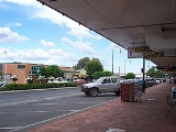
Quirindi, New South Wales
Encyclopedia
New South Wales
New South Wales is a state of :Australia, located in the east of the country. It is bordered by Queensland, Victoria and South Australia to the north, south and west respectively. To the east, the state is bordered by the Tasman Sea, which forms part of the Pacific Ocean. New South Wales...
, Australia
Australia
Australia , officially the Commonwealth of Australia, is a country in the Southern Hemisphere comprising the mainland of the Australian continent, the island of Tasmania, and numerous smaller islands in the Indian and Pacific Oceans. It is the world's sixth-largest country by total area...
, in Liverpool Plains Shire Local Government Area (LGA).
At the 2006 census
Census in Australia
The Australian census is administered once every five years by the Australian Bureau of Statistics. The most recent census was conducted on 9 August 2011; the next will be conducted in 2016. Prior to the introduction of regular censuses in 1961, they had also been run in 1901, 1911, 1921, 1933,...
, Quirindi had a population of 2,609. It is known as the Gateway to the North West — being the nearest link to Gunnedah
Gunnedah, New South Wales
Gunnedah is a town and Local government area in north-eastern New South Wales, Australia. 7,542 people lived in the town of Gunnedah in 2006, including 931 indigenous people ....
to the west and Tamworth
Tamworth, New South Wales
Tamworth is a city in the New England region of New South Wales, Australia. Straddling the Peel River, Tamworth, which contains an estimated population of 47,595 people, is the major regional centre for southern New England and in the local government area of Tamworth Regional Council. The city...
to the North. The local economy is based on agriculture, with broadacre farming dominant on the black soil plains to the west and livestock grazing in the hilly eastern part of the district.
The town is on the Kamilaroi Highway
Kamilaroi Highway
Kamilaroi Highway is a state highway in New South Wales. It has been given the national route number 37. Its status as a highway is fairly new....
15 kilometres (9.3 mi) northwest of its junction with the New England Highway
New England Highway
The New England Highway is a highway in Australia running from Hexham near Newcastle at its southern end to Yarraman near Toowoomba at its northern end. At its southern end it connects to the Pacific Highway and at its northern end it connects to the D'Aguilar Highway. It traverses the Hunter...
at Willow Tree
Willow Tree, New South Wales
Willow Tree is a village composed of about 169 people, located in New South Wales, Australia. It is situated in the Liverpool Plains, 14 kilometers south of Quirindi near the junction of the Kamilaroi and New England Highways. The town itself is small but the farms extend southwest out to the...
.
History
The IndigenousIndigenous Australians
Indigenous Australians are the original inhabitants of the Australian continent and nearby islands. The Aboriginal Indigenous Australians migrated from the Indian continent around 75,000 to 100,000 years ago....
Kamilaroi
Kamilaroi
The Kamilaroi or Gamilaraay are an Indigenous Australian people who are from the area between Tamworth and Goondiwindi, and west to Narrabri, Walgett and Lightning Ridge, in northern New South Wales...
people lived in the area for many thousands of years. The name Quirindi comes from the Gamilaraay language
Gamilaraay language
The Gamilaraay or Kamilaroi language is a Pama–Nyungan language of the Wiradhuric subgroup found mostly in South East Australia. It was the traditional language of the Kamilaroi people, but is now moribund—according to Ethnologue, there were only 3 speakers left in 1997...
, with a number of meanings having been attributed it. These include ‘nest in the hills’, ‘place where fish breed’, ‘place of many possums’ and ‘dead tree on mountain top’. Early spelling of the name included ‘Cuerindi’ and ‘Kuwherindi’.
Quirindi Post Office opened on 1 January 1858.
Sport
Quirindi has excellent sporting facilities, with several sporting ovals catering for athletics, cricket, both codes of rugby, soccer, basketball and netball. Other sporting complexes include the racecourse, better known as “The RandwickRandwick Racecourse
Royal Randwick Racecourse is a racecourse for horseracing in the Eastern Suburbs in Sydney, New South Wales. Randwick Racecourse, is operated by the Australian Jockey Club and known to many Sydney racegoers as headquarters...
of the North”, polo grounds, rodeo
Rodeo
Rodeo is a competitive sport which arose out of the working practices of cattle herding in Spain, Mexico, and later the United States, Canada, South America and Australia. It was based on the skills required of the working vaqueros and later, cowboys, in what today is the western United States,...
, campdrafting
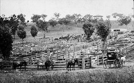
Campdrafting
Campdrafting is a unique and very popular Australian sport involving a horse and rider working cattle. The riding style is like that of Western riding and the event is somewhat related to the American events such as cutting, working cow horse, team penning, and ranch sorting.In the competition, a...
, a 9 hole Golf Course, two Tennis Clubs, three Bowling greens, gun club and swimming complex.
A motorcycle club is located 5 kilometres (3.1 mi) north-east of Quirindi on the Borah Creek Road. The track, named Stu Johnson Park, is well-maintained 1.2 kilometre (0.745647283979768 mi) of black rich soil with plenty of woops, berms and table tops to cater for every motorcross class.
Quirindi annual events
- Quirindi Rural Heritage Festival- 1st weekend in May
- Quirindi Show- September
- Prime Stock Show/ Hook and Hoof- August
- ANZAC DayANZAC DayAnzac Day is a national day of remembrance in Australia and New Zealand, commemorated by both countries on 25 April every year to honour the members of the Australian and New Zealand Army Corps who fought at Gallipoli in the Ottoman Empire during World War I. It now more broadly commemorates all...
Services- Dawn Service and Day time Service 25th of April
Monthly events
- Quota Markets- 2nd Saturday of each month
- Quirindi Motorcycle Club Meet- Last week of month
- Quirindi Jockey Club Race Day- Monthly
- Quirindi Miniature Railway- Fourth Sunday of every month at the Quirindi Rural Heritage Museum.
Surrounding towns
Werris CreekWerris Creek, New South Wales
Werris Creek is a small town in New South Wales, Australia, near Tamworth, in Liverpool Plains Shire. It is north of Quirindi and is at the junction of the Main North railway line to Armidale and Moree. At the 2006 census, Werris Creek had a population of 1,490.-History:The area is thought to...
is 20 kilometres (12.4 mi) north of Quirindi, following the path of the explorer Thomas Mitchell.
Wallabadah is located 15 kilometres (9.3 mi) east of Quirindi on the New England Highway
New England Highway
The New England Highway is a highway in Australia running from Hexham near Newcastle at its southern end to Yarraman near Toowoomba at its northern end. At its southern end it connects to the Pacific Highway and at its northern end it connects to the D'Aguilar Highway. It traverses the Hunter...
.
Spring Ridge
Spring Ridge, New South Wales
-Transport:It is served by a station on the Binnaway- Werris Creek railway line.-Maps:*...
is about 50 kilometres (31.1 mi) west of Quirindi. It has a shop and pub
Australian pubs
A public house in Australia is an establishment performing many functions, often serving alcoholic beverages, meals, and providing basic accommodation.-Origin:...
, as well as a state forest. Spring Ridge has vast black soil plains and is a rich agricultural area. North of the village is Goran Lake.
Railway station
Quirindi is located on the Main North railway lineMain North railway line, New South Wales
The Main North Line is a major railway in New South Wales, Australia. It runs through the Central Coast, Hunter and the New England regions. The line was the original main line between Sydney and Brisbane, however this required a change of gauge at Wallangarra...
, 392 kilometres (243.6 mi) from Sydney. The station opened in 1877,
and continues to be served by daily rail services operated by a Countrylink
CountryLink
CountryLink is the operator of passenger rail services in country New South Wales, Australia and into Queensland and Victoria. It is an operating brand of the Rail Corporation New South Wales, a government-owned entity...
Xplorer train to and from Sydney
Sydney
Sydney is the most populous city in Australia and the state capital of New South Wales. Sydney is located on Australia's south-east coast of the Tasman Sea. As of June 2010, the greater metropolitan area had an approximate population of 4.6 million people...
and Armidale
Armidale, New South Wales
Armidale is a city in the Northern Tablelands, New South Wales, Australia. Armidale Dumaresq Shire had a population of 19,485 people according to the 2006 census. It is the administrative centre for the Northern Tablelands region...
/Moree
Moree, New South Wales
Moree is a large town in Moree Plains Shire in northern New South Wales, Australia. It is located on the banks of the Mehi River in the centre of the rich black-soil plains....
.