

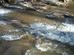
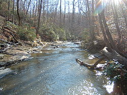
Quantico Creek
Encyclopedia
Tributary
A tributary or affluent is a stream or river that flows into a main stem river or a lake. A tributary does not flow directly into a sea or ocean...
of the Potomac River
Potomac River
The Potomac River flows into the Chesapeake Bay, located along the mid-Atlantic coast of the United States. The river is approximately long, with a drainage area of about 14,700 square miles...
in eastern Prince William County
Prince William County, Virginia
-National protected areas:* Featherstone National Wildlife Refuge* Manassas National Battlefield Park* Occoquan Bay National Wildlife Refuge* Prince William Forest Park-Government and politics:...
, Virginia
Virginia
The Commonwealth of Virginia , is a U.S. state on the Atlantic Coast of the Southern United States. Virginia is nicknamed the "Old Dominion" and sometimes the "Mother of Presidents" after the eight U.S. presidents born there...
. Quantico Creek rises southeast of Independent Hill
Independent Hill, Virginia
Independent Hill is an unincorporated town in Prince William County, Virginia. It is located along State Route 234 at the intersection with Joplin Road. The only visible remaining businesses seem to be Samsky's Market and Crosby's Crab Company. In early 2006, a realignment of 234 bypassed the...
, flows through Prince William Forest Park
Prince William Forest Park
Prince William Forest Park was established as Chopawamsic Recreational Demonstration Area in 1936 and is located in southeastern Prince William County, Virginia, adjacent to the Marine Corps Base Quantico. The park is the largest protected natural area in the Washington, D.C. metropolitan region at...
and Dumfries
Dumfries, Virginia
Dumfries is a town in Prince William County, Virginia, United States. The population was 4,937 at the 2000 census.-Geography:Dumfries is located at ....
and empties into the Potomac at Possum Point
Possum Point
Possum Point is a small peninsula in Northern Virginia that juts out into Quantico Creek and separates it from the Potomac River. It lies in a suburban area of Washington D.C.Dominion Virginia Power operates a power plant on the point...
.
History
Doeg (tribe)
The Doeg were a Native American tribe who lived in northern Virginia. They spoke an Algonquian language and may have been a branch of the Nanticoke tribe, historically based on the Eastern Shore of Maryland. The Nanticoke considered the Algonquian Lenape as "grandfathers"...
Indian community Pamacocack on the banks of this creek, as well as on the directly opposite (Maryland
Maryland
Maryland is a U.S. state located in the Mid Atlantic region of the United States, bordering Virginia, West Virginia, and the District of Columbia to its south and west; Pennsylvania to its north; and Delaware to its east...
) side of the Potomac. This is thought to be a likely candidate for the place Henry Spelman
Henry Spelman of Jamestown
Henry Spelman was an English adventurer, soldier, and author, the son of Erasmus Spelman and nephew to Sir Henry Spelman of Congham . The younger Henry Spelman was born in 1595, and left his home in Norfolk, England at age 14 to sail to Virginia Colony aboard the ship "Unity", as a part of the...
was found living among the natives, which he reported was named "Nacottawtanke, but by our english cald [sic] Camocacocke". Early land patents spell the name of the creek variously as Quancico (1654), Quanticotte (1654, 1658), Quantecot (1657), Quanticoke (1664), Quonticutt (1665), and Quanticutt (1665).
In 1690, settler Richard Gibson erected a gristmill
Gristmill
The terms gristmill or grist mill can refer either to a building in which grain is ground into flour, or to the grinding mechanism itself.- Early history :...
on Quantico Creek near what is now the town of Dumfries
Dumfries, Virginia
Dumfries is a town in Prince William County, Virginia, United States. The population was 4,937 at the 2000 census.-Geography:Dumfries is located at ....
. Scottish
Scotland
Scotland is a country that is part of the United Kingdom. Occupying the northern third of the island of Great Britain, it shares a border with England to the south and is bounded by the North Sea to the east, the Atlantic Ocean to the north and west, and the North Channel and Irish Sea to the...
settlers then established a settlement and port on the estuary
Estuary
An estuary is a partly enclosed coastal body of water with one or more rivers or streams flowing into it, and with a free connection to the open sea....
of Quantico Creek downstream after the bars to Virginia's profitable tobacco
Tobacco
Tobacco is an agricultural product processed from the leaves of plants in the genus Nicotiana. It can be consumed, used as a pesticide and, in the form of nicotine tartrate, used in some medicines...
trade were lifted by the Navigation Law
Navigation Acts
The English Navigation Acts were a series of laws that restricted the use of foreign shipping for trade between England and its colonies, a process which had started in 1651. Their goal was to force colonial development into lines favorable to England, and stop direct colonial trade with the...
of 1707. West of that port, the land was quickly cleared of its timber and was planted with crops such as cotton
Cotton
Cotton is a soft, fluffy staple fiber that grows in a boll, or protective capsule, around the seeds of cotton plants of the genus Gossypium. The fiber is almost pure cellulose. The botanical purpose of cotton fiber is to aid in seed dispersal....
and tobacco. These cash crop
Cash crop
In agriculture, a cash crop is a crop which is grown for profit.The term is used to differentiate from subsistence crops, which are those fed to the producer's own livestock or grown as food for the producer's family...
s were harvested and shipped out through the port of Dumfries at the head of the Quantico harbor. A customhouse and warehouse followed in 1731, and many others cropped up along the estuary by 1732. The growth of tobacco caused the area around the creek to erode
Erosion
Erosion is when materials are removed from the surface and changed into something else. It only works by hydraulic actions and transport of solids in the natural environment, and leads to the deposition of these materials elsewhere...
, and the creek was filled with silt
Silt
Silt is granular material of a size somewhere between sand and clay whose mineral origin is quartz and feldspar. Silt may occur as a soil or as suspended sediment in a surface water body...
.
The mid-19th century saw the development of some mining operations along the creek, consisting of the Greenwood Gold Mine, located at the headwaters of the North Branch near Independent Hill
Independent Hill, Virginia
Independent Hill is an unincorporated town in Prince William County, Virginia. It is located along State Route 234 at the intersection with Joplin Road. The only visible remaining businesses seem to be Samsky's Market and Crosby's Crab Company. In early 2006, a realignment of 234 bypassed the...
, and the Cabin Branch Pyrite Mine, located about 1 mile west of Dumfries
Dumfries, Virginia
Dumfries is a town in Prince William County, Virginia, United States. The population was 4,937 at the 2000 census.-Geography:Dumfries is located at ....
and now within the Park.
Both mines were significant sources of pollution on the creek. The pyrite
Pyrite
The mineral pyrite, or iron pyrite, is an iron sulfide with the formula FeS2. This mineral's metallic luster and pale-to-normal, brass-yellow hue have earned it the nickname fool's gold because of its resemblance to gold...
mine was a source of sulfuric acid
Sulfuric acid
Sulfuric acid is a strong mineral acid with the molecular formula . Its historical name is oil of vitriol. Pure sulfuric acid is a highly corrosive, colorless, viscous liquid. The salts of sulfuric acid are called sulfates...
, formed from the natural breakdown of pyrite, while mercury
Mercury (element)
Mercury is a chemical element with the symbol Hg and atomic number 80. It is also known as quicksilver or hydrargyrum...
was used extensively in the gold
Gold
Gold is a chemical element with the symbol Au and an atomic number of 79. Gold is a dense, soft, shiny, malleable and ductile metal. Pure gold has a bright yellow color and luster traditionally considered attractive, which it maintains without oxidizing in air or water. Chemically, gold is a...
extraction process. At one point, the water in the creek was nearly as acidic as vinegar
Vinegar
Vinegar is a liquid substance consisting mainly of acetic acid and water, the acetic acid being produced through the fermentation of ethanol by acetic acid bacteria. Commercial vinegar is produced either by fast or slow fermentation processes. Slow methods generally are used with traditional...
. Both mines have since undergone significant reclamation to restore the creek and its surroundings to an acceptable state of health, especially within the park.
Today, the creek is not navigable because of silting in. Most of its watershed lies in Prince William Forest Park
Prince William Forest Park
Prince William Forest Park was established as Chopawamsic Recreational Demonstration Area in 1936 and is located in southeastern Prince William County, Virginia, adjacent to the Marine Corps Base Quantico. The park is the largest protected natural area in the Washington, D.C. metropolitan region at...
and the town of Dumfries. The mines are no longer in operation. A power plant on Possum Point
Possum Point
Possum Point is a small peninsula in Northern Virginia that juts out into Quantico Creek and separates it from the Potomac River. It lies in a suburban area of Washington D.C.Dominion Virginia Power operates a power plant on the point...
uses the water from the creek to cool itself.
Communities
Several communities, some extinct, lie near Quantico Creek. Communities are listed from the Quantico's source to its mouth on the Potomac.- Independent HillIndependent Hill, VirginiaIndependent Hill is an unincorporated town in Prince William County, Virginia. It is located along State Route 234 at the intersection with Joplin Road. The only visible remaining businesses seem to be Samsky's Market and Crosby's Crab Company. In early 2006, a realignment of 234 bypassed the...
- Hickory RidgeHickory Ridge, VirginiaHickory Ridge is an extinct unincorporated town in Prince William County, Virginia. The town was located on land that is now part of Prince William Forest Park, a National Park Service property located adjacent to Marine Corps Base Quantico...
(extinct) - Batestown (extinct)
- TriangleTriangle, VirginiaTriangle is a census-designated place in Prince William County, Virginia, United States. The population was 5,500 at the 2000 census. It is bounded to the south by the Quantico Marine Corps Base, which surrounds the town of Quantico. It is bounded to the north and west by the town of Dumfries...
- DumfriesDumfries, VirginiaDumfries is a town in Prince William County, Virginia, United States. The population was 4,937 at the 2000 census.-Geography:Dumfries is located at ....
- QuanticoQuantico, Virginia- Demographics :As of the census of 2000, there are 561 people, 295 households, and 107 families living in the town. The population density is . There are 359 housing units at an average density of .-Racial composition:...
, site of the Marine Corps Base QuanticoMarine Corps Base QuanticoMarine Corps Base Quantico, sometimes abbreviated MCB Quantico, is a major United States Marine Corps training base located near Triangle, Virginia, covering nearly in southern Prince William County, northern Stafford County, and southeastern Fauquier County...