

Ports to Plains Corridor
Encyclopedia
Highway
A highway is any public road. In American English, the term is common and almost always designates major roads. In British English, the term designates any road open to the public. Any interconnected set of highways can be variously referred to as a "highway system", a "highway network", or a...
corridor between the United States Mexico border at Laredo, Texas
Laredo, Texas
Laredo is the county seat of Webb County, Texas, United States, located on the north bank of the Rio Grande in South Texas, across from Nuevo Laredo, Tamaulipas, Mexico. According to the 2010 census, the city population was 236,091 making it the 3rd largest on the United States-Mexican border,...
and Denver, Colorado
Denver, Colorado
The City and County of Denver is the capital and the most populous city of the U.S. state of Colorado. Denver is a consolidated city-county, located in the South Platte River Valley on the western edge of the High Plains just east of the Front Range of the Rocky Mountains...
. The reason for proposed improvements to this corridor is to expedite the transportation of goods and services
International trade
International trade is the exchange of capital, goods, and services across international borders or territories. In most countries, such trade represents a significant share of gross domestic product...
from Mexico
Mexico
The United Mexican States , commonly known as Mexico , is a federal constitutional republic in North America. It is bordered on the north by the United States; on the south and west by the Pacific Ocean; on the southeast by Guatemala, Belize, and the Caribbean Sea; and on the east by the Gulf of...
in the United States
United States
The United States of America is a federal constitutional republic comprising fifty states and a federal district...
and vice versa. The Ports-To-Plains Corridor starts in South Texas
South Texas
South Texas is a region of the U.S. state of Texas that lies roughly south of and including San Antonio. The southern and western boundary is the Rio Grande River, and to the east it is the Gulf of Mexico. The population of this region is about 3.7 million. The southern portion of this region is...
and traverses through Texas
Texas
Texas is the second largest U.S. state by both area and population, and the largest state by area in the contiguous United States.The name, based on the Caddo word "Tejas" meaning "friends" or "allies", was applied by the Spanish to the Caddo themselves and to the region of their settlement in...
, New Mexico
New Mexico
New Mexico is a state located in the southwest and western regions of the United States. New Mexico is also usually considered one of the Mountain States. With a population density of 16 per square mile, New Mexico is the sixth-most sparsely inhabited U.S...
, Oklahoma
Oklahoma
Oklahoma is a state located in the South Central region of the United States of America. With an estimated 3,751,351 residents as of the 2010 census and a land area of 68,667 square miles , Oklahoma is the 28th most populous and 20th-largest state...
, and ends in Colorado
Colorado
Colorado is a U.S. state that encompasses much of the Rocky Mountains as well as the northeastern portion of the Colorado Plateau and the western edge of the Great Plains...
.
The Intermodal Surface Transportation Efficiency Act
Intermodal Surface Transportation Efficiency Act
The Intermodal Surface Transportation Efficiency Act of 1991 is a United States federal law that posed a major change to transportation planning and policy, as the first U.S. federal legislation on the subject in the post-Interstate Highway System era...
of 1991 made the Ports-to-Plains Corridor a National Highway System "High-priority corridor" known as Corridor 38. The High-priority designation, which applies to 80 routes or groups of routes nationally, does not create any additional design requirements and does not have a separate Federal funding source.
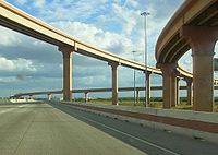
Present status
, the Ports-to-Plains Corridor starts as a Six-lane Interstate in Laredo, TexasLaredo, Texas
Laredo is the county seat of Webb County, Texas, United States, located on the north bank of the Rio Grande in South Texas, across from Nuevo Laredo, Tamaulipas, Mexico. According to the 2010 census, the city population was 236,091 making it the 3rd largest on the United States-Mexican border,...
. North of Laredo, the route takes the Texas portion of United States Highway 83, a two-lane highway, until Carrizo Springs, Texas
Carrizo Springs, Texas
Carrizo Springs is a city in and the county seat of Dimmit County, Texas, United States. The population was 5,655 at the 2000 census.The name of the town comes from the local springs, which were named by the Spanish for the cane grass that once grew around them. It is the oldest town in Dimmit...
. Out of Carizzo Springs, the route follows United States Highway 277 through Eagle Pass
Eagle Pass, Texas
Eagle Pass is a city in and the county seat of Maverick County The population was 27,183 as of the 2010 census.Eagle Pass borders the city of Piedras Negras, Coahuila, Mexico, which is to the southwest and across the Rio Grande. The Eagle Pass-Piedras Negras Metropolitan Area is one of six...
, Del Rio
Del Rio, Texas
Del Rio is a border city in and the county seat of Val Verde County, Texas, United States.. Del Rio is connected with Ciudad Acuña via the Lake Amistad Dam International Crossing and Del Río-Ciudad Acuña International Bridge...
, Sonora
Sonora, Texas
Sonora is the county seat of Sutton County, Texas, United States. The population was 2,924 at the 2000 census.Former State Senator and Lieutenant Governor Bill Ratliff of Mount Pleasant was reared in Sonora and graduated from high school there.-Geography and climate:Sonora is located at ...
, and San Angelo, Texas
San Angelo, Texas
San Angelo is a city in the state of Texas. Located in West Central Texas it is the county seat of Tom Green County. As of 2010 according to the United States Census Bureau, the city had a total population of 93,200...
. North of San Angelo, the route follows United States Highway 87, a four-lane highway, through Big Spring
Big Spring, Texas
Big Spring is a city in and the county seat of Howard County, Texas, United States, at the crossroads of U.S. Highway 87 and Interstate 20. With a population of 25,233 at the 2000 census, it is the largest city between Midland to the west, Abilene to the east, Lubbock to the north, and San Angelo...
and Lamesa
Lamesa, Texas
Lamesa is a city in and the county seat of Dawson County, Texas, United States. The population was 9,952 at the 2000 census. Located south of Lubbock on the Llano Estacado, Lamesa was founded in 1903. Most of the economy is based on cattle ranching and cotton farming. The Preston E...
and finally to Lubbock
Lubbock, Texas
Lubbock is a city in and the county seat of Lubbock County, Texas, United States. The city is located in the northwestern part of the state, a region known historically as the Llano Estacado, and the home of Texas Tech University and Lubbock Christian University...
(An alternate route passes through Midland
Midland, Texas
Midland is a city in and the county seat of Midland County, Texas, United States, on the Southern Plains of the state's western area. A small portion of the city extends into Martin County. As of 2010, the population of Midland was 111,147. It is the principal city of the Midland, Texas...
and Odessa
Odessa, Texas
Odessa is a city in and the county seat of Ector County, Texas, United States. It is located primarily in Ector County, although a small portion of the city extends into Midland County. Odessa's population was 99,940 at the 2010 census. It is the principal city of the Odessa, Texas Metropolitan...
instead of Big Spring.)
North of Lubbock, the route follows Interstate 27
Interstate 27
Interstate 27 is an intrastate Interstate Highway, located entirely in the U.S. state of Texas, running north from Lubbock to Interstate 40 in Amarillo. These two cities are the only control cities on I-27; other cities and towns served by I-27 include New Deal, Abernathy, Hale Center, Plainview,...
to Amarillo
Amarillo, Texas
Amarillo is the 14th-largest city, by population, in the state of Texas, the largest in the Texas Panhandle, and the seat of Potter County. A portion of the city extends into Randall County. The population was 190,695 at the 2010 census...
. North of Amarillo, the route is again marked as U.S. 87 and returns to 4-lane highway. At Dumas, Texas
Dumas, Texas
Dumas is a city in Moore County, Texas, United States. The population was 13,747 at the 2000 census. It is the county seat of Moore County. Located approximately fifty miles north of Amarillo, the city is named for...
, a spur of the route extends northwest to Raton, New Mexico
Raton, New Mexico
Raton is a city in Colfax County, New Mexico, United States. The population was 7,282 at the 2000 census. It is the county seat of Colfax County. The city is located just south of Raton Pass.-Name:...
, alternating between 2 and 4 lane state highways.
Continuing north from Dumas, Texas, the main route continues at U.S. 87, until north of the city of Stratford, Texas
Stratford, Texas
Stratford is a city in Sherman County, Texas, United States. The population was 1,991 at the 2000 census. It is the county seat of Sherman County...
. At the Oklahoma/Texas border, the route changes to United States Highway 287.
It passes through Boise City, Oklahoma
Boise City, Oklahoma
Boise City is a city in and the county seat of Cimarron County, Oklahoma, United States. The population was 1,266 at the 2010 census.'Boise' rhymes with 'voice'...
, in the western panhandle.
Continuing north, the route follows U.S. 287 through Springfield
Springfield, Colorado
The historic town of Springfield is a Statutory Town that is the county seat and most populous town of Baca County, Colorado, United States. The population was 1,562 at the 2000 census. The town was named for Springfield, Missouri, the origin of early settlers to the town...
, Lamar
Lamar, Colorado
The City of Lamar is a Home Rule Municipality that is the county seat and the most populous city of Prowers County, Colorado, United States. The city population was 8,869 at the U.S...
, and Kit Carson
Kit Carson, Colorado
The historic Town of Kit Carson is a Statutory Town in Cheyenne County, Colorado, United States. The population was 253 at the 2000 census.-Geography:Kit Carson is located at ....
. North of Kit Carson, the route follows US 40 to Limon, Colorado
Limon, Colorado
Limon is a Statutory Town that is the most populous town in Lincoln County, Colorado, United States immediately east of Elbert County. The population was 2,071 at the 2000 census. Limon has been called the "Hub City" of Eastern Colorado because Interstate 70, U.S. Highways 24, 40, and 287, and...
, where it joins Interstate 70
Interstate 70
Interstate 70 is an Interstate Highway in the United States that runs from Interstate 15 near Cove Fort, Utah, to a Park and Ride near Baltimore, Maryland. It was the first Interstate Highway project in the United States. I-70 approximately traces the path of U.S. Route 40 east of the Rocky...
for the final leg into Denver, Colorado
Denver, Colorado
The City and County of Denver is the capital and the most populous city of the U.S. state of Colorado. Denver is a consolidated city-county, located in the South Platte River Valley on the western edge of the High Plains just east of the Front Range of the Rocky Mountains...
.
The cities of Laredo, Eagle Pass, and Del Rio are each located on the U.S./Mexico Border and are gateways to trade between the two countries.