

Pennsylvania Route 741
Encyclopedia
Pennsylvania Route 741 is a 26 miles (41.8 km) long state highway
that runs through western and southern Lancaster County
in the U.S. state
of Pennsylvania
. The eastern terminus is at Pennsylvania Route 41
in Gap
. The western terminus is at Pennsylvania Route 722
in East Petersburg
.
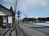 PA 741 begins at an intersection with PA 722
in East Petersburg
, Lancaster County
, heading to the south on two-lane undivided Lemon Street. The road passes homes prior to crossing into East Hempfield Township
, where it becomes Rohrerstown Road and continues through industrial parks. PA 741 gains a center left-turn lane as it reaches an interchange with PA 283
at which point it crosses the Little Conestoga Creek
into Manheim Township
. The route becomes two lanes again and turns east prior to turning southwest and crossing the Little Conestoga Creek back into East Hempfield Township. At this point, PA 741 becomes McGovernsville Road and comes to a bridge over Norfolk Southern's Lititz Secondary and Amtrak
's Philadelphia to Harrisburg Main Line
. The road passes a mix of homes and woods as it comes to the Harrisburg Pike intersection, where it makes a turn to the south onto Rohrerstown Road, a three lane road with a center left-turn lane. PA 741 passes homes to the west and a branch of Lancaster General Hospital
to the east prior to coming to the US 30
interchange. In the area of the interchange, PA 741 is briefly a divided highway
. Following US 30, the route becomes a two-lane undivided road and passes residences prior to crossing Norfolk Southern's Columbia Secondary and entering the residential and commercial community of Rohrerstown. Here, PA 741 crosses PA 23
. After leaving Rohrerstown, the road passes a mix of farms and businesses prior to an intersection with PA 462
.
After this intersection, PA 741 enters Manor Township
and becomes Millersville Road, passing farm fields to the west and suburban residential neighborhoods to the east. Farther south, the road enters areas of woods and homes, making a turn to the southeast. The road briefly forms the border between Manor Township to the southwest and Millersville
to the northeast prior to fully entering Millersville and crossing PA 999
, at which point the road passes businesses. Following this intersection, PA 741 passes through farmland before passing a few homes. At the Wabank Road intersection, the road enters Lancaster Township
and passes a mix of homes and farms before crossing the Conestoga River
. At this point, PA 741 continues into Pequea Township
and passes through agricultural areas prior to entering the residential community of New Danville
. Here, the route intersects PA 324
and forms a concurrency
with that route, heading south on Marticville Road out of New Danville. PA 741 splits from PA 324 by heading east on Long Lane, passing more farmland and crossing into West Lampeter Township
.
Upon reaching the community of Willow Street
, PA 741 widens into a two-lane divided highway and meets the southbound direction of US 222/PA 272
and forms a concurrency with southbound US 222 at this point, entering commercial areas. A short distance later, the road intersects the northbound direction of US 222/PA 272, at which point PA 741 becomes concurrent with both directions of US 222. The two routes continue east on Beaver Valley Pike, passing farms to the north and commercial development to the south. The road becomes undivided and passes agricultural areas and homes before PA 741 splits from US 222 by continuing east on Village Road. The route continues through a mix of farms and residences as it passes the community of Lampeter
. After crossing the Pequea Creek
, PA 741 enters Strasburg Township
and turns to the southeast. Upon crossing into Strasburg
, the route heads east-northeast onto Miller Street and passes several homes. At the Strasburg Pike intersection, PA 741 heads east onto West Main Street and comes to the center of Strasburg. The route continue past more homes on East Main Street prior to crossing into Strasburg Township and meeting PA 896
.
At this point, PA 741 continues east on Gap Road into commercial areas. The route crosses the Strasburg Rail Road
and passes between the Strasburg Rail Road station to the north and the Railroad Museum of Pennsylvania
to the south. The road continues into open farmland and crosses into Paradise Township
at the Paradise Lane intersection, becoming Strasburg Road. The road heads through more rural areas as it comes into Salisbury Township
, at which point PA 741 enters wooded areas with Amtrak's Philadelphia to Harrisburg Main Line parallel to the north of the road and homes to the south of the road. As the road enters the community of Gap
, it, along with the railroad line, make a sharp turn to the south. PA 741 turns east onto Bridge Street to cross over the Amtrak line prior to reaching its eastern terminus at PA 41
.
in New Danville. In 1985, it was moved to its present location at PA 722 in East Petersburg.
The route's intersection with US 30 was briefly seen in the 1985 film Witness
starring Harrison Ford
.
State highway
State highway, state road or state route can refer to one of three related concepts, two of them related to a state or provincial government in a country that is divided into states or provinces :#A...
that runs through western and southern Lancaster County
Lancaster County, Pennsylvania
Lancaster County, known as the Garden Spot of America or Pennsylvania Dutch Country, is a county located in the southeastern part of the Commonwealth of Pennsylvania, in the United States. As of 2010 the population was 519,445. Lancaster County forms the Lancaster Metropolitan Statistical Area, the...
in the U.S. state
U.S. state
A U.S. state is any one of the 50 federated states of the United States of America that share sovereignty with the federal government. Because of this shared sovereignty, an American is a citizen both of the federal entity and of his or her state of domicile. Four states use the official title of...
of Pennsylvania
Pennsylvania
The Commonwealth of Pennsylvania is a U.S. state that is located in the Northeastern and Mid-Atlantic regions of the United States. The state borders Delaware and Maryland to the south, West Virginia to the southwest, Ohio to the west, New York and Ontario, Canada, to the north, and New Jersey to...
. The eastern terminus is at Pennsylvania Route 41
Pennsylvania Route 41
Pennsylvania Route 41 is a major long state highway located in southeastern Pennsylvania. The southern terminus of the route is at the Delaware state line in New Garden Township, where it continues as Delaware Route 41. The northern terminus is at U.S...
in Gap
Gap, Pennsylvania
Gap is a census-designated place and town in Salisbury Township, Lancaster County, Pennsylvania with a zip code of 17527. The population was 1,611 at the 2000 census...
. The western terminus is at Pennsylvania Route 722
Pennsylvania Route 722
Pennsylvania Route 722 is an long, east–west state highway located in central Lancaster County, Pennsylvania. The eastern terminus is at PA 272 in Oregon...
in East Petersburg
East Petersburg, Pennsylvania
East Petersburg is a borough in Lancaster County, Pennsylvania, United States. The population was 4,450 at the 2000 census.-Geography:East Petersburg is located at ....
.
Route description
Pennsylvania Route 722
Pennsylvania Route 722 is an long, east–west state highway located in central Lancaster County, Pennsylvania. The eastern terminus is at PA 272 in Oregon...
in East Petersburg
East Petersburg, Pennsylvania
East Petersburg is a borough in Lancaster County, Pennsylvania, United States. The population was 4,450 at the 2000 census.-Geography:East Petersburg is located at ....
, Lancaster County
Lancaster County, Pennsylvania
Lancaster County, known as the Garden Spot of America or Pennsylvania Dutch Country, is a county located in the southeastern part of the Commonwealth of Pennsylvania, in the United States. As of 2010 the population was 519,445. Lancaster County forms the Lancaster Metropolitan Statistical Area, the...
, heading to the south on two-lane undivided Lemon Street. The road passes homes prior to crossing into East Hempfield Township
East Hempfield Township, Pennsylvania
East Hempfield Township is a township in west-central Lancaster County, Pennsylvania, United States. At the 2000 census the population was 21,399....
, where it becomes Rohrerstown Road and continues through industrial parks. PA 741 gains a center left-turn lane as it reaches an interchange with PA 283
Pennsylvania Route 283
Pennsylvania Route 283 is a long state highway in the U.S. state of Pennsylvania. It connects Harrisburg to Lancaster as a freeway, paralleling the old U.S. Route 230...
at which point it crosses the Little Conestoga Creek
Little Conestoga Creek
The Little Conestoga Creek is a tributary of the Conestoga River in Pennsylvania. The Landis Mill Covered Bridge crosses the creek.The name of the creek comes from the Susquehannock Kanestoge, meaning "at the place of the immersed pole". This was the name of the principal Susquehannock...
into Manheim Township
Manheim Township, Lancaster County, Pennsylvania
Manheim Township is a township in Lancaster County, Pennsylvania established in 1729, which southernmost border meets the city limits of Lancaster. The population as of the 2000 census was 33,697.-Government:...
. The route becomes two lanes again and turns east prior to turning southwest and crossing the Little Conestoga Creek back into East Hempfield Township. At this point, PA 741 becomes McGovernsville Road and comes to a bridge over Norfolk Southern's Lititz Secondary and Amtrak
Amtrak
The National Railroad Passenger Corporation, doing business as Amtrak , is a government-owned corporation that was organized on May 1, 1971, to provide intercity passenger train service in the United States. "Amtrak" is a portmanteau of the words "America" and "track". It is headquartered at Union...
's Philadelphia to Harrisburg Main Line
Philadelphia to Harrisburg Main Line
The Philadelphia to Harrisburg Main Line is an electrified rail line owned and operated by Amtrak in the U.S. state of Pennsylvania. The line runs from Zoo Interlocking in Philadelphia, where it meets the Northeast Corridor, west to Harrisburg , where electrification ends, along the former...
. The road passes a mix of homes and woods as it comes to the Harrisburg Pike intersection, where it makes a turn to the south onto Rohrerstown Road, a three lane road with a center left-turn lane. PA 741 passes homes to the west and a branch of Lancaster General Hospital
Lancaster General Hospital
Lancaster General Hospital is a hospital in Lancaster, Pennsylvania. Founded in 1893 in a small home on Queen Street, its headquarters are still located in Lancaster.-External Links:...
to the east prior to coming to the US 30
U.S. Route 30 in Pennsylvania
In the U.S. state of Pennsylvania, U.S. Route 30 runs east–west across the southern part of the state, passing through Pittsburgh and Philadelphia on its way from the West Virginia state line east to the Benjamin Franklin Bridge over the Delaware River into New Jersey...
interchange. In the area of the interchange, PA 741 is briefly a divided highway
Divided Highway
Divided Highway is a compilation album by American rock band The Doobie Brothers, released in 2003. . All tracks are taken from the albums Cycles and Brotherhood .-Track listing:...
. Following US 30, the route becomes a two-lane undivided road and passes residences prior to crossing Norfolk Southern's Columbia Secondary and entering the residential and commercial community of Rohrerstown. Here, PA 741 crosses PA 23
Pennsylvania Route 23
Pennsylvania Route 23 is a state highway in southeastern Pennsylvania. The route begins at Pennsylvania Route 441 in Marietta and heads east to U.S. Route 1 in Philadelphia.-Marietta to Valley Forge:...
. After leaving Rohrerstown, the road passes a mix of farms and businesses prior to an intersection with PA 462
Pennsylvania Route 462
Pennsylvania Route 462 is a long east–west running local route in central Pennsylvania. The western terminus is west of York. The eastern terminus is east of Lancaster. At both ends, PA 462 terminates at U.S. Route 30, and all of the route was signed as U.S. Route 30 before a freeway was...
.
After this intersection, PA 741 enters Manor Township
Manor Township, Lancaster County, Pennsylvania
Manor Township is a township in west central Lancaster County, Pennsylvania, United States. Manor Township takes its name from the Manor of Conestoga, which was originally surveyed and reserved for William Penn in 1719. It was changed to its present form in 1759...
and becomes Millersville Road, passing farm fields to the west and suburban residential neighborhoods to the east. Farther south, the road enters areas of woods and homes, making a turn to the southeast. The road briefly forms the border between Manor Township to the southwest and Millersville
Millersville, Pennsylvania
Millersville is a borough in Lancaster County, Pennsylvania, United States. At the 2000 census the population was 7,774.-Geography:Millersville is located at ....
to the northeast prior to fully entering Millersville and crossing PA 999
Pennsylvania Route 999
Pennsylvania Route 999 is a long, east–west state highway located in western Lancaster County, Pennsylvania. The western terminus is at PA 441, which has its southern terminus at this intersection, in Washington Boro. The eastern terminus is at PA 462 in Lancaster. It is the highest numbered...
, at which point the road passes businesses. Following this intersection, PA 741 passes through farmland before passing a few homes. At the Wabank Road intersection, the road enters Lancaster Township
Lancaster Township, Lancaster County, Pennsylvania
Lancaster Township is a civil township of Lancaster County, Pennsylvania, in the United States. It is in the central area and it immediately surrounds Lancaster City...
and passes a mix of homes and farms before crossing the Conestoga River
Conestoga River
The Conestoga River, also referred to as Conestoga Creek, is a tributary of the Susquehanna River flowing through the center of Lancaster County, Pennsylvania.-Geography:...
. At this point, PA 741 continues into Pequea Township
Pequea Township, Pennsylvania
Pequea Township is a township in central Lancaster County, Pennsylvania, United States. The population was 4,358 at the 2000 census. The community was named for the Piqua tribe.-Geography:...
and passes through agricultural areas prior to entering the residential community of New Danville
New Danville, Pennsylvania
New Danville, Pennsylvania is an unincorporated community located in Pequea Township in Lancaster County, Pennsylvania....
. Here, the route intersects PA 324
Pennsylvania Route 324
Pennsylvania Route 324 is a long state highway located in the western part of Lancaster County, Pennsylvania. The southern terminus is at River Road in Martic Township. The northern terminus is at US 222/PA 272 in Lancaster...
and forms a concurrency
Concurrency (road)
A concurrency, overlap, or coincidence in a road network is an instance of one physical road bearing two or more different highway, motorway, or other route numbers...
with that route, heading south on Marticville Road out of New Danville. PA 741 splits from PA 324 by heading east on Long Lane, passing more farmland and crossing into West Lampeter Township
West Lampeter Township, Pennsylvania
West Lampeter Township is a township in central Lancaster County, Pennsylvania, United States. The population was 13,145 at the 2000 census.- Geography :...
.
Upon reaching the community of Willow Street
Willow Street, Pennsylvania
Willow Street is a census-designated place in Lancaster County, Pennsylvania, United States. The population was 7,258 at the 2000 census. In the early part of the 20th century the main thoroughfare in town was lined with Willow trees on both sides for the length of the town. The community received...
, PA 741 widens into a two-lane divided highway and meets the southbound direction of US 222/PA 272
Pennsylvania Route 272
Pennsylvania Route 272 is a long highway in eastern Pennsylvania, in the Lancaster area. The southern terminus of the route is at the Mason-Dixon Line southeast of Nottingham, where it continues into Maryland as Maryland Route 272. The northern terminus is at U.S...
and forms a concurrency with southbound US 222 at this point, entering commercial areas. A short distance later, the road intersects the northbound direction of US 222/PA 272, at which point PA 741 becomes concurrent with both directions of US 222. The two routes continue east on Beaver Valley Pike, passing farms to the north and commercial development to the south. The road becomes undivided and passes agricultural areas and homes before PA 741 splits from US 222 by continuing east on Village Road. The route continues through a mix of farms and residences as it passes the community of Lampeter
Lampeter, Pennsylvania
Lampeter, Pennsylvania is an unincorporated community located in West Lampeter Township in Lancaster County, Pennsylvania with a zip code of 17537. The community is located along Pennsylvania Route 741, west of Strasburg. It is a suburb of Lancaster City, Pennsylvania.-Neighborhoods:Lampeter...
. After crossing the Pequea Creek
Pequea Creek
Pequea Creek is a tributary of the Susquehanna River that runs for from the eastern border of Lancaster County and Berks County, Pennsylvania to the village of Pequea, about above the hydroelectric dam at Holtwood along the Susquehanna River in Lancaster County.The name of the creek is Shawnee...
, PA 741 enters Strasburg Township
Strasburg Township, Pennsylvania
Strasburg Township is a township in south central Lancaster County, Pennsylvania, United States. The population was 4,021 at the 2000 census.-Geography:...
and turns to the southeast. Upon crossing into Strasburg
Strasburg, Pennsylvania
Strasburg is a borough in Lancaster County, Pennsylvania, United States. It developed as a linear village along the Great Conestoga Road, stretching about two miles along path later known as the Strasburg Road...
, the route heads east-northeast onto Miller Street and passes several homes. At the Strasburg Pike intersection, PA 741 heads east onto West Main Street and comes to the center of Strasburg. The route continue past more homes on East Main Street prior to crossing into Strasburg Township and meeting PA 896
Pennsylvania Route 896
Pennsylvania Route 896 is a north–south state highway located in the counties of Lancaster and Chester in southeastern Pennsylvania. The northern terminus is at Pennsylvania Route 340 in the East Lampeter Township hamlet of Smoketown, just east of Lancaster. The southern terminus is at the...
.
At this point, PA 741 continues east on Gap Road into commercial areas. The route crosses the Strasburg Rail Road
Strasburg Rail Road
The Strasburg Rail Road is a heritage railroad located near Strasburg, Pennsylvania. It operates excursion trains hauled by steam locomotives in the heart of Pennsylvania Dutch Country.Across the street lies the Railroad Museum of Pennsylvania...
and passes between the Strasburg Rail Road station to the north and the Railroad Museum of Pennsylvania
Railroad Museum of Pennsylvania
The Railroad Museum of Pennsylvania is a railroad museum in Strasburg, Lancaster County, Pennsylvania.The museum is located on the east side of Strasburg along Pennsylvania Route 741...
to the south. The road continues into open farmland and crosses into Paradise Township
Paradise Township, Lancaster County, Pennsylvania
Paradise Township is a township in east central Lancaster County, Pennsylvania, United States. The population was 4,698 at the 2000 census.-Geography:...
at the Paradise Lane intersection, becoming Strasburg Road. The road heads through more rural areas as it comes into Salisbury Township
Salisbury Township, Lancaster County, Pennsylvania
Salisbury Township is a township in east central Lancaster County, Pennsylvania, United States. The population was 10,012 at the 2000 census.Salisbury Township was carved out of Pequea Township in 1729 and named for Salisbury, England...
, at which point PA 741 enters wooded areas with Amtrak's Philadelphia to Harrisburg Main Line parallel to the north of the road and homes to the south of the road. As the road enters the community of Gap
Gap, Pennsylvania
Gap is a census-designated place and town in Salisbury Township, Lancaster County, Pennsylvania with a zip code of 17527. The population was 1,611 at the 2000 census...
, it, along with the railroad line, make a sharp turn to the south. PA 741 turns east onto Bridge Street to cross over the Amtrak line prior to reaching its eastern terminus at PA 41
Pennsylvania Route 41
Pennsylvania Route 41 is a major long state highway located in southeastern Pennsylvania. The southern terminus of the route is at the Delaware state line in New Garden Township, where it continues as Delaware Route 41. The northern terminus is at U.S...
.
History
The route was first signed in 1932. In 1978, the western terminus was moved from US 222 in Willow Street to Pennsylvania Route 324Pennsylvania Route 324
Pennsylvania Route 324 is a long state highway located in the western part of Lancaster County, Pennsylvania. The southern terminus is at River Road in Martic Township. The northern terminus is at US 222/PA 272 in Lancaster...
in New Danville. In 1985, it was moved to its present location at PA 722 in East Petersburg.
The route's intersection with US 30 was briefly seen in the 1985 film Witness
Witness (1985 film)
Witness is a 1985 American thriller film directed by Peter Weir and starring Harrison Ford and Kelly McGillis. The screenplay by William Kelley, Pamela Wallace, and Earl W...
starring Harrison Ford
Harrison Ford
Harrison Ford is an American film actor and producer. He is famous for his performances as Han Solo in the original Star Wars trilogy and as the title character of the Indiana Jones film series. Ford is also known for his roles as Rick Deckard in Blade Runner, John Book in Witness and Jack Ryan in...
.