
Pennsylvania Route 896
Encyclopedia
Pennsylvania Route 896 is a north–south state highway
located in the counties of Lancaster and Chester in southeastern Pennsylvania
. The northern terminus is at Pennsylvania Route 340
in the East Lampeter Township
hamlet of Smoketown, just east of Lancaster. The southern terminus is at the Maryland
state line just south of Strickersville in London Britain Township
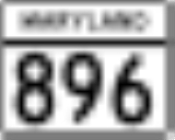
. South of the state line, PA 896 continues as unsigned Maryland Route 896
for about 400 feet (121.9 m), and then enters Delaware
as Delaware Route 896 toward Newark
.
The highway passes through the borough of Strasburg
, known for its Amish
tourist attractions. The section south of the borough up to the state line is predominantly farmland.
border in London Britain Township
, Chester County
, at which the point the route continues south into Maryland as MD 896
for a short distance before crossing into Delaware
and becoming DE 896. From the state line, PA 896 heads north on two-lane undivided New London Road, passing woods and homes as it comes to the community of Strickersville
. At this point, the road turns to the northwest into a mix of farmland, woodland, and residences as it crosses into Franklin Township
and reaches the community of Kemblesville
. Here, the road passes several homes prior to crossing PA 841
. Following this intersection, PA 896 becomes Newark Road and continues through a mix of rural areas and residential subdivisions as it enters New London Township
.
After turning more to the north, PA 896 intersects the southern terminus of PA 796
and heads north-northwest, crossing into Penn Township
. The road crosses an East Penn Railroad
line and makes a turn to the northwest, heading into farmland with some homes as it crosses the Big Elk Creek into Upper Oxford Township
. The route crosses Baltimore Pike
before reaching an interchange with US 1
. Following this interchange, PA 896 continues into open farmland with occasional residences, crossing PA 10
in Russellville. The road continues through rural areas past this intersection.
in a wooded area, PA 896 crosses into Colerain Township
, Lancaster County
, becoming Georgetown Road. The road continues through more agricultural areas, turning more to the north. The route enters Bart Township
and heads northwest again as it continues to the small residential community of Nine Points. Farther northwest, PA 896 crosses a bridge over the abandoned Atglen and Susquehanna Branch
railroad line before intersecting PA 372
. At this point, PA 372 turns north onto PA 896 and the two routes run concurrent through a mix of farms and homes. PA 372 splits from PA 896 by heading east on Christiana Pike, at which point PA 896 makes a turn to the west and enters the community of Georgetown
. In Georgetown, the route makes a turn to the north and curves to the northwest again as it leaves Georgetown.
The road continues through more farmland as it crosses into Paradise Township
. Upon crossing into Paradise Township, PA 896 turns to the west-northwest and passes a mix of woods and homes before heading back into agricultural areas and turning west. The route curves to the northwest as it enters Strasburg Township
and turns north onto Historic Drive, reaching an intersection with PA 741
a short distance to the west of the Strasburg Rail Road
and Railroad Museum of Pennsylvania
. At this point, PA 896 crosses PA 741 and continues northwest through farmland with some businesses, straddling the border between Strasburg
to the southwest and Strasburg Township to the northeast. North of town, PA 896 turns north onto Hartman Bridge Road and passes homes and businesses as it crosses back into Strasburg Township, at which point it runs through a mix of farms, homes, and businesses. After crossing the Pequea Creek
, PA 896 enters East Lampeter Township
and continues north to an intersection with US 30
(Lincoln Highway
) in a commercial area near several outlet malls. After this intersection, the route becomes Eastbrook Road and passes a mix of farm fields and residential subdivisions before ending at PA 340
in the community of Smoketown
.
State highway
State highway, state road or state route can refer to one of three related concepts, two of them related to a state or provincial government in a country that is divided into states or provinces :#A...
located in the counties of Lancaster and Chester in southeastern Pennsylvania
Pennsylvania
The Commonwealth of Pennsylvania is a U.S. state that is located in the Northeastern and Mid-Atlantic regions of the United States. The state borders Delaware and Maryland to the south, West Virginia to the southwest, Ohio to the west, New York and Ontario, Canada, to the north, and New Jersey to...
. The northern terminus is at Pennsylvania Route 340
Pennsylvania Route 340
Pennsylvania Route 340 is a long state highway located in Lancaster and Chester counties in Pennsylvania. The western terminus is at Pennsylvania Route 462 in Lancaster. The eastern terminus is at U.S...
in the East Lampeter Township
East Lampeter Township, Pennsylvania
East Lampeter Township is a township in central Lancaster County, Pennsylvania, United States. At the 2000 census the population was 13,556.East Lampeter Township is one of the six immediate suburbs of the city of Lancaster, all sharing the same official designation as Lancaster, Pennsylvania by...
hamlet of Smoketown, just east of Lancaster. The southern terminus is at the Maryland
Maryland
Maryland is a U.S. state located in the Mid Atlantic region of the United States, bordering Virginia, West Virginia, and the District of Columbia to its south and west; Pennsylvania to its north; and Delaware to its east...
state line just south of Strickersville in London Britain Township
London Britain Township, Pennsylvania
London Britain Township is a township in Chester County, Pennsylvania, United States. The population was 3,139 at the 2010 census. White Clay Creek Preserve is a Pennsylvania state park in London Britain Township along White Clay Creek.-History:...
. South of the state line, PA 896 continues as unsigned Maryland Route 896
Maryland Route 896
Maryland Route 896 is an unsigned state highway in the U.S. state of Maryland. Known as New London Road, the state highway runs from the Delaware state line north to the Pennsylvania state line in far northeastern Cecil County...
for about 400 feet (121.9 m), and then enters Delaware
Delaware
Delaware is a U.S. state located on the Atlantic Coast in the Mid-Atlantic region of the United States. It is bordered to the south and west by Maryland, and to the north by Pennsylvania...
as Delaware Route 896 toward Newark
Newark, Delaware
Newark is an American city in New Castle County, Delaware, west-southwest of Wilmington. According to the 2010 Census, the population of the city is 31,454. Newark is the home of the University of Delaware.- History :...
.
The highway passes through the borough of Strasburg
Strasburg, Pennsylvania
Strasburg is a borough in Lancaster County, Pennsylvania, United States. It developed as a linear village along the Great Conestoga Road, stretching about two miles along path later known as the Strasburg Road...
, known for its Amish
Amish
The Amish , sometimes referred to as Amish Mennonites, are a group of Christian church fellowships that form a subgroup of the Mennonite churches...
tourist attractions. The section south of the borough up to the state line is predominantly farmland.
Chester County
PA 896 begins at the MarylandMaryland
Maryland is a U.S. state located in the Mid Atlantic region of the United States, bordering Virginia, West Virginia, and the District of Columbia to its south and west; Pennsylvania to its north; and Delaware to its east...
border in London Britain Township
London Britain Township, Pennsylvania
London Britain Township is a township in Chester County, Pennsylvania, United States. The population was 3,139 at the 2010 census. White Clay Creek Preserve is a Pennsylvania state park in London Britain Township along White Clay Creek.-History:...
, Chester County
Chester County, Pennsylvania
-State parks:*French Creek State Park*Marsh Creek State Park*White Clay Creek Preserve-Demographics:As of the 2010 census, the county was 85.5% White, 6.1% Black or African American, 0.2% Native American or Alaskan Native, 3.9% Asian, 0.0% Native Hawaiian, 1.8% were two or more races, and 2.4% were...
, at which the point the route continues south into Maryland as MD 896
Maryland Route 896
Maryland Route 896 is an unsigned state highway in the U.S. state of Maryland. Known as New London Road, the state highway runs from the Delaware state line north to the Pennsylvania state line in far northeastern Cecil County...
for a short distance before crossing into Delaware
Delaware
Delaware is a U.S. state located on the Atlantic Coast in the Mid-Atlantic region of the United States. It is bordered to the south and west by Maryland, and to the north by Pennsylvania...
and becoming DE 896. From the state line, PA 896 heads north on two-lane undivided New London Road, passing woods and homes as it comes to the community of Strickersville
Strickersville, Pennsylvania
Strickersville is an unincorporated community in extreme southeastern Chester County, Pennsylvania, United States. It is located at the intersection of Route 896 and Strickersville Rd in London Britain Township. While it once supported a number of small businesses in the late 19th century, today...
. At this point, the road turns to the northwest into a mix of farmland, woodland, and residences as it crosses into Franklin Township
Franklin Township, Chester County, Pennsylvania
Franklin Township is a township in Chester County, Pennsylvania, United States. The population was 4,352 at the 2010 census.-Geography:According to the United States Census Bureau, the township has a total area of , all of it land....
and reaches the community of Kemblesville
Kemblesville, Pennsylvania
Kemblesville is an unincorporated community in Franklin Township, Chester County, Pennsylvania, United States. Located in the southern part of the county, it lies in the southeastern part of the state.-History:...
. Here, the road passes several homes prior to crossing PA 841
Pennsylvania Route 841
Pennsylvania Route 841 is a state highway in Chester County, Pennsylvania. The route runs from the Maryland border in the Lewisville section of Elk Township, where it continues as Maryland Route 213, north to Pennsylvania Route 82 in the Doe Run section of West Marlborough Township.-Route...
. Following this intersection, PA 896 becomes Newark Road and continues through a mix of rural areas and residential subdivisions as it enters New London Township
New London Township, Pennsylvania
New London Township is a township in Chester County, Pennsylvania, United States. The population was 5,631 at the 2010 census. It was the birthplace of U.S...
.
After turning more to the north, PA 896 intersects the southern terminus of PA 796
Pennsylvania Route 796
Pennsylvania Route 796 is a state highway in Chester County, Pennsylvania. The route runs from Pennsylvania Route 896 in New London Township north to Pennsylvania Route 41 in Londonderry Township.-Route description:...
and heads north-northwest, crossing into Penn Township
Penn Township, Chester County, Pennsylvania
Penn Township is a township in Chester County, Pennsylvania, United States. The population was 5,364 at the 2010 census. It is home to the Nursery Capital of Pennsylvania and, formerly, was the site of Sunset Park, one of country music's most popular venues....
. The road crosses an East Penn Railroad
East Penn Railroad
The East Penn Railroad is a short-line railroad that operates a number of mostly-unconnected lines in the U.S. states of Pennsylvania and Delaware...
line and makes a turn to the northwest, heading into farmland with some homes as it crosses the Big Elk Creek into Upper Oxford Township
Upper Oxford Township, Pennsylvania
Upper Oxford Township is a township in Chester County, Pennsylvania, United States. As of the 2010 census, the township population was 2,484.-Geography:According to the United States Census Bureau, the township has a total area of , all of it land....
. The route crosses Baltimore Pike
Baltimore Pike
thumb|[[SEPTA]]'s [[SEPTA Route 34|Route 34]] streetcar line runs through the 4500 block of Baltimore Avenue in [[West Philadelphia]]The Baltimore Pike was an auto trail in the United States, connecting Baltimore, Maryland with Philadelphia, Pennsylvania....
before reaching an interchange with US 1
U.S. Route 1 in Pennsylvania
U.S. Route 1 is a major north–south U.S. Highway, extending from the Florida Keys in the south to the Canadian border in the north. In the U.S. state of Pennsylvania, US 1 runs for from the Maryland state line near Oxford to the New Jersey state line near Trenton.-Maryland to Interstate...
. Following this interchange, PA 896 continues into open farmland with occasional residences, crossing PA 10
Pennsylvania Route 10
Pennsylvania Route 10 is a long state route in southeastern Pennsylvania. PA 10 runs parallel to Interstate 176 for less than near Morgantown. Its southern terminus is at Pennsylvania Route 472 in Oxford. Its northern terminus is at U.S...
in Russellville. The road continues through rural areas past this intersection.
Lancaster County
Upon crossing the Octoraro CreekOctoraro Creek
Octoraro Creek is a tributary of the Susquehanna River, joining it above the Susquehanna's mouth at Chesapeake Bay. The Octoraro rises as an East and West Branch in Pennsylvania. The East Branch and Octoraro Creek form the southern half of the border between Lancaster and Chester counties until...
in a wooded area, PA 896 crosses into Colerain Township
Colerain Township, Lancaster County, Pennsylvania
Colerain Township is a township in southeastern Lancaster County, Pennsylvania, United States. The population was 3,261 at the 2000 census. It is part of the Solanco School District....
, Lancaster County
Lancaster County, Pennsylvania
Lancaster County, known as the Garden Spot of America or Pennsylvania Dutch Country, is a county located in the southeastern part of the Commonwealth of Pennsylvania, in the United States. As of 2010 the population was 519,445. Lancaster County forms the Lancaster Metropolitan Statistical Area, the...
, becoming Georgetown Road. The road continues through more agricultural areas, turning more to the north. The route enters Bart Township
Bart Township, Pennsylvania
Bart Township is a township in southeastern Lancaster County, Pennsylvania, United States. At the 2000 Census the population was 3,003.-Founding:The name of Bart Township apparently comes from a reinterpretation of the abbreviation "Bart." for "Baronet"...
and heads northwest again as it continues to the small residential community of Nine Points. Farther northwest, PA 896 crosses a bridge over the abandoned Atglen and Susquehanna Branch
Atglen and Susquehanna Branch
The Atglen and Susquehanna Branch is an abandoned branch line of the Pennsylvania Railroad.-History:The Atglen and Susquehanna Branch was built by the Pennsylvania Railroad between 1902 and 1906. The branch was built to relieve congestion on the Philadelphia to Harrisburg Main Line and the...
railroad line before intersecting PA 372
Pennsylvania Route 372
Pennsylvania Route 372 is an east–west highway in York, Lancaster, and Chester counties. Its western terminus is at Pennsylvania Route 74 in Lower Chanceford Township north of Delta and west of Holtwood, and its eastern terminus is at Pennsylvania Route 82 in Coatesville.-York and Lancaster...
. At this point, PA 372 turns north onto PA 896 and the two routes run concurrent through a mix of farms and homes. PA 372 splits from PA 896 by heading east on Christiana Pike, at which point PA 896 makes a turn to the west and enters the community of Georgetown
Georgetown, Lancaster County, Pennsylvania
Georgetown is a small, unincorporated community located in Bart Township, Lancaster County, Pennsylvania. It is located approximately 54 miles from Philadelphia...
. In Georgetown, the route makes a turn to the north and curves to the northwest again as it leaves Georgetown.
The road continues through more farmland as it crosses into Paradise Township
Paradise Township, Lancaster County, Pennsylvania
Paradise Township is a township in east central Lancaster County, Pennsylvania, United States. The population was 4,698 at the 2000 census.-Geography:...
. Upon crossing into Paradise Township, PA 896 turns to the west-northwest and passes a mix of woods and homes before heading back into agricultural areas and turning west. The route curves to the northwest as it enters Strasburg Township
Strasburg Township, Pennsylvania
Strasburg Township is a township in south central Lancaster County, Pennsylvania, United States. The population was 4,021 at the 2000 census.-Geography:...
and turns north onto Historic Drive, reaching an intersection with PA 741
Pennsylvania Route 741
Pennsylvania Route 741 is a long state highway that runs through western and southern Lancaster County in the U.S. state of Pennsylvania. The eastern terminus is at Pennsylvania Route 41 in Gap...
a short distance to the west of the Strasburg Rail Road
Strasburg Rail Road
The Strasburg Rail Road is a heritage railroad located near Strasburg, Pennsylvania. It operates excursion trains hauled by steam locomotives in the heart of Pennsylvania Dutch Country.Across the street lies the Railroad Museum of Pennsylvania...
and Railroad Museum of Pennsylvania
Railroad Museum of Pennsylvania
The Railroad Museum of Pennsylvania is a railroad museum in Strasburg, Lancaster County, Pennsylvania.The museum is located on the east side of Strasburg along Pennsylvania Route 741...
. At this point, PA 896 crosses PA 741 and continues northwest through farmland with some businesses, straddling the border between Strasburg
Strasburg, Pennsylvania
Strasburg is a borough in Lancaster County, Pennsylvania, United States. It developed as a linear village along the Great Conestoga Road, stretching about two miles along path later known as the Strasburg Road...
to the southwest and Strasburg Township to the northeast. North of town, PA 896 turns north onto Hartman Bridge Road and passes homes and businesses as it crosses back into Strasburg Township, at which point it runs through a mix of farms, homes, and businesses. After crossing the Pequea Creek
Pequea Creek
Pequea Creek is a tributary of the Susquehanna River that runs for from the eastern border of Lancaster County and Berks County, Pennsylvania to the village of Pequea, about above the hydroelectric dam at Holtwood along the Susquehanna River in Lancaster County.The name of the creek is Shawnee...
, PA 896 enters East Lampeter Township
East Lampeter Township, Pennsylvania
East Lampeter Township is a township in central Lancaster County, Pennsylvania, United States. At the 2000 census the population was 13,556.East Lampeter Township is one of the six immediate suburbs of the city of Lancaster, all sharing the same official designation as Lancaster, Pennsylvania by...
and continues north to an intersection with US 30
U.S. Route 30 in Pennsylvania
In the U.S. state of Pennsylvania, U.S. Route 30 runs east–west across the southern part of the state, passing through Pittsburgh and Philadelphia on its way from the West Virginia state line east to the Benjamin Franklin Bridge over the Delaware River into New Jersey...
(Lincoln Highway
Lincoln Highway
The Lincoln Highway was the first road across the United States of America.Conceived and promoted by entrepreneur Carl G. Fisher, the Lincoln Highway spanned coast-to-coast from Times Square in New York City to Lincoln Park in San Francisco, originally through 13 states: New York, New Jersey,...
) in a commercial area near several outlet malls. After this intersection, the route becomes Eastbrook Road and passes a mix of farm fields and residential subdivisions before ending at PA 340
Pennsylvania Route 340
Pennsylvania Route 340 is a long state highway located in Lancaster and Chester counties in Pennsylvania. The western terminus is at Pennsylvania Route 462 in Lancaster. The eastern terminus is at U.S...
in the community of Smoketown
Smoketown, Pennsylvania
Smoketown is a small farming village in East Lampeter Township, Lancaster County, Pennsylvania, west of Bird-in-Hand at the intersection of Pennsylvania Route 340 and Pennsylvania Route 896 . Also known as Smoke Town, it is served by the Smoketown Airport...
.