
Ngati Toa
Encyclopedia
Iwi
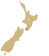
In New Zealand society, iwi form the largest everyday social units in Māori culture. The word iwi means "'peoples' or 'nations'. In "the work of European writers which treat iwi and hapū as parts of a hierarchical structure", it has been used to mean "tribe" , or confederation of tribes,...
(New Zealand
New Zealand
New Zealand is an island country in the south-western Pacific Ocean comprising two main landmasses and numerous smaller islands. The country is situated some east of Australia across the Tasman Sea, and roughly south of the Pacific island nations of New Caledonia, Fiji, and Tonga...
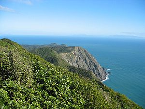
Māori tribe), traces its descent from the eponymous ancestor Toarangatira. The Ngāti Toa region extends from Miria-te-kakara at Rangitikei
Rangitikei District
The Rangitikei District is a Territorial Authority located primarily in the Manawatu-Wanganui Region in the North Island of New Zealand, although a small part, the town of Ngamatea , of it lies in the Hawke's Bay Region...
to Wellington
Wellington
Wellington is the capital city and third most populous urban area of New Zealand, although it is likely to have surpassed Christchurch due to the exodus following the Canterbury Earthquake. It is at the southwestern tip of the North Island, between Cook Strait and the Rimutaka Range...
, and across Cook Strait
Cook Strait
Cook Strait is the strait between the North and South Islands of New Zealand. It connects the Tasman Sea on the west with the South Pacific Ocean on the east....
to Wairau
Wairau River
The Wairau River is one of the longest rivers in New Zealand's South Island. It flows for 170 kilometres from the Spenser Mountains , firstly in a northwards direction and then northeast down a long, straight valley in inland Marlborough.The river's lower reaches are noted for the surrounding...
and Nelson
Nelson, New Zealand
Nelson is a city on the eastern shores of Tasman Bay, and is the economic and cultural centre of the Nelson-Tasman region. Established in 1841, it is the second oldest settled city in New Zealand and the oldest in the South Island....
.
However the tribe mainly lives around Porirua
Porirua
Porirua is a city in the Wellington Region of New Zealand, immediately north of the city of Wellington, with their central business districts 20 km apart. A large proportion of the population commutes to Wellington, so it may be considered a satellite city. It almost completely surrounds...
and Nelson. An aphorism links tribal identity with ancestors and landmarks:
Ko Whitireia te maunga
Ko Raukawa te moana
Ko Tainui te waka
Ko Ngāti Toarangatira te iwi
Ko Te Rauparaha te tangata
Toarangatira: origin of an iwi
Tupahau, a descendant of Hoturoa, the captain of the Tainui canoeTainui (canoe)
In Māori tradition, Tainui was the name of one of the great ocean-going canoes in which Polynesians migrated to New Zealand, approximately 800 years ago. The Tainui waka was named for an infant who did not survive childbirth...
, received warning of an imminent attack by Tamure, a priest of Tainui
Tainui
Tainui is a tribal waka confederation of New Zealand Māori iwi. The Tainui confederation comprises four principal related Māori iwi of the central North Island of New Zealand: Hauraki, Ngāti Maniapoto, Ngāti Raukawa and Waikato...
, and at once organised a plan of defence and attack. Tamure had an army of 2000 warriors whereas Tupahau had only 300. Tupahau and his followers won the battle, however Tupahau spared Tamure's life. Tamure responded to this by saying, Tēnā koe Tupahau, te toa rangatira! meaning "Hail Tupahau the chivalrous warrior!" (toa meaning "brave man" or "champion" and rangatira meaning "gallant", "grand", "admirable" or "chiefly").
Later, Tupahau’s daughter-in-law bore a son who received the name "Toarangatira" to commemorate both this event and the subsequent peace made between Tamure and Tupahau. Ngāti Toa trace their descent from Toarangatira.
Te Rauparaha
Parekowhatu of Ngāti RaukawaNgati Raukawa
Ngāti Raukawa is a Māori iwi with traditional bases in the Waikato, Taupo and Manawatū/Horowhenua regions of New Zealand. In 2006, 29,418 Māori registered their affiliation with Ngāti Raukawa.- Early History :...
, the wife of Werawera of Ngāti Toa, gave birth to Te Rauparaha in about the 1760s. According to tribal tradition the birth took place at Pātangata near Kāwhia
Kawhia Harbour
Kawhia Harbour is one of three large natural inlets in the Tasman Sea coast of the Waikato region of New Zealand's North Island. It is located to the south of Raglan Harbour, Ruapuke and Aotea Harbour, 40 kilometres southwest of Hamilton...
. Te Rauparaha became the foremost chief of Ngāti Toa, credited with leading Ngāti Toa forces against the Waikato
Tainui
Tainui is a tribal waka confederation of New Zealand Māori iwi. The Tainui confederation comprises four principal related Māori iwi of the central North Island of New Zealand: Hauraki, Ngāti Maniapoto, Ngāti Raukawa and Waikato...
and Ngāti Maniapoto
Ngati Maniapoto
Ngāti Maniapoto is an iwi based in the Waikato-Waitomo region of New Zealand's North Island. It is part of the Tainui confederation, the members of which trace their whakapapa back to people who arrived in New Zealand on the waka Tainui...
iwi; and then after his defeat with piloting the migration to, and the conquest and settlement of, the Cook Strait region in the 1820s. Later he crossed Cook Strait to attack the Rangitane people in the Wairau valley. His attempt to conquer the southern South Island iwi was thwarted by an outbreak of measles which killed many of his warriors.
Te Rauparaha signed the Treaty of Waitangi
Treaty of Waitangi
The Treaty of Waitangi is a treaty first signed on 6 February 1840 by representatives of the British Crown and various Māori chiefs from the North Island of New Zealand....
twice in May and June, 1840: first at Kapiti Island
Kapiti Island
-External links:* , Department of Conservation* * , Nature Coast Enterprise *...
and then again at Wairau. Te Rauparaha resisted European settlement in those areas which he claimed he had not sold. Later disputes occurred over Porirua and the Hutt Valley
Hutt Valley, New Zealand
The Hutt Valley is the large area of fairly flat land in the Hutt River valley in the Wellington region of New Zealand. Like the river that flows through it, it takes its name from Sir William Hutt, a director of the New Zealand Company in early colonial New Zealand.The river flows roughly along...
. But the major clash came in 1843 when Te Rauparaha and his warlike nephew Te Rangihaeata
Te Rangihaeata
Te Rangihaeata , was a Ngāti Toa chief, nephew of Te Rauparaha. He had a leading part in the Wairau Affray and the Hutt Valley Campaign.-Early life:...
tried to prevent the survey of their conquered lands in the Wairau plains that had already been sold to a British whaling captain, Captain Blenkinsop. Te Rauparaha burnt down a whare which contained survey equipment. The Nelson magistrate ordered his arrest and deputized a number of citizens as police.Te Rauparaha resisted arrest and fighting broke out, resulting in the death of Te Rongo, the wife of Te Rangihaeata,who had previously been Blenkinsop's wife. Te Rangihaeata, who was known as a savage warrior, then killed the survey-party, who had surrendered,to avenge his wife's death in an act of utu. This became known as the Wairau Affray
Wairau Affray
In New Zealand history, the Wairau Affray on 17 June 1843 was the first serious clash of arms between Māori and the British settlers after the signing of the Treaty of Waitangi, and the only one to take place in the South Island...
or until modern times, the Wairau massacre, as most of the Europeans were killed after the fighting had stopped.
Following fighting in the Hutt Valley in 1846, Governor George Grey
George Edward Grey
Sir George Grey, KCB was a soldier, explorer, Governor of South Australia, twice Governor of New Zealand, Governor of Cape Colony , the 11th Premier of New Zealand and a writer.-Early life and exploration:...
arrested Te Rauparaha after British troops discovered he was receiving and sending secret instructions to the local Maori who were attacking settlers. In a surprise attack on his pa, Te Rauparaha,who was now quite elderly, was captured and take prisoner of war. The government held him as a prisoner for 10 months and then kept him under house arrest in Auckland
Auckland
The Auckland metropolitan area , in the North Island of New Zealand, is the largest and most populous urban area in the country with residents, percent of the country's population. Auckland also has the largest Polynesian population of any city in the world...
on board a prison ship, the Driver. After his capture fighting stopped in the Wellington region. Te Rauparaha was released to attend a Maori peace conference at Kohimaramara in Auckland and then given his liberty after giving up any claim to the Wairau valley.Te Rauparaha's last notable achievement came with the construction of Rangiātea Church (1846) in Ōtaki
Otaki, New Zealand
Otaki is a town in the Kapiti Coast District of the North Island of New Zealand, situated half way between the capital city Wellington, 70 kilometres to the southwest, and Palmerston North, 70 kilometres to the northeast. It marks the northernmost point of the Wellington Region. The town's...
. He did not adopt Christianity
Christianity
Christianity is a monotheistic religion based on the life and teachings of Jesus as presented in canonical gospels and other New Testament writings...
, although he attended church services.
Te Rauparaha died on 27 November 1849,aged about 85, and was buried near Rangiātea, in Otaki. Many remember him as the author of the haka
Haka
Haka is a traditional ancestral war cry, dance or challenge from the Māori people of New Zealand. It is a posture dance performed by a group, with vigorous movements and stamping of the feet with rhythmically shouted accompaniment...
"Ka mate, ka mate
Ka Mate
"Ka Mate" is a Māori haka composed by Te Rauparaha, war leader of the Ngāti Toa tribe of the North Island of New Zealand.-The creation and composition of Ka Mate:...
", which he composed after being hidden in a rua (potato pit) by a woman in the Taupo region after a defeat in battle.
Invasion from the north
Ngati Maniapoto
Ngāti Maniapoto is an iwi based in the Waikato-Waitomo region of New Zealand's North Island. It is part of the Tainui confederation, the members of which trace their whakapapa back to people who arrived in New Zealand on the waka Tainui...
tribes for control of the rich fertile land north of Kāwhia. The wars intensified with every killing of a major chief and with each insult and slight suffered. Ngāti Toa migrated from Kāwhia to the Cook Strait
Cook Strait
Cook Strait is the strait between the North and South Islands of New Zealand. It connects the Tasman Sea on the west with the South Pacific Ocean on the east....
region under the leadership of their chief Te Rauparaha
Te Rauparaha
Te Rauparaha was a Māori rangatira and war leader of the Ngāti Toa tribe who took a leading part in the Musket Wars. He was influential in the original sale of conquered Rangitane land to the New Zealand Company and was a participant in the Wairau Incident in Marlborough...
in the 1820s.
Together, the two migrations Heke Tahutahuahi and Heke Tātaramoa have the name Heke mai raro, meaning "migration from the north". The carved meeting-house bearing the name Te Heke Mai Raro, which stands on Hongoeka Marae
Marae
A marae malae , malae , is a communal or sacred place which serves religious and social purposes in Polynesian societies...
, immortalises the migration.
First migration, Heke Tahutahuahi, 1820
Heke Tahutahuahi (translatable as the "fire lighting expedition") brought the Ngāti Toa iwi out of Kāwhia and into Taranaki in 1820. The Taranaki iwi Ngāti Mutunga presented Ngāti Toa with Pukewhakamaru Pā, as well as with the cultivations nearby. Pukewhakamaru lay inland of Ōkokī, up the UrenuiUrenui
Urenui is a settlement in northern Taranaki, in the North Island of New Zealand. It is located on State Highway 3 close to the shore of the North Taranaki Bight, 13 kilometres east of Waitara and 6 km south-west of Mimi...
River. Ngāti Toa stayed at Pukewhakamaru for 12 months. The Waikato-Maniapoto alliance followed Ngāti Toa to Taranaki and battles ensued there, most notably the battle of Motunui
Motunui
Motunui is a settlement in northern Taranaki, in the North Island of New Zealand. It is located on State Highway 3 close to the shore of the North Taranaki Bight, six kilometres east of Waitara....
between Waikato-Maniapoto and the Ngāti Tama, Te Āti Awa
Te Ati Awa
Te Āti Awa is a Māori iwi with traditional bases in the Taranaki and Wellington regions of New Zealand. Approximately 17,000 people registered their affiliation to Te Āti Awa in 2001, with around 10,000 in Taranaki, 2,000 in Wellington and around 5,000 of unspecified regional location.-Geographical...
and Ngāti Mutunga alliance.
Second migration, Heke Tātaramoa, 1822-
The name Heke Tātaramoa (translatable as the "bramble bush migration") commemorates the difficulties experienced during Ngāti Toa's second migration. Ngāti Toa left Ōkokī around February–March 1822 after harvesting crops planted for the journey. This heke also included some people from Ngāti Tama, Ngāti Mutunga and Te Āti Awa. The heke arrived in the Horowhenua-KapitiKapiti
Kapiti can refer to:*Kapiti Island, a small island a short distance off the New Zealand coast north of Wellington*Kapiti Coast, the stretch of coast that runs adjacent to the island.*Kapiti Line, a suburban railway in Wellington...
region in the early 1820s and settled first in Te Awamate, then at Te Wharangi, and then eventually on Kapiti Island
Kapiti Island
-External links:* , Department of Conservation* * , Nature Coast Enterprise *...
.
"Ka Mate" haka
Concern over inappropriate commercial use of Te RauparahaTe Rauparaha
Te Rauparaha was a Māori rangatira and war leader of the Ngāti Toa tribe who took a leading part in the Musket Wars. He was influential in the original sale of conquered Rangitane land to the New Zealand Company and was a participant in the Wairau Incident in Marlborough...
's Ka Mate
Ka Mate
"Ka Mate" is a Māori haka composed by Te Rauparaha, war leader of the Ngāti Toa tribe of the North Island of New Zealand.-The creation and composition of Ka Mate:...
led the iwi to attempt to trademark it
- but in 2006 the Intellectual Property Office of New Zealand
Intellectual Property Office of New Zealand
The Intellectual Property Office of New Zealand is a New Zealand government agency responsible for the granting and registration of intellectual property rights, specifically patent, trade mark, design and plant variety rights. It is part of the Ministry of Economic Development...
turned their claim down on the grounds that Ka Mate had achieved wide recognition in New Zealand and abroad as representing New Zealand as a whole and not a particular trader.
In 2009, as a part of a wider settlement of grievences, the New Zealand government agreed to:
- "...record the authorship and significance of the haka Ka Mate to Ngāti Toa and ... work with Ngāti Toa to address their concerns with the haka... [but] does not expect that redress will result in royalties for the use of Ka Mate or provide Ngāti Toa with a veto on the performance of Ka Mate...".
Ngāti Toa today
Ngāti Toa remains a small iwi with a population of only about 4500 (NZ Census 2001). It has four marae: Takapūwāhia and Hongoeka in Porirua, and Whakatū and Wairau in the north of the South IslandSouth Island
The South Island is the larger of the two major islands of New Zealand, the other being the more populous North Island. It is bordered to the north by Cook Strait, to the west by the Tasman Sea, to the south and east by the Pacific Ocean...
. Ngāti Toa's governing body has the name Te Rūnanga o Toa Rangatira.
External links
- Ngāti Toa
- Hongoeka Marae
- Te Rauparaha
- Ngāti Toarangatira in Te Ara - the Encyclopedia of New Zealand