

New Hampshire Route 12
Encyclopedia
New Hampshire Route 12 is a north-south state highway
running across the western portion of New Hampshire
from the Massachusetts
state line to the Vermont
state line at the Connecticut River
.
. It goes through Keene
, then travels along the east bank of the Connecticut River
until Claremont
. From there, it crosses the Connecticut River into Vermont.
 New Hampshire Route 12A is a designation held by two separate state highway
s in the U.S. state
of New Hampshire
. Although not directly connected, the two segments are linked by a 9 miles (14.5 km) section of New Hampshire Route 12.
to Keene
. The northern terminus is at NH 12 south of Charlestown. The southern terminus is at an interchange with NH 12 northwest of Keene.
. The northern terminus is at U.S. Route 4 and New Hampshire Route 10
in West Lebanon
. The southern terminus is at NH 12 north of Charlestown.
State highway
State highway, state road or state route can refer to one of three related concepts, two of them related to a state or provincial government in a country that is divided into states or provinces :#A...
running across the western portion of New Hampshire
New Hampshire
New Hampshire is a state in the New England region of the northeastern United States of America. The state was named after the southern English county of Hampshire. It is bordered by Massachusetts to the south, Vermont to the west, Maine and the Atlantic Ocean to the east, and the Canadian...
from the Massachusetts
Massachusetts
The Commonwealth of Massachusetts is a state in the New England region of the northeastern United States of America. It is bordered by Rhode Island and Connecticut to the south, New York to the west, and Vermont and New Hampshire to the north; at its east lies the Atlantic Ocean. As of the 2010...
state line to the Vermont
Vermont
Vermont is a state in the New England region of the northeastern United States of America. The state ranks 43rd in land area, , and 45th in total area. Its population according to the 2010 census, 630,337, is the second smallest in the country, larger only than Wyoming. It is the only New England...
state line at the Connecticut River
Connecticut River
The Connecticut River is the largest and longest river in New England, and also an American Heritage River. It flows roughly south, starting from the Fourth Connecticut Lake in New Hampshire. After flowing through the remaining Connecticut Lakes and Lake Francis, it defines the border between the...
.
Route description
Route 12 begins at the Massachusetts state line in FitzwilliamFitzwilliam, New Hampshire
Fitzwilliam is a town in Cheshire County, New Hampshire, United States. The population was 2,396 at the 2010 census. Fitzwilliam is home to Rhododendron State Park, a grove of native rhododendrons that bloom in mid-July.-History:...
. It goes through Keene
Keene, New Hampshire
Keene is a city in Cheshire County, New Hampshire, United States. The population was 23,409 at the 2010 census. It is the county seat of Cheshire County.Keene is home to Keene State College and Antioch University New England, and hosts the annual Pumpkin Fest...
, then travels along the east bank of the Connecticut River
Connecticut River
The Connecticut River is the largest and longest river in New England, and also an American Heritage River. It flows roughly south, starting from the Fourth Connecticut Lake in New Hampshire. After flowing through the remaining Connecticut Lakes and Lake Francis, it defines the border between the...
until Claremont
Claremont, New Hampshire
There were 5,685 households out of which 27.4% had children under the age of 18 living with them, 45.5% were married couples living together, 10.3% had a female householder with no husband present, and 39.7% were non-families. 32.2% of all households were made up of individuals and 14.7% had...
. From there, it crosses the Connecticut River into Vermont.
| Town | Milepost | Junction | Notes |
|---|---|---|---|
| Fitzwilliam Fitzwilliam, New Hampshire Fitzwilliam is a town in Cheshire County, New Hampshire, United States. The population was 2,396 at the 2010 census. Fitzwilliam is home to Rhododendron State Park, a grove of native rhododendrons that bloom in mid-July.-History:... |
5.5 |  NH 119 NH 119New Hampshire Route 119 New Hampshire Route 119 is a long east–west state highway in Cheshire County in southwestern New Hampshire. The highway runs from the Massachusetts border in New Ipswich to Hinsdale on the Vermont border.... |
|
| Keene Keene, New Hampshire Keene is a city in Cheshire County, New Hampshire, United States. The population was 23,409 at the 2010 census. It is the county seat of Cheshire County.Keene is home to Keene State College and Antioch University New England, and hosts the annual Pumpkin Fest... |
17.0 |  NH 32 NH 32 |
|
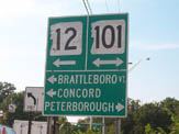
| 17.9 |  NH 101 NH 101New Hampshire Route 101 New Hampshire Route 101 is a state-maintained highway in southern New Hampshire extending from Keene to Hampton Beach. It is the major east–west highway in the southern portion of the state.... East |
Begin overlap with NH 101 | |
| 18.7 |  NH 10 NH 10New Hampshire Route 10 New Hampshire Route 10 is a north–south state highway in the U.S. state of New Hampshire. Its southern terminus is at the Massachusetts state line in the town of Winchester. In Massachusetts the highway becomes Massachusetts Route 10. Total length of the highway is .-Route description:NH 10... South |
||
 NH 9 West NH 9 West |
End overlap with NH 101 (western terminus of NH 101) | ||
| 20.6 | NH 9 East / NH 10 North |
Grade-separated | |
| 22.0 |  NH 12A NH 12A |
Southern segment (southern terminus) | |
| Westmoreland Westmoreland, New Hampshire Westmoreland is a town in Cheshire County, New Hampshire, United States. The population was 1,874 at the 2010 census. Westmoreland is historically an agricultural town, with much arable farmland.-History:... |
30.3 |  NH 63 NH 63New Hampshire Route 63 New Hampshire Route 63 is a long north–south state highway in Cheshire County in southwestern New Hampshire. It runs from Winchester to Westmoreland.The northern terminus of NH 63 is in Westmoreland at New Hampshire Route 12... |
|
| Walpole Walpole, New Hampshire Walpole is a town in Cheshire County, New Hampshire, United States. The population was 3,734 at the 2010 census.The town's central settlement, where 605 people resided at the 2010 census, is defined as the Walpole census-designated place , and is east of New Hampshire Route 12... |
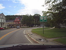
36.0 |  NH 123 NH 123New Hampshire Route 123 New Hampshire Route 123 is a long secondary north–south state highway in southwestern New Hampshire. The southern terminus of the route is at the Massachusetts state line in Mason where, as Valley Road, the road continues as an unnumbered local road in the town of Townsend... West to  US 5 US 5U.S. Route 5 U.S. Route 5 is a north–south United States highway running through the New England states of Connecticut, Massachusetts, and Vermont. Significant cities along the route include New Haven, Connecticut; Hartford, Connecticut; and Springfield, Massachusetts. From Hartford northward to St... |
Begin overlap |
| 38.8 | NH 123 New Hampshire Route 123 New Hampshire Route 123 is a long secondary north–south state highway in southwestern New Hampshire. The southern terminus of the route is at the Massachusetts state line in Mason where, as Valley Road, the road continues as an unnumbered local road in the town of Townsend... East |
End overlap | |
| 40.4 | To U.S. Route 5 U.S. Route 5 U.S. Route 5 is a north–south United States highway running through the New England states of Connecticut, Massachusetts, and Vermont. Significant cities along the route include New Haven, Connecticut; Hartford, Connecticut; and Springfield, Massachusetts. From Hartford northward to St... |
||
| Charlestown Charlestown, New Hampshire Charlestown is a town in Sullivan County, New Hampshire, United States. The population was 5,114 at the 2010 census. The town is home to Hubbard State Forest and the headquarters of the Student Conservation Association.... |
43.7 | NH 12A |
Southern segment (northern terminus} |
| 48.4 |  NH 11 NH 11New Hampshire Route 11 New Hampshire Route 11 is a long east–west state highway in New Hampshire, running westward along the southern shore of Lake Winnipesaukee. Its eastern terminus is at the Maine state line in the city of Rochester, where it continues north as Maine State Route 11. U.S. Route 202, which runs... West |
Begin overlap with NH 11 To U.S. Route 5 |
|
| NH 12A |
Northern segment (southern terminus) | ||
| Claremont Claremont, New Hampshire There were 5,685 households out of which 27.4% had children under the age of 18 living with them, 45.5% were married couples living together, 10.3% had a female householder with no husband present, and 39.7% were non-families. 32.2% of all households were made up of individuals and 14.7% had... |
NH 11 New Hampshire Route 11 New Hampshire Route 11 is a long east–west state highway in New Hampshire, running westward along the southern shore of Lake Winnipesaukee. Its eastern terminus is at the Maine state line in the city of Rochester, where it continues north as Maine State Route 11. U.S. Route 202, which runs... East /  NH 103 NH 103New Hampshire Route 103 New Hampshire Route 103 is a long east–west highway in west-central New Hampshire, United States. The highway runs from Claremont, near the Vermont border on the Connecticut River, to Hopkinton, west of Concord.... East |
End overlap with NH 11 Begin overlap with NH 103 |
|
| 62.1 | NH 12A |
End overlap with NH 103 (western terminus of NH 103) |
New Hampshire Route 12A
State highway
State highway, state road or state route can refer to one of three related concepts, two of them related to a state or provincial government in a country that is divided into states or provinces :#A...
s in the U.S. state
U.S. state
A U.S. state is any one of the 50 federated states of the United States of America that share sovereignty with the federal government. Because of this shared sovereignty, an American is a citizen both of the federal entity and of his or her state of domicile. Four states use the official title of...
of New Hampshire
New Hampshire
New Hampshire is a state in the New England region of the northeastern United States of America. The state was named after the southern English county of Hampshire. It is bordered by Massachusetts to the south, Vermont to the west, Maine and the Atlantic Ocean to the east, and the Canadian...
. Although not directly connected, the two segments are linked by a 9 miles (14.5 km) section of New Hampshire Route 12.
Southern segment
The southern segment of NH 12A is a 21.56 miles (34.7 km) long loop route that runs southwest and south from CharlestownCharlestown, New Hampshire
Charlestown is a town in Sullivan County, New Hampshire, United States. The population was 5,114 at the 2010 census. The town is home to Hubbard State Forest and the headquarters of the Student Conservation Association....
to Keene
Keene, New Hampshire
Keene is a city in Cheshire County, New Hampshire, United States. The population was 23,409 at the 2010 census. It is the county seat of Cheshire County.Keene is home to Keene State College and Antioch University New England, and hosts the annual Pumpkin Fest...
. The northern terminus is at NH 12 south of Charlestown. The southern terminus is at an interchange with NH 12 northwest of Keene.
Northern segment
The northern segment of NH 12A is a 26.89 miles (43.3 km) long spur route that runs north–south along the eastern side of the Connecticut RiverConnecticut River
The Connecticut River is the largest and longest river in New England, and also an American Heritage River. It flows roughly south, starting from the Fourth Connecticut Lake in New Hampshire. After flowing through the remaining Connecticut Lakes and Lake Francis, it defines the border between the...
. The northern terminus is at U.S. Route 4 and New Hampshire Route 10
New Hampshire Route 10
New Hampshire Route 10 is a north–south state highway in the U.S. state of New Hampshire. Its southern terminus is at the Massachusetts state line in the town of Winchester. In Massachusetts the highway becomes Massachusetts Route 10. Total length of the highway is .-Route description:NH 10...
in West Lebanon
West Lebanon, New Hampshire
West Lebanon, New Hampshire, is a district within the city of Lebanon on the Connecticut River. The area contains a major shopping plaza strip along New Hampshire Route 12A, serving the Upper Valley communities along Interstates 89 and 91...
. The southern terminus is at NH 12 north of Charlestown.
Related routes
 New England Interstate Route 12, the designation carried by NH 12 in the 1920s