

New Hampshire Route 123
Encyclopedia
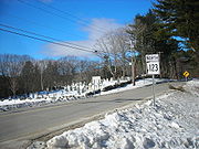
New Hampshire Route 123 (abbreviated NH 123) is a 62.95 miles (101.3 km) long secondary north–south state highway
in southwestern New Hampshire
. The southern terminus of the route is at the Massachusetts
state line in Mason
where, as Valley Road, the road continues as an unnumbered local road in the town of Townsend
. The northern terminus, as signed, is at the Vermont
border, where NH 123 continues west for a half-mile to U.S. Route 5 as Vermont Route 123. Route logs, however, place the terminus at New Hampshire Route 12
in Walpole
.
In Walpole, NH 123 departs Whitcomb Road and turns south onto NH 12 to run north–south alongside the Connecticut River
, the water body that represents the border between New Hampshire and Vermont
. One point of interest is that for the entire length of the NH 12/NH 123 concurrency, NH 123 south is, in reality, heading north on the compass while NH 123 north is traveling to the south.
 In October 2005, heavy flooding in the New Hampshire area forced the closure of NH 123 in two different locations. The first was at the intersection of NH 123 and Cold River Road, approximately five miles from the beginning of NH 123 in New Hampshire
, where a bridge was destroyed from high water in the Cold River
. The second closure was approximately three miles from New Hampshire Route 123A in the town of Alstead
where a section of roadway was completely washed away by the water. Both sections were subsequently rebuilt and reopened.
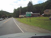 New Hampshire Route 123A (abbreviated NH 123A) is a designation held by two separate state highway
s in New Hampshire
, USA. Although the two segments are not directly connected, they are linked by their parent route, New Hampshire Route 123.
to the Massachusetts
border.
The southern terminus of this segment is at the Massachusetts state line in New Ipswich. At this location, the road is locally named Ashburnham Road. The road continues into Massachusetts and becomes West Road in the town of Ashby
. The northern terminus is at NH 123 and New Hampshire Route 124
in New Ipswich. At this location, NH 123A is locally named Main Street.
, running between the towns of Alstead
and Marlow
. The eastern terminus of this segment of NH 123A is at New Hampshire Route 10
in Marlow. The western terminus is at NH 123 in Alstead.
State highway
State highway, state road or state route can refer to one of three related concepts, two of them related to a state or provincial government in a country that is divided into states or provinces :#A...
in southwestern New Hampshire
New Hampshire
New Hampshire is a state in the New England region of the northeastern United States of America. The state was named after the southern English county of Hampshire. It is bordered by Massachusetts to the south, Vermont to the west, Maine and the Atlantic Ocean to the east, and the Canadian...
. The southern terminus of the route is at the Massachusetts
Massachusetts
The Commonwealth of Massachusetts is a state in the New England region of the northeastern United States of America. It is bordered by Rhode Island and Connecticut to the south, New York to the west, and Vermont and New Hampshire to the north; at its east lies the Atlantic Ocean. As of the 2010...
state line in Mason
Mason, New Hampshire
Mason is a town in Hillsborough County, New Hampshire, United States. The population was 1,382 at the 2010 census. Mason, together with Wilton, is home to Russell-Abbott State Forest.-History:...
where, as Valley Road, the road continues as an unnumbered local road in the town of Townsend
Townsend, Massachusetts
Townsend is a town in Middlesex County, Massachusetts, United States. The population was 8,926 at the 2010 census.For geographic and demographic information on the census-designated place Townsend, please see the article Townsend , Massachusetts....
. The northern terminus, as signed, is at the Vermont
Vermont
Vermont is a state in the New England region of the northeastern United States of America. The state ranks 43rd in land area, , and 45th in total area. Its population according to the 2010 census, 630,337, is the second smallest in the country, larger only than Wyoming. It is the only New England...
border, where NH 123 continues west for a half-mile to U.S. Route 5 as Vermont Route 123. Route logs, however, place the terminus at New Hampshire Route 12
New Hampshire Route 12
New Hampshire Route 12 is a north-south state highway running across the western portion of New Hampshire from the Massachusetts state line to the Vermont state line at the Connecticut River.-Route description:...
in Walpole
Walpole, New Hampshire
Walpole is a town in Cheshire County, New Hampshire, United States. The population was 3,734 at the 2010 census.The town's central settlement, where 605 people resided at the 2010 census, is defined as the Walpole census-designated place , and is east of New Hampshire Route 12...
.
In Walpole, NH 123 departs Whitcomb Road and turns south onto NH 12 to run north–south alongside the Connecticut River
Connecticut River
The Connecticut River is the largest and longest river in New England, and also an American Heritage River. It flows roughly south, starting from the Fourth Connecticut Lake in New Hampshire. After flowing through the remaining Connecticut Lakes and Lake Francis, it defines the border between the...
, the water body that represents the border between New Hampshire and Vermont
Vermont
Vermont is a state in the New England region of the northeastern United States of America. The state ranks 43rd in land area, , and 45th in total area. Its population according to the 2010 census, 630,337, is the second smallest in the country, larger only than Wyoming. It is the only New England...
. One point of interest is that for the entire length of the NH 12/NH 123 concurrency, NH 123 south is, in reality, heading north on the compass while NH 123 north is traveling to the south.
History
New Hampshire
New Hampshire is a state in the New England region of the northeastern United States of America. The state was named after the southern English county of Hampshire. It is bordered by Massachusetts to the south, Vermont to the west, Maine and the Atlantic Ocean to the east, and the Canadian...
, where a bridge was destroyed from high water in the Cold River
Cold River (Connecticut River)
The Cold River is a 22.6 mile long river located in western New Hampshire in the United States. It is a tributary of the Connecticut River, which flows to Long Island Sound....
. The second closure was approximately three miles from New Hampshire Route 123A in the town of Alstead
Alstead, New Hampshire
Alstead is a town in Cheshire County, New Hampshire, United States. The population was 1,937 at the 2010 census. Alstead is home to Feuer State Forest.-History:...
where a section of roadway was completely washed away by the water. Both sections were subsequently rebuilt and reopened.
New Hampshire Route 123A
State highway
State highway, state road or state route can refer to one of three related concepts, two of them related to a state or provincial government in a country that is divided into states or provinces :#A...
s in New Hampshire
New Hampshire
New Hampshire is a state in the New England region of the northeastern United States of America. The state was named after the southern English county of Hampshire. It is bordered by Massachusetts to the south, Vermont to the west, Maine and the Atlantic Ocean to the east, and the Canadian...
, USA. Although the two segments are not directly connected, they are linked by their parent route, New Hampshire Route 123.
Southern segment
The southern segment of NH 123A is a 4.2 miles (6.8 km) long secondary rural road that runs from the town of New IpswichNew Ipswich, New Hampshire
New Ipswich is a town in Hillsborough County, New Hampshire, United States. The population was 5,099 at the 2010 census. New Ipswich, situated on the Massachusetts border, includes the villages of Bank, Davis, Gibson Four Corners, Highbridge, New Ipswich Center, Smithville, and Wilder, though these...
to the Massachusetts
Massachusetts
The Commonwealth of Massachusetts is a state in the New England region of the northeastern United States of America. It is bordered by Rhode Island and Connecticut to the south, New York to the west, and Vermont and New Hampshire to the north; at its east lies the Atlantic Ocean. As of the 2010...
border.
The southern terminus of this segment is at the Massachusetts state line in New Ipswich. At this location, the road is locally named Ashburnham Road. The road continues into Massachusetts and becomes West Road in the town of Ashby
Ashby, Massachusetts
Ashby is a town in Middlesex County, Massachusetts, United States. The population was 3,120 as of the 2010 census.-Geography:According to the United States Census Bureau, the town has a total area of , of which is land and is water....
. The northern terminus is at NH 123 and New Hampshire Route 124
New Hampshire Route 124
New Hampshire Route 124 is a long east–west highway in southern New Hampshire. It runs from Marlborough to the Massachusetts border....
in New Ipswich. At this location, NH 123A is locally named Main Street.
Northern segment
The northern segment of NH 123A is a 10.06 miles (16.2 km) long secondary rural east–west highway in western New HampshireNew Hampshire
New Hampshire is a state in the New England region of the northeastern United States of America. The state was named after the southern English county of Hampshire. It is bordered by Massachusetts to the south, Vermont to the west, Maine and the Atlantic Ocean to the east, and the Canadian...
, running between the towns of Alstead
Alstead, New Hampshire
Alstead is a town in Cheshire County, New Hampshire, United States. The population was 1,937 at the 2010 census. Alstead is home to Feuer State Forest.-History:...
and Marlow
Marlow, New Hampshire
Marlow is a town in Cheshire County, New Hampshire, United States. The population was 742 at the 2010 census. Marlow is home to Honey Brook State Forest.-History:...
. The eastern terminus of this segment of NH 123A is at New Hampshire Route 10
New Hampshire Route 10
New Hampshire Route 10 is a north–south state highway in the U.S. state of New Hampshire. Its southern terminus is at the Massachusetts state line in the town of Winchester. In Massachusetts the highway becomes Massachusetts Route 10. Total length of the highway is .-Route description:NH 10...
in Marlow. The western terminus is at NH 123 in Alstead.