

New Hampshire Route 101
Encyclopedia
New Hampshire Route 101 is a state-maintained highway in southern New Hampshire
extending from Keene
to Hampton Beach
. It is the major east–west highway in the southern portion of the state.
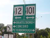
The western terminus of NH 101 is in Keene at the junction with New Hampshire Routes 9, 10
and 12
. The eastern terminus is in Hampton Beach at the junction with Ocean Boulevard (NH 1A
). The total length of NH 101 is approximately 95 miles (153 km), however, the New Hampshire Department of Transportation
has installed mileposts on the freeway section east of Interstate 93 that begin at mile 100.
NH 101 travels through the following municipalities (west to east): Keene, Marlborough
, Dublin
, Peterborough
, Temple
, Wilton
, Milford
, Amherst
, Bedford
, Manchester
, Auburn
, Candia
, Raymond
, Epping
, Brentwood
, Exeter
, Stratham
, and Hampton
.
Between Exeter and Hampton, NH 101 is known as the Exeter-Hampton Expressway.
 NH 101 is a two-lane surface road from its western terminus in Keene to the western terminus of New Hampshire Route 101A in Milford. From there, NH 101 splits off to the south and becomes a two-lane limited-access highway that bypasses Milford and Amherst, becoming a two-lane surface road just north of Amherst. At the eastern terminus of New Hampshire Route 114
in Bedford, NH 101 becomes a four-lane limited-access highway. It expands to six lanes upon merging with Interstate 293
in Manchester, and eight lanes upon merging with Interstate 93. East of I-93, NH 101 narrows to four lanes. The route remains a four-lane expressway until exit 12 (Interstate 95) in Hampton, where NH 101 becomes a two-lane freeway at exit 13. At an interchange with U.S. Route 1, it becomes a two-lane surface road to its terminus in Hampton Beach.
from Albany, New York
to Portsmouth. Because of the cancellation, NH 101 remained a two-lane freeway until the mid-1990s. This highly traveled road had numerous accidents, prominently advertised on large signs at the start of the two-lane freeway segment between exits 5 and 6 in Raymond
, which read, "XX Highway Deaths next XX miles." Locally, this road was known as the Highway of Death for the unusually high number of accidents and the sign advertising.http://archive.seacoastonline.com/2000news/eight.htm In the mid-1990s, the two-lane freeway segment was dualized over much of the swampland it traversed in Rockingham County
, creating a full divided controlled access freeway between Manchester and I-95. The old Highway of Death nickname and the signs have disappeared from use.
In 1991, an overpass was constructed over North Road in Brentwood near the Rockingham County Jail Farm for the future routing of NH 101. However, the NH 101 expressway was not built in this area until 2000, giving the bridge the nickname the Overpass to Nowhere.
 NH 101 between New Hampshire Route 108
in Stratham
, just east of the Exeter
town line, to New Hampshire Route 1A
in Hampton Beach was at its construction named the Exeter-Hampton Expressway, which was marked with seemingly unique round shields featuring the highway's name and was later designated New Hampshire Route 51 during the 1980s until 1994.
During this time, NH 101 exited the expressway at NH 108 (exit 11) and formed a concurrency with NH 108 north to the community of Stratham. After traversing a traffic circle
, NH 101 split from NH 108 and followed the current alignment of New Hampshire Route 33
into downtown Portsmouth
, where NH 101 terminated at U.S. Route 1.
On NH 51, there were two traffic lights located on the limited access 2 lane highway: the east-end lights at the terminus of New Hampshire Route 88
southeast of exit 11 and the west-end lights west of the Newfields (then-New Hampshire Route 85
) exit with what is now New Hampshire Route 27
. While NH 88 was rerouted on a new stretch of road to intersect with NH 108 just south of the NH 101/108 SPUI interchange at exit 11, the Newfields exit was upgraded to a full diamond interchange. NH 27 west of Stratham was formerly NH 101 prior to the completion of the four-lane bypass.
In the fall of 1994, the eastern terminus of NH 101 was shifted eight miles (13 km) south from Portsmouth to its current terminus in Hampton Beach, replacing NH 51 along the Super-2 between Exeter and Hampton Beach. Old NH 101 between Stratham and downtown Portsmouth became NH 33 and the NH 51 designation was eliminated.
, New Hampshire
, connecting Milford
and Nashua
. It also runs through Merrimack
and Amherst
, and very briefly touches Hollis
.
The western terminus of NH 101A is in western Milford at the intersection with NH 101. The eastern terminus is in the center of Nashua, when it meets New Hampshire Route 111
at the Merrimack River
. Most of it is two lanes in each direction, sometimes with a central turning lane.
Route 101A is quite busy by southern New Hampshire standards, with traffic ranging from 26,000 vehicles per weekday in Nashua to 9,000 in western Milford. http://www.nashuarpc.org/trafficcount/index.htm
The road carries a number of names. In Milford it is Elm Street and then Nashua Street; in Amherst and Merrimack it is the Milford Road or, more commonly, just 101A; in Nashua it is Amherst Street, then Canal Street and finally Bridge Street.
. Although the two segments did not directly connect, they were linked at the time by their parent route, New Hampshire Route 101.
area. The western terminus of the route was at U.S. Route 3 and New Hampshire Route 28
in Hooksett
, the current western terminus of New Hampshire Route 27
. The eastern terminus was at NH 101 near Candia
.
All of the western segment of NH 101B was renumbered NH 27 at an unknown time.
. The western terminus was at the intersection of Islington Street and Middle Road, where NH 101, which followed the present alignment of New Hampshire Route 33
into Portsmouth, departed the routing of NH 33 and followed Islington Street to U.S. Route 1. NH 101B continued east on Middle Road and South Street, following the modern alignment of NH 33 to the present eastern terminus of NH 33 at US 1. At US 1, NH 101B continued east on South Street, running along the local street to its eastern terminus at New Hampshire Route 1B.
Prior to 1971, NH 101B from Islington Street east to US 1 became NH 101 while Islington Street and the portion of NH101B east of US 1 reverted to city maintenance. This section of NH 101 was renumbered to NH 33 in 1994.
in Hampton
and NH 1A in Hampton Beach
was once designated New Hampshire Route 101D.
, Rockingham County
, New Hampshire
. This road connects Lafayette Road (U.S. Route 1) with Ocean Boulevard (New Hampshire Route 1A
). NH 101E is locally named Winnacunnet Road. Oddly, this highway has never connected with NH 101, its "parent", or any of its spurs. The entire route is maintained by the town of Hampton.
NH 101E is very poorly signed. There exists one sign on southbound U.S. Route 1 using an old state-highway logo (without the Old Man of the Mountain
), and green guide signs at the eastern terminus at NH 1A, but along the road itself, there is no signage to indicate the route's number. It is not known as "Route 101E" to local residents; they refer to it as "Winnacunnet Road."
New Hampshire
New Hampshire is a state in the New England region of the northeastern United States of America. The state was named after the southern English county of Hampshire. It is bordered by Massachusetts to the south, Vermont to the west, Maine and the Atlantic Ocean to the east, and the Canadian...
extending from Keene
Keene, New Hampshire
Keene is a city in Cheshire County, New Hampshire, United States. The population was 23,409 at the 2010 census. It is the county seat of Cheshire County.Keene is home to Keene State College and Antioch University New England, and hosts the annual Pumpkin Fest...
to Hampton Beach
Hampton Beach, New Hampshire
Hampton Beach is a village district, census-designated place, and beach resort within the town of Hampton, in the U.S. state of New Hampshire, located on the Atlantic Ocean. Its population at the 2010 census was 2,275. Hampton Beach is located in Rockingham County, approximately south of Portsmouth...
. It is the major east–west highway in the southern portion of the state.
The western terminus of NH 101 is in Keene at the junction with New Hampshire Routes 9, 10
New Hampshire Route 10
New Hampshire Route 10 is a north–south state highway in the U.S. state of New Hampshire. Its southern terminus is at the Massachusetts state line in the town of Winchester. In Massachusetts the highway becomes Massachusetts Route 10. Total length of the highway is .-Route description:NH 10...
and 12
New Hampshire Route 12
New Hampshire Route 12 is a north-south state highway running across the western portion of New Hampshire from the Massachusetts state line to the Vermont state line at the Connecticut River.-Route description:...
. The eastern terminus is in Hampton Beach at the junction with Ocean Boulevard (NH 1A
New Hampshire Route 1A
New Hampshire Route 1A is an long state highway located in southeast New Hampshire. The route runs along the Atlantic coastline from the Massachusetts border north to Rye, then turns toward downtown Portsmouth. The southern terminus is at the Massachusetts state line in Seabrook at the junction...
). The total length of NH 101 is approximately 95 miles (153 km), however, the New Hampshire Department of Transportation
New Hampshire Department of Transportation
The State of New Hampshire Department of Transportation is a government agency of the U.S. state of New Hampshire. The NHDOT is under the executive direction of Commissioner of Transportation George Campbell. The main office of the NHDOT is located in the J.O...
has installed mileposts on the freeway section east of Interstate 93 that begin at mile 100.
NH 101 travels through the following municipalities (west to east): Keene, Marlborough
Marlborough, New Hampshire
Marlborough is a town in Cheshire County, New Hampshire, United States. The population was 2,063 at the 2010 census. The town is home to the Kensan-Devan Wildlife Sanctuary at Meetinghouse Pond....
, Dublin
Dublin, New Hampshire
Dublin is a town in Cheshire County, New Hampshire, United States. The population was 1,597 at the 2010 census. It is home to both the Dublin School and Yankee Magazine.-History:...
, Peterborough
Peterborough, New Hampshire
Peterborough is a town in Hillsborough County, New Hampshire, United States. The population was 6,284 at the 2010 census. Home to the MacDowell Art Colony, the town is a popular tourist destination....
, Temple
Temple, New Hampshire
Temple is a town in Hillsborough County, New Hampshire, United States. The population was 1,366 at the 2010 census.- History :Incorporated in 1768, Temple takes its name from colonial governor John Wentworth's lieutenant governor, John Temple.- Geography :...
, Wilton
Wilton, New Hampshire
- Demographics :As of the census of 2000, there were 3,743 people, 1,410 households, and 1,023 families living in the town. The population density was 145.3 people per square mile . There were 1,451 housing units at an average density of 56.3 per square mile...
, Milford
Milford, New Hampshire
Milford is a town in Hillsborough County, New Hampshire, United States, on the Souhegan River. The population was 15,115 at the 2010 census. It is the retail and manufacturing center of a six-town area known informally as the Souhegan Valley....
, Amherst
Amherst, New Hampshire
Amherst is a town in Hillsborough County, New Hampshire, United States. The population was 11,201 at the 2010 census. Amherst is home to Ponemah Bog Wildlife Sanctuary, Hodgman State Forest, the Joe English Reservation and Baboosic Lake....
, Bedford
Bedford, New Hampshire
-Demographics:As of the Census of 2000, there were 18,274 people, 6,251 households, and 5,125 families residing in the town. The population density was 556.6 people per square mile . There were 6,401 housing units at an average density of 195.0 per square mile...
, Manchester
Manchester, New Hampshire
Manchester is the largest city in the U.S. state of New Hampshire, the tenth largest city in New England, and the largest city in northern New England, an area comprising the states of Maine, New Hampshire, and Vermont. It is in Hillsborough County along the banks of the Merrimack River, which...
, Auburn
Auburn, New Hampshire
Auburn is a town in Rockingham County, New Hampshire, United States. The population was 4,953 at the 2010 census. The town was called by WMUR News 9 as number one of "New Hampshire's Most Beautiful Towns" in July 2010. It was also named 18 in The New York Times' "Top 200 Towns To Raise a Family."-...
, Candia
Candia, New Hampshire
Candia is a town in Rockingham County, New Hampshire, United States. The population was 3,909 at the 2010 census. The town includes the villages of Candia, Candia Four Corners and East Candia.-History:...
, Raymond
Raymond, New Hampshire
Raymond is a town in Rockingham County, New Hampshire, United States. The population was 10,138 at the 2010 census. Part of Pawtuckaway State Park is in the north....
, Epping
Epping, New Hampshire
Epping is a town in Rockingham County, New Hampshire, United States. The population was 6,411 at the 2010 census. Epping includes the area known as Camp Hedding....
, Brentwood
Brentwood, New Hampshire
Brentwood is a town in Rockingham County, New Hampshire, United States. As of the 2010 census, the town had a total population of 4,486. Brentwood has been the county seat of Rockingham County since 1997...
, Exeter
Exeter, New Hampshire
Exeter is a town in Rockingham County, New Hampshire, United States. The town's population was 14,306 at the 2010 census. Exeter was the county seat until 1997, when county offices were moved to neighboring Brentwood...
, Stratham
Stratham, New Hampshire
Stratham is a town in Rockingham County, New Hampshire, United States. The population was 7,255 at the 2010 census. It is bounded on the west by the Squamscott River. The town is the home of the only U.S. Lindt & Sprüngli factory and the headquarters of the Timberland Corporation.-History:Stratham...
, and Hampton
Hampton, New Hampshire
Hampton is a town in Rockingham County, New Hampshire, United States. The population was 14,976 at the 2010 census. Located beside the Atlantic Ocean, Hampton is home to Hampton Beach, a summer tourist destination....
.
Between Exeter and Hampton, NH 101 is known as the Exeter-Hampton Expressway.
Route description
New Hampshire Route 114
New Hampshire Route 114 is a long secondary north–south highway in central New Hampshire. The highway runs between Bedford, in Hillsborough County and Grantham, in Sullivan County....
in Bedford, NH 101 becomes a four-lane limited-access highway. It expands to six lanes upon merging with Interstate 293
Interstate 293
Interstate 293 is an long loop surrounding Manchester, New Hampshire, USA roughly shaped like two sides of a triangle. Completing the loop in the northeast is Interstate 93. The southern portion of the loop shares the road with NH 101 and passes near Manchester-Boston Regional Airport and the...
in Manchester, and eight lanes upon merging with Interstate 93. East of I-93, NH 101 narrows to four lanes. The route remains a four-lane expressway until exit 12 (Interstate 95) in Hampton, where NH 101 becomes a two-lane freeway at exit 13. At an interchange with U.S. Route 1, it becomes a two-lane surface road to its terminus in Hampton Beach.
History
Most of the eastern section of NH 101 was originally going to be part of the cancelled New England east–west HighwayEast-West Highway (New England)
The East–West Highway is a long-proposed east–west highway corridor in northern New England, intended to link remote northern communities in Maine, New Hampshire and Vermont with markets in the Maritimes, Quebec, and upper New York State.-History:...
from Albany, New York
Albany, New York
Albany is the capital city of the U.S. state of New York, the seat of Albany County, and the central city of New York's Capital District. Roughly north of New York City, Albany sits on the west bank of the Hudson River, about south of its confluence with the Mohawk River...
to Portsmouth. Because of the cancellation, NH 101 remained a two-lane freeway until the mid-1990s. This highly traveled road had numerous accidents, prominently advertised on large signs at the start of the two-lane freeway segment between exits 5 and 6 in Raymond
Raymond, New Hampshire
Raymond is a town in Rockingham County, New Hampshire, United States. The population was 10,138 at the 2010 census. Part of Pawtuckaway State Park is in the north....
, which read, "XX Highway Deaths next XX miles." Locally, this road was known as the Highway of Death for the unusually high number of accidents and the sign advertising.http://archive.seacoastonline.com/2000news/eight.htm In the mid-1990s, the two-lane freeway segment was dualized over much of the swampland it traversed in Rockingham County
Rockingham County, New Hampshire
-Demographics:As of the census of 2000, there were 277,359 people, 104,529 households, and 74,320 families residing in the county. The population density was 399 people per square mile . There were 113,023 housing units at an average density of 163 per square mile...
, creating a full divided controlled access freeway between Manchester and I-95. The old Highway of Death nickname and the signs have disappeared from use.
In 1991, an overpass was constructed over North Road in Brentwood near the Rockingham County Jail Farm for the future routing of NH 101. However, the NH 101 expressway was not built in this area until 2000, giving the bridge the nickname the Overpass to Nowhere.
New Hampshire Route 108
New Hampshire Route 108 is a long north–south state highway in Rockingham and Strafford counties in southeastern New Hampshire. The northern terminus of the route is in the city of Rochester at NH Route 125 and NH Route 202A...
in Stratham
Stratham, New Hampshire
Stratham is a town in Rockingham County, New Hampshire, United States. The population was 7,255 at the 2010 census. It is bounded on the west by the Squamscott River. The town is the home of the only U.S. Lindt & Sprüngli factory and the headquarters of the Timberland Corporation.-History:Stratham...
, just east of the Exeter
Exeter, New Hampshire
Exeter is a town in Rockingham County, New Hampshire, United States. The town's population was 14,306 at the 2010 census. Exeter was the county seat until 1997, when county offices were moved to neighboring Brentwood...
town line, to New Hampshire Route 1A
New Hampshire Route 1A
New Hampshire Route 1A is an long state highway located in southeast New Hampshire. The route runs along the Atlantic coastline from the Massachusetts border north to Rye, then turns toward downtown Portsmouth. The southern terminus is at the Massachusetts state line in Seabrook at the junction...
in Hampton Beach was at its construction named the Exeter-Hampton Expressway, which was marked with seemingly unique round shields featuring the highway's name and was later designated New Hampshire Route 51 during the 1980s until 1994.
During this time, NH 101 exited the expressway at NH 108 (exit 11) and formed a concurrency with NH 108 north to the community of Stratham. After traversing a traffic circle
Traffic circle
A traffic circle or rotary is a type of circular intersection in which traffic must travel in one direction around a central island. In some countries, traffic entering the circle has the right-of-way and drivers in the circle must yield. In many other countries, traffic entering the circle must...
, NH 101 split from NH 108 and followed the current alignment of New Hampshire Route 33
New Hampshire Route 33
New Hampshire Route 33 is an long east–west highway in the Seacoast Region of the U.S. state of New Hampshire. It is the main road connecting Stratham with Portsmouth. The eastern terminus of NH 33 is in Portsmouth at U.S. Route 1...
into downtown Portsmouth
Portsmouth, New Hampshire
Portsmouth is a city in Rockingham County, New Hampshire in the United States. It is the largest city but only the fourth-largest community in the county, with a population of 21,233 at the 2010 census...
, where NH 101 terminated at U.S. Route 1.
On NH 51, there were two traffic lights located on the limited access 2 lane highway: the east-end lights at the terminus of New Hampshire Route 88
New Hampshire Route 88
New Hampshire Route 88 is a long east–west state highway in Rockingham County in southeastern New Hampshire, USA...
southeast of exit 11 and the west-end lights west of the Newfields (then-New Hampshire Route 85
New Hampshire Route 85
New Hampshire Route 85 is a long north–south state highway in Rockingham County in southeastern New Hampshire. It runs from Exeter to Newfields....
) exit with what is now New Hampshire Route 27
New Hampshire Route 27
New Hampshire Route 27 is a long east–west highway in southeastern New Hampshire. The western terminus of NH 27 is in Hooksett at U.S. Route 3 and New Hampshire Route 28 north of Manchester...
. While NH 88 was rerouted on a new stretch of road to intersect with NH 108 just south of the NH 101/108 SPUI interchange at exit 11, the Newfields exit was upgraded to a full diamond interchange. NH 27 west of Stratham was formerly NH 101 prior to the completion of the four-lane bypass.
In the fall of 1994, the eastern terminus of NH 101 was shifted eight miles (13 km) south from Portsmouth to its current terminus in Hampton Beach, replacing NH 51 along the Super-2 between Exeter and Hampton Beach. Old NH 101 between Stratham and downtown Portsmouth became NH 33 and the NH 51 designation was eliminated.
Major intersections
Keene to Manchester
Manchester to Hampton Beach
| County | Location | Mile | # Exit number An exit number is a number assigned to a road junction, usually an exit from a freeway. It is usually marked on the same sign as the destinations of the exit, as well as a sign in the gore.... |
Destinations | Notes |
|---|---|---|---|---|---|
| Hillsborough Hillsborough County, New Hampshire -Demographics:As of the census of 2000, there were 380,841 people, 144,455 households, and 98,807 families residing in the county. The population density was 435 people per square mile . There were 149,961 housing units at an average density of 171 per square mile... |
Bedford Bedford, New Hampshire -Demographics:As of the Census of 2000, there were 18,274 people, 6,251 households, and 5,125 families residing in the town. The population density was 556.6 people per square mile . There were 6,401 housing units at an average density of 195.0 per square mile... |
52.45 | Straight:  NH 114 NH 114New Hampshire Route 114 New Hampshire Route 114 is a long secondary north–south highway in central New Hampshire. The highway runs between Bedford, in Hillsborough County and Grantham, in Sullivan County.... North Right: Boynton Street Left:  NH 101 West NH 101 West |
At-grade intersection; Western end of limited access segment. | |
| 53.88 |  US 3 (Daniel Webster Hwy.) US 3 (Daniel Webster Hwy.) |
||||
Western terminus of  I-293 I-293Interstate 293 Interstate 293 is an long loop surrounding Manchester, New Hampshire, USA roughly shaped like two sides of a triangle. Completing the loop in the northeast is Interstate 93. The southern portion of the loop shares the road with NH 101 and passes near Manchester-Boston Regional Airport and the... / NH 101 concurrencyConcurrency (road) A concurrency, overlap, or coincidence in a road network is an instance of one physical road bearing two or more different highway, motorway, or other route numbers... . |
|||||
| 54.10 |  Everett Turnpike Everett TurnpikeEverett Turnpike The Frederick E. Everett Turnpike, also called the Central New Hampshire Turnpike, is a toll road in New Hampshire, USA, running from the Massachusetts border at Nashua north to Concord... /I-293 Interstate 293 Interstate 293 is an long loop surrounding Manchester, New Hampshire, USA roughly shaped like two sides of a triangle. Completing the loop in the northeast is Interstate 93. The southern portion of the loop shares the road with NH 101 and passes near Manchester-Boston Regional Airport and the... (North) |
Everett Tpk. - toll road. | |||
| Manchester Manchester, New Hampshire Manchester is the largest city in the U.S. state of New Hampshire, the tenth largest city in New England, and the largest city in northern New England, an area comprising the states of Maine, New Hampshire, and Vermont. It is in Hillsborough County along the banks of the Merrimack River, which... |
55.19 | 2 |  NH 3A NH 3ANew Hampshire Route 3A New Hampshire Route 3A is a designation held by two separate state highways in New Hampshire. The two segments, although not directly connected, are linked by U.S. Route 3, from which they derive their route number.-Southern segment:... (Brown Ave.) |
||
| 56.26 | 1 |  NH 28 NH 28New Hampshire Route 28 New Hampshire Route 28 is an north–south state highway in southeastern New Hampshire. It connects the town of Ossipee in east-central New Hampshire with Salem on the Massachusetts border.... (South Willow St.) - Mall of New Hampshire Mall of New Hampshire The Mall of New Hampshire is a shopping mall located in the Lower South Willow neighborhood of Manchester, New Hampshire. Its major anchoring stores are Macy's, JCPenney, Sears and Best Buy... |
|||
| 57.73 |  I-93/I-293 I-93/I-293Interstate 293 Interstate 293 is an long loop surrounding Manchester, New Hampshire, USA roughly shaped like two sides of a triangle. Completing the loop in the northeast is Interstate 93. The southern portion of the loop shares the road with NH 101 and passes near Manchester-Boston Regional Airport and the... - Concord Concord, New Hampshire The city of Concord is the capital of the state of New Hampshire in the United States. It is also the county seat of Merrimack County. As of the 2010 census, its population was 42,695.... , Boston |
Southern terminus of I-293. Eastbound NH 101 merges with I-93 north. Westbound NH 101 exits onto I-293. |
|||
| Eastern terminus of I-293 Interstate 293 Interstate 293 is an long loop surrounding Manchester, New Hampshire, USA roughly shaped like two sides of a triangle. Completing the loop in the northeast is Interstate 93. The southern portion of the loop shares the road with NH 101 and passes near Manchester-Boston Regional Airport and the... / NH 101 concurrencyConcurrency (road) A concurrency, overlap, or coincidence in a road network is an instance of one physical road bearing two or more different highway, motorway, or other route numbers... Southern terminus of I-93/ NH 101 concurrencyConcurrency (road) A concurrency, overlap, or coincidence in a road network is an instance of one physical road bearing two or more different highway, motorway, or other route numbers... . |
|||||
| 58.91 | 6 | Hanover St./Candia Rd. | To  NH 28A. NH 28A. |
||
| 59.30 | I-93 - Concord Concord, New Hampshire The city of Concord is the capital of the state of New Hampshire in the United States. It is also the county seat of Merrimack County. As of the 2010 census, its population was 42,695.... , Boston |
||||
| Northern terminus of I-93/ NH 101 concurrency Concurrency (road) A concurrency, overlap, or coincidence in a road network is an instance of one physical road bearing two or more different highway, motorway, or other route numbers... . |
|||||
| 60.98 | 1 |  NH 28 BYP (Londonderry Tpk.) NH 28 BYP (Londonderry Tpk.) |
|||
| Rockingham Rockingham County, New Hampshire -Demographics:As of the census of 2000, there were 277,359 people, 104,529 households, and 74,320 families residing in the county. The population density was 399 people per square mile . There were 113,023 housing units at an average density of 163 per square mile... |
Auburn Auburn, New Hampshire Auburn is a town in Rockingham County, New Hampshire, United States. The population was 4,953 at the 2010 census. The town was called by WMUR News 9 as number one of "New Hampshire's Most Beautiful Towns" in July 2010. It was also named 18 in The New York Times' "Top 200 Towns To Raise a Family."-... |
62.94 | 2 | Hooksett Rd. | |
| Candia Candia, New Hampshire Candia is a town in Rockingham County, New Hampshire, United States. The population was 3,909 at the 2010 census. The town includes the villages of Candia, Candia Four Corners and East Candia.-History:... |
65.83 | 3 |  NH 43 NH 43New Hampshire Route 43 New Hampshire Route 43 is a long north–south state highway in southeastern New Hampshire, the United States. It runs from Candia to Northwood.... |
Trumpet interchange. | |
| Raymond Raymond, New Hampshire Raymond is a town in Rockingham County, New Hampshire, United States. The population was 10,138 at the 2010 census. Part of Pawtuckaway State Park is in the north.... |
72.21 | 4 | Old Manchester Rd. | ||
| 73.78 | 5 |      NH 102 NH 102New Hampshire Route 102 New Hampshire Route 102 is a state highway in Rockingham and Hillsborough counties in the southern part of the U.S. state of New Hampshire. NH 102 runs southwest to northeast between Hudson and Raymond, but is signed as an east–west route.Some confusion exists over the western terminus... /NH 107 New Hampshire Route 107 New Hampshire Route 107 is a long north–south state highway in New Hampshire. It connects Laconia in the Lakes Region with Seabrook on the Atlantic coast.... / NH 156 New Hampshire Route 156 New Hampshire Route 156 is a long secondary north–south highway in Rockingham County in southeastern New Hampshire. The road runs from Raymond to Nottingham.... |
|||
| Epping Epping, New Hampshire Epping is a town in Rockingham County, New Hampshire, United States. The population was 6,411 at the 2010 census. Epping includes the area known as Camp Hedding.... |
76.27 | 6 | Depot Rd./Beede Hill Rd. | ||
| 78.47 | 7 |  NH 125 NH 125New Hampshire Route 125 New Hampshire Route 125 is a long north–south state highway in Rockingham and Strafford counties in southeastern New Hampshire. It runs from Plaistow to just north of Milton... |
|||
| Brentwood Brentwood, New Hampshire Brentwood is a town in Rockingham County, New Hampshire, United States. As of the 2010 census, the town had a total population of 4,486. Brentwood has been the county seat of Rockingham County since 1997... |
80.69 | 8 | North Rd. | ||
| Exeter Exeter, New Hampshire Exeter is a town in Rockingham County, New Hampshire, United States. The town's population was 14,306 at the 2010 census. Exeter was the county seat until 1997, when county offices were moved to neighboring Brentwood... |
83.72 | 9 |  NH 27 NH 27New Hampshire Route 27 New Hampshire Route 27 is a long east–west highway in southeastern New Hampshire. The western terminus of NH 27 is in Hooksett at U.S. Route 3 and New Hampshire Route 28 north of Manchester... (Epping Rd.) |
||
| 85.22 | 10 |  NH 85 NH 85New Hampshire Route 85 New Hampshire Route 85 is a long north–south state highway in Rockingham County in southeastern New Hampshire. It runs from Exeter to Newfields.... (Newfields Rd.) |
|||
| Stratham Stratham, New Hampshire Stratham is a town in Rockingham County, New Hampshire, United States. The population was 7,255 at the 2010 census. It is bounded on the west by the Squamscott River. The town is the home of the only U.S. Lindt & Sprüngli factory and the headquarters of the Timberland Corporation.-History:Stratham... |
86.46 | 11 |  NH 108 NH 108New Hampshire Route 108 New Hampshire Route 108 is a long north–south state highway in Rockingham and Strafford counties in southeastern New Hampshire. The northern terminus of the route is in the city of Rochester at NH Route 125 and NH Route 202A... (Portsmouth Ave.) |
||
| Exeter Exeter, New Hampshire Exeter is a town in Rockingham County, New Hampshire, United States. The town's population was 14,306 at the 2010 census. Exeter was the county seat until 1997, when county offices were moved to neighboring Brentwood... |
88.75 | 12 |  NH 111 NH 111New Hampshire Route 111 New Hampshire Route 111 is a east–west highway in Hillsborough and Rockingham counties in southeastern New Hampshire. The road runs from Hollis to North Hampton on the Atlantic shore.... (Exeter Rd.) |
||
| Hampton Hampton, New Hampshire Hampton is a town in Rockingham County, New Hampshire, United States. The population was 14,976 at the 2010 census. Located beside the Atlantic Ocean, Hampton is home to Hampton Beach, a summer tourist destination.... |
90.74 |  I-95 I-95 |
Trumpet interchange. | ||
| 91.05 | 13 | NH 27 New Hampshire Route 27 New Hampshire Route 27 is a long east–west highway in southeastern New Hampshire. The western terminus of NH 27 is in Hooksett at U.S. Route 3 and New Hampshire Route 28 north of Manchester... (Exeter Rd.) |
|||
| 93.03 |  US 1 (Lafayette Rd.) US 1 (Lafayette Rd.) |
||||
 Western terminus of at-grade intersections 0.5 mile (0.80467 km) west of Western terminus of at-grade intersections 0.5 mile (0.80467 km) west of  NH 1A NH 1ANew Hampshire Route 1A New Hampshire Route 1A is an long state highway located in southeast New Hampshire. The route runs along the Atlantic coastline from the Massachusetts border north to Rye, then turns toward downtown Portsmouth. The southern terminus is at the Massachusetts state line in Seabrook at the junction... . |
|||||
| 94.95 | NH 1A New Hampshire Route 1A New Hampshire Route 1A is an long state highway located in southeast New Hampshire. The route runs along the Atlantic coastline from the Massachusetts border north to Rye, then turns toward downtown Portsmouth. The southern terminus is at the Massachusetts state line in Seabrook at the junction... (Ocean Blvd.) |
||||
New Hampshire Route 101A
New Hampshire Route 101A (abbreviated NH 101A) is a 13.82 miles (22.2 km) long east–west highway in Hillsborough CountyHillsborough County, New Hampshire
-Demographics:As of the census of 2000, there were 380,841 people, 144,455 households, and 98,807 families residing in the county. The population density was 435 people per square mile . There were 149,961 housing units at an average density of 171 per square mile...
, New Hampshire
New Hampshire
New Hampshire is a state in the New England region of the northeastern United States of America. The state was named after the southern English county of Hampshire. It is bordered by Massachusetts to the south, Vermont to the west, Maine and the Atlantic Ocean to the east, and the Canadian...
, connecting Milford
Milford, New Hampshire
Milford is a town in Hillsborough County, New Hampshire, United States, on the Souhegan River. The population was 15,115 at the 2010 census. It is the retail and manufacturing center of a six-town area known informally as the Souhegan Valley....
and Nashua
Nashua, New Hampshire
-Climate:-Demographics:As of the census of 2010, there were 86,494 people, 35,044 households, and 21,876 families residing in the city. The population density was 2,719.9 people per square mile . There were 37,168 housing units at an average density of 1,202.8 per square mile...
. It also runs through Merrimack
Merrimack, New Hampshire
Merrimack is a town in Hillsborough County, New Hampshire, United States. The population was 25,494 at the 2010 census, making it the eighth-largest municipality in New Hampshire....
and Amherst
Amherst, New Hampshire
Amherst is a town in Hillsborough County, New Hampshire, United States. The population was 11,201 at the 2010 census. Amherst is home to Ponemah Bog Wildlife Sanctuary, Hodgman State Forest, the Joe English Reservation and Baboosic Lake....
, and very briefly touches Hollis
Hollis, New Hampshire
Hollis is a town in Hillsborough County, New Hampshire, United States. The population was 7,684 at the 2010 census. The town center village is listed on the National Register of Historic Places as Hollis Village Historic District....
.
The western terminus of NH 101A is in western Milford at the intersection with NH 101. The eastern terminus is in the center of Nashua, when it meets New Hampshire Route 111
New Hampshire Route 111
New Hampshire Route 111 is a east–west highway in Hillsborough and Rockingham counties in southeastern New Hampshire. The road runs from Hollis to North Hampton on the Atlantic shore....
at the Merrimack River
Merrimack River
The Merrimack River is a river in the northeastern United States. It rises at the confluence of the Pemigewasset and Winnipesaukee rivers in Franklin, New Hampshire, flows southward into Massachusetts, and then flows northeast until it empties into the Atlantic Ocean at Newburyport...
. Most of it is two lanes in each direction, sometimes with a central turning lane.
Route 101A is quite busy by southern New Hampshire standards, with traffic ranging from 26,000 vehicles per weekday in Nashua to 9,000 in western Milford. http://www.nashuarpc.org/trafficcount/index.htm
The road carries a number of names. In Milford it is Elm Street and then Nashua Street; in Amherst and Merrimack it is the Milford Road or, more commonly, just 101A; in Nashua it is Amherst Street, then Canal Street and finally Bridge Street.
New Hampshire Route 101B
New Hampshire Route 101B was a designation once held by two separate state highways in New HampshireNew Hampshire
New Hampshire is a state in the New England region of the northeastern United States of America. The state was named after the southern English county of Hampshire. It is bordered by Massachusetts to the south, Vermont to the west, Maine and the Atlantic Ocean to the east, and the Canadian...
. Although the two segments did not directly connect, they were linked at the time by their parent route, New Hampshire Route 101.
Western segment
The western segment of NH 101B was a roughly 8.5 miles (13.7 km) east–west road in the ManchesterManchester, New Hampshire
Manchester is the largest city in the U.S. state of New Hampshire, the tenth largest city in New England, and the largest city in northern New England, an area comprising the states of Maine, New Hampshire, and Vermont. It is in Hillsborough County along the banks of the Merrimack River, which...
area. The western terminus of the route was at U.S. Route 3 and New Hampshire Route 28
New Hampshire Route 28
New Hampshire Route 28 is an north–south state highway in southeastern New Hampshire. It connects the town of Ossipee in east-central New Hampshire with Salem on the Massachusetts border....
in Hooksett
Hooksett, New Hampshire
Hooksett is a town in Merrimack County, New Hampshire, United States. The population was 13,451 at the 2010 census. The town is located between Manchester, the state's largest city, and Concord, the state capital...
, the current western terminus of New Hampshire Route 27
New Hampshire Route 27
New Hampshire Route 27 is a long east–west highway in southeastern New Hampshire. The western terminus of NH 27 is in Hooksett at U.S. Route 3 and New Hampshire Route 28 north of Manchester...
. The eastern terminus was at NH 101 near Candia
Candia, New Hampshire
Candia is a town in Rockingham County, New Hampshire, United States. The population was 3,909 at the 2010 census. The town includes the villages of Candia, Candia Four Corners and East Candia.-History:...
.
All of the western segment of NH 101B was renumbered NH 27 at an unknown time.
Eastern segment
The eastern segment of NH 101B was a short east–west road in downtown PortsmouthPortsmouth, New Hampshire
Portsmouth is a city in Rockingham County, New Hampshire in the United States. It is the largest city but only the fourth-largest community in the county, with a population of 21,233 at the 2010 census...
. The western terminus was at the intersection of Islington Street and Middle Road, where NH 101, which followed the present alignment of New Hampshire Route 33
New Hampshire Route 33
New Hampshire Route 33 is an long east–west highway in the Seacoast Region of the U.S. state of New Hampshire. It is the main road connecting Stratham with Portsmouth. The eastern terminus of NH 33 is in Portsmouth at U.S. Route 1...
into Portsmouth, departed the routing of NH 33 and followed Islington Street to U.S. Route 1. NH 101B continued east on Middle Road and South Street, following the modern alignment of NH 33 to the present eastern terminus of NH 33 at US 1. At US 1, NH 101B continued east on South Street, running along the local street to its eastern terminus at New Hampshire Route 1B.
Prior to 1971, NH 101B from Islington Street east to US 1 became NH 101 while Islington Street and the portion of NH101B east of US 1 reverted to city maintenance. This section of NH 101 was renumbered to NH 33 in 1994.
New Hampshire Route 101C
New Hampshire Route 101C ran from NH 108 east along what is now NH 27 to NH 1A in Hampton Beach.New Hampshire Route 101D
The portion of NH 111 between New Hampshire Route 27New Hampshire Route 27
New Hampshire Route 27 is a long east–west highway in southeastern New Hampshire. The western terminus of NH 27 is in Hooksett at U.S. Route 3 and New Hampshire Route 28 north of Manchester...
in Hampton
Hampton, New Hampshire
Hampton is a town in Rockingham County, New Hampshire, United States. The population was 14,976 at the 2010 census. Located beside the Atlantic Ocean, Hampton is home to Hampton Beach, a summer tourist destination....
and NH 1A in Hampton Beach
Hampton Beach, New Hampshire
Hampton Beach is a village district, census-designated place, and beach resort within the town of Hampton, in the U.S. state of New Hampshire, located on the Atlantic Ocean. Its population at the 2010 census was 2,275. Hampton Beach is located in Rockingham County, approximately south of Portsmouth...
was once designated New Hampshire Route 101D.
New Hampshire Route 101E
New Hampshire Route 101E is a short stretch of urban road 2.35 miles (3.8 km) in length in HamptonHampton, New Hampshire
Hampton is a town in Rockingham County, New Hampshire, United States. The population was 14,976 at the 2010 census. Located beside the Atlantic Ocean, Hampton is home to Hampton Beach, a summer tourist destination....
, Rockingham County
Rockingham County, New Hampshire
-Demographics:As of the census of 2000, there were 277,359 people, 104,529 households, and 74,320 families residing in the county. The population density was 399 people per square mile . There were 113,023 housing units at an average density of 163 per square mile...
, New Hampshire
New Hampshire
New Hampshire is a state in the New England region of the northeastern United States of America. The state was named after the southern English county of Hampshire. It is bordered by Massachusetts to the south, Vermont to the west, Maine and the Atlantic Ocean to the east, and the Canadian...
. This road connects Lafayette Road (U.S. Route 1) with Ocean Boulevard (New Hampshire Route 1A
New Hampshire Route 1A
New Hampshire Route 1A is an long state highway located in southeast New Hampshire. The route runs along the Atlantic coastline from the Massachusetts border north to Rye, then turns toward downtown Portsmouth. The southern terminus is at the Massachusetts state line in Seabrook at the junction...
). NH 101E is locally named Winnacunnet Road. Oddly, this highway has never connected with NH 101, its "parent", or any of its spurs. The entire route is maintained by the town of Hampton.
NH 101E is very poorly signed. There exists one sign on southbound U.S. Route 1 using an old state-highway logo (without the Old Man of the Mountain
Old Man of the Mountain
The Old Man of the Mountain, also known as the Great Stone Face or the Profile, was a series of five granite cliff ledges on Cannon Mountain in the White Mountains of New Hampshire, USA that, when viewed from the north, appeared to be the jagged profile of a face. The rock formation was above...
), and green guide signs at the eastern terminus at NH 1A, but along the road itself, there is no signage to indicate the route's number. It is not known as "Route 101E" to local residents; they refer to it as "Winnacunnet Road."