
New Hampshire Route 119
Encyclopedia
New Hampshire Route 119 (abbreviated NH 119) is a 39.91 miles (64.2 km) long east–west state highway
in Cheshire County
in southwestern New Hampshire
. The highway runs from the Massachusetts
border in New Ipswich
to Hinsdale
on the Vermont
border.
The eastern terminus of NH 119 is at the Massachusetts
state line in New Ipswich, where the road continues southeast as Massachusetts Route 119 in the town of Ashburnham
. The first 75 yards (68.6 m) of NH 119 in New Hampshire, beginning at the state line, are in Hillsborough County
and the town of New Ipswich before the road crosses into the town of Rindge
and Cheshire County. In Rindge it intersects with U.S. Route 202
. It continues west through Fitzwilliam
where it intersects with NH 12
. It then passes into Winchester where it intersects with NH 10
and NH 78
.
The highway runs nearly due west until it reaches the Connecticut River
at Hinsdale. At Hinsdale the road takes a turn north and runs along the river for 5 miles (8 km). Across the river from Brattleboro
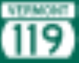
, the road turns west once more and crosses the river into Vermont. Over the bridge in Brattleboro, the road becomes Vermont Route 119
for about 400 feet (121.9 m) until it ends at U.S. Route 5.
State highway
State highway, state road or state route can refer to one of three related concepts, two of them related to a state or provincial government in a country that is divided into states or provinces :#A...
in Cheshire County
Cheshire County, New Hampshire
-Demographics:As of the census of 2000, there were 73,825 people, 28,299 households, and 18,790 families residing in the county. The population density was 104 people per square mile . There were 31,876 housing units at an average density of 45 per square mile...
in southwestern New Hampshire
New Hampshire
New Hampshire is a state in the New England region of the northeastern United States of America. The state was named after the southern English county of Hampshire. It is bordered by Massachusetts to the south, Vermont to the west, Maine and the Atlantic Ocean to the east, and the Canadian...
. The highway runs from the Massachusetts
Massachusetts
The Commonwealth of Massachusetts is a state in the New England region of the northeastern United States of America. It is bordered by Rhode Island and Connecticut to the south, New York to the west, and Vermont and New Hampshire to the north; at its east lies the Atlantic Ocean. As of the 2010...
border in New Ipswich
New Ipswich, New Hampshire
New Ipswich is a town in Hillsborough County, New Hampshire, United States. The population was 5,099 at the 2010 census. New Ipswich, situated on the Massachusetts border, includes the villages of Bank, Davis, Gibson Four Corners, Highbridge, New Ipswich Center, Smithville, and Wilder, though these...
to Hinsdale
Hinsdale, New Hampshire
Hinsdale is a town in Cheshire County, New Hampshire, United States. The population was 4,046 at the 2010 census. Hinsdale is home to part of Pisgah State Park in the northeast, and part of Wantastiquet Mountain State Forest in the northwest....
on the Vermont
Vermont
Vermont is a state in the New England region of the northeastern United States of America. The state ranks 43rd in land area, , and 45th in total area. Its population according to the 2010 census, 630,337, is the second smallest in the country, larger only than Wyoming. It is the only New England...
border.
The eastern terminus of NH 119 is at the Massachusetts
Massachusetts
The Commonwealth of Massachusetts is a state in the New England region of the northeastern United States of America. It is bordered by Rhode Island and Connecticut to the south, New York to the west, and Vermont and New Hampshire to the north; at its east lies the Atlantic Ocean. As of the 2010...
state line in New Ipswich, where the road continues southeast as Massachusetts Route 119 in the town of Ashburnham
Ashburnham, Massachusetts
As of the census of 2000, there were 5,546 people, 1,929 households, and 1,541 families residing in the town. The population density was 143.4 people per square mile . There were 2,204 housing units at an average density of 57.0 per square mile...
. The first 75 yards (68.6 m) of NH 119 in New Hampshire, beginning at the state line, are in Hillsborough County
Hillsborough County, New Hampshire
-Demographics:As of the census of 2000, there were 380,841 people, 144,455 households, and 98,807 families residing in the county. The population density was 435 people per square mile . There were 149,961 housing units at an average density of 171 per square mile...
and the town of New Ipswich before the road crosses into the town of Rindge
Rindge, New Hampshire
Rindge is a town in Cheshire County, New Hampshire, United States. The population was 6,014 at the 2010 census. Rindge is home to Franklin Pierce University, the Cathedral of the Pines, and part of Annett State Forest.-Native American inhabitants:...
and Cheshire County. In Rindge it intersects with U.S. Route 202
U.S. Route 202
U.S. Route 202 is a highway stretching from Delaware to Maine, also passing through the states of Pennsylvania, New Jersey, New York, Connecticut, Massachusetts, and New Hampshire....
. It continues west through Fitzwilliam
Fitzwilliam, New Hampshire
Fitzwilliam is a town in Cheshire County, New Hampshire, United States. The population was 2,396 at the 2010 census. Fitzwilliam is home to Rhododendron State Park, a grove of native rhododendrons that bloom in mid-July.-History:...
where it intersects with NH 12
New Hampshire Route 12
New Hampshire Route 12 is a north-south state highway running across the western portion of New Hampshire from the Massachusetts state line to the Vermont state line at the Connecticut River.-Route description:...
. It then passes into Winchester where it intersects with NH 10
New Hampshire Route 10
New Hampshire Route 10 is a north–south state highway in the U.S. state of New Hampshire. Its southern terminus is at the Massachusetts state line in the town of Winchester. In Massachusetts the highway becomes Massachusetts Route 10. Total length of the highway is .-Route description:NH 10...
and NH 78
New Hampshire Route 78
New Hampshire Route 78 is a long secondary north–south state highway in Cheshire County in the southern part of the U.S. state of New Hampshire. It runs from the Massachusetts border to Winchester....
.
The highway runs nearly due west until it reaches the Connecticut River
Connecticut River
The Connecticut River is the largest and longest river in New England, and also an American Heritage River. It flows roughly south, starting from the Fourth Connecticut Lake in New Hampshire. After flowing through the remaining Connecticut Lakes and Lake Francis, it defines the border between the...
at Hinsdale. At Hinsdale the road takes a turn north and runs along the river for 5 miles (8 km). Across the river from Brattleboro
Brattleboro, Vermont
Brattleboro, originally Brattleborough, is a town in Windham County, Vermont, United States, located in the southeast corner of the state, along the state line with New Hampshire. The population was 12,046 at the 2010 census...
, the road turns west once more and crosses the river into Vermont. Over the bridge in Brattleboro, the road becomes Vermont Route 119
Vermont Route 119
Vermont Route 119 is a very short east–west state highway located within Brattleboro in Windham County, Vermont, United States. It is the second shortest numbered highway in Vermont, after Vermont Route 26...
for about 400 feet (121.9 m) until it ends at U.S. Route 5.