
List of county routes in Bergen County, New Jersey
Encyclopedia
The following is a list of county routes
in Bergen County
in the U.S. state
of New Jersey
. For more information on the county route system in New Jersey as a whole, including its history, see County routes in New Jersey
.
County highway
A county highway is a road in the United States and in the Canadian province of Ontario that is designated and/or maintained by the county highway department...
in Bergen County
Bergen County, New Jersey
Bergen County is the most populous county of the state of New Jersey, United States. As of the 2010 United States Census, its population was 905,116. The county is part of the New York City Metropolitan Area. Its county seat is Hackensack...
in the U.S. state
U.S. state
A U.S. state is any one of the 50 federated states of the United States of America that share sovereignty with the federal government. Because of this shared sovereignty, an American is a citizen both of the federal entity and of his or her state of domicile. Four states use the official title of...
of New Jersey
New Jersey
New Jersey is a state in the Northeastern and Middle Atlantic regions of the United States. , its population was 8,791,894. It is bordered on the north and east by the state of New York, on the southeast and south by the Atlantic Ocean, on the west by Pennsylvania and on the southwest by Delaware...
. For more information on the county route system in New Jersey as a whole, including its history, see County routes in New Jersey
County routes in New Jersey
In the U.S. state of New Jersey, county routes exist in all 21 counties. They are typically the fourth type of roadway classified below the Interstate Highway, the U.S. Route numbered highway and the state highway. The County Route system is defined by two types in New Jersey...
.
500-series county routes
In addition to those listed below, the following 500-series county routes serve Bergen County:- CR 501County Route 501 (New Jersey)County Route 501 is a county highway in New Jersey in two sections spanning Middlesex, Hudson and Bergen Counties. The southern section runs from South Plainfield to Perth Amboy, the northern section runs from Bayonne to Rockleigh, and the two sections are connected by New York State Route 440...
, CR 502County Route 502 (New Jersey)County Route 502 is a county highway in the U.S. state of New Jersey. The highway extends 23.79 miles from Paterson-Hamburg Turnpike in Wayne to Palisades Boulevard in Alpine....
, CR 503County Route 503 (New Jersey)County Route 503 is a county highway in the U.S. state of New Jersey. The highway extends 17.95 miles from Paterson Plank Road in Carlstadt to the New York state line at the Montvale NJ/Pearl River NY border, where it continues as New York State Route 304...
, CR 505County Route 505 (New Jersey)County Route 505 is a county highway in the U.S. state of New Jersey. The highway extends 20.64 miles from John F. Kennedy Boulevard in Union City to the New York state line in Northvale.-Route description:...
, CR 507County Route 507 (New Jersey)County Route 507 is a county highway in the U.S. state of New Jersey. The highway extends from Harrison Avenue on the Kearny-Harrison town line to the New York state line in Mahwah. Between Ho-Ho-Kus and Mahwah, this highway is known as Franklin Turnpike...
County routes in Bergen County
| Route | Lengthhttp://www.state.nj.us/transportation/refdata/sldiag/Bergen.pdf | South/West end | North/East end | Road Name(s) | |
|---|---|---|---|---|---|
 |
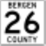
County Route 26 | 0.49 mi. | CR 507 County Route 507 (New Jersey) County Route 507 is a county highway in the U.S. state of New Jersey. The highway extends from Harrison Avenue on the Kearny-Harrison town line to the New York state line in Mahwah. Between Ho-Ho-Kus and Mahwah, this highway is known as Franklin Turnpike... in North Arlington North Arlington, New Jersey North Arlington is a borough in Bergen County, New Jersey, United States. As of the 2010 United States Census, the borough population was 15,392... |
NJ 17 in North Arlington North Arlington, New Jersey North Arlington is a borough in Bergen County, New Jersey, United States. As of the 2010 United States Census, the borough population was 15,392... |
Jauncey Avenue |
 |
County Route 27 | 1.96 mi. | Hudson CR 719 at Hudson County Hudson County, New Jersey Hudson County is the smallest county in New Jersey and one of the most densely populated in United States. It takes its name from the Hudson River, which creates part of its eastern border. Part of the New York metropolitan area, its county seat and largest city is Jersey City.- Municipalities... line in Cliffside Park Cliffside Park, New Jersey Cliffside Park is a borough in Bergen County, New Jersey, United States. As of the 2010 United States Census, the borough population was 23,594.... |
NJ 5 in Fort Lee Fort Lee, New Jersey Fort Lee is a borough in Bergen County, New Jersey, United States. As of the 2010 United States Census, the borough population was 35,345. Located atop the Hudson Palisades, the borough is the western terminus of the George Washington Bridge... |
Palisade Avenue Palisade Avenue (Hudson Palisades) Palisade Avenue is the name given to a historic road which parallels the eastern crest of Hudson Palisades in northeastern New Jersey. It travels between in Jersey City and Fort Lee, passing through Jersey City Heights, North Hudson, and Cliffside Park, various parts carrying Hudson and Bergen... |
 |
County Route 28 | 0.92 mi. | CR 507 County Route 507 (New Jersey) County Route 507 is a county highway in the U.S. state of New Jersey. The highway extends from Harrison Avenue on the Kearny-Harrison town line to the New York state line in Mahwah. Between Ho-Ho-Kus and Mahwah, this highway is known as Franklin Turnpike... in Lyndhurst Twp. Lyndhurst, New Jersey Lyndhurst is a township in Bergen County, New Jersey, United States. As of the 2010 United States Census, the township population was 20,554.Lyndhurst was originally formed as Union Township on February 19, 1852 from portions of Harrison Township... |
NJ 17 in Lyndhurst Twp. Lyndhurst, New Jersey Lyndhurst is a township in Bergen County, New Jersey, United States. As of the 2010 United States Census, the township population was 20,554.Lyndhurst was originally formed as Union Township on February 19, 1852 from portions of Harrison Township... |
Kingsland Avenue |
 |
County Route 29 | 4.01 mi. | CR 48 in Fairview | US 9W U.S. Route 9W U.S. Route 9W is a north–south U.S. Highway in the states of New Jersey and New York. It begins on Fletcher Avenue in Fort Lee, New Jersey as it crosses the US 1 & 9, US 46, and the Interstate 95 approaches to the George Washington Bridge, where it heads north up the west... in Fort Lee Fort Lee, New Jersey Fort Lee is a borough in Bergen County, New Jersey, United States. As of the 2010 United States Census, the borough population was 35,345. Located atop the Hudson Palisades, the borough is the western terminus of the George Washington Bridge... |
Anderson Avenue, Linwood Avenue |
 |
County Route 30 | 1.85 mi. | CR 507 County Route 507 (New Jersey) County Route 507 is a county highway in the U.S. state of New Jersey. The highway extends from Harrison Avenue on the Kearny-Harrison town line to the New York state line in Mahwah. Between Ho-Ho-Kus and Mahwah, this highway is known as Franklin Turnpike... in Lyndhurst Twp. Lyndhurst, New Jersey Lyndhurst is a township in Bergen County, New Jersey, United States. As of the 2010 United States Census, the township population was 20,554.Lyndhurst was originally formed as Union Township on February 19, 1852 from portions of Harrison Township... |
CR 32 in Rutherford Rutherford, New Jersey Rutherford is a borough in Bergen County, New Jersey, United States. As of the 2010 United States Census, the borough population was 18,061. It is an inner-ring suburb of New York City, located west of Midtown Manhattan.... |
Park Avenue |
 |
County Route 31 | 1.14 mi. | US 1-9 U.S. Route 1/9 U.S. Route 9 is a U.S. highway in the northeast United States, running from Laurel, Delaware north to the Canadian border near Champlain, New York... in Ridgefield Ridgefield, New Jersey There were 4,020 households out of which 32.1% had children under the age of 18 living with them, 59.7% were married couples living together, 9.9% had a female householder with no husband present, and 26.2% were non-families. 23.0% of all households were made up of individuals and 11.8% had someone... |
CR S31 in Ridgefield Ridgefield, New Jersey There were 4,020 households out of which 32.1% had children under the age of 18 living with them, 59.7% were married couples living together, 9.9% had a female householder with no husband present, and 26.2% were non-families. 23.0% of all households were made up of individuals and 11.8% had someone... |
Shaler Boulevard |
 |
County Route 32 | 1.76 mi. | NJ 17 in Rutherford Rutherford, New Jersey Rutherford is a borough in Bergen County, New Jersey, United States. As of the 2010 United States Census, the borough population was 18,061. It is an inner-ring suburb of New York City, located west of Midtown Manhattan.... |
CR 507 County Route 507 (New Jersey) County Route 507 is a county highway in the U.S. state of New Jersey. The highway extends from Harrison Avenue on the Kearny-Harrison town line to the New York state line in Mahwah. Between Ho-Ho-Kus and Mahwah, this highway is known as Franklin Turnpike... in Rutherford Rutherford, New Jersey Rutherford is a borough in Bergen County, New Jersey, United States. As of the 2010 United States Census, the borough population was 18,061. It is an inner-ring suburb of New York City, located west of Midtown Manhattan.... |
Meadow Road, East Erie Avenue |
 |
County Route 33 | 0.40 mi. | Emerson Street in Ridgefield Park Ridgefield Park, New Jersey Ridgefield Park is a village in Bergen County, New Jersey, United States. The population was 12,729 at the 2010 United States Census. Of 566 municipalities statewide, Ridgefield Park is only one of three with a village type of government in New Jersey, along with Loch Arbour and Ridgewood.The... |
Overpeck County Park Overpeck County Park Overpeck County Park is an county park in Bergen County, New Jersey, with major sections in Leonia, Palisades Park, Ridgefield Park, and Teaneck, surrounding Overpeck Creek, a tributary of the Hackensack River.... entrance in Ridgefield Park Ridgefield Park, New Jersey Ridgefield Park is a village in Bergen County, New Jersey, United States. The population was 12,729 at the 2010 United States Census. Of 566 municipalities statewide, Ridgefield Park is only one of three with a village type of government in New Jersey, along with Loch Arbour and Ridgewood.The... |
Challenger Road |
 |
County Route 34 | 0.59 mi. | CR 507 County Route 507 (New Jersey) County Route 507 is a county highway in the U.S. state of New Jersey. The highway extends from Harrison Avenue on the Kearny-Harrison town line to the New York state line in Mahwah. Between Ho-Ho-Kus and Mahwah, this highway is known as Franklin Turnpike... in Wallington Wallington, New Jersey Wallington is a borough in Bergen County, New Jersey, United States. As of the 2010 United States Census, the borough population was 11,335.Wallington was created as a borough on January 2, 1895 , at the height of the "Boroughitis" fever then sweeping through Bergen County... |
Passaic CR 619 at Passaic County Passaic County, New Jersey Passaic County is a county located in the U.S. state of New Jersey. As of the 2010 Census, the population was 501,226. Its county seat is Paterson... line in Wallington Wallington, New Jersey Wallington is a borough in Bergen County, New Jersey, United States. As of the 2010 United States Census, the borough population was 11,335.Wallington was created as a borough on January 2, 1895 , at the height of the "Boroughitis" fever then sweeping through Bergen County... |
Wallington Avenue |
 |
County Route 35 | 0.74 mi. | CR 501 County Route 501 (New Jersey) County Route 501 is a county highway in New Jersey in two sections spanning Middlesex, Hudson and Bergen Counties. The southern section runs from South Plainfield to Perth Amboy, the northern section runs from Bayonne to Rockleigh, and the two sections are connected by New York State Route 440... in Demarest Demarest, New Jersey Demarest is a Borough in Bergen County, New Jersey, United States. As of the 2010 United States Census, the borough population was 4,881.Demarest was formed by an Act of the New Jersey Legislature on April 8, 1903, from portions of Harrington Township and Palisades Township. The borough was named... |
CR 502 County Route 502 (New Jersey) County Route 502 is a county highway in the U.S. state of New Jersey. The highway extends 23.79 miles from Paterson-Hamburg Turnpike in Wayne to Palisades Boulevard in Alpine.... in Closter Closter, New Jersey Closter is a Borough in Bergen County, New Jersey, United States. As of the 2010 United States Census, the borough population was 8,373. After the turn of the century, Closter changed from being sprawling estates and farms into a middle and upper middle class suburban town... |
County Road |
 |
County Route 36 | 1.87 mi. | CR 55 in Wood-Ridge Wood-Ridge, New Jersey Wood-Ridge is a borough in Bergen County, New Jersey, United States. As of the 2010 United States Census, the borough population was 7,626.Wood-Ridge was incorporated as a borough by an Act of the New Jersey Legislature on December 6, 1894, from portions of Bergen Township, based on the results of... |
CR 503 County Route 503 (New Jersey) County Route 503 is a county highway in the U.S. state of New Jersey. The highway extends 17.95 miles from Paterson Plank Road in Carlstadt to the New York state line at the Montvale NJ/Pearl River NY border, where it continues as New York State Route 304... in Carlstadt Carlstadt, New Jersey Carlstadt is a borough in Bergen County, New Jersey, United States. As of the 2010 United States Census, the borough population was 6,127.Carlstadt was originally formed as a village by an Act of the New Jersey Legislature on March 12, 1860, within Lodi Township. It was named after Dr... |
Moonachie Avenue |
 |
County Route 37 | 0.53 mi. | CR 64 in Englewood Englewood, New Jersey Englewood is a city located in Bergen County, New Jersey. As of the 2010 United States Census, the city had a total population of 27,147.Englewood was incorporated as a city by an Act of the New Jersey Legislature on March 17, 1899, from portions of Ridgefield Township and the remaining portions of... |
Englewood Avenue/Lafayette Avenue in Englewood Englewood, New Jersey Englewood is a city located in Bergen County, New Jersey. As of the 2010 United States Census, the city had a total population of 27,147.Englewood was incorporated as a city by an Act of the New Jersey Legislature on March 17, 1899, from portions of Ridgefield Township and the remaining portions of... |
Lafayette Place |
 |
County Route 38 | 1.84 mi. | CR 507 County Route 507 (New Jersey) County Route 507 is a county highway in the U.S. state of New Jersey. The highway extends from Harrison Avenue on the Kearny-Harrison town line to the New York state line in Mahwah. Between Ho-Ho-Kus and Mahwah, this highway is known as Franklin Turnpike... /CR 67 in Garfield Garfield, New Jersey Garfield is a city in Bergen County, New Jersey, United States. As of the 2010 United States Census, the city population was 30,487.When the area that is now Garfield was first developed in 1873, it was known as East Passaic. In 1881, the community's name was changed to Garfield in honor of... |
CR 55 in Hasbrouck Heights Hasbrouck Heights, New Jersey Hasbrouck Heights is a borough in Bergen County, New Jersey, United States. As of the 2010 census, the borough population was 11,842. An inner-ring suburb of New York City, Hasbrouck Heights is located approximately northwest of Midtown Manhattan and west of Upper Manhattan.Hasbrouck Heights was... |
River Drive, Saddle River Avenue, South Main Street, Passaic Avenue |
 |
County Route 39 | 13.14 mi. | CR 124 in Ridgefield Park Ridgefield Park, New Jersey Ridgefield Park is a village in Bergen County, New Jersey, United States. The population was 12,729 at the 2010 United States Census. Of 566 municipalities statewide, Ridgefield Park is only one of three with a village type of government in New Jersey, along with Loch Arbour and Ridgewood.The... |
Rockland CR 15 at New York New York New York is a state in the Northeastern region of the United States. It is the nation's third most populous state. New York is bordered by New Jersey and Pennsylvania to the south, and by Connecticut, Massachusetts and Vermont to the east... border in Northvale Northvale, New Jersey Northvale is a borough in Bergen County, New Jersey, United States. As of the 2010 United States Census, the borough population was 4,640.Northvale was formed on March 15, 1916, from the remaining portions of Harrington Township, based on the results of a referendum held on April 4, 1916. With the... |
Teaneck Road, Washington Avenue, North Washington Avenue, Schraalenburgh Road, Tappan Road |
 |
County Route 40 (section 1) | 2.98 mi. | CR 507 County Route 507 (New Jersey) County Route 507 is a county highway in the U.S. state of New Jersey. The highway extends from Harrison Avenue on the Kearny-Harrison town line to the New York state line in Mahwah. Between Ho-Ho-Kus and Mahwah, this highway is known as Franklin Turnpike... in Garfield Garfield, New Jersey Garfield is a city in Bergen County, New Jersey, United States. As of the 2010 United States Census, the city population was 30,487.When the area that is now Garfield was first developed in 1873, it was known as East Passaic. In 1881, the community's name was changed to Garfield in honor of... |
NJ 17 in Hasbrouck Heights Hasbrouck Heights, New Jersey Hasbrouck Heights is a borough in Bergen County, New Jersey, United States. As of the 2010 census, the borough population was 11,842. An inner-ring suburb of New York City, Hasbrouck Heights is located approximately northwest of Midtown Manhattan and west of Upper Manhattan.Hasbrouck Heights was... |
Memorial Drive, Union Street, Williams Avenue |
|
County Route 40 (section 2) | 0.95 mi. | US 46 U.S. Route 46 U.S. Route 46 is an east–west U.S. Highway, running for , completely within the state of New Jersey. The west end is at an interchange with Interstate 80 and Route 94 in Columbia, Warren County on the Delaware River... in South Hackensack Twp. South Hackensack, New Jersey South Hackensack Township is a township in Bergen County, New Jersey, United States. As of the 2010 United States Census, the township population was 2,378.... |
CR 124 in Little Ferry Little Ferry, New Jersey Little Ferry is a borough in Bergen County, New Jersey, United States. As of the 2010 census, the borough population was 10,626.-Geography:Little Ferry is located at .... |
Main Street |
 |
County Route 41 (section 1) | 6.80 mi. | CR 39 in Ridgefield Park Ridgefield Park, New Jersey Ridgefield Park is a village in Bergen County, New Jersey, United States. The population was 12,729 at the 2010 United States Census. Of 566 municipalities statewide, Ridgefield Park is only one of three with a village type of government in New Jersey, along with Loch Arbour and Ridgewood.The... |
CR 126 in New Milford New Milford, New Jersey New Milford is a borough in Bergen County, New Jersey, United States. As of the 2010 United States Census, the borough population was 16,341.New Milford was incorporated as a borough on March 11, 1922, from what remained of Palisades Township, based on the results of a referendum held on April 18,... |
West Shore Avenue |
|
County Route 41 (section 2) | 1.36 mi. | CR 111 in Closter Closter, New Jersey Closter is a Borough in Bergen County, New Jersey, United States. As of the 2010 United States Census, the borough population was 8,373. After the turn of the century, Closter changed from being sprawling estates and farms into a middle and upper middle class suburban town... |
CR 502 County Route 502 (New Jersey) County Route 502 is a county highway in the U.S. state of New Jersey. The highway extends 23.79 miles from Paterson-Hamburg Turnpike in Wayne to Palisades Boulevard in Alpine.... in Closter Closter, New Jersey Closter is a Borough in Bergen County, New Jersey, United States. As of the 2010 United States Census, the borough population was 8,373. After the turn of the century, Closter changed from being sprawling estates and farms into a middle and upper middle class suburban town... |
Durie Avenue, Demarest Avenue |
 |
County Route 42 | 2.18 mi. | Passaic County Passaic County, New Jersey Passaic County is a county located in the U.S. state of New Jersey. As of the 2010 Census, the population was 501,226. Its county seat is Paterson... line in Garfield Garfield, New Jersey Garfield is a city in Bergen County, New Jersey, United States. As of the 2010 United States Census, the city population was 30,487.When the area that is now Garfield was first developed in 1873, it was known as East Passaic. In 1881, the community's name was changed to Garfield in honor of... |
CR 61 in Saddle Brook Twp. Saddle Brook, New Jersey Saddle Brook is a township in Bergen County, New Jersey, United States. As of the 2010 United States Census, the township population was 13,659.... |
Outwater Lane |
 |
County Route 44 | 2.18 mi. | CR 61 in Rochelle Park Twp. Rochelle Park, New Jersey Rochelle Park is a township in Bergen County, New Jersey, United States. As of the 2010 United States Census, the township population was 5,530.... |
State Street in Hackensack Hackensack, New Jersey Hackensack is a city in Bergen County, New Jersey, United States and the county seat of Bergen County. Although informally called Hackensack, it was officially named New Barbadoes Township until 1921. As of the 2010 United States Census, the city population was 43,010.... |
Central Avenue |
 |
County Route 48 | 0.97 mi. | Hudson County Hudson County, New Jersey Hudson County is the smallest county in New Jersey and one of the most densely populated in United States. It takes its name from the Hudson River, which creates part of its eastern border. Part of the New York metropolitan area, its county seat and largest city is Jersey City.- Municipalities... line in Fairview |
US 1-9 U.S. Route 1/9 U.S. Route 9 is a U.S. highway in the northeast United States, running from Laurel, Delaware north to the Canadian border near Champlain, New York... in Fairview |
Fairview Avenue |
 |
County Route 49 | 7.54 mi. | CR 124 in Little Ferry Little Ferry, New Jersey Little Ferry is a borough in Bergen County, New Jersey, United States. As of the 2010 census, the borough population was 10,626.-Geography:Little Ferry is located at .... |
CR 505 County Route 505 (New Jersey) County Route 505 is a county highway in the U.S. state of New Jersey. The highway extends 20.64 miles from John F. Kennedy Boulevard in Union City to the New York state line in Northvale.-Route description:... in Englewood Englewood, New Jersey Englewood is a city located in Bergen County, New Jersey. As of the 2010 United States Census, the city had a total population of 27,147.Englewood was incorporated as a city by an Act of the New Jersey Legislature on March 17, 1899, from portions of Ridgefield Township and the remaining portions of... |
South River Street, New Bridge Road, Liberty Road |
|
County Route 49 S | 0.30 mi. | CR 41/ County Route 49 in Teaneck Twp. Teaneck, New Jersey Teaneck is a township in Bergen County, New Jersey, and a suburb in the New York metropolitan area. As of the 2010 United States Census, the township population was 39,776, making it the second-most populous among the 70 municipalities in Bergen County.... |
County Route 49 in Teaneck Twp. Teaneck, New Jersey Teaneck is a township in Bergen County, New Jersey, and a suburb in the New York metropolitan area. As of the 2010 United States Census, the township population was 39,776, making it the second-most populous among the 70 municipalities in Bergen County.... |
Rosmer Avenue |
 |
County Route 50 | 1.65 mi. | US 1-9 U.S. Route 1/9 U.S. Route 9 is a U.S. highway in the northeast United States, running from Laurel, Delaware north to the Canadian border near Champlain, New York... in Ridgefield Ridgefield, New Jersey There were 4,020 households out of which 32.1% had children under the age of 18 living with them, 59.7% were married couples living together, 9.9% had a female householder with no husband present, and 26.2% were non-families. 23.0% of all households were made up of individuals and 11.8% had someone... |
County Route S25 in Cliffside Park Cliffside Park, New Jersey Cliffside Park is a borough in Bergen County, New Jersey, United States. As of the 2010 United States Census, the borough population was 23,594.... |
Edgewater Avenue |
 |
County Route 51 | 1.57 mi. | CR 60 in Hackensack Hackensack, New Jersey Hackensack is a city in Bergen County, New Jersey, United States and the county seat of Bergen County. Although informally called Hackensack, it was officially named New Barbadoes Township until 1921. As of the 2010 United States Census, the city population was 43,010.... |
CR 503 County Route 503 (New Jersey) County Route 503 is a county highway in the U.S. state of New Jersey. The highway extends 17.95 miles from Paterson Plank Road in Carlstadt to the New York state line at the Montvale NJ/Pearl River NY border, where it continues as New York State Route 304... in River Edge River Edge, New Jersey River Edge is a borough in Bergen County, New Jersey, United States. As of the 2010 United States Census, the borough population was 11,340.The community was incorporated as the borough of Riverside by an Act of the New Jersey Legislature on June 30, 1894, from portions of Midland Township, at the... |
Main Street, Johnson Avenue, Kinderkamack Road |
 |
County Route 53 | 5.85 mi. | CR 39 in Harrington Park Harrington Park, New Jersey Harrington Park is a borough in Bergen County, New Jersey, United States. As of the 2010 United States Census, the borough population was 4,664.... |
New York New York New York is a state in the Northeastern region of the United States. It is the nation's third most populous state. New York is bordered by New Jersey and Pennsylvania to the south, and by Connecticut, Massachusetts and Vermont to the east... border in Montvale Montvale, New Jersey Montvale is a borough in Bergen County, New Jersey, United States. As of the 2010 United States Census, the borough population was 7,844.Montvale was incorporated as a borough on August 31, 1894, from portions of Orvil Township and Washington Township, at the height of the "Boroughitis" craze then... |
Harriot Avenue, Rivervale Road, Middletown Road |
 |
County Route 54 | 0.36 mi. | NJ 63 New Jersey Route 63 Route 63 is a short, long state highway in Hudson and Bergen Counties in New Jersey. The route is known as Bergen Boulevard and concurrent with County Route 501 for most of its alignment. The southern terminus is at Kennedy Boulevard and County Route 501 in the community of North North Bergen... in Palisades Park Palisades Park, New Jersey Palisades Park is a borough in Bergen County, New Jersey, United States. As of the 2010 United States Census, the borough population was 19,622.... |
NJ 5 in Fort Lee Fort Lee, New Jersey Fort Lee is a borough in Bergen County, New Jersey, United States. As of the 2010 United States Census, the borough population was 35,345. Located atop the Hudson Palisades, the borough is the western terminus of the George Washington Bridge... |
Central Boulevard |
 |
County Route 55 | 5.52 mi. | CR 32 in East Rutherford East Rutherford, New Jersey East Rutherford is a borough in Bergen County, New Jersey. As of the 2010 United States Census, the borough population was 8,913. It is an inner-ring suburb of New York City, located west of Midtown Manhattan.... |
CR 62 in Hackensack Hackensack, New Jersey Hackensack is a city in Bergen County, New Jersey, United States and the county seat of Bergen County. Although informally called Hackensack, it was officially named New Barbadoes Township until 1921. As of the 2010 United States Census, the city population was 43,010.... |
Terrace Avenue, Polifly Road, First Street |
 |
County Route 56 (section 1) | 5.83 mi. | Passaic County Passaic County, New Jersey Passaic County is a county located in the U.S. state of New Jersey. As of the 2010 Census, the population was 501,226. Its county seat is Paterson... line in Elmwood Park Elmwood Park, New Jersey Elmwood Park is a borough in Bergen County, New Jersey, United States. As of the 2010 United States Census, the borough population was 19,403.... |
CR 41 in Bogota Bogota, New Jersey As of the 2010 Census, Bogota had a population of 8,187. The median age was 38.6. The racial and ethnic composition of the population was 61.0% White, 9.4% Black or African American, 0.8% Native American, 9.8% Asian, 0.1% Native Hawaiian / Pacific Islander, 14.8% some other race and 4.1% reporting... |
Market Street, Essex Street, Court Street, West Fort Lee Road |
|
County Route 56 (section 2) | 0.21 mi. | CR 56 (section 3) in Hackensack Hackensack, New Jersey Hackensack is a city in Bergen County, New Jersey, United States and the county seat of Bergen County. Although informally called Hackensack, it was officially named New Barbadoes Township until 1921. As of the 2010 United States Census, the city population was 43,010.... |
CR 503 County Route 503 (New Jersey) County Route 503 is a county highway in the U.S. state of New Jersey. The highway extends 17.95 miles from Paterson Plank Road in Carlstadt to the New York state line at the Montvale NJ/Pearl River NY border, where it continues as New York State Route 304... in Hackensack Hackensack, New Jersey Hackensack is a city in Bergen County, New Jersey, United States and the county seat of Bergen County. Although informally called Hackensack, it was officially named New Barbadoes Township until 1921. As of the 2010 United States Census, the city population was 43,010.... |
East Salem Street |
|
County Route 56(section 3) | 4.85 mi. | CR 503 County Route 503 (New Jersey) County Route 503 is a county highway in the U.S. state of New Jersey. The highway extends 17.95 miles from Paterson Plank Road in Carlstadt to the New York state line at the Montvale NJ/Pearl River NY border, where it continues as New York State Route 304... in Hackensack Hackensack, New Jersey Hackensack is a city in Bergen County, New Jersey, United States and the county seat of Bergen County. Although informally called Hackensack, it was officially named New Barbadoes Township until 1921. As of the 2010 United States Census, the city population was 43,010.... |
CR 505 County Route 505 (New Jersey) County Route 505 is a county highway in the U.S. state of New Jersey. The highway extends 20.64 miles from John F. Kennedy Boulevard in Union City to the New York state line in Northvale.-Route description:... in Fort Lee Fort Lee, New Jersey Fort Lee is a borough in Bergen County, New Jersey, United States. As of the 2010 United States Census, the borough population was 35,345. Located atop the Hudson Palisades, the borough is the western terminus of the George Washington Bridge... |
Midtown Bridge Approach, East Salem Street, West Main Street, East Main Street, Degraw Avenue, Fort Lee Road, Main Street |
|
County Route 56(section 4) | 0.12 mi. | CR 39 in Teaneck Twp. Teaneck, New Jersey Teaneck is a township in Bergen County, New Jersey, and a suburb in the New York metropolitan area. As of the 2010 United States Census, the township population was 39,776, making it the second-most populous among the 70 municipalities in Bergen County.... |
dead end in Teaneck Twp. Teaneck, New Jersey Teaneck is a township in Bergen County, New Jersey, and a suburb in the New York metropolitan area. As of the 2010 United States Census, the township population was 39,776, making it the second-most populous among the 70 municipalities in Bergen County.... |
Fort Lee Road |
 |
County Route 57 | 4.28 mi. | Fritsch Avenue in Wood-Ridge Wood-Ridge, New Jersey Wood-Ridge is a borough in Bergen County, New Jersey, United States. As of the 2010 United States Census, the borough population was 7,626.Wood-Ridge was incorporated as a borough by an Act of the New Jersey Legislature on December 6, 1894, from portions of Bergen Township, based on the results of... |
CR 62 in Hackensack Hackensack, New Jersey Hackensack is a city in Bergen County, New Jersey, United States and the county seat of Bergen County. Although informally called Hackensack, it was officially named New Barbadoes Township until 1921. As of the 2010 United States Census, the city population was 43,010.... |
Fourth Avenue, Valley Boulevard, Boulevard, South Summit Avenue, Summit Avenue |
 |
County Route 59 (section 1) | 7.45 mi. | CR 56 (section 1) in Maywood Maywood, New Jersey Maywood is a borough in Bergen County, New Jersey, United States. As of the 2010 United States Census, the borough population was 9,555.Maywood was incorporated as a borough on June 29, 1894, from portions of Midland Township, based on the results of a referendum held that day, at the height of the... |
CR 502 County Route 502 (New Jersey) County Route 502 is a county highway in the U.S. state of New Jersey. The highway extends 23.79 miles from Paterson-Hamburg Turnpike in Wayne to Palisades Boulevard in Alpine.... in Westwood Westwood, New Jersey Westwood is a borough in Bergen County, New Jersey, United States. As of the 2010 United States Census, the borough population was 10,908.... |
Maywood Avenue, Forest Avenue, Fourth Avenue, Third Avenue |
|
County Route 59 (section 2) | 0.51 mi. | CR 59 in Westwood Westwood, New Jersey Westwood is a borough in Bergen County, New Jersey, United States. As of the 2010 United States Census, the borough population was 10,908.... |
CR 110 in Westwood Westwood, New Jersey Westwood is a borough in Bergen County, New Jersey, United States. As of the 2010 United States Census, the borough population was 10,908.... |
Forest Avenue |
 |
County Route 60 | 1.98 mi. | CR 62 in Hackensack Hackensack, New Jersey Hackensack is a city in Bergen County, New Jersey, United States and the county seat of Bergen County. Although informally called Hackensack, it was officially named New Barbadoes Township until 1921. As of the 2010 United States Census, the city population was 43,010.... |
CR 39 in Teaneck Twp. Teaneck, New Jersey Teaneck is a township in Bergen County, New Jersey, and a suburb in the New York metropolitan area. As of the 2010 United States Census, the township population was 39,776, making it the second-most populous among the 70 municipalities in Bergen County.... |
Union Street, East Anderson Street |
 |
County Route 61 | 7.61 mi. | CR 507 County Route 507 (New Jersey) County Route 507 is a county highway in the U.S. state of New Jersey. The highway extends from Harrison Avenue on the Kearny-Harrison town line to the New York state line in Mahwah. Between Ho-Ho-Kus and Mahwah, this highway is known as Franklin Turnpike... in Wallington Wallington, New Jersey Wallington is a borough in Bergen County, New Jersey, United States. As of the 2010 United States Census, the borough population was 11,335.Wallington was created as a borough on January 2, 1895 , at the height of the "Boroughitis" fever then sweeping through Bergen County... |
CR 63/ CR S80 in Paramus Paramus, New Jersey Paramus is a borough in Bergen County, New Jersey, United States. As of the 2010 United States Census, the borough population was 26,342. A suburb of New York City, Paramus is located between 15–20 miles northwest of Midtown Manhattan and approximately west of Upper Manhattan.Paramus is one of... |
South Main Street, Lodi Road, Main Street, Rochelle Avenue, Farview Avenue |
 |
County Route 62 (section 1) | 7.72 mi. | Main Street in Hackensack Hackensack, New Jersey Hackensack is a city in Bergen County, New Jersey, United States and the county seat of Bergen County. Although informally called Hackensack, it was officially named New Barbadoes Township until 1921. As of the 2010 United States Census, the city population was 43,010.... |
NJ 17 in Paramus Paramus, New Jersey Paramus is a borough in Bergen County, New Jersey, United States. As of the 2010 United States Census, the borough population was 26,342. A suburb of New York City, Paramus is located between 15–20 miles northwest of Midtown Manhattan and approximately west of Upper Manhattan.Paramus is one of... |
Passaic Street, Paramus Road |
|
County Route 62 (section 2) | 1.27 mi. | CR 82 in Ridgewood Ridgewood, New Jersey Ridgewood is a village in Bergen County, New Jersey, United States. As of the 2010 United States Census, the village population was 24,958. Ridgewood is an affluent suburban bedroom community of New York City, located approximately northwest of Midtown Manhattan.The Village of Ridgewood was... |
CR 507 County Route 507 (New Jersey) County Route 507 is a county highway in the U.S. state of New Jersey. The highway extends from Harrison Avenue on the Kearny-Harrison town line to the New York state line in Mahwah. Between Ho-Ho-Kus and Mahwah, this highway is known as Franklin Turnpike... /CR 77 in Ho-Ho-Kus Ho-Ho-Kus, New Jersey Ho-Ho-Kus is a borough in Bergen County, New Jersey, United States. As of the 2010 census, the borough population was 4,078. It is the home of several historical landmarks, including the Ho-Ho-Kus Inn and The Hermitage.... |
Franklin Turnpike |
 |
County Route 63 | 6.47 mi. | CR 61/ CR S80 in Paramus Paramus, New Jersey Paramus is a borough in Bergen County, New Jersey, United States. As of the 2010 United States Census, the borough population was 26,342. A suburb of New York City, Paramus is located between 15–20 miles northwest of Midtown Manhattan and approximately west of Upper Manhattan.Paramus is one of... |
CR 94 in Park Ridge Park Ridge, New Jersey Park Ridge is a borough in Bergen County, New Jersey, United States. Park Ridge had a population of 8,645 as of the 2010 United States Census.... |
Pascack Road |
 |
County Route 64 | 1.45 mi. | CR 39 in Teaneck Twp. Teaneck, New Jersey Teaneck is a township in Bergen County, New Jersey, and a suburb in the New York metropolitan area. As of the 2010 United States Census, the township population was 39,776, making it the second-most populous among the 70 municipalities in Bergen County.... |
CR 501 County Route 501 (New Jersey) County Route 501 is a county highway in New Jersey in two sections spanning Middlesex, Hudson and Bergen Counties. The southern section runs from South Plainfield to Perth Amboy, the northern section runs from Bayonne to Rockleigh, and the two sections are connected by New York State Route 440... in Englewood Englewood, New Jersey Englewood is a city located in Bergen County, New Jersey. As of the 2010 United States Census, the city had a total population of 27,147.Englewood was incorporated as a city by an Act of the New Jersey Legislature on March 17, 1899, from portions of Ridgefield Township and the remaining portions of... |
East Forest Road |
 |
County Route 65 | 0.75 mi. | US 46 U.S. Route 46 U.S. Route 46 is an east–west U.S. Highway, running for , completely within the state of New Jersey. The west end is at an interchange with Interstate 80 and Route 94 in Columbia, Warren County on the Delaware River... in Saddle Brook Twp. Saddle Brook, New Jersey Saddle Brook is a township in Bergen County, New Jersey, United States. As of the 2010 United States Census, the township population was 13,659.... |
CR 56 in Saddle Brook Twp. Saddle Brook, New Jersey Saddle Brook is a township in Bergen County, New Jersey, United States. As of the 2010 United States Census, the township population was 13,659.... |
Westminster Place |
 |
County Route 67 | 4.23 mi. | CR 507 County Route 507 (New Jersey) County Route 507 is a county highway in the U.S. state of New Jersey. The highway extends from Harrison Avenue on the Kearny-Harrison town line to the New York state line in Mahwah. Between Ho-Ho-Kus and Mahwah, this highway is known as Franklin Turnpike... /CR 38 in Garfield Garfield, New Jersey Garfield is a city in Bergen County, New Jersey, United States. As of the 2010 United States Census, the city population was 30,487.When the area that is now Garfield was first developed in 1873, it was known as East Passaic. In 1881, the community's name was changed to Garfield in honor of... |
NJ 4 in Fair Lawn Fair Lawn, New Jersey Fair Lawn is a borough in Bergen County, New Jersey, United States and a suburban municipality in the New York City Metropolitan Area. As of the 2010 United States Census, the borough's population was 32,457. Fair Lawn was incorporated as a borough by an Act of the New Jersey Legislature on March... |
Midland Avenue, North Midland Avenue, Midland Avenue |
 |
County Route 68 | 0.17 mi. | NJ 4 in River Edge River Edge, New Jersey River Edge is a borough in Bergen County, New Jersey, United States. As of the 2010 United States Census, the borough population was 11,340.The community was incorporated as the borough of Riverside by an Act of the New Jersey Legislature on June 30, 1894, from portions of Midland Township, at the... |
CR 503 County Route 503 (New Jersey) County Route 503 is a county highway in the U.S. state of New Jersey. The highway extends 17.95 miles from Paterson Plank Road in Carlstadt to the New York state line at the Montvale NJ/Pearl River NY border, where it continues as New York State Route 304... /CR 51 in River Edge River Edge, New Jersey River Edge is a borough in Bergen County, New Jersey, United States. As of the 2010 United States Census, the borough population was 11,340.The community was incorporated as the borough of Riverside by an Act of the New Jersey Legislature on June 30, 1894, from portions of Midland Township, at the... |
Main Street |
 |
County Route 69 | 3.11 mi. | CR 507 County Route 507 (New Jersey) County Route 507 is a county highway in the U.S. state of New Jersey. The highway extends from Harrison Avenue on the Kearny-Harrison town line to the New York state line in Mahwah. Between Ho-Ho-Kus and Mahwah, this highway is known as Franklin Turnpike... in Fair Lawn Fair Lawn, New Jersey Fair Lawn is a borough in Bergen County, New Jersey, United States and a suburban municipality in the New York City Metropolitan Area. As of the 2010 United States Census, the borough's population was 32,457. Fair Lawn was incorporated as a borough by an Act of the New Jersey Legislature on March... |
CR 80 in Ridgewood Ridgewood, New Jersey Ridgewood is a village in Bergen County, New Jersey, United States. As of the 2010 United States Census, the village population was 24,958. Ridgewood is an affluent suburban bedroom community of New York City, located approximately northwest of Midtown Manhattan.The Village of Ridgewood was... |
Wagaraw Road, Lincoln Avenue, Lake Street |
 |
County Route 70 | 3.97 mi. | CR 503 County Route 503 (New Jersey) County Route 503 is a county highway in the U.S. state of New Jersey. The highway extends 17.95 miles from Paterson Plank Road in Carlstadt to the New York state line at the Montvale NJ/Pearl River NY border, where it continues as New York State Route 304... in River Edge River Edge, New Jersey River Edge is a borough in Bergen County, New Jersey, United States. As of the 2010 United States Census, the borough population was 11,340.The community was incorporated as the borough of Riverside by an Act of the New Jersey Legislature on June 30, 1894, from portions of Midland Township, at the... |
W. Railroad Avenue in Tenafly Tenafly, New Jersey Tenafly is a borough in Bergen County, New Jersey, United States. As of the 2010 census, the borough population was 14,488. Tenafly is an affluent suburb of New York City.... |
Prospect Street, River Edge Road, North Prospect Street, West Main Street, East Main Street, River Edge Road |
 |
County Route 71 | 4.13 mi. | NJ 17 in Ridgewood Ridgewood, New Jersey Ridgewood is a village in Bergen County, New Jersey, United States. As of the 2010 United States Census, the village population was 24,958. Ridgewood is an affluent suburban bedroom community of New York City, located approximately northwest of Midtown Manhattan.The Village of Ridgewood was... |
CR 92 in Woodcliff Lake Woodcliff Lake, New Jersey Woodcliff Lake is a borough in Bergen County, New Jersey, United States. As of the 2010 Census, the borough population was 5,730.Woodcliff Lake is also the name of the reservoir that lies primarily within the borough, with a small part of it located in neighboring Hillsdale.The borough is an... |
Van Emburgh Avenue, Wierimus Road |
 |
County Route 72 | 2.05 mi. | CR 501 County Route 501 (New Jersey) County Route 501 is a county highway in New Jersey in two sections spanning Middlesex, Hudson and Bergen Counties. The southern section runs from South Plainfield to Perth Amboy, the northern section runs from Bayonne to Rockleigh, and the two sections are connected by New York State Route 440... in Tenafly Tenafly, New Jersey Tenafly is a borough in Bergen County, New Jersey, United States. As of the 2010 census, the borough population was 14,488. Tenafly is an affluent suburb of New York City.... |
US 9W U.S. Route 9W U.S. Route 9W is a north–south U.S. Highway in the states of New Jersey and New York. It begins on Fletcher Avenue in Fort Lee, New Jersey as it crosses the US 1 & 9, US 46, and the Interstate 95 approaches to the George Washington Bridge, where it heads north up the west... in Tenafly Tenafly, New Jersey Tenafly is a borough in Bergen County, New Jersey, United States. As of the 2010 census, the borough population was 14,488. Tenafly is an affluent suburb of New York City.... |
East Clinton Avenue |
 |
County Route 73 | 5.36 mi. | CR 75 in Ho-Ho-Kus Ho-Ho-Kus, New Jersey Ho-Ho-Kus is a borough in Bergen County, New Jersey, United States. As of the 2010 census, the borough population was 4,078. It is the home of several historical landmarks, including the Ho-Ho-Kus Inn and The Hermitage.... |
NY 45 New York State Route 45 New York State Route 45 is a north–south state highway in central Rockland County, New York, United States. It spans from the village of Chestnut Ridge at the New Jersey – New York border, where it becomes County Route 73 in Bergen County, New Jersey, to U.S. Route 202 in... at New York New York New York is a state in the Northeastern region of the United States. It is the nation's third most populous state. New York is bordered by New Jersey and Pennsylvania to the south, and by Connecticut, Massachusetts and Vermont to the east... border in Montvale Montvale, New Jersey Montvale is a borough in Bergen County, New Jersey, United States. As of the 2010 United States Census, the borough population was 7,844.Montvale was incorporated as a borough on August 31, 1894, from portions of Orvil Township and Washington Township, at the height of the "Boroughitis" craze then... |
Jacquelin Avenue, Chestnut Ridge Road, County Road, Chestnut Ridge Road |
 |
County Route 74 (section 1) | 1.53 mi. | CR 61 in Paramus Paramus, New Jersey Paramus is a borough in Bergen County, New Jersey, United States. As of the 2010 United States Census, the borough population was 26,342. A suburb of New York City, Paramus is located between 15–20 miles northwest of Midtown Manhattan and approximately west of Upper Manhattan.Paramus is one of... |
CR 503 County Route 503 (New Jersey) County Route 503 is a county highway in the U.S. state of New Jersey. The highway extends 17.95 miles from Paterson Plank Road in Carlstadt to the New York state line at the Montvale NJ/Pearl River NY border, where it continues as New York State Route 304... in River Edge River Edge, New Jersey River Edge is a borough in Bergen County, New Jersey, United States. As of the 2010 United States Census, the borough population was 11,340.The community was incorporated as the borough of Riverside by an Act of the New Jersey Legislature on June 30, 1894, from portions of Midland Township, at the... |
Midland Avenue |
|
County Route 74 (section 2) | 5.82 mi. | New Milford Avenue in Oradell Oradell, New Jersey Oradell is a borough in Bergen County, New Jersey, United States. At the 2010 United States Census, the borough population was 7,978. The borough's territory includes a dam on the Hackensack River that forms the Oradell Reservoir... |
US 9W U.S. Route 9W U.S. Route 9W is a north–south U.S. Highway in the states of New Jersey and New York. It begins on Fletcher Avenue in Fort Lee, New Jersey as it crosses the US 1 & 9, US 46, and the Interstate 95 approaches to the George Washington Bridge, where it heads north up the west... in Alpine Alpine, New Jersey Alpine is a borough in Bergen County, New Jersey, United States. It is a suburb of New York City, located northwest of Midtown Manhattan. As of the 2010 United States Census, the borough population was 1,849.... |
Madison Avenue, Hillside Avenue |
 |
County Route 75 | 7.09 mi. | NJ 17 in Ridgewood Ridgewood, New Jersey Ridgewood is a village in Bergen County, New Jersey, United States. As of the 2010 United States Census, the village population was 24,958. Ridgewood is an affluent suburban bedroom community of New York City, located approximately northwest of Midtown Manhattan.The Village of Ridgewood was... |
Rockland CR 73 at New York New York New York is a state in the Northeastern region of the United States. It is the nation's third most populous state. New York is bordered by New Jersey and Pennsylvania to the south, and by Connecticut, Massachusetts and Vermont to the east... border in Upper Saddle River Upper Saddle River, New Jersey Upper Saddle River is an affluent borough in Bergen County, New Jersey, United States. As of the 2010 United States Census, the borough population was 8,208. It is not to be confused with the neighboring borough of Saddle River.-History:... |
East Saddle River Road |
 |
County Route 76 | 2.73 mi. | Passaic County Passaic County, New Jersey Passaic County is a county located in the U.S. state of New Jersey. As of the 2010 Census, the population was 501,226. Its county seat is Paterson... line in Fair Lawn Fair Lawn, New Jersey Fair Lawn is a borough in Bergen County, New Jersey, United States and a suburban municipality in the New York City Metropolitan Area. As of the 2010 United States Census, the borough's population was 32,457. Fair Lawn was incorporated as a borough by an Act of the New Jersey Legislature on March... |
CR 62 in Paramus Paramus, New Jersey Paramus is a borough in Bergen County, New Jersey, United States. As of the 2010 United States Census, the borough population was 26,342. A suburb of New York City, Paramus is located between 15–20 miles northwest of Midtown Manhattan and approximately west of Upper Manhattan.Paramus is one of... |
Fairlawn Avenue, Century Road |
 |
County Route 77 | 6.18 mi. | CR 507 County Route 507 (New Jersey) County Route 507 is a county highway in the U.S. state of New Jersey. The highway extends from Harrison Avenue on the Kearny-Harrison town line to the New York state line in Mahwah. Between Ho-Ho-Kus and Mahwah, this highway is known as Franklin Turnpike... /CR 62 in Ho-Ho-Kus Ho-Ho-Kus, New Jersey Ho-Ho-Kus is a borough in Bergen County, New Jersey, United States. As of the 2010 census, the borough population was 4,078. It is the home of several historical landmarks, including the Ho-Ho-Kus Inn and The Hermitage.... |
New York New York New York is a state in the Northeastern region of the United States. It is the nation's third most populous state. New York is bordered by New Jersey and Pennsylvania to the south, and by Connecticut, Massachusetts and Vermont to the east... border in Upper Saddle River Upper Saddle River, New Jersey Upper Saddle River is an affluent borough in Bergen County, New Jersey, United States. As of the 2010 United States Census, the borough population was 8,208. It is not to be confused with the neighboring borough of Saddle River.-History:... |
Sheridan Avenue, West Saddle River Road |
 |
County Route 78 | 2.39 mi. | Passaic CR 651 at Passaic County Passaic County, New Jersey Passaic County is a county located in the U.S. state of New Jersey. As of the 2010 Census, the population was 501,226. Its county seat is Paterson... line in Fair Lawn Fair Lawn, New Jersey Fair Lawn is a borough in Bergen County, New Jersey, United States and a suburban municipality in the New York City Metropolitan Area. As of the 2010 United States Census, the borough's population was 32,457. Fair Lawn was incorporated as a borough by an Act of the New Jersey Legislature on March... |
CR 79 in Fair Lawn Fair Lawn, New Jersey Fair Lawn is a borough in Bergen County, New Jersey, United States and a suburban municipality in the New York City Metropolitan Area. As of the 2010 United States Census, the borough's population was 32,457. Fair Lawn was incorporated as a borough by an Act of the New Jersey Legislature on March... |
Morlot Avenue |
 |
County Route 79 | 6.69 mi. | CR 56 in Saddle Brook Twp. Saddle Brook, New Jersey Saddle Brook is a township in Bergen County, New Jersey, United States. As of the 2010 United States Census, the township population was 13,659.... |
CR 80 in Ridgewood Ridgewood, New Jersey Ridgewood is a village in Bergen County, New Jersey, United States. As of the 2010 United States Census, the village population was 24,958. Ridgewood is an affluent suburban bedroom community of New York City, located approximately northwest of Midtown Manhattan.The Village of Ridgewood was... |
Saddle River Road, Ackerman Avenue |
 |
County Route 80 (section 1) | 6.48 mi. | CR 84 in Midland Park Midland Park, New Jersey Midland Park is a borough in Bergen County, New Jersey, United States. As of the 2010 United States Census, the borough's population was 7,128.... |
CR 503 County Route 503 (New Jersey) County Route 503 is a county highway in the U.S. state of New Jersey. The highway extends 17.95 miles from Paterson Plank Road in Carlstadt to the New York state line at the Montvale NJ/Pearl River NY border, where it continues as New York State Route 304... in Oradell Oradell, New Jersey Oradell is a borough in Bergen County, New Jersey, United States. At the 2010 United States Census, the borough population was 7,978. The borough's territory includes a dam on the Hackensack River that forms the Oradell Reservoir... |
Godwin Avenue, Franklin Avenue, East Ridgewood Avenue, Ridgewood Avenue, Oradell Avenue |
|
County Route 80 (section 2) | 4.35 mi. | Haworth Haworth, New Jersey Haworth is a borough in Bergen County, New Jersey, United States. As of the 2010 United States Census, the borough population was 3,382.Haworth was formed by an Act of the New Jersey Legislature on February 24, 1904, from portions of both Dumont and Harrington Townships.-Geography:Haworth is... /Oradell Oradell, New Jersey Oradell is a borough in Bergen County, New Jersey, United States. At the 2010 United States Census, the borough population was 7,978. The borough's territory includes a dam on the Hackensack River that forms the Oradell Reservoir... border |
CR S33 in Demarest Demarest, New Jersey Demarest is a Borough in Bergen County, New Jersey, United States. As of the 2010 United States Census, the borough population was 4,881.Demarest was formed by an Act of the New Jersey Legislature on April 8, 1903, from portions of Harrington Township and Palisades Township. The borough was named... |
Lakeshore Drive, Sunset Avenue, Haworth Avenue, Hardenburgh Avenue |
 |
County Route 81 | 7.61 mi. | CR 84 in Midland Park Midland Park, New Jersey Midland Park is a borough in Bergen County, New Jersey, United States. As of the 2010 United States Census, the borough's population was 7,128.... |
New York New York New York is a state in the Northeastern region of the United States. It is the nation's third most populous state. New York is bordered by New Jersey and Pennsylvania to the south, and by Connecticut, Massachusetts and Vermont to the east... border in Mahwah Twp. Mahwah, New Jersey Mahwah is a township in Bergen County, New Jersey, United States. As of the 2010 United States Census, the township population was 25,890. The name Mahwah is derived from the Lenni Lenape word "mawewi" which means "Meeting Place" or "Place Where Paths Meet".The area that is now Mahwah was... |
Prospect Street, Crescent Avenue, West Crescent Avenue, East Crescent Avenue |
 |
County Route 82 (section 1) | 2.75 mi. | CR 81 in Midland Park Midland Park, New Jersey Midland Park is a borough in Bergen County, New Jersey, United States. As of the 2010 United States Census, the borough's population was 7,128.... |
CR 62 in Ridgewood Ridgewood, New Jersey Ridgewood is a village in Bergen County, New Jersey, United States. As of the 2010 United States Census, the village population was 24,958. Ridgewood is an affluent suburban bedroom community of New York City, located approximately northwest of Midtown Manhattan.The Village of Ridgewood was... |
Glen Avenue, West Glen Avenue, East Glen Avenue |
|
County Route 82 (section 2) | 1.25 mi. | CR 75 in Ridgewood Ridgewood, New Jersey Ridgewood is a village in Bergen County, New Jersey, United States. As of the 2010 United States Census, the village population was 24,958. Ridgewood is an affluent suburban bedroom community of New York City, located approximately northwest of Midtown Manhattan.The Village of Ridgewood was... |
CR 63 in Washington Twp. | East Glen Avenue |
 |
County Route 83 | 2.65 mi. | CR 507 County Route 507 (New Jersey) County Route 507 is a county highway in the U.S. state of New Jersey. The highway extends from Harrison Avenue on the Kearny-Harrison town line to the New York state line in Mahwah. Between Ho-Ho-Kus and Mahwah, this highway is known as Franklin Turnpike... in Ramsey Ramsey, New Jersey Ramsey is a borough in Bergen County, New Jersey, United States. It is a suburb of New York City, located northwest of Midtown Manhattan. As of the 2010 United States Census, the borough population was 14,473.... |
Rockland CR 89 at New York New York New York is a state in the Northeastern region of the United States. It is the nation's third most populous state. New York is bordered by New Jersey and Pennsylvania to the south, and by Connecticut, Massachusetts and Vermont to the east... border in Mahwah Twp. Mahwah, New Jersey Mahwah is a township in Bergen County, New Jersey, United States. As of the 2010 United States Census, the township population was 25,890. The name Mahwah is derived from the Lenni Lenape word "mawewi" which means "Meeting Place" or "Place Where Paths Meet".The area that is now Mahwah was... |
Airmount Avenue |
 |
County Route 84 | 7.86 mi. | US 202 U.S. Route 202 in New Jersey U.S. Route 202 is a U.S. Highway running from New Castle, Delaware northeast to Bangor, Maine. In the U.S. state of New Jersey, the route runs from the New Hope-Lambertville Toll Bridge over the Delaware River at the Pennsylvania border in Delaware Township, Hunterdon County near Lambertville... in Oakland Oakland, New Jersey Oakland is a borough in Bergen County, New Jersey, United States. As of the 2010 United States Census, the borough population was 12,754.Oakland was incorporated as a borough by an Act of the New Jersey Legislature on April 8, 1902, from portions of Franklin Township.-History:The Van Allen House... |
Passaic CR 659 at Passaic County Passaic County, New Jersey Passaic County is a county located in the U.S. state of New Jersey. As of the 2010 Census, the population was 501,226. Its county seat is Paterson... line in Wyckoff Twp. Wyckoff, New Jersey Wyckoff is a township in Bergen County, New Jersey, United States. As of the 2010 United States Census, the township population was 16,696. As of the 2000 Census, Wyckoff ranked 54th in 100 highest-income places in the United States... |
Franklin Avenue, Godwin Avenue, Goffle Avenue, Goffle Road |
 |
County Route 85 | 5.53 mi. | CR 81 in Allendale Allendale, New Jersey Allendale is a borough in Bergen County, New Jersey, United States. As of the 2010 United States Census, the borough population was 6,505.Allendale was formed on November 8, 1894 from portions of Franklin Township, Hohokus Township and Orvil Township at the height of the Boroughitis phenomenon then... |
US 202 U.S. Route 202 in New Jersey U.S. Route 202 is a U.S. Highway running from New Castle, Delaware northeast to Bangor, Maine. In the U.S. state of New Jersey, the route runs from the New Hope-Lambertville Toll Bridge over the Delaware River at the Pennsylvania border in Delaware Township, Hunterdon County near Lambertville... in Mahwah Twp. Mahwah, New Jersey Mahwah is a township in Bergen County, New Jersey, United States. As of the 2010 United States Census, the township population was 25,890. The name Mahwah is derived from the Lenni Lenape word "mawewi" which means "Meeting Place" or "Place Where Paths Meet".The area that is now Mahwah was... |
Hillside Avenue, South Central Avenue, North Central Avenue, Island Road |
 |
County Route 87 | 7.85 mi. | CR 80 in Ridgewood Ridgewood, New Jersey Ridgewood is a village in Bergen County, New Jersey, United States. As of the 2010 United States Census, the village population was 24,958. Ridgewood is an affluent suburban bedroom community of New York City, located approximately northwest of Midtown Manhattan.The Village of Ridgewood was... |
CR 507 County Route 507 (New Jersey) County Route 507 is a county highway in the U.S. state of New Jersey. The highway extends from Harrison Avenue on the Kearny-Harrison town line to the New York state line in Mahwah. Between Ho-Ho-Kus and Mahwah, this highway is known as Franklin Turnpike... in Ramsey Ramsey, New Jersey Ramsey is a borough in Bergen County, New Jersey, United States. It is a suburb of New York City, located northwest of Midtown Manhattan. As of the 2010 United States Census, the borough population was 14,473.... |
Lake Avenue, Wyckoff Avenue, West Main Street, East Main Street |
|
County Route 87 Spur | 0.57 mi. | CR 502 County Route 502 (New Jersey) County Route 502 is a county highway in the U.S. state of New Jersey. The highway extends 23.79 miles from Paterson-Hamburg Turnpike in Wayne to Palisades Boulevard in Alpine.... in Wyckoff Twp. Wyckoff, New Jersey Wyckoff is a township in Bergen County, New Jersey, United States. As of the 2010 United States Census, the township population was 16,696. As of the 2000 Census, Wyckoff ranked 54th in 100 highest-income places in the United States... |
CR 87 in Wyckoff Twp. Wyckoff, New Jersey Wyckoff is a township in Bergen County, New Jersey, United States. As of the 2010 United States Census, the township population was 16,696. As of the 2000 Census, Wyckoff ranked 54th in 100 highest-income places in the United States... |
Bergen County 87 Spur |
 |
County Route 89 (section 1) | 3.10 mi. | Passaic CR 677 at Passaic County Passaic County, New Jersey Passaic County is a county located in the U.S. state of New Jersey. As of the 2010 Census, the population was 501,226. Its county seat is Paterson... line in Franklin Lakes Franklin Lakes, New Jersey Franklin Lakes is a borough in Bergen County, New Jersey, United States. As of the 2010 census, the borough population was 10,590. As of the 2000 Census, Franklin Lakes had the 18th-highest per-capita income of all 566 municipalities in the state. Nationwide, Franklin Lakes ranked 17th among the... |
CR 117 in Franklin Lakes Franklin Lakes, New Jersey Franklin Lakes is a borough in Bergen County, New Jersey, United States. As of the 2010 census, the borough population was 10,590. As of the 2000 Census, Franklin Lakes had the 18th-highest per-capita income of all 566 municipalities in the state. Nationwide, Franklin Lakes ranked 17th among the... |
High Mountain Road |
|
County Route 89 (section 2) | 0.14 mi. | CR 84 in Oakland Oakland, New Jersey Oakland is a borough in Bergen County, New Jersey, United States. As of the 2010 United States Census, the borough population was 12,754.Oakland was incorporated as a borough by an Act of the New Jersey Legislature on April 8, 1902, from portions of Franklin Township.-History:The Van Allen House... |
dead end in Oakland Oakland, New Jersey Oakland is a borough in Bergen County, New Jersey, United States. As of the 2010 United States Census, the borough population was 12,754.Oakland was incorporated as a borough by an Act of the New Jersey Legislature on April 8, 1902, from portions of Franklin Township.-History:The Van Allen House... |
High Mountain Road |
 |
County Route 90 | 6.89 mi. | CR 507 County Route 507 (New Jersey) County Route 507 is a county highway in the U.S. state of New Jersey. The highway extends from Harrison Avenue on the Kearny-Harrison town line to the New York state line in Mahwah. Between Ho-Ho-Kus and Mahwah, this highway is known as Franklin Turnpike... in Allendale Allendale, New Jersey Allendale is a borough in Bergen County, New Jersey, United States. As of the 2010 United States Census, the borough population was 6,505.Allendale was formed on November 8, 1894 from portions of Franklin Township, Hohokus Township and Orvil Township at the height of the Boroughitis phenomenon then... |
CR 53 in River Vale Twp. River Vale, New Jersey River Vale is a township in Bergen County, New Jersey, United States. As of the 2010 United States Census, the township population was 9,659. The community was ranked #29 on the 100 Best Places to Live 2007 survey published by CNN/Money magazine.... |
East Allendale Road, Woodcliff Lake Road, Saddle River Road, Woodcliff Avenue, Prospect Avenue |
 |
County Route 92 (section 1) | 2.35 mi. | CR 114 in Hillsdale Hillsdale, New Jersey Hillsdale is a borough in Bergen County, New Jersey, United States. As of the 2010 census, the borough population was 10,219.The populated area today known as Hillsdale took form in the mid-to-late 19th century as land speculators, led by David P. Patterson, developed subdivisons to profit from the... |
CR 63 in Park Ridge Park Ridge, New Jersey Park Ridge is a borough in Bergen County, New Jersey, United States. Park Ridge had a population of 8,645 as of the 2010 United States Census.... |
Ruckman Road, Park Avenue |
|
County Route 92 (section 2) | 1.45 mi. | CR S73 in Woodcliff Lake Woodcliff Lake, New Jersey Woodcliff Lake is a borough in Bergen County, New Jersey, United States. As of the 2010 Census, the borough population was 5,730.Woodcliff Lake is also the name of the reservoir that lies primarily within the borough, with a small part of it located in neighboring Hillsdale.The borough is an... |
Ridge Avenue in Park Ridge Park Ridge, New Jersey Park Ridge is a borough in Bergen County, New Jersey, United States. Park Ridge had a population of 8,645 as of the 2010 United States Census.... |
Glen Road, Spring Valley Road |
|
County Route 92 (section 3) | 0.49 mi. | CR 90 in Saddle River Saddle River, New Jersey Saddle River is a borough in Bergen County, New Jersey, United States. As of the 2010 United States Census, the borough population was 3,152. Saddle River has the second-highest per-capita income in the state... |
CR 73 in Saddle River Saddle River, New Jersey Saddle River is a borough in Bergen County, New Jersey, United States. As of the 2010 United States Census, the borough population was 3,152. Saddle River has the second-highest per-capita income in the state... |
East Allendale Road |
 |
County Route 93 (section 1) | 5.60 mi. | US 202 U.S. Route 202 in New Jersey U.S. Route 202 is a U.S. Highway running from New Castle, Delaware northeast to Bangor, Maine. In the U.S. state of New Jersey, the route runs from the New Hope-Lambertville Toll Bridge over the Delaware River at the Pennsylvania border in Delaware Township, Hunterdon County near Lambertville... in Oakland Oakland, New Jersey Oakland is a borough in Bergen County, New Jersey, United States. As of the 2010 United States Census, the borough population was 12,754.Oakland was incorporated as a borough by an Act of the New Jersey Legislature on April 8, 1902, from portions of Franklin Township.-History:The Van Allen House... |
Passaic CR 667 at Passaic County Passaic County, New Jersey Passaic County is a county located in the U.S. state of New Jersey. As of the 2010 Census, the population was 501,226. Its county seat is Paterson... line in Wyckoff Twp. Wyckoff, New Jersey Wyckoff is a township in Bergen County, New Jersey, United States. As of the 2010 United States Census, the township population was 16,696. As of the 2000 Census, Wyckoff ranked 54th in 100 highest-income places in the United States... |
Long Hill Road, Franklin Lake Road, Sicomac Avenue |
|
County Route 93 (section 2) | 1.55 mi. | CR 93 (section 1) in Wyckoff Twp. Wyckoff, New Jersey Wyckoff is a township in Bergen County, New Jersey, United States. As of the 2010 United States Census, the township population was 16,696. As of the 2000 Census, Wyckoff ranked 54th in 100 highest-income places in the United States... |
CR 84 in Midland Park Midland Park, New Jersey Midland Park is a borough in Bergen County, New Jersey, United States. As of the 2010 United States Census, the borough's population was 7,128.... |
Cedar Hill Avenue, Newtown Road, Greenwood Avenue |
 |
County Route 94 | 4.12 mi. | CR 73 in Montvale Montvale, New Jersey Montvale is a borough in Bergen County, New Jersey, United States. As of the 2010 United States Census, the borough population was 7,844.Montvale was incorporated as a borough on August 31, 1894, from portions of Orvil Township and Washington Township, at the height of the "Boroughitis" craze then... |
Rockland CR 23 at New York New York New York is a state in the Northeastern region of the United States. It is the nation's third most populous state. New York is bordered by New Jersey and Pennsylvania to the south, and by Connecticut, Massachusetts and Vermont to the east... border in River Vale Twp. River Vale, New Jersey River Vale is a township in Bergen County, New Jersey, United States. As of the 2010 United States Census, the township population was 9,659. The community was ranked #29 on the 100 Best Places to Live 2007 survey published by CNN/Money magazine.... |
Grand Avenue West, Grand Avenue East, Blue Hill Road, Orangeburgh Road |
 |
County Route 96 | 4.06 mi. | CR 81 in Upper Saddle River Upper Saddle River, New Jersey Upper Saddle River is an affluent borough in Bergen County, New Jersey, United States. As of the 2010 United States Census, the borough population was 8,208. It is not to be confused with the neighboring borough of Saddle River.-History:... |
CR S94 in Montvale Montvale, New Jersey Montvale is a borough in Bergen County, New Jersey, United States. As of the 2010 United States Census, the borough population was 7,844.Montvale was incorporated as a borough on August 31, 1894, from portions of Orvil Township and Washington Township, at the height of the "Boroughitis" craze then... |
Lake Street, Grand Avenue, Summit Avenue |
 |
County Route 97 | 0.99 mi. | CR 89 in Franklin Lakes Franklin Lakes, New Jersey Franklin Lakes is a borough in Bergen County, New Jersey, United States. As of the 2010 census, the borough population was 10,590. As of the 2000 Census, Franklin Lakes had the 18th-highest per-capita income of all 566 municipalities in the state. Nationwide, Franklin Lakes ranked 17th among the... |
CR 502 County Route 502 (New Jersey) County Route 502 is a county highway in the U.S. state of New Jersey. The highway extends 23.79 miles from Paterson-Hamburg Turnpike in Wayne to Palisades Boulevard in Alpine.... /CR 93 in Franklin Lakes Franklin Lakes, New Jersey Franklin Lakes is a borough in Bergen County, New Jersey, United States. As of the 2010 census, the borough population was 10,590. As of the 2000 Census, Franklin Lakes had the 18th-highest per-capita income of all 566 municipalities in the state. Nationwide, Franklin Lakes ranked 17th among the... |
Ewing Avenue |
 |
County Route 98 | 2.83 mi. | US 202 U.S. Route 202 in New Jersey U.S. Route 202 is a U.S. Highway running from New Castle, Delaware northeast to Bangor, Maine. In the U.S. state of New Jersey, the route runs from the New Hope-Lambertville Toll Bridge over the Delaware River at the Pennsylvania border in Delaware Township, Hunterdon County near Lambertville... in Mahwah Twp. Mahwah, New Jersey Mahwah is a township in Bergen County, New Jersey, United States. As of the 2010 United States Census, the township population was 25,890. The name Mahwah is derived from the Lenni Lenape word "mawewi" which means "Meeting Place" or "Place Where Paths Meet".The area that is now Mahwah was... |
CR 85 in Ramsey Ramsey, New Jersey Ramsey is a borough in Bergen County, New Jersey, United States. It is a suburb of New York City, located northwest of Midtown Manhattan. As of the 2010 United States Census, the borough population was 14,473.... |
Darlington Avenue |
 |
County Route 99 | 0.74 mi. | CR 53 in River Vale Twp. River Vale, New Jersey River Vale is a township in Bergen County, New Jersey, United States. As of the 2010 United States Census, the township population was 9,659. The community was ranked #29 on the 100 Best Places to Live 2007 survey published by CNN/Money magazine.... |
CR 94 in River Vale Twp. River Vale, New Jersey River Vale is a township in Bergen County, New Jersey, United States. As of the 2010 United States Census, the township population was 9,659. The community was ranked #29 on the 100 Best Places to Live 2007 survey published by CNN/Money magazine.... |
Orangeburg Road |
 |
County Route 100 | 1.17 mi. | US 202 U.S. Route 202 in New Jersey U.S. Route 202 is a U.S. Highway running from New Castle, Delaware northeast to Bangor, Maine. In the U.S. state of New Jersey, the route runs from the New Hope-Lambertville Toll Bridge over the Delaware River at the Pennsylvania border in Delaware Township, Hunterdon County near Lambertville... in Mahwah Twp. Mahwah, New Jersey Mahwah is a township in Bergen County, New Jersey, United States. As of the 2010 United States Census, the township population was 25,890. The name Mahwah is derived from the Lenni Lenape word "mawewi" which means "Meeting Place" or "Place Where Paths Meet".The area that is now Mahwah was... |
CR 507 County Route 507 (New Jersey) County Route 507 is a county highway in the U.S. state of New Jersey. The highway extends from Harrison Avenue on the Kearny-Harrison town line to the New York state line in Mahwah. Between Ho-Ho-Kus and Mahwah, this highway is known as Franklin Turnpike... in Mahwah Twp. Mahwah, New Jersey Mahwah is a township in Bergen County, New Jersey, United States. As of the 2010 United States Census, the township population was 25,890. The name Mahwah is derived from the Lenni Lenape word "mawewi" which means "Meeting Place" or "Place Where Paths Meet".The area that is now Mahwah was... |
West Ramapo Road |
 |
County Route 101 | 2.39 mi. | CR 87 in Wyckoff Twp. Wyckoff, New Jersey Wyckoff is a township in Bergen County, New Jersey, United States. As of the 2010 United States Census, the township population was 16,696. As of the 2000 Census, Wyckoff ranked 54th in 100 highest-income places in the United States... |
CR 507 County Route 507 (New Jersey) County Route 507 is a county highway in the U.S. state of New Jersey. The highway extends from Harrison Avenue on the Kearny-Harrison town line to the New York state line in Mahwah. Between Ho-Ho-Kus and Mahwah, this highway is known as Franklin Turnpike... in Allendale Allendale, New Jersey Allendale is a borough in Bergen County, New Jersey, United States. As of the 2010 United States Census, the borough population was 6,505.Allendale was formed on November 8, 1894 from portions of Franklin Township, Hohokus Township and Orvil Township at the height of the Boroughitis phenomenon then... |
Crescent Avenue, Brookside Avenue, Park Avenue, West Orchard Street |
 |
County Route 102 (section 1) | 1.02 mi. | CR 39 in Harrington Park Harrington Park, New Jersey Harrington Park is a borough in Bergen County, New Jersey, United States. As of the 2010 United States Census, the borough population was 4,664.... |
CR 102 (section 2) in Closter Closter, New Jersey Closter is a Borough in Bergen County, New Jersey, United States. As of the 2010 United States Census, the borough population was 8,373. After the turn of the century, Closter changed from being sprawling estates and farms into a middle and upper middle class suburban town... |
Closter Road, Harrington Avenue |
|
County Route 102 (section 2) | 0.85 mi. | CR 102 (section 1) in Closter Closter, New Jersey Closter is a Borough in Bergen County, New Jersey, United States. As of the 2010 United States Census, the borough population was 8,373. After the turn of the century, Closter changed from being sprawling estates and farms into a middle and upper middle class suburban town... |
CR 502 County Route 502 (New Jersey) County Route 502 is a county highway in the U.S. state of New Jersey. The highway extends 23.79 miles from Paterson-Hamburg Turnpike in Wayne to Palisades Boulevard in Alpine.... /CR 104 in Closter Closter, New Jersey Closter is a Borough in Bergen County, New Jersey, United States. As of the 2010 United States Census, the borough population was 8,373. After the turn of the century, Closter changed from being sprawling estates and farms into a middle and upper middle class suburban town... |
Old Closter Dock Road, Perry Street |
 |
County Route 104 (section 1) | 3.02 mi. | CR 502 County Route 502 (New Jersey) County Route 502 is a county highway in the U.S. state of New Jersey. The highway extends 23.79 miles from Paterson-Hamburg Turnpike in Wayne to Palisades Boulevard in Alpine.... /CR S114 in Westwood Westwood, New Jersey Westwood is a borough in Bergen County, New Jersey, United States. As of the 2010 United States Census, the borough population was 10,908.... |
CR 92 in Park Ridge Park Ridge, New Jersey Park Ridge is a borough in Bergen County, New Jersey, United States. Park Ridge had a population of 8,645 as of the 2010 United States Census.... |
Broadway |
|
County Route 104 (section 2) | 0.36 mi. | CR 501 County Route 501 (New Jersey) County Route 501 is a county highway in New Jersey in two sections spanning Middlesex, Hudson and Bergen Counties. The southern section runs from South Plainfield to Perth Amboy, the northern section runs from Bayonne to Rockleigh, and the two sections are connected by New York State Route 440... in Closter Closter, New Jersey Closter is a Borough in Bergen County, New Jersey, United States. As of the 2010 United States Census, the borough population was 8,373. After the turn of the century, Closter changed from being sprawling estates and farms into a middle and upper middle class suburban town... |
CR 502 County Route 502 (New Jersey) County Route 502 is a county highway in the U.S. state of New Jersey. The highway extends 23.79 miles from Paterson-Hamburg Turnpike in Wayne to Palisades Boulevard in Alpine.... /CR 102 in Closter Closter, New Jersey Closter is a Borough in Bergen County, New Jersey, United States. As of the 2010 United States Census, the borough population was 8,373. After the turn of the century, Closter changed from being sprawling estates and farms into a middle and upper middle class suburban town... |
High Street |
 |
County Route 105 (section 1) | 0.82 mi. | CR 56 in Elmwood Park Elmwood Park, New Jersey Elmwood Park is a borough in Bergen County, New Jersey, United States. As of the 2010 United States Census, the borough population was 19,403.... |
dead end in Elmwood Park Elmwood Park, New Jersey Elmwood Park is a borough in Bergen County, New Jersey, United States. As of the 2010 United States Census, the borough population was 19,403.... |
Van Riper Avenue |
|
County Route 105 (section 2) | 0.80 mi. | CR 67 in Saddle Brook Twp. Saddle Brook, New Jersey Saddle Brook is a township in Bergen County, New Jersey, United States. As of the 2010 United States Census, the township population was 13,659.... |
CR 79 in Saddle Brook Twp. Saddle Brook, New Jersey Saddle Brook is a township in Bergen County, New Jersey, United States. As of the 2010 United States Census, the township population was 13,659.... |
New Pehile Avenue |
 |
County Route 106 | 3.16 mi. | CR 110 in Old Tappan Old Tappan, New Jersey As of the 2010 United States Census, there were 5,750 people. The population density was 1,725.7 people per square mile. The racial makeup of the borough was 74.8% Caucasian, 22.2% Asian, 0.7% African American, 0.1% Native American, 0.6% from other races, and 1.5% from two or more races. Hispanics... |
CR 501 County Route 501 (New Jersey) County Route 501 is a county highway in New Jersey in two sections spanning Middlesex, Hudson and Bergen Counties. The southern section runs from South Plainfield to Perth Amboy, the northern section runs from Bayonne to Rockleigh, and the two sections are connected by New York State Route 440... in Norwood Norwood, New Jersey As of the 2010 United States Census, there were 5,711 people. The population density was 2,083.3 people per square mile. The racial makeup of the borough was 69.3% Caucasian, 27.2% Asian, 1.4% African American, 0.0% Native American, 1.0% from other races, and 1.2% from two or more races. Hispanics... |
Central Avenue, Broadway |
 |
County Route 108 | 1.34 mi. | CR 39 in Northvale Northvale, New Jersey Northvale is a borough in Bergen County, New Jersey, United States. As of the 2010 United States Census, the borough population was 4,640.Northvale was formed on March 15, 1916, from the remaining portions of Harrington Township, based on the results of a referendum held on April 4, 1916. With the... |
CR 501 County Route 501 (New Jersey) County Route 501 is a county highway in New Jersey in two sections spanning Middlesex, Hudson and Bergen Counties. The southern section runs from South Plainfield to Perth Amboy, the northern section runs from Bayonne to Rockleigh, and the two sections are connected by New York State Route 440... in Rockleigh Rockleigh, New Jersey Rockleigh is a borough in Bergen County, New Jersey, United States. As of the United States 2010 Census, the borough population was 531.Rockleigh was incorporated as a borough by an Act of the New Jersey Legislature on March 13, 1923 from portions of Northvale.New Jersey Monthly magazine ranked... |
Paris Avenue |
 |
County Route 109 | 1.73 mi. | CR 39 in Harrington Park Harrington Park, New Jersey Harrington Park is a borough in Bergen County, New Jersey, United States. As of the 2010 United States Census, the borough population was 4,664.... |
CR 110 in Old Tappan Old Tappan, New Jersey As of the 2010 United States Census, there were 5,750 people. The population density was 1,725.7 people per square mile. The racial makeup of the borough was 74.8% Caucasian, 22.2% Asian, 0.7% African American, 0.1% Native American, 0.6% from other races, and 1.5% from two or more races. Hispanics... |
Lafayette Road, Cripple Bush Road |
 |
County Route 110 (section 1) | 4.68 mi. | CR 507 County Route 507 (New Jersey) County Route 507 is a county highway in the U.S. state of New Jersey. The highway extends from Harrison Avenue on the Kearny-Harrison town line to the New York state line in Mahwah. Between Ho-Ho-Kus and Mahwah, this highway is known as Franklin Turnpike... in Ridgewood Ridgewood, New Jersey Ridgewood is a village in Bergen County, New Jersey, United States. As of the 2010 United States Census, the village population was 24,958. Ridgewood is an affluent suburban bedroom community of New York City, located approximately northwest of Midtown Manhattan.The Village of Ridgewood was... |
CR 502 County Route 502 (New Jersey) County Route 502 is a county highway in the U.S. state of New Jersey. The highway extends 23.79 miles from Paterson-Hamburg Turnpike in Wayne to Palisades Boulevard in Alpine.... in Westwood Westwood, New Jersey Westwood is a borough in Bergen County, New Jersey, United States. As of the 2010 United States Census, the borough population was 10,908.... |
Linwood Avenue, Ridgewood Road, Lafayette Avenue |
|
County Route 110 (section 2) | 5.40 mi. | CR 503 County Route 503 (New Jersey) County Route 503 is a county highway in the U.S. state of New Jersey. The highway extends 17.95 miles from Paterson Plank Road in Carlstadt to the New York state line at the Montvale NJ/Pearl River NY border, where it continues as New York State Route 304... /CR S114 in Westwood Westwood, New Jersey Westwood is a borough in Bergen County, New Jersey, United States. As of the 2010 United States Census, the borough population was 10,908.... |
Rockland CR 8 at New York New York New York is a state in the Northeastern region of the United States. It is the nation's third most populous state. New York is bordered by New Jersey and Pennsylvania to the south, and by Connecticut, Massachusetts and Vermont to the east... border in Old Tappan Old Tappan, New Jersey As of the 2010 United States Census, there were 5,750 people. The population density was 1,725.7 people per square mile. The racial makeup of the borough was 74.8% Caucasian, 22.2% Asian, 0.7% African American, 0.1% Native American, 0.6% from other races, and 1.5% from two or more races. Hispanics... |
Harrington Avenue, Westwood Avenue, Washington Avenue, Old Tappan Road |
 |
County Route 111 | 0.55 mi. | CR 80 in Haworth Haworth, New Jersey Haworth is a borough in Bergen County, New Jersey, United States. As of the 2010 United States Census, the borough population was 3,382.Haworth was formed by an Act of the New Jersey Legislature on February 24, 1904, from portions of both Dumont and Harrington Townships.-Geography:Haworth is... |
CR 41 in Haworth Haworth, New Jersey Haworth is a borough in Bergen County, New Jersey, United States. As of the 2010 United States Census, the borough population was 3,382.Haworth was formed by an Act of the New Jersey Legislature on February 24, 1904, from portions of both Dumont and Harrington Townships.-Geography:Haworth is... |
Valley Road |
 |
County Route 112 (section 1) | 4.09 mi. | NJ 17 in Ho-Ho-Kus Ho-Ho-Kus, New Jersey Ho-Ho-Kus is a borough in Bergen County, New Jersey, United States. As of the 2010 census, the borough population was 4,078. It is the home of several historical landmarks, including the Ho-Ho-Kus Inn and The Hermitage.... |
CR 503 County Route 503 (New Jersey) County Route 503 is a county highway in the U.S. state of New Jersey. The highway extends 17.95 miles from Paterson Plank Road in Carlstadt to the New York state line at the Montvale NJ/Pearl River NY border, where it continues as New York State Route 304... in Hillsdale Hillsdale, New Jersey Hillsdale is a borough in Bergen County, New Jersey, United States. As of the 2010 census, the borough population was 10,219.The populated area today known as Hillsdale took form in the mid-to-late 19th century as land speculators, led by David P. Patterson, developed subdivisons to profit from the... |
Race Track Road, Bogert Road, Wearimus Road, Hillsdale Avenue |
|
County Route 112 (section 2) | 0.46 mi. | CR 62 in Ho-Ho-Kus Ho-Ho-Kus, New Jersey Ho-Ho-Kus is a borough in Bergen County, New Jersey, United States. As of the 2010 census, the borough population was 4,078. It is the home of several historical landmarks, including the Ho-Ho-Kus Inn and The Hermitage.... |
NJ 17 in Ho-Ho-Kus Ho-Ho-Kus, New Jersey Ho-Ho-Kus is a borough in Bergen County, New Jersey, United States. As of the 2010 census, the borough population was 4,078. It is the home of several historical landmarks, including the Ho-Ho-Kus Inn and The Hermitage.... |
Race Track Road |
 |
County Route 114 | 1.62 mi. | CR 104 in Hillsdale Hillsdale, New Jersey Hillsdale is a borough in Bergen County, New Jersey, United States. As of the 2010 census, the borough population was 10,219.The populated area today known as Hillsdale took form in the mid-to-late 19th century as land speculators, led by David P. Patterson, developed subdivisons to profit from the... |
CR 53 in River Vale Twp. River Vale, New Jersey River Vale is a township in Bergen County, New Jersey, United States. As of the 2010 United States Census, the township population was 9,659. The community was ranked #29 on the 100 Best Places to Live 2007 survey published by CNN/Money magazine.... |
Piermont Avenue |
 |
County Route 115 | 1.01 mi. | CR 59 in Emerson Emerson, New Jersey Emerson is a borough in Bergen County, New Jersey, United States, a suburb in the New York metropolitan area. As of the 2010 United States Census, the borough population was 7,401.... |
CR 503 County Route 503 (New Jersey) County Route 503 is a county highway in the U.S. state of New Jersey. The highway extends 17.95 miles from Paterson Plank Road in Carlstadt to the New York state line at the Montvale NJ/Pearl River NY border, where it continues as New York State Route 304... in Oradell Oradell, New Jersey Oradell is a borough in Bergen County, New Jersey, United States. At the 2010 United States Census, the borough population was 7,978. The borough's territory includes a dam on the Hackensack River that forms the Oradell Reservoir... |
Soldier Hill Road |
 |
County Route 116 | 1.04 mi. | CR 53 in Old Tappan Old Tappan, New Jersey As of the 2010 United States Census, there were 5,750 people. The population density was 1,725.7 people per square mile. The racial makeup of the borough was 74.8% Caucasian, 22.2% Asian, 0.7% African American, 0.1% Native American, 0.6% from other races, and 1.5% from two or more races. Hispanics... |
CR 110 in Old Tappan Old Tappan, New Jersey As of the 2010 United States Census, there were 5,750 people. The population density was 1,725.7 people per square mile. The racial makeup of the borough was 74.8% Caucasian, 22.2% Asian, 0.7% African American, 0.1% Native American, 0.6% from other races, and 1.5% from two or more races. Hispanics... |
Old Tappan Road West |
 |
County Route 117 | 2.53 mi. | CR 502 County Route 502 (New Jersey) County Route 502 is a county highway in the U.S. state of New Jersey. The highway extends 23.79 miles from Paterson-Hamburg Turnpike in Wayne to Palisades Boulevard in Alpine.... in Franklin Lakes Franklin Lakes, New Jersey Franklin Lakes is a borough in Bergen County, New Jersey, United States. As of the 2010 census, the borough population was 10,590. As of the 2000 Census, Franklin Lakes had the 18th-highest per-capita income of all 566 municipalities in the state. Nationwide, Franklin Lakes ranked 17th among the... |
CR 84 in Franklin Lakes Franklin Lakes, New Jersey Franklin Lakes is a borough in Bergen County, New Jersey, United States. As of the 2010 census, the borough population was 10,590. As of the 2000 Census, Franklin Lakes had the 18th-highest per-capita income of all 566 municipalities in the state. Nationwide, Franklin Lakes ranked 17th among the... |
Colonial Road |
 |
County Route 119 | 0.31 mi. | CR 29 in Fort Lee Fort Lee, New Jersey Fort Lee is a borough in Bergen County, New Jersey, United States. As of the 2010 United States Census, the borough population was 35,345. Located atop the Hudson Palisades, the borough is the western terminus of the George Washington Bridge... |
CR 27 in Fort Lee Fort Lee, New Jersey Fort Lee is a borough in Bergen County, New Jersey, United States. As of the 2010 United States Census, the borough population was 35,345. Located atop the Hudson Palisades, the borough is the western terminus of the George Washington Bridge... |
Columbia Avenue |
 |
County Route 120 | 2.41 mi. | Passaic County Passaic County, New Jersey Passaic County is a county located in the U.S. state of New Jersey. As of the 2010 Census, the population was 501,226. Its county seat is Paterson... line in Wallington Wallington, New Jersey Wallington is a borough in Bergen County, New Jersey, United States. As of the 2010 United States Census, the borough population was 11,335.Wallington was created as a borough on January 2, 1895 , at the height of the "Boroughitis" fever then sweeping through Bergen County... |
NJ 17/NJ 120 New Jersey Route 120 Route 120 is a state highway located in Bergen County, New Jersey, United States. It extends from an interchange with Route 3 in East Rutherford to another interchange with Route 17 in Carlstadt, where it continues to the west as County Route 120. NJ 120 serves the Meadowlands Sports Complex,... in East Rutherford East Rutherford, New Jersey East Rutherford is a borough in Bergen County, New Jersey. As of the 2010 United States Census, the borough population was 8,913. It is an inner-ring suburb of New York City, located west of Midtown Manhattan.... |
Main Avenue, Paterson Avenue |
 |
County Route 123 | 0.77 mi. | CR 92 in Park Ridge Park Ridge, New Jersey Park Ridge is a borough in Bergen County, New Jersey, United States. Park Ridge had a population of 8,645 as of the 2010 United States Census.... |
CR 63 in Park Ridge Park Ridge, New Jersey Park Ridge is a borough in Bergen County, New Jersey, United States. Park Ridge had a population of 8,645 as of the 2010 United States Census.... |
Fremont Avenue |
 |
County Route 124 (section 1) | 1.59 mi. | CR S124 in Ridgefield Park Ridgefield Park, New Jersey Ridgefield Park is a village in Bergen County, New Jersey, United States. The population was 12,729 at the 2010 United States Census. Of 566 municipalities statewide, Ridgefield Park is only one of three with a village type of government in New Jersey, along with Loch Arbour and Ridgewood.The... |
US 1-9 U.S. Route 1/9 U.S. Route 9 is a U.S. highway in the northeast United States, running from Laurel, Delaware north to the Canadian border near Champlain, New York... in Ridgefield Ridgefield, New Jersey There were 4,020 households out of which 32.1% had children under the age of 18 living with them, 59.7% were married couples living together, 9.9% had a female householder with no husband present, and 26.2% were non-families. 23.0% of all households were made up of individuals and 11.8% had someone... |
Bergen Turnpike, Motel Avenue, Hendricks Causeway |
|
County Route 124 (section 2) | 2.11 mi. | CR 40 in Little Ferry Little Ferry, New Jersey Little Ferry is a borough in Bergen County, New Jersey, United States. As of the 2010 census, the borough population was 10,626.-Geography:Little Ferry is located at .... |
CR 56 in Hackensack Hackensack, New Jersey Hackensack is a city in Bergen County, New Jersey, United States and the county seat of Bergen County. Although informally called Hackensack, it was officially named New Barbadoes Township until 1921. As of the 2010 United States Census, the city population was 43,010.... |
Bergen Turnpike, Hudson Street |
 |
County Route 126 | 1.65 mi. | CR 74 in New Milford New Milford, New Jersey New Milford is a borough in Bergen County, New Jersey, United States. As of the 2010 United States Census, the borough population was 16,341.New Milford was incorporated as a borough on March 11, 1922, from what remained of Palisades Township, based on the results of a referendum held on April 18,... |
CR 39 in Dumont Dumont, New Jersey Dumont is a borough in Bergen County, New Jersey, United States. The population was 17,479 at the 2010 Census.Dumont was formed on July 20, 1894, as the Borough of Schraalenburgh from portions of Harrington Township and Palisades Township, at the height of the "Boroughitis" phenomenon then sweeping... |
Milford Avenue, New Milford Avenue |
 |
County Route 127 (section 1) | 1.36 mi. | NJ 208 in Glen Rock Glen Rock, New Jersey Glen Rock is a borough in Bergen County, New Jersey, United States. As of the 2010 United States Census, the borough population was 11,601.-History:... |
CR 79 in Glen Rock Glen Rock, New Jersey Glen Rock is a borough in Bergen County, New Jersey, United States. As of the 2010 United States Census, the borough population was 11,601.-History:... |
Harristown Road |
|
County Route 127 (section 2) | 0.46 mi. | CR 69 in Fair Lawn Fair Lawn, New Jersey Fair Lawn is a borough in Bergen County, New Jersey, United States and a suburban municipality in the New York City Metropolitan Area. As of the 2010 United States Census, the borough's population was 32,457. Fair Lawn was incorporated as a borough by an Act of the New Jersey Legislature on March... |
Elm Avenue in Fair Lawn Fair Lawn, New Jersey Fair Lawn is a borough in Bergen County, New Jersey, United States and a suburban municipality in the New York City Metropolitan Area. As of the 2010 United States Census, the borough's population was 32,457. Fair Lawn was incorporated as a borough by an Act of the New Jersey Legislature on March... |
Harristown Road |
 |
County Route 130 | 2.84 mi. | NJ 7 in North Arlington North Arlington, New Jersey North Arlington is a borough in Bergen County, New Jersey, United States. As of the 2010 United States Census, the borough population was 15,392... |
NJ 17 in Lyndhurst Twp. Lyndhurst, New Jersey Lyndhurst is a township in Bergen County, New Jersey, United States. As of the 2010 United States Census, the township population was 20,554.Lyndhurst was originally formed as Union Township on February 19, 1852 from portions of Harrison Township... |
Schuyler Avenue, Page Avenue, Orient Way |
 |
County Route 131 | 0.52 mi. | CR 110 in River Vale Twp. River Vale, New Jersey River Vale is a township in Bergen County, New Jersey, United States. As of the 2010 United States Census, the township population was 9,659. The community was ranked #29 on the 100 Best Places to Live 2007 survey published by CNN/Money magazine.... |
CR S114 in River Vale Twp. River Vale, New Jersey River Vale is a township in Bergen County, New Jersey, United States. As of the 2010 United States Census, the township population was 9,659. The community was ranked #29 on the 100 Best Places to Live 2007 survey published by CNN/Money magazine.... |
Cedar Lane |
 |
County Route 134 | 1.59 mi. | CR 69 in Glen Rock Glen Rock, New Jersey Glen Rock is a borough in Bergen County, New Jersey, United States. As of the 2010 United States Census, the borough population was 11,601.-History:... |
CR S79 in Glen Rock Glen Rock, New Jersey Glen Rock is a borough in Bergen County, New Jersey, United States. As of the 2010 United States Census, the borough population was 11,601.-History:... |
Rock Road |
 |
County Route C4 | 0.11 mi. | CR 124 in Hackensack Hackensack, New Jersey Hackensack is a city in Bergen County, New Jersey, United States and the county seat of Bergen County. Although informally called Hackensack, it was officially named New Barbadoes Township until 1921. As of the 2010 United States Census, the city population was 43,010.... |
CR 503 County Route 503 (New Jersey) County Route 503 is a county highway in the U.S. state of New Jersey. The highway extends 17.95 miles from Paterson Plank Road in Carlstadt to the New York state line at the Montvale NJ/Pearl River NY border, where it continues as New York State Route 304... in Hackensack Hackensack, New Jersey Hackensack is a city in Bergen County, New Jersey, United States and the county seat of Bergen County. Although informally called Hackensack, it was officially named New Barbadoes Township until 1921. As of the 2010 United States Census, the city population was 43,010.... |
East Kansas Street |
 |
County Route C21 | 0.12 mi. | CR 51 in Hackensack Hackensack, New Jersey Hackensack is a city in Bergen County, New Jersey, United States and the county seat of Bergen County. Although informally called Hackensack, it was officially named New Barbadoes Township until 1921. As of the 2010 United States Census, the city population was 43,010.... |
dead end in Hackensack Hackensack, New Jersey Hackensack is a city in Bergen County, New Jersey, United States and the county seat of Bergen County. Although informally called Hackensack, it was officially named New Barbadoes Township until 1921. As of the 2010 United States Census, the city population was 43,010.... |
Zabriskiz Street |
 |
County Route C22 | 0.10 mi. | Main Street in Hackensack Hackensack, New Jersey Hackensack is a city in Bergen County, New Jersey, United States and the county seat of Bergen County. Although informally called Hackensack, it was officially named New Barbadoes Township until 1921. As of the 2010 United States Census, the city population was 43,010.... |
Johnson Avenue in Hackensack Hackensack, New Jersey Hackensack is a city in Bergen County, New Jersey, United States and the county seat of Bergen County. Although informally called Hackensack, it was officially named New Barbadoes Township until 1921. As of the 2010 United States Census, the city population was 43,010.... |
Jefferson Street |
 |
County Route S25 | 1.41 mi. | CR 505 County Route 505 (New Jersey) County Route 505 is a county highway in the U.S. state of New Jersey. The highway extends 20.64 miles from John F. Kennedy Boulevard in Union City to the New York state line in Northvale.-Route description:... in Edgewater Edgewater, New Jersey Edgewater is a borough located along the Hudson River in Bergen County, New Jersey. As of the 2010 census, the borough had a population of 11,513... |
CR 29 in Cliffside Park Cliffside Park, New Jersey Cliffside Park is a borough in Bergen County, New Jersey, United States. As of the 2010 United States Census, the borough population was 23,594.... |
Gorge Road |
 |
County Route S29 | 0.86 mi. | CR 29 in Fort Lee Fort Lee, New Jersey Fort Lee is a borough in Bergen County, New Jersey, United States. As of the 2010 United States Census, the borough population was 35,345. Located atop the Hudson Palisades, the borough is the western terminus of the George Washington Bridge... |
I-95 Interstate 95 in New Jersey Interstate 95 is a major Interstate Highway that traverses the full extent of the East Coast of the United States, from Florida to Maine... in Fort Lee Fort Lee, New Jersey Fort Lee is a borough in Bergen County, New Jersey, United States. As of the 2010 United States Census, the borough population was 35,345. Located atop the Hudson Palisades, the borough is the western terminus of the George Washington Bridge... |
Center Avenue |
 |
County Route S30 | 0.67 mi. | CR 507 County Route 507 (New Jersey) County Route 507 is a county highway in the U.S. state of New Jersey. The highway extends from Harrison Avenue on the Kearny-Harrison town line to the New York state line in Mahwah. Between Ho-Ho-Kus and Mahwah, this highway is known as Franklin Turnpike... in Rutherford Rutherford, New Jersey Rutherford is a borough in Bergen County, New Jersey, United States. As of the 2010 United States Census, the borough population was 18,061. It is an inner-ring suburb of New York City, located west of Midtown Manhattan.... |
NJ 17 in Rutherford Rutherford, New Jersey Rutherford is a borough in Bergen County, New Jersey, United States. As of the 2010 United States Census, the borough population was 18,061. It is an inner-ring suburb of New York City, located west of Midtown Manhattan.... |
Rutherford Avenue |
 |
County Route S31 | 0.51 mi. | CR 31 in Ridgefield Ridgefield, New Jersey There were 4,020 households out of which 32.1% had children under the age of 18 living with them, 59.7% were married couples living together, 9.9% had a female householder with no husband present, and 26.2% were non-families. 23.0% of all households were made up of individuals and 11.8% had someone... |
NJ 93 in Ridgefield Ridgefield, New Jersey There were 4,020 households out of which 32.1% had children under the age of 18 living with them, 59.7% were married couples living together, 9.9% had a female householder with no husband present, and 26.2% were non-families. 23.0% of all households were made up of individuals and 11.8% had someone... |
Maple Avenue |
 |
County Route S32 (section 1) | 1.41 mi. | Passaic County Passaic County, New Jersey Passaic County is a county located in the U.S. state of New Jersey. As of the 2010 Census, the population was 501,226. Its county seat is Paterson... line in Rutherford Rutherford, New Jersey Rutherford is a borough in Bergen County, New Jersey, United States. As of the 2010 United States Census, the borough population was 18,061. It is an inner-ring suburb of New York City, located west of Midtown Manhattan.... |
CR 32 in Rutherford Rutherford, New Jersey Rutherford is a borough in Bergen County, New Jersey, United States. As of the 2010 United States Census, the borough population was 18,061. It is an inner-ring suburb of New York City, located west of Midtown Manhattan.... |
Union Avenue |
|
County Route S32 (section 2) | 0.32 mi. | Park Avenue in East Rutherford East Rutherford, New Jersey East Rutherford is a borough in Bergen County, New Jersey. As of the 2010 United States Census, the borough population was 8,913. It is an inner-ring suburb of New York City, located west of Midtown Manhattan.... |
NJ 17 in East Rutherford East Rutherford, New Jersey East Rutherford is a borough in Bergen County, New Jersey. As of the 2010 United States Census, the borough population was 8,913. It is an inner-ring suburb of New York City, located west of Midtown Manhattan.... |
Union Avenue |
 |
County Route S33 | 0.83 mi. | CR 501 County Route 501 (New Jersey) County Route 501 is a county highway in New Jersey in two sections spanning Middlesex, Hudson and Bergen Counties. The southern section runs from South Plainfield to Perth Amboy, the northern section runs from Bayonne to Rockleigh, and the two sections are connected by New York State Route 440... in Demarest Demarest, New Jersey Demarest is a Borough in Bergen County, New Jersey, United States. As of the 2010 United States Census, the borough population was 4,881.Demarest was formed by an Act of the New Jersey Legislature on April 8, 1903, from portions of Harrington Township and Palisades Township. The borough was named... |
CR 502 County Route 502 (New Jersey) County Route 502 is a county highway in the U.S. state of New Jersey. The highway extends 23.79 miles from Paterson-Hamburg Turnpike in Wayne to Palisades Boulevard in Alpine.... in Closter Closter, New Jersey Closter is a Borough in Bergen County, New Jersey, United States. As of the 2010 United States Census, the borough population was 8,373. After the turn of the century, Closter changed from being sprawling estates and farms into a middle and upper middle class suburban town... |
Anderson Avenue |
 |
County Route S37 | 0.31 mi. | CR 37 in Englewood Englewood, New Jersey Englewood is a city located in Bergen County, New Jersey. As of the 2010 United States Census, the city had a total population of 27,147.Englewood was incorporated as a city by an Act of the New Jersey Legislature on March 17, 1899, from portions of Ridgefield Township and the remaining portions of... |
CR 505 County Route 505 (New Jersey) County Route 505 is a county highway in the U.S. state of New Jersey. The highway extends 20.64 miles from John F. Kennedy Boulevard in Union City to the New York state line in Northvale.-Route description:... in Englewood Englewood, New Jersey Englewood is a city located in Bergen County, New Jersey. As of the 2010 United States Census, the city had a total population of 27,147.Englewood was incorporated as a city by an Act of the New Jersey Legislature on March 17, 1899, from portions of Ridgefield Township and the remaining portions of... |
Lafayette Avenue |
 |
County Route S40 | 1.10 mi. | US 46 U.S. Route 46 U.S. Route 46 is an east–west U.S. Highway, running for , completely within the state of New Jersey. The west end is at an interchange with Interstate 80 and Route 94 in Columbia, Warren County on the Delaware River... in Teterboro Teterboro, New Jersey Teterboro is a borough in Bergen County, New Jersey, United States. As of the 2010 United States Census, the borough population was 67, making it the fourth smallest municipality, by population, in New Jersey.... |
Division Street/Pink Street in South Hackensack Twp. South Hackensack, New Jersey South Hackensack Township is a township in Bergen County, New Jersey, United States. As of the 2010 United States Census, the township population was 2,378.... |
Huyler Street |
 |
County Route S43 | 1.44 mi. | CR 36 in Moonachie Moonachie, New Jersey Moonachie is a borough in Bergen County, New Jersey, in the Hackensack River watershed. As of the 2010 United States Census, the borough population was 2,708.... |
CR 503 County Route 503 (New Jersey) County Route 503 is a county highway in the U.S. state of New Jersey. The highway extends 17.95 miles from Paterson Plank Road in Carlstadt to the New York state line at the Montvale NJ/Pearl River NY border, where it continues as New York State Route 304... in Little Ferry Little Ferry, New Jersey Little Ferry is a borough in Bergen County, New Jersey, United States. As of the 2010 census, the borough population was 10,626.-Geography:Little Ferry is located at .... |
Redneck Avenue |
 |
County Route S48 | 0.19 mi. | Hudson CR 723 at Hudson County Hudson County, New Jersey Hudson County is the smallest county in New Jersey and one of the most densely populated in United States. It takes its name from the Hudson River, which creates part of its eastern border. Part of the New York metropolitan area, its county seat and largest city is Jersey City.- Municipalities... line in Fairview |
CR 48 in Fairview | Bergenwood Road |
 |
County Route S49 | 0.13 mi. | CR 51 in River Edge River Edge, New Jersey River Edge is a borough in Bergen County, New Jersey, United States. As of the 2010 United States Census, the borough population was 11,340.The community was incorporated as the borough of Riverside by an Act of the New Jersey Legislature on June 30, 1894, from portions of Midland Township, at the... |
CR 503 County Route 503 (New Jersey) County Route 503 is a county highway in the U.S. state of New Jersey. The highway extends 17.95 miles from Paterson Plank Road in Carlstadt to the New York state line at the Montvale NJ/Pearl River NY border, where it continues as New York State Route 304... in River Edge River Edge, New Jersey River Edge is a borough in Bergen County, New Jersey, United States. As of the 2010 United States Census, the borough population was 11,340.The community was incorporated as the borough of Riverside by an Act of the New Jersey Legislature on June 30, 1894, from portions of Midland Township, at the... |
Grand Avenue |
 |
County Route S51 | 0.92 mi. | CR 104 in Hillsdale Hillsdale, New Jersey Hillsdale is a borough in Bergen County, New Jersey, United States. As of the 2010 census, the borough population was 10,219.The populated area today known as Hillsdale took form in the mid-to-late 19th century as land speculators, led by David P. Patterson, developed subdivisons to profit from the... |
CR S114 in Hillsdale Hillsdale, New Jersey Hillsdale is a borough in Bergen County, New Jersey, United States. As of the 2010 census, the borough population was 10,219.The populated area today known as Hillsdale took form in the mid-to-late 19th century as land speculators, led by David P. Patterson, developed subdivisons to profit from the... |
Washington Avenue |
 |
County Route S55 | 0.86 mi. | CR 120 in Carlstadt Carlstadt, New Jersey Carlstadt is a borough in Bergen County, New Jersey, United States. As of the 2010 United States Census, the borough population was 6,127.Carlstadt was originally formed as a village by an Act of the New Jersey Legislature on March 12, 1860, within Lodi Township. It was named after Dr... |
NJ 17 in Carlstadt Carlstadt, New Jersey Carlstadt is a borough in Bergen County, New Jersey, United States. As of the 2010 United States Census, the borough population was 6,127.Carlstadt was originally formed as a village by an Act of the New Jersey Legislature on March 12, 1860, within Lodi Township. It was named after Dr... |
Hoboken Road |
 |
County Route S56 | 0.13 mi. | CR 56 in Fort Lee Fort Lee, New Jersey Fort Lee is a borough in Bergen County, New Jersey, United States. As of the 2010 United States Census, the borough population was 35,345. Located atop the Hudson Palisades, the borough is the western terminus of the George Washington Bridge... |
CR 505 County Route 505 (New Jersey) County Route 505 is a county highway in the U.S. state of New Jersey. The highway extends 20.64 miles from John F. Kennedy Boulevard in Union City to the New York state line in Northvale.-Route description:... in Fort Lee Fort Lee, New Jersey Fort Lee is a borough in Bergen County, New Jersey, United States. As of the 2010 United States Census, the borough population was 35,345. Located atop the Hudson Palisades, the borough is the western terminus of the George Washington Bridge... |
Bigler Street |
 |
County Route S61 | 0.17 mi. | CR 79 in Rochelle Park Twp. Rochelle Park, New Jersey Rochelle Park is a township in Bergen County, New Jersey, United States. As of the 2010 United States Census, the township population was 5,530.... |
CR 61 in Rochelle Park Twp. Rochelle Park, New Jersey Rochelle Park is a township in Bergen County, New Jersey, United States. As of the 2010 United States Census, the township population was 5,530.... |
Railroad Avenue |
 |
County Route S68 | 1.56 mi. | CR 49 in Teaneck Twp. Teaneck, New Jersey Teaneck is a township in Bergen County, New Jersey, and a suburb in the New York metropolitan area. As of the 2010 United States Census, the township population was 39,776, making it the second-most populous among the 70 municipalities in Bergen County.... |
CR 501 County Route 501 (New Jersey) County Route 501 is a county highway in New Jersey in two sections spanning Middlesex, Hudson and Bergen Counties. The southern section runs from South Plainfield to Perth Amboy, the northern section runs from Bayonne to Rockleigh, and the two sections are connected by New York State Route 440... in Englewood Englewood, New Jersey Englewood is a city located in Bergen County, New Jersey. As of the 2010 United States Census, the city had a total population of 27,147.Englewood was incorporated as a city by an Act of the New Jersey Legislature on March 17, 1899, from portions of Ridgefield Township and the remaining portions of... |
Ivy Lane |
 |
County Route S69 (section 1) | 0.29 mi. | CR 56 in Elmwood Park Elmwood Park, New Jersey Elmwood Park is a borough in Bergen County, New Jersey, United States. As of the 2010 United States Census, the borough population was 19,403.... |
CR 507 County Route 507 (New Jersey) County Route 507 is a county highway in the U.S. state of New Jersey. The highway extends from Harrison Avenue on the Kearny-Harrison town line to the New York state line in Mahwah. Between Ho-Ho-Kus and Mahwah, this highway is known as Franklin Turnpike... in Elmwood Park Elmwood Park, New Jersey Elmwood Park is a borough in Bergen County, New Jersey, United States. As of the 2010 United States Census, the borough population was 19,403.... |
River Road |
|
County Route S69 (section 2) | 0.35 mi. | CR 507 County Route 507 (New Jersey) County Route 507 is a county highway in the U.S. state of New Jersey. The highway extends from Harrison Avenue on the Kearny-Harrison town line to the New York state line in Mahwah. Between Ho-Ho-Kus and Mahwah, this highway is known as Franklin Turnpike... in East Rutherford East Rutherford, New Jersey East Rutherford is a borough in Bergen County, New Jersey. As of the 2010 United States Census, the borough population was 8,913. It is an inner-ring suburb of New York City, located west of Midtown Manhattan.... |
CR 120 in East Rutherford East Rutherford, New Jersey East Rutherford is a borough in Bergen County, New Jersey. As of the 2010 United States Census, the borough population was 8,913. It is an inner-ring suburb of New York City, located west of Midtown Manhattan.... |
Carlton Avenue |
 |
County Route S70 | 0.99 mi. | CR 49 in Bergenfield Bergenfield, New Jersey Bergenfield is a borough in Bergen County, New Jersey, United States. As of the 2010 United States Census, the borough population was 26,764.Bergenfield was formed on the basis of a referendum held on June 25, 1894, from portions of Englewood Township and Palisades Township at the height of the... |
CR 70 in Bergenfield Bergenfield, New Jersey Bergenfield is a borough in Bergen County, New Jersey, United States. As of the 2010 United States Census, the borough population was 26,764.Bergenfield was formed on the basis of a referendum held on June 25, 1894, from portions of Englewood Township and Palisades Township at the height of the... |
South Prospect Avenue |
 |
County Route S73 | 0.90 mi. | CR 90 in Woodcliff Lake Woodcliff Lake, New Jersey Woodcliff Lake is a borough in Bergen County, New Jersey, United States. As of the 2010 Census, the borough population was 5,730.Woodcliff Lake is also the name of the reservoir that lies primarily within the borough, with a small part of it located in neighboring Hillsdale.The borough is an... |
CR 73 in Woodcliff Lake Woodcliff Lake, New Jersey Woodcliff Lake is a borough in Bergen County, New Jersey, United States. As of the 2010 Census, the borough population was 5,730.Woodcliff Lake is also the name of the reservoir that lies primarily within the borough, with a small part of it located in neighboring Hillsdale.The borough is an... |
Chestnut Ridge Road |
 |
County Route S76 | 0.49 mi. | dead end in Paramus Paramus, New Jersey Paramus is a borough in Bergen County, New Jersey, United States. As of the 2010 United States Census, the borough population was 26,342. A suburb of New York City, Paramus is located between 15–20 miles northwest of Midtown Manhattan and approximately west of Upper Manhattan.Paramus is one of... |
CR 62 in Paramus Paramus, New Jersey Paramus is a borough in Bergen County, New Jersey, United States. As of the 2010 United States Census, the borough population was 26,342. A suburb of New York City, Paramus is located between 15–20 miles northwest of Midtown Manhattan and approximately west of Upper Manhattan.Paramus is one of... |
Dunkerhook Road |
 |
County Route S79 | 1.11 mi. | CR 79 in Glen Rock Glen Rock, New Jersey Glen Rock is a borough in Bergen County, New Jersey, United States. As of the 2010 United States Census, the borough population was 11,601.-History:... |
CR 507 County Route 507 (New Jersey) County Route 507 is a county highway in the U.S. state of New Jersey. The highway extends from Harrison Avenue on the Kearny-Harrison town line to the New York state line in Mahwah. Between Ho-Ho-Kus and Mahwah, this highway is known as Franklin Turnpike... in Ridgewood Ridgewood, New Jersey Ridgewood is a village in Bergen County, New Jersey, United States. As of the 2010 United States Census, the village population was 24,958. Ridgewood is an affluent suburban bedroom community of New York City, located approximately northwest of Midtown Manhattan.The Village of Ridgewood was... |
Prospect Street |
 |
County Route S80 | 1.45 mi. | CR 61/CR 63 in Paramus Paramus, New Jersey Paramus is a borough in Bergen County, New Jersey, United States. As of the 2010 United States Census, the borough population was 26,342. A suburb of New York City, Paramus is located between 15–20 miles northwest of Midtown Manhattan and approximately west of Upper Manhattan.Paramus is one of... |
CR 503 County Route 503 (New Jersey) County Route 503 is a county highway in the U.S. state of New Jersey. The highway extends 17.95 miles from Paterson Plank Road in Carlstadt to the New York state line at the Montvale NJ/Pearl River NY border, where it continues as New York State Route 304... in Oradell Oradell, New Jersey Oradell is a borough in Bergen County, New Jersey, United States. At the 2010 United States Census, the borough population was 7,978. The borough's territory includes a dam on the Hackensack River that forms the Oradell Reservoir... |
East Ridgewood Avenue |
 |
County Route S81 | 0.42 mi. | CR 507 County Route 507 (New Jersey) County Route 507 is a county highway in the U.S. state of New Jersey. The highway extends from Harrison Avenue on the Kearny-Harrison town line to the New York state line in Mahwah. Between Ho-Ho-Kus and Mahwah, this highway is known as Franklin Turnpike... in Ramsey Ramsey, New Jersey Ramsey is a borough in Bergen County, New Jersey, United States. It is a suburb of New York City, located northwest of Midtown Manhattan. As of the 2010 United States Census, the borough population was 14,473.... |
CR 81 in Ramsey Ramsey, New Jersey Ramsey is a borough in Bergen County, New Jersey, United States. It is a suburb of New York City, located northwest of Midtown Manhattan. As of the 2010 United States Census, the borough population was 14,473.... |
Lake Street |
 |
County Route S85 | 2.55 mi. | CR S89 in Franklin Lakes Franklin Lakes, New Jersey Franklin Lakes is a borough in Bergen County, New Jersey, United States. As of the 2010 census, the borough population was 10,590. As of the 2000 Census, Franklin Lakes had the 18th-highest per-capita income of all 566 municipalities in the state. Nationwide, Franklin Lakes ranked 17th among the... |
CR 85 in Allendale Allendale, New Jersey Allendale is a borough in Bergen County, New Jersey, United States. As of the 2010 United States Census, the borough population was 6,505.Allendale was formed on November 8, 1894 from portions of Franklin Township, Hohokus Township and Orvil Township at the height of the Boroughitis phenomenon then... |
Pulis Avenue, Forest Road |
 |
County Route S89 | 6.07 mi. | CR 89 in Franklin Lakes Franklin Lakes, New Jersey Franklin Lakes is a borough in Bergen County, New Jersey, United States. As of the 2010 census, the borough population was 10,590. As of the 2000 Census, Franklin Lakes had the 18th-highest per-capita income of all 566 municipalities in the state. Nationwide, Franklin Lakes ranked 17th among the... |
CR 98 in Mahwah Twp. Mahwah, New Jersey Mahwah is a township in Bergen County, New Jersey, United States. As of the 2010 United States Census, the township population was 25,890. The name Mahwah is derived from the Lenni Lenape word "mawewi" which means "Meeting Place" or "Place Where Paths Meet".The area that is now Mahwah was... |
Summit Avenue, Pulis Avenue, Campagaw Road |
 |
County Route S91 | 3.14 mi. | US 202 U.S. Route 202 in New Jersey U.S. Route 202 is a U.S. Highway running from New Castle, Delaware northeast to Bangor, Maine. In the U.S. state of New Jersey, the route runs from the New Hope-Lambertville Toll Bridge over the Delaware River at the Pennsylvania border in Delaware Township, Hunterdon County near Lambertville... in Oakland Oakland, New Jersey Oakland is a borough in Bergen County, New Jersey, United States. As of the 2010 United States Census, the borough population was 12,754.Oakland was incorporated as a borough by an Act of the New Jersey Legislature on April 8, 1902, from portions of Franklin Township.-History:The Van Allen House... |
Passaic CR 692 at Passaic County Passaic County, New Jersey Passaic County is a county located in the U.S. state of New Jersey. As of the 2010 Census, the population was 501,226. Its county seat is Paterson... line in Oakland Oakland, New Jersey Oakland is a borough in Bergen County, New Jersey, United States. As of the 2010 United States Census, the borough population was 12,754.Oakland was incorporated as a borough by an Act of the New Jersey Legislature on April 8, 1902, from portions of Franklin Township.-History:The Van Allen House... |
West Oakland Avenue, Skyline Drive |
 |
County Route S93 | 1.07 mi. | CR 93 in Wyckoff Twp. Wyckoff, New Jersey Wyckoff is a township in Bergen County, New Jersey, United States. As of the 2010 United States Census, the township population was 16,696. As of the 2000 Census, Wyckoff ranked 54th in 100 highest-income places in the United States... |
CR 87 in Wyckoff Twp. Wyckoff, New Jersey Wyckoff is a township in Bergen County, New Jersey, United States. As of the 2010 United States Census, the township population was 16,696. As of the 2000 Census, Wyckoff ranked 54th in 100 highest-income places in the United States... |
Russell Avenue |
 |
County Route S94 | 1.63 mi. | Ridge Avenue in Park Ridge Park Ridge, New Jersey Park Ridge is a borough in Bergen County, New Jersey, United States. Park Ridge had a population of 8,645 as of the 2010 United States Census.... |
Rockland CR 41 at New York New York New York is a state in the Northeastern region of the United States. It is the nation's third most populous state. New York is bordered by New Jersey and Pennsylvania to the south, and by Connecticut, Massachusetts and Vermont to the east... border in Montvale Montvale, New Jersey Montvale is a borough in Bergen County, New Jersey, United States. As of the 2010 United States Census, the borough population was 7,844.Montvale was incorporated as a borough on August 31, 1894, from portions of Orvil Township and Washington Township, at the height of the "Boroughitis" craze then... |
Spring Valley Road |
 |
County Route S104 | 0.42 mi. | CR 502 County Route 502 (New Jersey) County Route 502 is a county highway in the U.S. state of New Jersey. The highway extends 23.79 miles from Paterson-Hamburg Turnpike in Wayne to Palisades Boulevard in Alpine.... in Harrington Park Harrington Park, New Jersey Harrington Park is a borough in Bergen County, New Jersey, United States. As of the 2010 United States Census, the borough population was 4,664.... |
CR 53 in Harrington Park Harrington Park, New Jersey Harrington Park is a borough in Bergen County, New Jersey, United States. As of the 2010 United States Census, the borough population was 4,664.... |
Bogerts Mill Road |
 |
County Route S109 | 1.39 mi. | CR 505 County Route 505 (New Jersey) County Route 505 is a county highway in the U.S. state of New Jersey. The highway extends 20.64 miles from John F. Kennedy Boulevard in Union City to the New York state line in Northvale.-Route description:... in Norwood Norwood, New Jersey As of the 2010 United States Census, there were 5,711 people. The population density was 2,083.3 people per square mile. The racial makeup of the borough was 69.3% Caucasian, 27.2% Asian, 1.4% African American, 0.0% Native American, 1.0% from other races, and 1.2% from two or more races. Hispanics... |
CR 109 in Harrington Park Harrington Park, New Jersey Harrington Park is a borough in Bergen County, New Jersey, United States. As of the 2010 United States Census, the borough population was 4,664.... |
Blanch Avenue |
 |
County Route S110 | 0.65 mi. | CR 80 in Paramus Paramus, New Jersey Paramus is a borough in Bergen County, New Jersey, United States. As of the 2010 United States Census, the borough population was 26,342. A suburb of New York City, Paramus is located between 15–20 miles northwest of Midtown Manhattan and approximately west of Upper Manhattan.Paramus is one of... |
CR 110 in Paramus Paramus, New Jersey Paramus is a borough in Bergen County, New Jersey, United States. As of the 2010 United States Census, the borough population was 26,342. A suburb of New York City, Paramus is located between 15–20 miles northwest of Midtown Manhattan and approximately west of Upper Manhattan.Paramus is one of... |
Highland Avenue |
 |
County Route S114 | 1.53 mi. | CR 502 County Route 502 (New Jersey) County Route 502 is a county highway in the U.S. state of New Jersey. The highway extends 23.79 miles from Paterson-Hamburg Turnpike in Wayne to Palisades Boulevard in Alpine.... /CR 104 in Westwood Westwood, New Jersey Westwood is a borough in Bergen County, New Jersey, United States. As of the 2010 United States Census, the borough population was 10,908.... |
CR 114 in Hillsdale Hillsdale, New Jersey Hillsdale is a borough in Bergen County, New Jersey, United States. As of the 2010 census, the borough population was 10,219.The populated area today known as Hillsdale took form in the mid-to-late 19th century as land speculators, led by David P. Patterson, developed subdivisons to profit from the... |
Westwood Avenue, Demarest Avenue, Cedar Lane |
 |
County Route S124 | 0.22 mi. | CR 124 in Ridgefield Park Ridgefield Park, New Jersey Ridgefield Park is a village in Bergen County, New Jersey, United States. The population was 12,729 at the 2010 United States Census. Of 566 municipalities statewide, Ridgefield Park is only one of three with a village type of government in New Jersey, along with Loch Arbour and Ridgewood.The... |
US 46 U.S. Route 46 U.S. Route 46 is an east–west U.S. Highway, running for , completely within the state of New Jersey. The west end is at an interchange with Interstate 80 and Route 94 in Columbia, Warren County on the Delaware River... in Ridgefield Park Ridgefield Park, New Jersey Ridgefield Park is a village in Bergen County, New Jersey, United States. The population was 12,729 at the 2010 United States Census. Of 566 municipalities statewide, Ridgefield Park is only one of three with a village type of government in New Jersey, along with Loch Arbour and Ridgewood.The... |
Ridgefield Avenue |