

List of bus routes in the Bronx
Encyclopedia
Metropolitan Transportation Authority (New York)
The Metropolitan Transportation Authority of the State of New York is a public benefit corporation responsible for public transportation in the U.S...
operates a number of bus
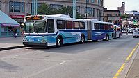
Bus
A bus is a road vehicle designed to carry passengers. Buses can have a capacity as high as 300 passengers. The most common type of bus is the single-decker bus, with larger loads carried by double-decker buses and articulated buses, and smaller loads carried by midibuses and minibuses; coaches are...
routes in the Bronx
The Bronx
The Bronx is the northernmost of the five boroughs of New York City. It is also known as Bronx County, the last of the 62 counties of New York State to be incorporated...
, New York
New York
New York is a state in the Northeastern region of the United States. It is the nation's third most populous state. New York is bordered by New Jersey and Pennsylvania to the south, and by Connecticut, Massachusetts and Vermont to the east...
, United States
United States
The United States of America is a federal constitutional republic comprising fifty states and a federal district...
. Many of them are the direct descendants of streetcar lines (see list of streetcar lines in the Bronx). All local buses are operated by the Manhattan and Bronx Surface Transit Operating Authority
Manhattan and Bronx Surface Transit Operating Authority
The Manhattan and Bronx Surface Transit Operating Authority is a subsidiary of the New York City Transit Authority that was created in 1962 to take over bus services from the bankrupt Fifth Avenue Coach Company and Surface Transit, Inc...
, a subsidiary of New York City Transit Authority
New York City Transit Authority
The New York City Transit Authority is a public authority in the U.S. state of New York that operates public transportation in New York City...
, except for the Bx23, operated by the MTA Bus Company
MTA Bus Company
MTA Bus Company is a service of MTA Regional Bus Operations used on routes previously controlled by the New York City Department of Transportation , and operated by private operators that provided service under contract to the NYCDOT...
.
Seven Metro-North Railroad
Metro-North Railroad
The Metro-North Commuter Railroad , trading as MTA Metro-North Railroad, or, more commonly, Metro-North, is a suburban commuter rail service that is run and managed by the Metropolitan Transportation Authority , an authority of New York State. It is the busiest commuter railroad in the United...
feeder routes are run by the brand name of Hudson Rail Link, operated by Atlantic Express
Atlantic Express (bus company)
Atlantic Express is an operator of transit buses, paratransit, and school buses in the United States, specializing primarily in school bus service, while operating transit buses in New York City...
under contract. All of these routes are listed below.
List of routes
This table gives details for the routes prefixed with "Bx" - in other words, those considered to run primarily in the Bronx by the MTA. For details on routes with other prefixes, see the following articles:- List of bus routes in Queens: Q44*, Q50 and Q100* (on Rikers IslandRikers IslandRikers Island is New York City's main jail complex, as well as the name of the island on which it sits, in the East River between Queens and the mainland Bronx, adjacent to the runways of LaGuardia Airport. The island itself is part of the borough of the Bronx, though it is included as part of...
) - List of express bus routes in New York City: BxM1, BxM2, BxM3, BxM4, BxM6, BxM7, BxM8, BxM9, BxM10, BxM11, and BxM18
- List of bus routes in Westchester County, New York: Bee-LineBee-Line Bus SystemThe Bee-Line Bus System, branded on the buses in lowercase as the bee-line system, is a bus system serving Westchester County, New York. The system is owned by the County's Department of Public Works and Transportation and operated, on contract , by Yonkers-based Liberty Lines Transit, Inc...
1, 2, 3, 4, 20, 21, 25, 26, 40, 41, 42, 43, 45, 52, 54, 55, 60, 61, and 62
All routes are operated under New York City Bus except for the Bx23, which is operated under MTA Bus.
Bx1 to Bx24
| Route | Terminals | Streets traveled | History | Notes | ||
|---|---|---|---|---|---|---|
| Local service | ||||||
| Mott Haven Mott Haven, Bronx Mott Haven is a primarily residential neighborhood in the Southwestern section of The Bronx in New York City. Zip codes include 10451, 10454, and 10455. The neighborhood is part of Bronx Community Board 1... East 138 Street and Lincoln Avenue at Third Avenue – 138th Street ( trains) |
↔ |
|
Grand Concourse Grand Concourse (Bronx) The Grand Concourse is a major thoroughfare in the borough of the Bronx in New York City... , Sedgwick Avenue, and 231st Street (Bx2 also serves 149 Street and 3 Avenue) |
Began July 3, 1921, Original terminus for Bx1 was East 138th St/Grand Concourse, Original Bx2 terminus was East 149th St/3rd Avenue, Bx2 ran along East 165th Street and Melrose Avenue until August 2008 |
|
|
| ↔ |
Kingsbridge Heights, Bronx Kingsbridge Heights is a working class residential neighborhood geographically located in the northwest Bronx, New York City. The neighborhood is part of Bronx Community Board 8. Its boundaries are Van Cortlandt Park to the north, Jerome Avenue to the east, Kingsbridge Road to the south, and the... Sedgwick Avenue and Ft. Independence Street |
|||||
| Limited-stop service (Bx1 only) | ||||||
| Mott Haven East 138 Street and Lincoln Avenue at Third Avenue – 138th Street ( trains) |
↔ |
Riverdale Riverdale, Bronx Riverdale is an affluent residential neighborhood in the northwest portion of the Bronx in New York City. Riverdale contains the northernmost point in New York City.-History:... West 231 Street and Riverdale Avenue |
(See Bx1 local routing above) | All Limited-Stop service became Bx1 in September 2010. |
|
|
| Washington Heights, Manhattan Washington Heights, Manhattan Washington Heights is a New York City neighborhood in the northern reaches of the borough of Manhattan. It is named for Fort Washington, a fortification constructed at the highest point on Manhattan island by Continental Army troops during the American Revolutionary War, to defend the area from the... George Washington Bridge Bus Terminal George Washington Bridge Bus Terminal The George Washington Bridge Bus Station is a commuter bus terminal located at the east end of the George Washington Bridge in the Washington Heights area of Manhattan in New York City, New York.... : Broadway |
↔ | Riverdale West 238 Street and Broadway at 238th Street ( train) |
University Avenue, Sedgwick Avenue | Replaced University Avenue Line streetcars on October 25, 1947; formerly Bx38 | ||
| Bx4A |
The Hub The Hub, Bronx The Hub is the retail heart of the South Bronx, located where four roads converge: East 149th Street, Willis, Melrose and Third Avenues. It is primarily located inside the neighborhood of Melrose but also lines the northern border of Mott Haven. The Hub has been called "the Broadway of the Bronx."... Bergen Avenue and Westchester Avenue near Third Avenue-149th Street station Third Avenue-149th Street (IRT White Plains Road Line) Third Avenue – 149th Street is a station on the IRT White Plains Road Line of the New York City Subway. It is located at Third Avenue and East 149th Street in Mott Haven, Bronx and is served by the 2 and 5 trains, the latter of which does not stop here during late night hours... |
↔ | Westchester Square Lane Avenue and East Tremont Avenue at Westchester Square-East Tremont Avenue station ( train) |
|
|
|
| Longwood Longwood, Bronx Longwood is a low income residential neighborhood geographically located in the southwest Bronx, New York City. The neighborhood is part of Bronx Community Board 2. Its boundaries, starting from the north and moving clockwise are: East 167th Street to the north, the Bronx River & the Bruckner... West Farms Road and Southern Boulevard near Simpson Street Simpson Street (IRT White Plains Road Line) Simpson Street is a local station on the IRT White Plains Road Line of the New York City Subway. Located at the intersection of Simpson Street and Westchester Avenue in the Bronx, it is served by the 2 train at all times, and the 5 train at all times except late nights and rush hours in the peak... ( trains) |
↔ | Pelham Bay Pelham Bay, Bronx Pelham Bay is a neighborhood in the borough of the Bronx, in New York City. It is named for Pelham Bay Park, New York City's largest park which lies on the neighborhood's northeastern border.-History:... Bruckner Boulevard at Pelham Bay Park Pelham Bay Park (IRT Pelham Line) Pelham Bay Park is the northern terminal station of the IRT Pelham Line of the New York City Subway. Located by Pelham Bay Park, at the intersection of the Bruckner Expressway and Westchester Avenue in the Bronx, it is served by the 6 train at all times except weekdays in the peak direction and... ( trains) |
Story Avenue, Bruckner Boulevard, Crosby Avenue |
Pelham Bay, Bronx Pelham Bay is a neighborhood in the borough of the Bronx, in New York City. It is named for Pelham Bay Park, New York City's largest park which lies on the neighborhood's northeastern border.-History:... to replace Bx8 service through the area on June 27, 2010 due to budget crisis. |
|
|
| ↔ | Orchard Beach (summer weekends only) |
Story Avenue, Bruckner Boulevard, City Island Road | ||||
| Washington Heights Washington Heights, Manhattan Washington Heights is a New York City neighborhood in the northern reaches of the borough of Manhattan. It is named for Fort Washington, a fortification constructed at the highest point on Manhattan island by Continental Army troops during the American Revolutionary War, to defend the area from the... Riverside Drive West and West 158th Street |
↔ | Hunts Point Cooperative Market Hunts Point Cooperative Market The Hunts Point Cooperative Market, a wholesale food market located on 60 acres in New York City's South Bronx district, is the largest food distribution center in the world... |
155th Street, 161st Street, 163rd Street, and Hunts Point Avenue | Replaced 163rd Street Crosstown Line streetcars on June 26, 1948; formerly Bx34 | ||
| Washington Heights, Manhattan St. Nicholas Avenue and West 167 Street at 168th Street 168th Street (New York City Subway) 168th Street , is an underground station complex on the New York City Subway shared by the IRT Broadway – Seventh Avenue Line and IND Eighth Avenue Line... ( trains) |
↔ | Riverdale Riverdale Avenue and West 263 Street (at New York City line) |
Broadway and Riverdale Avenue |
|
||
| Locust Point Locust Point, Bronx Locust Point is a small, peninsular neighborhood in the south eastern portion of the New York City Borough of the Bronx. It is bounded by Harding Avenue on the north, the Throggs Neck Bridge to the east, and Eastchester Bay. The area comprises single-family houses, populated by ethnically Irish,... Longstreet Avenue and Tierney Place |
↔ | Williamsbridge Williamsbridge, Bronx Williamsbridge is a working class neighborhood geographically located in the northeast Bronx borough of New York City in the United States. The neighborhood is part of Bronx Community Board 12. Its boundaries, starting from the north and moving clockwise are: East 222nd Street to the north, Boston... East 226 Street and White Plains Road near 225th Street station 225th Street (IRT White Plains Road Line) 225th Street is a local station on the IRT White Plains Road Line of the New York City Subway. Located in Wakefield, Bronx at the intersection of 225th Street and White Plains Road, it is served by the 2 train at all times, and the 5 train during rush hours in the peak direction.This elevated... ( trains) |
Throgs Neck Boulevard, Westchester Avenue, Williamsbridge Road, Bronxwood Avenue |
|
||
| Riverdale Riverdale, Bronx Riverdale is an affluent residential neighborhood in the northwest portion of the Bronx in New York City. Riverdale contains the northernmost point in New York City.-History:... Broadway and West 262 Street (at New York City line) |
↔ | West Farms West Farms, Bronx West Farms is a residential neighborhood in a west central part of The Bronx, New York City, also known as the northeast corner of the South Bronx. The neighborhood is part of Bronx Community Board 6... Tremont Avenue and Devoe Avenue at West Farms Square – East Tremont Avenue ( trains) |
Broadway, Kingsbridge Road, Fordham Road, and Southern Boulevard | Replaced Bronx and Van Cortlandt Parks Crosstown Line streetcars on January 24, 1948; formerly Bx20 | Via Marble Hill, Manhattan Marble Hill, Manhattan Marble Hill is the neighborhood which makes up the northernmost part of the Borough of Manhattan in New York City, United States. Although it is politically part of Manhattan and New York County, because of the re-routing of the Harlem River, it is located on the North American mainland contiguous... |
|
| Norwood Norwood, Bronx Norwood is a working class residential neighborhood in the northwest Bronx, New York City. As of the census of 2000, the seven census tracts that make up the neighborhood have a population of 40,748... East 206 Street and Bainbridge Avenue at Norwood – 205th Street ( train) |
↔ | Riverdale Riverdale Avenue and West 263 Street (at New York City line) |
Riverdale Avenue, 231st Street, and Sedgwick Avenue | New route 1984, created from eastern portion of Bx10 and northern section of Bx24. | ||
| Washington Heights, Manhattan George Washington Bridge Bus Terminal: West 178th Street |
↔ | Longwood West Farms Road and Southern Boulevard near Simpson Street Simpson Street (IRT White Plains Road Line) Simpson Street is a local station on the IRT White Plains Road Line of the New York City Subway. Located at the intersection of Simpson Street and Westchester Avenue in the Bronx, it is served by the 2 train at all times, and the 5 train at all times except late nights and rush hours in the peak... ( trains) |
170 Street, Claremont Parkway, and West Farms Road | Began February 27, 1948; original Bx11 terminus was Freeman Street/Southern Boulevard; extended to West Farms Road/Southern Blvd in 1998 | ||
| Local service | ||||||
| University Heights University Heights, Bronx University Heights is a residential neighborhood of the West Bronx in New York City. The neighborhood is part of Bronx Community Board 5 and Bronx Community Board 7. Its boundaries, starting from the north and moving clockwise, are: West 190th Street to the north, Jerome Avenue to the east, West... West Fordham Road and Sedgwick Avenue (full-time) |
↔ | Pelham Bay Bruckner Boulevard at Pelham Bay Park Pelham Bay Park (IRT Pelham Line) Pelham Bay Park is the northern terminal station of the IRT Pelham Line of the New York City Subway. Located by Pelham Bay Park, at the intersection of the Bruckner Expressway and Westchester Avenue in the Bronx, it is served by the 6 train at all times except weekdays in the peak direction and... ( trains) (full-time) |
Fordham Road, and Pelham Parkway | Replaced 207th Street Crosstown Line 207th Street Crosstown Line The 207th Street Crosstown Line is a public transit line in New York City serving the boroughs of Manhattan and The Bronx. The line, originally a streetcar pre-dating 1910, ran from Inwood in Manhattan to Belmont in the Bronx. The line is now the Bx12 bus route, operated by the New York City... streetcars on January 24, 1948 |
|
|
| ↔ | Orchard Beach Orchard Beach, New York Orchard Beach is a public beach in the borough of the Bronx in New York City. The beach is part of Pelham Bay Park and is situated on the western end of Long Island Sound... (summers only) |
|||||
| Select Bus Service | ||||||
| Inwood, Manhattan Broadway and Isham Street at Inwood – 207th Street ( train) |
↔ | Co-op City Co-op City, Bronx Co-op City , located in the Baychester section of the Borough of the Bronx in northeast New York City, is one of the largest cooperative housing developments in the world. Situated at the intersection of Interstate 95 and the Hutchinson River Parkway, the community is part of Bronx Community Board 10... Bay Plaza Shopping Center Bay Plaza Shopping Center Bay Plaza Shopping Center is a shopping center adjacent to Co-op City, in the Bronx, New York. In addition to various department stores and shops, such as JCPenney, Staples Inc., Kmart and Old Navy, it has a multiplex movie theater, several restaurants, a fitness club, and some office space... |
207th Street, Fordham Road, and Pelham Parkway | Replaced 207th Street Crosstown Line 207th Street Crosstown Line The 207th Street Crosstown Line is a public transit line in New York City serving the boroughs of Manhattan and The Bronx. The line, originally a streetcar pre-dating 1910, ran from Inwood in Manhattan to Belmont in the Bronx. The line is now the Bx12 bus route, operated by the New York City... streetcars on January 24, 1948 |
Select Bus Service Select Bus Service , marked on the buses as +selectbusservice, is a brand used by MTA Regional Bus Operations for bus rapid transit service.-History:... ; Payment before boarding required at payment stations at bus stops. |
|
| Washington Heights, Manhattan George Washington Bridge Bus Terminal: West 178th Street |
↔ | Yankee Stadium Yankee Stadium Yankee Stadium was a stadium located in The Bronx in New York City, New York. It was the home ballpark of the New York Yankees from 1923 to 1973 and from 1976 to 2008. The stadium hosted 6,581 Yankees regular season home games during its 85-year history. It was also the former home of the New York... East 161 Street at Gate 6 (full-time) |
Ogden Avenue, East 161 Street (some trips) | Replaced Ogden Avenue Line streetcars on October 25, 1947; formerly Bx37 | Service to Melrose operates during AM rush hours only. | |
| ↔ | Melrose Melrose, Bronx Melrose is primarily a residential neighborhood geographically located in the SouthWestern section of the borough of The Bronx in New York City. The neighborhood is part of Bronx Community Board 1. Its boundaries, starting from the North and moving clockwise are: East 161st Street to the North,... East 163 Street and Third Avenue |
|||||
| Harlem, Manhattan West 125 Street and 12 Avenue |
↔ | Fordham Fordham, Bronx Fordham is a neighborhood of New York City, United States, located in the West Bronx. The neighborhood is part of Bronx Community Board 5. It is bordered by Fordham Road to the north, Webster Avenue to the east, East 183rd Street to the south, and Jerome Avenue to the west... Fordham Plaza and railroad station Fordham (Metro-North station) The Fordham Metro-North Railroad station serves the residents of the Fordham neighborhood of the Bronx, New York via the Harlem Line and New Haven Line. It is the only Harlem Line stop in the Bronx that is an express station. It is 8.9 miles from Grand Central Terminal... |
125 Street, Third Avenue | Replaced Harlem Shuttle and Willis Avenue Line streetcars on August 5, 1941; formerly Bx29 | ||
| Norwood East 206 Street and Bainbridge Avenue at Norwood – 205th Street ( train) |
↔ | Eastchester Eastchester, Bronx Eastchester is a working class neighborhood in the northeast Bronx borough of New York City in the United States. The neighborhood is part of Bronx Community Board 12... Ropes Avenue and Boston Road |
Bainbridge Avenue, 233rd Street, Nereid Avenue, Baychester Avenue | Combined from the former Bx14 and Bx19 in February 1984 | ||
| Mott Haven Mott Haven, Bronx Mott Haven is a primarily residential neighborhood in the Southwestern section of The Bronx in New York City. Zip codes include 10451, 10454, and 10455. The neighborhood is part of Bronx Community Board 1... St. Ann's Avenue and East 135th Street |
↔ | Fordham Fordham Plaza and railroad station |
St. Ann's Avenue, Prospect Avenue, Crotona Avenue | Began October 24, 1921 by New York City Department of Plant and Structures; formerly Bx3 Replaced St. Ann's Avenue Line streetcars on July 10, 1948; formerly Bx3 |
Originally terminated at 132nd St/Walnut Avenue in Port Morris; rerouted via St. Ann's Avenue in September 2005 and service to Port Morris deleted | |
| Morris Heights Morris Heights, Bronx Morris Heights is a low income residential neighborhood located in the west Bronx. The neighborhood is part of Bronx Community Board 5. Its boundaries, starting from the north and moving clockwise are: West Burnside Avenue to the north, Jerome Avenue to the east, the Cross-Bronx Expressway to the... Undercliff Avenue |
↔ | Morrisania Morrisania, Bronx Morrisania is the historical name for the South Bronx and derives from the powerful and aristocratic Morris family, who at one time owned all of the Manor of Morrisania. Today the name is most commonly associated with the village of Morrisania, which is only a small corner of the original... East 170 Street and Grand Concourse at 170th Street 170th Street (IND Concourse Line) 170th Street is a local station on the IND Concourse Line of the New York City Subway, located at the Grand Concourse between East 170th and 171st Streets in the Bronx. It is served by the D train at all times except rush hours in the peak direction and the B train during rush hours.This... ( trains) |
Sedgwick Avenue, Undercliff Avenue, Macombs Road | Began June 22, 1941 | ||
| Riverbank State Park Riverbank State Park Riverbank State Park is a park built on the top of a sewage treatment facility on the Hudson River, in the New York City borough of Manhattan.... |
↔ | New York Botanical Garden New York Botanical Garden - See also :* Education in New York City* List of botanical gardens in the United States* List of museums and cultural institutions in New York City- External links :* official website** blog*... |
West 145 Street, East 149 Street, Southern Boulevard | Replaced 149th Street Crosstown Line streetcars on August 16, 1947; formerly Bx30 Replaced Southern Boulevard Line streetcars on August 21, 1948; formerly Bx31. Separate Bx30 and Bx31 routes merged into Bx19 in 1984. |
|
|
| Inwood, Manhattan Broadway and Isham Street at Inwood – 207th Street ( train) |
↔ | Riverdale Riverdale, Bronx Riverdale is an affluent residential neighborhood in the northwest portion of the Bronx in New York City. Riverdale contains the northernmost point in New York City.-History:... Henry Hudson Parkway and West 246 Street |
Broadway, Johnson Avenue, and Henry Hudson Parkway Henry Hudson Parkway The Henry Hudson Parkway is an long parkway in New York City. The southern terminus is at West 72nd Street in Manhattan, where the parkway continues south as the West Side Highway. It is often erroneously referred to as the West Side Highway throughout its entire course in Manhattan... |
Replaced Bailey Avenue Line streetcars on June 26, 1948; formerly Bx24 |
|
|
| Mott Haven East 138 Street and Lincoln Avenue at Third Avenue – 138th Street ( trains) |
↔ | Westchester Heights Westchester Avenue and Lane Avenue at Westchester Square – East Tremont Avenue ( trains) |
Third Avenue, Boston Road, Morris Park Avenue | Replaced Boston Road Line streetcars on August 21, 1948; formerly Bx26. | ||
| Castle Hill Castle Hill, Bronx Castle Hill is primarily a residential neighborhood geographically located in the South Central section of the borough of The Bronx in New York City. The neighborhood is part of Bronx Community Board 9... Castle Hill Avenue and Zerega Avenue |
↔ | Bedford Park Bedford Park, Bronx Bedford Park is a residential neighborhood in the northwest Bronx between the New York Botanical Garden and Lehman College. Its boundaries, starting from the north and moving clockwise are: Mosholu Parkway to the north, Webster Avenue to the east, East 198th Street to the south, and Jerome Avenue... Paul Avenue and West 205 Street |
Castle Hill Avenue, Unionport Road, White Plains Road, Fordham Road, Kingsbridge Road, Goulden Avenue | Began in 1928 Formerly Bx13. |
|
|
| Pelham Bay Pelham Bay, Bronx Pelham Bay is a neighborhood in the borough of the Bronx, in New York City. It is named for Pelham Bay Park, New York City's largest park which lies on the neighborhood's northeastern border.-History:... Bruckner Boulevard at Pelham Bay Park Pelham Bay Park (IRT Pelham Line) Pelham Bay Park is the northern terminal station of the IRT Pelham Line of the New York City Subway. Located by Pelham Bay Park, at the intersection of the Bruckner Expressway and Westchester Avenue in the Bronx, it is served by the 6 train at all times except weekdays in the peak direction and... ( trains) |
↻ | Co-op City Co-op City, Bronx Co-op City , located in the Baychester section of the Borough of the Bronx in northeast New York City, is one of the largest cooperative housing developments in the world. Situated at the intersection of Interstate 95 and the Hutchinson River Parkway, the community is part of Bronx Community Board 10... 1-2-3-4-5, and return to Pelham Bay Park |
Baychester Avenue Co-op City Boulevard Hutchinson River Parkway |
Queens Surface Corporation Queens Surface Corporation was a bus company in New York City, United States, operating local service in Queens and the Bronx and express service between Queens and Manhattan until February 27, 2005, when the MTA Bus Company took over the operations.... as the Co-op City portion of the QBx1. |
MTA Bus Company MTA Bus Company is a service of MTA Regional Bus Operations used on routes previously controlled by the New York City Department of Transportation , and operated by private operators that provided service under contract to the NYCDOT... . |
|
| ↺ | Co-op City Co-op City, Bronx Co-op City , located in the Baychester section of the Borough of the Bronx in northeast New York City, is one of the largest cooperative housing developments in the world. Situated at the intersection of Interstate 95 and the Hutchinson River Parkway, the community is part of Bronx Community Board 10... 5-4-3-2-1, and return to Pelham Bay Park via Edson Avenue |
|||||
| ↻ | Co-op City Co-op City, Bronx Co-op City , located in the Baychester section of the Borough of the Bronx in northeast New York City, is one of the largest cooperative housing developments in the world. Situated at the intersection of Interstate 95 and the Hutchinson River Parkway, the community is part of Bronx Community Board 10... 1-2-3-4, and return to Pelham Bay Park via Edson Avenue |
Baychester Avenue Co-op City Boulevard |
MTA Bus Company MTA Bus Company is a service of MTA Regional Bus Operations used on routes previously controlled by the New York City Department of Transportation , and operated by private operators that provided service under contract to the NYCDOT... . |
|||
| ↻ AM ---- ↺ PM |
Co-op City Co-op City, Bronx Co-op City , located in the Baychester section of the Borough of the Bronx in northeast New York City, is one of the largest cooperative housing developments in the world. Situated at the intersection of Interstate 95 and the Hutchinson River Parkway, the community is part of Bronx Community Board 10... Bartow Avenue, Section 5, and return to Pelham Bay Park |
Bartow Avenue, Hutchinson River Parkway East | ||||
| Pelham Bay Pelham Bay, Bronx Pelham Bay is a neighborhood in the borough of the Bronx, in New York City. It is named for Pelham Bay Park, New York City's largest park which lies on the neighborhood's northeastern border.-History:... Bruckner Boulevard at Pelham Bay Park station Pelham Bay Park (IRT Pelham Line) Pelham Bay Park is the northern terminal station of the IRT Pelham Line of the New York City Subway. Located by Pelham Bay Park, at the intersection of the Bruckner Expressway and Westchester Avenue in the Bronx, it is served by the 6 train at all times except weekdays in the peak direction and... ( train) |
↺ | Country Club Country Club, Bronx Country Club is a neighborhood located in the East Bronx in New York City. It shares the 10465 ZIP code with Throggs Neck, although it is part of Pelham Bay. The neighborhood's boundaries are Pelham Bay Park to the north, Eastchester Bay to the east, Layton Avenue to the south, and the New England... Loop |
Bruckner Boulevard, Rawlins Avenue, Stadium Avenue, Research Avenue, Kennelworth Avenue |
|
|
|
Bx26 to Bx55
| Route | Terminals | Streets traveled | History | Notes | ||
|---|---|---|---|---|---|---|
| Bedford Park Paul Avenue and West 205 Street |
↔ | Co-op City Co-op City, Bronx Co-op City , located in the Baychester section of the Borough of the Bronx in northeast New York City, is one of the largest cooperative housing developments in the world. Situated at the intersection of Interstate 95 and the Hutchinson River Parkway, the community is part of Bronx Community Board 10... Earhart Lane and Erskine Place |
|
Bx26 began in 1928, Original Bx26 terminus was East 192nd Street/Valentine Avenue Formerly Bx17 |
|
|
| Clasons Point Soundview Avenue cul-de-sac |
↔ | Longwood West Farms Road and Southern Boulevard near Simpson Street Simpson Street (IRT White Plains Road Line) Simpson Street is a local station on the IRT White Plains Road Line of the New York City Subway. Located at the intersection of Simpson Street and Westchester Avenue in the Bronx, it is served by the 2 train at all times, and the 5 train at all times except late nights and rush hours in the peak... ( trains) |
Soundview Avenue, Rosedale Avenue, and Westchester Avenue | Replaced Sound View Avenue Line streetcars on March 8, 1947 |
|
|
| Fordham Fordham, Bronx Fordham is a neighborhood of New York City, United States, located in the West Bronx. The neighborhood is part of Bronx Community Board 5. It is bordered by Fordham Road to the north, Webster Avenue to the east, East 183rd Street to the south, and Jerome Avenue to the west... East Kingsbridge Road and East 192 Street |
↔ | Co-op City Co-op City, Bronx Co-op City , located in the Baychester section of the Borough of the Bronx in northeast New York City, is one of the largest cooperative housing developments in the world. Situated at the intersection of Interstate 95 and the Hutchinson River Parkway, the community is part of Bronx Community Board 10... Earhart Lane and Erskine Place |
Jerome Avenue, Gun Hill Road, Bartow Avenue |
Formerly Bx15 |
|
|
| City Island City Island, Bronx City Island is a small island approximately 1.5 mi long by .5 mi wide. At one time attached to the town of Pelham, Westchester County, it is now part of the New York City borough of the Bronx. As of the 2000 census the island had a population of 4,520. Its land area is 1.023 km²... City Island Avenue and Rochelle Street |
↔ | Co-op City Bay Plaza Shopping Center Bay Plaza Shopping Center Bay Plaza Shopping Center is a shopping center adjacent to Co-op City, in the Bronx, New York. In addition to various department stores and shops, such as JCPenney, Staples Inc., Kmart and Old Navy, it has a multiplex movie theater, several restaurants, a fitness club, and some office space... |
City Island Avenue, Hutchinson River Parkway East | |||
| Norwood East 206 Street and Bainbridge Avenue at Norwood – 205th Street ( train) |
↔ | Co-op City Co-op City, Bronx Co-op City , located in the Baychester section of the Borough of the Bronx in northeast New York City, is one of the largest cooperative housing developments in the world. Situated at the intersection of Interstate 95 and the Hutchinson River Parkway, the community is part of Bronx Community Board 10... Earhart Lane |
Gun Hill Road, Boston Road, Baychester Avenue, Bartow Avenue | Formerly Bx7 |
|
|
| Westchester Heights Lane Avenue and East Tremont Avenue at Westchester Square – East Tremont Avenue ( trains) |
↔ | Woodlawn Woodlawn, Bronx Woodlawn is a neighborhood at the very north end of the borough of the Bronx in New York City. Unlike some neighborhoods in New York City, its boundaries are fairly well-defined, as it is bounded by McLean Avenue to the north, which is approximately the New York City / Westchester County line, the... Katonah Avenue and East 242 Street |
Eastchester Road, East 233 Street | Began November 1, 1927; Original Bx31 terminus was the Wakefield Metro-North station; extended to Woodlawn in 2006 Formerly Bx9 |
||
| Mott Haven East 138 Street and Lincoln Avenue at Third Avenue – 138th Street ( trains) |
↔ | Kingsbridge Heights Kingsbridge Heights, Bronx Kingsbridge Heights is a working class residential neighborhood geographically located in the northwest Bronx, New York City. The neighborhood is part of Bronx Community Board 8. Its boundaries are Van Cortlandt Park to the north, Jerome Avenue to the east, Kingsbridge Road to the south, and the... Bronx VA Hospital |
Morris Avenue, Jerome Avenue | Replaced Morris Avenue Line streetcars on January 1, 1941; formerly Bx25 | ||
| Harlem, Manhattan West 135 Street and St. Nicholas Avenue at 135th Street 135th Street (IND Eighth Avenue Line) 135th Street is a local station on the IND Eighth Avenue Line of the New York City Subway. Located at the intersection of 135th Street and St. Nicholas Avenue in Manhattan, it is served by the C train at all times except late nights, B train during weekdays, and A train during late nights.This is... ( trains) |
↔ | Port Morris Port Morris, Bronx Port Morris is a neighborhood in the southwest Bronx, New York City. It is a heavily industrial neighborhood. Its boundaries are the Major Deegan Expressway and Bruckner Expressway to the north, East 149th Street to the east, the East River to the southeast, the Bronx Kill south, and the Harlem... Locust Avenue and East 132 Street |
135 Street, East 138 Street | Replaced 138th Street Crosstown Line streetcars on July 10, 1948 | ||
| Fordham Fordham, Bronx Fordham is a neighborhood of New York City, United States, located in the West Bronx. The neighborhood is part of Bronx Community Board 5. It is bordered by Fordham Road to the north, Webster Avenue to the east, East 183rd Street to the south, and Jerome Avenue to the west... Valentine Avenue and Fordham Road |
↔ | Woodlawn Woodlawn, Bronx Woodlawn is a neighborhood at the very north end of the borough of the Bronx in New York City. Unlike some neighborhoods in New York City, its boundaries are fairly well-defined, as it is bounded by McLean Avenue to the north, which is approximately the New York City / Westchester County line, the... Katonah Avenue and East 242 Street |
Bainbridge Avenue, East 233 Street | Began April 2, 1928 by New York City Department of Plant and Structures Formerly Bx4 |
Weekday service only | |
| Washington Heights, Manhattan George Washington Bridge Bus Station: West 179 Street |
↔ | Longwood West Farms Road and Southern Boulevard near Simpson Street Simpson Street (IRT White Plains Road Line) Simpson Street is a local station on the IRT White Plains Road Line of the New York City Subway. Located at the intersection of Simpson Street and Westchester Avenue in the Bronx, it is served by the 2 train at all times, and the 5 train at all times except late nights and rush hours in the peak... ( trains) |
167 Street, East 168 Street, East 169 Street | Replaced 167th Street Crosstown Line streetcars on July 10, 1948 | ||
| Local service | ||||||
| Washington Heights, Manhattan George Washington Bridge Bus Station: West 178 Street |
↔ | Castle Hill Castle Hill, Bronx Castle Hill is primarily a residential neighborhood geographically located in the South Central section of the borough of The Bronx in New York City. The neighborhood is part of Bronx Community Board 9... Seward Avenue |
Tremont Avenue, East 180 Street, East 174 Street, White Plains Road | Replaced 180th Street Crosstown Line streetcars on October 25, 1947 | ||
| Limited-stop service | ||||||
| Washington Heights, Manhattan George Washington Bridge Bus Station: West 178 Street |
↔ | Castle Hill Castle Hill, Bronx Castle Hill is primarily a residential neighborhood geographically located in the South Central section of the borough of The Bronx in New York City. The neighborhood is part of Bronx Community Board 9... Olmstead Avenue and Seward Avenue |
(See Bx36 local routing above) | Limited-stop service began September 8, 2009. |
|
|
| Norwood East 206 Street and Bainbridge Avenue at Norwood – 205th Street ( train) |
↔ | Co-op City Co-op City, Bronx Co-op City , located in the Baychester section of the Borough of the Bronx in northeast New York City, is one of the largest cooperative housing developments in the world. Situated at the intersection of Interstate 95 and the Hutchinson River Parkway, the community is part of Bronx Community Board 10... Bay Plaza Shopping Center |
Jerome Avenue, Gun Hill Road, Co-op City Boulevard |
Formerly Bx15 |
|
|
| Clasons Point Soundview Avenue cul-de-sac |
↔ | Wakefield East 241 Street and White Plains Road at Wakefield – 241st Street ( train) |
White Plains Road |
|
|
|
| River Park Towers | ↔ | Bx40: SUNY Maritime College Front gate |
Burnside Avenue and East Tremont Avenue
|
Replaced Tremont Avenue Line streetcars on August 21, 1948. |
|
|
| ↔ | Bx42: Throgs Neck Harding Avenue |
|||||
| Local service | ||||||
| Mott Haven East 148 Street and Third Avenue at Third Avenue – 149th Street ( trains) |
↔ | Williamsbridge White Plains Road and East Gun Hill Road at Gun Hill Road Gun Hill Road (IRT White Plains Road Line) Gun Hill Road is an express station on the IRT White Plains Road Line of the New York City Subway. Located in the Bronx at the intersection of Gun Hill and White Plains Roads, it is served by the 2 train at all times while the 5 train provides additional rush hour service in the peak direction.This... ( trains) |
Melrose Avenue, Webster Avenue |
|
||
| Limited-stop service | ||||||
| Mott Haven East 148 Street and Third Avenue at Third Avenue – 149th Street ( trains) |
↔ | Williamsbridge White Plains Road and East Gun Hill Road at Gun Hill Road Gun Hill Road (IRT White Plains Road Line) Gun Hill Road is an express station on the IRT White Plains Road Line of the New York City Subway. Located in the Bronx at the intersection of Gun Hill and White Plains Roads, it is served by the 2 train at all times while the 5 train provides additional rush hour service in the peak direction.This... ( trains) |
Melrose Avenue, Webster Avenue |
|
||
| Limited-stop service (local service, use the Bx15 or Bx41) | ||||||
| Mott Haven Third Avenue and East 149 Street at Third Avenue – 149th Street ( trains) |
↔ | Williamsbridge White Plains Road and East Gun Hill Road at Gun Hill Road Gun Hill Road (IRT White Plains Road Line) Gun Hill Road is an express station on the IRT White Plains Road Line of the New York City Subway. Located in the Bronx at the intersection of Gun Hill and White Plains Roads, it is served by the 2 train at all times while the 5 train provides additional rush hour service in the peak direction.This... ( trains) |
Third Avenue and Webster Avenue |
IRT Third Avenue Line The IRT Third Avenue Line, commonly known as the Third Avenue El, was an elevated railway in Manhattan and the Bronx, New York City. Originally operated by an independent railway company, it was acquired by the Interborough Rapid Transit Company and eventually became part of the New York subway... on April 29, 1973. Stops only at its former stations. |
|
|
| Co-op City section note:
|
||||||
Hudson RailLink

Metro-North Railroad
The Metro-North Commuter Railroad , trading as MTA Metro-North Railroad, or, more commonly, Metro-North, is a suburban commuter rail service that is run and managed by the Metropolitan Transportation Authority , an authority of New York State. It is the busiest commuter railroad in the United...
by Atlantic Express.
Atlantic Express (bus company)
Atlantic Express is an operator of transit buses, paratransit, and school buses in the United States, specializing primarily in school bus service, while operating transit buses in New York City...
| Route | Terminals | Streets traveled | |
|---|---|---|---|
| Riverdale Riverdale, Bronx Riverdale is an affluent residential neighborhood in the northwest portion of the Bronx in New York City. Riverdale contains the northernmost point in New York City.-History:... College of Mount Saint Vincent College of Mount Saint Vincent For the university in Halifax, Nova Scotia, see Mount Saint Vincent University The College of Mount Saint Vincent is a Catholic liberal arts college located in the northeast corner of the Riverdale section of The Bronx, New York, adjacent to the Yonkers border. It is the northernmost location in... at West 263rd Street and Riverdale Avenue |
Riverdale Riverdale (Metro-North station) The Riverdale Metro-North Railroad station serves the residents of the Riverdale neighborhood of the Bronx, New York via the Hudson Line. Trains leave for New York City every 25 to 35 minutes on weekdays... station |
Riverdale Avenue | |
| Riverdale Riverdale, Bronx Riverdale is an affluent residential neighborhood in the northwest portion of the Bronx in New York City. Riverdale contains the northernmost point in New York City.-History:... West 259th Street and Arlington Avenue |
Riverdale Riverdale (Metro-North station) The Riverdale Metro-North Railroad station serves the residents of the Riverdale neighborhood of the Bronx, New York via the Hudson Line. Trains leave for New York City every 25 to 35 minutes on weekdays... station |
Riverdale Avenue | |
| Riverdale Riverdale, Bronx Riverdale is an affluent residential neighborhood in the northwest portion of the Bronx in New York City. Riverdale contains the northernmost point in New York City.-History:... Broadway and New York City Line |
Riverdale Riverdale (Metro-North station) The Riverdale Metro-North Railroad station serves the residents of the Riverdale neighborhood of the Bronx, New York via the Hudson Line. Trains leave for New York City every 25 to 35 minutes on weekdays... station |
Broadway and Mosholu Avenue | |
| Spuyten Duyvil Spuyten Duyvil, Bronx Spuyten Duyvil is the name of a subsection of the Riverdale section of the Bronx in New York City. The area is named after Spuyten Duyvil Creek, a Dutch name with various historical spellings and meanings, the most plausible of which is "Spinning Devil", "Devil's Whirlpool", or "Devil's Spate"... West 239th Street and Independence Avenue |
Spuyten Duyvil Spuyten Duyvil (Metro-North station) The Spuyten Duyvil Metro-North Railroad station serves the residents of the Spuyten Duyvil neighborhood of the Bronx, New York via the Hudson Line. Trains leave for New York City every 25 to 35 minutes on weekdays... station |
Henry Hudson Parkway | |
| Spuyten Duyvil Spuyten Duyvil, Bronx Spuyten Duyvil is the name of a subsection of the Riverdale section of the Bronx in New York City. The area is named after Spuyten Duyvil Creek, a Dutch name with various historical spellings and meanings, the most plausible of which is "Spinning Devil", "Devil's Whirlpool", or "Devil's Spate"... West 246th Street and Henry Hudson Parkway |
Spuyten Duyvil Spuyten Duyvil (Metro-North station) The Spuyten Duyvil Metro-North Railroad station serves the residents of the Spuyten Duyvil neighborhood of the Bronx, New York via the Hudson Line. Trains leave for New York City every 25 to 35 minutes on weekdays... station |
Henry Hudson Parkway, Riverdale Avenue and Johnson Avenue | |
| Spuyten Duyvil Spuyten Duyvil, Bronx Spuyten Duyvil is the name of a subsection of the Riverdale section of the Bronx in New York City. The area is named after Spuyten Duyvil Creek, a Dutch name with various historical spellings and meanings, the most plausible of which is "Spinning Devil", "Devil's Whirlpool", or "Devil's Spate"... West 230th Street and Henry Hudson Parkway |
Spuyten Duyvil Spuyten Duyvil (Metro-North station) The Spuyten Duyvil Metro-North Railroad station serves the residents of the Spuyten Duyvil neighborhood of the Bronx, New York via the Hudson Line. Trains leave for New York City every 25 to 35 minutes on weekdays... station |
Henry Hudson Parkway, Riverdale Avenue and Johnson Avenue | |
Renumbered services
On June 15, 1974, some suffixed routes were renumbered, including the following:| 1974 | |
|---|---|
| Old | New |
| Bx5A | Bx54 |
| Bx12A | Bx12 |
| Bx15B | Bx19 |
| Bx15C | Bx17 |
1984 route revamp
On February 18, 1984, the entire Bronx bus system was revamped, with several routes renumbered and merged. The changes were as follows:| Old route | Terminals | Streets traveled | New route | Notes | |
|---|---|---|---|---|---|
| Bx3 | Port Morris Port Morris, Bronx Port Morris is a neighborhood in the southwest Bronx, New York City. It is a heavily industrial neighborhood. Its boundaries are the Major Deegan Expressway and Bruckner Expressway to the north, East 149th Street to the east, the East River to the southeast, the Bronx Kill south, and the Harlem... East 138th Street- Jackson Avenue at Cypress Avenue Cypress Avenue (IRT Pelham Line) Cypress Avenue is a local station on the IRT Pelham Line of the New York City Subway. It is served by the 6 train at all times and is located at the intersection of Cypress Avenue and East 138th Street in the Bronx.... ( train) |
Fordham Fordham, Bronx Fordham is a neighborhood of New York City, United States, located in the West Bronx. The neighborhood is part of Bronx Community Board 5. It is bordered by Fordham Road to the north, Webster Avenue to the east, East 183rd Street to the south, and Jerome Avenue to the west... Fordham Plaza at Fordham railroad station Fordham (Metro-North station) The Fordham Metro-North Railroad station serves the residents of the Fordham neighborhood of the Bronx, New York via the Harlem Line and New Haven Line. It is the only Harlem Line stop in the Bronx that is an express station. It is 8.9 miles from Grand Central Terminal... |
Prospect Avenue, Crotona Avenue |
Bx17 |
|
| Bx4 | Fordham Fordham Road- Valentine Avenue near Fordham Road Fordham Road (IND Concourse Line) Fordham Road is an express station on the IND Concourse Line of the New York City Subway. Located at the intersection of Fordham Road and Grand Concourse in one of the largest shopping districts in New York City, it is served by the D train at all times and B during rush hours only.It is the... ( trains) |
Woodlawn Woodlawn, Bronx Woodlawn is a neighborhood at the very north end of the borough of the Bronx in New York City. Unlike some neighborhoods in New York City, its boundaries are fairly well-defined, as it is bounded by McLean Avenue to the north, which is approximately the New York City / Westchester County line, the... Katonah Avenue- East 242nd Street (New York City-Yonkers Yonkers, New York Yonkers is the fourth most populous city in the state of New York , and the most populous city in Westchester County, with a population of 195,976... line) |
Bainbridge Avenue, Valentine Avenue, Katonah Avenue |
Bx34 |
|
| Bx6 | Norwood Norwood, Bronx Norwood is a working class residential neighborhood in the northwest Bronx, New York City. As of the census of 2000, the seven census tracts that make up the neighborhood have a population of 40,748... East 206th Street-Bainbridge Avenue at 205th Street ( train) |
Baychester Baychester, Bronx Baychester is a working class neighborhood geographically located in the northeast Bronx borough of New York City in the United States. The neighborhood is part of Bronx Community Board 12. Its boundaries, starting from the north and moving clockwise are: East 222nd Street to the north, the New... Boston Road- Corsa Avenue |
Gun Hill Road, Boston Road |
Bx30 |
|
| Bx7 | Pelham Parkway Pelham Parkway, Bronx Pelham Parkway is primarily a residential neighborhood geographically located in the center of the Bronx borough of New York City in the United States. The neighborhood is part of Bronx Community Board 11. Its boundaries, starting from the north and moving clockwise are: Pelham Parkway to the... Pelham Parkway- White Plains Road at Pelham Parkway Pelham Parkway (IRT White Plains Road Line) Pelham Parkway is a local station on the IRT White Plains Road Line of the New York City Subway. Located in the Bronx at the intersection of Pelham Parkway and White Plains Road, it is served by the 2 train at all times, and the 5 train during rush hours in the peak direction... ( trains) |
Eastchester Eastchester, Bronx Eastchester is a working class neighborhood in the northeast Bronx borough of New York City in the United States. The neighborhood is part of Bronx Community Board 12... Ropes Avenue- Boston Road (New York City-Pelham Pelham, New York Pelham, New York is the name of two locations in Westchester County, New York:*Pelham , New York, the Town of Pelham*Pelham Manor , New York, the Village of Pelham Manor*Pelham , New York, the Village of Pelham... line) |
Bronx Park East, Allerton Avenue, Boston Road (upper portion U.S. Route 1 in New York U.S. Route 1 is a part of the U.S. Highway System that runs from Key West, Florida, to the Canada – United States border at Fort Kent, Maine. In the U.S. state of New York, US 1 extends from the George Washington Bridge in Manhattan to the Connecticut state line at Port Chester... ) |
Bx30 |
Bee-Line Bus System The Bee-Line Bus System, branded on the buses in lowercase as the bee-line system, is a bus system serving Westchester County, New York. The system is owned by the County's Department of Public Works and Transportation and operated, on contract , by Yonkers-based Liberty Lines Transit, Inc... #60/61 route, which became open-door along Boston Road. |
| Bx9 | Williamsbridge Williamsbridge, Bronx Williamsbridge is a working class neighborhood geographically located in the northeast Bronx borough of New York City in the United States. The neighborhood is part of Bronx Community Board 12. Its boundaries, starting from the north and moving clockwise are: East 222nd Street to the north, Boston... White Plains Road- East 233rd Street at 233rd Street 233rd Street (IRT White Plains Road Line) 233rd Street is a local station on the IRT White Plains Road Line of the New York City Subway. It is located in the Bronx at the intersection of 233rd Street and White Plains Road. It is served by the 2 train at all times and the 5 train during rush hours in the peak direction.This elevated... ( trains) |
Westchester Square subway station ( trains) |
Eastchester Road, East 233rd Street |
Bx31 |
Montefiore Medical Center Montefiore Medical Center, in the Bronx, New York, is the University Hospital for the Albert Einstein College of Medicine. The hospital, named for Moses Montefiore, is one of the 50 largest employers in New York State . In 2011, Montefiore Medical Center was ranked as #6 of the 180 New York City... ) around 1990. |
| Bx10 | Riverdale Riverdale, Bronx Riverdale is an affluent residential neighborhood in the northwest portion of the Bronx in New York City. Riverdale contains the northernmost point in New York City.-History:... Riverdale Avenue- West 263rd Street |
Inwood, Manhattan Inwood, Manhattan Inwood is the northernmost neighborhood on Manhattan Island in the New York City borough of Manhattan.-Geography:Inwood is physically bounded by the Harlem River to the north and east, and the Hudson River to the west. It extends southward to Fort Tryon Park and alternatively Dyckman Street or... Broadway- West 207th Street at 207th Street ( train) |
Riverdale Avenue, Henry Hudson Parkway, Broadway | Bx7 |
|
| Bx13 | Pelham Parkway Pelham Parkway- White Plains Road at Pelham Parkway ( trains) |
Castle Hill Castle Hill, Bronx Castle Hill is primarily a residential neighborhood geographically located in the South Central section of the borough of The Bronx in New York City. The neighborhood is part of Bronx Community Board 9... Castle Hill Avenue- Zerega Avenue |
Castle Hill Avenue, Unionport Road, White Plains Road |
Bx22 |
|
| Bx14 | Williamsbridge White Plains Road- East 233rd Street at 233rd Street ( trains) |
Eastchester Ropes Avenue- Boston Road (New York City-Pelham line) |
Edenwald Avenue, Seton Avenue, East 233rd Street, Dyre Avenue |
Bx16 |
|
| Bx15 | Fordham Valentine Avenue- East 192nd Street |
Co-op City Co-op City, Bronx Co-op City , located in the Baychester section of the Borough of the Bronx in northeast New York City, is one of the largest cooperative housing developments in the world. Situated at the intersection of Interstate 95 and the Hutchinson River Parkway, the community is part of Bronx Community Board 10... Earhart Lane- Erksine Place |
Gun Hill Road, Bartow Avenue, Co-op City Boulevard |
Bx28 |
|
| Bx17 | Fordham Valentine Avenue- East 192nd Street |
Co-op City Earhart Lane- Erksine Place |
Bedford Park Boulevard, Allerton Avenue, Bartow Avenue, Co-op City Boulevard |
Bx26 |
|
| Bx19 | Wakefield Wakefield, Bronx Wakefield is a working-class section of the northern borough of the Bronx in New York City, bounded by the New York city line with Westchester County or 243rd street to the north,and 222nd Street to the south, and the Bronx River, Bronx River Parkway and Metro-North Railroad tracks to the west... White Plains Road– East 241st Street at 241st Street ( train) |
Baychester Baychester, Bronx Baychester is a working class neighborhood geographically located in the northeast Bronx borough of New York City in the United States. The neighborhood is part of Bronx Community Board 12. Its boundaries, starting from the north and moving clockwise are: East 222nd Street to the north, the New... Boston Road- Eastchester Road |
Baychester Avenue, Schieffelin Avenue |
Bx16 |
|
| Bx20 | Riverdale Broadway- West 262nd Street |
West Farms West Farms, Bronx West Farms is a residential neighborhood in a west central part of The Bronx, New York City, also known as the northeast corner of the South Bronx. The neighborhood is part of Bronx Community Board 6... East Tremont Avenue-Boston Road at Tremont Avenue – West Farms Square subway station ( trains) |
Broadway, Kingsbridge Road, Fordham Road |
Bx9 |
|
| Bx21 | Port Morris East 138th Street- Jackson Avenue at Cypress Avenue ( train) |
Astoria, Queens Astoria, Queens Astoria is a neighborhood in the northwestern corner of the borough of Queens in New York City. Located in Community Board 1, Astoria is bounded by the East River and is adjacent to three other Queens neighborhoods: Long Island City, Sunnyside , and Woodside... 37th Street- 24th Avenue |
Triborough Bridge | N/A |
|
| Bx22 | Westchester Square subway station ( trains) |
Country Club Country Club, Bronx Country Club is a neighborhood located in the East Bronx in New York City. It shares the 10465 ZIP code with Throggs Neck, although it is part of Pelham Bay. The neighborhood's boundaries are Pelham Bay Park to the north, Eastchester Bay to the east, Layton Avenue to the south, and the New England... Research Avenue- Ampere Avenue |
Westchester Avenue, Bruckner Boulevard, Country Club Road |
Bx14 |
|
| Bx25 | Mott Haven Mott Haven, Bronx Mott Haven is a primarily residential neighborhood in the Southwestern section of The Bronx in New York City. Zip codes include 10451, 10454, and 10455. The neighborhood is part of Bronx Community Board 1... Lincoln Avenue- East 136th Street near Third Avenue – 138th Street ( trains) |
Kingsbridge Kingsbridge, Bronx Kingsbridge is a working class residential neighborhood geographically located in the northwest Bronx in New York City. The neighborhood is part of Bronx Community Board 8. Its boundaries are Van Cortlandt Park to the north, Goulden Avenue to the east, West 225th Street to the south, and Irwin... Reservoir Avenue- West 195th Street near Kingsbridge Road Kingsbridge Road (IRT Jerome Avenue Line) Kingsbridge Road is a rehabilitated local station on the elevated IRT Jerome Avenue Line of the New York City Subway. Located at the intersection of Kingsbridge Road and Jerome Avenue in the Bronx, it is served by the 4 train at all times. It is a typical IRT elevated station, except for an extra... ( train) |
Jerome Avenue, Morris Avenue |
Bx32 |
|
| Bx26 | Mott Haven Lincoln Avenue- East 136th Street near Third Avenue – 138th Street ( trains) |
Morris Park Morris Park, Bronx Morris Park is a neighborhood in the Bronx borough of New York City . The neighborhood is part of Community Board 11 in the East Bronx. Its boundaries, starting from the north and moving clockwise are: Pelham Parkway to the north, the Amtrak Northeast Corridor tracks to the east and south, and... Eastchester Road- Sackett Avenue |
Third Avenue, Boston Road (lower), Morris Park Avenue |
Bx21 |
|
| Bx28 | Bedford Park Bedford Park, Bronx Bedford Park is a residential neighborhood in the northwest Bronx between the New York Botanical Garden and Lehman College. Its boundaries, starting from the north and moving clockwise are: Mosholu Parkway to the north, Webster Avenue to the east, East 198th Street to the south, and Jerome Avenue... Paul Avenue- West 205th Street |
Tremont Tremont, Bronx Tremont is a low income residential neighborhood geographically located in the west Bronx, New York City. The neighborhood is part of Bronx Community Board 5. Its boundaries, starting from the north and moving clockwise are: East 183rd Street to the north, Webster Avenue to the east, the... Grand Concourse- East Burnside Avenue |
White Plains Road, Morris Park Avenue, East Tremont Avenue |
Bx10, Bx39 |
|
| Bx29 | Fordham Fordham Plaza at Fordham railroad station |
Harlem 12th Avenue- West 125th Street |
Third Avenue, Willis Avenue, 125th Street 125th Street (Manhattan) 125th Street is a two-way street that runs east-west in the New York City borough of Manhattan, considered the "Main Street" of Harlem; It is also called Martin Luther King, Jr... |
Bx15 |
|
| Bx30 | Mott Haven Southern Boulevard- East 142nd Street |
Harlem Broadway- West 145th Street at 145th Street ( train) |
149th Street, 145th Street 145th Street (Manhattan) 145th Street is a major crosstown street in the Harlem neighborhood, in the New York City borough of Manhattan. It is one of the 15 crosstown streets mapped out in the Commissioner's Plan of 1811 that established the numbered street grid in Manhattan... |
Bx19 |
|
| Bx31 | Bronx Park Bronx Park Bronx Park, laid out along the Bronx River in the Bronx, New York, is the home of the New York Botanical Garden and the Bronx Zoo. Bicycle paths go northwest, north and east, along Mosholu Parkway, Bronx River Parkway and Pelham Parkway respectively... New York Botanical Garden New York Botanical Garden - See also :* Education in New York City* List of botanical gardens in the United States* List of museums and cultural institutions in New York City- External links :* official website** blog*... |
Port Morris Cypress Avenue- East 133rd Street |
Southern Boulevard | Bx19 |
|
| Bx32 | Melrose Melrose, Bronx Melrose is primarily a residential neighborhood geographically located in the SouthWestern section of the borough of The Bronx in New York City. The neighborhood is part of Bronx Community Board 1. Its boundaries, starting from the North and moving clockwise are: East 161st Street to the North,... Third Avenue- East 161st Street |
Port Morris St. Ann's Avenue- East 132rd Street |
St. Ann's Avenue | N/A |
|
| Bx34 | Hunts Point Cooperative Market Hunts Point Cooperative Market The Hunts Point Cooperative Market, a wholesale food market located on 60 acres in New York City's South Bronx district, is the largest food distribution center in the world... |
Washington Heights Washington Heights, Manhattan Washington Heights is a New York City neighborhood in the northern reaches of the borough of Manhattan. It is named for Fort Washington, a fortification constructed at the highest point on Manhattan island by Continental Army troops during the American Revolutionary War, to defend the area from the... Riverside Drive- West 158th Street |
Hunts Point Avenue, 163rd Street, 161st Street, 155th Street 155th Street (Manhattan) 155th Street is a major crosstown street in the Harlem neighborhood, in the New York City borough of Manhattan. It is the northernmost of the 155 crosstown streets mapped out in the Commissioner's Plan of 1811 that established the numbered street grid in Manhattan.155th Street starts on the West... |
Bx6 |
|
| Bx37 | Yankee Stadium Yankee Stadium Yankee Stadium was a stadium located in The Bronx in New York City, New York. It was the home ballpark of the New York Yankees from 1923 to 1973 and from 1976 to 2008. The stadium hosted 6,581 Yankees regular season home games during its 85-year history. It was also the former home of the New York... East 161st Street- River Avenue at 161st Street – River Avenue ( trains) |
Washington Heights Broadway- West 181st Street |
Odgen Avenue | Bx13 |
|
| Bx38 | Riverdale Broadway- West 238 Street at 238th Street ( train) |
Washington Heights Broadway- West 181st Street |
University Avenue, Sedgwick Avenue | Bx3 |
|
| Bx42 | Westchester Square subway station ( trains) |
The Hub The Hub, Bronx The Hub is the retail heart of the South Bronx, located where four roads converge: East 149th Street, Willis, Melrose and Third Avenues. It is primarily located inside the neighborhood of Melrose but also lines the northern border of Mott Haven. The Hub has been called "the Broadway of the Bronx."... Third Avenue- Westchester Avenue near Third Avenue-149th Street station Third Avenue-149th Street (IRT White Plains Road Line) Third Avenue – 149th Street is a station on the IRT White Plains Road Line of the New York City Subway. It is located at Third Avenue and East 149th Street in Mott Haven, Bronx and is served by the 2 and 5 trains, the latter of which does not stop here during late night hours... ( trains) |
Westchester Avenue | Bx4 |
|
| Bx49 | Yankee Stadium East 161st Street- River Avenue at 161st Street – River Avenue ( trains) |
Washington Heights Broadway- West 181st Street |
Woodycrest Avenue, Nelson Avenue, Anderson Avenue |
N/A |
|
Discontinued services
| Route | Terminals | Major streets | History | |
|---|---|---|---|---|
| Bx6 | Westchester Square subway station | Throgs Neck Harding Avenue |
Tremont Avenue, Harding Avenue |
Was later merged into the Bx40. This Bx40 branch became the current Bx42 on September 10, 1990. |
| Parkchester Parkchester subway station Parkchester (IRT Pelham Line) Parkchester is an express station on the IRT Pelham Line of the New York City Subway. It is located in the Bronx at the intersection of the Cross-Bronx Expressway service roads , Metropolitan Avenue, and Westchester Avenue, atop Hugh J. Grant Circle... |
Country Club Country Club, Bronx Country Club is a neighborhood located in the East Bronx in New York City. It shares the 10465 ZIP code with Throggs Neck, although it is part of Pelham Bay. The neighborhood's boundaries are Pelham Bay Park to the north, Eastchester Bay to the east, Layton Avenue to the south, and the New England... |
Metropolitan Avenue, East Tremont Avenue, Westchester Avenue, and Bruckner Boulevard |
|
|
| Bx19 | Fordham Fordham, Bronx Fordham is a neighborhood of New York City, United States, located in the West Bronx. The neighborhood is part of Bronx Community Board 5. It is bordered by Fordham Road to the north, Webster Avenue to the east, East 183rd Street to the south, and Jerome Avenue to the west... Southern Boulevard- East 189th Street |
Inwood, Manhattan Inwood, Manhattan Inwood is the northernmost neighborhood on Manhattan Island in the New York City borough of Manhattan.-Geography:Inwood is physically bounded by the Harlem River to the north and east, and the Hudson River to the west. It extends southward to Fort Tryon Park and alternatively Dyckman Street or... 207th Street – Broadway subway station |
Fordham Road, 207th Street |
Merged into the Bx12 by the 1970s. |
| Bx21 | Port Morris East 138th Street-Jackson Avenue |
Astoria, Queens 37th Street- 24th Avenue |
Robert F. Kennedy Bridge | Was the Bronx branch of the TB (along with the M35) until July 1974. Discontinued on Feb. 18, 1984. |
| Bx23 | Pelham Bay Pelham Bay, Bronx Pelham Bay is a neighborhood in the borough of the Bronx, in New York City. It is named for Pelham Bay Park, New York City's largest park which lies on the neighborhood's northeastern border.-History:... Buhre Avenue subway station Buhre Avenue (IRT Pelham Line) Buhre Avenue is a local station on the IRT Pelham Line of the New York City Subway. Located at the intersection of Buhre and Westchester Avenues in the Bronx, it is served by the 6 train at all times except weekdays in the peak direction... |
Throgs Neck Ellsworth Avenue- Schley Avenue |
Crosby Avenue, Layton Avenue, Dean Avenue |
Merged into the Bx8 on Sept. 10, 1990. |
| Bx24 | Fordham Fordham Plaza |
Riverdale Fieldston Road- West 256th Street |
Fordham Road, Bailey Avenue |
Eliminated on September 10, 1995 |
| Bedford Park Paul Avenue and West 205 Street |
Co-op City Co-op City, Bronx Co-op City , located in the Baychester section of the Borough of the Bronx in northeast New York City, is one of the largest cooperative housing developments in the world. Situated at the intersection of Interstate 95 and the Hutchinson River Parkway, the community is part of Bronx Community Board 10... Earhart Lane |
Bedford Park Blvd, Allerton Av, Bartown Blvd | Designation discontinued on June 27, 2010 as part of budget crisis. Service still remains on Bx26. | |
| Bx39 | Sedgwick Avenue | |||
| Bx49 | 161st Street – River Avenue subway station |
Washington Heights Broadway- West 181st Street |
Woodycrest Avenue, Nelson Avenue, Anderson Avenue | Merged with redundant Bx37 into the current Bx13 on Feb. 18, 1984. |
| Bx52 | Co-op City Earhart Lane- Erksine Place |
Orchard Beach | Baychester Avenue, Shore Road, City Island Road |
Summer seasonal service (Memorial Day Memorial Day Memorial Day is a United States federal holiday observed on the last Monday of May. Formerly known as Decoration Day, it originated after the American Civil War to commemorate the fallen Union soldiers of the Civil War... to Labor Day Labor Day Labor Day is a United States federal holiday observed on the first Monday in September that celebrates the economic and social contributions of workers.-History:... only). Eliminated on Sept. 10, 1990. |
| Bx54 | Simpson Street subway station Simpson Street (IRT White Plains Road Line) Simpson Street is a local station on the IRT White Plains Road Line of the New York City Subway. Located at the intersection of Simpson Street and Westchester Avenue in the Bronx, it is served by the 2 train at all times, and the 5 train at all times except late nights and rush hours in the peak... |
Parkchester Parkchester, Bronx Parkchester is a residential neighborhood geographically located in the south central Bronx, New York City. The neighborhood is part of Bronx Community Board 9... Purdy Street-Metropolitan Avenue |
Story Avenue, White Plains Road, Metropolitan Avenue |
introduced January 20, 1964 as the Bx5A to Parkchester IRT station; extended through Parkchester via Metropolitan Avenue in 1969; renumbered Bx54 on June 15, 1974. Route was discontinued Sept. 10, 1990; the Bx14 was rerouted to serve Metropolitan Avenue. |
| Bx56 | "Culture Bus Loop III" | |||
| POOL | Hunts Point Avenue subway station Hunts Point Avenue (IRT Pelham Line) Hunts Point Avenue is an express station on the IRT Pelham Line of the New York City Subway. It has three tracks and two island platforms; served by the 6 train at all times and the <6> train on weekdays in the peak direction... |
Baretto Point Park |
In 2008, western terminus was the Prospect Avenue subway station Prospect Avenue (IRT White Plains Road Line) Prospect Avenue is a local station on the IRT White Plains Road Line of the New York City Subway. Located at the intersection of Prospect and Westchester Avenues in the Bronx, it is served by the 2 train at all times, and by the 5 train at all times except late nights and rush hours in peak... |
|