
Pelham Parkway, Bronx
Encyclopedia
Pelham Parkway is primarily a residential neighborhood geographically located in the center of the Bronx
borough of New York City
in the United States
. The neighborhood is part of Bronx Community Board 11
. Its boundaries, starting from the north and moving clockwise are: Pelham Parkway to the north, the 5 line
tracks to the east and south, and Bronx River Parkway
to the west. White Plains Road
is the primary commercial thoroughfare through Pelham Parkway. The local subway is the 2 line
; operating along White Plains Road. Zip codes include 10462 and 10467. The area is patrolled by the NYPD 49th Precinct located at 2121 Eastchester Road in the Morris Park
section of the Bronx.
and Tudor Style apartment buildings. In the last decade, construction of modern 2 and 3 unit row-houses and apartment buildings have increased the percentage of owners versus renters. The total land area is roughly one square mile. The terrain is relatively low laying and flat.
, laid out 718 acres (291 ha) along the Bronx River in the Bronx, New York, is the home of the New York Botanical Garden
and the Bronx Zoo
. Bicycle paths go northwest, north and east, along Mosholu Parkway
, Bronx River Parkway
and Pelham Parkway respectively. The east end of Fordham Road is inside the park, at an interchange with the Pelham and Bronx River Parkways. The park is operated by the New York City Department of Parks and Recreation.
The park is bounded by Southern Boulevard, Webster Avenue, Burke Avenue, Bronx Park East, and E. 180th Street.
is a subsidiary of the Wildlife Conservation Society
which was founded in 1895 as the New York Zoological Society. The Bronx Zoo opened to the public in 1899 and still adheres to its original mission to advance the study of zoology, protect wildlife and educate the public. The zoo is a leader in the care, feeding and exhibition of animals–including mammals, birds, reptiles and amphibians from around the world. With the award winning Congo Gorilla Forest, Tiger Mountain, Jungle World and Baboon Reserve, the Bronx Zoo has earned its place as one of the foremost zoos in the world.
and middle class
New York families. The six-story apartment houses in which they reside provide comfortable living at affordable prices and stand in large numbers throughout the metropolitan area. This commonality of the speculative six-story elevator apartment house has long left the building type underrecognized and unappreciated. Though many of these dwellings stand alone or in small numbers, a survey of other groups of six-story apartment houses affirm that the Pelham Parkway area is one of few truly cohesive neighborhoods of this typology, also containing facilities to meet residents' commercial, religious and educational needs.
and Pelham Bay Park
. It is also an integral part of the Mosholu-Pelham Greenway. Pelham Parkway was established in 1911 and was originally only one lane, which is today’s westbound lane. The parkway was lined with trees on both sides and had a strict building code. Nobody was allowed to build within 150 feet (45.7 m) of the center. No railroads were allowed to cross over the parkway; this is why the roadbed of the New York, Westchester and Boston Railway
, which is now the Dyre Avenue subway line
, had to be laid in a tunnel underneath the parkway. Bars and hotels are also prohibited alongside the parkway. Land in 1900 cost between $3500 and $5000 for one lot; near Bronx Park the prices were even higher.
After a late 20th century deterioration of the neighborhood, coinciding with what was known as white flight
from The Bronx, Pelham Parkway showed signs of revitalization in the new century. Many apartments have been rehabilitated and offered as rentals to the growing middle income population found in the area. A number of buildings have been converted to cooperative ownership
and the business section on White Plains Road
and Lydig Avenue is a beehive of activity. Their stores reflect the neighborhood's polyglot lineage with many ethnic restaurants side by side with Kosher and Italian butchers and bakeries.
Today’s parkway was constructed in the 1930s and is 2.3 miles (3.7 km) in length and 400 feet (121.9 m) wide and features wide expanses of lawn with full canopies of trees. The center of the parkway, prior to World War II was closed off on Sunday mornings for professional bicycle racing. Today, a recreational bikeway
runs alongside the westbound motor lanes of the parkway, near the north side of the Parkway.
is in the neighborhood, on the northside of the Pelham Parkway road. CUNY Prep High School is in the southwest part of the neighborhood. The Albert Einstein College of Medicine
is also nearby.
train carries passengers to the west side of Manhattan
along 7th Avenue and the number 5
train runs down the east side along Lexington Avenue. There are 3 stops in the neighborhood: Pelham Parkway
and Bronx Park East
on the IRT White Plains Road Line
(served by the 2 and the 5) and Morris Park
on the IRT Dyre Avenue Line
(served by the 5). Travel time to midtown Manhattan is about 35 mins.
The BxM11 bus provides express service to midtown along 5th Avenue and returns along Madison Avenue. The Bx12 bus route goes through Pelham Parkway, beginning at 207th Street in Manhattan and ending in Bay Plaza (Co-Op City) with transfers to other bus routes on White Plains Road, Williamsbridge Road and Eastchester Road.
The Bronx
The Bronx is the northernmost of the five boroughs of New York City. It is also known as Bronx County, the last of the 62 counties of New York State to be incorporated...
borough of New York City
New York City
New York is the most populous city in the United States and the center of the New York Metropolitan Area, one of the most populous metropolitan areas in the world. New York exerts a significant impact upon global commerce, finance, media, art, fashion, research, technology, education, and...
in the United States
United States
The United States of America is a federal constitutional republic comprising fifty states and a federal district...
. The neighborhood is part of Bronx Community Board 11
Bronx Community Board 11
Bronx Community Board 11 is a local government unit of the City of New York , which encompasses the neighborhoods of Allerton, Bronx Park East, Indian Village, Morris Park, Olinville, Pelham Gardens, Pelham Parkway, Van Nest and Westchester Heights in the borough of the Bronx...
. Its boundaries, starting from the north and moving clockwise are: Pelham Parkway to the north, the 5 line
IRT Dyre Avenue Line
The IRT Dyre Avenue Line is a New York City Subway rapid transit line as part of the A Division . It is a branch of the IRT White Plains Road Line serving passengers in the northeastern section of the Bronx...
tracks to the east and south, and Bronx River Parkway
Bronx River Parkway
The Bronx River Parkway is a long parkway in downstate New York. It is named for the nearby Bronx River, which it parallels. The southern terminus of the parkway is at Story Avenue near Bruckner Expressway in the Bronx neighborhood of Soundview...
to the west. White Plains Road
White Plains Road
White Plains Road is a major thoroughfare which runs the length of the Bronx, New York, from Castle Hill and Clason Point in the south to Wakefield in the north, where it crosses the city line and becomes West 1st Street of Mount Vernon, New York. The Bronx River Parkway lies to its west and...
is the primary commercial thoroughfare through Pelham Parkway. The local subway is the 2 line
IRT White Plains Road Line
The White Plains Road Line is a rapid transit line of the IRT division of the New York City Subway, serving the central Bronx. It is mostly elevated, and served both subway and elevated trains until 1952...
; operating along White Plains Road. Zip codes include 10462 and 10467. The area is patrolled by the NYPD 49th Precinct located at 2121 Eastchester Road in the Morris Park
Morris Park, Bronx
Morris Park is a neighborhood in the Bronx borough of New York City . The neighborhood is part of Community Board 11 in the East Bronx. Its boundaries, starting from the north and moving clockwise are: Pelham Parkway to the north, the Amtrak Northeast Corridor tracks to the east and south, and...
section of the Bronx.
Demographics
Pelham Parkway is a high density neighborhood with a population over 15,000. The neighborhood has a significantly diverse population including Albanians (The largest concentration in New York City), Arabs, African Americans, Christians, Dominicans, Filipino, Germans, Guyanese, Indians, Irish, Italians, Jamaicans, Jews, Muslims, Pakistanis, Puerto Ricans, and Russians. Hispanics of various races account for 45% of the community; 38% of the community are non-Hispanic White and 20% non-Hispanic Black. Like most neighborhoods in New York City the vast majority of households are renter occupied however there is a community of co-op owners in the area. There is significant income diversity on a block by block basis, spanning from low wage immigrant households to solid upper middle class. While the poverty rate for The Bronx as a whole is 28%, the poverty rate in The Pelham Parkway neighborhood, at less than 20%, is much closer to the overall New York City rate of 15%Land Use and Terrain
Pelham Parkway is dominated by 6 and 7-story elevator apartment and coop buildings but the residential streets are lined with a vibrant blend of housing types including detached houses and larger Art DecoArt Deco
Art deco , or deco, is an eclectic artistic and design style that began in Paris in the 1920s and flourished internationally throughout the 1930s, into the World War II era. The style influenced all areas of design, including architecture and interior design, industrial design, fashion and...
and Tudor Style apartment buildings. In the last decade, construction of modern 2 and 3 unit row-houses and apartment buildings have increased the percentage of owners versus renters. The total land area is roughly one square mile. The terrain is relatively low laying and flat.
Bronx Park
Bronx ParkBronx Park
Bronx Park, laid out along the Bronx River in the Bronx, New York, is the home of the New York Botanical Garden and the Bronx Zoo. Bicycle paths go northwest, north and east, along Mosholu Parkway, Bronx River Parkway and Pelham Parkway respectively...
, laid out 718 acres (291 ha) along the Bronx River in the Bronx, New York, is the home of the New York Botanical Garden
New York Botanical Garden
- See also :* Education in New York City* List of botanical gardens in the United States* List of museums and cultural institutions in New York City- External links :* official website** blog*...
and the Bronx Zoo
Bronx Zoo
The Bronx Zoo is located in the Bronx borough of New York City, within Bronx Park. It is the largest metropolitan zoo in the United States, comprising of park lands and naturalistic habitats, through which the Bronx River flows....
. Bicycle paths go northwest, north and east, along Mosholu Parkway
Mosholu Parkway
The Mosholu Parkway is a hybrid freeway-standard parkway and grade-level roadway in the New York City borough of the Bronx, constructed from 1935 to 1937 as part of the roadway network created under Robert Moses...
, Bronx River Parkway
Bronx River Parkway
The Bronx River Parkway is a long parkway in downstate New York. It is named for the nearby Bronx River, which it parallels. The southern terminus of the parkway is at Story Avenue near Bruckner Expressway in the Bronx neighborhood of Soundview...
and Pelham Parkway respectively. The east end of Fordham Road is inside the park, at an interchange with the Pelham and Bronx River Parkways. The park is operated by the New York City Department of Parks and Recreation.
The park is bounded by Southern Boulevard, Webster Avenue, Burke Avenue, Bronx Park East, and E. 180th Street.
The Bronx Zoo
The Bronx ZooBronx Zoo
The Bronx Zoo is located in the Bronx borough of New York City, within Bronx Park. It is the largest metropolitan zoo in the United States, comprising of park lands and naturalistic habitats, through which the Bronx River flows....
is a subsidiary of the Wildlife Conservation Society
Wildlife Conservation Society
The Wildlife Conservation Society based at the Bronx Zoo was founded in 1895 as the New York Zoological Society and currently manages some of wild places around the world, with over 500 field conservation projects in 60 countries, and 200 scientists on staff...
which was founded in 1895 as the New York Zoological Society. The Bronx Zoo opened to the public in 1899 and still adheres to its original mission to advance the study of zoology, protect wildlife and educate the public. The zoo is a leader in the care, feeding and exhibition of animals–including mammals, birds, reptiles and amphibians from around the world. With the award winning Congo Gorilla Forest, Tiger Mountain, Jungle World and Baboon Reserve, the Bronx Zoo has earned its place as one of the foremost zoos in the world.
Proposed Pelham Parkway Historic District (2007)
The Pelham Parkway neighborhood of the Bronx has long served as home to workingWorking class
Working class is a term used in the social sciences and in ordinary conversation to describe those employed in lower tier jobs , often extending to those in unemployment or otherwise possessing below-average incomes...
and middle class
Middle class
The middle class is any class of people in the middle of a societal hierarchy. In Weberian socio-economic terms, the middle class is the broad group of people in contemporary society who fall socio-economically between the working class and upper class....
New York families. The six-story apartment houses in which they reside provide comfortable living at affordable prices and stand in large numbers throughout the metropolitan area. This commonality of the speculative six-story elevator apartment house has long left the building type underrecognized and unappreciated. Though many of these dwellings stand alone or in small numbers, a survey of other groups of six-story apartment houses affirm that the Pelham Parkway area is one of few truly cohesive neighborhoods of this typology, also containing facilities to meet residents' commercial, religious and educational needs.
Bronx House
The beauty of the parkway defines the community. Bronx House, a settlement house that moved to Pelham Parkway in the 1950s is the heart of the neighborhood. It is run by the Federation of Jewish Philanthropies as a community center and provides social services, support networks, English Language classes, free lunches for the elderly, and a gym for all neighborhood residents.History
The Parkway’s official name is the Bronx and Pelham Parkway since it connects Bronx ParkBronx Park
Bronx Park, laid out along the Bronx River in the Bronx, New York, is the home of the New York Botanical Garden and the Bronx Zoo. Bicycle paths go northwest, north and east, along Mosholu Parkway, Bronx River Parkway and Pelham Parkway respectively...
and Pelham Bay Park
Pelham Bay Park
Pelham Bay Park, located in the northeast corner of the New York City borough of The Bronx and extending partially into Westchester County, is at the largest public park in New York City. The section of the park within New York City's borders is more than three times the size of Manhattan's...
. It is also an integral part of the Mosholu-Pelham Greenway. Pelham Parkway was established in 1911 and was originally only one lane, which is today’s westbound lane. The parkway was lined with trees on both sides and had a strict building code. Nobody was allowed to build within 150 feet (45.7 m) of the center. No railroads were allowed to cross over the parkway; this is why the roadbed of the New York, Westchester and Boston Railway
New York, Westchester and Boston Railway
The New York, Westchester and Boston Railway Company , known to its riders as "the Westchester" and colloquially as the "Boston-Westchester", operated as an electric commuter railroad in the Bronx and Westchester County, New York from 1912 to 1937...
, which is now the Dyre Avenue subway line
IRT Dyre Avenue Line
The IRT Dyre Avenue Line is a New York City Subway rapid transit line as part of the A Division . It is a branch of the IRT White Plains Road Line serving passengers in the northeastern section of the Bronx...
, had to be laid in a tunnel underneath the parkway. Bars and hotels are also prohibited alongside the parkway. Land in 1900 cost between $3500 and $5000 for one lot; near Bronx Park the prices were even higher.
After a late 20th century deterioration of the neighborhood, coinciding with what was known as white flight
White flight
White flight has been a term that originated in the United States, starting in the mid-20th century, and applied to the large-scale migration of whites of various European ancestries from racially mixed urban regions to more racially homogeneous suburban or exurban regions. It was first seen as...
from The Bronx, Pelham Parkway showed signs of revitalization in the new century. Many apartments have been rehabilitated and offered as rentals to the growing middle income population found in the area. A number of buildings have been converted to cooperative ownership
Cooperative
A cooperative is a business organization owned and operated by a group of individuals for their mutual benefit...
and the business section on White Plains Road
White Plains Road
White Plains Road is a major thoroughfare which runs the length of the Bronx, New York, from Castle Hill and Clason Point in the south to Wakefield in the north, where it crosses the city line and becomes West 1st Street of Mount Vernon, New York. The Bronx River Parkway lies to its west and...
and Lydig Avenue is a beehive of activity. Their stores reflect the neighborhood's polyglot lineage with many ethnic restaurants side by side with Kosher and Italian butchers and bakeries.
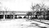
Today’s parkway was constructed in the 1930s and is 2.3 miles (3.7 km) in length and 400 feet (121.9 m) wide and features wide expanses of lawn with full canopies of trees. The center of the parkway, prior to World War II was closed off on Sunday mornings for professional bicycle racing. Today, a recreational bikeway
Bikeway
A Bikeway is a route, way or path which in some manner is specifically designed and /or designated for bicycle travel.-See also:*Bicycle boulevard*Bicycle trail*Bicycle transportation engineering*Foreshoreway*Greenway* List of cycleways...
runs alongside the westbound motor lanes of the parkway, near the north side of the Parkway.
Education
Christopher Columbus High SchoolChristopher Columbus High School (Bronx, New York)
Christopher Columbus High School is a public secondary school located in the Pelham Parkway, northeast section of the Bronx, New York. It is within walking distance from the Bronx Zoo and the New York Botanical Garden....
is in the neighborhood, on the northside of the Pelham Parkway road. CUNY Prep High School is in the southwest part of the neighborhood. The Albert Einstein College of Medicine
Albert Einstein College of Medicine
Albert Einstein College of Medicine is a graduate school of Yeshiva University. It is a not-for-profit, private, nonsectarian medical school located on the Jack and Pearl Resnick Campus in the Morris Park neighborhood of the borough of the Bronx of New York City...
is also nearby.
Transportation
The neighborhood is served by two New York City subway lines, a local bus route and an express bus to midtown Manhattan. The 22 (New York City Subway service)
The 2 Seventh Avenue Express is a rapid transit service of the New York City Subway. It is colored red on station signs, route signs, and the official subway map, since it uses the IRT Broadway – Seventh Avenue Line through most of Manhattan....
train carries passengers to the west side of Manhattan
Manhattan
Manhattan is the oldest and the most densely populated of the five boroughs of New York City. Located primarily on the island of Manhattan at the mouth of the Hudson River, the boundaries of the borough are identical to those of New York County, an original county of the state of New York...
along 7th Avenue and the number 5
5 (New York City Subway service)
The 5 Lexington Avenue Express is a rapid transit service of the New York City Subway. It is colored green on station signs, route signs, and the official subway map, since it uses IRT Lexington Avenue Line in Manhattan....
train runs down the east side along Lexington Avenue. There are 3 stops in the neighborhood: Pelham Parkway
Pelham Parkway (IRT White Plains Road Line)
Pelham Parkway is a local station on the IRT White Plains Road Line of the New York City Subway. Located in the Bronx at the intersection of Pelham Parkway and White Plains Road, it is served by the 2 train at all times, and the 5 train during rush hours in the peak direction...
and Bronx Park East
Bronx Park East (IRT White Plains Road Line)
Bronx Park East is a local station on the IRT White Plains Road Line of the New York City Subway. Located in the Bronx on White Plains Road at Bronx Park East, it is served by the 2 train at all times, and the 5 train during rush hours in the peak direction...
on the IRT White Plains Road Line
IRT White Plains Road Line
The White Plains Road Line is a rapid transit line of the IRT division of the New York City Subway, serving the central Bronx. It is mostly elevated, and served both subway and elevated trains until 1952...
(served by the 2 and the 5) and Morris Park
Morris Park (IRT Dyre Avenue Line)
Morris Park is a station on the IRT Dyre Avenue Line of the New York City Subway. Served by the 5 train, it is located at Paulding Avenue and the Esplanade in Morris Park, Bronx....
on the IRT Dyre Avenue Line
IRT Dyre Avenue Line
The IRT Dyre Avenue Line is a New York City Subway rapid transit line as part of the A Division . It is a branch of the IRT White Plains Road Line serving passengers in the northeastern section of the Bronx...
(served by the 5). Travel time to midtown Manhattan is about 35 mins.
The BxM11 bus provides express service to midtown along 5th Avenue and returns along Madison Avenue. The Bx12 bus route goes through Pelham Parkway, beginning at 207th Street in Manhattan and ending in Bay Plaza (Co-Op City) with transfers to other bus routes on White Plains Road, Williamsbridge Road and Eastchester Road.
Facts
- Pelham Parkway has a sizable Italian immigrant population; the neighborhood's main streets, White Plains Road and Lydig Avenue, have a very distinct ethnic Albanian flavor.
- The White Plains Road Business Improvement DistrictBusiness improvement districtA business improvement district is a defined area within which businesses pay an additional tax or fee in order to fund improvements within the district's boundaries. Grant funds acquired by the city for special programs and/or incentives such as tax abatements can be made available to assist...
is a major retail district in the neighborhood. - Michael Paciello the musician is from the Pelham Parkway area.