
List of bus routes in Queens
Encyclopedia
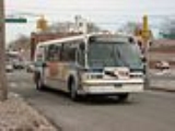
MTA Regional Bus
operates a number of bus
routes in Queens
, New York
, United States
, under two different public brands. Some of them are the direct descendants of streetcar lines (see list of streetcar lines in Queens).
Each route is marked with the operator. NOTE: Routes marked with an asterisk (*) run 24 hours a day. The full route is shown except for branching.
MTA Regional Bus Operations
MTA Regional Bus Operations is the surface transit division of the Metropolitan Transportation Authority , created in 2008 to consolidate all bus operations operated by the MTA.-History:...
operates a number of bus
Bus
A bus is a road vehicle designed to carry passengers. Buses can have a capacity as high as 300 passengers. The most common type of bus is the single-decker bus, with larger loads carried by double-decker buses and articulated buses, and smaller loads carried by midibuses and minibuses; coaches are...
routes in Queens
Queens
Queens is the easternmost of the five boroughs of New York City. The largest borough in area and the second-largest in population, it is coextensive with Queens County, an administrative division of New York state, in the United States....
, New York
New York
New York is a state in the Northeastern region of the United States. It is the nation's third most populous state. New York is bordered by New Jersey and Pennsylvania to the south, and by Connecticut, Massachusetts and Vermont to the east...
, United States
United States
The United States of America is a federal constitutional republic comprising fifty states and a federal district...
, under two different public brands. Some of them are the direct descendants of streetcar lines (see list of streetcar lines in Queens).
List of routes
This table gives details for the routes prefixed with "Q"—in other words, those considered to run primarily in Queens by the MTA. For details on routes with other prefixes, see the following articles:- List of bus routes in Brooklyn: B13, B15, B20, B24, B26, B38, B52, B54, B57, and B62
- List of bus routes in Manhattan: M60
- List of bus routes in Nassau County, New York: N1, N4, N6, N8, N20, N21, N22, N22A, N24, N26, N31, N32, and N33
- List of express bus routes in New York City: X63, X64, X68, BM5, QM1, QM2, QM3, QM4, QM5, QM6, QM7, QM8, QM10, QM11, QM12, QM15, QM16, QM17, QM18, QM20, QM21, QM24, and QM25
Each route is marked with the operator. NOTE: Routes marked with an asterisk (*) run 24 hours a day. The full route is shown except for branching.
Q1 to Q24
| Route | Operator | Terminals | Streets traveled | History and notes | ||
|---|---|---|---|---|---|---|
Local |
NYCT | Jamaica Jamaica, Queens Jamaica is a neighborhood in the borough of Queens in New York City, New York, United States. It was settled under Dutch rule in 1656 in New Netherland as Rustdorp. Under British rule, the Village of Jamaica became the center of the "Town of Jamaica"... 165th Street Bus Terminal 165th Street Bus Terminal The 165th Street Bus Terminal, also known as Jamaica Bus Terminal or simply 165th Street Terminal, is a major bus terminal in Jamaica, Queens, owned by MTA Regional Bus. It is located at 89th Avenue and Merrick Boulevard, near the Queens Library. Most buses that pass through Jamaica serve either... |
↔ | Bellerose Bellerose, Queens Bellerose, also called Bellerose Manor, is a neighborhood on the eastern edge of the New York City borough of Queens, near the border with Nassau County. It is sometimes referred to as Bellerose Manor, to distinguish it from the adjacent Bellerose Village and Bellerose Terrace in Nassau County,... 243 Street and Braddock Avenue |
Hillside Avenue, Braddock Avenue |
|
| ↔ | Queens Village Queens Village, Queens Queens Village is mostly a residential neighborhood in the eastern part of the New York City borough of Queens.The Queens Village Post Office serves the ZIP codes of 11427 , 11428 , and 11429... Jamaica Avenue and Springfield Boulevard at Queens Village LIRR station Queens Village (LIRR station) Queens Village is a station on the Main Line of the Long Island Rail Road, located between 218th Street and Springfield Boulevard in Queens Village, Queens, New York City. It has two side platforms along the four-track line, and only serves Hempstead Branch trains. The two-story station house is... |
Hillside Avenue, Springfield Boulevard | ||||
Local |
NYCT | Jamaica Jamaica, Queens Jamaica is a neighborhood in the borough of Queens in New York City, New York, United States. It was settled under Dutch rule in 1656 in New Netherland as Rustdorp. Under British rule, the Village of Jamaica became the center of the "Town of Jamaica"... 165th Street Bus Terminal 165th Street Bus Terminal The 165th Street Bus Terminal, also known as Jamaica Bus Terminal or simply 165th Street Terminal, is a major bus terminal in Jamaica, Queens, owned by MTA Regional Bus. It is located at 89th Avenue and Merrick Boulevard, near the Queens Library. Most buses that pass through Jamaica serve either... |
↔ | Queens Village Queens Village, Queens Queens Village is mostly a residential neighborhood in the eastern part of the New York City borough of Queens.The Queens Village Post Office serves the ZIP codes of 11427 , 11428 , and 11429... 225 Street and Hempstead Avenue |
Hillside Avenue, Hollis Avenue |
Belmont Park Belmont Park is a major thoroughbred horse-racing facility located in Elmont in the Town of Hempstead in Nassau County, New York, on Long Island adjoining New York City. It first opened on May 4, 1905... , Elmont, Nassau County Elmont, New York Elmont is an unincorporated census-designated place located in the northwest corner of the Town of Hempstead in Nassau County, New York, along its border with the borough of Queens in New York City... on race days during the Spring/Summer and the Fall Championship meetings. |
Local |
NYCT | Jamaica Jamaica, Queens Jamaica is a neighborhood in the borough of Queens in New York City, New York, United States. It was settled under Dutch rule in 1656 in New Netherland as Rustdorp. Under British rule, the Village of Jamaica became the center of the "Town of Jamaica"... 165th Street Bus Terminal 165th Street Bus Terminal The 165th Street Bus Terminal, also known as Jamaica Bus Terminal or simply 165th Street Terminal, is a major bus terminal in Jamaica, Queens, owned by MTA Regional Bus. It is located at 89th Avenue and Merrick Boulevard, near the Queens Library. Most buses that pass through Jamaica serve either... |
↔ | JFK International Airport Terminal 4 |
Hillside Avenue and Farmers Boulevard |
|
| NYCT | ||||||
| Local service | ||||||
| Jamaica Jamaica, Queens Jamaica is a neighborhood in the borough of Queens in New York City, New York, United States. It was settled under Dutch rule in 1656 in New Netherland as Rustdorp. Under British rule, the Village of Jamaica became the center of the "Town of Jamaica"... Parsons Boulevard and Archer Avenue at Jamaica Center – Parsons/Archer ( trains) |
↔ | Cambria Heights Cambria Heights, Queens Cambria Heights is a middle-class neighborhood in the southeastern portion of the New York City borough of Queens. It is bounded by Springfield Boulevard and Francis Lewis Boulevard to the west, the Elmont, Nassau County border on the east, Queens Village to the north, St. Albans to the west, and... 235 Street and Linden Boulevard |
Merrick Boulevard and Linden Boulevard |
|
||
| Limited-stop service | ||||||
| Jamaica Jamaica, Queens Jamaica is a neighborhood in the borough of Queens in New York City, New York, United States. It was settled under Dutch rule in 1656 in New Netherland as Rustdorp. Under British rule, the Village of Jamaica became the center of the "Town of Jamaica"... Parsons Boulevard and Archer Avenue at Jamaica Center – Parsons/Archer ( trains) |
↔ AM ---- → PM |
Cambria Heights Cambria Heights, Queens Cambria Heights is a middle-class neighborhood in the southeastern portion of the New York City borough of Queens. It is bounded by Springfield Boulevard and Francis Lewis Boulevard to the west, the Elmont, Nassau County border on the east, Queens Village to the north, St. Albans to the west, and... 235 Street and Linden Boulevard |
(See Q4 local routing above) |
|
||
| NYCT | ||||||
| Local service | ||||||
| Jamaica Jamaica, Queens Jamaica is a neighborhood in the borough of Queens in New York City, New York, United States. It was settled under Dutch rule in 1656 in New Netherland as Rustdorp. Under British rule, the Village of Jamaica became the center of the "Town of Jamaica"... Parsons Boulevard and Archer Avenue at Jamaica Center – Parsons/Archer ( trains) |
↔ | Valley Stream, Nassau County Valley Stream, New York Valley Stream is a village in Nassau County, New York in the United States. The population in the village of Valley Stream was 37,511 at the 2010 census... Green Acres Shopping Mall Green Acres Mall Green Acres Mall is an indoor shopping mall located in Valley Stream, New York, off Sunrise Highway in Nassau County right off the border of New York City. The mall has a gross leasable area of . The mall is the 26th largest in the United States. The mall is extremely popular in Nassau County and... |
Merrick Boulevard, Hook Creek Boulevard, Sunrise Highway (Green Acres trips). |
during late nights. Boulevard via Brookville Boulevard. |
||
| ↔ | Rosedale Rosedale, Queens Rosedale is a suburban neighborhood in Queens. The neighborhood is on the Nassau County, New York - Queens border and is part of Queens Community Board 13.- History :... 243 Street and Francis Lewis Boulevard at Rosedale LIRR station Rosedale (LIRR station) Rosedale is a station on the Long Island Rail Road's Atlantic Branch in the Rosedale neighborhood of Queens in New York City. The station is at Sunrise Highway, Francis Lewis Boulevard and 243rd Street. Rosedale has an island platform and a municipal parking lot on street level. The Rosedale... |
|||||
| Limited-stop service | ||||||
| Jamaica Jamaica, Queens Jamaica is a neighborhood in the borough of Queens in New York City, New York, United States. It was settled under Dutch rule in 1656 in New Netherland as Rustdorp. Under British rule, the Village of Jamaica became the center of the "Town of Jamaica"... Parsons Boulevard and Archer Avenue at Jamaica Center – Parsons/Archer ( trains) |
← AM ---- → PM |
Rosedale Rosedale, Queens Rosedale is a suburban neighborhood in Queens. The neighborhood is on the Nassau County, New York - Queens border and is part of Queens Community Board 13.- History :... 243 Street and Francis Lewis Boulevard at Rosedale LIRR station Rosedale (LIRR station) Rosedale is a station on the Long Island Rail Road's Atlantic Branch in the Rosedale neighborhood of Queens in New York City. The station is at Sunrise Highway, Francis Lewis Boulevard and 243rd Street. Rosedale has an island platform and a municipal parking lot on street level. The Rosedale... |
(See Q5 local routing above) |
afternoons towards Rosedale only. |
||
| MTA Bus | ||||||
| Local service | ||||||
| Jamaica Jamaica, Queens Jamaica is a neighborhood in the borough of Queens in New York City, New York, United States. It was settled under Dutch rule in 1656 in New Netherland as Rustdorp. Under British rule, the Village of Jamaica became the center of the "Town of Jamaica"... 165th Street Bus Terminal 165th Street Bus Terminal The 165th Street Bus Terminal, also known as Jamaica Bus Terminal or simply 165th Street Terminal, is a major bus terminal in Jamaica, Queens, owned by MTA Regional Bus. It is located at 89th Avenue and Merrick Boulevard, near the Queens Library. Most buses that pass through Jamaica serve either... |
↔ | JFK International Airport North Cargo Road and Eastern Road |
Jamaica Avenue, Supthin Boulevard, Rockaway Boulevard, North Boundary Road |
Green Bus Lines Green Bus Lines was a bus company in New York City, United States, managed most recently by Jerome Cooper , operating local service in Queens and express service to Manhattan until January 9, 2006, when the MTA Bus Company took over its routes.The company was incorporated on April 3, 1925 to... . |
||
| Limited-stop service | ||||||
| Jamaica Jamaica, Queens Jamaica is a neighborhood in the borough of Queens in New York City, New York, United States. It was settled under Dutch rule in 1656 in New Netherland as Rustdorp. Under British rule, the Village of Jamaica became the center of the "Town of Jamaica"... 165th Street Bus Terminal 165th Street Bus Terminal The 165th Street Bus Terminal, also known as Jamaica Bus Terminal or simply 165th Street Terminal, is a major bus terminal in Jamaica, Queens, owned by MTA Regional Bus. It is located at 89th Avenue and Merrick Boulevard, near the Queens Library. Most buses that pass through Jamaica serve either... |
← AM ---- → PM |
JFK International Airport North Cargo Road and Eastern Road |
(See Q6 local routing above) |
afternoon towards JFK Airport only. |
||
Local |
MTA Bus | City Line, Brooklyn City Line, Brooklyn City Line is a sub-section of the East New York neighborhood in Brooklyn, New York City, bordering the neighborhoods of Cypress Hills to the north and Ozone Park, Queens to the east, and the Shore Parkway to the south... Euclid Avenue and Pitkin Avenue at Euclid Avenue Euclid Avenue (IND Fulton Street Line) Euclid Avenue is an express station on the IND Fulton Street Line of the New York City Subway. Located at the intersection of Euclid Avenue and Pitkin Avenue in Brooklyn, it is served by the A train at all times, and the southern terminal for the C train, at all times except late nights... ( trains) |
↔ | JFK International Airport 148th Street and South Cargo Road |
Pitkin Avenue, Rockaway Boulevard, 150 Street |
|
Local |
MTA Bus | Jamaica Jamaica, Queens Jamaica is a neighborhood in the borough of Queens in New York City, New York, United States. It was settled under Dutch rule in 1656 in New Netherland as Rustdorp. Under British rule, the Village of Jamaica became the center of the "Town of Jamaica"... 165th Street Bus Terminal 165th Street Bus Terminal The 165th Street Bus Terminal, also known as Jamaica Bus Terminal or simply 165th Street Terminal, is a major bus terminal in Jamaica, Queens, owned by MTA Regional Bus. It is located at 89th Avenue and Merrick Boulevard, near the Queens Library. Most buses that pass through Jamaica serve either... |
↔ | Spring Creek Starrett City, Brooklyn Starrett City is a housing development in Brooklyn, New York City. Starrett City opened in 1974, and in 2002, changed its name to the Spring Creek Towers. The neighborhood is part of Brooklyn Community Board 5. Starrett City is patrolled by the NYPD's 75th Precinct.The Starrett City site spanned... Gateway Drive and Erskine Street at Gateway Center Mall |
Jamaica Avenue, 101 Avenue, Fountain Avenue |
|
| Local |
MTA Bus | Jamaica Jamaica, Queens Jamaica is a neighborhood in the borough of Queens in New York City, New York, United States. It was settled under Dutch rule in 1656 in New Netherland as Rustdorp. Under British rule, the Village of Jamaica became the center of the "Town of Jamaica"... 165th Street Bus Terminal 165th Street Bus Terminal The 165th Street Bus Terminal, also known as Jamaica Bus Terminal or simply 165th Street Terminal, is a major bus terminal in Jamaica, Queens, owned by MTA Regional Bus. It is located at 89th Avenue and Merrick Boulevard, near the Queens Library. Most buses that pass through Jamaica serve either... |
↔ | South Ozone Park South Ozone Park, Queens South Ozone Park is a neighborhood in the southwestern section of the New York City borough of Queens. It was originally developed as low-cost housing in the early 1900s. Adjacently north of JFK Airport, its boundaries extend from the Aqueduct Racetrack westward to the Van Wyck Expressway.Its main... Rockaway Boulevard and Lincoln Street |
Jamaica Avenue, Supthin Boulevard, Liberty Avenue, 135th Street (Northbound), Van Wyck Expressway Service Road (Southbound), Lincoln Street. |
|
| MTA Bus | ||||||
| Local service | ||||||
| Kew Gardens Kew Gardens, Queens Kew Gardens is a triangular-shaped neighborhood in central Queens bounded to the north by the Jackie Robinson Parkway , to the east by Van Wyck Expressway and 131st Street, to the south by Hillside Avenue, and to the west by Park Lane, Abingdon Road and 118th Street... Union Turnpike and Queens Boulevard at Kew Gardens – Union Turnpike ( trains) |
↔ | JFK International Airport Terminal 4 |
Lefferts Boulevard, Rockaway Boulevard (some trips), Service Road |
|
||
| Limited-stop service | ||||||
| Kew Gardens Kew Gardens, Queens Kew Gardens is a triangular-shaped neighborhood in central Queens bounded to the north by the Jackie Robinson Parkway , to the east by Van Wyck Expressway and 131st Street, to the south by Hillside Avenue, and to the west by Park Lane, Abingdon Road and 118th Street... Union Turnpike and Queens Boulevard at Kew Gardens – Union Turnpike ( trains) |
↔ | JFK International Airport Terminal 4 |
Lefferts Boulevard, Service Road |
|
||
Local |
MTA Bus | Elmhurst Elmhurst, Queens Elmhurst is a neighborhood in the New York City borough of Queens. It is bounded by Roosevelt Avenue on the north; Corona to the northeast; Junction Boulevard on the east; Rego Park to the southeast; the Long Island Expressway on the south; Middle Village to the south and southwest; and Maspeth... Queens Boulevard and Woodhaven Boulevard at Woodhaven Boulevard Woodhaven Boulevard (IND Queens Boulevard Line) Woodhaven Boulevard is a local station on the IND Queens Boulevard Line of the New York City Subway. It is served by the R train at all times except late nights, when the E train replaces it as the local along Queens Boulevard... ( trains) and Queens Center Mall Queens Center Queens Center is an urban shopping mall in the Elmhurst neighborhood of Queens, New York City, United States. It is located at the intersection of Queens Boulevard and Woodhaven Boulevard, adjacent to the Woodhaven Boulevard station on the IND Queens Boulevard Line of the New York City Subway. It... |
↔ | Howard Beach Howard Beach, Queens Howard Beach is a suburban neighborhood in the southwestern portion of the borough of Queens in New York City. It is bordered in the north by the Belt Parkway and South Conduit Avenue in Ozone Park, the south by Jamaica Bay in Broad Channel, the east by 102nd-104th streets, and the west by 78th... 164th Avenue and 99th Street at Charles Park |
Woodhaven Boulevard, Cross Bay Boulevard...
99th Street |
|
| ↔ | Hamilton Beach Hamilton Beach, Queens Hamilton Beach, one of the oldest sections of Howard Beach, is a neighborhood in the New York City borough of Queens. Its boundaries are the 102nd Street Creek to the north, the IND Rockaway Line tracks and JFK Airport to the east, Hawtree Creek to the west, and Jamaica Bay to the south... 164th Avenue and 104th Street |
|||||
Local |
NYCT | Flushing Flushing, Queens Flushing, founded in 1645, is a neighborhood in the north central part of the City of New York borough of Queens, east of Manhattan.Flushing was one of the first Dutch settlements on Long Island. Today, it is one of the largest and most diverse neighborhoods in New York City... Roosevelt Avenue and Main Street at Flushing – Main Street ( trains) |
↔ | Little Neck Little Neck, Queens Little Neck is a community in the northeast corner of Queens County, bordered on the north by Little Neck Bay and on the east by Great Neck in Nassau County. Due to this proximity to Nassau, Little Neck remains one of the most suburban-looking areas in New York City. The southern border is the... Glenwood Street and Northern Boulevard |
Sanford Avenue, Northern Boulevard | |
Local |
NYCT | Flushing Flushing, Queens Flushing, founded in 1645, is a neighborhood in the north central part of the City of New York borough of Queens, east of Manhattan.Flushing was one of the first Dutch settlements on Long Island. Today, it is one of the largest and most diverse neighborhoods in New York City... 39th Avenue and Union Street near Flushing – Main Street ( trains) |
↔ | Fort Totten Fort Road and Cross Island Parkway |
Northern Boulevard, Bell Boulevard |
|
Local |
NYCT | Flushing Flushing, Queens Flushing, founded in 1645, is a neighborhood in the north central part of the City of New York borough of Queens, east of Manhattan.Flushing was one of the first Dutch settlements on Long Island. Today, it is one of the largest and most diverse neighborhoods in New York City... Roosevelt Avenue and Lippmann Arcade at Flushing – Main Street ( trains) |
↔ | Beechhurst Beechhurst, Queens Beechhurst is a neighborhood in the northeastern part of the New York City borough of Queens. It is on the northeastern side of Whitestone, Queens, New York, near the East River, north of the Cross Island Parkway and between the approaches to the Throgs Neck and Whitestone bridges.Parts of the... 166th Street and Powells Cove Boulevard |
|
|
Local |
NYCT | Flushing Flushing, Queens Flushing, founded in 1645, is a neighborhood in the north central part of the City of New York borough of Queens, east of Manhattan.Flushing was one of the first Dutch settlements on Long Island. Today, it is one of the largest and most diverse neighborhoods in New York City... 39th Avenue and Union Street near at Flushing – Main Street ( trains) |
↔ | Fort Totten Fort Road and Cross Island Parkway |
Bayside Avenue, Francis Lewis Boulevard or Utopia Parkway |
branch or Utopia Parkway branch. |
| NYCT | ||||||
| Local service | ||||||
| Flushing Flushing, Queens Flushing, founded in 1645, is a neighborhood in the north central part of the City of New York borough of Queens, east of Manhattan.Flushing was one of the first Dutch settlements on Long Island. Today, it is one of the largest and most diverse neighborhoods in New York City... Main Street and 39th Avenue near Flushing – Main Street ( trains) |
↔ | Jamaica Jamaica, Queens Jamaica is a neighborhood in the borough of Queens in New York City, New York, United States. It was settled under Dutch rule in 1656 in New Netherland as Rustdorp. Under British rule, the Village of Jamaica became the center of the "Town of Jamaica"... Archer Avenue and Merrick Boulevard |
Kissena Boulevard, Horace Harding Expressway, 188 Street, Hillside Avenue |
|
||
| Limited-stop service | ||||||
| Flushing Flushing, Queens Flushing, founded in 1645, is a neighborhood in the north central part of the City of New York borough of Queens, east of Manhattan.Flushing was one of the first Dutch settlements on Long Island. Today, it is one of the largest and most diverse neighborhoods in New York City... Main Street and 39th Avenue near Flushing – Main Street ( trains) |
↔ | Jamaica Jamaica, Queens Jamaica is a neighborhood in the borough of Queens in New York City, New York, United States. It was settled under Dutch rule in 1656 in New Netherland as Rustdorp. Under British rule, the Village of Jamaica became the center of the "Town of Jamaica"... Archer Avenue and Merrick Boulevard |
(See Q17 local routing above) |
|
||
| Local |
MTA Bus | Astoria Astoria, Queens Astoria is a neighborhood in the northwestern corner of the borough of Queens in New York City. Located in Community Board 1, Astoria is bounded by the East River and is adjacent to three other Queens neighborhoods: Long Island City, Sunnyside , and Woodside... 2 Street and 27 Avenue |
↔ | Maspeth Maspeth, Queens Maspeth is a small community in the borough of Queens in New York City. Neighborhoods sharing borders with Maspeth are Woodside and Sunnyside to the north, Long Island City to the northwest, Greenpoint to the west, East Williamsburg to the southwest, Fresh Pond and Ridgewood to the south, and... 69th Street and Grand Avenue |
30 Avenue, 58 Street, Woodside Avenue, 65 Place, 69 Street |
|
| Local |
MTA Bus | Astoria Astoria, Queens Astoria is a neighborhood in the northwestern corner of the borough of Queens in New York City. Located in Community Board 1, Astoria is bounded by the East River and is adjacent to three other Queens neighborhoods: Long Island City, Sunnyside , and Woodside... 21st Street and Astoria Boulevard |
↔ | Flushing Flushing, Queens Flushing, founded in 1645, is a neighborhood in the north central part of the City of New York borough of Queens, east of Manhattan.Flushing was one of the first Dutch settlements on Long Island. Today, it is one of the largest and most diverse neighborhoods in New York City... Main Street and 39th Avenue near Flushing – Main Street ( trains) |
Astoria Boulevard |
|
Local |
NYCT | College Point College Point, Queens College Point is a working-middle class neighborhood in the New York City borough of Queens. It is located north of Flushing on Flushing Bay and the East River and is part of the Queens Community Board 7. Willets Point Boulevard and the Whitestone Expressway are often the neighborhood's... College Point Boulevard and 15th Avenue |
↔ | Jamaica Jamaica, Queens Jamaica is a neighborhood in the borough of Queens in New York City, New York, United States. It was settled under Dutch rule in 1656 in New Netherland as Rustdorp. Under British rule, the Village of Jamaica became the center of the "Town of Jamaica"... Merrick Boulevard and Archer Avenue |
20th Avenue (Q20A) / 14th Avenue (Q20B), Union Street, Main Street, Archer Avenue |
North Shore Bus Company The North Shore Bus Company operated public buses in Queens, New York City, United States. It was established in 1920 as the successor to the New York and North Shore Traction Company trolley system, and operated until 1947 when it went bankrupt, and its operations were taken over by the New York... began operating the Q44FS on February 15, 1932. |
Local |
NYCT | |||||
| Local |
MTA Bus | Elmhurst Elmhurst, Queens Elmhurst is a neighborhood in the New York City borough of Queens. It is bounded by Roosevelt Avenue on the north; Corona to the northeast; Junction Boulevard on the east; Rego Park to the southeast; the Long Island Expressway on the south; Middle Village to the south and southwest; and Maspeth... Queens Boulevard and Woodhaven Boulevard at Woodhaven Boulevard Woodhaven Boulevard (IND Queens Boulevard Line) Woodhaven Boulevard is a local station on the IND Queens Boulevard Line of the New York City Subway. It is served by the R train at all times except late nights, when the E train replaces it as the local along Queens Boulevard... ( trains) and Queens Center Mall Queens Center Queens Center is an urban shopping mall in the Elmhurst neighborhood of Queens, New York City, United States. It is located at the intersection of Queens Boulevard and Woodhaven Boulevard, adjacent to the Woodhaven Boulevard station on the IND Queens Boulevard Line of the New York City Subway. It... |
↔ | Rockaway Park Rockaway Park, Queens Rockaway Park is a neighborhood in the New York City borough of Queens. The area is on the Rockaway Peninsula, nestled between Jamaica Bay to the north and the Atlantic Ocean to the south. The neighborhood of Rockaway Beach lies on its eastern border while the community of Belle Harbor is situated... Beach 116th Street and Rockaway Beach Boulevard at Rockaway Park – Beach 116th Street ( trains) |
Woodhaven Boulevard, Cross Bay Boulevard, Rockaway Beach Boulevard |
|
| Local |
MTA Bus | Far Rockaway Far Rockaway, Queens Far Rockaway is a neighborhood on the Rockaway Peninsula in the New York City borough of Queens in the United States. It is the easternmost section of the Rockaways. The neighborhood starts at the Nassau County line and extends west to Beach 32nd Street. The neighborhood is part of Queens Community... Mott Avenue and Beach 20th Street at Far Rockaway – Mott Avenue ( train) |
↔ | Roxbury Roxbury, Queens Roxbury is a community on the Rockaway Peninsula in the New York City borough of Queens. The neighborhood is just west of the Marine Parkway Bridge and adjoins Fort Tilden... Beach 169th Street and Rockaway Point Boulevard |
Beach Channel Drive, Rockaway Beach Boulevard |
|
| Local |
MTA Bus | East Elmhurst East Elmhurst, Queens East Elmhurst is a culturally diverse area in New York City, in the northwest of the borough of Queens. It is located north of Jackson Heights and Corona and is bounded on the east and north by Flushing Bay. Residents are mostly moderate-income families, but there are also low-income areas. It... 102nd Street and Ditmars Boulevard |
↔ | Glendale Glendale, Queens Glendale is a neighborhood in the west-central portion of the borough of Queens in New York City. It is bounded by Cooper Avenue to the north, Woodhaven Boulevard to the east, Myrtle Avenue to the south and Fresh Pond Road to the West... Union Turnpike and Trotting Course Lane (Crescent Apartments) |
Ditmars Boulevard, 108th Street, 69th Avenue |
|
Local |
NYCT | Jamaica Jamaica, Queens Jamaica is a neighborhood in the borough of Queens in New York City, New York, United States. It was settled under Dutch rule in 1656 in New Netherland as Rustdorp. Under British rule, the Village of Jamaica became the center of the "Town of Jamaica"... 168th Street and Archer Avenue |
↔ | East New York East New York, Brooklyn East New York is a residential neighborhood located in the Eastern section of the borough of Brooklyn in New York City, United States. The neighborhood is part of Brooklyn Community Board 5... Broadway and Fulton Street at Broadway Junction Broadway Junction (New York City Subway) Broadway Junction is a New York City Subway station complex shared by the elevated BMT Canarsie Line and BMT Jamaica Line, and the underground IND Fulton Street Line. It was also served by trains of the Fulton Street Elevated until that line closed in 1956... ( trains) |
Archer/Jamaica Avenues, Atlantic Avenue |
and Parsons Boulevard to 170th Street and Jamaica Avenue on December 11, 1988. |
Q25 to Q49
| Route | Operator | Terminals | Streets Traveled | History and Notes | |
|---|---|---|---|---|---|
| MTA Bus |
Local service | ||||
| Jamaica Jamaica, Queens Jamaica is a neighborhood in the borough of Queens in New York City, New York, United States. It was settled under Dutch rule in 1656 in New Netherland as Rustdorp. Under British rule, the Village of Jamaica became the center of the "Town of Jamaica"... Sutphin Boulevard and 95 Avenue at Sutphin Boulevard – Archer Avenue – JFK Airport ( trains) and Jamaica LIRR / AirTrain Station Jamaica (LIRR station) Jamaica is a major hub station of the Long Island Rail Road, and is located in Jamaica, Queens, New York City. It is the largest transit hub on Long Island and is one of the busiest railroad stations in the country with over 200,000 daily passengers... |
↔ | College Point College Point, Queens College Point is a working-middle class neighborhood in the New York City borough of Queens. It is located north of Flushing on Flushing Bay and the East River and is part of the Queens Community Board 7. Willets Point Boulevard and the Whitestone Expressway are often the neighborhood's... Poppenhusen Avenue and 119 Street |
Parsons Boulevard Kissena Boulevard 127 Street |
|
|
| Limited-stop service | |||||
| Jamaica Jamaica, Queens Jamaica is a neighborhood in the borough of Queens in New York City, New York, United States. It was settled under Dutch rule in 1656 in New Netherland as Rustdorp. Under British rule, the Village of Jamaica became the center of the "Town of Jamaica"... Sutphin Boulevard and 95 Avenue at Sutphin Boulevard – Archer Avenue – JFK Airport ( trains) and Jamaica LIRR / AirTrain Station Jamaica (LIRR station) Jamaica is a major hub station of the Long Island Rail Road, and is located in Jamaica, Queens, New York City. It is the largest transit hub on Long Island and is one of the busiest railroad stations in the country with over 200,000 daily passengers... |
↔ | College Point College Point, Queens College Point is a working-middle class neighborhood in the New York City borough of Queens. It is located north of Flushing on Flushing Bay and the East River and is part of the Queens Community Board 7. Willets Point Boulevard and the Whitestone Expressway are often the neighborhood's... Poppenhusen Avenue and 119 Street |
(See Q25 local routing above) |
|
|
| NYCT | Flushing Flushing, Queens Flushing, founded in 1645, is a neighborhood in the north central part of the City of New York borough of Queens, east of Manhattan.Flushing was one of the first Dutch settlements on Long Island. Today, it is one of the largest and most diverse neighborhoods in New York City... Roosevelt Avenue and Lippmann Arcade at Flushing – Main Street ( trains) |
↔ | Fresh Meadows Fresh Meadows, Queens Fresh Meadows is a residential neighborhood in northeastern section of the New York City borough of Queens.-Location:Fresh Meadows is located on the northeast side of Hillcrest, bordered to the east by Cunningham Park, to the south by Union Turnpike and St. John's University, and to the west by... Francis Lewis Boulevard and Hollis Court Boulevard |
Parsons Boulevard, 46th Avenue, Hollis Court Boulevard |
|
| NYCT | Local service | ||||
| Flushing Flushing, Queens Flushing, founded in 1645, is a neighborhood in the north central part of the City of New York borough of Queens, east of Manhattan.Flushing was one of the first Dutch settlements on Long Island. Today, it is one of the largest and most diverse neighborhoods in New York City... Main Street and 39th Avenue near Flushing – Main Street ( trains) |
↔ | Cambria Heights Cambria Heights, Queens Cambria Heights is a middle-class neighborhood in the southeastern portion of the New York City borough of Queens. It is bounded by Springfield Boulevard and Francis Lewis Boulevard to the west, the Elmont, Nassau County border on the east, Queens Village to the north, St. Albans to the west, and... Francis Lewis Boulevard and 120 Avenue |
Kissena Boulevard 46 Avenue 48 Avenue Springfield Boulevard |
|
|
| Limited-stop service | |||||
| Flushing Flushing, Queens Flushing, founded in 1645, is a neighborhood in the north central part of the City of New York borough of Queens, east of Manhattan.Flushing was one of the first Dutch settlements on Long Island. Today, it is one of the largest and most diverse neighborhoods in New York City... Main Street and 39th Avenue near Flushing – Main Street ( trains) |
↔ AM ---- → PM |
Cambria Heights Cambria Heights, Queens Cambria Heights is a middle-class neighborhood in the southeastern portion of the New York City borough of Queens. It is bounded by Springfield Boulevard and Francis Lewis Boulevard to the west, the Elmont, Nassau County border on the east, Queens Village to the north, St. Albans to the west, and... Francis Lewis Boulevard and 120 Avenue |
(See Q27 local routing above) |
Queensborough Community College Not to be confused with Queens College, City University of New YorkQueensborough Community College , is one of six community colleges within the City University of New York system. It is located in the neighborhood of Bayside, Queens County, New York City, New York. The total enrollments are... . |
|
| NYCT | Flushing Flushing, Queens Flushing, founded in 1645, is a neighborhood in the north central part of the City of New York borough of Queens, east of Manhattan.Flushing was one of the first Dutch settlements on Long Island. Today, it is one of the largest and most diverse neighborhoods in New York City... 39th Avenue and Union Street at Flushing – Main Street ( trains) |
↔ | Bay Terrace Bay Terrace, Queens Bay Terrace is an affluent neighborhood in the northeastern part of the New York City borough of Queens, and is often considered part of Bayside, despite Bayside's more suburban character. The construction of the Bay Terrace Cooperative apartment buildings and garden apartments in the 1950s, as... Shopping Center |
Northern Boulevard New York State Route 25A New York State Route 25A is a state highway on Long Island in New York in the United States. It serves as the main east–west route for most of the North Shore of Long Island, running from the Queens Midtown Tunnel in the New York City borough of Queens at its western terminus to... Crocheron Avenue 32 Avenue Corporal Kennedy Street |
|
| MTA Bus |
Glendale Glendale, Queens Glendale is a neighborhood in the west-central portion of the borough of Queens in New York City. It is bounded by Cooper Avenue to the north, Woodhaven Boulevard to the east, Myrtle Avenue to the south and Fresh Pond Road to the West... Myrtle Avenue and 80 Street |
↔ | Jackson Heights Jackson Heights, Queens Jackson Heights is a neighborhood in the Northwestern portion of the borough of Queens in New York, New York, United States. The neighborhood is part of Queens Community Board 3... 82nd Street and Roosevelt Avenue at 82nd Street – Jackson Heights ( train) |
80 Street Dry Harbor Road 90/92 Streets |
|
| NYCT | Jamaica Jamaica, Queens Jamaica is a neighborhood in the borough of Queens in New York City, New York, United States. It was settled under Dutch rule in 1656 in New Netherland as Rustdorp. Under British rule, the Village of Jamaica became the center of the "Town of Jamaica"... Archer Avenue and Sutphin Boulevard at Sutphin Boulevard – Archer Avenue – JFK Airport ( trains) and Jamaica LIRR / AirTrain Station Jamaica (LIRR station) Jamaica is a major hub station of the Long Island Rail Road, and is located in Jamaica, Queens, New York City. It is the largest transit hub on Long Island and is one of the busiest railroad stations in the country with over 200,000 daily passengers... |
↔ | Little Neck Little Neck, Queens Little Neck is a community in the northeast corner of Queens County, bordered on the north by Little Neck Bay and on the east by Great Neck in Nassau County. Due to this proximity to Nassau, Little Neck remains one of the most suburban-looking areas in New York City. The southern border is the... Horace Harding Expressway and city line |
Homelawn Street Utopia Parkway Horace Harding Expressway |
Jamaica (LIRR station) Jamaica is a major hub station of the Long Island Rail Road, and is located in Jamaica, Queens, New York City. It is the largest transit hub on Long Island and is one of the busiest railroad stations in the country with over 200,000 daily passengers... LIRR station on December 11, 1988 |
| NYCT | Jamaica Jamaica, Queens Jamaica is a neighborhood in the borough of Queens in New York City, New York, United States. It was settled under Dutch rule in 1656 in New Netherland as Rustdorp. Under British rule, the Village of Jamaica became the center of the "Town of Jamaica"... Archer Avenue and Sutphin Boulevard at Sutphin Boulevard – Archer Avenue – JFK Airport ( trains) and Jamaica LIRR / AirTrain Station Jamaica (LIRR station) Jamaica is a major hub station of the Long Island Rail Road, and is located in Jamaica, Queens, New York City. It is the largest transit hub on Long Island and is one of the busiest railroad stations in the country with over 200,000 daily passengers... |
↔ | Bayside Bayside, Queens Bayside is a suburban neighborhood in the borough of Queens in New York, New York in the United States. Bayside is known as one of the most expensive areas to live in Queens, with well kept homes and landscaping... Francis Lewis Boulevard and 27 Avenue |
Homelawn Street Utopia Parkway 48 Avenue Bell Boulevard 32 Avenue |
Jamaica (LIRR station) Jamaica is a major hub station of the Long Island Rail Road, and is located in Jamaica, Queens, New York City. It is the largest transit hub on Long Island and is one of the busiest railroad stations in the country with over 200,000 daily passengers... LIRR station on December 11, 1988 |
| NYCT | New York Penn Station Pennsylvania Station (New York City) Pennsylvania Station—commonly known as Penn Station—is the major intercity train station and a major commuter rail hub in New York City. It is one of the busiest rail stations in the world, and a hub for inbound and outbound railroad traffic in New York City. The New York City Subway system also... 32 Street and 7 Avenue |
↔ | Jackson Heights Jackson Heights, Queens Jackson Heights is a neighborhood in the Northwestern portion of the borough of Queens in New York, New York, United States. The neighborhood is part of Queens Community Board 3... Northern Boulevard and 81 Street |
Madison/5 Avenue Queens Boulevard Roosevelt Avenue |
|
| MTA Bus |
Jackson Heights Jackson Heights, Queens Jackson Heights is a neighborhood in the Northwestern portion of the borough of Queens in New York, New York, United States. The neighborhood is part of Queens Community Board 3... Roosevelt Avenue / 74th Street ( trains) Bus terminal |
↔ | LaGuardia Airport LaGuardia Airport LaGuardia Airport is an airport located in the northern part of Queens County on Long Island in the City of New York. The airport is located on the waterfront of Flushing Bay and Bowery Bay, and borders the neighborhoods of Astoria, Jackson Heights and East Elmhurst. The airport was originally... Central Terminals |
94 Street 23 Avenue 82/83 Streets |
|
| MTA Bus |
Jamaica Jamaica, Queens Jamaica is a neighborhood in the borough of Queens in New York City, New York, United States. It was settled under Dutch rule in 1656 in New Netherland as Rustdorp. Under British rule, the Village of Jamaica became the center of the "Town of Jamaica"... Sutphin Boulevard and 95 Avenue at Sutphin Boulevard – Archer Avenue – JFK Airport ( trains) and Jamaica LIRR / AirTrain Station Jamaica (LIRR station) Jamaica is a major hub station of the Long Island Rail Road, and is located in Jamaica, Queens, New York City. It is the largest transit hub on Long Island and is one of the busiest railroad stations in the country with over 200,000 daily passengers... |
↔ | Whitestone Whitestone, Queens Whitestone is a residential neighborhood in the northernmost part of the City of New York borough of Queens. Located between the East River to the north and 25th Avenue to the south. Whitestone is surrounded by College Point, Flushing, Bayside, Auburndale, Linden Hill, and Murray Hill... Willets Point Boulevard and 149 Street |
Parsons Boulevard Kissena Boulevard Union Street |
Queens Surface Corporation Queens Surface Corporation was a bus company in New York City, United States, operating local service in Queens and the Bronx and express service between Queens and Manhattan until February 27, 2005, when the MTA Bus Company took over the operations.... . |
| MTA Bus |
Midwood, Brooklyn Midwood, Brooklyn Midwood is a neighborhood in the south central part of the New York City borough of Brooklyn, New York, USA, roughly halfway between Prospect Park and Coney Island. The neighborhood is within Community District 14... Flatbush Avenue and Nostrand Avenue at Flatbush Avenue ( trains) |
↔ | Rockaway Park Rockaway Park, Queens Rockaway Park is a neighborhood in the New York City borough of Queens. The area is on the Rockaway Peninsula, nestled between Jamaica Bay to the north and the Atlantic Ocean to the south. The neighborhood of Rockaway Beach lies on its eastern border while the community of Belle Harbor is situated... Newport Avenue and Beach 116 Street |
Flatbush Avenue Newport Avenue |
Green Bus Lines Green Bus Lines was a bus company in New York City, United States, managed most recently by Jerome Cooper , operating local service in Queens and express service to Manhattan until January 9, 2006, when the MTA Bus Company took over its routes.The company was incorporated on April 3, 1925 to... . |
| NYCT | Local service | ||||
| Jamaica Jamaica, Queens Jamaica is a neighborhood in the borough of Queens in New York City, New York, United States. It was settled under Dutch rule in 1656 in New Netherland as Rustdorp. Under British rule, the Village of Jamaica became the center of the "Town of Jamaica"... 165th Street Bus Terminal 165th Street Bus Terminal The 165th Street Bus Terminal, also known as Jamaica Bus Terminal or simply 165th Street Terminal, is a major bus terminal in Jamaica, Queens, owned by MTA Regional Bus. It is located at 89th Avenue and Merrick Boulevard, near the Queens Library. Most buses that pass through Jamaica serve either... |
↔ | Floral Park Floral Park, Queens Floral Park is a neighborhood in the New York City borough of Queens. It is adjacent to the Village of Floral Park, which is in Nassau County. It may be distinguished from the latter by the use of the designation "North Floral Park". The neighborhood is part of Queens Community Board 13.Union... Jamaica Avenue and 257 Street |
Hillside Avenue 212th Place/Street and Jamaica Avenue |
|
|
| Limited-stop service | |||||
| Jamaica Jamaica, Queens Jamaica is a neighborhood in the borough of Queens in New York City, New York, United States. It was settled under Dutch rule in 1656 in New Netherland as Rustdorp. Under British rule, the Village of Jamaica became the center of the "Town of Jamaica"... 165th Street Bus Terminal 165th Street Bus Terminal The 165th Street Bus Terminal, also known as Jamaica Bus Terminal or simply 165th Street Terminal, is a major bus terminal in Jamaica, Queens, owned by MTA Regional Bus. It is located at 89th Avenue and Merrick Boulevard, near the Queens Library. Most buses that pass through Jamaica serve either... |
← AM ---- → PM |
Floral Park Floral Park, Queens Floral Park is a neighborhood in the New York City borough of Queens. It is adjacent to the Village of Floral Park, which is in Nassau County. It may be distinguished from the latter by the use of the designation "North Floral Park". The neighborhood is part of Queens Community Board 13.Union... Jamaica Avenue and 257 Street |
(See Q36 local routing above) |
|
|
| MTA Bus |
Kew Gardens Kew Gardens, Queens Kew Gardens is a triangular-shaped neighborhood in central Queens bounded to the north by the Jackie Robinson Parkway , to the east by Van Wyck Expressway and 131st Street, to the south by Hillside Avenue, and to the west by Park Lane, Abingdon Road and 118th Street... Union Turnpike and Queens Boulevard at Kew Gardens – Union Turnpike ( trains) |
↔ | South Ozone Park South Ozone Park, Queens South Ozone Park is a neighborhood in the southwestern section of the New York City borough of Queens. It was originally developed as low-cost housing in the early 1900s. Adjacently north of JFK Airport, its boundaries extend from the Aqueduct Racetrack westward to the Van Wyck Expressway.Its main... 150 Avenue and 149 Avenue |
Park Lane South 111 Street 135 Avenue |
Green Bus Lines Green Bus Lines was a bus company in New York City, United States, managed most recently by Jerome Cooper , operating local service in Queens and express service to Manhattan until January 9, 2006, when the MTA Bus Company took over its routes.The company was incorporated on April 3, 1925 to... . |
| MTA Bus |
Rego Park Rego Park, Queens Rego Park is a neighborhood in the New York City borough of Queens.-Geography:Rego Park is bordered to the north by Elmhurst and Corona, the east and south by Forest Hills and the west by Middle Village.-History:... 62 Drive and 108 Street (South) East end |
↔ | Corona Corona, Queens Corona is a densely-populated neighborhood in the former Township of Newtown in the borough of Queens in New York City, New York, United States... 60 Avenue and Otis Avenue (North) East end |
63 Drive Penelope Avenue Metropolitan Avenue Fresh Pond Road Eliot Avenue 57/59 Avenues |
|
| MTA Bus |
Long Island City Long Island City, Queens Long Island City is the westernmost neighborhood of the borough of Queens in New York City. L.I.C. is notable for its rapid and ongoing gentrification, its waterfront parks, and its thriving arts community. L.I.C. has among the highest concentration of art galleries, art institutions, and studio... Queens Plaza South at Queensboro Plaza Queensboro Plaza (New York City Subway) Queensboro Plaza is an elevated New York City Subway station over Queens Plaza in Long Island City, at the east end of the Queensboro Bridge, with Queens Boulevard running east from the plaza. It stands over the south side of the roadway, but formerly spanned the whole plaza... ( trains) and Queens Plaza Queens Plaza (IND Queens Boulevard Line) Queens Plaza is an express station on the IND Queens Boulevard Line of the New York City Subway. Located at the large Queens Plaza interchange, it is served by the E train at all times, by the R train at all times except late nights, and by the M train on weekdays except late nights.While situated... ( trains) |
↔ | Glendale Glendale, Queens Glendale is a neighborhood in the west-central portion of the borough of Queens in New York City. It is bounded by Cooper Avenue to the north, Woodhaven Boulevard to the east, Myrtle Avenue to the south and Fresh Pond Road to the West... Cooper Avenue and 60 Lane |
Thomson Avenue 48 Avenue 58 Street 61 Street Forest Avenue |
|
| MTA Bus |
Jamaica Jamaica, Queens Jamaica is a neighborhood in the borough of Queens in New York City, New York, United States. It was settled under Dutch rule in 1656 in New Netherland as Rustdorp. Under British rule, the Village of Jamaica became the center of the "Town of Jamaica"... Sutphin Boulevard and Hillside Avenue at Sutphin Boulevard Sutphin Boulevard (IND Queens Boulevard Line) Sutphin Boulevard is a local station on the IND Queens Boulevard Line of the New York City Subway. Located at Sutphin Boulevard and Hillside Avenue in Jamaica, Queens, it is served by the F train at all times.... ( train) |
↔ | South Ozone Park South Ozone Park, Queens South Ozone Park is a neighborhood in the southwestern section of the New York City borough of Queens. It was originally developed as low-cost housing in the early 1900s. Adjacently north of JFK Airport, its boundaries extend from the Aqueduct Racetrack westward to the Van Wyck Expressway.Its main... 135 Avenue and 142 Street |
Sutphin Boulevard Lakewood Avenue 142 Street |
Green Bus Lines Green Bus Lines was a bus company in New York City, United States, managed most recently by Jerome Cooper , operating local service in Queens and express service to Manhattan until January 9, 2006, when the MTA Bus Company took over its routes.The company was incorporated on April 3, 1925 to... . |
| MTA Bus |
Jamaica Jamaica, Queens Jamaica is a neighborhood in the borough of Queens in New York City, New York, United States. It was settled under Dutch rule in 1656 in New Netherland as Rustdorp. Under British rule, the Village of Jamaica became the center of the "Town of Jamaica"... 165th Street Bus Terminal 165th Street Bus Terminal The 165th Street Bus Terminal, also known as Jamaica Bus Terminal or simply 165th Street Terminal, is a major bus terminal in Jamaica, Queens, owned by MTA Regional Bus. It is located at 89th Avenue and Merrick Boulevard, near the Queens Library. Most buses that pass through Jamaica serve either... |
↔ | Howard Beach Howard Beach, Queens Howard Beach is a suburban neighborhood in the southwestern portion of the borough of Queens in New York City. It is bordered in the north by the Belt Parkway and South Conduit Avenue in Ozone Park, the south by Jamaica Bay in Broad Channel, the east by 102nd-104th streets, and the west by 78th... 164 Avenue and 92 Street |
127 Street 111 Avenue Cross Bay Boulevard |
Green Bus Lines Green Bus Lines was a bus company in New York City, United States, managed most recently by Jerome Cooper , operating local service in Queens and express service to Manhattan until January 9, 2006, when the MTA Bus Company took over its routes.The company was incorporated on April 3, 1925 to... . |
| NYCT | Jamaica Jamaica, Queens Jamaica is a neighborhood in the borough of Queens in New York City, New York, United States. It was settled under Dutch rule in 1656 in New Netherland as Rustdorp. Under British rule, the Village of Jamaica became the center of the "Town of Jamaica"... Archer Avenue and 158 Street at Jamaica Center – Parsons/Archer ( trains) |
↔ | Addisleigh Park Sayres Avenue and 180 Street |
Liberty Avenue 174 Street Sayres Avenue |
169th Street (IND Queens Boulevard Line) 169th Street is a local station on the IND Queens Boulevard Line of the New York City Subway. Located at the intersection of 169th Street and Hillside Avenue in Queens, it is served by the F train at all times. This is the closest subway station to the 165th Street Bus Terminal.This station has... subway station |
| NYCT | Local service | ||||
| Jamaica Jamaica, Queens Jamaica is a neighborhood in the borough of Queens in New York City, New York, United States. It was settled under Dutch rule in 1656 in New Netherland as Rustdorp. Under British rule, the Village of Jamaica became the center of the "Town of Jamaica"... Archer Avenue and Sutphin Boulevard at Sutphin Boulevard – Archer Avenue – JFK Airport ( trains) and Jamaica LIRR / AirTrain Station Jamaica (LIRR station) Jamaica is a major hub station of the Long Island Rail Road, and is located in Jamaica, Queens, New York City. It is the largest transit hub on Long Island and is one of the busiest railroad stations in the country with over 200,000 daily passengers... |
↔ | Floral Park Floral Park, Queens Floral Park is a neighborhood in the New York City borough of Queens. It is adjacent to the Village of Floral Park, which is in Nassau County. It may be distinguished from the latter by the use of the designation "North Floral Park". The neighborhood is part of Queens Community Board 13.Union... Hillside Avenue and 268 Street |
Hillside Avenue |
|
|
| Limited-stop service | |||||
| Jamaica Jamaica, Queens Jamaica is a neighborhood in the borough of Queens in New York City, New York, United States. It was settled under Dutch rule in 1656 in New Netherland as Rustdorp. Under British rule, the Village of Jamaica became the center of the "Town of Jamaica"... Archer Avenue and Sutphin Boulevard at Sutphin Boulevard – Archer Avenue – JFK Airport ( trains) and Jamaica LIRR / AirTrain Station Jamaica (LIRR station) Jamaica is a major hub station of the Long Island Rail Road, and is located in Jamaica, Queens, New York City. It is the largest transit hub on Long Island and is one of the busiest railroad stations in the country with over 200,000 daily passengers... |
↔ | Floral Park Floral Park, Queens Floral Park is a neighborhood in the New York City borough of Queens. It is adjacent to the Village of Floral Park, which is in Nassau County. It may be distinguished from the latter by the use of the designation "North Floral Park". The neighborhood is part of Queens Community Board 13.Union... Hillside Avenue and 268 Street |
Hillside Avenue |
|
|
| NYCT | Limited-stop service (local service, use the Q20A or Q20B) | ||||
| Jamaica Jamaica, Queens Jamaica is a neighborhood in the borough of Queens in New York City, New York, United States. It was settled under Dutch rule in 1656 in New Netherland as Rustdorp. Under British rule, the Village of Jamaica became the center of the "Town of Jamaica"... Merrick Boulevard and Archer Avenue |
↔ | Bronx Zoo Bronx Zoo The Bronx Zoo is located in the Bronx borough of New York City, within Bronx Park. It is the largest metropolitan zoo in the United States, comprising of park lands and naturalistic habitats, through which the Bronx River flows.... East 180 Street |
Main Street Bronx Whitestone Bridge Bronx Whitestone Bridge The Bronx–Whitestone Bridge is a suspension bridge in New York City that crosses the East River and connects the boroughs of Queens on Long Island and The Bronx via Interstate 678... Cross Bronx Expressway |
North Shore Bus Company The North Shore Bus Company operated public buses in Queens, New York City, United States. It was established in 1920 as the successor to the New York and North Shore Traction Company trolley system, and operated until 1947 when it went bankrupt, and its operations were taken over by the New York... began operating the Q44 on March 22, 1938. |
|
| Local service (late nights only) | |||||
| Jamaica Jamaica, Queens Jamaica is a neighborhood in the borough of Queens in New York City, New York, United States. It was settled under Dutch rule in 1656 in New Netherland as Rustdorp. Under British rule, the Village of Jamaica became the center of the "Town of Jamaica"... Merrick Boulevard and Archer Avenue |
↔ | Bronx Zoo Bronx Zoo The Bronx Zoo is located in the Bronx borough of New York City, within Bronx Park. It is the largest metropolitan zoo in the United States, comprising of park lands and naturalistic habitats, through which the Bronx River flows.... East 180 Street |
(see daytime routing above) |
North Shore Bus Company The North Shore Bus Company operated public buses in Queens, New York City, United States. It was established in 1920 as the successor to the New York and North Shore Traction Company trolley system, and operated until 1947 when it went bankrupt, and its operations were taken over by the New York... began operating the Q44 on March 22, 1938. |
|
| NYCT | Local service | ||||
| Kew Gardens Kew Gardens, Queens Kew Gardens is a triangular-shaped neighborhood in central Queens bounded to the north by the Jackie Robinson Parkway , to the east by Van Wyck Expressway and 131st Street, to the south by Hillside Avenue, and to the west by Park Lane, Abingdon Road and 118th Street... Queens Boulevard and 78 Avenue at Kew Gardens – Union Turnpike ( trains) |
↔ | Long Island Jewish Medical Center Long Island Jewish Medical Center Long Island Jewish Medical Center shares the title of clinical and academic hub of the North Shore-LIJ Health System. It is an 827-bed voluntary, non-profit tertiary care teaching hospital serving the greater New York metropolitan area. The campus is east of Manhattan, on the border of Queens... |
Union Turnpike |
North Shore Bus Company The North Shore Bus Company operated public buses in Queens, New York City, United States. It was established in 1920 as the successor to the New York and North Shore Traction Company trolley system, and operated until 1947 when it went bankrupt, and its operations were taken over by the New York... began operating the Q44A on December 4, 1939. |
|
| Glen Oaks Glen Oaks, Queens Glen Oaks is a neighborhood in the easternmost portion of the New York City Borough of Queens. The neighborhood is part of Queens Community Board 13.-Location:... 260 Street and Little Neck Parkway |
|||||
| Limited-stop service | |||||
| Kew Gardens Kew Gardens, Queens Kew Gardens is a triangular-shaped neighborhood in central Queens bounded to the north by the Jackie Robinson Parkway , to the east by Van Wyck Expressway and 131st Street, to the south by Hillside Avenue, and to the west by Park Lane, Abingdon Road and 118th Street... Queens Boulevard and 78 Avenue at Kew Gardens – Union Turnpike ( trains) |
↔ AM ---- → PM |
Long Island Jewish Medical Center Long Island Jewish Medical Center Long Island Jewish Medical Center shares the title of clinical and academic hub of the North Shore-LIJ Health System. It is an 827-bed voluntary, non-profit tertiary care teaching hospital serving the greater New York metropolitan area. The campus is east of Manhattan, on the border of Queens... |
Union Turnpike |
North Shore Bus Company The North Shore Bus Company operated public buses in Queens, New York City, United States. It was established in 1920 as the successor to the New York and North Shore Traction Company trolley system, and operated until 1947 when it went bankrupt, and its operations were taken over by the New York... began operating the Q44A on December 4, 1939. |
|
| Glen Oaks Glen Oaks, Queens Glen Oaks is a neighborhood in the easternmost portion of the New York City Borough of Queens. The neighborhood is part of Queens Community Board 13.-Location:... 260 Street and Little Neck Parkway |
|||||
| MTA Bus |
LaGuardia Airport LaGuardia Airport LaGuardia Airport is an airport located in the northern part of Queens County on Long Island in the City of New York. The airport is located on the waterfront of Flushing Bay and Bowery Bay, and borders the neighborhoods of Astoria, Jackson Heights and East Elmhurst. The airport was originally... Marine Air Terminal Marine Air Terminal -External links:*... |
↔ | Glendale Glendale, Queens Glendale is a neighborhood in the west-central portion of the borough of Queens in New York City. It is bounded by Cooper Avenue to the north, Woodhaven Boulevard to the east, Myrtle Avenue to the south and Fresh Pond Road to the West... The Shops at Atlas Park The Shops at Atlas Park The Shops at Atlas Park is an open-air lifestyle center located in the Glendale neighborhood of Queens, New York City, United States. The center is located at the intersection of Cooper Avenue and 80th street... |
Roosevelt Avenue 73/74 Streets 69 Street Calamus Avenue 80 Street |
|
| NYCT | Flushing Flushing, Queens Flushing, founded in 1645, is a neighborhood in the north central part of the City of New York borough of Queens, east of Manhattan.Flushing was one of the first Dutch settlements on Long Island. Today, it is one of the largest and most diverse neighborhoods in New York City... Roosevelt Avenue and Main Street at Flushing – Main Street ( trains) |
↔ | LaGuardia Airport LaGuardia Airport LaGuardia Airport is an airport located in the northern part of Queens County on Long Island in the City of New York. The airport is located on the waterfront of Flushing Bay and Bowery Bay, and borders the neighborhoods of Astoria, Jackson Heights and East Elmhurst. The airport was originally... All terminals |
Ditmars Boulevard 108 Street Roosevelt Avenue |
North Shore Bus Company The North Shore Bus Company operated public buses in Queens, New York City, United States. It was established in 1920 as the successor to the New York and North Shore Traction Company trolley system, and operated until 1947 when it went bankrupt, and its operations were taken over by the New York... began service in 1940. |
| MTA Bus |
Jackson Heights Jackson Heights, Queens Jackson Heights is a neighborhood in the Northwestern portion of the borough of Queens in New York, New York, United States. The neighborhood is part of Queens Community Board 3... Roosevelt Avenue / 74th Street ( trains) Bus terminal |
↔ | East Elmhurst East Elmhurst, Queens East Elmhurst is a culturally diverse area in New York City, in the northwest of the borough of Queens. It is located north of Jackson Heights and Corona and is bounded on the east and north by Flushing Bay. Residents are mostly moderate-income families, but there are also low-income areas. It... Astoria Boulevard and 102 Street |
35 Avenue 89/90 Streets Astoria Boulevard |
|
Q50 to Q77
| Route | Operator | Terminals | Streets traveled | History and Notes | |
|---|---|---|---|---|---|
| MTA Bus |
Limited-stop service | ||||
| Flushing Flushing, Queens Flushing, founded in 1645, is a neighborhood in the north central part of the City of New York borough of Queens, east of Manhattan.Flushing was one of the first Dutch settlements on Long Island. Today, it is one of the largest and most diverse neighborhoods in New York City... Main Street and 39th Avenue near Flushing – Main Street ( trains) |
↔ | Co-op City Co-op City, Bronx Co-op City , located in the Baychester section of the Borough of the Bronx in northeast New York City, is one of the largest cooperative housing developments in the world. Situated at the intersection of Interstate 95 and the Hutchinson River Parkway, the community is part of Bronx Community Board 10... Earhart Lane and Erskine Place |
Whitestone Expressway Hutchinson River Parkway Bruckner Boulevard Co-op City Boulevard |
|
|
| MTA Bus |
Limited-stop service (local service, use the Q11 or Q21) | ||||
| Woodside Woodside, Queens Woodside is a neighborhood in the western portion of the New York City borough of Queens. It is bordered on the south by Maspeth, on the north by Astoria, on the west by Sunnyside and on the east by Elmhurst and Jackson Heights. Some areas are widely residential and very quiet, while others are... 61 Street and Roosevelt Avenue at Woodside – 61st Street subway / LIRR station Woodside (LIRR station) Woodside is a railroad station on the Long Island Rail Road's Main Line in the Woodside neighborhood of Queens. It is the first station passed by eastward trains from Pennsylvania Station, and it is the only Queens station that serves both the Port Washington Branch and the other LIRR branches that... ( trains) |
↔ | Rockaway Park Rockaway Park, Queens Rockaway Park is a neighborhood in the New York City borough of Queens. The area is on the Rockaway Peninsula, nestled between Jamaica Bay to the north and the Atlantic Ocean to the south. The neighborhood of Rockaway Beach lies on its eastern border while the community of Belle Harbor is situated... Beach 116 Street at Rockaway Park – Beach 116th Street station ( trains) |
Broadway Woodhaven Boulevard Cross Bay Boulevard Rockaway Beach Boulevard |
Jamaica Bay Wildlife Refuge Jamaica Bay Wildlife Refuge is a wildlife refuge in New York City that is managed by the National Park Service as part of the Gateway National Recreation Area.... ; converted to limited-stop service in 2006. Rockaway Beach Branch The Rockaway Beach Branch was a rail line owned and operated by the Long Island Rail Road in Queens, New York City, United States. The line left the Main Line at Whitepot Junction in Rego Park heading south via Ozone Park and across Jamaica Bay to Hammels in the Rockaways turning west there to a... |
|
| NYCT | Williamsburg, Brooklyn Williamsburg, Brooklyn Williamsburg is a neighborhood in the New York City borough of Brooklyn, bordering Greenpoint to the north, Bedford-Stuyvesant to the south, Bushwick to the east and the East River to the west. The neighborhood is part of Brooklyn Community Board 1. The neighborhood is served by the NYPD's 90th ... Williamsburg Bridge Plaza Lane 5 |
↔ | Jamaica Jamaica, Queens Jamaica is a neighborhood in the borough of Queens in New York City, New York, United States. It was settled under Dutch rule in 1656 in New Netherland as Rustdorp. Under British rule, the Village of Jamaica became the center of the "Town of Jamaica"... Jamaica Avenue and 170 Street |
Grand Street Metropolitan Avenue Jamaica Avenue |
|
| NYCT | Ridgewood, Queens Ridgewood, Queens Ridgewood is a neighborhood in the New York City borough of Queens. It borders the neighborhoods of Maspeth, Middle Village and Glendale, as well as the Brooklyn neighborhood of Bushwick. Historically, the neighborhood straddled the Queens-Brooklyn boundary. The neighborhood is part of Queens... Wyckoff Avenue and Palmetto Street at Myrtle–Wyckoff Avenues ( trains) |
↔ | Richmond Hill Richmond Hill, Queens Richmond Hill is a neighborhood in central-southern Queens, New York City, USA. It is bordered by Kew Gardens to the north, Woodhaven and Ozone Park to the west, South Ozone Park to the south and South Jamaica to the east... Myrtle Avenue and Jamaica Avenue |
Myrtle Avenue |
|
| NYCT | East New York East New York, Brooklyn East New York is a residential neighborhood located in the Eastern section of the borough of Brooklyn in New York City, United States. The neighborhood is part of Brooklyn Community Board 5... Broadway and Fulton Street at Broadway Junction Broadway Junction (New York City Subway) Broadway Junction is a New York City Subway station complex shared by the elevated BMT Canarsie Line and BMT Jamaica Line, and the underground IND Fulton Street Line. It was also served by trains of the Fulton Street Elevated until that line closed in 1956... ( trains) |
↔ | Jamaica Jamaica, Queens Jamaica is a neighborhood in the borough of Queens in New York City, New York, United States. It was settled under Dutch rule in 1656 in New Netherland as Rustdorp. Under British rule, the Village of Jamaica became the center of the "Town of Jamaica"... Jamaica Avenue and 170 Street |
Jamaica Avenue |
|
| NYCT | Local service | ||||
| Ridgewood, Queens Ridgewood, Queens Ridgewood is a neighborhood in the New York City borough of Queens. It borders the neighborhoods of Maspeth, Middle Village and Glendale, as well as the Brooklyn neighborhood of Bushwick. Historically, the neighborhood straddled the Queens-Brooklyn boundary. The neighborhood is part of Queens... Wyckoff Avenue and Palmetto Street at Myrtle–Wyckoff Avenues ( trains) |
↔ | Flushing Flushing, Queens Flushing, founded in 1645, is a neighborhood in the north central part of the City of New York borough of Queens, east of Manhattan.Flushing was one of the first Dutch settlements on Long Island. Today, it is one of the largest and most diverse neighborhoods in New York City... 41 Road and Main Street |
Fresh Pond Road Grand Avenue Corona Avenue College Point Boulevard |
|
|
| Limited-stop service | |||||
| Ridgewood, Queens Ridgewood, Queens Ridgewood is a neighborhood in the New York City borough of Queens. It borders the neighborhoods of Maspeth, Middle Village and Glendale, as well as the Brooklyn neighborhood of Bushwick. Historically, the neighborhood straddled the Queens-Brooklyn boundary. The neighborhood is part of Queens... Wyckoff Avenue and Palmetto Street at Myrtle–Wyckoff Avenues ( trains) |
↔ | Flushing Flushing, Queens Flushing, founded in 1645, is a neighborhood in the north central part of the City of New York borough of Queens, east of Manhattan.Flushing was one of the first Dutch settlements on Long Island. Today, it is one of the largest and most diverse neighborhoods in New York City... 41 Road and Main Street |
(See Q58 local routing above) |
|
|
| NYCT | Williamsburg, Brooklyn Williamsburg, Brooklyn Williamsburg is a neighborhood in the New York City borough of Brooklyn, bordering Greenpoint to the north, Bedford-Stuyvesant to the south, Bushwick to the east and the East River to the west. The neighborhood is part of Brooklyn Community Board 1. The neighborhood is served by the NYPD's 90th ... Broadway and Roebling Street |
↔ | Rego Park Rego Park, Queens Rego Park is a neighborhood in the New York City borough of Queens.-Geography:Rego Park is bordered to the north by Elmhurst and Corona, the east and south by Forest Hills and the west by Middle Village.-History:... 63 Drive and Queens Boulevard at 63rd Drive – Rego Park ( trains) |
Grand Street/Avenue |
|
| MTA Bus |
East Midtown 2 Avenue and East 60 Street |
↔ | South Jamaica South Jamaica, Queens South Jamaica, known colloquially as Southside & Southside Jamaica Queens, is a neighborhood in the New York City borough of Queens, located south of downtown Jamaica, the Long Island Rail Road tracks Jamaica Avenue and Liberty Avenue. The western border is the Van Wyck Expressway, and it... 109 Avenue and 157 Street |
Queens Boulevard Sutphin Boulevard |
Green Bus Lines Green Bus Lines was a bus company in New York City, United States, managed most recently by Jerome Cooper , operating local service in Queens and express service to Manhattan until January 9, 2006, when the MTA Bus Company took over its routes.The company was incorporated on April 3, 1925 to... . |
| MTA Bus |
Forest Hills Forest Hills, Queens Forest Hills is a neighborhood in the borough of Queens in New York City, New York, United States.-Neighborhood:The neighborhood is home to upper-middle class residents, of whom the wealthier residents often live in the neighborhood's Forest Hills Gardens area... Queens Boulevard and 71 Avenue at Forest Hills – 71st Avenue ( trains) |
↔ | Electchester Electchester, Queens Electchester is a cooperative housing complex at Jewel Avenue and Parsons Boulevard in South Flushing, Queens, established by Harry Van Arsdale, Jr... 164 Street and Jewel Avenue |
Jewel Avenue |
Queens Surface Corporation Queens Surface Corporation was a bus company in New York City, United States, operating local service in Queens and the Bronx and express service between Queens and Manhattan until February 27, 2005, when the MTA Bus Company took over the operations.... . |
| MTA Bus |
Local service | ||||
| Jamaica Jamaica, Queens Jamaica is a neighborhood in the borough of Queens in New York City, New York, United States. It was settled under Dutch rule in 1656 in New Netherland as Rustdorp. Under British rule, the Village of Jamaica became the center of the "Town of Jamaica"... Sutphin Boulevard and 95 Avenue at Sutphin Boulevard – Archer Avenue – JFK Airport ( trains) and Jamaica LIRR / AirTrain Station Jamaica (LIRR station) Jamaica is a major hub station of the Long Island Rail Road, and is located in Jamaica, Queens, New York City. It is the largest transit hub on Long Island and is one of the busiest railroad stations in the country with over 200,000 daily passengers... |
↔ | College Point College Point, Queens College Point is a working-middle class neighborhood in the New York City borough of Queens. It is located north of Flushing on Flushing Bay and the East River and is part of the Queens Community Board 7. Willets Point Boulevard and the Whitestone Expressway are often the neighborhood's... 14 Avenue and 110 Street |
164 Street 45 Avenue College Point Boulevard |
Queens Surface Corporation Queens Surface Corporation was a bus company in New York City, United States, operating local service in Queens and the Bronx and express service between Queens and Manhattan until February 27, 2005, when the MTA Bus Company took over the operations.... . |
|
| Limited-stop service | |||||
| Jamaica Jamaica, Queens Jamaica is a neighborhood in the borough of Queens in New York City, New York, United States. It was settled under Dutch rule in 1656 in New Netherland as Rustdorp. Under British rule, the Village of Jamaica became the center of the "Town of Jamaica"... Sutphin Boulevard and 95 Avenue at Sutphin Boulevard – Archer Avenue – JFK Airport ( trains) and Jamaica LIRR / AirTrain Station Jamaica (LIRR station) Jamaica is a major hub station of the Long Island Rail Road, and is located in Jamaica, Queens, New York City. It is the largest transit hub on Long Island and is one of the busiest railroad stations in the country with over 200,000 daily passengers... |
↔ | College Point College Point, Queens College Point is a working-middle class neighborhood in the New York City borough of Queens. It is located north of Flushing on Flushing Bay and the East River and is part of the Queens Community Board 7. Willets Point Boulevard and the Whitestone Expressway are often the neighborhood's... 14 Avenue and 110 Street |
(See Q65 local routing above) |
|
|
| MTA Bus |
Long Island City Long Island City, Queens Long Island City is the westernmost neighborhood of the borough of Queens in New York City. L.I.C. is notable for its rapid and ongoing gentrification, its waterfront parks, and its thriving arts community. L.I.C. has among the highest concentration of art galleries, art institutions, and studio... 28 Street and Queens Plaza South at Queensboro Plaza Queensboro Plaza (New York City Subway) Queensboro Plaza is an elevated New York City Subway station over Queens Plaza in Long Island City, at the east end of the Queensboro Bridge, with Queens Boulevard running east from the plaza. It stands over the south side of the roadway, but formerly spanned the whole plaza... ( trains) and Queens Plaza Queens Plaza (IND Queens Boulevard Line) Queens Plaza is an express station on the IND Queens Boulevard Line of the New York City Subway. Located at the large Queens Plaza interchange, it is served by the E train at all times, by the R train at all times except late nights, and by the M train on weekdays except late nights.While situated... ( trains) |
↔ | Flushing Flushing, Queens Flushing, founded in 1645, is a neighborhood in the north central part of the City of New York borough of Queens, east of Manhattan.Flushing was one of the first Dutch settlements on Long Island. Today, it is one of the largest and most diverse neighborhoods in New York City... Main Street and 39th Avenue near Flushing – Main Street ( trains) |
35 Avenue Northern Boulevard |
Queens Surface Corporation Queens Surface Corporation was a bus company in New York City, United States, operating local service in Queens and the Bronx and express service between Queens and Manhattan until February 27, 2005, when the MTA Bus Company took over the operations.... . |
| MTA Bus |
Long Island City Long Island City, Queens Long Island City is the westernmost neighborhood of the borough of Queens in New York City. L.I.C. is notable for its rapid and ongoing gentrification, its waterfront parks, and its thriving arts community. L.I.C. has among the highest concentration of art galleries, art institutions, and studio... Jackson Avenue and Queens Plaza South at Queensboro Plaza Queensboro Plaza (New York City Subway) Queensboro Plaza is an elevated New York City Subway station over Queens Plaza in Long Island City, at the east end of the Queensboro Bridge, with Queens Boulevard running east from the plaza. It stands over the south side of the roadway, but formerly spanned the whole plaza... ( trains) and Queens Plaza Queens Plaza (IND Queens Boulevard Line) Queens Plaza is an express station on the IND Queens Boulevard Line of the New York City Subway. Located at the large Queens Plaza interchange, it is served by the E train at all times, by the R train at all times except late nights, and by the M train on weekdays except late nights.While situated... ( trains) |
↔ | Ridgewood Ridgewood, Queens Ridgewood is a neighborhood in the New York City borough of Queens. It borders the neighborhoods of Maspeth, Middle Village and Glendale, as well as the Brooklyn neighborhood of Bushwick. Historically, the neighborhood straddled the Queens-Brooklyn boundary. The neighborhood is part of Queens... Metropolitan Avenue and Fresh Pond Road |
21 Street Borden Avenue 55 Avenue 69 Street |
Queens Surface Corporation Queens Surface Corporation was a bus company in New York City, United States, operating local service in Queens and the Bronx and express service between Queens and Manhattan until February 27, 2005, when the MTA Bus Company took over the operations.... . |
| MTA Bus |
Long Island City Long Island City, Queens Long Island City is the westernmost neighborhood of the borough of Queens in New York City. L.I.C. is notable for its rapid and ongoing gentrification, its waterfront parks, and its thriving arts community. L.I.C. has among the highest concentration of art galleries, art institutions, and studio... 28 Street and Queens Plaza South at Queensboro Plaza Queensboro Plaza (New York City Subway) Queensboro Plaza is an elevated New York City Subway station over Queens Plaza in Long Island City, at the east end of the Queensboro Bridge, with Queens Boulevard running east from the plaza. It stands over the south side of the roadway, but formerly spanned the whole plaza... ( trains) and Queens Plaza Queens Plaza (IND Queens Boulevard Line) Queens Plaza is an express station on the IND Queens Boulevard Line of the New York City Subway. Located at the large Queens Plaza interchange, it is served by the E train at all times, by the R train at all times except late nights, and by the M train on weekdays except late nights.While situated... ( trains) |
↔ | Jackson Heights Jackson Heights, Queens Jackson Heights is a neighborhood in the Northwestern portion of the borough of Queens in New York, New York, United States. The neighborhood is part of Queens Community Board 3... 82 Street and Astoria Boulevard |
21 Street Ditmars Boulevard |
|
| MTA Bus |
Rego Park Rego Park, Queens Rego Park is a neighborhood in the New York City borough of Queens.-Geography:Rego Park is bordered to the north by Elmhurst and Corona, the east and south by Forest Hills and the west by Middle Village.-History:... 64 Road and Queens Boulevard at 63rd Drive – Rego Park ( trains) |
↔ | LaGuardia Airport LaGuardia Airport LaGuardia Airport is an airport located in the northern part of Queens County on Long Island in the City of New York. The airport is located on the waterfront of Flushing Bay and Bowery Bay, and borders the neighborhoods of Astoria, Jackson Heights and East Elmhurst. The airport was originally... Central Terminals |
Junction Boulevard |
|
| NYCT | Jamaica Jamaica, Queens Jamaica is a neighborhood in the borough of Queens in New York City, New York, United States. It was settled under Dutch rule in 1656 in New Netherland as Rustdorp. Under British rule, the Village of Jamaica became the center of the "Town of Jamaica"... 165th Street Bus Terminal 165th Street Bus Terminal The 165th Street Bus Terminal, also known as Jamaica Bus Terminal or simply 165th Street Terminal, is a major bus terminal in Jamaica, Queens, owned by MTA Regional Bus. It is located at 89th Avenue and Merrick Boulevard, near the Queens Library. Most buses that pass through Jamaica serve either... |
↔ | College Point College Point, Queens College Point is a working-middle class neighborhood in the New York City borough of Queens. It is located north of Flushing on Flushing Bay and the East River and is part of the Queens Community Board 7. Willets Point Boulevard and the Whitestone Expressway are often the neighborhood's... 20 Avenue and 131 Street |
Hillside Avenue Francis Lewis Boulevard 20 Avenue |
|
| NYCT | Jamaica Jamaica, Queens Jamaica is a neighborhood in the borough of Queens in New York City, New York, United States. It was settled under Dutch rule in 1656 in New Netherland as Rustdorp. Under British rule, the Village of Jamaica became the center of the "Town of Jamaica"... 165th Street Bus Terminal 165th Street Bus Terminal The 165th Street Bus Terminal, also known as Jamaica Bus Terminal or simply 165th Street Terminal, is a major bus terminal in Jamaica, Queens, owned by MTA Regional Bus. It is located at 89th Avenue and Merrick Boulevard, near the Queens Library. Most buses that pass through Jamaica serve either... |
↔ | Springfield Gardens Springfield Gardens, Queens Springfield Gardens is a neighborhood in the southeastern area of the New York City borough of Queens, bounded to the north by St. Albans, to the east by Laurelton & Rosedale, to the south by John F. Kennedy International Airport, and to the west by Farmers Boulevard... Springfield Boulevard and 145 Road |
Hillside Avenue Francis Lewis Boulevard Springfield Boulevard |
|
Q83 to Q113
| Route | Operator | Terminals | Streets traveled | History and Notes | |
|---|---|---|---|---|---|
| NYCT | Local service | ||||
| Jamaica Jamaica, Queens Jamaica is a neighborhood in the borough of Queens in New York City, New York, United States. It was settled under Dutch rule in 1656 in New Netherland as Rustdorp. Under British rule, the Village of Jamaica became the center of the "Town of Jamaica"... 153 Street and Hillside Avenue at Parsons Boulevard Parsons Boulevard (IND Queens Boulevard Line) Parsons Boulevard is an express station on the IND Queens Boulevard Line of the New York City Subway. Located at the intersection of Parsons Boulevard and Hillside Avenue in Queens, it is served by F train at all times... ( trains) |
↔ | Cambria Heights Cambria Heights, Queens Cambria Heights is a middle-class neighborhood in the southeastern portion of the New York City borough of Queens. It is bounded by Springfield Boulevard and Francis Lewis Boulevard to the west, the Elmont, Nassau County border on the east, Queens Village to the north, St. Albans to the west, and... 114 Road and 227 Street |
Liberty Avenue, Murdock Avenue, and Springfield Boulevard |
|
|
| Limited-stop service | |||||
| Jamaica Jamaica, Queens Jamaica is a neighborhood in the borough of Queens in New York City, New York, United States. It was settled under Dutch rule in 1656 in New Netherland as Rustdorp. Under British rule, the Village of Jamaica became the center of the "Town of Jamaica"... 153 Street and Hillside Avenue at Parsons Boulevard Parsons Boulevard (IND Queens Boulevard Line) Parsons Boulevard is an express station on the IND Queens Boulevard Line of the New York City Subway. Located at the intersection of Parsons Boulevard and Hillside Avenue in Queens, it is served by F train at all times... ( trains) |
← AM ---- → PM |
Cambria Heights Cambria Heights, Queens Cambria Heights is a middle-class neighborhood in the southeastern portion of the New York City borough of Queens. It is bounded by Springfield Boulevard and Francis Lewis Boulevard to the west, the Elmont, Nassau County border on the east, Queens Village to the north, St. Albans to the west, and... 114 Road and 227 Street |
(See Q83 local routing above) |
|
|
| NYCT | Jamaica Jamaica, Queens Jamaica is a neighborhood in the borough of Queens in New York City, New York, United States. It was settled under Dutch rule in 1656 in New Netherland as Rustdorp. Under British rule, the Village of Jamaica became the center of the "Town of Jamaica"... Parsons Boulevard and Archer Avenue at Jamaica Center – Parsons/Archer ( trains) |
↔ | Laurelton Laurelton, Queens Laurelton is a neighborhood in the New York City borough of Queens. It is now a largely middle class neighborhood. In the 1930s through 1970s and beyond, the neighborhood was populated by many Jewish Americans, but succeeding generations have been made up of new migrants. The neighborhood is part... 238 Street and 130 Avenue |
Merrick Boulevard 120 Avenue |
169th Street (IND Queens Boulevard Line) 169th Street is a local station on the IND Queens Boulevard Line of the New York City Subway. Located at the intersection of 169th Street and Hillside Avenue in Queens, it is served by the F train at all times. This is the closest subway station to the 165th Street Bus Terminal.This station has... subway station |
| NYCT | Local service | ||||
| Jamaica Jamaica, Queens Jamaica is a neighborhood in the borough of Queens in New York City, New York, United States. It was settled under Dutch rule in 1656 in New Netherland as Rustdorp. Under British rule, the Village of Jamaica became the center of the "Town of Jamaica"... Parsons Boulevard and Archer Avenue at Jamaica Center – Parsons/Archer ( trains) |
↔ | Rosedale Rosedale, Queens Rosedale is a suburban neighborhood in Queens. The neighborhood is on the Nassau County, New York - Queens border and is part of Queens Community Board 13.- History :... 243 Street and 147 Avenue |
Merrick Boulevard Bedell Street Conduit Avenue 243 Street |
169th Street (IND Queens Boulevard Line) 169th Street is a local station on the IND Queens Boulevard Line of the New York City Subway. Located at the intersection of 169th Street and Hillside Avenue in Queens, it is served by the F train at all times. This is the closest subway station to the 165th Street Bus Terminal.This station has... subway station Green Acres Mall Green Acres Mall is an indoor shopping mall located in Valley Stream, New York, off Sunrise Highway in Nassau County right off the border of New York City. The mall has a gross leasable area of . The mall is the 26th largest in the United States. The mall is extremely popular in Nassau County and... in 1991; service begins after AM rush. |
|
| Valley Stream, Nassau County Valley Stream, New York Valley Stream is a village in Nassau County, New York in the United States. The population in the village of Valley Stream was 37,511 at the 2010 census... Green Acres Shopping Mall Green Acres Mall Green Acres Mall is an indoor shopping mall located in Valley Stream, New York, off Sunrise Highway in Nassau County right off the border of New York City. The mall has a gross leasable area of . The mall is the 26th largest in the United States. The mall is extremely popular in Nassau County and... |
Merrick Boulevard Bedell Street Conduit Avenue Green Acres Road |
||||
| Limited-stop service | |||||
| Jamaica Jamaica, Queens Jamaica is a neighborhood in the borough of Queens in New York City, New York, United States. It was settled under Dutch rule in 1656 in New Netherland as Rustdorp. Under British rule, the Village of Jamaica became the center of the "Town of Jamaica"... Parsons Boulevard and Archer Avenue at Jamaica Center – Parsons/Archer ( trains) |
← AM ---- → PM |
Rosedale Rosedale, Queens Rosedale is a suburban neighborhood in Queens. The neighborhood is on the Nassau County, New York - Queens border and is part of Queens Community Board 13.- History :... 243 Street and 147 Avenue |
(See Q85 Rosedale routing above) |
|
|
| NYCT | Elmhurst Elmhurst, Queens Elmhurst is a neighborhood in the New York City borough of Queens. It is bounded by Roosevelt Avenue on the north; Corona to the northeast; Junction Boulevard on the east; Rego Park to the southeast; the Long Island Expressway on the south; Middle Village to the south and southwest; and Maspeth... 92 Street and 59 Avenue at Woodhaven Boulevard Woodhaven Boulevard (IND Queens Boulevard Line) Woodhaven Boulevard is a local station on the IND Queens Boulevard Line of the New York City Subway. It is served by the R train at all times except late nights, when the E train replaces it as the local along Queens Boulevard... ( trains) and Queens Center Mall Queens Center Queens Center is an urban shopping mall in the Elmhurst neighborhood of Queens, New York City, United States. It is located at the intersection of Queens Boulevard and Woodhaven Boulevard, adjacent to the Woodhaven Boulevard station on the IND Queens Boulevard Line of the New York City Subway. It... |
↔ | Queens Village Queens Village, Queens Queens Village is mostly a residential neighborhood in the eastern part of the New York City borough of Queens.The Queens Village Post Office serves the ZIP codes of 11427 , 11428 , and 11429... Jamaica Avenue and Springfield Boulevard at Queens Village LIRR station Queens Village (LIRR station) Queens Village is a station on the Main Line of the Long Island Rail Road, located between 218th Street and Springfield Boulevard in Queens Village, Queens, New York City. It has two side platforms along the four-track line, and only serves Hempstead Branch trains. The two-story station house is... |
Horace Harding Expressway, 188th Street, 73rd Avenue, and Springfield Boulevard |
|
| MTA Bus |
Limited-stop service (local service, use the Q69) | ||||
| Long Island City, Queens Long Island City, Queens Long Island City is the westernmost neighborhood of the borough of Queens in New York City. L.I.C. is notable for its rapid and ongoing gentrification, its waterfront parks, and its thriving arts community. L.I.C. has among the highest concentration of art galleries, art institutions, and studio... Jackson Avenue and Queens Plaza South at Queensboro Plaza Queensboro Plaza (New York City Subway) Queensboro Plaza is an elevated New York City Subway station over Queens Plaza in Long Island City, at the east end of the Queensboro Bridge, with Queens Boulevard running east from the plaza. It stands over the south side of the roadway, but formerly spanned the whole plaza... ( trains) and Queens Plaza Queens Plaza (IND Queens Boulevard Line) Queens Plaza is an express station on the IND Queens Boulevard Line of the New York City Subway. Located at the large Queens Plaza interchange, it is served by the E train at all times, by the R train at all times except late nights, and by the M train on weekdays except late nights.While situated... ( trains) |
↔ | Rikers Island Rikers Island Rikers Island is New York City's main jail complex, as well as the name of the island on which it sits, in the East River between Queens and the mainland Bronx, adjacent to the runways of LaGuardia Airport. The island itself is part of the borough of the Bronx, though it is included as part of... |
21 Street 20 Avenue |
Queens Surface Corporation Queens Surface Corporation was a bus company in New York City, United States, operating local service in Queens and the Bronx and express service between Queens and Manhattan until February 27, 2005, when the MTA Bus Company took over the operations.... until takeover in 2005. |
|
| MTA Bus |
East Midtown East 61 Street and 2 Avenue |
↔ | Steinway 19 Avenue and Hazen Street |
Northern Boulevard Steinway Street 20 Avenue |
Queens Surface Corporation Queens Surface Corporation was a bus company in New York City, United States, operating local service in Queens and the Bronx and express service between Queens and Manhattan until February 27, 2005, when the MTA Bus Company took over the operations.... until takeover in 2005. |
| MTA Bus |
Roosevelt Island Coler-Goldwater Hospital |
↔ | Astoria Astoria, Queens Astoria is a neighborhood in the northwestern corner of the borough of Queens in New York City. Located in Community Board 1, Astoria is bounded by the East River and is adjacent to three other Queens neighborhoods: Long Island City, Sunnyside , and Woodside... 27 Avenue and 2 Street |
Vernon Boulevard 31 Street Newtown Avenue |
Queens Surface Corporation Queens Surface Corporation was a bus company in New York City, United States, operating local service in Queens and the Bronx and express service between Queens and Manhattan until February 27, 2005, when the MTA Bus Company took over the operations.... until takeover in 2005. |
| MTA Bus |
Hunters Point Hunters Point, Queens Hunters Point is a neighborhood on the south side of Long Island City, in the New York City borough of Queens. The neighborhood is part of Queens Community Board 2.- History :... Borden Avenue and Vernon Boulevard at Vernon Boulevard – Jackson Avenue ( trains) and Long Island City LIRR station Long Island City (LIRR station) Long Island City is a rail terminal of the Long Island Rail Road in Long Island City, Queens. Within the City Terminal Zone and located at Borden Avenue and 2nd Street, it is the westernmost LIRR station in Queens and the end of both the Main Line and the Montauk Branch... |
↔ | Astoria Astoria, Queens Astoria is a neighborhood in the northwestern corner of the borough of Queens in New York City. Located in Community Board 1, Astoria is bounded by the East River and is adjacent to three other Queens neighborhoods: Long Island City, Sunnyside , and Woodside... 27 Avenue and 2 Street |
Vernon Boulevard |
Queens Surface Corporation Queens Surface Corporation was a bus company in New York City, United States, operating local service in Queens and the Bronx and express service between Queens and Manhattan until February 27, 2005, when the MTA Bus Company took over the operations.... until takeover in 2005. |
| MTA Bus |
Ravenswood Ravenswood, Queens Ravenswood is the name for the strip of land bordering the East River in Long Island City, in the New York City borough of Queens. The area is part of Queens Community Board 1.-History:... Vernon Boulevard and 34 Avenue |
↔ | Sunnyside Sunnyside, Queens Sunnyside is a neighborhood in the western portion of the New York City borough of Queens, in New York state, in the United States. It shares borders with Hunters Point and Long Island City to the west, Astoria to the north, Woodside to the east and Maspeth to the south... 48 Street and Queens Boulevard at 46th Street – Bliss Street ( train) |
Broadway 48 Street |
Queens Surface Corporation Queens Surface Corporation was a bus company in New York City, United States, operating local service in Queens and the Bronx and express service between Queens and Manhattan until February 27, 2005, when the MTA Bus Company took over the operations.... until takeover in 2005. |
| MTA Bus |
Jamaica Jamaica, Queens Jamaica is a neighborhood in the borough of Queens in New York City, New York, United States. It was settled under Dutch rule in 1656 in New Netherland as Rustdorp. Under British rule, the Village of Jamaica became the center of the "Town of Jamaica"... 88 Avenue and Parsons Boulevard at Parsons Boulevard Parsons Boulevard (IND Queens Boulevard Line) Parsons Boulevard is an express station on the IND Queens Boulevard Line of the New York City Subway. Located at the intersection of Parsons Boulevard and Hillside Avenue in Queens, it is served by F train at all times... ( trains) |
↔ | Queens Village Queens Village, Queens Queens Village is mostly a residential neighborhood in the eastern part of the New York City borough of Queens.The Queens Village Post Office serves the ZIP codes of 11427 , 11428 , and 11429... 225 Street and Hempstead Avenue |
Jamaica Avenue Hempstead Avenue |
Jamaica Buses Jamaica Buses was a bus company in New York City, United States, operating local service in Queens and express service to Manhattan until January 30, 2006, when the MTA Bus Company took over its operations.... . Belmont Park Belmont Park is a major thoroughbred horse-racing facility located in Elmont in the Town of Hempstead in Nassau County, New York, on Long Island adjoining New York City. It first opened on May 4, 1905... , Elmont, Nassau County Elmont, New York Elmont is an unincorporated census-designated place located in the northwest corner of the Town of Hempstead in Nassau County, New York, along its border with the borough of Queens in New York City... on race days during the Spring/Summer and the Fall Championship meetings. |
| Jamaica Jamaica, Queens Jamaica is a neighborhood in the borough of Queens in New York City, New York, United States. It was settled under Dutch rule in 1656 in New Netherland as Rustdorp. Under British rule, the Village of Jamaica became the center of the "Town of Jamaica"... 179 Street and Hillside Avenue at Jamaica – 179th Street ( trains) |
← AM ---- → PM |
||||
| MTA Bus |
Jamaica Jamaica, Queens Jamaica is a neighborhood in the borough of Queens in New York City, New York, United States. It was settled under Dutch rule in 1656 in New Netherland as Rustdorp. Under British rule, the Village of Jamaica became the center of the "Town of Jamaica"... Parsons Boulevard and Hillside Avenue at Parsons Boulevard Parsons Boulevard (IND Queens Boulevard Line) Parsons Boulevard is an express station on the IND Queens Boulevard Line of the New York City Subway. Located at the intersection of Parsons Boulevard and Hillside Avenue in Queens, it is served by F train at all times... ( trains) |
↔ | Rosedale Rosedale, Queens Rosedale is a suburban neighborhood in Queens. The neighborhood is on the Nassau County, New York - Queens border and is part of Queens Community Board 13.- History :... 147 Avenue and Hook Creek Boulevard or Cedarhurst Cedarhurst, New York Cedarhurst is a village in Nassau County, on the South Shore of Long Island, New York, in the USA. The population was 6,592 at the 2010 United States Census. The village is named after a grove of trees that once stood at the post office.... , Nassau County |
Guy R. Brewer Boulevard 147 Avenue |
Jamaica Buses Jamaica Buses was a bus company in New York City, United States, operating local service in Queens and express service to Manhattan until January 30, 2006, when the MTA Bus Company took over its operations.... . |
| → AM ---- ← PM |
Cedarhurst Cedarhurst, New York Cedarhurst is a village in Nassau County, on the South Shore of Long Island, New York, in the USA. The population was 6,592 at the 2010 United States Census. The village is named after a grove of trees that once stood at the post office.... , Nassau County Peninsula Boulevard and Rockaway Turnpike |
Guy R. Brewer Boulevard 147 Avenue Rosedale Road Peninsula Boulevard |
|||
| MTA Bus |
Jamaica Jamaica, Queens Jamaica is a neighborhood in the borough of Queens in New York City, New York, United States. It was settled under Dutch rule in 1656 in New Netherland as Rustdorp. Under British rule, the Village of Jamaica became the center of the "Town of Jamaica"... Parsons Boulevard and 88 Avenue at Parsons Boulevard Parsons Boulevard (IND Queens Boulevard Line) Parsons Boulevard is an express station on the IND Queens Boulevard Line of the New York City Subway. Located at the intersection of Parsons Boulevard and Hillside Avenue in Queens, it is served by F train at all times... ( trains) |
↔ | Ozone Park Ozone Park, Queens Ozone Park is a working class neighborhood located in the southwestern section of the New York City borough of Queens bordering Woodhaven, Richmond Hill, South Ozone Park, Howard Beach, and City Line, Brooklyn.... Rockaway Boulevard and 98 Street at Rockaway Boulevard Rockaway Boulevard (IND Fulton Street Line) Rockaway Boulevard is a station on the IND Fulton Street Line of the New York City Subway. Located at the intersection of Rockaway Boulevard, Woodhaven Boulevard/Cross Bay Boulevard, and Liberty Avenue in Ozone Park, Queens, it is served by the A train at all times.This station has two side... ( train) |
South Road Liberty Avenue |
Jamaica Buses Jamaica Buses was a bus company in New York City, United States, operating local service in Queens and express service to Manhattan until January 30, 2006, when the MTA Bus Company took over its operations.... . |
| MTA Bus |
Local service | ||||
| Jamaica Jamaica, Queens Jamaica is a neighborhood in the borough of Queens in New York City, New York, United States. It was settled under Dutch rule in 1656 in New Netherland as Rustdorp. Under British rule, the Village of Jamaica became the center of the "Town of Jamaica"... Parsons Boulevard and 88 Avenue at Parsons Boulevard Parsons Boulevard (IND Queens Boulevard Line) Parsons Boulevard is an express station on the IND Queens Boulevard Line of the New York City Subway. Located at the intersection of Parsons Boulevard and Hillside Avenue in Queens, it is served by F train at all times... ( trains) |
↔ | Far Rockaway Far Rockaway, Queens Far Rockaway is a neighborhood on the Rockaway Peninsula in the New York City borough of Queens in the United States. It is the easternmost section of the Rockaways. The neighborhood starts at the Nassau County line and extends west to Beach 32nd Street. The neighborhood is part of Queens Community... Seagirt Boulevard and Beach 20 Street |
|
Jamaica Buses Jamaica Buses was a bus company in New York City, United States, operating local service in Queens and express service to Manhattan until January 30, 2006, when the MTA Bus Company took over its operations.... . Nassau County, New York Nassau County is a suburban county on Long Island, east of New York City in the U.S. state of New York, within the New York Metropolitan Area. As of the 2010 census, the population was 1,339,532... . |
|
| Limited-stop service | |||||
| Jamaica Jamaica, Queens Jamaica is a neighborhood in the borough of Queens in New York City, New York, United States. It was settled under Dutch rule in 1656 in New Netherland as Rustdorp. Under British rule, the Village of Jamaica became the center of the "Town of Jamaica"... Parsons Boulevard and 88 Avenue at Parsons Boulevard Parsons Boulevard (IND Queens Boulevard Line) Parsons Boulevard is an express station on the IND Queens Boulevard Line of the New York City Subway. Located at the intersection of Parsons Boulevard and Hillside Avenue in Queens, it is served by F train at all times... ( trains) |
↔ | Far Rockaway Far Rockaway, Queens Far Rockaway is a neighborhood on the Rockaway Peninsula in the New York City borough of Queens in the United States. It is the easternmost section of the Rockaways. The neighborhood starts at the Nassau County line and extends west to Beach 32nd Street. The neighborhood is part of Queens Community... Seagirt Boulevard and Beach 20 Street |
|
Nassau County, New York Nassau County is a suburban county on Long Island, east of New York City in the U.S. state of New York, within the New York Metropolitan Area. As of the 2010 census, the population was 1,339,532... Five Towns The Five Towns is an informal grouping of villages and hamlets in Nassau County, New York, United States on the South Shore of western Long Island adjoining the border with Queens County in New York City. Despite the name, none of the communities is a town... . |
|
Dollar vans
When the MTA discontinued some routes on June 27th, 2010, dollar van operators were allowed to take over certain discontinued routes. These routes were the Q74 and Q79. The fare is $2.00, lower than the $2.25 fare for MTA-operated local buses, but without free transfers.Former routes
On December 11, 1988, when the Jamaica Center – Parsons/Archer subway station opened, some of the Brooklyn "B" routes primarily in Queens were redesignated as "Q" routes, and a number of other routes were renumbered or modified. Most of the former routes are operated by NYCTA; some were operated by private companies in Queens.| Route | Terminals | Major streets | History | |
|---|---|---|---|---|
| Q3A | became Q83 on December 11, 1988 | |||
| Q4A | became Q84 on December 11, 1988 | |||
| Q5A | Rosedale Rosedale, Queens Rosedale is a suburban neighborhood in Queens. The neighborhood is on the Nassau County, New York - Queens border and is part of Queens Community Board 13.- History :... |
Jamaica Jamaica, Queens Jamaica is a neighborhood in the borough of Queens in New York City, New York, United States. It was settled under Dutch rule in 1656 in New Netherland as Rustdorp. Under British rule, the Village of Jamaica became the center of the "Town of Jamaica"... |
243rd Street, Conduit Avenue, Farmers Boulevard, and Merrick Boulevard | merged with Q5AB to become the Q85 on December 11, 1988 |
| Q5AB | Locust Manor Locust Manor (LIRR station) Locust Manor is a station on the Long Island Rail Road's Atlantic Branch serving the residents of the Locust Manor neighborhood of Queens, New York.... LIRR station, Springfield Gardens Springfield Gardens, Queens Springfield Gardens is a neighborhood in the southeastern area of the New York City borough of Queens, bounded to the north by St. Albans, to the east by Laurelton & Rosedale, to the south by John F. Kennedy International Airport, and to the west by Farmers Boulevard... |
Jamaica Jamaica, Queens Jamaica is a neighborhood in the borough of Queens in New York City, New York, United States. It was settled under Dutch rule in 1656 in New Netherland as Rustdorp. Under British rule, the Village of Jamaica became the center of the "Town of Jamaica"... |
Bedell Street and Merrick Boulevard | merged with Q5A to become the Q85 on December 11, 1988 |
| Q5AS | Rosedale Rosedale, Queens Rosedale is a suburban neighborhood in Queens. The neighborhood is on the Nassau County, New York - Queens border and is part of Queens Community Board 13.- History :... |
Laurelton Laurelton, Queens Laurelton is a neighborhood in the New York City borough of Queens. It is now a largely middle class neighborhood. In the 1930s through 1970s and beyond, the neighborhood was populated by many Jewish Americans, but succeeding generations have been made up of new migrants. The neighborhood is part... |
147th Avenue and 225th Street | originally Q5ALS; discontinued on December 11, 1988 |
| Q5S | became Q86 on December 11, 1988 | |||
| Q9A | became second version of Q89 on April 7, 2008. Discontinued June 25, 2010. | |||
| Q10A | Kew Gardens Kew Gardens, Queens Kew Gardens is a triangular-shaped neighborhood in central Queens bounded to the north by the Jackie Robinson Parkway , to the east by Van Wyck Expressway and 131st Street, to the south by Hillside Avenue, and to the west by Park Lane, Abingdon Road and 118th Street... |
JFK Airport | Van Wyck Expressway | To JFK Airport only in weekday morning hours, express service, became Q10 Limited stop service in 2006. Originally operated by Green Bus Lines Green Bus Lines Green Bus Lines was a bus company in New York City, United States, managed most recently by Jerome Cooper , operating local service in Queens and express service to Manhattan until January 9, 2006, when the MTA Bus Company took over its routes.The company was incorporated on April 3, 1925 to... then MTA Bus. |
| Q12A | became Q79 on April 12, 1990 | |||
| Flushing Flushing, Queens Flushing, founded in 1645, is a neighborhood in the north central part of the City of New York borough of Queens, east of Manhattan.Flushing was one of the first Dutch settlements on Long Island. Today, it is one of the largest and most diverse neighborhoods in New York City... |
Whitestone Whitestone, Queens Whitestone is a residential neighborhood in the northernmost part of the City of New York borough of Queens. Located between the East River to the north and 25th Avenue to the south. Whitestone is surrounded by College Point, Flushing, Bayside, Auburndale, Linden Hill, and Murray Hill... |
Union Street, 149th Street, 150th Street | Discontinued June 27, 2010 due to budget crisis. | |
| Q17A | became Q30 on December 11, 1988 | |||
| Q18X | became X68 | |||
| became second version of Q69 on April 20, 2008 | ||||
| became second version of Q49 on April 20, 2008 | ||||
| Q20X | became X63 | |||
| Q21A | Far Rockaway Far Rockaway, Queens Far Rockaway is a neighborhood on the Rockaway Peninsula in the New York City borough of Queens in the United States. It is the easternmost section of the Rockaways. The neighborhood starts at the Nassau County line and extends west to Beach 32nd Street. The neighborhood is part of Queens Community... |
East New York, Brooklyn East New York, Brooklyn East New York is a residential neighborhood located in the Eastern section of the borough of Brooklyn in New York City, United States. The neighborhood is part of Brooklyn Community Board 5... |
Edgemere Avenue, Cross Bay Boulevard, Pitkin Avenue, and Linden Boulevard | Discontinued in 1990, due to poor ridership. Operated by Green Bus Lines Green Bus Lines Green Bus Lines was a bus company in New York City, United States, managed most recently by Jerome Cooper , operating local service in Queens and express service to Manhattan until January 9, 2006, when the MTA Bus Company took over its routes.The company was incorporated on April 3, 1925 to... |
| Far Rockaway – Mott Avenue subway station, Far Rockaway Far Rockaway, Queens Far Rockaway is a neighborhood on the Rockaway Peninsula in the New York City borough of Queens in the United States. It is the easternmost section of the Rockaways. The neighborhood starts at the Nassau County line and extends west to Beach 32nd Street. The neighborhood is part of Queens Community... |
Bayswater Bayswater, Queens Bayswater is a small neighborhood in the New York City borough of Queens, on the eastern end of the Rockaway Peninsula. The community is located to the northeast of Far Rockaway, along the southeastern shore of Jamaica Bay... |
Mott Avenue | Discontinued in 2008. operated by Green Bus Lines Green Bus Lines Green Bus Lines was a bus company in New York City, United States, managed most recently by Jerome Cooper , operating local service in Queens and express service to Manhattan until January 9, 2006, when the MTA Bus Company took over its routes.The company was incorporated on April 3, 1925 to... until MTA takeover in 2006 |
|
| Q24 | Grand Avenue | Woodside Woodside, Queens Woodside is a neighborhood in the western portion of the New York City borough of Queens. It is bordered on the south by Maspeth, on the north by Astoria, on the west by Sunnyside and on the east by Elmhurst and Jackson Heights. Some areas are widely residential and very quiet, while others are... |
65th Place | now part of the Q18; operated by Triboro Coach Corporation |
| Q24X | became X64 | |||
| Q33A | Ditmars Boulevard | now part of Q69; Operated by Triboro Coach Corporation | ||
| Q44A | became Q46 on April 12, 1990 | |||
| Q44B | Malba Malba, Queens Malba is an upper middle-class neighborhood in the New York City borough of Queens. A small area on the waterfront home to some of the largest and most expensive private houses in New York City, Malba is bounded to the north by the East River, to the east by the Whitestone Expressway, to the south... |
"Malba Shuttle" on Parsons Boulevard | discontinued in 1980s; was to become Q71 on December 11, 1988 | |
| Q44FS | became Q20 on April 12, 1990 | |||
| Q44VP | became Q74 on April 12, 1990 | |||
| Q45 | Jackson Heights Jackson Heights, Queens Jackson Heights is a neighborhood in the Northwestern portion of the borough of Queens in New York, New York, United States. The neighborhood is part of Queens Community Board 3... |
The Shops at Atlas Park The Shops at Atlas Park The Shops at Atlas Park is an open-air lifestyle center located in the Glendale neighborhood of Queens, New York City, United States. The center is located at the intersection of Cooper Avenue and 80th street... |
Roosevelt Avenue 69 Street Calamus Avenue 80 Street |
|
| Q45X | Queens Center Mall | Middle Village 69 Street |
Eliot Avenue | Operated by Triboro Coach Corporation |
| Q46 First version |
Sunnyside Sunnyside, Queens Sunnyside is a neighborhood in the western portion of the New York City borough of Queens, in New York state, in the United States. It shares borders with Hunters Point and Long Island City to the west, Astoria to the north, Woodside to the east and Maspeth to the south... |
Corona Corona, Queens Corona is a densely-populated neighborhood in the former Township of Newtown in the borough of Queens in New York City, New York, United States... |
Roosevelt Avenue, 111th Street | Operated by Triboro Coach Corporation |
| Q49 First version |
Richmond Hill Richmond Hill, Queens Richmond Hill is a neighborhood in central-southern Queens, New York City, USA. It is bordered by Kew Gardens to the north, Woodhaven and Ozone Park to the west, South Ozone Park to the south and South Jamaica to the east... |
Jamaica Jamaica, Queens Jamaica is a neighborhood in the borough of Queens in New York City, New York, United States. It was settled under Dutch rule in 1656 in New Netherland as Rustdorp. Under British rule, the Village of Jamaica became the center of the "Town of Jamaica"... |
Jamaica Avenue | Started October 1977. Subway shuttle provided for discontinued BMT Jamaica Line BMT Jamaica Line The Jamaica Line is an elevated rapid transit line of the B Division of the New York City Subway, in Brooklyn and Queens, New York City, United States. It runs from the Williamsburg Bridge southeast over Broadway to East New York, Brooklyn, and then east over Fulton Street and Jamaica Avenue to... service from Queens Boulevard to 168th Street. Starting in April 1985, the service ran from 121st Street to 168th Street. Discontinued on December 11, 1988. Additional service is available on the Q56 |
| Q50 First version |
69th Street | Rego Park Rego Park, Queens Rego Park is a neighborhood in the New York City borough of Queens.-Geography:Rego Park is bordered to the north by Elmhurst and Corona, the east and south by Forest Hills and the west by Middle Village.-History:... |
Eliot Avenue | now part of the Q38; operated by Triboro Coach Corporation |
| Q51 | Astoria – Ditmars Boulevard subway station | 82nd Street | Ditmars Boulevard | became part of the Q19A; operated by Triboro Coach Corporation |
| Q52 | became Q19B; operated by Triboro Coach Corporation | |||
| became Q64 on September 2, 2007 | ||||
| Q69 First version |
Hunters Point Hunters Point, Queens Hunters Point is a neighborhood on the south side of Long Island City, in the New York City borough of Queens. The neighborhood is part of Queens Community Board 2.- History :... Ferry |
Long Island City | Borden Avenue and 49th Avenue | Fare free, weekday rush hour service, discontinued in 2002 due to poor ridership. Operated by Queens Surface Queens Surface Corporation Queens Surface Corporation was a bus company in New York City, United States, operating local service in Queens and the Bronx and express service between Queens and Manhattan until February 27, 2005, when the MTA Bus Company took over the operations.... . |
| Kew Gardens – Union Turnpike subway station | Queens College Queens College, City University of New York Queens College, located in Flushing, Queens, New York City, is one of the senior colleges of the City University of New York. It is also the fifth oldest of the City University's twenty-three institutions of higher learning. The college's seventy seven acre campus is located in the heart of the... |
Vleigh Place, Main Street | Discontinued June 27, 2010 due to budget crisis. | |
| Jamaica Jamaica, Queens Jamaica is a neighborhood in the borough of Queens in New York City, New York, United States. It was settled under Dutch rule in 1656 in New Netherland as Rustdorp. Under British rule, the Village of Jamaica became the center of the "Town of Jamaica"... |
Oakland Gardens Oakland Gardens, Queens Oakland Gardens is a neighborhood in the northern part of the New York City borough of Queens. The neighborhood is bounded to the north by 48th Avenue, to the east by Alley Pond Park, to the south by Union Turnpike, and to the west by Cunningham Park. Bayside is to the north, and Queens Village and... |
Hillside Avenue, 188 Street, 73 Avenue | Discontinued June 27, 2010 due to budget crisis. | |
| Little Neck Little Neck (LIRR station) Little Neck is a station in the Little Neck section of Queens, the last station in the branch in New York City on the Port Washington Branch of the Long Island Rail Road. The station is at Little Neck Parkway and 39th Road, about half a mile north of Northern Boulevard, and is 14.5 miles from... LIRR Station |
Floral Park Floral Park, Queens Floral Park is a neighborhood in the New York City borough of Queens. It is adjacent to the Village of Floral Park, which is in Nassau County. It may be distinguished from the latter by the use of the designation "North Floral Park". The neighborhood is part of Queens Community Board 13.Union... |
Little Neck Parkway | Discontinued June 27, 2010 due to budget crisis. | |
| Q86 | Rosedale Rosedale, Queens Rosedale is a suburban neighborhood in Queens. The neighborhood is on the Nassau County, New York - Queens border and is part of Queens Community Board 13.- History :... |
Francis Lewis Boulevard | originally Q5S; renumbered on December 11, 1988 Discontinued in 1996 due to poor ridership |
|
| First version | Elmhurst Elmhurst, Queens Elmhurst is a neighborhood in the New York City borough of Queens. It is bounded by Roosevelt Avenue on the north; Corona to the northeast; Junction Boulevard on the east; Rego Park to the southeast; the Long Island Expressway on the south; Middle Village to the south and southwest; and Maspeth... |
Jackson Heights Jackson Heights, Queens Jackson Heights is a neighborhood in the Northwestern portion of the borough of Queens in New York, New York, United States. The neighborhood is part of Queens Community Board 3... |
Broadway, 81st Street, and 82nd Street | Fifth Avenue Coach Company began operating the 16 on July 9, 1925 |
| Q89 Second version |
South Ozone Park South Ozone Park, Queens South Ozone Park is a neighborhood in the southwestern section of the New York City borough of Queens. It was originally developed as low-cost housing in the early 1900s. Adjacently north of JFK Airport, its boundaries extend from the Aqueduct Racetrack westward to the Van Wyck Expressway.Its main... |
Jamaica Jamaica, Queens Jamaica is a neighborhood in the borough of Queens in New York City, New York, United States. It was settled under Dutch rule in 1656 in New Netherland as Rustdorp. Under British rule, the Village of Jamaica became the center of the "Town of Jamaica"... |
Linden Boulevard, Merrick Boulevard | Discontinued June 27, 2010 due to budget crisis. |
| Q99 | Jamaica Center – Parsons/Archer subway station, Jamaica Jamaica, Queens Jamaica is a neighborhood in the borough of Queens in New York City, New York, United States. It was settled under Dutch rule in 1656 in New Netherland as Rustdorp. Under British rule, the Village of Jamaica became the center of the "Town of Jamaica"... |
169th Street 169th Street (IND Queens Boulevard Line) 169th Street is a local station on the IND Queens Boulevard Line of the New York City Subway. Located at the intersection of 169th Street and Hillside Avenue in Queens, it is served by the F train at all times. This is the closest subway station to the 165th Street Bus Terminal.This station has... subway station, Jamaica |
"Jamaica Link"; only operated ca. 1990.Now part of the Q30 and Q31 | |
| Q100 First version |
Long Island City Long Island City, Queens Long Island City is the westernmost neighborhood of the borough of Queens in New York City. L.I.C. is notable for its rapid and ongoing gentrification, its waterfront parks, and its thriving arts community. L.I.C. has among the highest concentration of art galleries, art institutions, and studio... |
Woodside | Jackson Avenue, Northern Blvd | Operated by Steinway Omnibus from September 29, 1939 (renamed Steinway Transit in 1959) until discontinued c. 1970s; daily franchise run during most of its operation |
| became Q100 on April 6, 2008 | ||||