

Pelham Bay, Bronx
Encyclopedia
Pelham Bay is a neighborhood in the borough
of the Bronx
, in New York City
. It is named for Pelham Bay Park
, New York City's largest park which lies on the neighborhood's northeastern border.
in 1654, part of an original grant to the Dutch West India Company
.
Despite the name, the area that is now the Pelham Bay neighborhood was not part of the historical Town of Pelham
, which consisted of the modern-day town of Pelham in Westchester County as well as Pelham Bay Park and City Island
in the Bronx. The latter two areas were annex
ed by the City of New York in 1895.
 Pelham Bay's boundaries, starting from the north and moving clockwise, are as follows:
Pelham Bay includes the residential enclave of Country Club, which occupies the portion of the neighborhood east of Interstate 95
(I-95). The core of Pelham Bay is the portion west of I-95 and north of Middletown Road.
, which also covers Throgs Neck
and Co-op City
. Pelham Bay is home to a large Italian and Hispanic population.
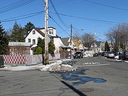
A variety of stores and eateries line the streets of this neighborhood, including Westchester Avenue (which runs under the 6 train), Buhre Avenue, Middletown Road and Crosby Avenue (these two cross to form one of the main intersections of the neighborhood). Pelham Bay Park
is the last stop on the IRT Pelham Line
, which in Manhattan comprises the Lexington Avenue Local of the New York City Subway
system. The neighborhood has two other stops as well, the Buhre Avenue
and Middletown Road
stops on the Pelham Line. The IRT Pelham Line was immortalized in the movie, The Taking of Pelham One Two Three, starring Walter Matthau
, which involved the hijacking of a subway train leaving Pelham Bay Station at the scheduled time of 1:23.
The neighborhood is home to the elementary schools Public School 71 (named the Rose E. Scala School to honor a former principal) and Public School 14 (named the John D. Calandra School to honor a former State Senator), as well as to Herbert H. Lehman High School
(right on the neighborhood's border). Several private and parochial schools also serve the neighborhood, including the Roman Catholic elementary schools associated with the churches of Our Lady of the Assumption and St. Theresa. The neighborhood is home to a number of active civic and community associations, including the Pelham Bay Little League.
The neighborhood is home to longstanding Italian, Irish, Greek and Albanian populations with a recent influx of Hispanics changing the neighborhoods demographics considerably.
Arnow Place, a small street between Westchester Avenue and the New England Thruway (I-95) in Pelham Bay, was the site of the December 2005 shooting death of off-duty police officer, Daniel Enchautegui. Actor Lillo Brancato and an accomplice were charged with murder in the case. In 2006, the street was renamed Daniel Enchautegui Way, in honor of the fallen police officer.
Borough (New York City)
New York City, one of the largest cities in the world, is composed of five boroughs. Each borough now has the same boundaries as the county it is in. County governments were dissolved when the city consolidated in 1898, along with all city, town, and village governments within each county...
of the Bronx
The Bronx
The Bronx is the northernmost of the five boroughs of New York City. It is also known as Bronx County, the last of the 62 counties of New York State to be incorporated...
, in New York City
New York City
New York is the most populous city in the United States and the center of the New York Metropolitan Area, one of the most populous metropolitan areas in the world. New York exerts a significant impact upon global commerce, finance, media, art, fashion, research, technology, education, and...
. It is named for Pelham Bay Park
Pelham Bay Park
Pelham Bay Park, located in the northeast corner of the New York City borough of The Bronx and extending partially into Westchester County, is at the largest public park in New York City. The section of the park within New York City's borders is more than three times the size of Manhattan's...
, New York City's largest park which lies on the neighborhood's northeastern border.
History
Most of the neighborhood is land that was purchased by Thomas PellThomas Pell
Dates may not be entirely accurate in this article due to disagreements between sources.Thomas Pell was a physician who was famous for buying the area known as Pelham, Westchester, New York, as well as land that now includes the eastern Bronx and southern Westchester County. He founded the town...
in 1654, part of an original grant to the Dutch West India Company
Dutch West India Company
Dutch West India Company was a chartered company of Dutch merchants. Among its founding fathers was Willem Usselincx...
.
Despite the name, the area that is now the Pelham Bay neighborhood was not part of the historical Town of Pelham
Pelham (town), New York
Pelham is a town in Westchester County, New York, United States. As of the 2010 census, it had a population of 12,396. Historically, Pelham was composed of five villages and became known as "the Pelhams"...
, which consisted of the modern-day town of Pelham in Westchester County as well as Pelham Bay Park and City Island
City Island, Bronx
City Island is a small island approximately 1.5 mi long by .5 mi wide. At one time attached to the town of Pelham, Westchester County, it is now part of the New York City borough of the Bronx. As of the 2000 census the island had a population of 4,520. Its land area is 1.023 km²...
in the Bronx. The latter two areas were annex
Annexation
Annexation is the de jure incorporation of some territory into another geo-political entity . Usually, it is implied that the territory and population being annexed is the smaller, more peripheral, and weaker of the two merging entities, barring physical size...
ed by the City of New York in 1895.
Geography
- Pelham ParkwayPelham ParkwayThe Bronx and Pelham Parkway is a parkway in the borough of the Bronx in New York City. Despite the parkway moniker, Pelham Parkway is a local street, with two main roadways , and two service roads. Like other parkways in New York City, commercial traffic is disallowed, and is redirected to the...
to the north - Bruckner ExpresswayBruckner ExpresswayThe Bruckner Expressway is a freeway in The Bronx. It carries Interstate 278 and Interstate 95 from the Robert F. Kennedy Bridge to the south end of the New England Thruway at the Pelham Parkway interchange....
to the east and south - Hutchinson River ParkwayHutchinson River ParkwayThe Hutchinson River Parkway is a north–south parkway in southern New York, United States. It extends for from the massive Bruckner Interchange in the Throgs Neck section of the Bronx to the New York – Connecticut state line at Rye Brook...
to the west
Pelham Bay includes the residential enclave of Country Club, which occupies the portion of the neighborhood east of Interstate 95
Interstate 95 in New York
Interstate 95 is a part of the Interstate Highway System that runs from Miami, Florida, to the Canada – United States border near Houlton, Maine. In the U.S. state of New York, I-95 extends from the George Washington Bridge in New York City to the Connecticut state line at Port Chester...
(I-95). The core of Pelham Bay is the portion west of I-95 and north of Middletown Road.
Community profile
Pelham Bay is part of Bronx Community Board 10Bronx Community Board 10
Bronx Community Board 10 is a local government unit of the New York City borough of the Bronx, encompassing the neighborhoods of City Island, Co-op City, Pelham Bay, Throggs Neck and Westchester Square...
, which also covers Throgs Neck
Throgs Neck
Throggs Neck is a narrow spit of land in the southeastern portion of the borough of the Bronx in New York City. It demarcates the passage between the East River , and Long Island Sound...
and Co-op City
Co-op City, Bronx
Co-op City , located in the Baychester section of the Borough of the Bronx in northeast New York City, is one of the largest cooperative housing developments in the world. Situated at the intersection of Interstate 95 and the Hutchinson River Parkway, the community is part of Bronx Community Board 10...
. Pelham Bay is home to a large Italian and Hispanic population.
A variety of stores and eateries line the streets of this neighborhood, including Westchester Avenue (which runs under the 6 train), Buhre Avenue, Middletown Road and Crosby Avenue (these two cross to form one of the main intersections of the neighborhood). Pelham Bay Park
Pelham Bay Park (IRT Pelham Line)
Pelham Bay Park is the northern terminal station of the IRT Pelham Line of the New York City Subway. Located by Pelham Bay Park, at the intersection of the Bruckner Expressway and Westchester Avenue in the Bronx, it is served by the 6 train at all times except weekdays in the peak direction and...
is the last stop on the IRT Pelham Line
IRT Pelham Line
The IRT Pelham Line is a rapid transit line on the New York City Subway, served by the 6 and <6> trains. It was built as part of the Dual Contracts expansion and opened in 1919. It is both elevated and underground, with Whitlock Avenue being the first elevated station...
, which in Manhattan comprises the Lexington Avenue Local of the New York City Subway
New York City Subway
The New York City Subway is a rapid transit system owned by the City of New York and leased to the New York City Transit Authority, a subsidiary agency of the Metropolitan Transportation Authority and also known as MTA New York City Transit...
system. The neighborhood has two other stops as well, the Buhre Avenue
Buhre Avenue (IRT Pelham Line)
Buhre Avenue is a local station on the IRT Pelham Line of the New York City Subway. Located at the intersection of Buhre and Westchester Avenues in the Bronx, it is served by the 6 train at all times except weekdays in the peak direction...
and Middletown Road
Middletown Road (IRT Pelham Line)
Middletown Road is a local station of the IRT Pelham Line of the New York City Subway. Located at Middletown Road and Westchester Avenue in the Bronx, it is served by the 6 train at all times except weekdays in the peak direction...
stops on the Pelham Line. The IRT Pelham Line was immortalized in the movie, The Taking of Pelham One Two Three, starring Walter Matthau
Walter Matthau
Walter Matthau was an American actor best known for his role as Oscar Madison in The Odd Couple and his frequent collaborations with Odd Couple star Jack Lemmon, as well as his role as Coach Buttermaker in the 1976 comedy The Bad News Bears...
, which involved the hijacking of a subway train leaving Pelham Bay Station at the scheduled time of 1:23.
The neighborhood is home to the elementary schools Public School 71 (named the Rose E. Scala School to honor a former principal) and Public School 14 (named the John D. Calandra School to honor a former State Senator), as well as to Herbert H. Lehman High School
Herbert H. Lehman High School
Herbert H. Lehman High School is a public high school at 3000 East Tremont Avenue, in the Bronx, New York City, U.S.A. The school is named after former New York State Governor Herbert Henry Lehman...
(right on the neighborhood's border). Several private and parochial schools also serve the neighborhood, including the Roman Catholic elementary schools associated with the churches of Our Lady of the Assumption and St. Theresa. The neighborhood is home to a number of active civic and community associations, including the Pelham Bay Little League.
The neighborhood is home to longstanding Italian, Irish, Greek and Albanian populations with a recent influx of Hispanics changing the neighborhoods demographics considerably.
Arnow Place, a small street between Westchester Avenue and the New England Thruway (I-95) in Pelham Bay, was the site of the December 2005 shooting death of off-duty police officer, Daniel Enchautegui. Actor Lillo Brancato and an accomplice were charged with murder in the case. In 2006, the street was renamed Daniel Enchautegui Way, in honor of the fallen police officer.
Transportation
Buses and subway lines serving the community are:- Bx5: to Simpson StreetSimpson Street (IRT White Plains Road Line)Simpson Street is a local station on the IRT White Plains Road Line of the New York City Subway. Located at the intersection of Simpson Street and Westchester Avenue in the Bronx, it is served by the 2 train at all times, and the 5 train at all times except late nights and rush hours in the peak...
station ( trains) (via Crosby Avenue / Bruckner Boulevard / Story Avenue) - Bx8: to WilliamsbridgeWilliamsbridge, BronxWilliamsbridge is a working class neighborhood geographically located in the northeast Bronx borough of New York City in the United States. The neighborhood is part of Bronx Community Board 12. Its boundaries, starting from the north and moving clockwise are: East 222nd Street to the north, Boston...
or Locust PointLocust Point, BronxLocust Point is a small, peninsular neighborhood in the south eastern portion of the New York City Borough of the Bronx. It is bounded by Harding Avenue on the north, the Throggs Neck Bridge to the east, and Eastchester Bay. The area comprises single-family houses, populated by ethnically Irish,...
(via Westchester Avenue / Williamsbridge Road) - Bx12: to University HeightsUniversity Heights, BronxUniversity Heights is a residential neighborhood of the West Bronx in New York City. The neighborhood is part of Bronx Community Board 5 and Bronx Community Board 7. Its boundaries, starting from the north and moving clockwise, are: West 190th Street to the north, Jerome Avenue to the east, West...
- Bx12 Select Bus Service: to Bay Plaza Shopping CenterBay Plaza Shopping CenterBay Plaza Shopping Center is a shopping center adjacent to Co-op City, in the Bronx, New York. In addition to various department stores and shops, such as JCPenney, Staples Inc., Kmart and Old Navy, it has a multiplex movie theater, several restaurants, a fitness club, and some office space...
or Inwood – 207th Street station ( train) (via Fordham RoadFordham RoadFordham Road is a major street in The Bronx borough of New York City. It runs east-west from the Harlem River to Bronx Park.This street runs through the neighborhood of University Heights, divides Fordham from Fordham-Bedford and finally runs along the northern border of Belmont...
– Pelham ParkwayPelham ParkwayThe Bronx and Pelham Parkway is a parkway in the borough of the Bronx in New York City. Despite the parkway moniker, Pelham Parkway is a local street, with two main roadways , and two service roads. Like other parkways in New York City, commercial traffic is disallowed, and is redirected to the...
) - Bx23: to Co-op CityCo-op City, BronxCo-op City , located in the Baychester section of the Borough of the Bronx in northeast New York City, is one of the largest cooperative housing developments in the world. Situated at the intersection of Interstate 95 and the Hutchinson River Parkway, the community is part of Bronx Community Board 10...
- Bx24: to Country ClubCountry Club, BronxCountry Club is a neighborhood located in the East Bronx in New York City. It shares the 10465 ZIP code with Throggs Neck, although it is part of Pelham Bay. The neighborhood's boundaries are Pelham Bay Park to the north, Eastchester Bay to the east, Layton Avenue to the south, and the New England...
- Bx29: to City IslandCity Island, BronxCity Island is a small island approximately 1.5 mi long by .5 mi wide. At one time attached to the town of Pelham, Westchester County, it is now part of the New York City borough of the Bronx. As of the 2000 census the island had a population of 4,520. Its land area is 1.023 km²...
or Bay Plaza Shopping CenterBay Plaza Shopping CenterBay Plaza Shopping Center is a shopping center adjacent to Co-op City, in the Bronx, New York. In addition to various department stores and shops, such as JCPenney, Staples Inc., Kmart and Old Navy, it has a multiplex movie theater, several restaurants, a fitness club, and some office space...
(via City Island Avenue) - Q50: to Co-op CityCo-op City, BronxCo-op City , located in the Baychester section of the Borough of the Bronx in northeast New York City, is one of the largest cooperative housing developments in the world. Situated at the intersection of Interstate 95 and the Hutchinson River Parkway, the community is part of Bronx Community Board 10...
or Flushing – Main Street station ( trains) (via Bronx–Whitestone Bridge) - Bee-Line 45Bee-Line Bus SystemThe Bee-Line Bus System, branded on the buses in lowercase as the bee-line system, is a bus system serving Westchester County, New York. The system is owned by the County's Department of Public Works and Transportation and operated, on contract , by Yonkers-based Liberty Lines Transit, Inc...
: to Eastchester - Middletown RoadMiddletown Road (IRT Pelham Line)Middletown Road is a local station of the IRT Pelham Line of the New York City Subway. Located at Middletown Road and Westchester Avenue in the Bronx, it is served by the 6 train at all times except weekdays in the peak direction...
station ( trains) - Buhre AvenueBuhre Avenue (IRT Pelham Line)Buhre Avenue is a local station on the IRT Pelham Line of the New York City Subway. Located at the intersection of Buhre and Westchester Avenues in the Bronx, it is served by the 6 train at all times except weekdays in the peak direction...
station ( trains) - Pelham Bay ParkPelham Bay Park (IRT Pelham Line)Pelham Bay Park is the northern terminal station of the IRT Pelham Line of the New York City Subway. Located by Pelham Bay Park, at the intersection of the Bruckner Expressway and Westchester Avenue in the Bronx, it is served by the 6 train at all times except weekdays in the peak direction and...
station ( trains)