

List of Registered Historic Places in Jefferson County, Kentucky
Encyclopedia

National Register of Historic Places
The National Register of Historic Places is the United States government's official list of districts, sites, buildings, structures, and objects deemed worthy of preservation...
in Jefferson County
Jefferson County, Kentucky
As of the census of 2000, there were 693,604 people, 287,012 households, and 183,113 families residing in the county. The population density was . There were 305,835 housing units at an average density of...
, Kentucky
Kentucky
The Commonwealth of Kentucky is a state located in the East Central United States of America. As classified by the United States Census Bureau, Kentucky is a Southern state, more specifically in the East South Central region. Kentucky is one of four U.S. states constituted as a commonwealth...
, United States
United States
The United States of America is a federal constitutional republic comprising fifty states and a federal district...
. The locations of National Register properties and districts for which the latitude and longitude coordinates are included below, may be seen in a Google map.
There are 465 properties and districts listed on the National Register in the county, 8 of which are National Historic Landmark
National Historic Landmark
A National Historic Landmark is a building, site, structure, object, or district, that is officially recognized by the United States government for its historical significance...
s. Properties in Downtown Louisville
Downtown Louisville
Downtown Louisville is the largest central business district in the Commonwealth of Kentucky and the urban hub of the Louisville, Kentucky Metropolitan Area. Its boundaries are the Ohio River to the north, Hancock Street to the east, York and Jacob Streets to the south, and 9th Street to the west...
and many other parts of the city are listed separately:
Listings county-wide
| Landmark name | Image | Date listed | Location | City or Town | Summary | |
|---|---|---|---|---|---|---|
| 1 | Abell House | 12210 Old Shelbyville Rd. 38°14′38"N 85°31′41"W |
Middletown Middletown, Kentucky The median income for a household in the city was $53,608, and the median income for a family was $61,667. Males had a median income of $45,417 versus $33,135 for females. The per capita income for the city was $26,660... |
|||
| 2 | Adath Israel Cemetery | 2716 Preston St. 38°12′32"N 85°44′26"W |
Louisville Louisville, Kentucky Louisville is the largest city in the U.S. state of Kentucky, and the county seat of Jefferson County. Since 2003, the city's borders have been coterminous with those of the county because of a city-county merger. The city's population at the 2010 census was 741,096... |
|||
| 3 | Allison-Barrickman House | 6909 Wolf Pen Branch Rd. 38°19′13"N 85°37′8"W |
Harrods Creek Harrods Creek, Kentucky Harrods Creek is a neighborhood of Louisville, Kentucky centered near Harrods Creek at the intersection of River Road and Wolf Pen Branch Road. It is roughly bordered by the Ohio River to the west and US 42 to the east. Its Zip Code is 40027... |
|||
| 4 | Altawood Historic District | Altawood Ct. 38°18′5"N 85°30′19"W |
Louisville Louisville, Kentucky Louisville is the largest city in the U.S. state of Kentucky, and the county seat of Jefferson County. Since 2003, the city's borders have been coterminous with those of the county because of a city-county merger. The city's population at the 2010 census was 741,096... |
|||
| 5 | Arcadia Apartments | 68 Apartments in the vicinity of Arcade and Utah Aves. 38°12′23"N 85°47′5"W |
Louisville Louisville, Kentucky Louisville is the largest city in the U.S. state of Kentucky, and the county seat of Jefferson County. Since 2003, the city's borders have been coterminous with those of the county because of a city-county merger. The city's population at the 2010 census was 741,096... |
|||
| 6 | Ashbourne | Upper River Rd. 38°19′33"N 85°38′3"W |
Harrods Creek Harrods Creek, Kentucky Harrods Creek is a neighborhood of Louisville, Kentucky centered near Harrods Creek at the intersection of River Road and Wolf Pen Branch Road. It is roughly bordered by the Ohio River to the west and US 42 to the east. Its Zip Code is 40027... |
|||
| 7 | Atherton Carriage House | 3204 Woodside Rd. 38°17′40"N 85°38′49"W |
Northeast Louisville Louisville, Kentucky Louisville is the largest city in the U.S. state of Kentucky, and the county seat of Jefferson County. Since 2003, the city's borders have been coterminous with those of the county because of a city-county merger. The city's population at the 2010 census was 741,096... |
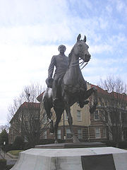
|||
| 8 | Audubon Park Historic District Audubon Park, Kentucky Audubon Park is a city in central Jefferson County, Kentucky, United States. The population was 1,545 at the 2000 census. It is located about south of Downtown Louisville, and is surrounded on all sides by the city of Louisville... |
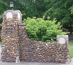 |
Roughly bounded by Hess Ln. and Cardinal Dr. between Eagle Pass and Preston St. 38°12′18"N 85°43′38"W |
Audubon Park Audubon Park, Kentucky Audubon Park is a city in central Jefferson County, Kentucky, United States. The population was 1,545 at the 2000 census. It is located about south of Downtown Louisville, and is surrounded on all sides by the city of Louisville... |
||
| 9 | B.F. Avery and Sons Industrial District | 1721-1821 7th St. 38°13′17"N 85°46′23"W |
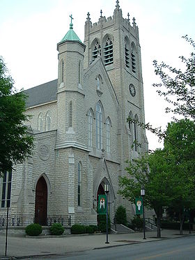
Louisville Louisville, Kentucky Louisville is the largest city in the U.S. state of Kentucky, and the county seat of Jefferson County. Since 2003, the city's borders have been coterminous with those of the county because of a city-county merger. The city's population at the 2010 census was 741,096... |
|||
| 10 | Aydelott House | 6814 Bethany Lane 38°6′12"N 85°53′48"W |
Valley Station Valley Station, Kentucky Valley Station is a former census-designated place in southwest Jefferson County, Kentucky, United States. The population was 23,489 at the 2010 census. When the government of Jefferson County merged with the city of Louisville, Kentucky in 2003, residents of Valley Station also became citizens of... |
|||
| 11 | Rogers Clark Ballard Memorial School | 4200 Lime Kiln Ln. 38°18′46"N 85°38′45"W |
Northeast Louisville Louisville, Kentucky Louisville is the largest city in the U.S. state of Kentucky, and the county seat of Jefferson County. Since 2003, the city's borders have been coterminous with those of the county because of a city-county merger. The city's population at the 2010 census was 741,096... |
|||
| 12 | Bank of Middletown | 11615 Main St. 38°14′44"N 85°32′25"W |
Middletown Middletown, Kentucky The median income for a household in the city was $53,608, and the median income for a family was $61,667. Males had a median income of $45,417 versus $33,135 for females. The per capita income for the city was $26,660... |
|||
| 13 | Martin Jeff (M.J.) Bannon House | 5112 Bannon Crossing 38°10′52"N 85°37′46"W |
Louisville Louisville, Kentucky Louisville is the largest city in the U.S. state of Kentucky, and the county seat of Jefferson County. Since 2003, the city's borders have been coterminous with those of the county because of a city-county merger. The city's population at the 2010 census was 741,096... |
|||
| 14 | Patrick Bannon House | 4518 Bardstown Rd. 38°10′57"N 85°37′42"W |
Buechel Buechel, Kentucky Buechel is a former census-designated place in Jefferson County, Kentucky, United States. The population was 7,272 at the 2000 census. In 2003, The area was annexed to the city of Louisville due to a merger between the city and Jefferson County's unincorporated areas... |
|||
| 15 | Barber-Barbour House | 6415 Transylvania Ave. 38°20′14"N 85°38′6"W |
Harrods Creek Harrods Creek, Kentucky Harrods Creek is a neighborhood of Louisville, Kentucky centered near Harrods Creek at the intersection of River Road and Wolf Pen Branch Road. It is roughly bordered by the Ohio River to the west and US 42 to the east. Its Zip Code is 40027... |
|||
| 16 | Levin Bates House | 7300 Bardstown Rd. 38°8′28"N 85°35′0"W |
Buechel Buechel, Kentucky Buechel is a former census-designated place in Jefferson County, Kentucky, United States. The population was 7,272 at the 2000 census. In 2003, The area was annexed to the city of Louisville due to a merger between the city and Jefferson County's unincorporated areas... |
|||
| 17 | Bayly-Schroering House | 1012 S. 4th St. 38°14′18"N 85°45′37"W |
Louisville Louisville, Kentucky Louisville is the largest city in the U.S. state of Kentucky, and the county seat of Jefferson County. Since 2003, the city's borders have been coterminous with those of the county because of a city-county merger. The city's population at the 2010 census was 741,096... |
|||
| 18 | Beech Lawn | 8000 Six Mile Lane 38°11′54"N 85°36′28"W |
Jeffersontown Jeffersontown, Kentucky Jeffersontown is a city in Jefferson County, Kentucky, United States. Before Louisville and Jefferson County were consolidated in 2003, it was the county's largest city outside of Louisville. The population was 26,633 at the 2000 census.- History :... |
|||
| 19 | Beechland | 8500 Six Mile Lane 38°11′42"N 85°35′53"W |
Jeffersontown Jeffersontown, Kentucky Jeffersontown is a city in Jefferson County, Kentucky, United States. Before Louisville and Jefferson County were consolidated in 2003, it was the county's largest city outside of Louisville. The population was 26,633 at the 2000 census.- History :... |
|||
| 20 | Willam R. Belknap School Willam R. Belknap School The Willam R. Belknap School is a former school building in the Belknap neighborhood of Louisville, Kentucky USA. It was added to the National Register of Historic Places in 1982.... |
1800 Sils Ave. 38°13′19"N 85°41′22"W |
The Highlands The Highlands (Louisville) The Highlands is an area of Louisville, Kentucky which contains a high density of nightclubs, eclectic businesses, and many upscale and fast food restaurants. It is centered along a three-mile stretch of Bardstown Road and Baxter Avenue and is so named because it sits atop a ridge between the... |
|||
| 21 | Belleview | 6600 Upper River Rd. 38°19′56"N 85°38′14"W |
Harrods Creek Harrods Creek, Kentucky Harrods Creek is a neighborhood of Louisville, Kentucky centered near Harrods Creek at the intersection of River Road and Wolf Pen Branch Road. It is roughly bordered by the Ohio River to the west and US 42 to the east. Its Zip Code is 40027... |
|||
| 22 | Bellevoir-Ormsby Village | Whipps Mill Rd. 38°16′1"N 85°34′33"W |
Lyndon Lyndon, Kentucky There were 4,520 households out of which 21.9% had children under the age of 18 living with them, 37.5% were married couples living together, 8.9% had a female householder with no husband present, and 50.3% were non-families. 40.1% of all households were made up of individuals and 7.4% had someone... |
|||
| 23 | Berry Hill | Dunraven Ct. 38°17′44"N 85°38′28"W |
Glenview Glenview, Kentucky Glenview is a city in northeastern Jefferson County, Kentucky, United States, along the Ohio River. The population was 558 at the 2000 census, and was estimated to have increased to 718 by the 2006 census estimate.... |
|||
| 24 | Beynroth House | 11503 Main St. 38°14′41"N 85°32′36"W |
Middletown Middletown, Kentucky The median income for a household in the city was $53,608, and the median income for a family was $61,667. Males had a median income of $45,417 versus $33,135 for females. The per capita income for the city was $26,660... |
|||
| 25 | Bingham-Hilliard Doll House | 5001 Avish Lane 38°19′14"N 85°38′13"W |
Harrods Creek Harrods Creek, Kentucky Harrods Creek is a neighborhood of Louisville, Kentucky centered near Harrods Creek at the intersection of River Road and Wolf Pen Branch Road. It is roughly bordered by the Ohio River to the west and US 42 to the east. Its Zip Code is 40027... |
|||
| 26 | Blankenbaker Station | 21 Poplar Hill Rd. 38°17′41"N 85°39′53"W |
St. Matthews St. Matthews, Kentucky St. Matthews is the 20th largest city in Kentucky, United States and is a prominent suburb of Louisville. It is located 8 miles east of downtown Louisville in Jefferson County. It is one of the state's major shopping areas, being home to second and fifth largest malls in Kentucky St. Matthews is... |
|||
| 27 | Board of Extension of the Methodist Episcopal Church, South Board of Extension of the Methodist Episcopal Church, South Board of Extension of the Methodist Episcopal Church, South is a historic building at 1115 S. 4th Street in Louisville, Kentucky.It was built in 1915 and added to the National Register in 1983.... |
1115 S. 4th St. 38°14′12"N 85°45′33"W |
Louisville Louisville, Kentucky Louisville is the largest city in the U.S. state of Kentucky, and the county seat of Jefferson County. Since 2003, the city's borders have been coterminous with those of the county because of a city-county merger. The city's population at the 2010 census was 741,096... |
|||
| 28 | Temple Bodley Summer House | Off Riva Ridge Rd. southwest of Palatka Rd. 38°8′59"N 85°47′45"W |
Louisville Louisville, Kentucky Louisville is the largest city in the U.S. state of Kentucky, and the county seat of Jefferson County. Since 2003, the city's borders have been coterminous with those of the county because of a city-county merger. The city's population at the 2010 census was 741,096... |
|||
| 29 | Bowman Field Historic District | 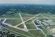 |
Taylorsville Rd. and Peewee Reese Boulevard 38°13′25"N 85°39′58"W |
The Highlands The Highlands (Louisville) The Highlands is an area of Louisville, Kentucky which contains a high density of nightclubs, eclectic businesses, and many upscale and fast food restaurants. It is centered along a three-mile stretch of Bardstown Road and Baxter Avenue and is so named because it sits atop a ridge between the... |
||
| 30 | Bradford Mills | 1034 E. Oak St. 38°13′45"N 85°44′23"W |
Louisville Louisville, Kentucky Louisville is the largest city in the U.S. state of Kentucky, and the county seat of Jefferson County. Since 2003, the city's borders have been coterminous with those of the county because of a city-county merger. The city's population at the 2010 census was 741,096... |
|||
| 31 | Brass Finishing Building, Standard Sanitary Manufacturing Company | 1547 S. 7th St. 38°13′37"N 85°46′11"W |
Louisville Louisville, Kentucky Louisville is the largest city in the U.S. state of Kentucky, and the county seat of Jefferson County. Since 2003, the city's borders have been coterminous with those of the county because of a city-county merger. The city's population at the 2010 census was 741,096... |
|||
| 32 | Bray Place Bray Place The Bray Place in Louisville, Kentucky refers to the early farmstead and home built in 1796 by Major Samuel E. Bray and his wife, Nancy Lyle Bray from Virginia. The was granted by Thomas Jefferson to Bray as payment for serving in the Revolutionary War and surveying what was then Virginia... |
2227 Bashford Manor Lane 38°12′17"N 85°39′39"W |
Louisville Louisville, Kentucky Louisville is the largest city in the U.S. state of Kentucky, and the county seat of Jefferson County. Since 2003, the city's borders have been coterminous with those of the county because of a city-county merger. The city's population at the 2010 census was 741,096... |
|||
| 33 | James Brown House | Browns Lane 38°14′22"N 85°37′54"W |
St. Matthews St. Matthews, Kentucky St. Matthews is the 20th largest city in Kentucky, United States and is a prominent suburb of Louisville. It is located 8 miles east of downtown Louisville in Jefferson County. It is one of the state's major shopping areas, being home to second and fifth largest malls in Kentucky St. Matthews is... |
|||
| 34 | Theodore Brown House | Browns Lane 38°14′29"N 85°38′14"W |
St. Matthews St. Matthews, Kentucky St. Matthews is the 20th largest city in Kentucky, United States and is a prominent suburb of Louisville. It is located 8 miles east of downtown Louisville in Jefferson County. It is one of the state's major shopping areas, being home to second and fifth largest malls in Kentucky St. Matthews is... |
|||
| 35 | Buildings at 900-906 East Main Street | 900-906 E. Main St. 38°15′15"N 85°44′8"W |
Butchertown/Clifton Clifton, Louisville Clifton, a neighborhood east of downtown Louisville, Kentucky USA. Clifton was named because of its hilly location on the Ohio River valley escarpment.... |
|||
| 36 | William Bull House | 11918 Old Shelbyville Rd. 38°14′38"N 85°32′0"W |
Middletown Middletown, Kentucky The median income for a household in the city was $53,608, and the median income for a family was $61,667. Males had a median income of $45,417 versus $33,135 for females. The per capita income for the city was $26,660... |
|||
| 37 | Bullock-Clifton House Bullock-Clifton House The Bullock-Clifton House is a historic home in the Deer Park neighborhood of Louisville, Kentucky, USA. It is the oldest known surviving wood-frame structure in Jefferson County.-History:... |
 |
1824 Rosedale Ave. 38°13′27"N 85°42′14"W |
The Highlands The Highlands (Louisville) The Highlands is an area of Louisville, Kentucky which contains a high density of nightclubs, eclectic businesses, and many upscale and fast food restaurants. It is centered along a three-mile stretch of Bardstown Road and Baxter Avenue and is so named because it sits atop a ridge between the... |
||
| 38 | Cornelia Bush House | 316 Kenwood Dr. 38°9′30"N 85°46′9"W |
South End Louisville Louisville, Kentucky Louisville is the largest city in the U.S. state of Kentucky, and the county seat of Jefferson County. Since 2003, the city's borders have been coterminous with those of the county because of a city-county merger. The city's population at the 2010 census was 741,096... |
|||
| 39 | S.S. Bush House | 230 Kenwood Hill Rd. 38°9′22"N 85°46′20"W |
South End Louisville Louisville, Kentucky Louisville is the largest city in the U.S. state of Kentucky, and the county seat of Jefferson County. Since 2003, the city's borders have been coterminous with those of the county because of a city-county merger. The city's population at the 2010 census was 741,096... |
|||
| 40 | Butchertown Historic District |  |
Roughly bounded by Main, Hancock, Geiger, Quincy Sts., U.S. Route 42 U.S. Route 42 U.S. Route 42 is an east–west United States highway that runs northeast-southwest for 355 miles from Cleveland, Ohio to Louisville, Kentucky. The route has several names including Pearl Road from Cleveland to Medina in Northeast Ohio, the Cincinnati and Lebanon Pike in southwestern Ohio and... , S. Fort Beargrass Creek, and Baxter Ave. 38°15′20"N 85°43′47"W |
Butchertown/Clifton Clifton, Louisville Clifton, a neighborhood east of downtown Louisville, Kentucky USA. Clifton was named because of its hilly location on the Ohio River valley escarpment.... |
||
| 41 | Calvary Episcopal Church Calvary Episcopal Church (Louisville, Kentucky) The historic Calvary Episcopal Church was established in 1857 and is located at 821 South 4th Street Louisville, Kentucky. This stone gothic church was built in Old Louisville in 1888 and is listed on the National Register of Historic Places. The church is a member parish of the Episcopal Diocese... |
821 S. 4th St. 38°14′35"N 85°45′31"W |
Louisville Louisville, Kentucky Louisville is the largest city in the U.S. state of Kentucky, and the county seat of Jefferson County. Since 2003, the city's borders have been coterminous with those of the county because of a city-county merger. The city's population at the 2010 census was 741,096... |
|||
| 42 | Cardinal Hill Reservoir | Cardinal Hill Rd. 38°8′47"N 85°48′15"W |
Louisville Louisville, Kentucky Louisville is the largest city in the U.S. state of Kentucky, and the county seat of Jefferson County. Since 2003, the city's borders have been coterminous with those of the county because of a city-county merger. The city's population at the 2010 census was 741,096... |
|||
| 43 | Carmichael House | Off KY 155 Kentucky Route 155 Kentucky Route 155 is a 20.815 mile long state highway in the U.S. state of Kentucky. The route originates at a junction with U.S. Route 31E and US 150 in Louisville, Kentucky. On the other side of intersection, KY 155 becomes a local road called Trevilian Way... 38°10′12"N 85°25′23"W |
Fisherville | |||
| 44 | John B. Castleman Monument John B. Castleman Monument The John B. Castleman Monument, within the Cherokee Triangle of Louisville, Kentucky, was placed on the National Register of Historic Places on July 17, 1997, as part of the Civil War Monuments of Kentucky MPS.... |
 |
Junction of Cherokee Rd. and Willow Ave. 38°14′9"N 85°42′32"W |
The Highlands The Highlands (Louisville) The Highlands is an area of Louisville, Kentucky which contains a high density of nightclubs, eclectic businesses, and many upscale and fast food restaurants. It is centered along a three-mile stretch of Bardstown Road and Baxter Avenue and is so named because it sits atop a ridge between the... |
||
| 45 | Cave Hill Cemetery | 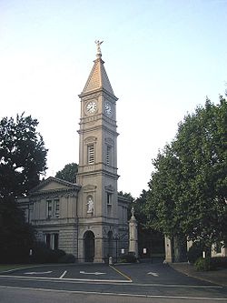 |
701 Baxter Ave. 38°14′44"N 85°42′56"W |
The Highlands The Highlands (Louisville) The Highlands is an area of Louisville, Kentucky which contains a high density of nightclubs, eclectic businesses, and many upscale and fast food restaurants. It is centered along a three-mile stretch of Bardstown Road and Baxter Avenue and is so named because it sits atop a ridge between the... |
||
| 46 | Cave Hill National Cemetery | 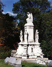 |
701 Baxter Ave. 38°15′2"N 85°43′16"W |
The Highlands The Highlands (Louisville) The Highlands is an area of Louisville, Kentucky which contains a high density of nightclubs, eclectic businesses, and many upscale and fast food restaurants. It is centered along a three-mile stretch of Bardstown Road and Baxter Avenue and is so named because it sits atop a ridge between the... |
||
| 47 | Cedarbrook Farm | 4800 Springdale Rd. 38°18′50"N 85°35′35"W |
Louisville Louisville, Kentucky Louisville is the largest city in the U.S. state of Kentucky, and the county seat of Jefferson County. Since 2003, the city's borders have been coterminous with those of the county because of a city-county merger. The city's population at the 2010 census was 741,096... |
|||
| 48 | Central Colored School | 542 W. Kentucky St. 38°14′22"N 85°45′46"W |
Louisville Louisville, Kentucky Louisville is the largest city in the U.S. state of Kentucky, and the county seat of Jefferson County. Since 2003, the city's borders have been coterminous with those of the county because of a city-county merger. The city's population at the 2010 census was 741,096... |
|||
| 49 | Chenoweth Fort-Springhouse | Avoca Rd. 38°15′41"N 85°30′21"W |
Middletown Middletown, Kentucky The median income for a household in the city was $53,608, and the median income for a family was $61,667. Males had a median income of $45,417 versus $33,135 for females. The per capita income for the city was $26,660... |
|||
| 50 | Chenoweth House | 255 Chenoweth Lane 38°15′42"N 85°39′37"W |
St. Matthews St. Matthews, Kentucky St. Matthews is the 20th largest city in Kentucky, United States and is a prominent suburb of Louisville. It is located 8 miles east of downtown Louisville in Jefferson County. It is one of the state's major shopping areas, being home to second and fifth largest malls in Kentucky St. Matthews is... |
|||
| 51 | Cherokee Triangle Area Residential District Cherokee Triangle, Louisville Cherokee Triangle is a historic neighborhood in Louisville, Kentucky, USA, known for its large homes displaying an eclectic mix of architectural styles. Its boundaries are Bardstown Road to the southwest, Cherokee Park and Eastern Parkway to the southeast, and Cave Hill Cemetery to the north, and... |
Roughly bounded by Bardstown Rd., Sherwood Rd., and Broadway, east to the junction of Grinstead Dr. and Cherokee Parkway 38°14′21"N 85°42′42"W |
Louisville Louisville, Kentucky Louisville is the largest city in the U.S. state of Kentucky, and the county seat of Jefferson County. Since 2003, the city's borders have been coterminous with those of the county because of a city-county merger. The city's population at the 2010 census was 741,096... |
|||
| 52 | Chestnut Street Baptist Church Chestnut Street Baptist Church Chestnut Street Baptist Church is a historic church at 912 W. Chestnut Street in Louisville, Kentucky.It was built in 1884 and added to the National Register in 1980.... |
912 W. Chestnut St. 38°14′58"N 85°46′1"W |
Louisville Louisville, Kentucky Louisville is the largest city in the U.S. state of Kentucky, and the county seat of Jefferson County. Since 2003, the city's borders have been coterminous with those of the county because of a city-county merger. The city's population at the 2010 census was 741,096... |
|||
| 53 | Chrisler House | 4508 Upper River Rd. 38°18′2"N 85°39′51"W |
Harrods Creek Harrods Creek, Kentucky Harrods Creek is a neighborhood of Louisville, Kentucky centered near Harrods Creek at the intersection of River Road and Wolf Pen Branch Road. It is roughly bordered by the Ohio River to the west and US 42 to the east. Its Zip Code is 40027... |
|||
| 54 | Churchill Downs Churchill Downs Churchill Downs, located in Central Avenue in south Louisville, Kentucky, United States, is a Thoroughbred racetrack most famous for hosting the Kentucky Derby annually. It officially opened in 1875, and held the first Kentucky Derby and the first Kentucky Oaks in the same year. Churchill Downs... |
700 Central Ave. 38°12′6"N 85°46′16"W |
South End Louisville Louisville, Kentucky Louisville is the largest city in the U.S. state of Kentucky, and the county seat of Jefferson County. Since 2003, the city's borders have been coterminous with those of the county because of a city-county merger. The city's population at the 2010 census was 741,096... |
|||
| 55 | Clifton Historic District |  |
Roughly bounded by Brownsboro Rd., William and E. Main Sts., Frankfort and N. Ewing Aves.; also roughly bounded by CSX CSX Transportation CSX Transportation operates a Class I railroad in the United States known as the CSX Railroad. It is the main subsidiary of the CSX Corporation. The company is headquartered in Jacksonville, Florida, and owns approximately 21,000 route miles... railroad tracks, Ewing Ave. alley, Interstate 64 Interstate 64 Interstate 64 is an Interstate Highway in the Midwestern and Southeastern United States. Its western terminus is at I-70, U.S. 40, and U.S. 61 in Wentzville, Missouri. Its eastern terminus is at an interchange with I-264 and I-664 at Bowers Hill in Chesapeake, Virginia. As I-64 is concurrent with... , and Mellwood Ave. 38°15′24"N 85°42′36"W |
Butchertown/Clifton Clifton, Louisville Clifton, a neighborhood east of downtown Louisville, Kentucky USA. Clifton was named because of its hilly location on the Ohio River valley escarpment.... |
Second group of addresses represents a boundary increase | |
| 56 | James Clore House | North of Prospect off Kentucky Route 329KY 329 38°21′30"N 85°36′28"W |
Prospect Prospect, Kentucky Prospect is a city in far northeastern Jefferson and southwestern Oldham Counties in the U.S. state of Kentucky, along the Ohio River. The city is a suburb of Louisville, Kentucky. It's one of few cities in Jefferson County that extend into another county. The population was 4,657 at the 2000... |
|||
| 57 | Clover Hill | 2618 Dixie Highway 38°12′43"N 85°47′52"W |
Louisville Louisville, Kentucky Louisville is the largest city in the U.S. state of Kentucky, and the county seat of Jefferson County. Since 2003, the city's borders have been coterminous with those of the county because of a city-county merger. The city's population at the 2010 census was 741,096... |
|||
| 58 | College Street Presbyterian Church College Street Presbyterian Church College Street Presbyterian Church is a historic church at 113 W. College Street in Louisville, Kentucky.It was built in 1867 and added to the National Register in 1978.... |
113 W. College St. 38°14′36"N 85°45′18"W |
Louisville Louisville, Kentucky Louisville is the largest city in the U.S. state of Kentucky, and the county seat of Jefferson County. Since 2003, the city's borders have been coterminous with those of the county because of a city-county merger. The city's population at the 2010 census was 741,096... |
|||
| 59 | Commodore Apartment Building Commodore Apartment Building (Louisville, Kentucky) The Commodore Apartment Building, also called Commodore Apartments, is a luxury condominium complex located in Louisville, Kentucky's Bonnycastle neighborhood. The building is listed on the National Register of Historic Places.-History:... |
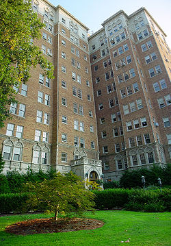 |
2140 Bonnycastle Ave. 38°13′58"N 85°42′2"W |
The Highlands The Highlands (Louisville) The Highlands is an area of Louisville, Kentucky which contains a high density of nightclubs, eclectic businesses, and many upscale and fast food restaurants. It is centered along a three-mile stretch of Bardstown Road and Baxter Avenue and is so named because it sits atop a ridge between the... |
||
| 60 | Confederate Martyrs Monument in Jeffersontown Confederate Martyrs Monument in Jeffersontown The Confederate Martyrs Monument at the Jeffersontown City Cemetery in Jeffersontown, Kentucky marks where four Confederate soldiers were executed "without cause or trial", due to Order #59, the creation of Union General Stephen G. Burbridge, known as "Butcher Burbridge" in Kentucky, which called... |
 |
City Cemetery, 0.1 miles south of the junction of Billtown and Maple Rds. 38°11′25"N 85°34′8"W |
Jeffersontown Jeffersontown, Kentucky Jeffersontown is a city in Jefferson County, Kentucky, United States. Before Louisville and Jefferson County were consolidated in 2003, it was the county's largest city outside of Louisville. The population was 26,633 at the 2000 census.- History :... |
||
| 61 | Confederate Monument in Louisville | 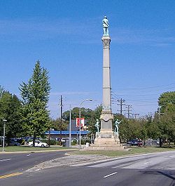 |
Junction of 2nd and 3rd Sts. 38°13′6"N 85°45′43"W |
Louisville Louisville, Kentucky Louisville is the largest city in the U.S. state of Kentucky, and the county seat of Jefferson County. Since 2003, the city's borders have been coterminous with those of the county because of a city-county merger. The city's population at the 2010 census was 741,096... |
||
| 62 | Conrad-Seaton House and Archeological Site | Address Restricted | Louisville Louisville, Kentucky Louisville is the largest city in the U.S. state of Kentucky, and the county seat of Jefferson County. Since 2003, the city's borders have been coterminous with those of the county because of a city-county merger. The city's population at the 2010 census was 741,096... |
|||
| 63 | Cooper Memorial Church Cooper Memorial Church Cooper Memorial Church is a historic church at 9900 Cooper Church Drive in Okolona, Kentucky.It was built in 1896 and added to the National Register of Historic Places in 1980.-External links:*... |
9900 Preston Highway 38°6′23"N 85°40′28"W |
Okolona Okolona, Kentucky Okolona is a former census-designated place in southern Jefferson County, Kentucky, United States. It is centered around the intersection of Preston Highway and the Outer Loop. The population was 17,807 at the 2000 census. When the government of Jefferson County merged with the city of Louisville,... |
|||
| 64 | Cornwall and Brown Houses | 957 S. 4th St. 38°14′23"N 85°45′33"W |
Louisville Louisville, Kentucky Louisville is the largest city in the U.S. state of Kentucky, and the county seat of Jefferson County. Since 2003, the city's borders have been coterminous with those of the county because of a city-county merger. The city's population at the 2010 census was 741,096... |
|||
| 65 | Country Estates of River Road | Roughly along River Rd. and Wolf Pen Branch Rd. fron Longview Ln. to 500 feet west of U.S. Route 42 U.S. Route 42 U.S. Route 42 is an east–west United States highway that runs northeast-southwest for 355 miles from Cleveland, Ohio to Louisville, Kentucky. The route has several names including Pearl Road from Cleveland to Medina in Northeast Ohio, the Cincinnati and Lebanon Pike in southwestern Ohio and... 38°18′48"N 85°38′38"W |
Glenview Glenview, Kentucky Glenview is a city in northeastern Jefferson County, Kentucky, United States, along the Ohio River. The population was 558 at the 2000 census, and was estimated to have increased to 718 by the 2006 census estimate.... |
|||
| 66 | Carrie Gaulbert Cox and Attilla Cox, Jr. House | 389 Mockingbird Valley Rd. 38°16′12"N 85°40′51"W |
Louisville Louisville, Kentucky Louisville is the largest city in the U.S. state of Kentucky, and the county seat of Jefferson County. Since 2003, the city's borders have been coterminous with those of the county because of a city-county merger. The city's population at the 2010 census was 741,096... |
|||
| 67 | Crescent Hill Branch Library Crescent Hill Branch Library The Crescent Hill Branch Library, constructed in 1908 in Louisville, Kentucky, was one of the first of nine Carnegie-endowed libraries built in Louisville, and is a branch of the Louisville Free Public Library. The building has a Beaux-Arts architecture style created by the Thomas & Bohne architect... |
2762 Frankfort Ave. 38°15′16"N 85°41′29"W |
Butchertown/Clifton Clifton, Louisville Clifton, a neighborhood east of downtown Louisville, Kentucky USA. Clifton was named because of its hilly location on the Ohio River valley escarpment.... |
|||
| 68 | Crescent Hill Historic District Crescent Hill, Louisville Crescent Hill is a neighborhood four miles east of downtown Louisville, Kentucky USA. Area was originally called "Beargrass" because it sits on a ridge between two forks of Beargrass Creek.... |
 |
Roughly bounded by Brownsboro and Lexington Rds, Peterson, Zorn, and Frankfort Aves., and Crabbs Lane 38°15′15"N 85°41′19"W |
Butchertown/Clifton Clifton, Louisville Clifton, a neighborhood east of downtown Louisville, Kentucky USA. Clifton was named because of its hilly location on the Ohio River valley escarpment.... |
||
| 69 | Crescent Hill Reservoir Crescent Hill, Louisville Crescent Hill is a neighborhood four miles east of downtown Louisville, Kentucky USA. Area was originally called "Beargrass" because it sits on a ridge between two forks of Beargrass Creek.... |
Reservoir Ave. 38°15′25"N 85°40′46"W |
Butchertown/Clifton Clifton, Louisville Clifton, a neighborhood east of downtown Louisville, Kentucky USA. Clifton was named because of its hilly location on the Ohio River valley escarpment.... |
|||
| 70 | The Cumberland | 201 York St. 38°14′35"N 85°45′20"W |
Louisville Louisville, Kentucky Louisville is the largest city in the U.S. state of Kentucky, and the county seat of Jefferson County. Since 2003, the city's borders have been coterminous with those of the county because of a city-county merger. The city's population at the 2010 census was 741,096... |
|||
| 71 | Davis Tavern | 11180 Shelbyville Rd. 38°14′43"N 85°32′14"W |
Middletown Middletown, Kentucky The median income for a household in the city was $53,608, and the median income for a family was $61,667. Males had a median income of $45,417 versus $33,135 for females. The per capita income for the city was $26,660... |
|||
| 72 | Diamond Fruit Farm | 8101 Six Mile Lane 38°12′4"N 85°36′18"W |
Jeffersontown Jeffersontown, Kentucky Jeffersontown is a city in Jefferson County, Kentucky, United States. Before Louisville and Jefferson County were consolidated in 2003, it was the county's largest city outside of Louisville. The population was 26,633 at the 2000 census.- History :... |
|||
| 73 | Anton Diebold House | 4303 W. Broadway 38°15′28"N 85°50′0"W |
Louisville Louisville, Kentucky Louisville is the largest city in the U.S. state of Kentucky, and the county seat of Jefferson County. Since 2003, the city's borders have been coterminous with those of the county because of a city-county merger. The city's population at the 2010 census was 741,096... |
|||
| 74 | District #1 | S. Brook and E. Breckinbridge St. 38°14′31"N 85°45′7"W |
Louisville Louisville, Kentucky Louisville is the largest city in the U.S. state of Kentucky, and the county seat of Jefferson County. Since 2003, the city's borders have been coterminous with those of the county because of a city-county merger. The city's population at the 2010 census was 741,096... |
|||
| 75 | District #2 | W. Breckinridge St. and S. 2nd St. 38°14′31"N 85°45′19"W |
Louisville Louisville, Kentucky Louisville is the largest city in the U.S. state of Kentucky, and the county seat of Jefferson County. Since 2003, the city's borders have been coterminous with those of the county because of a city-county merger. The city's population at the 2010 census was 741,096... |
|||
| 76 | William J. Dodd Residence | 1448 St. James Court 38°13′37"N 85°45′49"W |
Louisville Louisville, Kentucky Louisville is the largest city in the U.S. state of Kentucky, and the county seat of Jefferson County. Since 2003, the city's borders have been coterminous with those of the county because of a city-county merger. The city's population at the 2010 census was 741,096... |
|||
| 77 | Peter C. Doerhoefer House | 4422 W. Broadway 38°15′0"N 85°49′34"W |
Louisville Louisville, Kentucky Louisville is the largest city in the U.S. state of Kentucky, and the county seat of Jefferson County. Since 2003, the city's borders have been coterminous with those of the county because of a city-county merger. The city's population at the 2010 census was 741,096... |
|||
| 78 | Dogwood Hill | 7001 U.S. Route 42 U.S. Route 42 U.S. Route 42 is an east–west United States highway that runs northeast-southwest for 355 miles from Cleveland, Ohio to Louisville, Kentucky. The route has several names including Pearl Road from Cleveland to Medina in Northeast Ohio, the Cincinnati and Lebanon Pike in southwestern Ohio and... 38°18′53"N 85°37′41"W |
Lyndon Lyndon, Kentucky There were 4,520 households out of which 21.9% had children under the age of 18 living with them, 37.5% were married couples living together, 8.9% had a female householder with no husband present, and 50.3% were non-families. 40.1% of all households were made up of individuals and 7.4% had someone... |
|||
| 79 | Stuart E. and Annie L. Duncan Estate | 404 Mockingbird Valley Rd. 38°16′31"N 85°41′24"W |
Louisville Louisville, Kentucky Louisville is the largest city in the U.S. state of Kentucky, and the county seat of Jefferson County. Since 2003, the city's borders have been coterminous with those of the county because of a city-county merger. The city's population at the 2010 census was 741,096... |
|||
| 80 | Eclipse Woolen Mill | 1044 E. Chestnut St. 38°14′57"N 85°43′56"W |
Butchertown/Clifton Clifton, Louisville Clifton, a neighborhood east of downtown Louisville, Kentucky USA. Clifton was named because of its hilly location on the Ohio River valley escarpment.... |
|||
| 81 | Edgewood | 3605 Glenview Ave. 38°18′6"N 85°38′39"W |
Northeast Louisville Louisville, Kentucky Louisville is the largest city in the U.S. state of Kentucky, and the county seat of Jefferson County. Since 2003, the city's borders have been coterminous with those of the county because of a city-county merger. The city's population at the 2010 census was 741,096... |
|||
| 82 | Eight-Mile House | North of Louisville on Shelbyville Rd. 38°14′56"N 85°36′11"W |
Louisville Louisville, Kentucky Louisville is the largest city in the U.S. state of Kentucky, and the county seat of Jefferson County. Since 2003, the city's borders have been coterminous with those of the county because of a city-county merger. The city's population at the 2010 census was 741,096... |
|||
| 83 | Emerson School | 1100 Sylvia Ave. 38°13′17"N 85°44′23"W |
Louisville Louisville, Kentucky Louisville is the largest city in the U.S. state of Kentucky, and the county seat of Jefferson County. Since 2003, the city's borders have been coterminous with those of the county because of a city-county merger. The city's population at the 2010 census was 741,096... |
|||
| 84 | Engelhard House | 1080 Baxter Ave. 38°14′17.7"N 85°43′21.792"W |
Louisville Louisville, Kentucky Louisville is the largest city in the U.S. state of Kentucky, and the county seat of Jefferson County. Since 2003, the city's borders have been coterminous with those of the county because of a city-county merger. The city's population at the 2010 census was 741,096... |
|||
| 85 | Epworth Methodist Evangelical Church Epworth Methodist Evangelical Church Epworth Methodist Evangelical Church is a historic church at 412 M. Street in Louisville, Kentucky.It was built in 1895 and added to the National Register in 1983.... |
412 M. St. 38°11′27"N 85°45′57"W |
South End Louisville Louisville, Kentucky Louisville is the largest city in the U.S. state of Kentucky, and the county seat of Jefferson County. Since 2003, the city's borders have been coterminous with those of the county because of a city-county merger. The city's population at the 2010 census was 741,096... |
|||
| 86 | D.H. Ewing & Sons Creamery | 981 S. 3rd St. 38°15′26"N 85°45′24"W |
Louisville Louisville, Kentucky Louisville is the largest city in the U.S. state of Kentucky, and the county seat of Jefferson County. Since 2003, the city's borders have been coterminous with those of the county because of a city-county merger. The city's population at the 2010 census was 741,096... |
|||
| 87 | Falls City Jeans and Woolen Mills | 1010 S. Preston St. 38°13′58"N 85°44′6"W |
Louisville Louisville, Kentucky Louisville is the largest city in the U.S. state of Kentucky, and the county seat of Jefferson County. Since 2003, the city's borders have been coterminous with those of the county because of a city-county merger. The city's population at the 2010 census was 741,096... |
|||
| 88 | Farmington | 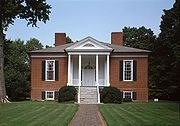 |
3033 Bardstown Rd. 38°12′52"N 85°40′6"W |
The Highlands The Highlands (Louisville) The Highlands is an area of Louisville, Kentucky which contains a high density of nightclubs, eclectic businesses, and many upscale and fast food restaurants. It is centered along a three-mile stretch of Bardstown Road and Baxter Avenue and is so named because it sits atop a ridge between the... |
||
| 89 | David Farnsley House | 4816 Cane Run Rd. 38°11′0"N 85°51′21"W |
Louisville Louisville, Kentucky Louisville is the largest city in the U.S. state of Kentucky, and the county seat of Jefferson County. Since 2003, the city's borders have been coterminous with those of the county because of a city-county merger. The city's population at the 2010 census was 741,096... |
|||
| 90 | Farnsley-Moremen House Riverside, The Farnsley-Moremen Landing Riverside, The Farnsley-Moremen Landing is a historic 300 acre farm and house in Southwest Louisville, Kentucky along the banks of the Ohio River... |
West of Louisville at 10908 Lower River Rd. 38°5′52"N 85°53′51"W |
Louisville Louisville, Kentucky Louisville is the largest city in the U.S. state of Kentucky, and the county seat of Jefferson County. Since 2003, the city's borders have been coterminous with those of the county because of a city-county merger. The city's population at the 2010 census was 741,096... |
|||
| 91 | Fincastle | 7501 Wolf Pen Branch Rd. 38°19′47"N 85°36′23"W |
Prospect Prospect, Kentucky Prospect is a city in far northeastern Jefferson and southwestern Oldham Counties in the U.S. state of Kentucky, along the Ohio River. The city is a suburb of Louisville, Kentucky. It's one of few cities in Jefferson County that extend into another county. The population was 4,657 at the 2000... |
|||
| 92 | J. Finzer and Brothers Company Building | 419 Finzer St. 38°14′36"N 85°44′49"W |
Louisville Louisville, Kentucky Louisville is the largest city in the U.S. state of Kentucky, and the county seat of Jefferson County. Since 2003, the city's borders have been coterminous with those of the county because of a city-county merger. The city's population at the 2010 census was 741,096... |
|||
| 93 | Nicholas Finzer House | 1212 Hull St. 38°14′52"N 85°43′43"W |
The Highlands The Highlands (Louisville) The Highlands is an area of Louisville, Kentucky which contains a high density of nightclubs, eclectic businesses, and many upscale and fast food restaurants. It is centered along a three-mile stretch of Bardstown Road and Baxter Avenue and is so named because it sits atop a ridge between the... |
|||
| 94 | First Christian Church First Christian Church (Louisville, Kentucky) First Christian Church is a historic church at 850 S. 4th Street in Louisville, Kentucky.It was built in 1910 and added to the National Register in 1979.... |
850 S. 4th St. 38°14′32"N 85°45′35"W |
Louisville Louisville, Kentucky Louisville is the largest city in the U.S. state of Kentucky, and the county seat of Jefferson County. Since 2003, the city's borders have been coterminous with those of the county because of a city-county merger. The city's population at the 2010 census was 741,096... |
|||
| 95 | First Street District | Roughly bounded by E. Breckinridge, E. Kentucky, and Interstate 65 Interstate 65 Interstate 65 is a major Interstate Highway in the United States. The southern terminus is located at an intersection with Interstate 10 in Mobile, Alabama, and its northern terminus is at an interchange with Interstate 90 , U.S. Route 12, and U.S... 38°9′29"N 85°45′20"W |
South End Louisville Louisville, Kentucky Louisville is the largest city in the U.S. state of Kentucky, and the county seat of Jefferson County. Since 2003, the city's borders have been coterminous with those of the county because of a city-county merger. The city's population at the 2010 census was 741,096... |
|||
| 96 | Fisher House | Old Taylorsville Rd. 38°11′26"N 85°27′48"W |
Fisherville Fisherville, Kentucky Fisherville is a neighborhood of Louisville, Kentucky centered along Taylorsville Road & Finchville Road. It was originally named Curreys after Edward Currey, who opened a post office in 1833. In 1847, it was renamed after Robert Fisher who had died two years earlier and operated a mill on Floyds... |
|||
| 97 | Fishpool Plantation | 9710 Preston Highway 38°6′26"N 85°40′52"W |
Louisville Louisville, Kentucky Louisville is the largest city in the U.S. state of Kentucky, and the county seat of Jefferson County. Since 2003, the city's borders have been coterminous with those of the county because of a city-county merger. The city's population at the 2010 census was 741,096... |
|||
| 98 | Fitzhugh House | 6401 Wolf Pen Branch Rd. 38°22′10"N 85°37′25"W |
Harrods Creek Harrods Creek, Kentucky Harrods Creek is a neighborhood of Louisville, Kentucky centered near Harrods Creek at the intersection of River Road and Wolf Pen Branch Road. It is roughly bordered by the Ohio River to the west and US 42 to the east. Its Zip Code is 40027... |
|||
| 99 | Ford Motor Company, Louisville Plant | 2500 S. 3rd St. 38°12′54"N 85°45′46"W |
Louisville Louisville, Kentucky Louisville is the largest city in the U.S. state of Kentucky, and the county seat of Jefferson County. Since 2003, the city's borders have been coterminous with those of the county because of a city-county merger. The city's population at the 2010 census was 741,096... |
|||
| 100 | Fourth Avenue Methodist Episcopal Church Fourth Avenue Methodist Episcopal Church Fourth Avenue Methodist Episcopal Church is a historic church at 318 W. St. Catherine Street in Louisville, Kentucky.It was built in 1900 and added to the National Register in 1979.... |
318 W. St. Catherine St. 38°14′13"N 85°45′34"W |
Louisville Louisville, Kentucky Louisville is the largest city in the U.S. state of Kentucky, and the county seat of Jefferson County. Since 2003, the city's borders have been coterminous with those of the county because of a city-county merger. The city's population at the 2010 census was 741,096... |
|||
| 101 | Henry Frank House | Madison Ave. 38°14′31"N 85°32′21"W |
Middletown Middletown, Kentucky The median income for a household in the city was $53,608, and the median income for a family was $61,667. Males had a median income of $45,417 versus $33,135 for females. The per capita income for the city was $26,660... |
|||
| 102 | Mary Alica Hadley House | 1638 Story Ave. 38°15′35.82"N 85°43′12.432"W |
Butchertown/Clifton Clifton, Louisville Clifton, a neighborhood east of downtown Louisville, Kentucky USA. Clifton was named because of its hilly location on the Ohio River valley escarpment.... |
|||
| 103 | Harriet Funk House | 9316 Hurstbourne 38°13′8"N 85°35′10"W |
Jeffersontown Jeffersontown, Kentucky Jeffersontown is a city in Jefferson County, Kentucky, United States. Before Louisville and Jefferson County were consolidated in 2003, it was the county's largest city outside of Louisville. The population was 26,633 at the 2000 census.- History :... |
|||
| 104 | James H. Funk House | 9000 Taylorsville 38°12′53"N 85°35′35"W |
Jeffersontown Jeffersontown, Kentucky Jeffersontown is a city in Jefferson County, Kentucky, United States. Before Louisville and Jefferson County were consolidated in 2003, it was the county's largest city outside of Louisville. The population was 26,633 at the 2000 census.- History :... |
|||
| 105 | Gaar-Fenton House | 4124 Nachand Lane 38°11′8"N 85°37′3"W |
Buechel Buechel, Kentucky Buechel is a former census-designated place in Jefferson County, Kentucky, United States. The population was 7,272 at the 2000 census. In 2003, The area was annexed to the city of Louisville due to a merger between the city and Jefferson County's unincorporated areas... |
|||
| 106 | Gaffney House | River Rd. 38°18′8"N 85°39′48"W |
Louisville Louisville, Kentucky Louisville is the largest city in the U.S. state of Kentucky, and the county seat of Jefferson County. Since 2003, the city's borders have been coterminous with those of the county because of a city-county merger. The city's population at the 2010 census was 741,096... |
|||
| 107 | Gardencourt Historic District | 1010 Alta Vista Rd. 38°14′20"N 85°41′14"W |
The Highlands The Highlands (Louisville) The Highlands is an area of Louisville, Kentucky which contains a high density of nightclubs, eclectic businesses, and many upscale and fast food restaurants. It is centered along a three-mile stretch of Bardstown Road and Baxter Avenue and is so named because it sits atop a ridge between the... |
|||
| 108 | German Evangelical Church of Christ Complex German Evangelical Church of Christ Complex German Evangelical Church of Christ Complex is a historic church at 1236 E. Breckinridge Street in Louisville, Kentucky.It was built in 1902 and added to the National Register in 1987.... |
1236 E. Breckinridge St. 38°14′23"N 85°43′52"W |
The Highlands The Highlands (Louisville) The Highlands is an area of Louisville, Kentucky which contains a high density of nightclubs, eclectic businesses, and many upscale and fast food restaurants. It is centered along a three-mile stretch of Bardstown Road and Baxter Avenue and is so named because it sits atop a ridge between the... |
|||
| 109 | Givens Headley and Co. Tobacco Warehouse | 1119-1121 W. Main St. 38°15′29"N 85°46′4"W |
Louisville Louisville, Kentucky Louisville is the largest city in the U.S. state of Kentucky, and the county seat of Jefferson County. Since 2003, the city's borders have been coterminous with those of the county because of a city-county merger. The city's population at the 2010 census was 741,096... |
|||
| 110 | Glenview Historic District | Glenview Ave. 38°18′30"N 85°38′56"W |
Northeast Louisville Louisville, Kentucky Louisville is the largest city in the U.S. state of Kentucky, and the county seat of Jefferson County. Since 2003, the city's borders have been coterminous with those of the county because of a city-county merger. The city's population at the 2010 census was 741,096... |
|||
| 111 | Cornelia Gordon House | 308 Kenwood Hill Rd. 38°9′31"N 85°46′18"W |
South End Louisville Louisville, Kentucky Louisville is the largest city in the U.S. state of Kentucky, and the county seat of Jefferson County. Since 2003, the city's borders have been coterminous with those of the county because of a city-county merger. The city's population at the 2010 census was 741,096... |
|||
| 112 | Green Tree Manor Residential Historic District | 107 Fenley Ave. 38°15′21"N 85°40′10"W |
Louisville Louisville, Kentucky Louisville is the largest city in the U.S. state of Kentucky, and the county seat of Jefferson County. Since 2003, the city's borders have been coterminous with those of the county because of a city-county merger. The city's population at the 2010 census was 741,096... |
|||
| 113 | Greve, Buhrlage, and Company | 1501 Lytle St. 38°15′41.4"N 85°46′28"W |
Louisville Louisville, Kentucky Louisville is the largest city in the U.S. state of Kentucky, and the county seat of Jefferson County. Since 2003, the city's borders have been coterminous with those of the county because of a city-county merger. The city's population at the 2010 census was 741,096... |
|||
| 114 | Benjamin Grove House | 518 N. 26th St. 38°16′12"N 85°47′27"W |
Louisville Louisville, Kentucky Louisville is the largest city in the U.S. state of Kentucky, and the county seat of Jefferson County. Since 2003, the city's borders have been coterminous with those of the county because of a city-county merger. The city's population at the 2010 census was 741,096... |
|||
| 115 | Haldeman House | 3609 Glenview Ave. 38°17′18.6"N 85°38′14.424"W |
Louisville Louisville, Kentucky Louisville is the largest city in the U.S. state of Kentucky, and the county seat of Jefferson County. Since 2003, the city's borders have been coterminous with those of the county because of a city-county merger. The city's population at the 2010 census was 741,096... |
|||
| 116 | Harrods Creek Historic District | Junction of Upper River and Wolf Pen Branch Rds. 38°19′19"N 85°38′13"W |
Harrods Creek Harrods Creek, Kentucky Harrods Creek is a neighborhood of Louisville, Kentucky centered near Harrods Creek at the intersection of River Road and Wolf Pen Branch Road. It is roughly bordered by the Ohio River to the west and US 42 to the east. Its Zip Code is 40027... |
|||
| 117 | Hayfield | 1809 Tyler Lane 38°12′28"N 85°41′10"W |
The Highlands The Highlands (Louisville) The Highlands is an area of Louisville, Kentucky which contains a high density of nightclubs, eclectic businesses, and many upscale and fast food restaurants. It is centered along a three-mile stretch of Bardstown Road and Baxter Avenue and is so named because it sits atop a ridge between the... |
|||
| 118 | Head House | Main St. 38°14′43"N 85°32′29"W |
Middletown Middletown, Kentucky The median income for a household in the city was $53,608, and the median income for a family was $61,667. Males had a median income of $45,417 versus $33,135 for females. The per capita income for the city was $26,660... |
|||
| 119 | Herr-Rudy Family Houses | 520 Old Stone Lane, 4319 and 4417 Westport Rd., 612 Rudy Lane, 726 Waterford Rd., 1823 Ballard Mill Lane, and 1705 Lynn Way 38°16′16"N 85°37′52"W |
Louisville Louisville, Kentucky Louisville is the largest city in the U.S. state of Kentucky, and the county seat of Jefferson County. Since 2003, the city's borders have been coterminous with those of the county because of a city-county merger. The city's population at the 2010 census was 741,096... |
|||
| 120 | John H. Heywood Elementary School | 422 Heywood Ave. 38°11′18"N 85°46′1"W |
Louisville Louisville, Kentucky Louisville is the largest city in the U.S. state of Kentucky, and the county seat of Jefferson County. Since 2003, the city's borders have been coterminous with those of the county because of a city-county merger. The city's population at the 2010 census was 741,096... |
|||
| 121 | Highlands Historic District | Roughly bounded by Barrett Ave., Eastern Parkway, and Fernwood, Bardstown, Woodbourne, Ellerbee, and Sherwood Aves. 38°14′6"N 85°42′40"W |
The Highlands The Highlands (Louisville) The Highlands is an area of Louisville, Kentucky which contains a high density of nightclubs, eclectic businesses, and many upscale and fast food restaurants. It is centered along a three-mile stretch of Bardstown Road and Baxter Avenue and is so named because it sits atop a ridge between the... |
|||
| 122 | Hikes Family Houses | 4118 Taylorsville Rd., 2806 Meadow Dr., 3026 Hikes Lane 38°12′51"N 85°38′9"W |
Louisville Louisville, Kentucky Louisville is the largest city in the U.S. state of Kentucky, and the county seat of Jefferson County. Since 2003, the city's borders have been coterminous with those of the county because of a city-county merger. The city's population at the 2010 census was 741,096... |
|||
| 123 | Hikes-Hunsinger House | 2834 Hikes Lane 38°12′27"N 85°38′48"W |
Louisville Louisville, Kentucky Louisville is the largest city in the U.S. state of Kentucky, and the county seat of Jefferson County. Since 2003, the city's borders have been coterminous with those of the county because of a city-county merger. The city's population at the 2010 census was 741,096... |
|||
| 124 | Abraham Hite House | Starlight Lane 38°11′11"N 85°37′18"W |
Buechel Buechel, Kentucky Buechel is a former census-designated place in Jefferson County, Kentucky, United States. The population was 7,272 at the 2000 census. In 2003, The area was annexed to the city of Louisville due to a merger between the city and Jefferson County's unincorporated areas... |
|||
| 125 | Hite-Chenoweth House | 4219 Starlight Lane 38°11′10"N 85°37′15"W |
Buechel Buechel, Kentucky Buechel is a former census-designated place in Jefferson County, Kentucky, United States. The population was 7,272 at the 2000 census. In 2003, The area was annexed to the city of Louisville due to a merger between the city and Jefferson County's unincorporated areas... |
|||
| 126 | Andrew Hoke House | 2700 Llandovery Dr. 38°12′20"N 85°34′15"W |
Jeffersontown Jeffersontown, Kentucky Jeffersontown is a city in Jefferson County, Kentucky, United States. Before Louisville and Jefferson County were consolidated in 2003, it was the county's largest city outside of Louisville. The population was 26,633 at the 2000 census.- History :... |
|||
| 127 | Holy Name Church Rectory, Convent and School Holy Name Church Rectory, Convent and School Holy Name Church Rectory, Convent and School is a historic church at 2920 and 2914 S. 3rd Street and 2911 and 2921 S. 4th Street in Louisville, Kentucky.It was built in 1902 and added to the National Register in 1982.... |
2920 and 2914 S. 3rd St. and 2911 and 2921 S. 4th St. 38°14′34"N 85°45′49"W |
Louisville Louisville, Kentucky Louisville is the largest city in the U.S. state of Kentucky, and the county seat of Jefferson County. Since 2003, the city's borders have been coterminous with those of the county because of a city-county merger. The city's population at the 2010 census was 741,096... |
|||
| 128 | Hook and Ladder Company No. 2 Historic Firehouses of Louisville The Historic Firehouses of Louisville was a Multiple Property Submission for the National Register of Historic Places. The submission represented seventeen historic fire stations, located in Louisville, Kentucky, and these were added to the National Register due to their historical and... |
221 S. Hancock St. 38°15′11"N 85°44′31"W |
Butchertown/Clifton Clifton, Louisville Clifton, a neighborhood east of downtown Louisville, Kentucky USA. Clifton was named because of its hilly location on the Ohio River valley escarpment.... |
|||
| 129 | Hook and Ladder Company No. 3 Historic Firehouses of Louisville The Historic Firehouses of Louisville was a Multiple Property Submission for the National Register of Historic Places. The submission represented seventeen historic fire stations, located in Louisville, Kentucky, and these were added to the National Register due to their historical and... |
Frankfort Ave. and Pope St. 38°15′25"N 85°43′0"W |
Louisville Louisville, Kentucky Louisville is the largest city in the U.S. state of Kentucky, and the county seat of Jefferson County. Since 2003, the city's borders have been coterminous with those of the county because of a city-county merger. The city's population at the 2010 census was 741,096... |
|||
| 130 | Hook and Ladder Company No. 5 Historic Firehouses of Louisville The Historic Firehouses of Louisville was a Multiple Property Submission for the National Register of Historic Places. The submission represented seventeen historic fire stations, located in Louisville, Kentucky, and these were added to the National Register due to their historical and... |
1824 Garland Ave. 38°15′15"N 85°41′44"W |
Louisville Louisville, Kentucky Louisville is the largest city in the U.S. state of Kentucky, and the county seat of Jefferson County. Since 2003, the city's borders have been coterminous with those of the county because of a city-county merger. The city's population at the 2010 census was 741,096... |
|||
| 131 | Hope Worsted Mills | 942 E. Kentucky St. 38°14′8"N 85°44′14"W |
Louisville Louisville, Kentucky Louisville is the largest city in the U.S. state of Kentucky, and the county seat of Jefferson County. Since 2003, the city's borders have been coterminous with those of the county because of a city-county merger. The city's population at the 2010 census was 741,096... |
|||
| 132 | Robert Hord House | U.S. Route 60 U.S. Route 60 U.S. Route 60 is an east–west United States highway, running from the Atlantic Ocean on the east coast in Virginia to western Arizona. Despite the final "0" in its number, indicating a transcontinental designation, the 1926 route formerly ended in Springfield, Missouri, at its intersection... 38°14′7"N 85°27′32"W |
Eastwood Eastwood, Kentucky Eastwood is a neighborhood of Louisville, Kentucky centered along Shelbyville Road & Johnson Road.-References:... |
|||
| 133 | Horner House | 3509 Woodside 38°18′7"N 85°39′4"W |
Northeast Louisville Louisville, Kentucky Louisville is the largest city in the U.S. state of Kentucky, and the county seat of Jefferson County. Since 2003, the city's borders have been coterminous with those of the county because of a city-county merger. The city's population at the 2010 census was 741,096... |
|||
| 134 | Howard-Gettys House | 1226 Bates Ct. 38°13′50"N 85°43′28"W |
Louisville Louisville, Kentucky Louisville is the largest city in the U.S. state of Kentucky, and the county seat of Jefferson County. Since 2003, the city's borders have been coterminous with those of the county because of a city-county merger. The city's population at the 2010 census was 741,096... |
|||
| 135 | Humphrey-McMeekin House | 2240 Douglass Boulevard 38°13′42"N 85°41′9"W |
The Highlands The Highlands (Louisville) The Highlands is an area of Louisville, Kentucky which contains a high density of nightclubs, eclectic businesses, and many upscale and fast food restaurants. It is centered along a three-mile stretch of Bardstown Road and Baxter Avenue and is so named because it sits atop a ridge between the... |
|||
| 136 | Immanuel Chapel Protestant Episcopal Church Immanuel Chapel Protestant Episcopal Church Immanuel Chapel Protestant Episcopal Church is a historic church at 410 Fairmont Avenue in Louisville, Kentucky.It was built in 1909 and added to the National Register in 1983.... |
410 Fairmont Ave. 38°11′42"N 85°46′3"W |
South End Louisville Louisville, Kentucky Louisville is the largest city in the U.S. state of Kentucky, and the county seat of Jefferson County. Since 2003, the city's borders have been coterminous with those of the county because of a city-county merger. The city's population at the 2010 census was 741,096... |
|||
| 137 | Jeffersontown Colored School | 10400 Shelby St. 38°11′48"N 85°33′53"W |
Jeffersontown Jeffersontown, Kentucky Jeffersontown is a city in Jefferson County, Kentucky, United States. Before Louisville and Jefferson County were consolidated in 2003, it was the county's largest city outside of Louisville. The population was 26,633 at the 2000 census.- History :... |
|||
| 138 | J. Stoddard Johnston Elementary School | 2301 Bradley Boulevard 38°12′52.272"N 85°44′54.24"W |
Louisville Louisville, Kentucky Louisville is the largest city in the U.S. state of Kentucky, and the county seat of Jefferson County. Since 2003, the city's borders have been coterminous with those of the county because of a city-county merger. The city's population at the 2010 census was 741,096... |
|||
| 139 | Jones House | 4998 Valley Station Rd. 38°6′13"N 85°51′15"W |
Valley Station Valley Station, Kentucky Valley Station is a former census-designated place in southwest Jefferson County, Kentucky, United States. The population was 23,489 at the 2010 census. When the government of Jefferson County merged with the city of Louisville, Kentucky in 2003, residents of Valley Station also became citizens of... |
|||
| 140 | Judge Kirby House | Kirby Lane 38°11′15"N 85°35′48"W |
Jeffersontown Jeffersontown, Kentucky Jeffersontown is a city in Jefferson County, Kentucky, United States. Before Louisville and Jefferson County were consolidated in 2003, it was the county's largest city outside of Louisville. The population was 26,633 at the 2000 census.- History :... |
|||
| 141 | Kennedy-Hunsinger Farm | 4334 Taylorsville Rd. 38°12′55"N 85°36′34"W |
Jeffersontown Jeffersontown, Kentucky Jeffersontown is a city in Jefferson County, Kentucky, United States. Before Louisville and Jefferson County were consolidated in 2003, it was the county's largest city outside of Louisville. The population was 26,633 at the 2000 census.- History :... |
|||
| 142 | Kentucky Street School | 119 E. Kentucky St. 38°14′19"N 85°45′11"W |
Louisville Louisville, Kentucky Louisville is the largest city in the U.S. state of Kentucky, and the county seat of Jefferson County. Since 2003, the city's borders have been coterminous with those of the county because of a city-county merger. The city's population at the 2010 census was 741,096... |
|||
| 143 | Kentucky Wagon Works | 2601 S. 3rd St. 38°11′35"N 85°45′41"W |
South End Louisville Louisville, Kentucky Louisville is the largest city in the U.S. state of Kentucky, and the county seat of Jefferson County. Since 2003, the city's borders have been coterminous with those of the county because of a city-county merger. The city's population at the 2010 census was 741,096... |
|||
| 144 | Kosmosdale Depot | Off Dixie Highway 38°1′56"N 85°54′27"W |
Valley Station Valley Station, Kentucky Valley Station is a former census-designated place in southwest Jefferson County, Kentucky, United States. The population was 23,489 at the 2010 census. When the government of Jefferson County merged with the city of Louisville, Kentucky in 2003, residents of Valley Station also became citizens of... |
|||
| 145 | KYANG Site (15JF267) | Address Restricted | Louisville Louisville, Kentucky Louisville is the largest city in the U.S. state of Kentucky, and the county seat of Jefferson County. Since 2003, the city's borders have been coterminous with those of the county because of a city-county merger. The city's population at the 2010 census was 741,096... |
|||
| 146 | Ladless Hill | 6501 Longview Lane 38°17′59"N 85°39′38"W |
Northeast Louisville Louisville, Kentucky Louisville is the largest city in the U.S. state of Kentucky, and the county seat of Jefferson County. Since 2003, the city's borders have been coterminous with those of the county because of a city-county merger. The city's population at the 2010 census was 741,096... |
|||
| 147 | Landward House | 1385-1387 S. 4th St. 38°13′46"N 85°45′39"W |
Louisville Louisville, Kentucky Louisville is the largest city in the U.S. state of Kentucky, and the county seat of Jefferson County. Since 2003, the city's borders have been coterminous with those of the county because of a city-county merger. The city's population at the 2010 census was 741,096... |
|||
| 148 | Leatherman House | 3606 College Dr. 38°11′31"N 85°34′1"W |
Jeffersontown Jeffersontown, Kentucky Jeffersontown is a city in Jefferson County, Kentucky, United States. Before Louisville and Jefferson County were consolidated in 2003, it was the county's largest city outside of Louisville. The population was 26,633 at the 2000 census.- History :... |
|||
| 149 | Addison W. Lee House | 4218 Upper River Rd. 38°17′36"N 85°40′29"W |
Louisville Louisville, Kentucky Louisville is the largest city in the U.S. state of Kentucky, and the county seat of Jefferson County. Since 2003, the city's borders have been coterminous with those of the county because of a city-county merger. The city's population at the 2010 census was 741,096... |
|||
| 150 | Dr. John Lewis House Dr. John Lewis House Dr. John Lewis House is a house near St. Matthews, Kentucky. It was listed on the National Register of Historic Places in 1984.... |
220 Ridgeway Ave. 38°15′21"N 85°38′57"W |
St. Matthews St. Matthews, Kentucky St. Matthews is the 20th largest city in Kentucky, United States and is a prominent suburb of Louisville. It is located 8 miles east of downtown Louisville in Jefferson County. It is one of the state's major shopping areas, being home to second and fifth largest malls in Kentucky St. Matthews is... |
|||
| 151 | Lewiston House | 4902 Ranchland 38°10′20"N 85°49′47"W |
Valley Station Valley Station, Kentucky Valley Station is a former census-designated place in southwest Jefferson County, Kentucky, United States. The population was 23,489 at the 2010 census. When the government of Jefferson County merged with the city of Louisville, Kentucky in 2003, residents of Valley Station also became citizens of... |
|||
| 152 | Limerick Historic District Limerick, Louisville Limerick is a neighborhood one mile south of downtown Louisville, Kentucky USA. It was developed in the 1860s as a place of residence for employees of the Louisville and Nashville Railroad freight yard. It was named because nearly all of the residents were from the Irish county of Limerick. The St.... |
 |
Roughly bounded by Breckinridge, Oak, 5th, and 8th Sts. 38°13′59"N 85°45′49"W |
Louisville Louisville, Kentucky Louisville is the largest city in the U.S. state of Kentucky, and the county seat of Jefferson County. Since 2003, the city's borders have been coterminous with those of the county because of a city-county merger. The city's population at the 2010 census was 741,096... |
||
| 153 | Lincliff Lincliff Lincliff is a Georgian Revival house in Glenview, Kentucky, a small city east of Louisville, Kentucky where wealthy Louisvillians began building estates around 1900. Lincliff was built in 1911-1912 and added to the National Register of Historic Places in 1983.... |
6100 Longview Lane 38°17′47"N 85°39′46"W |
Northeast Louisville Louisville, Kentucky Louisville is the largest city in the U.S. state of Kentucky, and the county seat of Jefferson County. Since 2003, the city's borders have been coterminous with those of the county because of a city-county merger. The city's population at the 2010 census was 741,096... |
|||
| 154 | Lindenberger-Grant House | 8200 Railroad Ave. 38°15′45"N 85°36′8"W |
Lyndon Lyndon, Kentucky There were 4,520 households out of which 21.9% had children under the age of 18 living with them, 37.5% were married couples living together, 8.9% had a female householder with no husband present, and 50.3% were non-families. 40.1% of all households were made up of individuals and 7.4% had someone... |
|||
| 155 | Little Loomhouse Little Loomhouse The Little Loomhouse is a place on the National Register of Historic Places in the Kenwood Hill neighborhood on the south side of Louisville, Kentucky. It consists of three log cabins from the nineteenth century Victorian Era: Esta Cabin, Tophouse, and Wisteria Cabin. It not only displays weavings,... s |
 |
328 Kenwood Hill Rd. 38°9′28"N 85°46′15"W |
South End Louisville Louisville, Kentucky Louisville is the largest city in the U.S. state of Kentucky, and the county seat of Jefferson County. Since 2003, the city's borders have been coterminous with those of the county because of a city-county merger. The city's population at the 2010 census was 741,096... |
||
| 156 | Locust Avenue | 1814 Fern Valley Rd. 38°9′20"N 85°40′0"W |
Louisville Louisville, Kentucky Louisville is the largest city in the U.S. state of Kentucky, and the county seat of Jefferson County. Since 2003, the city's borders have been coterminous with those of the county because of a city-county merger. The city's population at the 2010 census was 741,096... |
|||
| 157 | Locust Grove Historic Locust Grove Historic Locust Grove is a 55-acre 18th century farm site and National Historic Landmark situated in eastern Jefferson County, Kentucky . The site is presently owned by the Louisville Metro government, and operated as a historic interpretive site by Historic Locust Grove, Inc.The main feature on... |
561 Blankenbaker Ln. 38°17′19"N 85°39′40"W |
Northeast Louisville Louisville, Kentucky Louisville is the largest city in the U.S. state of Kentucky, and the county seat of Jefferson County. Since 2003, the city's borders have been coterminous with those of the county because of a city-county merger. The city's population at the 2010 census was 741,096... |
|||
| 158 | Long Run Baptist Church and Cemetery Long Run Baptist Church and Cemetery Long Run Baptist Church and Cemetery is a historic church and cemetery on Long Run Road in Eastwood, Kentucky.... |
Long Run Rd. 38°15′17"N 85°24′47"W |
Eastwood Eastwood, Kentucky Eastwood is a neighborhood of Louisville, Kentucky centered along Shelbyville Road & Johnson Road.-References:... |
|||
| 159 | Louisville Cotton Mills | 1008 Goss Ave. 38°13′45"N 85°44′23"W |
The Highlands The Highlands (Louisville) The Highlands is an area of Louisville, Kentucky which contains a high density of nightclubs, eclectic businesses, and many upscale and fast food restaurants. It is centered along a three-mile stretch of Bardstown Road and Baxter Avenue and is so named because it sits atop a ridge between the... |
|||
| 160 | Louisville Free Public Library Louisville Free Public Library The Louisville Free Public Library is the largest public library system in Kentucky. Officially opened in 1908, the library's main site resides south of Broadway in downtown Louisville. Additional branches were added over time, including the Western Colored Branch, which was the first... |
 |
301 W. York St. 38°14′40"N 85°45′28"W |
Louisville Louisville, Kentucky Louisville is the largest city in the U.S. state of Kentucky, and the county seat of Jefferson County. Since 2003, the city's borders have been coterminous with those of the county because of a city-county merger. The city's population at the 2010 census was 741,096... |
||
| 161 | Louisville Male High School Louisville Male High School Louisville Male Traditional High School is a public secondary school serving students in grades 9 through 12 in the southside of Louisville, Kentucky, USA. It is part of the Jefferson County Public School District.... |
911 S. Brook St. 38°14′25"N 85°45′5"W |
Louisville Louisville, Kentucky Louisville is the largest city in the U.S. state of Kentucky, and the county seat of Jefferson County. Since 2003, the city's borders have been coterminous with those of the county because of a city-county merger. The city's population at the 2010 census was 741,096... |
|||
| 162 | Louisville War Memorial Auditorium | 970 S. 4th St. 38°14′21"N 85°45′36"W |
Louisville Louisville, Kentucky Louisville is the largest city in the U.S. state of Kentucky, and the county seat of Jefferson County. Since 2003, the city's borders have been coterminous with those of the county because of a city-county merger. The city's population at the 2010 census was 741,096... |
|||
| 163 | Louisville Water Company Pumping Station Louisville Water Tower The Water Tower of Louisville, Kentucky , is the oldest ornamental water tower in the world, having been built before the more famous Chicago Water Tower. Both the actual water tower and its pumping station are on the National Register of Historic Places... |
 |
Zorn Ave. 38°16′50"N 85°42′5"W |
Butchertown/Clifton Clifton, Louisville Clifton, a neighborhood east of downtown Louisville, Kentucky USA. Clifton was named because of its hilly location on the Ohio River valley escarpment.... |
||
| 164 | James Russell Lowell Elementary School | 4501 Crittenden Dr. 38°11′17"N 85°44′59"W |
South End Louisville Louisville, Kentucky Louisville is the largest city in the U.S. state of Kentucky, and the county seat of Jefferson County. Since 2003, the city's borders have been coterminous with those of the county because of a city-county merger. The city's population at the 2010 census was 741,096... |
|||
| 165 | Lyndon Cottage | Terminus of Hurstbourne Country Club Dr. 38°14′22"N 85°35′25"W |
Louisville Louisville, Kentucky Louisville is the largest city in the U.S. state of Kentucky, and the county seat of Jefferson County. Since 2003, the city's borders have been coterminous with those of the county because of a city-county merger. The city's population at the 2010 census was 741,096... |
|||
| 166 | Lynnford-Lyndon Hall | 8222 Shelbyville Rd. 38°14′23"N 85°35′27"W |
Lyndon Lyndon, Kentucky There were 4,520 households out of which 21.9% had children under the age of 18 living with them, 37.5% were married couples living together, 8.9% had a female householder with no husband present, and 50.3% were non-families. 40.1% of all households were made up of individuals and 7.4% had someone... |
|||
| 167 | Maghera Glass-Ormsby Hall | 8521 La Grange Rd. 38°16′20"N 85°35′46"W |
Lyndon Lyndon, Kentucky There were 4,520 households out of which 21.9% had children under the age of 18 living with them, 37.5% were married couples living together, 8.9% had a female householder with no husband present, and 50.3% were non-families. 40.1% of all households were made up of individuals and 7.4% had someone... |
|||
| 168 | Jefferson Marders House | 211 Madison Ave. 38°14′55"N 85°32′22"W |
Middletown Middletown, Kentucky The median income for a household in the city was $53,608, and the median income for a family was $61,667. Males had a median income of $45,417 versus $33,135 for females. The per capita income for the city was $26,660... |
|||
| 169 | Dr. J.B. Marvin House | 809 S. 4th St. 38°14′41"N 85°45′29"W |
Louisville Louisville, Kentucky Louisville is the largest city in the U.S. state of Kentucky, and the county seat of Jefferson County. Since 2003, the city's borders have been coterminous with those of the county because of a city-county merger. The city's population at the 2010 census was 741,096... |
|||
| 170 | Masonic Hall Masonic Hall (Eastwood, Kentucky) The Masonic Temple in Fisherville, Kentucky is a building from 1952. It was listed on the National Register of Historic Places in 1983.... |
15116 Old Taylorsville Rd. 38°11′21"N 85°27′42"W |
Fisherville Fisherville, Kentucky Fisherville is a neighborhood of Louisville, Kentucky centered along Taylorsville Road & Finchville Road. It was originally named Curreys after Edward Currey, who opened a post office in 1833. In 1847, it was renamed after Robert Fisher who had died two years earlier and operated a mill on Floyds... |
|||
| 171 | Masonic Widows and Orphans Home Masonic Widows and Orphans Home The Masonic Widows and Orphans Home, located in Louisville , Kentucky, is a historic building on the National Register of Historic Places... |
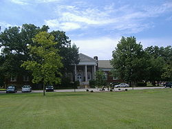 |
3701 Frankfort Ave. 38°15′16"N 85°40′3"W |
Louisville Louisville, Kentucky Louisville is the largest city in the U.S. state of Kentucky, and the county seat of Jefferson County. Since 2003, the city's borders have been coterminous with those of the county because of a city-county merger. The city's population at the 2010 census was 741,096... |
||
| 172 | McBride's Harrods Creek Landing | 5913 River Rd. 38°19′20"N 85°38′38"W |
Harrods Creek vicinity | |||
| 173 | McClure House | North of Westport Rd. 38°16′46"N 85°35′52"W |
Lyndon Lyndon, Kentucky There were 4,520 households out of which 21.9% had children under the age of 18 living with them, 37.5% were married couples living together, 8.9% had a female householder with no husband present, and 50.3% were non-families. 40.1% of all households were made up of individuals and 7.4% had someone... |
|||
| 174 | Merriwether House | 6421 Upper River Rd. 38°19′41"N 85°37′50"W |
Louisville Louisville, Kentucky Louisville is the largest city in the U.S. state of Kentucky, and the county seat of Jefferson County. Since 2003, the city's borders have been coterminous with those of the county because of a city-county merger. The city's population at the 2010 census was 741,096... |
|||
| 175 | Middletown Inn | 11705 Main St. 38°14′44"N 85°32′22"W |
Middletown Middletown, Kentucky The median income for a household in the city was $53,608, and the median income for a family was $61,667. Males had a median income of $45,417 versus $33,135 for females. The per capita income for the city was $26,660... |
|||
| 176 | Middletown United Methodist Church Middletown United Methodist Church Middletown United Methodist Church is a historic church at Madison and Main Streets in Middletown, Kentucky.It was built in 1899 and added to the National Register in 1980.... |
Madison and Main Sts. 38°14′42"N 85°32′21"W |
Middletown Middletown, Kentucky The median income for a household in the city was $53,608, and the median income for a family was $61,667. Males had a median income of $45,417 versus $33,135 for females. The per capita income for the city was $26,660... |
|||
| 177 | Midlands | 25 Poplar Hill Rd. 38°17′33"N 85°39′44"W |
Northeast Louisville Louisville, Kentucky Louisville is the largest city in the U.S. state of Kentucky, and the county seat of Jefferson County. Since 2003, the city's borders have been coterminous with those of the county because of a city-county merger. The city's population at the 2010 census was 741,096... |
|||
| 178 | Mockingbird Valley Historic District Mockingbird Valley, Kentucky Mockingbird Valley is a city in Jefferson County, Kentucky, United States. The population was 190 at the 2000 census. It has the highest per capita income of any location in Kentucky, and the tenth highest of any location in America.... |
Roughly bounded by River Rd., Indian Hills Trail, Fairway, Swing, Brownsboro, Jarvis, and Green Ridge Ln. 38°16′21"N 85°40′56"W |
Louisville Louisville, Kentucky Louisville is the largest city in the U.S. state of Kentucky, and the county seat of Jefferson County. Since 2003, the city's borders have been coterminous with those of the county because of a city-county merger. The city's population at the 2010 census was 741,096... |
|||
| 179 | Simeon Moore House | 17317 Taylorsville Rd. 38°9′29"N 85°26′4"W |
Fisherville Fisherville, Kentucky Fisherville is a neighborhood of Louisville, Kentucky centered along Taylorsville Road & Finchville Road. It was originally named Curreys after Edward Currey, who opened a post office in 1833. In 1847, it was renamed after Robert Fisher who had died two years earlier and operated a mill on Floyds... |
|||
| 180 | Most Blessed Sacrament School | 1128 Berry Blvd. 38°11′46"N 85°46′48"W |
Louisville Louisville, Kentucky Louisville is the largest city in the U.S. state of Kentucky, and the county seat of Jefferson County. Since 2003, the city's borders have been coterminous with those of the county because of a city-county merger. The city's population at the 2010 census was 741,096... |
|||
| 181 | Municipal College Campus, Simmons University Simmons College of Kentucky Simmons College of Kentucky, also referred to as Simmons College and Simmons Bible College, is a private, co-educational college located in Louisville, Kentucky. Founded in 1879, Simmons College is a historically black college... |
1018 S. 7th St. 38°14′22"N 85°45′56"W |
Louisville Louisville, Kentucky Louisville is the largest city in the U.S. state of Kentucky, and the county seat of Jefferson County. Since 2003, the city's borders have been coterminous with those of the county because of a city-county merger. The city's population at the 2010 census was 741,096... |
|||
| 182 | Dr. John Murray Farm | Murray Hill Pike 38°17′26"N 85°35′13"W |
Lyndon Lyndon, Kentucky There were 4,520 households out of which 21.9% had children under the age of 18 living with them, 37.5% were married couples living together, 8.9% had a female householder with no husband present, and 50.3% were non-families. 40.1% of all households were made up of individuals and 7.4% had someone... |
|||
| 183 | Nitta Yuma Historic District | 5028, 5040, 5044, and 5051 Nitta Yuma 38°19′19"N 85°37′39"W |
Harrods Creek Harrods Creek, Kentucky Harrods Creek is a neighborhood of Louisville, Kentucky centered near Harrods Creek at the intersection of River Road and Wolf Pen Branch Road. It is roughly bordered by the Ohio River to the west and US 42 to the east. Its Zip Code is 40027... |
|||
| 184 | Oakdale District | Roughly bounded by Terrace Park, Southern Parkway, 4th and Kenton Sts. 38°11′59"N 85°46′0"W |
South End Louisville Louisville, Kentucky Louisville is the largest city in the U.S. state of Kentucky, and the county seat of Jefferson County. Since 2003, the city's borders have been coterminous with those of the county because of a city-county merger. The city's population at the 2010 census was 741,096... |
|||
| 185 | Old Louisville Residential District Old Louisville Old Louisville is a historic district and neighborhood in central Louisville, Kentucky, USA. It is the third largest such district in the United States, and the largest preservation district featuring almost entirely Victorian architecture... |
Irregular pattern roughly bounded by S. 7th St. on the west, North-South Expressway (Interstate 65 Interstate 65 Interstate 65 is a major Interstate Highway in the United States. The southern terminus is located at an intersection with Interstate 10 in Mobile, Alabama, and its northern terminus is at an interchange with Interstate 90 , U.S. Route 12, and U.S... ) on the east, Kentucky St. on the north, and Avery St. on the south 38°13′46"N 85°45′33"W |
Louisville Louisville, Kentucky Louisville is the largest city in the U.S. state of Kentucky, and the county seat of Jefferson County. Since 2003, the city's borders have been coterminous with those of the county because of a city-county merger. The city's population at the 2010 census was 741,096... |
|||
| 186 | Olmsted Park System Parkways of Louisville, Kentucky The parkway system of Louisville, Kentucky, also known as the Olmsted Park System, was designed by the firm of preeminent 19th century landscape architect Frederick Law Olmsted... |
Algonquin, Cherokee, Eastern, Southern, North, and South Western Parkways 38°12′55"N 85°46′34"W |
Louisville Louisville, Kentucky Louisville is the largest city in the U.S. state of Kentucky, and the county seat of Jefferson County. Since 2003, the city's borders have been coterminous with those of the county because of a city-county merger. The city's population at the 2010 census was 741,096... |
|||
| 187 | Omer/Pound House | 6609 Billtown Rd. 38°8′55"N 85°32′34"W |
Louisville Louisville, Kentucky Louisville is the largest city in the U.S. state of Kentucky, and the county seat of Jefferson County. Since 2003, the city's borders have been coterminous with those of the county because of a city-county merger. The city's population at the 2010 census was 741,096... |
|||
| 188 | Oxmoor Oxmoor Farm -External links:*Oxmoor Farm is the location of the Food literacy project. They are a non-profit education agency partnering with a working farm to teach the Louisville community about the processes and products of organic and local agriculture... |
7500 Shelbyville Rd. 38°14′15"N 85°36′30"W |
Louisville Louisville, Kentucky Louisville is the largest city in the U.S. state of Kentucky, and the county seat of Jefferson County. Since 2003, the city's borders have been coterminous with those of the county because of a city-county merger. The city's population at the 2010 census was 741,096... |
|||
| 189 | Paget House and Heigold House Facade | 1562 Fulton St. and River Rd. 38°15′53"N 85°43′40"W |
Butchertown/Clifton Clifton, Louisville Clifton, a neighborhood east of downtown Louisville, Kentucky USA. Clifton was named because of its hilly location on the Ohio River valley escarpment.... |
|||
| 190 | Parkland Evangelical Church Parkland Evangelical Church Parkland Evangelical Church is a historic church at 1102 S. 26th Street in Louisville, Kentucky.It was built in 1915 and added to the National Register in 1983.... |
1102 S. 26th St. 38°14′25"N 85°47′47"W |
Louisville Louisville, Kentucky Louisville is the largest city in the U.S. state of Kentucky, and the county seat of Jefferson County. Since 2003, the city's borders have been coterminous with those of the county because of a city-county merger. The city's population at the 2010 census was 741,096... |
|||
| 191 | Peaslee-Gaulbert Warehouse | 1427 Lytle St. 38°15′41"N 85°47′50"W |
Louisville Louisville, Kentucky Louisville is the largest city in the U.S. state of Kentucky, and the county seat of Jefferson County. Since 2003, the city's borders have been coterminous with those of the county because of a city-county merger. The city's population at the 2010 census was 741,096... |
|||
| 192 | Pennsylvania Run Presbyterian Church Pennsylvania Run Presbyterian Church Pennsylvania Run Presbyterian Church is a historic church in Okolona, Kentucky.It was added to the National Register in 1983.... |
Vaughn's Mill Rd. 38°7′37"N 85°37′46"W |
Okolona Okolona, Kentucky Okolona is a former census-designated place in southern Jefferson County, Kentucky, United States. It is centered around the intersection of Preston Highway and the Outer Loop. The population was 17,807 at the 2000 census. When the government of Jefferson County merged with the city of Louisville,... |
|||
| 193 | Peterson Avenue Hill Peterson Avenue Hill Peterson Avenue Hill is one of the few remaining brick streets in Louisville, Kentucky. It is Louisville's best known brick street or alley.-Description:The brick portion of the street covers a steep hill with a mean slope of approximately 15 degrees... |
Peterson Ave. 38°14′58"N 85°41′49"W |
Butchertown/Clifton Clifton, Louisville Clifton, a neighborhood east of downtown Louisville, Kentucky USA. Clifton was named because of its hilly location on the Ohio River valley escarpment.... |
|||
| 194 | Peterson-Dumesnil House Peterson-Dumesnil House The Peterson-Dumesnil House is a Victorian-Italianate house in the Crescent Hill neighborhood of Louisville, Kentucky, USA. Of the remaining large country estates built by Louisvillians in the late 19th century to the east of the city, it is the closest to Downtown Louisville, and primarily for... |
310 S. Peterson Ave. 38°15′3"N 85°41′47"W |
Butchertown/Clifton Clifton, Louisville Clifton, a neighborhood east of downtown Louisville, Kentucky USA. Clifton was named because of its hilly location on the Ohio River valley escarpment.... |
|||
| 195 | Phoenix Hill Historic District | Roughly bounded by Main, Campbell, Jefferson, Chestnut, Broadway, Hancock, Walnut, Shelby, Market, and Floyd Sts. 38°14′59"N 85°44′24"W |
Butchertown/Clifton Clifton, Louisville Clifton, a neighborhood east of downtown Louisville, Kentucky USA. Clifton was named because of its hilly location on the Ohio River valley escarpment.... |
|||
| 196 | Pirtle House | 5803 Orion Rd. 38°18′18"N 85°38′49"W |
Northeast Louisville Louisville, Kentucky Louisville is the largest city in the U.S. state of Kentucky, and the county seat of Jefferson County. Since 2003, the city's borders have been coterminous with those of the county because of a city-county merger. The city's population at the 2010 census was 741,096... |
|||
| 197 | Porter-Todd House | 929 S. 4th St. 38°14′29"N 85°45′33"W |
Louisville Louisville, Kentucky Louisville is the largest city in the U.S. state of Kentucky, and the county seat of Jefferson County. Since 2003, the city's borders have been coterminous with those of the county because of a city-county merger. The city's population at the 2010 census was 741,096... |
|||
| 198 | Presentation Academy Presentation Academy Presentation Academy, a college-preparatory high school for young women, is located just south of Downtown Louisville, Kentucky in the Roman Catholic Archdiocese of Louisville... |
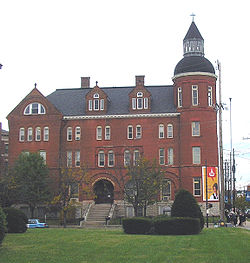 |
861 S. 4th St. 38°14′31"N 85°45′32"W |
Louisville Louisville, Kentucky Louisville is the largest city in the U.S. state of Kentucky, and the county seat of Jefferson County. Since 2003, the city's borders have been coterminous with those of the county because of a city-county merger. The city's population at the 2010 census was 741,096... |
||
| 199 | Preston-St. Catherine Street Historic District | Roughly bounded by Roland, Preston, Jackson, St. Catherine, and Floyd Sts. 38°14′11"N 85°44′58"W |
Louisville Louisville, Kentucky Louisville is the largest city in the U.S. state of Kentucky, and the county seat of Jefferson County. Since 2003, the city's borders have been coterminous with those of the county because of a city-county merger. The city's population at the 2010 census was 741,096... |
|||
| 200 | J.V. Reed and Company | 1100 W. Main St. 38°15′29"N 85°46′4"W |
Louisville Louisville, Kentucky Louisville is the largest city in the U.S. state of Kentucky, and the county seat of Jefferson County. Since 2003, the city's borders have been coterminous with those of the county because of a city-county merger. The city's population at the 2010 census was 741,096... |
|||
| 201 | Repton | 314 Ridgedale Rd. 38°15′38"N 85°41′47"W |
Butchertown/Clifton Clifton, Louisville Clifton, a neighborhood east of downtown Louisville, Kentucky USA. Clifton was named because of its hilly location on the Ohio River valley escarpment.... |
|||
| 202 | Ridgeway | 4095 Massie Ave. 38°15′50"N 85°38′53"W |
Louisville Louisville, Kentucky Louisville is the largest city in the U.S. state of Kentucky, and the county seat of Jefferson County. Since 2003, the city's borders have been coterminous with those of the county because of a city-county merger. The city's population at the 2010 census was 741,096... |
|||
| 203 | Rockdale | 12109 Taylorsville Rd. 38°12′20"N 85°31′39"W |
Jeffersontown Jeffersontown, Kentucky Jeffersontown is a city in Jefferson County, Kentucky, United States. Before Louisville and Jefferson County were consolidated in 2003, it was the county's largest city outside of Louisville. The population was 26,633 at the 2000 census.- History :... |
|||
| 204 | Rockledge | 4810 Upper River Rd. 38°18′20"N 85°39′11"W |
Northeast Louisville Louisville, Kentucky Louisville is the largest city in the U.S. state of Kentucky, and the county seat of Jefferson County. Since 2003, the city's borders have been coterminous with those of the county because of a city-county merger. The city's population at the 2010 census was 741,096... |
|||
| 205 | Rose Hill | 1835 Hampden Ct. 38°13′42"N 85°41′54"W |
The Highlands The Highlands (Louisville) The Highlands is an area of Louisville, Kentucky which contains a high density of nightclubs, eclectic businesses, and many upscale and fast food restaurants. It is centered along a three-mile stretch of Bardstown Road and Baxter Avenue and is so named because it sits atop a ridge between the... |
|||
| 206 | St. Anthony's Roman Catholic Church, Rectory, Convent, and School St. Anthony's Roman Catholic Church, Rectory, Convent, and School St. Anthony's Roman Catholic Church, Rectory, Convent, and School is a historic church campus at 2222—233 W. Market Street in Louisville, Kentucky.... |
2222-233 W. Market St. 38°15′30"N 85°47′18"W |
Louisville Louisville, Kentucky Louisville is the largest city in the U.S. state of Kentucky, and the county seat of Jefferson County. Since 2003, the city's borders have been coterminous with those of the county because of a city-county merger. The city's population at the 2010 census was 741,096... |
|||
| 207 | St. Bartholomew Parish School | 2036 Buechel Bank Rd. 38°11′3"N 85°38′53"W |
Louisville Louisville, Kentucky Louisville is the largest city in the U.S. state of Kentucky, and the county seat of Jefferson County. Since 2003, the city's borders have been coterminous with those of the county because of a city-county merger. The city's population at the 2010 census was 741,096... |
|||
| 208 | St. Bonifacius Kirche Complex St. Bonifacius Kirche Complex St.Bonifacius Kirche Complex is a historic church at 501-531 E. Liberty Street in Louisville, Kentucky.It was built in 1899 and added to the National Register in 1982.-References:... |
501-531 E. Liberty St. 38°14′41"N 85°45′5"W |
Louisville Louisville, Kentucky Louisville is the largest city in the U.S. state of Kentucky, and the county seat of Jefferson County. Since 2003, the city's borders have been coterminous with those of the county because of a city-county merger. The city's population at the 2010 census was 741,096... |
|||
| 209 | St. Cecilia School Building | 2530 Slevin St. 38°15′54"N 85°47′30"W |
Louisville Louisville, Kentucky Louisville is the largest city in the U.S. state of Kentucky, and the county seat of Jefferson County. Since 2003, the city's borders have been coterminous with those of the county because of a city-county merger. The city's population at the 2010 census was 741,096... |
|||
| 210 | St. Columba Catholic Campus | 3514 W. Market 38°15′38"N 85°48′34"W |
Louisville Louisville, Kentucky Louisville is the largest city in the U.S. state of Kentucky, and the county seat of Jefferson County. Since 2003, the city's borders have been coterminous with those of the county because of a city-county merger. The city's population at the 2010 census was 741,096... |
|||
| 211 | St. Elizabeth of Hungary Roman Catholic Church St. Elizabeth of Hungary Roman Catholic Church St. Elizabeth of Hungary Roman Catholic Church is a historic church at 1024—1028 E. Burnett Street in Louisville, Kentucky.It was built in 1915 and added to the National Register in 1982.-References:... |
1024-1028 E. Burnett St. 38°13′22"N 85°44′23"W |
Louisville Louisville, Kentucky Louisville is the largest city in the U.S. state of Kentucky, and the county seat of Jefferson County. Since 2003, the city's borders have been coterminous with those of the county because of a city-county merger. The city's population at the 2010 census was 741,096... |
|||
| 212 | Saint Frances of Rome School Saint Frances of Rome School Saint Frances of Rome School is a historic church at 2105-2117 Payne Street in Louisville, Kentucky.It was built in 1930 and added to the National Register in 1987.... |
2105-2117 Payne St. 38°12′55"N 85°42′27"W |
The Highlands The Highlands (Louisville) The Highlands is an area of Louisville, Kentucky which contains a high density of nightclubs, eclectic businesses, and many upscale and fast food restaurants. It is centered along a three-mile stretch of Bardstown Road and Baxter Avenue and is so named because it sits atop a ridge between the... |
|||
| 213 | Saint Francis of Assisi Complex Saint Francis of Assisi Complex Saint Francis of Assisi Complex is a historic church at 1960 Bardstown Road in Louisville, Kentucky.It was built in 1926 and added to the National Register in 1987.... |
1960 Bardstown Rd. 38°13′32"N 85°41′52"W |
The Highlands The Highlands (Louisville) The Highlands is an area of Louisville, Kentucky which contains a high density of nightclubs, eclectic businesses, and many upscale and fast food restaurants. It is centered along a three-mile stretch of Bardstown Road and Baxter Avenue and is so named because it sits atop a ridge between the... |
|||
| 214 | St. James Roman Catholic Church, Rectory, and School | 1430 Bardstown Rd. and 1826 and 1818 Edenside Ave. 38°13′55"N 85°42′40"W |
The Highlands The Highlands (Louisville) The Highlands is an area of Louisville, Kentucky which contains a high density of nightclubs, eclectic businesses, and many upscale and fast food restaurants. It is centered along a three-mile stretch of Bardstown Road and Baxter Avenue and is so named because it sits atop a ridge between the... |
|||
| 215 | St. James-Belgravia Historic District St. James-Belgravia Historic District The St. James-Belgravia Historic District, within Old Louisville, was placed on the National Register of Historic Places in 1972. It comprises St. James Court and the Belgravia Court . It was the site of the Southern Exposition, and is bordered to the north by the scenic Central Park, a popular... |
Roughly bounded by Central Park, S. 4th, S. 6th, and Hill Sts. 38°13′43"N 85°45′47"W |
Louisville Louisville, Kentucky Louisville is the largest city in the U.S. state of Kentucky, and the county seat of Jefferson County. Since 2003, the city's borders have been coterminous with those of the county because of a city-county merger. The city's population at the 2010 census was 741,096... |
|||
| 216 | St. Patrick's Roman Catholic Church, Rectory, and School St. Patrick's Roman Catholic Church, Rectory, and School St. Patrick's Roman Catholic Church, Rectory, and School is a historic church at 1301—1305 W. Market Street in Louisville, Kentucky.It was built in 1853 and added to the National Register in 1982.-References:... |
1301-1305 W. Market St. 38°15′26"N 85°46′19"W |
Louisville Louisville, Kentucky Louisville is the largest city in the U.S. state of Kentucky, and the county seat of Jefferson County. Since 2003, the city's borders have been coterminous with those of the county because of a city-county merger. The city's population at the 2010 census was 741,096... |
|||
| 217 | St. Peter's German Evangelical Church St. Peter's German Evangelical Church St. Peter's German Evangelical Church is a historic church at 1231 W. Jefferson Street in Louisville, Kentucky.It was built in 1894 in Late Gothic Revival style and added to the National Register in 1980.-References:... |
1231 W. Jefferson St. 38°15′21"N 85°46′16"W |
Louisville Louisville, Kentucky Louisville is the largest city in the U.S. state of Kentucky, and the county seat of Jefferson County. Since 2003, the city's borders have been coterminous with those of the county because of a city-county merger. The city's population at the 2010 census was 741,096... |
|||
| 218 | St. Therese Roman Catholic Church, School, and Rectory St. Therese Roman Catholic Church, School, and Rectory St. Therese Roman Catholic Church, School, and Rectory is a historic church at 1010 Schiller Avenue in Louisville, Kentucky.It was built in 1907 and added to the National Register in 1975.-References:... |
1010 Schiller Ave. 38°14′8"N 85°43′56"W |
Louisville Louisville, Kentucky Louisville is the largest city in the U.S. state of Kentucky, and the county seat of Jefferson County. Since 2003, the city's borders have been coterminous with those of the county because of a city-county merger. The city's population at the 2010 census was 741,096... |
|||
| 219 | St. Vincent DePaul Church, Rectory, School, St. Ursula Home and Convent St. Vincent DePaul Church, Rectory, School, St. Ursula Home and Convent St. Vincent DePaul Church, Rectory, School, St. Ursula Home and Convent is a historic church building at Oak and Shelby Sts., and 1214 Logan Street in Louisville, Kentucky.It was built in 1884 and added to the National Register in 1984.... |
Oak and Shelby Sts., and 1214 Logan St. 38°13′59"N 85°44′27"W |
Louisville Louisville, Kentucky Louisville is the largest city in the U.S. state of Kentucky, and the county seat of Jefferson County. Since 2003, the city's borders have been coterminous with those of the county because of a city-county merger. The city's population at the 2010 census was 741,096... |
|||
| 220 | Valentine Schneikert House | 1234 Lexington Rd. 38°14′58"N 85°43′39"W |
The Highlands The Highlands (Louisville) The Highlands is an area of Louisville, Kentucky which contains a high density of nightclubs, eclectic businesses, and many upscale and fast food restaurants. It is centered along a three-mile stretch of Bardstown Road and Baxter Avenue and is so named because it sits atop a ridge between the... |
|||
| 221 | Schuster Building Schuster Building The Schuster Building is a mixed-use structure at the intersection of Bardstown Road and Eastern Parkway in the Highlands area of Louisville, Kentucky... |
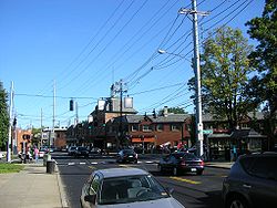 |
1500-1512 Bardstown Rd. 38°13′54"N 85°42′34"W |
The Highlands The Highlands (Louisville) The Highlands is an area of Louisville, Kentucky which contains a high density of nightclubs, eclectic businesses, and many upscale and fast food restaurants. It is centered along a three-mile stretch of Bardstown Road and Baxter Avenue and is so named because it sits atop a ridge between the... |
||
| 222 | Selema Hall | 2837 Riedling Dr. 38°15′42"N 85°41′32"W |
Butchertown/Clifton Clifton, Louisville Clifton, a neighborhood east of downtown Louisville, Kentucky USA. Clifton was named because of its hilly location on the Ohio River valley escarpment.... |
|||
| 223 | Shady Brook Farm | Avish Lane 38°19′6"N 85°38′22"W |
Harrods Creek Harrods Creek, Kentucky Harrods Creek is a neighborhood of Louisville, Kentucky centered near Harrods Creek at the intersection of River Road and Wolf Pen Branch Road. It is roughly bordered by the Ohio River to the west and US 42 to the east. Its Zip Code is 40027... |
|||
| 224 | Shelby Park Branch Library | 600 E. Oak St. 38°14′1"N 85°44′44"W |
Louisville Louisville, Kentucky Louisville is the largest city in the U.S. state of Kentucky, and the county seat of Jefferson County. Since 2003, the city's borders have been coterminous with those of the county because of a city-county merger. The city's population at the 2010 census was 741,096... |
|||
| 225 | Shwab House | 4812 Upper River Rd. 38°18′28"N 85°39′20"W |
Northeast Louisville Louisville, Kentucky Louisville is the largest city in the U.S. state of Kentucky, and the county seat of Jefferson County. Since 2003, the city's borders have been coterminous with those of the county because of a city-county merger. The city's population at the 2010 census was 741,096... |
|||
| 226 | Simeon Lewis Rural Historic District | 5215 Bardstown Rd. 38°10′19"N 85°36′26"W |
Louisville Louisville, Kentucky Louisville is the largest city in the U.S. state of Kentucky, and the county seat of Jefferson County. Since 2003, the city's borders have been coterminous with those of the county because of a city-county merger. The city's population at the 2010 census was 741,096... |
|||
| 227 | Smoketown Historic District Smoketown, Louisville Smoketown is a neighborhood one mile southeast of downtown Louisville, Kentucky. Smoketown has been a historically black neighborhood since the Civil War. It is the only neighborhood in the city that has had such a continuous presence.... |
Roughly bounded by Preston, Caldwell, and Jacob Sts., and the alley east of Shelby St. 38°14′27"N 85°44′38"W |
Butchertown/Clifton Clifton, Louisville Clifton, a neighborhood east of downtown Louisville, Kentucky USA. Clifton was named because of its hilly location on the Ohio River valley escarpment.... |
|||
| 228 | Snapp House | 8300 Bardstown Rd. 38°7′41"N 85°34′37"W |
Buechel Buechel, Kentucky Buechel is a former census-designated place in Jefferson County, Kentucky, United States. The population was 7,272 at the 2000 census. In 2003, The area was annexed to the city of Louisville due to a merger between the city and Jefferson County's unincorporated areas... |
|||
| 229 | Soldiers Retreat | Seaton Springs Parkway 38°14′9"N 85°34′45"W |
Lyndon Lyndon, Kentucky There were 4,520 households out of which 21.9% had children under the age of 18 living with them, 37.5% were married couples living together, 8.9% had a female householder with no husband present, and 50.3% were non-families. 40.1% of all households were made up of individuals and 7.4% had someone... |
|||
| 230 | South Louisville Reformed Church South Louisville Reformed Church South Louisville Reformed Church is a historic church at 1060 Lynnhurst Avenue in Louisville, Kentucky.It was built in 1908 and added to the National Register in 1983.... |
1060 Lynnhurst Ave. 38°10′41"N 85°46′54"W |
South End Louisville Louisville, Kentucky Louisville is the largest city in the U.S. state of Kentucky, and the county seat of Jefferson County. Since 2003, the city's borders have been coterminous with those of the county because of a city-county merger. The city's population at the 2010 census was 741,096... |
|||
| 231 | Southern Heights-Beechmont District | Roughly bounded by Southern Parkway, 6th St., Ashland, and Southern Heights Aves. 38°11′13"N 85°46′4"W |
South End Louisville Louisville, Kentucky Louisville is the largest city in the U.S. state of Kentucky, and the county seat of Jefferson County. Since 2003, the city's borders have been coterminous with those of the county because of a city-county merger. The city's population at the 2010 census was 741,096... |
|||
| 232 | Spring Station | 3241 Trinity Rd. 38°14′49"N 85°40′9"W |
Louisville Louisville, Kentucky Louisville is the largest city in the U.S. state of Kentucky, and the county seat of Jefferson County. Since 2003, the city's borders have been coterminous with those of the county because of a city-county merger. The city's population at the 2010 census was 741,096... |
|||
| 233 | Steam Engine Company No. 3 Historic Firehouses of Louisville The Historic Firehouses of Louisville was a Multiple Property Submission for the National Register of Historic Places. The submission represented seventeen historic fire stations, located in Louisville, Kentucky, and these were added to the National Register due to their historical and... |
802-804 E. Main St. 38°15′16"N 85°44′14"W |
Butchertown/Clifton Clifton, Louisville Clifton, a neighborhood east of downtown Louisville, Kentucky USA. Clifton was named because of its hilly location on the Ohio River valley escarpment.... |
|||
| 234 | Steam Engine Company No. 4 Historic Firehouses of Louisville The Historic Firehouses of Louisville was a Multiple Property Submission for the National Register of Historic Places. The submission represented seventeen historic fire stations, located in Louisville, Kentucky, and these were added to the National Register due to their historical and... |
1024 Logan St. 38°14′10"N 85°44′23"W |
Butchertown/Clifton Clifton, Louisville Clifton, a neighborhood east of downtown Louisville, Kentucky USA. Clifton was named because of its hilly location on the Ohio River valley escarpment.... |
|||
| 235 | Steam Engine Company No. 4 Historic Firehouses of Louisville The Historic Firehouses of Louisville was a Multiple Property Submission for the National Register of Historic Places. The submission represented seventeen historic fire stations, located in Louisville, Kentucky, and these were added to the National Register due to their historical and... |
1617 W. Main St. 38°15′33"N 85°46′39"W |
Louisville Louisville, Kentucky Louisville is the largest city in the U.S. state of Kentucky, and the county seat of Jefferson County. Since 2003, the city's borders have been coterminous with those of the county because of a city-county merger. The city's population at the 2010 census was 741,096... |
|||
| 236 | Steam Engine Company No. 7 Historic Firehouses of Louisville The Historic Firehouses of Louisville was a Multiple Property Submission for the National Register of Historic Places. The submission represented seventeen historic fire stations, located in Louisville, Kentucky, and these were added to the National Register due to their historical and... |
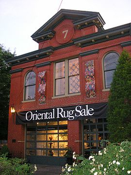 |
821 S. 6th St. 38°14′34"N 85°45′43"W |
Louisville Louisville, Kentucky Louisville is the largest city in the U.S. state of Kentucky, and the county seat of Jefferson County. Since 2003, the city's borders have been coterminous with those of the county because of a city-county merger. The city's population at the 2010 census was 741,096... |
||
| 237 | Steam Engine Company No. 10 Historic Firehouses of Louisville The Historic Firehouses of Louisville was a Multiple Property Submission for the National Register of Historic Places. The submission represented seventeen historic fire stations, located in Louisville, Kentucky, and these were added to the National Register due to their historical and... |
1419 E. Washington 38°14′46"N 85°43′38"W |
The Highlands The Highlands (Louisville) The Highlands is an area of Louisville, Kentucky which contains a high density of nightclubs, eclectic businesses, and many upscale and fast food restaurants. It is centered along a three-mile stretch of Bardstown Road and Baxter Avenue and is so named because it sits atop a ridge between the... |
|||
| 238 | Steam Engine Company No. 11 Historic Firehouses of Louisville The Historic Firehouses of Louisville was a Multiple Property Submission for the National Register of Historic Places. The submission represented seventeen historic fire stations, located in Louisville, Kentucky, and these were added to the National Register due to their historical and... |
1122 Rogers 38°15′29"N 85°43′36"W |
Louisville Louisville, Kentucky Louisville is the largest city in the U.S. state of Kentucky, and the county seat of Jefferson County. Since 2003, the city's borders have been coterminous with those of the county because of a city-county merger. The city's population at the 2010 census was 741,096... |
|||
| 239 | Steam Engine Company No. 18 Historic Firehouses of Louisville The Historic Firehouses of Louisville was a Multiple Property Submission for the National Register of Historic Places. The submission represented seventeen historic fire stations, located in Louisville, Kentucky, and these were added to the National Register due to their historical and... |
2600 S. 4th St. 38°13′33"N 85°45′54"W |
Louisville Louisville, Kentucky Louisville is the largest city in the U.S. state of Kentucky, and the county seat of Jefferson County. Since 2003, the city's borders have been coterminous with those of the county because of a city-county merger. The city's population at the 2010 census was 741,096... |
|||
| 240 | Steam Engine Company No. 20 Historic Firehouses of Louisville The Historic Firehouses of Louisville was a Multiple Property Submission for the National Register of Historic Places. The submission represented seventeen historic fire stations, located in Louisville, Kentucky, and these were added to the National Register due to their historical and... |
1735 Bardstown Rd. 38°12′41"N 85°45′52"W |
Louisville Louisville, Kentucky Louisville is the largest city in the U.S. state of Kentucky, and the county seat of Jefferson County. Since 2003, the city's borders have been coterminous with those of the county because of a city-county merger. The city's population at the 2010 census was 741,096... |
|||
| 241 | Steam Engine Company No. 20 Historic Firehouses of Louisville The Historic Firehouses of Louisville was a Multiple Property Submission for the National Register of Historic Places. The submission represented seventeen historic fire stations, located in Louisville, Kentucky, and these were added to the National Register due to their historical and... |
1330 Bardstown Rd. 38°13′48"N 85°45′1"W |
Louisville Louisville, Kentucky Louisville is the largest city in the U.S. state of Kentucky, and the county seat of Jefferson County. Since 2003, the city's borders have been coterminous with those of the county because of a city-county merger. The city's population at the 2010 census was 741,096... |
|||
| 242 | Steam Engine Company No. 22 Historic Firehouses of Louisville The Historic Firehouses of Louisville was a Multiple Property Submission for the National Register of Historic Places. The submission represented seventeen historic fire stations, located in Louisville, Kentucky, and these were added to the National Register due to their historical and... |
37th and Broadway 38°14′4"N 85°42′59"W |
The Highlands The Highlands (Louisville) The Highlands is an area of Louisville, Kentucky which contains a high density of nightclubs, eclectic businesses, and many upscale and fast food restaurants. It is centered along a three-mile stretch of Bardstown Road and Baxter Avenue and is so named because it sits atop a ridge between the... |
|||
| 243 | Stephen Foster Elementary School | 4020 Garland Ave. 38°14′53"N 85°49′8"W |
Louisville Louisville, Kentucky Louisville is the largest city in the U.S. state of Kentucky, and the county seat of Jefferson County. Since 2003, the city's borders have been coterminous with those of the county because of a city-county merger. The city's population at the 2010 census was 741,096... |
|||
| 244 | Arthur P. Stitzel House | 9707 Shelbyville Rd. 38°14′46"N 85°34′27"W |
Louisville Louisville, Kentucky Louisville is the largest city in the U.S. state of Kentucky, and the county seat of Jefferson County. Since 2003, the city's borders have been coterminous with those of the county because of a city-county merger. The city's population at the 2010 census was 741,096... |
|||
| 245 | Zodia Stivers House | Fern Creek 38°11′44"N 85°37′12"W |
Buechel Buechel, Kentucky Buechel is a former census-designated place in Jefferson County, Kentucky, United States. The population was 7,272 at the 2000 census. In 2003, The area was annexed to the city of Louisville due to a merger between the city and Jefferson County's unincorporated areas... |
|||
| 246 | Ben Stout House | 8630 Stout Rd. 38°7′16"N 85°32′12"W |
Jeffersontown Jeffersontown, Kentucky Jeffersontown is a city in Jefferson County, Kentucky, United States. Before Louisville and Jefferson County were consolidated in 2003, it was the county's largest city outside of Louisville. The population was 26,633 at the 2000 census.- History :... |
|||
| 247 | Struss House | 1920 Winston Ave. 38°12′52"N 85°40′47"W |
Louisville Louisville, Kentucky Louisville is the largest city in the U.S. state of Kentucky, and the county seat of Jefferson County. Since 2003, the city's borders have been coterminous with those of the county because of a city-county merger. The city's population at the 2010 census was 741,096... |
|||
| 248 | Stuart Building | 601 W. Oak St. 38°14′7"N 85°45′50"W |
Louisville Louisville, Kentucky Louisville is the largest city in the U.S. state of Kentucky, and the county seat of Jefferson County. Since 2003, the city's borders have been coterminous with those of the county because of a city-county merger. The city's population at the 2010 census was 741,096... |
|||
| 249 | Stucky House | 3504 Marlin Dr. 38°11′27"N 85°34′34"W |
Jeffersontown Jeffersontown, Kentucky Jeffersontown is a city in Jefferson County, Kentucky, United States. Before Louisville and Jefferson County were consolidated in 2003, it was the county's largest city outside of Louisville. The population was 26,633 at the 2000 census.- History :... |
|||
| 250 | Sunnyside | 3020 Poppy Way 38°14′51"N 85°40′43"W |
Butchertown/Clifton Clifton, Louisville Clifton, a neighborhood east of downtown Louisville, Kentucky USA. Clifton was named because of its hilly location on the Ohio River valley escarpment.... |
|||
| 251 | Taggart House | 5000 Bardstown Rd. 38°10′29"N 85°37′6"W |
Buechel Buechel, Kentucky Buechel is a former census-designated place in Jefferson County, Kentucky, United States. The population was 7,272 at the 2000 census. In 2003, The area was annexed to the city of Louisville due to a merger between the city and Jefferson County's unincorporated areas... |
|||
| 252 | Zachary Taylor House Zachary Taylor House The Zachary Taylor House, also known as Springfield, was the boyhood home of the twelfth President of the United States, Zachary Taylor. Located in Louisville, Kentucky, Taylor lived there from 1790 to 1808, held his marriage there in 1810, and returned there periodically the rest of his... |
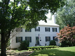 |
5608 Apache Rd. 38°16′45"N 85°38′50"W |
Northeast Louisville Louisville, Kentucky Louisville is the largest city in the U.S. state of Kentucky, and the county seat of Jefferson County. Since 2003, the city's borders have been coterminous with those of the county because of a city-county merger. The city's population at the 2010 census was 741,096... |
||
| 253 | Zachary Taylor National Cemetery Zachary Taylor National Cemetery Zachary Taylor National Cemetery, located at 4701 Brownsboro Road , in northeast Louisville, Kentucky is a national cemetery where former President of the United States Zachary Taylor and his first lady Margaret Taylor are buried. Zachary Taylor National Cemetery was listed in the National... |
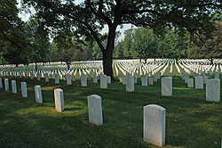 |
4701 Brownsboro Rd. 38°16′39"N 85°38′21"W |
St. Matthews St. Matthews, Kentucky St. Matthews is the 20th largest city in Kentucky, United States and is a prominent suburb of Louisville. It is located 8 miles east of downtown Louisville in Jefferson County. It is one of the state's major shopping areas, being home to second and fifth largest malls in Kentucky St. Matthews is... |
||
| 254 | Three Mile Tollhouse | 2311 Frankfort Ave. 38°15′13"N 85°42′9"W |
Butchertown/Clifton Clifton, Louisville Clifton, a neighborhood east of downtown Louisville, Kentucky USA. Clifton was named because of its hilly location on the Ohio River valley escarpment.... |
|||
| 255 | F.M. Tiller House | 4309 W. Broadway 38°15′28"N 85°50′0"W |
Louisville Louisville, Kentucky Louisville is the largest city in the U.S. state of Kentucky, and the county seat of Jefferson County. Since 2003, the city's borders have been coterminous with those of the county because of a city-county merger. The city's population at the 2010 census was 741,096... |
|||
| 256 | George H. Tingley Elementary School | 1311-1317 S. Preston St. 38°13′49"N 85°44′59"W |
Louisville Louisville, Kentucky Louisville is the largest city in the U.S. state of Kentucky, and the county seat of Jefferson County. Since 2003, the city's borders have been coterminous with those of the county because of a city-county merger. The city's population at the 2010 census was 741,096... |
|||
| 257 | Tompkins-Buchanan House | 851 S. 4th St. 38°14′32"N 85°45′31"W |
Louisville Louisville, Kentucky Louisville is the largest city in the U.S. state of Kentucky, and the county seat of Jefferson County. Since 2003, the city's borders have been coterminous with those of the county because of a city-county merger. The city's population at the 2010 census was 741,096... |
|||
| 258 | James Trigg House | Covered Bridge Rd. 38°21′12"N 85°36′41"W |
Prospect Prospect, Kentucky Prospect is a city in far northeastern Jefferson and southwestern Oldham Counties in the U.S. state of Kentucky, along the Ohio River. The city is a suburb of Louisville, Kentucky. It's one of few cities in Jefferson County that extend into another county. The population was 4,657 at the 2000... |
|||
| 259 | Hazael Tucker House | 2406 Tucker Station Rd. 38°12′21"N 85°33′1"W |
Jeffersontown Jeffersontown, Kentucky Jeffersontown is a city in Jefferson County, Kentucky, United States. Before Louisville and Jefferson County were consolidated in 2003, it was the county's largest city outside of Louisville. The population was 26,633 at the 2000 census.- History :... |
|||
| 260 | Tway House | 1021 Watterson Trail 38°13′54"N 85°33′58"W |
Jeffersontown Jeffersontown, Kentucky Jeffersontown is a city in Jefferson County, Kentucky, United States. Before Louisville and Jefferson County were consolidated in 2003, it was the county's largest city outside of Louisville. The population was 26,633 at the 2000 census.- History :... |
|||
| 261 | Tyler Settlement Rural Historic District | Roughly bounded by the Southern railroad line, Taylorsville Rd., and Jeffersontown City 38°11′37"N 85°31′47"W |
Jeffersontown Jeffersontown, Kentucky Jeffersontown is a city in Jefferson County, Kentucky, United States. Before Louisville and Jefferson County were consolidated in 2003, it was the county's largest city outside of Louisville. The population was 26,633 at the 2000 census.- History :... |
|||
| 262 | Moses Tyler House | 3200 Tucker Station Rd. 38°11′45"N 85°32′2"W |
Jeffersontown Jeffersontown, Kentucky Jeffersontown is a city in Jefferson County, Kentucky, United States. Before Louisville and Jefferson County were consolidated in 2003, it was the county's largest city outside of Louisville. The population was 26,633 at the 2000 census.- History :... |
|||
| 263 | Robert Tylor Place | 12603 Taylorsville Rd. 38°11′28"N 85°31′14"W |
Jeffersontown Jeffersontown, Kentucky Jeffersontown is a city in Jefferson County, Kentucky, United States. Before Louisville and Jefferson County were consolidated in 2003, it was the county's largest city outside of Louisville. The population was 26,633 at the 2000 census.- History :... |
|||
| 264 | Union Monument in Louisville Union Monument in Louisville The Union Monument in Louisville is located in Cave Hill Cemetery in Louisville, Kentucky. It was built in 1914 from granite, honoring unknown soldiers who fought in the Union during the American Civil War... |
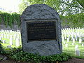 |
Cave Hill Cemetery, junction of Payne St. and Lexington Rd. 38°14′54"N 85°43′20"W |
The Highlands The Highlands (Louisville) The Highlands is an area of Louisville, Kentucky which contains a high density of nightclubs, eclectic businesses, and many upscale and fast food restaurants. It is centered along a three-mile stretch of Bardstown Road and Baxter Avenue and is so named because it sits atop a ridge between the... |
||
| 265 | Universal Car Company | 2500 W. Broadway 38°14′57"N 85°47′38"W |
Louisville Louisville, Kentucky Louisville is the largest city in the U.S. state of Kentucky, and the county seat of Jefferson County. Since 2003, the city's borders have been coterminous with those of the county because of a city-county merger. The city's population at the 2010 census was 741,096... |
|||
| 266 | University of Louisville Belknap Campus University of Louisville The University of Louisville is a public university in Louisville, Kentucky. When founded in 1798, it was the first city-owned public university in the United States and one of the first universities chartered west of the Allegheny Mountains. The university is mandated by the Kentucky General... |
.jpg) |
2301 S. 3rd St. 38°12′56"N 85°45′38"W |
Louisville Louisville, Kentucky Louisville is the largest city in the U.S. state of Kentucky, and the county seat of Jefferson County. Since 2003, the city's borders have been coterminous with those of the county because of a city-county merger. The city's population at the 2010 census was 741,096... |
||
| 267 | Ursuline Academy and Convent | 800 E. Chestnut St. 38°14′48"N 85°44′20"W |
Butchertown/Clifton Clifton, Louisville Clifton, a neighborhood east of downtown Louisville, Kentucky USA. Clifton was named because of its hilly location on the Ohio River valley escarpment.... |
|||
| 268 | Virginia Avenue Colored School | 3628 Virginia Ave. 38°14′18"N 85°48′53"W |
Louisville Louisville, Kentucky Louisville is the largest city in the U.S. state of Kentucky, and the county seat of Jefferson County. Since 2003, the city's borders have been coterminous with those of the county because of a city-county merger. The city's population at the 2010 census was 741,096... |
|||
| 269 | Von Allmen Dairy Farm House Von Allmen Dairy Farm House The Von Allmen Dairy Farm House in Louisville, Kentucky was placed on the National Register of Historic Places on December 11, 2007. Built in 1912, it was owned by Emil Von Allmen, a Louisville dairy leader... |
5050 Norton Healthcare Boulevard 38°18′47"N 85°34′28"W |
Louisville Louisville, Kentucky Louisville is the largest city in the U.S. state of Kentucky, and the county seat of Jefferson County. Since 2003, the city's borders have been coterminous with those of the county because of a city-county merger. The city's population at the 2010 census was 741,096... |
|||
| 270 | Waverly Hills Tuberculosis Sanitarium Historic Buildings Waverly Hills Sanatorium The Waverly Hills Sanatorium is a closed sanatorium located in southwestern Louisville/Jefferson County, Kentucky. It opened in 1910 as a two-story hospital to accommodate 40 to 50 tuberculosis patients. In the early 1900s, Jefferson County was ravaged by an outbreak of tuberculosis which prompted... |
8101 Dixie Highway 38°7′53"N 85°50′28"W |
Louisville Louisville, Kentucky Louisville is the largest city in the U.S. state of Kentucky, and the county seat of Jefferson County. Since 2003, the city's borders have been coterminous with those of the county because of a city-county merger. The city's population at the 2010 census was 741,096... |
|||
| 271 | Western Junior High School | 22nd and Main Sts. 38°15′38"N 85°47′13"W |
Louisville Louisville, Kentucky Louisville is the largest city in the U.S. state of Kentucky, and the county seat of Jefferson County. Since 2003, the city's borders have been coterminous with those of the county because of a city-county merger. The city's population at the 2010 census was 741,096... |
|||
| 272 | Westwood Farm | 7800 Six Mile Lane 38°11′48"N 85°36′4"W |
Jeffersontown Jeffersontown, Kentucky Jeffersontown is a city in Jefferson County, Kentucky, United States. Before Louisville and Jefferson County were consolidated in 2003, it was the county's largest city outside of Louisville. The population was 26,633 at the 2000 census.- History :... |
|||
| 273 | Widman's Saloon and Grocery | 2317-19 Frankfort Ave. 38°15′13"N 85°42′9"W |
Butchertown/Clifton Clifton, Louisville Clifton, a neighborhood east of downtown Louisville, Kentucky USA. Clifton was named because of its hilly location on the Ohio River valley escarpment.... |
|||
| 274 | Wilhoyte House | Covered Bridge Rd. 38°21′20"N 85°35′50"W |
Prospect Prospect, Kentucky Prospect is a city in far northeastern Jefferson and southwestern Oldham Counties in the U.S. state of Kentucky, along the Ohio River. The city is a suburb of Louisville, Kentucky. It's one of few cities in Jefferson County that extend into another county. The population was 4,657 at the 2000... |
|||
| 275 | Abraham L. Williams L & N Guest House | Murphy Lane 38°16′11"N 85°31′44"W |
Lyndon Lyndon, Kentucky There were 4,520 households out of which 21.9% had children under the age of 18 living with them, 37.5% were married couples living together, 8.9% had a female householder with no husband present, and 50.3% were non-families. 40.1% of all households were made up of individuals and 7.4% had someone... |
|||
| 276 | David Wilson House | 2215 Carolina Ave. 38°13′45"N 85°41′1"W |
The Highlands The Highlands (Louisville) The Highlands is an area of Louisville, Kentucky which contains a high density of nightclubs, eclectic businesses, and many upscale and fast food restaurants. It is centered along a three-mile stretch of Bardstown Road and Baxter Avenue and is so named because it sits atop a ridge between the... |
|||
| 277 | Winchester House | 613 Breckinridge Lane 38°14′37"N 85°38′43"W |
Louisville Louisville, Kentucky Louisville is the largest city in the U.S. state of Kentucky, and the county seat of Jefferson County. Since 2003, the city's borders have been coterminous with those of the county because of a city-county merger. The city's population at the 2010 census was 741,096... |
|||
| 278 | Winkworth Boxhill (Louisville) Boxhill, also called Winkworth, is a Georgian Revival house in Glenview, Kentucky, a small city east of Louisville, Kentucky. It was built in 1906 or 1910 and added to the National Register of Historic Places in 1983.... |
3200 Boxhill Lane 38°18′5"N 85°39′28"W |
Northeast Louisville Louisville, Kentucky Louisville is the largest city in the U.S. state of Kentucky, and the county seat of Jefferson County. Since 2003, the city's borders have been coterminous with those of the county because of a city-county merger. The city's population at the 2010 census was 741,096... |
|||
| 279 | Wirth, Lang and Company-The Louisville Leather Company Tannery Building | 711-715 Brent St. 38°14′35"N 85°44′6"W |
Louisville Louisville, Kentucky Louisville is the largest city in the U.S. state of Kentucky, and the county seat of Jefferson County. Since 2003, the city's borders have been coterminous with those of the county because of a city-county merger. The city's population at the 2010 census was 741,096... |
|||
| 280 | Wolf Pen Branch Mill | East of Harrods Creek on Wolf Pen Branch Rd. 38°19′48"N 85°35′47"W |
Harrods Creek Harrods Creek, Kentucky Harrods Creek is a neighborhood of Louisville, Kentucky centered near Harrods Creek at the intersection of River Road and Wolf Pen Branch Road. It is roughly bordered by the Ohio River to the west and US 42 to the east. Its Zip Code is 40027... |
|||
| 281 | Woodbourne House | 2024 Woodford Pl. 38°13′33"N 85°41′38"W |
The Highlands The Highlands (Louisville) The Highlands is an area of Louisville, Kentucky which contains a high density of nightclubs, eclectic businesses, and many upscale and fast food restaurants. It is centered along a three-mile stretch of Bardstown Road and Baxter Avenue and is so named because it sits atop a ridge between the... |
|||
| 282 | Woodside/John T. Bate House | 3100 Woodside Rd. 38°17′39"N 85°38′53"W |
Northeast Louisville Louisville, Kentucky Louisville is the largest city in the U.S. state of Kentucky, and the county seat of Jefferson County. Since 2003, the city's borders have been coterminous with those of the county because of a city-county merger. The city's population at the 2010 census was 741,096... |
|||
| 283 | Wrampelmeier Furniture Company | 226-228 N. 15th St. 38°15′41"N 85°47′50"W |
Louisville Louisville, Kentucky Louisville is the largest city in the U.S. state of Kentucky, and the county seat of Jefferson County. Since 2003, the city's borders have been coterminous with those of the county because of a city-county merger. The city's population at the 2010 census was 741,096... |
|||
| 284 | George B. Yenowine House | 1021 Watterson Trail 38°13′41"N 85°32′53"W |
Middletown Middletown, Kentucky The median income for a household in the city was $53,608, and the median income for a family was $61,667. Males had a median income of $45,417 versus $33,135 for females. The per capita income for the city was $26,660... |
|||
| 285 | Yenowine-Kennedy House | 4420 Taylorsville Rd. 38°13′5"N 85°36′12"W |
Jeffersontown Jeffersontown, Kentucky Jeffersontown is a city in Jefferson County, Kentucky, United States. Before Louisville and Jefferson County were consolidated in 2003, it was the county's largest city outside of Louisville. The population was 26,633 at the 2000 census.- History :... |
Former listings
| Landmark name | Image | Date removed | Location | City or Town | Summary | |
|---|---|---|---|---|---|---|
| 1 | August Bloedner Monument 32nd Indiana Monument The 32nd Indiana Monument, also known as the August Bloedner Monument, is located in Cave Hill National Cemetery in Louisville, Kentucky. It honors the fallen soldiers of the 32nd Indiana Volunteer Infantry Regiment, also known as the "1st German," at the Battle of Rowlett's Station, near... |
Cave Hill Cemetery, junction of Payne St. and Lexington Rd. 38°14′54"N 85°43′19"W |
The Highlands The Highlands (Louisville) The Highlands is an area of Louisville, Kentucky which contains a high density of nightclubs, eclectic businesses, and many upscale and fast food restaurants. It is centered along a three-mile stretch of Bardstown Road and Baxter Avenue and is so named because it sits atop a ridge between the... |
Listed July 17, 1997 |