

List of Interstate Highways in Illinois
Encyclopedia
This is a list of Interstate Highways in Illinois, all of which are owned and maintained by the U.S. state
of Illinois
. The Illinois Department of Transportation
(IDOT) is responsible for maintaining the Interstate Highways
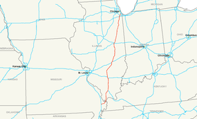
in Illinois. The Interstate Highway System in Illinois consists of twelve primary highways and eleven auxiliary highways which cover 2169.53 miles (3,491.5 km). The Interstate Highway with the longest section in Illinois is Interstate 57
at 358.57 miles (577.1 km); the shortest Interstate Highway in Illinois is Interstate 190
at 3.07 miles (4.9 km).
U.S. state
A U.S. state is any one of the 50 federated states of the United States of America that share sovereignty with the federal government. Because of this shared sovereignty, an American is a citizen both of the federal entity and of his or her state of domicile. Four states use the official title of...
of Illinois
Illinois
Illinois is the fifth-most populous state of the United States of America, and is often noted for being a microcosm of the entire country. With Chicago in the northeast, small industrial cities and great agricultural productivity in central and northern Illinois, and natural resources like coal,...
. The Illinois Department of Transportation
Illinois Department of Transportation
The Illinois Department of Transportation is a state agency in charge of state-maintained public roadways of the U.S. state of Illinois. In addition, IDOT provides funding for rail, public transit and airport projects and administers fuel tax and federal funding to local juridictions in the...
(IDOT) is responsible for maintaining the Interstate Highways
Interstate Highway System
The Dwight D. Eisenhower National System of Interstate and Defense Highways, , is a network of limited-access roads including freeways, highways, and expressways forming part of the National Highway System of the United States of America...
in Illinois. The Interstate Highway System in Illinois consists of twelve primary highways and eleven auxiliary highways which cover 2169.53 miles (3,491.5 km). The Interstate Highway with the longest section in Illinois is Interstate 57
Interstate 57
Interstate 57 is an Interstate Highway in Missouri and Illinois that parallels the old Illinois Central rail line for much of its route. It goes from Miner, Missouri, at Interstate 55 to Chicago, Illinois, at Interstate 94. I-57 essentially serves as a shortcut route for travelers headed between...
at 358.57 miles (577.1 km); the shortest Interstate Highway in Illinois is Interstate 190
Interstate 190 (Illinois)
Interstate 190 is an intrastate Interstate Highway in the U.S. state of Illinois. I-190 runs west from I-90 to O'Hare International Airport. This is a distance of . Interstate 190 is the westernmost leg of the Kennedy Expressway...
at 3.07 miles (4.9 km).
Primary Interstate Highways
| Highway | Location | Length | Description | Date established | Notes | Map |
|---|---|---|---|---|---|---|
 I-24 I-24Interstate 24 in Illinois In the U.S. state of Illinois, Interstate 24 is a remote, four-lane freeway that travels through hilly rural southern Illinois and the Shawnee National Forest. I-24 is in length in Illinois. There are only five mainline exits; of those five, four have services... |
Williamson Williamson County, Illinois -2010:Whereas according to the 2010 U.S. Census Bureau:*92.7% White*3.8% Black*0.4% Native American*0.8% Asian*0.0% Native Hawaiian or Pacific Islander*1.7% Two or more races*0.4% Other races*2.0% Hispanic or Latino -2000:... , Johnson, and Massac counties |
I-24 runs from I-57 Interstate 57 Interstate 57 is an Interstate Highway in Missouri and Illinois that parallels the old Illinois Central rail line for much of its route. It goes from Miner, Missouri, at Interstate 55 to Chicago, Illinois, at Interstate 94. I-57 essentially serves as a shortcut route for travelers headed between... in rural Williamson County east to the Kentucky Kentucky The Commonwealth of Kentucky is a state located in the East Central United States of America. As classified by the United States Census Bureau, Kentucky is a Southern state, more specifically in the East South Central region. Kentucky is one of four U.S. states constituted as a commonwealth... border in Metropolis Metropolis, Illinois Metropolis is a city located along the Ohio River in Massac County, Illinois, in the United States. As of the 2000 census, the city population was 6,482... . |
||||
 I-39 I-39 |
McLean McLean County, Illinois McLean County is a county in the U.S. state of Illinois. McLean County is included in the Bloomington–Normal, Illinois Metropolitan Statistical Area. According to the 2010 census, it has a population of 169,572, which is an increase of 12.7% from 150,433 in 2000. Its county seat is... , Woodford, Marshall Marshall County, Illinois The median income for a household in the county was $41,576, and the median income for a family was $48,061. Males had a median income of $35,765 versus $21,452 for females. The per capita income for the county was $19,065... , LaSalle, Lee, Ogle Ogle County, Illinois Ogle County is a county located in the U.S. state of Illinois. According to the 2010 census, it has a population of 53,497, which is an increase of 4.8% from 51,032 in 2000. Its county seat is Oregon, and its largest city is Rochelle... , and Winnebago Winnebago County, Illinois Winnebago County is a county located in the U.S. state of Illinois. According to the 2010 census, it has a population of 295,266, which is an increase of 6.1% from 278,418 in 2000... counties |
I-39 runs from I-55 Interstate 55 in Illinois In the U.S. state of Illinois, Interstate 55 is a major north–south Interstate Highway that connects the St. Louis, Missouri and Chicago metropolitan areas. It runs from the Poplar Street Bridge in East St. Louis to U.S. Route 41 near downtown Chicago... in Normal Normal, Illinois Normal is an incorporated town in McLean County, Illinois, United States. It had a population of 52,497 as of the 2010 census. Normal is the smaller of two principal municipalities of the Bloomington-Normal metropolitan area... to the Wisconsin Wisconsin Wisconsin is a U.S. state located in the north-central United States and is part of the Midwest. It is bordered by Minnesota to the west, Iowa to the southwest, Illinois to the south, Lake Michigan to the east, Michigan to the northeast, and Lake Superior to the north. Wisconsin's capital is... border in South Beloit South Beloit, Illinois South Beloit is a city located in Winnebago County, Illinois, United States. It is part of the Rockford, Illinois Metropolitan Statistical Area... . |
1989 | _map.png) |
||
 I-55 I-55Interstate 55 in Illinois In the U.S. state of Illinois, Interstate 55 is a major north–south Interstate Highway that connects the St. Louis, Missouri and Chicago metropolitan areas. It runs from the Poplar Street Bridge in East St. Louis to U.S. Route 41 near downtown Chicago... |
St. Clair St. Clair County, Illinois St. Clair County is a county located in the U.S. state of Illinois. In 1970, the U.S. Census Bureau placed the mean center of U.S. population in St. Clair County. According to the 2010 census, it has a population of 270,056, which is an increase of 5.5% from 256,082 in 2000. Its county seat is... , Madison Madison County, Illinois Madison County is a county located in the U.S. state of Illinois. Madison County is part of the Metro-East region of the St. Louis Metro Area. According to the 2010 census, it has a population of 269,282, which is an increase of 4.0% from 258,941 in 2000. The county seat is Edwardsville, home to... , Macoupin Macoupin County, Illinois Macoupin County is a county located in the southwestern portion of the U.S. state of Illinois. According to the 2010 census, it has a population of 47,765, which is a decrease of 2.6% from 49,019 in 2000. The county seat is Carlinville. Macoupin County is an outlying county of the Metro-East region... , Montgomery, Sangamon Sangamon County, Illinois Sangamon County is a county located in the U.S. state of Illinois. According to the 2010 census, it has a population of 197,465, which is an increase of 4.5% from 188,951 in 2000... , Logan Logan County, Illinois Logan County is a county located in the U.S. state of Illinois. According to the 2010 census, it has a population of 30,305, which is a decrease of 2.8% from 31,183 in 2000... , McLean McLean County, Illinois McLean County is a county in the U.S. state of Illinois. McLean County is included in the Bloomington–Normal, Illinois Metropolitan Statistical Area. According to the 2010 census, it has a population of 169,572, which is an increase of 12.7% from 150,433 in 2000. Its county seat is... , Livingston Livingston County, Illinois Livingston County is a county located in the U.S. state of Illinois. According to the 2010 census, it has a population of 38,950, which is a decrease of 1.8% from 39,678 in 2000. Its county seat is Pontiac.... , Grundy, Will Will County, Illinois As of the census of 2000, there were 502,266 people, 167,542 households, and 131,017 families residing in the county. The population density was 600 people per square mile . There were 175,524 housing units at an average density of 210 per square mile... , DuPage DuPage County, Illinois As of the 2010 Census, the population of the county was 916,924, White Americans made up 77.9% of Dupage County's population; non-Hispanic whites represented 70.5% of the population. Black Americans made up 4.6% of the population. Native Americans made up 0.3% of Dupage County's population... , and Cook Cook County, Illinois Cook County is a county in the U.S. state of Illinois, with its county seat in Chicago. It is the second most populous county in the United States after Los Angeles County. The county has 5,194,675 residents, which is 40.5 percent of all Illinois residents. Cook County's population is larger than... counties |
I-55 runs from the Missouri Missouri Missouri is a US state located in the Midwestern United States, bordered by Iowa, Illinois, Kentucky, Tennessee, Arkansas, Oklahoma, Kansas and Nebraska. With a 2010 population of 5,988,927, Missouri is the 18th most populous state in the nation and the fifth most populous in the Midwest. It... border in East St. Louis East St. Louis, Illinois East St. Louis is a city located in St. Clair County, Illinois, USA, directly across the Mississippi River from St. Louis, Missouri in the Metro-East region of Southern Illinois. As of the 2010 census, the city had a total population of 27,006, less than one-third of its peak of 82,366 in 1950... to US 41 U.S. Route 41 in Illinois In the U.S. state of Illinois, U.S. Route 41 runs north from the Indiana border beneath the Chicago Skyway on Indianapolis Boulevard to the Wisconsin border north of the northern terminus of the Tri-State Tollway with Interstate 94. It is the only north–south U.S... in Chicago Chicago Chicago is the largest city in the US state of Illinois. With nearly 2.7 million residents, it is the most populous city in the Midwestern United States and the third most populous in the US, after New York City and Los Angeles... . |
||||
 I-57 I-57 |
Alexander Alexander County, Illinois Alexander County is a county located in the U.S. state of Illinois. According to the 2010 census, it has a population of 8,238, which is a decrease of 14.1% from 9,590 in 2000. Its county seat is Cairo. Alexander County is part of the Cape Girardeau–Jackson, MO-IL Metropolitan Statistical... , Pulaski, Union, Johnson, Williamson Williamson County, Illinois -2010:Whereas according to the 2010 U.S. Census Bureau:*92.7% White*3.8% Black*0.4% Native American*0.8% Asian*0.0% Native Hawaiian or Pacific Islander*1.7% Two or more races*0.4% Other races*2.0% Hispanic or Latino -2000:... , Franklin Franklin County, Illinois Franklin County is a county located in the U.S. state of Illinois. According to the 2010 census, it has a population of 39,561, which is an increase of 1.4% from 39,018 in 2000. Its county seat is Benton.-History:... , Jefferson Jefferson County, Illinois Jefferson County is a county located in the southern part of the U.S. state of Illinois. According to the 2010 census, it has a population of 38,827, which is a decrease of 3.0% from 40,045 in 2000... , Marion, Fayette Fayette County, Illinois Fayette County is a county located in the U.S. state of Illinois. According to the 2010 census, it has a population of 22,140, which is an increase of 1.6% from 21,802 in 2000. Its county seat is Vandalia... , Effingham, Cumberland, Coles Coles County, Illinois Coles County is a county located in the U.S. state of Illinois. According to the 2010 census, it has a population of 53,873, which is an increase of 1.3% from 53,196 in 2000. Its county seat is Charleston, which is also the home of Eastern Illinois University.... , Douglas, Champaign Champaign County, Illinois Champaign County is a county located in the U.S. state of Illinois. According to the 2010 census, it has a population of 201,081, which is an increase of 11.9% from 179,669 in 2000.. It is the 10th most populous county in Illinois... , Ford, Iroquois Iroquois County, Illinois Iroquois County is a county located in the northeast part of the U.S. state of Illinois along the border with Indiana. It is the third largest county in the state in terms of area, covering over . According to the 2010 census, it has a population of 29,718, which is a decrease of 5.2% from 31,334... , Kankakee Kankakee County, Illinois Kankakee County is a county located in the U.S. state of Illinois. According to the 2010 census, it has a population of 113,449, which is an increase of 9.3% from 103,833 in 2000. Its county seat is Kankakee.... , Will Will County, Illinois As of the census of 2000, there were 502,266 people, 167,542 households, and 131,017 families residing in the county. The population density was 600 people per square mile . There were 175,524 housing units at an average density of 210 per square mile... , and Cook Cook County, Illinois Cook County is a county in the U.S. state of Illinois, with its county seat in Chicago. It is the second most populous county in the United States after Los Angeles County. The county has 5,194,675 residents, which is 40.5 percent of all Illinois residents. Cook County's population is larger than... counties |
I-57 runs from the Missouri Missouri Missouri is a US state located in the Midwestern United States, bordered by Iowa, Illinois, Kentucky, Tennessee, Arkansas, Oklahoma, Kansas and Nebraska. With a 2010 population of 5,988,927, Missouri is the 18th most populous state in the nation and the fifth most populous in the Midwest. It... border near Cairo Cairo, Illinois Cairo is the southernmost city in the U.S. state of Illinois. It is the county seat of Alexander County. Cairo is located at the confluence of the Mississippi and Ohio rivers. The rivers converge at Fort Defiance State Park, an American Civil War fort that was commanded by General Ulysses S. Grant... to I-94 Interstate 94 in Illinois In the U.S. state of Illinois, Interstate 94 generally runs north–south through the northeastern portion of the state, in Lake and Cook Counties. It is marked east–west in Illinois in accordance with its general alignment across the country, although some entrances on the Tri-State... in southern Chicago Chicago Chicago is the largest city in the US state of Illinois. With nearly 2.7 million residents, it is the most populous city in the Midwestern United States and the third most populous in the US, after New York City and Los Angeles... . |
 |
|||
 I-64 I-64 |
St. Clair St. Clair County, Illinois St. Clair County is a county located in the U.S. state of Illinois. In 1970, the U.S. Census Bureau placed the mean center of U.S. population in St. Clair County. According to the 2010 census, it has a population of 270,056, which is an increase of 5.5% from 256,082 in 2000. Its county seat is... , Clinton Clinton County, Illinois -Demographics: As of the census of 2000, there were 35,535 people, 12,754 households, and 9,221 families residing in the county. The population density was 75 people per square mile . There were 13,805 housing units at an average density of 29 per square mile... , Washington Washington County, Illinois Washington County is a county located in the U.S. state of Illinois. According to the 2010 census, it has a population of 14,716, which is a decrease of 2.9% from 15,148 in 2000. Its county seat is Nashville.-Geography:... , Jefferson Jefferson County, Illinois Jefferson County is a county located in the southern part of the U.S. state of Illinois. According to the 2010 census, it has a population of 38,827, which is a decrease of 3.0% from 40,045 in 2000... , Wayne, White White County, Illinois White County is a county located in the U.S. state of Illinois. According to the 2010 census, it has a population of 14,665, which is a decrease of 4.6% from 15,371 in 2000... |
I-64 runs from the Missouri Missouri Missouri is a US state located in the Midwestern United States, bordered by Iowa, Illinois, Kentucky, Tennessee, Arkansas, Oklahoma, Kansas and Nebraska. With a 2010 population of 5,988,927, Missouri is the 18th most populous state in the nation and the fifth most populous in the Midwest. It... state line in East St. Louis East St. Louis, Illinois East St. Louis is a city located in St. Clair County, Illinois, USA, directly across the Mississippi River from St. Louis, Missouri in the Metro-East region of Southern Illinois. As of the 2010 census, the city had a total population of 27,006, less than one-third of its peak of 82,366 in 1950... to the Indiana Indiana Indiana is a US state, admitted to the United States as the 19th on December 11, 1816. It is located in the Midwestern United States and Great Lakes Region. With 6,483,802 residents, the state is ranked 15th in population and 16th in population density. Indiana is ranked 38th in land area and is... state line in Grayville Grayville, Illinois Grayville is a city in Edwards and White counties in Illinois. The population was 1,725 at the 2000 census. Grayville is the birthplace of naval hero James Meredith Helm.-Geography:Grayville is located at .... . |
||||
 I-70 I-70Interstate 70 in Illinois Interstate 70 is a part of the Interstate Highway System that runs from Cove Fort, Utah to Baltimore, Maryland. In the U.S. state of Illinois, the Interstate highway runs from the Missouri state line at the Mississippi River in East St. Louis east to the Indiana state line near Marshall... |
St. Clair St. Clair County, Illinois St. Clair County is a county located in the U.S. state of Illinois. In 1970, the U.S. Census Bureau placed the mean center of U.S. population in St. Clair County. According to the 2010 census, it has a population of 270,056, which is an increase of 5.5% from 256,082 in 2000. Its county seat is... , Madison Madison County, Illinois Madison County is a county located in the U.S. state of Illinois. Madison County is part of the Metro-East region of the St. Louis Metro Area. According to the 2010 census, it has a population of 269,282, which is an increase of 4.0% from 258,941 in 2000. The county seat is Edwardsville, home to... , Bond Bond County, Illinois Bond County is a county located in the U.S. state of Illinois. It is part of the St. Louis Metro Area. According to the 2010 census, it has a population of 17,768, which is an increase of 0.8% from 17,633 in 2000. Its county seat is Greenville, Illinois.... , Fayette Fayette County, Illinois Fayette County is a county located in the U.S. state of Illinois. According to the 2010 census, it has a population of 22,140, which is an increase of 1.6% from 21,802 in 2000. Its county seat is Vandalia... , Effingham, Cumberland, and Clark counties |
I-70 runs from the Missouri Missouri Missouri is a US state located in the Midwestern United States, bordered by Iowa, Illinois, Kentucky, Tennessee, Arkansas, Oklahoma, Kansas and Nebraska. With a 2010 population of 5,988,927, Missouri is the 18th most populous state in the nation and the fifth most populous in the Midwest. It... state line in East St. Louis East St. Louis, Illinois East St. Louis is a city located in St. Clair County, Illinois, USA, directly across the Mississippi River from St. Louis, Missouri in the Metro-East region of Southern Illinois. As of the 2010 census, the city had a total population of 27,006, less than one-third of its peak of 82,366 in 1950... to the Indiana Indiana Indiana is a US state, admitted to the United States as the 19th on December 11, 1816. It is located in the Midwestern United States and Great Lakes Region. With 6,483,802 residents, the state is ranked 15th in population and 16th in population density. Indiana is ranked 38th in land area and is... state line in Clark County. |
||||
 I-72 I-72 |
Pike Pike County, Illinois Pike County is a county located in the U.S. state of Illinois. According to the 2010 census, it has a population of 16,430, which is a decrease of 5.5% from 17,384 in 2000... , Scott, Morgan, Sangamon Sangamon County, Illinois Sangamon County is a county located in the U.S. state of Illinois. According to the 2010 census, it has a population of 197,465, which is an increase of 4.5% from 188,951 in 2000... , Macon, Piatt Piatt County, Illinois Piatt County is a county located in the U.S. state of Illinois. According to the 2010 census, it has a population of 16,729, which is an increase of 2.2% from 16,365 in 2000... , and Champaign Champaign County, Illinois Champaign County is a county located in the U.S. state of Illinois. According to the 2010 census, it has a population of 201,081, which is an increase of 11.9% from 179,669 in 2000.. It is the 10th most populous county in Illinois... counties |
I-72 runs from the Missouri Missouri Missouri is a US state located in the Midwestern United States, bordered by Iowa, Illinois, Kentucky, Tennessee, Arkansas, Oklahoma, Kansas and Nebraska. With a 2010 population of 5,988,927, Missouri is the 18th most populous state in the nation and the fifth most populous in the Midwest. It... state line in Pike County to east of I-57 in Champaign Champaign, Illinois Champaign is a city in Champaign County, Illinois, in the United States. The city is located south of Chicago, west of Indianapolis, Indiana, and 178 miles northeast of St. Louis, Missouri. Though surrounded by farm communities, Champaign is notable for sharing the campus of the University of... . |
_map.svg.png) |
|||
 I-74 I-74Interstate 74 in Illinois In the U.S. state of Illinois, Interstate 74 is a major northwest-southeast Interstate Highway that runs across the northern portion of the state. It runs from the Iowa state line at the Mississippi River southeast to the Indiana state line east of Danville, Illinois. This is a distance of 220.34... |
Rock Island Rock Island County, Illinois Rock Island County is a county located in the U.S. state of Illinois. According to the 2010 census, it has a population of 147,546, which is a decrease of 1.2% from 149,374 in 2000. Its county seat is Rock Island... , Henry Henry County, Illinois Henry County is a county located in the U.S. state of Illinois. According to the 2010 census, it has a population of 50,486, which is a decrease of 1.0% from 51,020 in 2000. Its county seat is Cambridge... , Knox Knox County, Illinois Knox County is a county located in the U.S. state of Illinois. According to the 2010 census, it has a population of 52,919, which is a decrease of 5.2% from 55,836 in 2000... , Peoria Peoria County, Illinois Peoria County is a county located in the U.S. state of Illinois. According to the 2010 census, it has a population of 186,494, which is an increase of 1.7% from 183,433 in 2000. Its county seat is Peoria.... , Tazewell Tazewell County, Illinois Tazewell County is a county located in the U.S. state of Illinois. According to the 2010 census, it has a population of 135,394, which is an increase of 5.4% from 128,485 in 2000. Its county seat and largest city is Pekin. The majority of the population live in the suburbs and bedroom communities... , Woodford, McLean McLean County, Illinois McLean County is a county in the U.S. state of Illinois. McLean County is included in the Bloomington–Normal, Illinois Metropolitan Statistical Area. According to the 2010 census, it has a population of 169,572, which is an increase of 12.7% from 150,433 in 2000. Its county seat is... , De Witt, Piatt Piatt County, Illinois Piatt County is a county located in the U.S. state of Illinois. According to the 2010 census, it has a population of 16,729, which is an increase of 2.2% from 16,365 in 2000... , Champaign Champaign County, Illinois Champaign County is a county located in the U.S. state of Illinois. According to the 2010 census, it has a population of 201,081, which is an increase of 11.9% from 179,669 in 2000.. It is the 10th most populous county in Illinois... , and Vermillion counties |
I-74 runs from the Iowa Iowa Iowa is a state located in the Midwestern United States, an area often referred to as the "American Heartland". It derives its name from the Ioway people, one of the many American Indian tribes that occupied the state at the time of European exploration. Iowa was a part of the French colony of New... border in Moline Moline, Illinois Moline is a city located in Rock Island County, Illinois, United States, with a population of 45,792 in 2010. Moline is one of the Quad Cities, along with neighboring East Moline and Rock Island in Illinois and the cities of Davenport and Bettendorf in Iowa. The Quad Cities has a population of... to the Indiana Indiana Indiana is a US state, admitted to the United States as the 19th on December 11, 1816. It is located in the Midwestern United States and Great Lakes Region. With 6,483,802 residents, the state is ranked 15th in population and 16th in population density. Indiana is ranked 38th in land area and is... border in Danville Danville, Illinois Danville is a city in Vermilion County, Illinois, United States. It is the principal city of the'Danville, Illinois Metropolitan Statistical Area' which encompasses all of Danville and Vermilion County. As of the 2010 census, the city had a total population of 32,467. It is the county seat of... . |
||||
 I-80 I-80Interstate 80 in Illinois In the U.S. state of Illinois, Interstate 80 is an Interstate Highway that runs from the Quad Cities east to south of Chicago. It is a main east–west route for trafficcoming and going through Illinois, especially for cross-country truckers.... |
Rock Island Rock Island County, Illinois Rock Island County is a county located in the U.S. state of Illinois. According to the 2010 census, it has a population of 147,546, which is a decrease of 1.2% from 149,374 in 2000. Its county seat is Rock Island... , Henry Henry County, Illinois Henry County is a county located in the U.S. state of Illinois. According to the 2010 census, it has a population of 50,486, which is a decrease of 1.0% from 51,020 in 2000. Its county seat is Cambridge... , Bureau Bureau County, Illinois Bureau County is a county located in the U.S. state of Illinois. According to the 2010 census, it has a population of 34,978, which is a decrease of 1.5% from 35,503 in 2000. Its county seat is Princeton. Bureau County is part of the Ottawa–Streator Micropolitan Statistical Area... , LaSalle, Grundy, Kendall Kendall County, Illinois Kendall County is a county located in the U.S. state of Illinois, about 40 miles southwest of Chicago. According to the 2010 census, it has a population of 114,736, which is an increase of 110% from 54,544 in 2000. It was the fastest-growing county in the United States between the years 2000 and... , Will Will County, Illinois As of the census of 2000, there were 502,266 people, 167,542 households, and 131,017 families residing in the county. The population density was 600 people per square mile . There were 175,524 housing units at an average density of 210 per square mile... , and Cook Cook County, Illinois Cook County is a county in the U.S. state of Illinois, with its county seat in Chicago. It is the second most populous county in the United States after Los Angeles County. The county has 5,194,675 residents, which is 40.5 percent of all Illinois residents. Cook County's population is larger than... counties |
I-80 runs from the Iowa Iowa Iowa is a state located in the Midwestern United States, an area often referred to as the "American Heartland". It derives its name from the Ioway people, one of the many American Indian tribes that occupied the state at the time of European exploration. Iowa was a part of the French colony of New... border in Rock Island County to the Indiana Indiana Indiana is a US state, admitted to the United States as the 19th on December 11, 1816. It is located in the Midwestern United States and Great Lakes Region. With 6,483,802 residents, the state is ranked 15th in population and 16th in population density. Indiana is ranked 38th in land area and is... border in Lansing Lansing, Illinois Lansing is a village in Cook County, Illinois, USA. Lansing is a southern suburb of Chicago. The population was 28,332 at the 2000 census.-Geography:... . |
||||
 I-88 I-88 |
Rock Island Rock Island County, Illinois Rock Island County is a county located in the U.S. state of Illinois. According to the 2010 census, it has a population of 147,546, which is a decrease of 1.2% from 149,374 in 2000. Its county seat is Rock Island... , Whiteside, Lee, Ogle Ogle County, Illinois Ogle County is a county located in the U.S. state of Illinois. According to the 2010 census, it has a population of 53,497, which is an increase of 4.8% from 51,032 in 2000. Its county seat is Oregon, and its largest city is Rochelle... , DeKalb DeKalb County, Illinois DeKalb County is a county located in the U.S. state of Illinois. According to the 2010 census, it has a population of 105,160, which is an increase of 18.2% from 88,969 in 2000. Its county seat is Sycamore. DeKalb County is part of the Chicago metropolitan statistical area.-History:DeKalb County... , Kane Kane County, Illinois Kane County is a county located in the U.S. state of Illinois. According to the 2010 census, it has a population of 515,269, which is an increase of 27.5% from 404,119 in 2000. Its county seat is Geneva, and its largest city is Aurora.- Geography :... , DuPage DuPage County, Illinois As of the 2010 Census, the population of the county was 916,924, White Americans made up 77.9% of Dupage County's population; non-Hispanic whites represented 70.5% of the population. Black Americans made up 4.6% of the population. Native Americans made up 0.3% of Dupage County's population... , and Cook Cook County, Illinois Cook County is a county in the U.S. state of Illinois, with its county seat in Chicago. It is the second most populous county in the United States after Los Angeles County. The county has 5,194,675 residents, which is 40.5 percent of all Illinois residents. Cook County's population is larger than... counties |
I-88 runs from I-80 in Silvis Silvis, Illinois Silvis is a city in Rock Island County, Illinois, United States. The population as of 2010 had broken the 10,000 marker to 10,021.-Geography:Silvis is located at .... to I-290 in Hillside Hillside, Illinois Hillside is a village in Cook County, Illinois, United States. The population was 8,155 at the 2000 census.One notable landmark in Hillside is the Mount Carmel Cemetery. On the grounds of the cemetery are the graves of a number of organized crime figures, such as Al Capone and Dion O'Bannion... . |
1987 | |||
 I-90 I-90Interstate 90 in Illinois In the U.S. state of Illinois, Interstate 90 runs roughly northwest through the northern end of the state, from the Indiana border to Wisconsin. I-90 traverses a variety of settings, from farmland west of the Fox River Valley to medium-density suburban west of O'Hare International Airport, to the... |
Winnebago Winnebago County, Illinois Winnebago County is a county located in the U.S. state of Illinois. According to the 2010 census, it has a population of 295,266, which is an increase of 6.1% from 278,418 in 2000... , McHenry McHenry County, Illinois McHenry County is a county located in the U.S. state of Illinois. According to the 2010 census, it has a population of 308,760, which is an increase of 18.7% from 260,077 in 2000. Its county seat is Woodstock. This county is part of the Chicago metropolitan area. It is the sixth largest county, in... , Kane Kane County, Illinois Kane County is a county located in the U.S. state of Illinois. According to the 2010 census, it has a population of 515,269, which is an increase of 27.5% from 404,119 in 2000. Its county seat is Geneva, and its largest city is Aurora.- Geography :... , and Cook Cook County, Illinois Cook County is a county in the U.S. state of Illinois, with its county seat in Chicago. It is the second most populous county in the United States after Los Angeles County. The county has 5,194,675 residents, which is 40.5 percent of all Illinois residents. Cook County's population is larger than... counties |
I-90 runs from the Wisconsin Wisconsin Wisconsin is a U.S. state located in the north-central United States and is part of the Midwest. It is bordered by Minnesota to the west, Iowa to the southwest, Illinois to the south, Lake Michigan to the east, Michigan to the northeast, and Lake Superior to the north. Wisconsin's capital is... state line in South Beloit South Beloit, Illinois South Beloit is a city located in Winnebago County, Illinois, United States. It is part of the Rockford, Illinois Metropolitan Statistical Area... to the Indiana Indiana Indiana is a US state, admitted to the United States as the 19th on December 11, 1816. It is located in the Midwestern United States and Great Lakes Region. With 6,483,802 residents, the state is ranked 15th in population and 16th in population density. Indiana is ranked 38th in land area and is... state line in Chicago Chicago Chicago is the largest city in the US state of Illinois. With nearly 2.7 million residents, it is the most populous city in the Midwestern United States and the third most populous in the US, after New York City and Los Angeles... . |
||||
 I-94 I-94Interstate 94 in Illinois In the U.S. state of Illinois, Interstate 94 generally runs north–south through the northeastern portion of the state, in Lake and Cook Counties. It is marked east–west in Illinois in accordance with its general alignment across the country, although some entrances on the Tri-State... |
Lake Lake County, Illinois Lake County is a county in the northeastern corner of the state of Illinois, on the shore of Lake Michigan. According to the 2010 census, it has a population of 703,462, which is an increase of 9.2% from 644,356 in 2000. Its county seat is Waukegan. The county is part of the Chicago metropolitan area... and Cook Cook County, Illinois Cook County is a county in the U.S. state of Illinois, with its county seat in Chicago. It is the second most populous county in the United States after Los Angeles County. The county has 5,194,675 residents, which is 40.5 percent of all Illinois residents. Cook County's population is larger than... counties |
I-94 runs from the Wisconsin Wisconsin Wisconsin is a U.S. state located in the north-central United States and is part of the Midwest. It is bordered by Minnesota to the west, Iowa to the southwest, Illinois to the south, Lake Michigan to the east, Michigan to the northeast, and Lake Superior to the north. Wisconsin's capital is... state line north of Wadsworth Wadsworth, Illinois Wadsworth is a village in Lake County, Illinois, United States. The population was 3,083 at the 2000 census. It is named after , who was on the board of directors for the Chicago, Milwaukee, St... to the Indiana Indiana Indiana is a US state, admitted to the United States as the 19th on December 11, 1816. It is located in the Midwestern United States and Great Lakes Region. With 6,483,802 residents, the state is ranked 15th in population and 16th in population density. Indiana is ranked 38th in land area and is... state line in Lansing Lansing, Illinois Lansing is a village in Cook County, Illinois, USA. Lansing is a southern suburb of Chicago. The population was 28,332 at the 2000 census.-Geography:... |
_map.svg.png) |
Auxiliary Interstate Highways
| Highway | Location | Length | Description | Date established | Notes |
|---|---|---|---|---|---|
 I-155 I-155Interstate 155 (Illinois) Interstate 155 is a north–south spur of Interstate 55 that provides an interstate connection for the Illinois cities of Peoria and Lincoln. The northern terminus for the interstate is just east of Peoria, at Interstate 74 exit 101 in Morton. The southern terminus, which is northwest of... |
Logan Logan County, Illinois Logan County is a county located in the U.S. state of Illinois. According to the 2010 census, it has a population of 30,305, which is a decrease of 2.8% from 31,183 in 2000... and Tazewell Tazewell County, Illinois Tazewell County is a county located in the U.S. state of Illinois. According to the 2010 census, it has a population of 135,394, which is an increase of 5.4% from 128,485 in 2000. Its county seat and largest city is Pekin. The majority of the population live in the suburbs and bedroom communities... counties |
I-155 runs from I-55 Interstate 55 in Illinois In the U.S. state of Illinois, Interstate 55 is a major north–south Interstate Highway that connects the St. Louis, Missouri and Chicago metropolitan areas. It runs from the Poplar Street Bridge in East St. Louis to U.S. Route 41 near downtown Chicago... in Logan County to I-74 Interstate 74 in Illinois In the U.S. state of Illinois, Interstate 74 is a major northwest-southeast Interstate Highway that runs across the northern portion of the state. It runs from the Iowa state line at the Mississippi River southeast to the Indiana state line east of Danville, Illinois. This is a distance of 220.34... in Morton Morton, Illinois Morton is a village in Tazewell County, Illinois, USA, known for its pumpkins and annual Pumpkin Festival. The population was 15,198 at the 2000 census. Morton, the home of a Caterpillar distribution facility and a Libby's pumpkin plant, is part of the Peoria, Illinois Metropolitan Statistical... . |
1992 | ||
 I-172 I-172 |
Adams County Adams County, Illinois Adams County is the westernmost county of the U.S. state of Illinois. According to the 2010 census, it has a population of 67,103, which is a decrease of 1.7% from 68,277 in 2000... |
I-172 runs from I-72 in Fall Creek Fall Creek, Illinois Fall Creek is an unincorporated community in Fall Creek Township, Adams County, Illinois, United States. Fall Creek is located along Interstate 172 southwest of Payson.... to US 24 U.S. Route 24 in Illinois In the U.S. state of Illinois, U.S. Route 24 is a major arterial road that runs from the Missouri state line at the Mississippi River in Quincy to Sheldon. This is a distance of .-Route description:... in Fowler Fowler, Illinois Fowler is an unincorporated community in Gilmer Township, Adams County, Illinois, USA, and is located near Quincy. It is part of the Quincy, IL–MO Micropolitan Statistical Area. As far as infrastructure is concerned U.S. Route 24 runs right through the center of town as well as the... . |
1995 | ||
 I-180 I-180Interstate 180 (Illinois) Interstate 180 is a north–south spur highway that runs from Princeton, Illinois to the small town of Hennepin, Illinois on its southern terminus. It is long.- Route description :... |
Bureau County Bureau County, Illinois Bureau County is a county located in the U.S. state of Illinois. According to the 2010 census, it has a population of 34,978, which is a decrease of 1.5% from 35,503 in 2000. Its county seat is Princeton. Bureau County is part of the Ottawa–Streator Micropolitan Statistical Area... |
I-180 runs from IL 71 Illinois Route 71 Illinois Route 71 is a long southwest-to-northeast state highway in north central Illinois. It runs from the end of Interstate 180 in Hennepin to U.S. Route 34 in Oswego... in Hennepin Hennepin, Illinois Hennepin is a village on the Illinois River in Putnam County, Illinois, United States. The population was 707 at the 2000 census. It is the county seat of Putnam County.Hennepin is part of the Ottawa–Streator Micropolitan Statistical Area.-Geography:... to I-80 Interstate 80 in Illinois In the U.S. state of Illinois, Interstate 80 is an Interstate Highway that runs from the Quad Cities east to south of Chicago. It is a main east–west route for trafficcoming and going through Illinois, especially for cross-country truckers.... in rural Bureau County. |
|||
 I-190 I-190Interstate 190 (Illinois) Interstate 190 is an intrastate Interstate Highway in the U.S. state of Illinois. I-190 runs west from I-90 to O'Hare International Airport. This is a distance of . Interstate 190 is the westernmost leg of the Kennedy Expressway... |
Cook County Cook County, Illinois Cook County is a county in the U.S. state of Illinois, with its county seat in Chicago. It is the second most populous county in the United States after Los Angeles County. The county has 5,194,675 residents, which is 40.5 percent of all Illinois residents. Cook County's population is larger than... |
I-190 runs from O'Hare International Airport O'Hare International Airport Chicago O'Hare International Airport , also known as O'Hare Airport, O'Hare Field, Chicago Airport, Chicago International Airport, or simply O'Hare, is a major airport located in the northwestern-most corner of Chicago, Illinois, United States, northwest of the Chicago Loop... in Chicago Chicago Chicago is the largest city in the US state of Illinois. With nearly 2.7 million residents, it is the most populous city in the Midwestern United States and the third most populous in the US, after New York City and Los Angeles... to I-90 Interstate 90 in Illinois In the U.S. state of Illinois, Interstate 90 runs roughly northwest through the northern end of the state, from the Indiana border to Wisconsin. I-90 traverses a variety of settings, from farmland west of the Fox River Valley to medium-density suburban west of O'Hare International Airport, to the... in Chicago. |
|||
 I-255 I-255 |
Monroe Monroe County, Illinois Monroe County is a county located in the U.S. state of Illinois. According to the 2010 census, it has a population of 32,957, which is an increase of 19.3% from 27,619 in 2000. Its county seat is Waterloo... , St. Clair St. Clair County, Illinois St. Clair County is a county located in the U.S. state of Illinois. In 1970, the U.S. Census Bureau placed the mean center of U.S. population in St. Clair County. According to the 2010 census, it has a population of 270,056, which is an increase of 5.5% from 256,082 in 2000. Its county seat is... , and Madison Madison County, Illinois Madison County is a county located in the U.S. state of Illinois. Madison County is part of the Metro-East region of the St. Louis Metro Area. According to the 2010 census, it has a population of 269,282, which is an increase of 4.0% from 258,941 in 2000. The county seat is Edwardsville, home to... counties |
I-255 runs from the Missouri Missouri Missouri is a US state located in the Midwestern United States, bordered by Iowa, Illinois, Kentucky, Tennessee, Arkansas, Oklahoma, Kansas and Nebraska. With a 2010 population of 5,988,927, Missouri is the 18th most populous state in the nation and the fifth most populous in the Midwest. It... state line in Columbia Columbia, Illinois Columbia is a city in Monroe and St. Clair County in the U.S. state of Illinois, about south of St. Louis, Missouri. The population was 7,922 at the 2000 census.-History:... to I-270 and IL 255 Illinois Route 255 Illinois Route 255, also referred to as the Alton Bypass , is a northwesterly extension of Interstate 255 in southwestern Illinois... in Pontoon Beach Pontoon Beach, Illinois Pontoon Beach is a village in Madison County, Illinois, United States. The population was 5,620 at the 2000 census.-Geography:Pontoon Beach is located at .... . |
|||
 I-270 I-270 |
Madison County Madison County, Illinois Madison County is a county located in the U.S. state of Illinois. Madison County is part of the Metro-East region of the St. Louis Metro Area. According to the 2010 census, it has a population of 269,282, which is an increase of 4.0% from 258,941 in 2000. The county seat is Edwardsville, home to... |
I-270 runs from the Missouri Missouri Missouri is a US state located in the Midwestern United States, bordered by Iowa, Illinois, Kentucky, Tennessee, Arkansas, Oklahoma, Kansas and Nebraska. With a 2010 population of 5,988,927, Missouri is the 18th most populous state in the nation and the fifth most populous in the Midwest. It... state line at the New Chain of Rocks Bridge New Chain of Rocks Bridge The New Chain of Rocks Bridge is a pair of bridges across the Mississippi River on the north edge of St. Louis, Missouri. It was constructed in 1966 to bypass the Chain of Rocks Bridge immediately to the south. It originally carried traffic for Bypass US 66 and currently carries traffic for... to I-70 Interstate 70 in Illinois Interstate 70 is a part of the Interstate Highway System that runs from Cove Fort, Utah to Baltimore, Maryland. In the U.S. state of Illinois, the Interstate highway runs from the Missouri state line at the Mississippi River in East St. Louis east to the Indiana state line near Marshall... in Troy Troy, Illinois Troy is a city in Madison County, Illinois, United States. The population was 8,524 at the 2000 census.Troy is part of the St. Louis Metropolitan Statistical Area... . |
|||
 I-280 I-280 |
Rock Island Rock Island County, Illinois Rock Island County is a county located in the U.S. state of Illinois. According to the 2010 census, it has a population of 147,546, which is a decrease of 1.2% from 149,374 in 2000. Its county seat is Rock Island... and Henry Henry County, Illinois Henry County is a county located in the U.S. state of Illinois. According to the 2010 census, it has a population of 50,486, which is a decrease of 1.0% from 51,020 in 2000. Its county seat is Cambridge... counties |
I-280 runs from the Iowa Iowa Iowa is a state located in the Midwestern United States, an area often referred to as the "American Heartland". It derives its name from the Ioway people, one of the many American Indian tribes that occupied the state at the time of European exploration. Iowa was a part of the French colony of New... state line in Rock Island Rock Island, Illinois Rock Island is the county seat of Rock Island County, Illinois, United States. The population was 40,884 at the 2010 census. Located on the Mississippi River, it is one of the Quad Cities, along with neighboring Moline, East Moline, and the Iowa cities of Davenport and Bettendorf. The Quad Cities... to I-74 Interstate 74 in Illinois In the U.S. state of Illinois, Interstate 74 is a major northwest-southeast Interstate Highway that runs across the northern portion of the state. It runs from the Iowa state line at the Mississippi River southeast to the Indiana state line east of Danville, Illinois. This is a distance of 220.34... and I-80 Interstate 80 in Illinois In the U.S. state of Illinois, Interstate 80 is an Interstate Highway that runs from the Quad Cities east to south of Chicago. It is a main east–west route for trafficcoming and going through Illinois, especially for cross-country truckers.... in Colona Colona, Illinois Colona is a city in Henry County, Illinois, along the Green River. It is part of the Quad Cities metropolitan area. The population was 5,099 at the 2010 census, down from 5,173 at the 2000 census.... . |
|||
 I-290 I-290Interstate 290 (Illinois) Interstate 290 is a main Interstate freeway that runs westwards from the Chicago Loop. A portion of I-290 is officially called the Dwight D. Eisenhower Expressway. In short form, it is known as "the Ike" or the Eisenhower... |
Cook Cook County, Illinois Cook County is a county in the U.S. state of Illinois, with its county seat in Chicago. It is the second most populous county in the United States after Los Angeles County. The county has 5,194,675 residents, which is 40.5 percent of all Illinois residents. Cook County's population is larger than... and DuPage DuPage County, Illinois As of the 2010 Census, the population of the county was 916,924, White Americans made up 77.9% of Dupage County's population; non-Hispanic whites represented 70.5% of the population. Black Americans made up 4.6% of the population. Native Americans made up 0.3% of Dupage County's population... counties |
I-290 runs from I-90 Interstate 90 in Illinois In the U.S. state of Illinois, Interstate 90 runs roughly northwest through the northern end of the state, from the Indiana border to Wisconsin. I-90 traverses a variety of settings, from farmland west of the Fox River Valley to medium-density suburban west of O'Hare International Airport, to the... in Schaumburg Schaumburg, Illinois Schaumburg is a city located in Cook County in northeastern Illinois. A common misspelling of the city name is Schaumberg, a spelling which persists on some modern maps. Schaumburg is located just under northwest of downtown Chicago and approximately northwest of O'Hare International Airport. As... to I-90 and I-94 Interstate 94 in Illinois In the U.S. state of Illinois, Interstate 94 generally runs north–south through the northeastern portion of the state, in Lake and Cook Counties. It is marked east–west in Illinois in accordance with its general alignment across the country, although some entrances on the Tri-State... in Chicago Chicago Chicago is the largest city in the US state of Illinois. With nearly 2.7 million residents, it is the most populous city in the Midwestern United States and the third most populous in the US, after New York City and Los Angeles... . |
|||
 I-294 I-294 |
Cook County Cook County, Illinois Cook County is a county in the U.S. state of Illinois, with its county seat in Chicago. It is the second most populous county in the United States after Los Angeles County. The county has 5,194,675 residents, which is 40.5 percent of all Illinois residents. Cook County's population is larger than... |
I-294 runs from I-94 Interstate 94 in Illinois In the U.S. state of Illinois, Interstate 94 generally runs north–south through the northeastern portion of the state, in Lake and Cook Counties. It is marked east–west in Illinois in accordance with its general alignment across the country, although some entrances on the Tri-State... in Northbrook Northbrook, Illinois Northbrook is a village located at the northern edge of Cook County, Illinois, which is also a North Shore suburb of Chicago. The population was 33,170 at the 2010 census.... to I-80 Interstate 80 in Illinois In the U.S. state of Illinois, Interstate 80 is an Interstate Highway that runs from the Quad Cities east to south of Chicago. It is a main east–west route for trafficcoming and going through Illinois, especially for cross-country truckers.... and I-94 in South Holland South Holland, Illinois South Holland is a village in Cook County, Illinois, United States and serves as the seat of Thornton Township. The population was 22,147 at the 2000 census.-History:... . |
|||
 I-355 I-355 |
Will Will County, Illinois As of the census of 2000, there were 502,266 people, 167,542 households, and 131,017 families residing in the county. The population density was 600 people per square mile . There were 175,524 housing units at an average density of 210 per square mile... , Cook Cook County, Illinois Cook County is a county in the U.S. state of Illinois, with its county seat in Chicago. It is the second most populous county in the United States after Los Angeles County. The county has 5,194,675 residents, which is 40.5 percent of all Illinois residents. Cook County's population is larger than... , and DuPage DuPage County, Illinois As of the 2010 Census, the population of the county was 916,924, White Americans made up 77.9% of Dupage County's population; non-Hispanic whites represented 70.5% of the population. Black Americans made up 4.6% of the population. Native Americans made up 0.3% of Dupage County's population... counties |
I-355 runs from I-80 Interstate 80 in Illinois In the U.S. state of Illinois, Interstate 80 is an Interstate Highway that runs from the Quad Cities east to south of Chicago. It is a main east–west route for trafficcoming and going through Illinois, especially for cross-country truckers.... in New Lenox New Lenox, Illinois New Lenox is a village in Will County, Illinois, United States. The village population is estimated to be 24,938 as of 2006. The Chicago Metropolitan Agency for Planning forecasts New Lenox will have a population of 90,652 in 2030.-Geography:... to I-290 Interstate 290 (Illinois) Interstate 290 is a main Interstate freeway that runs westwards from the Chicago Loop. A portion of I-290 is officially called the Dwight D. Eisenhower Expressway. In short form, it is known as "the Ike" or the Eisenhower... in Itasca Itasca, Illinois Itasca is a village in DuPage County, Illinois, United States. The population was 8,302 at the 2000 census.In 2009, BusinessWeek rated Itasca as the 'Best Affordable Suburb' in the state of Illinois... . |
1989 | ||
 I-474 I-474 |
Peoria Peoria County, Illinois Peoria County is a county located in the U.S. state of Illinois. According to the 2010 census, it has a population of 186,494, which is an increase of 1.7% from 183,433 in 2000. Its county seat is Peoria.... and Tazewell Tazewell County, Illinois Tazewell County is a county located in the U.S. state of Illinois. According to the 2010 census, it has a population of 135,394, which is an increase of 5.4% from 128,485 in 2000. Its county seat and largest city is Pekin. The majority of the population live in the suburbs and bedroom communities... counties |
I-474 runs from I-74 Interstate 74 in Illinois In the U.S. state of Illinois, Interstate 74 is a major northwest-southeast Interstate Highway that runs across the northern portion of the state. It runs from the Iowa state line at the Mississippi River southeast to the Indiana state line east of Danville, Illinois. This is a distance of 220.34... and IL 6 Illinois Route 6 Illinois Route 6 is a 4-lane freeway in central Illinois. It begins as a northern extension of Interstate 474 at Interstate 74 west of Peoria, and ends at Illinois Route 29 in Mossville, south of Chillicothe... in Peoria Peoria, Illinois Peoria is the largest city on the Illinois River and the county seat of Peoria County, Illinois, in the United States. It is named after the Peoria tribe. As of the 2010 census, the city was the seventh-most populated in Illinois, with a population of 115,007, and is the third-most populated... to I-74 in Tazewell County. It serves as a bypass of Peoria. |