

St. Clair County, Illinois
Encyclopedia
St. Clair County is a county located in the U.S. state
of Illinois
. In 1970, the U.S. Census Bureau
placed the mean center of U.S. population
in St. Clair County. According to the 2010 census, it has a population of 270,056, which is an increase of 5.5% from 256,082 in 2000. Its county seat
is Belleville
. St. Clair County is part of the Metro-East
.
It is a part of the St. Louis Metropolitan Area
.
The western portion of the county sits in the American Bottom
. Urban decay
, and urban prairie
are common in the formerly industrialized and once heavily populated East St. Louis
; other cities in St. Clair County often border agricultural or vacant lands. Unlike the suburbs on the Missouri side of the metro area, those in Metro-East
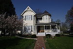
are typically separated by agriculture, or otherwise undeveloped land left after the decline of industry. The central portion of St. Clair county, sitting atop the Mississippi River bluff, is becoming increasingly suburban with new homes being built every year. Particularly in Belleville
, and its satellite cities. The eastern and southern portion of the county is sparsely populated, dotted with older small communities and small tracts of newer suburban villages between large swathes of corn
and soybean
fields.
stations on the Red
and Blue
Lines.
, first governor of the Northwest Territory
, who named it after himself. In its original boundaries, the county covered a large area between the Mackinaw
and Ohio
Rivers. In 1801 Governor William Henry Harrison
re-established St. Clair County as part of the Indiana Territory
, extending its northern border to Lake Superior
and the international border with Rupert's Land
.
In 1809, when the Illinois Territory
was created, Territorial Secretary Nathaniel Pope
, in his capacity as acting governor, issued a proclamation establishing St. Clair and Randolph County
as the two original counties of Illinois.
1This is not a county, but an independent city
which is not part of a county.
As of the census
of 2000, there were 256,082 people, 96,810 households, and 67,282 families residing in the county. The population density
was 386 people per square mile (149/km²). There were 104,446 housing units at an average density of 157 per square mile (61/km²). The racial makeup of the county was 67.94% White
, 28.77% Black
or African American
, 0.26% Native American
, 0.91% Asian American
, 0.05% Pacific Islander
, 0.80% from other races
, and 1.29% from two or more races. 2.19% of the population were Hispanic
or Latino
of any race. 26.9% were of German
, 7.3% Irish
, 7.0% American
and 6.1% English
ancestry according to Census 2000.
There were 96,810 households out of which 34.50% had children under the age of 18 living with them, 48.10% were married couples
living together, 17.10% had a female householder with no husband present, and 30.50% were non-families. 25.90% of all households were made up of individuals and 10.30% had someone living alone who was 65 years of age or older. The average household size was 2.59 and the average family size was 3.13.
In the county the population was spread out with 27.70% under the age of 18, 8.90% from 18 to 24, 29.20% from 25 to 44, 21.10% from 45 to 64, and 13.20% who were 65 years of age or older. The median age was 35 years. For every 100 females there were 91.40 males. For every 100 females age 18 and over, there were 87.20 males.
The median income for a household in the county was $39,148, and the median income for a family was $47,409. Males had a median income of $36,569 versus $25,773 for females. The per capita income
for the county was $18,932. About 11.80% of families and 14.50% of the population were below the poverty line, including 21.60% of those under age 18 and 9.80% of those age 65 or over.
:
U.S. state
A U.S. state is any one of the 50 federated states of the United States of America that share sovereignty with the federal government. Because of this shared sovereignty, an American is a citizen both of the federal entity and of his or her state of domicile. Four states use the official title of...
of Illinois
Illinois
Illinois is the fifth-most populous state of the United States of America, and is often noted for being a microcosm of the entire country. With Chicago in the northeast, small industrial cities and great agricultural productivity in central and northern Illinois, and natural resources like coal,...
. In 1970, the U.S. Census Bureau
United States Census Bureau
The United States Census Bureau is the government agency that is responsible for the United States Census. It also gathers other national demographic and economic data...
placed the mean center of U.S. population
Mean center of U.S. population
The mean center of U.S. population is determined by the United States Census Bureau from the results of each census. The Bureau defines it to be:...
in St. Clair County. According to the 2010 census, it has a population of 270,056, which is an increase of 5.5% from 256,082 in 2000. Its county seat
County seat
A county seat is an administrative center, or seat of government, for a county or civil parish. The term is primarily used in the United States....
is Belleville
Belleville, Illinois
Belleville is a city in St. Clair County, Illinois, United States. As of the 2010 census, the city has a population of 44,478. It is the eighth-most populated city outside of the Chicago Metropolitan Area and the most populated city south of Springfield in the state of Illinois. It is the county...
. St. Clair County is part of the Metro-East
Metro-East
Metro East is a region in Illinois that comprises the eastern suburbs of St. Louis, Missouri, United States. It encompasses five Southern Illinois counties in the St. Louis Metropolitan Statistical Area. The region's most populated city is Belleville at 45,000 residents...
.
It is a part of the St. Louis Metropolitan Area
St. Louis Metropolitan Statistical Area
Greater St. Louis is the area of Missouri and Illinois that surrounds and includes the independent city of St. Louis. Depending on the counties included in the area, it can refer to the St. Louis, MO-IL metropolitan statistical area or the St. Louis-St. Charles-Farmington, MO-IL combined...
.
Geography
According to the 2010 census, the county has a total area of 674.03 square miles (1,745.7 km²), of which 657.76 square miles (1,703.6 km²) (or 97.59%) is land and 16.27 square miles (42.1 km²) (or 2.41%) is water.The western portion of the county sits in the American Bottom
American Bottom
The American Bottom is the flood plain of the Mississippi River in the Metro-East region of Southern Illinois, extending from Alton, Illinois, to the Kaskaskia River. It is also sometimes called "American Bottoms". The area is about , mostly protected from flooding by a levee and drainage canal...
. Urban decay
Urban decay
Urban decay is the process whereby a previously functioning city, or part of a city, falls into disrepair and decrepitude...
, and urban prairie
Urban prairie
Urban prairie is a term coined to characterize vacant city lots. Urban prairie results from widespread building demolition to facilitate urban renewal....
are common in the formerly industrialized and once heavily populated East St. Louis
East St. Louis, Illinois
East St. Louis is a city located in St. Clair County, Illinois, USA, directly across the Mississippi River from St. Louis, Missouri in the Metro-East region of Southern Illinois. As of the 2010 census, the city had a total population of 27,006, less than one-third of its peak of 82,366 in 1950...
; other cities in St. Clair County often border agricultural or vacant lands. Unlike the suburbs on the Missouri side of the metro area, those in Metro-East
Metro-East
Metro East is a region in Illinois that comprises the eastern suburbs of St. Louis, Missouri, United States. It encompasses five Southern Illinois counties in the St. Louis Metropolitan Statistical Area. The region's most populated city is Belleville at 45,000 residents...
are typically separated by agriculture, or otherwise undeveloped land left after the decline of industry. The central portion of St. Clair county, sitting atop the Mississippi River bluff, is becoming increasingly suburban with new homes being built every year. Particularly in Belleville
Belleville, Illinois
Belleville is a city in St. Clair County, Illinois, United States. As of the 2010 census, the city has a population of 44,478. It is the eighth-most populated city outside of the Chicago Metropolitan Area and the most populated city south of Springfield in the state of Illinois. It is the county...
, and its satellite cities. The eastern and southern portion of the county is sparsely populated, dotted with older small communities and small tracts of newer suburban villages between large swathes of corn
Maize
Maize known in many English-speaking countries as corn or mielie/mealie, is a grain domesticated by indigenous peoples in Mesoamerica in prehistoric times. The leafy stalk produces ears which contain seeds called kernels. Though technically a grain, maize kernels are used in cooking as a vegetable...
and soybean
Soybean
The soybean or soya bean is a species of legume native to East Asia, widely grown for its edible bean which has numerous uses...
fields.
Major highways

 Interstate 64
 Interstate 255
 U.S. Highway 40


Public transit
St. Clair County is home to 11 St. Louis MetroLinkSt. Louis Metrolink
MetroLink is the light rail transit system in the Greater St. Louis area of Missouri and the Metro East area of Illinois. The entire system currently consists of two lines connecting Lambert-St. Louis International Airport and Shrewsbury, MO with Scott Air Force Base near Shiloh, Illinois through...
stations on the Red
Red Line (St. Louis MetroLink)
The Red Line of the St. Louis MetroLink is a light rail service operating between 28 stations in Greater St. Louis. It is the oldest and longest line in the system.-Route description:...
and Blue
Blue Line (St. Louis MetroLink)
The Blue Line of the St. Louis MetroLink is a light rail service operating between 24 stations in Greater St. Louis. It is the newest line in the system.-Route description:The Blue Line branch starts in Shrewsbury just west of River des Peres...
Lines.
- East RiverfrontEast Riverfront (St. Louis Metrolink)East Riverfront is a St. Louis MetroLink station. The station is located by the Casino Queen in East St. Louis.- External links :*...
- 5th & Missouri5th & Missouri (St. Louis MetroLink)5th & Missouri is a St. Louis MetroLink station located in East St. Louis, Illinois. The station features 322 Park-Ride spaces, including 25 long term spaces.-MetroBus:*1 Main Street-State St*2 Cahokia*4 Bond Ave-19th & Central...
- Emerson ParkEmerson Park (St. Louis MetroLink)Emerson Park is a St. Louis MetroLink station. This station features 816 Park-Ride spaces.- External links :*...
- Jackie Joyner-Kersee CenterJackie Joyner-Kersee Center (St. Louis MetroLink)Jackie Joyner-Kersee Center is a St. Louis MetroLink station. It is adjacent to the Jackie Joyner-Kersee Youth Center....
- Washington ParkWashington Park (St. Louis MetroLink)- External links :*...
- Fairview HeightsFairview Heights (St. Louis MetroLink)Fairview Heights is a St. Louis MetroLink station in Fairview Heights, Illinois, on Illinois Route 161.-MetroBus:* 1 Main – State St* 12 O'Fallon – Fairview Heights* 13 Caseyville – Maryville* 16 St. Clair Square* 512X MetroLink Station Shuttle...
- Memorial HospitalMemorial Hospital (St. Louis MetroLink)Memorial Hospital is a St. Louis MetroLink station in Belleville, Illinois, near the intersection of Illinois Route 161 and Frank Scott Parkway.- External links :*...
- SwanseaSwansea (St. Louis Metrolink)The Swansea MetroLink station lies in between two major Illinois Highways, IL 159 and IL 161. Amenities nearby include a Schnucks supermarket , a Phillips 66, McDonald's, Walgreens, Wendy's, Applebee's, FCB Bank, UMB Bank, and a U.S. Bank branch inside Schnucks.- External links :*...
- BellevilleBelleville (St. Louis MetroLink)-MetroBus:* 1 Main St - State St* 15 Lebanon Avenue* 16 St. Clair Square* 17 Carlyle Plaza-17th Street* 512X MetroLink Station Shuttle...
- CollegeCollege (St. Louis Metrolink)College Station is a St. Louis MetroLink station that is located at Southwestern Illinois College in Saint Clair County, Illinois. The station is east of Belleville, Illinois on Illinois Route 161 1and west of Scott Air Force Base.- External links :*...
- Shiloh-ScottShiloh-Scott (St. Louis MetroLink)Shiloh-Scott is a St. Louis MetroLink station located adjacent to Scott Air Force Base in Shiloh, IL and is the eastern terminus of the MetroLink system. It opened on June 23, 2003 as part of Phase 2 of the St. Clair County Extension which extended MetroLink from College to Shiloh-Scott station...
History
St. Clair County was the first county established in what is today Illinois; in fact the county antedates Illinois' existence as a separate entity. It was established in 1790 by proclamation of Arthur St. ClairArthur St. Clair
Arthur St. Clair was an American soldier and politician. Born in Scotland, he served in the British Army during the French and Indian War before settling in Pennsylvania, where he held local office...
, first governor of the Northwest Territory
Northwest Territory
The Territory Northwest of the River Ohio, more commonly known as the Northwest Territory, was an organized incorporated territory of the United States that existed from July 13, 1787, until March 1, 1803, when the southeastern portion of the territory was admitted to the Union as the state of Ohio...
, who named it after himself. In its original boundaries, the county covered a large area between the Mackinaw
Mackinaw River
The Mackinaw River, also called Mackinac River, is a river in the U.S. state of Illinois. It flows through what was once the Grande Prairie region of central Illinois...
and Ohio
Ohio River
The Ohio River is the largest tributary, by volume, of the Mississippi River. At the confluence, the Ohio is even bigger than the Mississippi and, thus, is hydrologically the main stream of the whole river system, including the Allegheny River further upstream...
Rivers. In 1801 Governor William Henry Harrison
William Henry Harrison
William Henry Harrison was the ninth President of the United States , an American military officer and politician, and the first president to die in office. He was 68 years, 23 days old when elected, the oldest president elected until Ronald Reagan in 1980, and last President to be born before the...
re-established St. Clair County as part of the Indiana Territory
Indiana Territory
The Territory of Indiana was an organized incorporated territory of the United States that existed from July 4, 1800, until November 7, 1816, when the southern portion of the territory was admitted to the Union as the state of Indiana....
, extending its northern border to Lake Superior
Lake Superior
Lake Superior is the largest of the five traditionally-demarcated Great Lakes of North America. It is bounded to the north by the Canadian province of Ontario and the U.S. state of Minnesota, and to the south by the U.S. states of Wisconsin and Michigan. It is the largest freshwater lake in the...
and the international border with Rupert's Land
Rupert's Land
Rupert's Land, or Prince Rupert's Land, was a territory in British North America, consisting of the Hudson Bay drainage basin that was nominally owned by the Hudson's Bay Company for 200 years from 1670 to 1870, although numerous aboriginal groups lived in the same territory and disputed the...
.
In 1809, when the Illinois Territory
Illinois Territory
The Territory of Illinois was an organized incorporated territory of the United States that existed from March 1, 1809, until December 3, 1818, when the southern portion of the territory was admitted to the Union as the State of Illinois. The area was earlier known as "Illinois Country" while under...
was created, Territorial Secretary Nathaniel Pope
Nathaniel Pope
Nathaniel Pope was a politician and jurist from the U.S. state of Illinois.-Early life, education, and career:...
, in his capacity as acting governor, issued a proclamation establishing St. Clair and Randolph County
Randolph County, Illinois
Randolph County is a county located in the U.S. state of Illinois. According to the 2010 census, it has a population of 33,476, which is a decrease of 1.2% from 33,893 in 2000. Its county seat is Chester....
as the two original counties of Illinois.
Townships
Belleville, Cahokia, Canteen, Caseyville, Centreville, Dupo, East St. Louis, Englemann, Freeburg, Lebanon, Lenzburg, Marissa, Mascoutah, Millstadt, New Athens, O'Fallon, Prairie Du Long, Shiloh Valley, Smithton, Saint Claire, Stites, Stookey, Sugar Loaf, SwanseaAdjacent counties
- Madison CountyMadison County, IllinoisMadison County is a county located in the U.S. state of Illinois. Madison County is part of the Metro-East region of the St. Louis Metro Area. According to the 2010 census, it has a population of 269,282, which is an increase of 4.0% from 258,941 in 2000. The county seat is Edwardsville, home to...
(north) - Clinton CountyClinton County, Illinois-Demographics: As of the census of 2000, there were 35,535 people, 12,754 households, and 9,221 families residing in the county. The population density was 75 people per square mile . There were 13,805 housing units at an average density of 29 per square mile...
(northeast) - Washington CountyWashington County, IllinoisWashington County is a county located in the U.S. state of Illinois. According to the 2010 census, it has a population of 14,716, which is a decrease of 2.9% from 15,148 in 2000. Its county seat is Nashville.-Geography:...
(east) - Randolph CountyRandolph County, IllinoisRandolph County is a county located in the U.S. state of Illinois. According to the 2010 census, it has a population of 33,476, which is a decrease of 1.2% from 33,893 in 2000. Its county seat is Chester....
(south) - Monroe CountyMonroe County, IllinoisMonroe County is a county located in the U.S. state of Illinois. According to the 2010 census, it has a population of 32,957, which is an increase of 19.3% from 27,619 in 2000. Its county seat is Waterloo...
(southwest) - St. LouisSt. Louis, MissouriSt. Louis is an independent city on the eastern border of Missouri, United States. With a population of 319,294, it was the 58th-largest U.S. city at the 2010 U.S. Census. The Greater St...
, MissouriMissouriMissouri is a US state located in the Midwestern United States, bordered by Iowa, Illinois, Kentucky, Tennessee, Arkansas, Oklahoma, Kansas and Nebraska. With a 2010 population of 5,988,927, Missouri is the 18th most populous state in the nation and the fifth most populous in the Midwest. It...
(west)1 - St. Louis CountySt. Louis County, MissouriSt. Louis County is a county located in the U.S. state of Missouri. Its county seat is Clayton. St. Louis County is part of the St. Louis Metro Area wherein the independent City of St. Louis and its suburbs in St. Louis County, as well as the surrounding counties in both Missouri and Illinois all...
, MissouriMissouriMissouri is a US state located in the Midwestern United States, bordered by Iowa, Illinois, Kentucky, Tennessee, Arkansas, Oklahoma, Kansas and Nebraska. With a 2010 population of 5,988,927, Missouri is the 18th most populous state in the nation and the fifth most populous in the Midwest. It...
(west)
1This is not a county, but an independent city
Independent city
An independent city is a city that does not form part of another general-purpose local government entity. These type of cities should not be confused with city-states , which are fully sovereign cities that are not part of any other sovereign state.-Historical precursors:In the Holy Roman Empire,...
which is not part of a county.
Demographics
As of the census
Census
A census is the procedure of systematically acquiring and recording information about the members of a given population. It is a regularly occurring and official count of a particular population. The term is used mostly in connection with national population and housing censuses; other common...
of 2000, there were 256,082 people, 96,810 households, and 67,282 families residing in the county. The population density
Population density
Population density is a measurement of population per unit area or unit volume. It is frequently applied to living organisms, and particularly to humans...
was 386 people per square mile (149/km²). There were 104,446 housing units at an average density of 157 per square mile (61/km²). The racial makeup of the county was 67.94% White
Race (United States Census)
Race and ethnicity in the United States Census, as defined by the Federal Office of Management and Budget and the United States Census Bureau, are self-identification data items in which residents choose the race or races with which they most closely identify, and indicate whether or not they are...
, 28.77% Black
Race (United States Census)
Race and ethnicity in the United States Census, as defined by the Federal Office of Management and Budget and the United States Census Bureau, are self-identification data items in which residents choose the race or races with which they most closely identify, and indicate whether or not they are...
or African American
Race (United States Census)
Race and ethnicity in the United States Census, as defined by the Federal Office of Management and Budget and the United States Census Bureau, are self-identification data items in which residents choose the race or races with which they most closely identify, and indicate whether or not they are...
, 0.26% Native American
Race (United States Census)
Race and ethnicity in the United States Census, as defined by the Federal Office of Management and Budget and the United States Census Bureau, are self-identification data items in which residents choose the race or races with which they most closely identify, and indicate whether or not they are...
, 0.91% Asian American
Asian American
Asian Americans are Americans of Asian descent. The U.S. Census Bureau definition of Asians as "Asian” refers to a person having origins in any of the original peoples of the Far East, Southeast Asia, or the Indian subcontinent, including, for example, Cambodia, China, India, Indonesia, Japan,...
, 0.05% Pacific Islander
Race (United States Census)
Race and ethnicity in the United States Census, as defined by the Federal Office of Management and Budget and the United States Census Bureau, are self-identification data items in which residents choose the race or races with which they most closely identify, and indicate whether or not they are...
, 0.80% from other races
Race (United States Census)
Race and ethnicity in the United States Census, as defined by the Federal Office of Management and Budget and the United States Census Bureau, are self-identification data items in which residents choose the race or races with which they most closely identify, and indicate whether or not they are...
, and 1.29% from two or more races. 2.19% of the population were Hispanic
Race (United States Census)
Race and ethnicity in the United States Census, as defined by the Federal Office of Management and Budget and the United States Census Bureau, are self-identification data items in which residents choose the race or races with which they most closely identify, and indicate whether or not they are...
or Latino
Race (United States Census)
Race and ethnicity in the United States Census, as defined by the Federal Office of Management and Budget and the United States Census Bureau, are self-identification data items in which residents choose the race or races with which they most closely identify, and indicate whether or not they are...
of any race. 26.9% were of German
Germans
The Germans are a Germanic ethnic group native to Central Europe. The English term Germans has referred to the German-speaking population of the Holy Roman Empire since the Late Middle Ages....
, 7.3% Irish
Irish people
The Irish people are an ethnic group who originate in Ireland, an island in northwestern Europe. Ireland has been populated for around 9,000 years , with the Irish people's earliest ancestors recorded having legends of being descended from groups such as the Nemedians, Fomorians, Fir Bolg, Tuatha...
, 7.0% American
United States
The United States of America is a federal constitutional republic comprising fifty states and a federal district...
and 6.1% English
English people
The English are a nation and ethnic group native to England, who speak English. The English identity is of early mediaeval origin, when they were known in Old English as the Anglecynn. England is now a country of the United Kingdom, and the majority of English people in England are British Citizens...
ancestry according to Census 2000.
There were 96,810 households out of which 34.50% had children under the age of 18 living with them, 48.10% were married couples
Marriage
Marriage is a social union or legal contract between people that creates kinship. It is an institution in which interpersonal relationships, usually intimate and sexual, are acknowledged in a variety of ways, depending on the culture or subculture in which it is found...
living together, 17.10% had a female householder with no husband present, and 30.50% were non-families. 25.90% of all households were made up of individuals and 10.30% had someone living alone who was 65 years of age or older. The average household size was 2.59 and the average family size was 3.13.
In the county the population was spread out with 27.70% under the age of 18, 8.90% from 18 to 24, 29.20% from 25 to 44, 21.10% from 45 to 64, and 13.20% who were 65 years of age or older. The median age was 35 years. For every 100 females there were 91.40 males. For every 100 females age 18 and over, there were 87.20 males.
The median income for a household in the county was $39,148, and the median income for a family was $47,409. Males had a median income of $36,569 versus $25,773 for females. The per capita income
Per capita income
Per capita income or income per person is a measure of mean income within an economic aggregate, such as a country or city. It is calculated by taking a measure of all sources of income in the aggregate and dividing it by the total population...
for the county was $18,932. About 11.80% of families and 14.50% of the population were below the poverty line, including 21.60% of those under age 18 and 9.80% of those age 65 or over.
Cities and towns
- AlortonAlorton, IllinoisAlorton is a village in St. Clair County, Illinois, United States. The population was 2,749 at the 2000 census.Alorton was home to Cahokia Downs, an American horse racing track located on Highway 15 which hosted both Standardbred harness racing and Thoroughbred flat racing events from 1954 through...
- BellevilleBelleville, IllinoisBelleville is a city in St. Clair County, Illinois, United States. As of the 2010 census, the city has a population of 44,478. It is the eighth-most populated city outside of the Chicago Metropolitan Area and the most populated city south of Springfield in the state of Illinois. It is the county...
- BrooklynBrooklyn, IllinoisBrooklyn , is a village in St. Clair County, Illinois, United States. Located just 2 miles north of East St. Louis, Illinois and 3 miles northeast of Downtown St. Louis, Missouri, it is the oldest town incorporated by African Americans in the United States...
- CahokiaCahokia, IllinoisCahokia is a village in St. Clair County, Illinois, United States. As of the 2000 census, the village had a population of 16,391. The name is a reference to one of the clans of the historic Illini confederacy, who were encountered by early French explorers to the region.Early European settlers also...
- CaseyvilleCaseyville, IllinoisCaseyville is a village in St. Clair County, Illinois, United States. The population was 4,310 at the 2000 census.-Geography:Caseyville is located at ....
- CentrevilleCentreville, IllinoisCentreville is a city in St. Clair County, Illinois, United States of America. The population was 5,951 at the 2000 census.-Geography:Centreville is located at ....
- CollinsvilleCollinsville, IllinoisCollinsville is a city located mainly in Madison County, and partially in St. Clair County, both in Illinois. As of the 2010 census, the city had a population of 26,016. Collinsville is approximately 12 miles from St. Louis, Missouri and is considered part of that city's Metro-East area...
(southern part) - DupoDupo, IllinoisDupo is a village in St. Clair County, Illinois, United States. The population was 3,933 at the 2000 census. The village was settled in about 1750 and was incorporated in 1876. Its name is derived from Prairie du Pont .-Geography:...
- East CarondeletEast Carondelet, IllinoisEast Carondelet is a village in St. Clair County, Illinois, United States. The population was 267 at the 2000 census.-Demographics:As of the census of 2000, there were 267 people, 94 households, and 68 families residing in the village. The population density was 213.5 people per square mile...
- East St. LouisEast St. Louis, IllinoisEast St. Louis is a city located in St. Clair County, Illinois, USA, directly across the Mississippi River from St. Louis, Missouri in the Metro-East region of Southern Illinois. As of the 2010 census, the city had a total population of 27,006, less than one-third of its peak of 82,366 in 1950...
- Fairmont CityFairmont City, IllinoisFairmont City is a village in St. Clair and Madison Counties, Illinois, United States. The population was 2,436 at the 2000 census. Fairmont City holds the highest percentage of Hispanics in the entire St...
- Fairview HeightsFairview Heights, IllinoisFairview Heights is a city in St. Clair County, Illinois, United States. The population was 17,078 at the 2010 census. Fairview Heights is a dominant shopping center for Southwestern Illinois and includes numerous shopping plazas and the St...
- FayettevilleFayetteville, IllinoisFayetteville is a village on the Kaskaskia River in St. Clair County, Illinois, United States. The population was 384 at the 2000 census.-Geography:Fayetteville is located at ....
- FreeburgFreeburg, IllinoisFreeburg is a village in St. Clair County, Illinois, United States. As of 2010, Freeburg had a population of 4,354.-History:Freeburg lies in the fertile and rolling southern Illinois plains between the Kaskaskia and Mississippi Rivers. It was platted in 1836 as the town of Urbana by immigrants to...
- LebanonLebanon, IllinoisLebanon is a city in St. Clair County, Illinois, United States. The population was 3,523 at the 2000 census. Like many other places in "Little Egypt" or Southern Illinois, Lebanon was named after the Middle Eastern country of the same name. It is a part of the Metro-East region of the Greater St...
- LenzburgLenzburg, IllinoisLenzburg is a village in St. Clair County, Illinois, USA. The population was 577 at the 2000 census.-Geography:Lenzburg is located at .According to the United States Census Bureau, the village has a total area of , of which, of it is land and of it is water.-Demographics:As of the census of...
- MarissaMarissa, IllinoisMarissa is a village in St. Clair County, Illinois, United States. The population was 2,141 at the 2000 census.-Geography:Marissa is located at ....
- MascoutahMascoutah, IllinoisMascoutah is a small town in St. Clair County, Illinois, United States. The population was 7,483 at the 2010 census.-Geography:Mascoutah is located at ....
- MillstadtMillstadt, IllinoisMillstadt is a suburb of St. Louis and a village in St. Clair County, Illinois, at the crossing of Illinois Route 163 and Illinois Route 158 . The village is known for its German heritage, with more than half its people of German descent...
- New AthensNew Athens, IllinoisNew Athens is a village in St. Clair County, Illinois, United States. Based upon common usage, the 'A' is always sounded with a long vowel, rather than a short vowel, by its residents, unlike the most commonly used English pronunciation of the city in Greece....
- O'FallonO'Fallon, IllinoisO'Fallon is a city in St. Clair County, Illinois, United States, and one of the fastest-growing communities in the Metropolitan St. Louis area. As of the 2010 census, the city had a total population of 28,281. The city is the third largest city in the Metro-East and Southern Illinois...
- SaugetSauget, IllinoisSauget is a village in St. Clair County, Illinois, United States. It is part of Greater St. Louis. The population was 249 at the 2000 census.-Geography:Sauget is located at ....
- Scott AFB
- ShilohShiloh, IllinoisShiloh is a village in St. Clair County, Illinois, United States. A 2005 census recorded a population of 11,000.-Geography:Shiloh is located at ....
- SmithtonSmithton, IllinoisSmithton is a village in St. Clair County, Illinois, United States. The population was 2,248 at the 2000 census.-Geography:Smithton is located at ....
- St. LiborySt. Libory, IllinoisSt. Libory is a village in St. Clair County, Illinois, United States. The population was 583 at the 2000 census.-Geography:St. Libory is located at ....
- SummerfieldSummerfield, IllinoisSummerfield is a village in St. Clair County, Illinois, United States. The population was 472 at the 2000 census.-Geography:Summerfield is located at ....
- SwanseaSwansea, IllinoisSwansea is a village in St. Clair County, Illinois, United States. The population was 10,579 at the 2000 census.-History:In the late 19th century the area that is now Swansea was a mix of farming and commerce. It was home to underground coal mines, foundries, brickyards, and the Gundlach Drill...
- Washington ParkWashington Park, IllinoisWashington Park is a village in St. Clair County, Illinois, United States. The population was 5,345 at the 2000 census.-History:Washington Park filed for Chapter 9 bankruptcy protection in July, 2009, citing assets of less than $50,000 and debt of more than $1 million...
Townships
St. Clair County is divided into these townshipsCivil township
A civil township is a widely used unit of local government in the United States, subordinate to, and geographic divisions of, a county. Specific responsibilities and the degree of autonomy vary based on each state. Civil townships are distinct from survey townships, but in states that have both,...
:
- Belleville
- CanteenCanteen Township, St. Clair County, IllinoisCanteen Township is located in St. Clair County, Illinois. The population was 12,032 at the 2000 census. Canteen Township was formed from Centreville Station Township when it was subdivided on March 5, 1910.- External links :****...
- CaseyvilleCaseyville Township, St. Clair County, IllinoisCaseyville Township is located in St. Clair County, Illinois, United States. The population was 25,987 at the 2000 census.- External links :****...
- CentrevilleCentreville Township, St. Clair County, IllinoisCentreville Township is located in St. Clair County, Illinois. The population was 28,711 at the 2000 census. Centreville Township was formed from Centreville Station when it was subdivided on March 5, 1910.- External links :****...
- EngelmannEngelmann Township, St. Clair County, IllinoisEngelmann Township is located in St. Clair County, Illinois. The population was 654 at the 2000 census.- External links :****...
- FayettevilleFayetteville Township, St. Clair County, IllinoisFayetteville Township is located in St. Clair County, Illinois. The population was 1,656 at the 2000 census.- External links :****...
- FreeburgFreeburg Township, St. Clair County, IllinoisFreeburg Township is located in St. Clair County, Illinois. The population was 5,124 at the 2000 census.- External links :****...
- LebanonLebanon Township, St. Clair County, IllinoisLebanon Township is located in St. Clair County, Illinois. The population was 4,096 at the 2000 census.- External links :****...
- LenzburgLenzburg Township, St. Clair County, IllinoisLenzburg Township is located in St. Clair County, Illinois. The population was 1,148 at the 2000 census.- External links :****...
- MarissaMarissa Township, St. Clair County, IllinoisMarissa Township is located in St. Clair County, Illinois. The population was 2,664 at the 2000 census.****...
- MascoutahMascoutah Township, St. Clair County, IllinoisMascoutah Township is located in St. Clair County, Illinois. The population was 6,474 at the 2000 census.- External links :****...
- MillstadtMillstadt Township, St. Clair County, IllinoisMillstadt Township is located in St. Clair County, Illinois. The population was 5,493 at the 2000 census.- External links :*****...
- New AthensNew Athens Township, St. Clair County, IllinoisNew Athens Township is located in St. Clair County, Illinois. The population was 2,620 at the 2000 census.- External links :****...
- O'FallonO’Fallon Township, St. Clair County, IllinoisO'Fallon Township is located in St. Clair County, Illinois. The population was 21,859 at the 2000 census.- External links :****...
- Prairie du LongPrairie du Long Township, St. Clair County, IllinoisPrairie du Long Township is located in St. Clair County, Illinois. The population was 1,352 at the 2000 census.- External links :****...
- St. ClairSt. Clair Township, St. Clair County, IllinoisSt. Clair Township is located in St. Clair County, Illinois. The population was 31,798 at the 2000 census. St. Clair Township formed from a portion of Belleville Township on October 5, 1885.- External links :*****...
- Shiloh ValleyShiloh Valley Township, St. Clair County, IllinoisShiloh Valley Township is located in St. Clair County, Illinois. The population was 10,108 at the 2000 census. Shiloh Valley Township was originally called Shiloh before its name was changed on an unknown date.- External links :****...
- SmithtonSmithton Township, St. Clair County, IllinoisSmithton Township is located in St. Clair County, Illinois. The population was 3,392 at the 2000 census.- External links :****...
- StitesStites Township, St. Clair County, IllinoisStites Township is located in St. Clair County, Illinois. The population was 679 at the 2000 census. Stites Township was originally named Brooklyn Township when it was reorganized from a portion of East St. Louis Township in February, 1888. Its name was changed to Stites in April, 1888.- External...
- StookeyStookey Township, St. Clair County, IllinoisStookey Township is a township located in St. Clair County, Illinois. It is an unincorporated part of Belleville, Illinois located just west of downtown Belleville, for that reason it is often referred to by locals as Belleville West...
- SugarloafSugarloaf Township, St. Clair County, IllinoisSugarloaf Township is located in St. Clair County, Illinois. The population was 7,098 at the 2000 census.- External links :****...
Government and infrastructure
The Southwestern Illinois Correctional Center, operated by the Illinois Department of Corrections, is near East St. Louis in St. Clair County.Climate and weather
In recent years, average temperatures in the county seat of Belleville have ranged from a low of 22 °F (-5.6 °C) in January to a high of 90 °F (32.2 °C) in July, although a record low of -27 °F was recorded in January 1977 and a record high of 110 °F (43.3 °C) was recorded in July 1954. Average monthly precipitation ranged from 2.02 inches (5.1 cm) in January to 4.18 inches (10.6 cm) in May.External links
- A Brief History of St. Clair County, Illinois from rootsweb.com