

List of Alaska Routes
Encyclopedia
Alaska Route 2
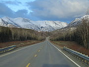
Alaska Route 2 is a state highway in the central and east-central portions of the U.S. state of Alaska. It runs from Manley Hot Springs via Fairbanks to the Yukon Territory, including the entire length of the Alaska Highway in the state.-Route description:...
runs largely east and west, but runs north and south passing through and to the north of Fairbanks
Fairbanks
Fairbanks may refer to:Places in the United States*Fairbanks, Alaska, city*Fairbanks, California, unincorporated community in El Dorado County*Fairbanks, Mendocino County, California, former settlement*Fairbanks, Indiana, unincorporated community...
. The Klondike Highway
Klondike Highway
The Klondike Highway links the Alaskan coastal town of Skagway to Yukon's Dawson City and its route somewhat parallels that used by prospectors in the 1898 Klondike Gold Rush....
, built in 1978, was unnumbered until 1998, when it was given its designation during the centennial of the Klondike Gold Rush
Klondike Gold Rush
The Klondike Gold Rush, also called the Yukon Gold Rush, the Alaska Gold Rush and the Last Great Gold Rush, was an attempt by an estimated 100,000 people to travel to the Klondike region the Yukon in north-western Canada between 1897 and 1899 in the hope of successfully prospecting for gold...
. However, many Alaskan highways of greater length than the Klondike Highway remain unnumbered.
Non-contiguous
Highways 7Alaska Route 7
Alaska Route 7 is a state highway in the Alaska Panhandle of the U.S. state of Alaska. It consists of four unconnected pieces, serving some of the Panhandle communities that the Alaska Marine Highway ferries stop at, and connecting to the Alaska Highway in Yukon via the Haines Highway.-Route...
and 10
Alaska Route 10
Alaska Route 10 refers to two unconnected highways in the U.S. state of Alaska:*Copper River Highway*Edgerton Highway...
consist of multiple separately named segments that do not physically approach each other, unless the Alaska Marine Highway System ferries as part of Alaska Route 7
Alaska Route 7
Alaska Route 7 is a state highway in the Alaska Panhandle of the U.S. state of Alaska. It consists of four unconnected pieces, serving some of the Panhandle communities that the Alaska Marine Highway ferries stop at, and connecting to the Alaska Highway in Yukon via the Haines Highway.-Route...
, and former Copper River and Northwestern Railway
Copper River and Northwestern Railway
The Copper River and Northwestern Railway was a railroad built by the Kennecott Corporation between 1907 and 1911 to take copper ore from Kennicott, Alaska to Cordova, Alaska, a distance of . The railroad was built by thousands of workers, who laid tracks around glaciers, across canyons and...
track bed as part of Alaska Route 10
Alaska Route 10
Alaska Route 10 refers to two unconnected highways in the U.S. state of Alaska:*Copper River Highway*Edgerton Highway...
, are included.
Names versus numbers
Numbers and names do not always coincide well. Alaska Route 1Alaska Route 1
Alaska Route 1 is a state highway in the southern portion of the U.S. state of Alaska. It runs from Homer northeast and east to Tok by way of Anchorage...
can refer to any of the Glenn Highway
Glenn Highway
-References:* Pasch, A. D., K. C. May. 2001. Taphonomy and paleoenvironment of hadrosaur from the Matanuska Formation in South-Central Alaska. In: Mesozioc Vertebrate Life. Ed.s Tanke, D. H., Carpenter, K., Skrepnick, M. W. Indiana University Press. Pages 219-236.-External links:**...
, Seward Highway
Seward Highway
The Seward Highway is a highway in the U.S. state of Alaska that extends 127 miles from Seward to Anchorage. It was completed in 1951 and runs through the scenic Kenai Peninsula and Turnagain Arm, for which it was designated an All-American Road by the U.S...
, Sterling Highway
Sterling Highway
The Sterling Highway is a 142-mile highway in the Southcentral region of the U.S. state of Alaska, leading from the Seward Highway at Tern Lake Junction, south of Anchorage, to Homer....
, or Tok Cut-Off
Tok Cut-Off
The Tok Cut-Off is a highway in the U.S. state of Alaska, running 125 miles from Gakona Junction on the Richardson Highway, 14 miles north of Glennallen, to Tok on the Alaska Highway....
; meanwhile, portions of the Seward Highway
Seward Highway
The Seward Highway is a highway in the U.S. state of Alaska that extends 127 miles from Seward to Anchorage. It was completed in 1951 and runs through the scenic Kenai Peninsula and Turnagain Arm, for which it was designated an All-American Road by the U.S...
are numbered Alaska Route 1
Alaska Route 1
Alaska Route 1 is a state highway in the southern portion of the U.S. state of Alaska. It runs from Homer northeast and east to Tok by way of Anchorage...
, 9 and Interstate A3
Interstate Highways in Alaska
There are four officially designated Interstate Highways in Alaska, even though the routes do not connect directly to any highways in the contiguous United States, except either by the Alaska Marine Highway System ferries or via Canadian highways....
. (Interstate highway shields are not posted along highways in Alaska; these designations occur only on paper
Interstate Highways in Alaska
There are four officially designated Interstate Highways in Alaska, even though the routes do not connect directly to any highways in the contiguous United States, except either by the Alaska Marine Highway System ferries or via Canadian highways....
.)
Within Alaska, roads are almost invariably referred to by name or general destination, and not by number(s). Many residents are unfamiliar with official highway numbers even for those highways that they use frequently. Visitors are usually advised to avoid using highway numbers in asking for directions.
Mileposts
Mileposts, frequently used for road markers and official addressing in rural areas, are also more commonly reckoned by landmark names.Highways by number
! width="200" | Number !! width="150" | Name(s) !! Route
|-
|


 Alaska Route 1
Alaska Route 1
Alaska Route 1 is a state highway in the southern portion of the U.S. state of Alaska. It runs from Homer northeast and east to Tok by way of Anchorage...
>
Tok Cut-Off
The Tok Cut-Off is a highway in the U.S. state of Alaska, running 125 miles from Gakona Junction on the Richardson Highway, 14 miles north of Glennallen, to Tok on the Alaska Highway....
Richardson Highway
Richardson Highway
The Richardson Highway is a highway in the U.S. state of Alaska, running 368 miles from Valdez to Fairbanks. It is marked as Alaska Route 4 from Valdez to Delta Junction and as Alaska Route 2 from there to Fairbanks. It is also connects segments of Alaska Route 1 between the Glenn Highway and the...
Glenn Highway
Glenn Highway
-References:* Pasch, A. D., K. C. May. 2001. Taphonomy and paleoenvironment of hadrosaur from the Matanuska Formation in South-Central Alaska. In: Mesozioc Vertebrate Life. Ed.s Tanke, D. H., Carpenter, K., Skrepnick, M. W. Indiana University Press. Pages 219-236.-External links:**...
Seward Highway
Seward Highway
The Seward Highway is a highway in the U.S. state of Alaska that extends 127 miles from Seward to Anchorage. It was completed in 1951 and runs through the scenic Kenai Peninsula and Turnagain Arm, for which it was designated an All-American Road by the U.S...
Sterling Highway
Sterling Highway
The Sterling Highway is a 142-mile highway in the Southcentral region of the U.S. state of Alaska, leading from the Seward Highway at Tern Lake Junction, south of Anchorage, to Homer....
Tok, Alaska
Tok is a census-designated place in Southeast Fairbanks Census Area, Alaska, United States. The population was 1,393 at the 2000 census.-Geography:...
to Homer
Homer, Alaska
Homer is a city located in Kenai Peninsula Borough in the U.S. state of Alaska. According to 2005 Census Bureau estimates, the population was 5,364. One of Homer's nicknames is "the cosmic hamlet by the sea"; another is "the end of the road"...
>- bgcolor="#EFEFEF"
|

 Alaska Route 2
Alaska Route 2
Alaska Route 2 is a state highway in the central and east-central portions of the U.S. state of Alaska. It runs from Manley Hot Springs via Fairbanks to the Yukon Territory, including the entire length of the Alaska Highway in the state.-Route description:...
Alaska Highway
The Alaska Highway was constructed during World War II for the purpose of connecting the contiguous U.S. to Alaska through Canada. It begins at the junction with several Canadian highways in Dawson Creek, British Columbia and runs to Delta Junction, Alaska, via Whitehorse, Yukon...
Richardson Highway
Richardson Highway
The Richardson Highway is a highway in the U.S. state of Alaska, running 368 miles from Valdez to Fairbanks. It is marked as Alaska Route 4 from Valdez to Delta Junction and as Alaska Route 2 from there to Fairbanks. It is also connects segments of Alaska Route 1 between the Glenn Highway and the...
Steese Highway
Steese Highway
The Steese Highway is a highway in the Interior region of the U.S. state of Alaska that extends from Fairbanks to Circle, a town on the Yukon River about 50 miles south of the Arctic Circle. The highway was completed in 1927 and is named for U.S. Army General James G. Steese, a former president...
Elliott Highway
Elliott Highway
The Elliott Highway is a highway in the U.S. state of Alaska that extends 152 miles from Fox, about 10 miles north of Fairbanks, to Manley Hot Springs...
Canada
Canada is a North American country consisting of ten provinces and three territories. Located in the northern part of the continent, it extends from the Atlantic Ocean in the east to the Pacific Ocean in the west, and northward into the Arctic Ocean...
border to Manley Hot Springs
Manley Hot Springs, Alaska
Manley Hot Springs is a census-designated place in Yukon-Koyukuk Census Area, Alaska, Manley Hot Springs is a [[census-designated place]] in [[Yukon-Koyukuk Census Area, Alaska|Yukon-Koyukuk Census Area]], [[Alaska]], Manley Hot Springs Manley Hot Springs (Too Naaleł Denh in Koyukon) is a...
>-
|

 Alaska Route 3
 George Parks Highway
The George Parks Highway , usually called simply the Parks Highway, runs 323 miles from the Glenn Highway 35 miles north of Anchorage to Fairbanks in the Alaska Interior...
Glenn Highway
-References:* Pasch, A. D., K. C. May. 2001. Taphonomy and paleoenvironment of hadrosaur from the Matanuska Formation in South-Central Alaska. In: Mesozioc Vertebrate Life. Ed.s Tanke, D. H., Carpenter, K., Skrepnick, M. W. Indiana University Press. Pages 219-236.-External links:**...
to Fairbanks
Fairbanks, Alaska
Fairbanks is a home rule city in and the borough seat of the Fairbanks North Star Borough in the U.S. state of Alaska.Fairbanks is the largest city in the Interior region of Alaska, and second largest in the state behind Anchorage...
>- bgcolor="#EFEFEF"
|
 Alaska Route 4
 Richardson Highway
The Richardson Highway is a highway in the U.S. state of Alaska, running 368 miles from Valdez to Fairbanks. It is marked as Alaska Route 4 from Valdez to Delta Junction and as Alaska Route 2 from there to Fairbanks. It is also connects segments of Alaska Route 1 between the Glenn Highway and the...
Valdez, Alaska
Valdez is a city in Valdez-Cordova Census Area in the U.S. state of Alaska. According to 2005 Census Bureau estimates, the population of the city is 4,020. The city is one of the most important ports in Alaska. The port of Valdez was named in 1790 after the Spanish naval officer Antonio Valdés y...
to Delta Junction
Delta Junction, Alaska
Delta Junction is a city in the Southeast Fairbanks Census Area, Alaska, United States. According to 2005 Census Bureau estimates, the population of the city is 897. The city is located a short distance south of the confluence of the Delta River with the Tanana River, which is at Big Delta...
>-
|
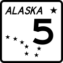 Alaska Route 5
 Taylor Highway
The Taylor Highway is a highway in the U.S. state of Alaska that extends 160 miles from Tetlin, about 11 miles south of Tok on the Alaska Highway, to Eagle....
Alaska Highway
The Alaska Highway was constructed during World War II for the purpose of connecting the contiguous U.S. to Alaska through Canada. It begins at the junction with several Canadian highways in Dawson Creek, British Columbia and runs to Delta Junction, Alaska, via Whitehorse, Yukon...
east of Tok) to Eagle
Eagle, Alaska
Eagle is a city located along the United States-Canada border in the Southeast Fairbanks Census Area, Alaska, United States. It includes Eagle Historic District, a U.S. National Historic Landmark. The population was 129 at the 2000 census...
>- bgcolor="#EFEFEF"
|
 Alaska Route 6
 Steese Highway
The Steese Highway is a highway in the Interior region of the U.S. state of Alaska that extends from Fairbanks to Circle, a town on the Yukon River about 50 miles south of the Arctic Circle. The highway was completed in 1927 and is named for U.S. Army General James G. Steese, a former president...
Fox, Alaska
Fox is a census-designated place in Fairbanks North Star Borough, Alaska, United States. It is part of the Fairbanks, Alaska Metropolitan Statistical Area. At the 2007 census the population was 353.-Geography:...
to Circle
Circle, Alaska
Circle is a census-designated place in Yukon-Koyukuk Census Area, Alaska, United States. At the 2000 census the population was 100....
>-
|
 Alaska Route 7
Alaska Route 7
Alaska Route 7 is a state highway in the Alaska Panhandle of the U.S. state of Alaska. It consists of four unconnected pieces, serving some of the Panhandle communities that the Alaska Marine Highway ferries stop at, and connecting to the Alaska Highway in Yukon via the Haines Highway.-Route...
Haines Highway
The Haines Highway or Haines Cut-Off is a highway that connects Haines, Alaska, in the United States, with Haines Junction, Yukon, Canada, passing through the province of British Columbia. It follows the route of the old Dalton Trail from the port of Haines inland for about to Klukshu, Yukon, and...
Glacier Highway
Egan Drive
Mitkof Highway
Tongass Highway
Haines, Alaska
Haines is a census-designated place in Haines Borough, Alaska, United States. As of the 2000 census, the population of the area was 1,811. Haines was formerly a city but no longer has a municipal government...
to Canadian
Canada
Canada is a North American country consisting of ten provinces and three territories. Located in the northern part of the continent, it extends from the Atlantic Ocean in the east to the Pacific Ocean in the west, and northward into the Arctic Ocean...
border with segments in Juneau
Juneau, Alaska
The City and Borough of Juneau is a unified municipality located on the Gastineau Channel in the panhandle of the U.S. state of Alaska. It has been the capital of Alaska since 1906, when the government of the then-District of Alaska was moved from Sitka as dictated by the U.S. Congress in 1900...
, Petersburg
Petersburg, Alaska
Petersburg is a city in Petersburg Census Area, Alaska, in the United States. According to 2009 Census Bureau estimates, the population of the city is 2,824 full time residents.- History :...
, and Ketchikan
Ketchikan, Alaska
Ketchikan is a city in Ketchikan Gateway Borough, Alaska, United States, the southeasternmost sizable city in that state. With an estimated population of 7,368 in 2010 within the city limits, it is the fifth most populous city in the state....
>- bgcolor="#EFEFEF"
|
 Alaska Route 8
 Denali Highway
Denali Highway is a lightly traveled, mostly gravel highway in the U.S. state of Alaska. It leads from Paxson on the Richardson Highway to Cantwell on the Parks Highway. Opened in 1957, it was the first road access to Denali National Park...
Paxson, Alaska
Paxson is a census-designated place in Valdez-Cordova Census Area, Alaska, United States. As of the 2000 census, its population was 43. It is located on the Richardson Highway at the junction with the Denali Highway.-Geography:...
to Cantwell
Cantwell, Alaska
Cantwell was a railway flag stop at the junction with the Denali Highway. The original town is off the Parks Highway. It is a census-designated place in Denali Borough, Alaska, United States...
>-
|
 Alaska Route 9
 Seward Highway
The Seward Highway is a highway in the U.S. state of Alaska that extends 127 miles from Seward to Anchorage. It was completed in 1951 and runs through the scenic Kenai Peninsula and Turnagain Arm, for which it was designated an All-American Road by the U.S...
Seward, Alaska
Seward is a city in Kenai Peninsula Borough in the U.S. state of Alaska. According to 2005 Census Bureau estimates, the population of the city is 3,016....
to Tern Lake Junction (Sterling Highway
Sterling Highway
The Sterling Highway is a 142-mile highway in the Southcentral region of the U.S. state of Alaska, leading from the Seward Highway at Tern Lake Junction, south of Anchorage, to Homer....
)
>- bgcolor="#EFEFEF"
|
 Alaska Route 10
Alaska Route 10
Alaska Route 10 refers to two unconnected highways in the U.S. state of Alaska:*Copper River Highway*Edgerton Highway...
Edgerton Highway
The Edgerton Highway is a minor highway in the U.S. state of Alaska that extends 33 miles from the Richardson Highway near Copper Center to the town of Chitina. The McCarthy Road, within the Wrangell-Saint Elias National Park and Preserve, is a 58-mile extension from Chitina to McCarthy.The...
Copper River Highway
Copper River Highway
The Copper River Highway extends from Cordova along the old railbed of the Copper River and Northwestern Railway. Construction began in 1945, and was originally intended to link Cordova with the state highway system at Chitina. The Million Dollar Bridge, which had carried trains until the CR&NW...
Richardson Highway
The Richardson Highway is a highway in the U.S. state of Alaska, running 368 miles from Valdez to Fairbanks. It is marked as Alaska Route 4 from Valdez to Delta Junction and as Alaska Route 2 from there to Fairbanks. It is also connects segments of Alaska Route 1 between the Glenn Highway and the...
to Chitina
Chitina, Alaska
Chitina is a census-designated place in Valdez-Cordova Census Area, Alaska, United States. At the 2000 census the population was 123.-Geography:Chitina is located at ....
and Cordova
Cordova, Alaska
As of the census of 2000, there were 2,454 people, 958 households, and 597 families residing in the city. The population density was 40.0 per square mile . There are 1,099 housing units at an average density of 17.9 per square mile...
to Million Dollar Bridge
Million Dollar Bridge
The Miles Glacier Bridge, also known as the Million Dollar Bridge, was built in the early 1900s, across the Copper River fifty miles from Cordova in what is now the U.S. state of Alaska. It is a multiple-span Pennsylvania truss bridge which completed a railroad line for the Copper River and...
>-
|
 Alaska Route 11
 Dalton Highway
The James W. Dalton Highway, usually Dalton Highway is a 414-mile road in Alaska. It begins at the Elliott Highway, north of Fairbanks, and ends at Deadhorse near the Arctic Ocean and the Prudhoe Bay oil fields...
Elliott Highway
The Elliott Highway is a highway in the U.S. state of Alaska that extends 152 miles from Fox, about 10 miles north of Fairbanks, to Manley Hot Springs...
to Deadhorse
Deadhorse, Alaska
Deadhorse is an unincorporated community in North Slope Borough, Alaska, United States, along the North Slope near the Arctic Ocean. The town consists mainly of facilities for the workers and companies that operate at the nearby Prudhoe Bay oil fields. Deadhorse is accessible via the Dalton Highway...
>- bgcolor="#EFEFEF"
|
 Alaska Route 98
 Klondike Highway
The Klondike Highway links the Alaskan coastal town of Skagway to Yukon's Dawson City and its route somewhat parallels that used by prospectors in the 1898 Klondike Gold Rush....
Highways by name
Many roads in Alaska are not numbered at all; a few of these are listed below in addition to those above.! width="200" | Name !! Number(s) !! Route
|-
| Alaska Highway
Alaska Highway
The Alaska Highway was constructed during World War II for the purpose of connecting the contiguous U.S. to Alaska through Canada. It begins at the junction with several Canadian highways in Dawson Creek, British Columbia and runs to Delta Junction, Alaska, via Whitehorse, Yukon...
>
Canada
Canada is a North American country consisting of ten provinces and three territories. Located in the northern part of the continent, it extends from the Atlantic Ocean in the east to the Pacific Ocean in the west, and northward into the Arctic Ocean...
border to Delta Junction
Delta Junction, Alaska
Delta Junction is a city in the Southeast Fairbanks Census Area, Alaska, United States. According to 2005 Census Bureau estimates, the population of the city is 897. The city is located a short distance south of the confluence of the Delta River with the Tanana River, which is at Big Delta...
>-
| Alaska Marine Highway
Alaska Marine Highway
The Alaska Marine Highway or the Alaska Marine Highway System is a ferry service operated by the government of the U.S. state of Alaska. It has its headquarters in Ketchikan, Alaska....
Bellingham, Washington
Bellingham is the largest city in, and the county seat of, Whatcom County in the U.S. state of Washington. It is the twelfth-largest city in the state. Situated on Bellingham Bay, Bellingham is protected by Lummi Island, Portage Island, and the Lummi Peninsula, and opens onto the Strait of Georgia...
to Prince Rupert, British Columbia
Prince Rupert, British Columbia
Prince Rupert is a port city in the province of British Columbia, Canada. It is the land, air, and water transportation hub of British Columbia's North Coast, and home to some 12,815 people .-History:...
Canada to Ketchikan
Ketchikan, Alaska
Ketchikan is a city in Ketchikan Gateway Borough, Alaska, United States, the southeasternmost sizable city in that state. With an estimated population of 7,368 in 2010 within the city limits, it is the fifth most populous city in the state....
, Wrangell
Wrangell, Alaska
Wrangell is a city and borough in the U.S. state of Alaska. At the 2000 census the population was 2,308.Its Tlingit name is Ḵaachx̱aana.áakʼw . The Tlingit people residing in the Wrangell area, who were there centuries before Europeans, call themselves the Shtaxʼhéen Ḵwáan after the nearby Stikine...
, Petersburg
Petersburg, Alaska
Petersburg is a city in Petersburg Census Area, Alaska, in the United States. According to 2009 Census Bureau estimates, the population of the city is 2,824 full time residents.- History :...
, Sitka, Juneau
Auke Bay, Alaska
Auke Bay is a community located in the borough of Juneau, Alaska that contains Auke Bay Harbor, Auke Lake, the University of Alaska Southeast, a branch office of NOAA, an elementary school, a church, a post office, a bar, a coffee shop, a waffle house, a Thai restaurant, and two convenience stores....
, Haines
Haines, Alaska
Haines is a census-designated place in Haines Borough, Alaska, United States. As of the 2000 census, the population of the area was 1,811. Haines was formerly a city but no longer has a municipal government...
to Skagway
Skagway, Alaska
Skagway is a first-class borough in Alaska, on the Alaska Panhandle. It was formerly a city first incorporated in 1900 that was re-incorporated as a borough on June 25, 2007. As of the 2000 census, the population of the city was 862...
Cross-Gulf: Ketchikan
Ketchikan, Alaska
Ketchikan is a city in Ketchikan Gateway Borough, Alaska, United States, the southeasternmost sizable city in that state. With an estimated population of 7,368 in 2010 within the city limits, it is the fifth most populous city in the state....
to Juneau
Juneau, Alaska
The City and Borough of Juneau is a unified municipality located on the Gastineau Channel in the panhandle of the U.S. state of Alaska. It has been the capital of Alaska since 1906, when the government of the then-District of Alaska was moved from Sitka as dictated by the U.S. Congress in 1900...
to Yakutat to Whittier
Whittier, Alaska
Whittier is a city in the Valdez-Cordova Census Area, in the U.S. state of Alaska. As of 2006, the population was 177. The city is also a port for the Alaska Marine Highway.-Geography:...
Prince William Sound loop: Valdez
Valdez, Alaska
Valdez is a city in Valdez-Cordova Census Area in the U.S. state of Alaska. According to 2005 Census Bureau estimates, the population of the city is 4,020. The city is one of the most important ports in Alaska. The port of Valdez was named in 1790 after the Spanish naval officer Antonio Valdés y...
to Cordova
Cordova, Alaska
As of the census of 2000, there were 2,454 people, 958 households, and 597 families residing in the city. The population density was 40.0 per square mile . There are 1,099 housing units at an average density of 17.9 per square mile...
to Whittier
Whittier, Alaska
Whittier is a city in the Valdez-Cordova Census Area, in the U.S. state of Alaska. As of 2006, the population was 177. The city is also a port for the Alaska Marine Highway.-Geography:...
South-Central loop: Homer
Homer, Alaska
Homer is a city located in Kenai Peninsula Borough in the U.S. state of Alaska. According to 2005 Census Bureau estimates, the population was 5,364. One of Homer's nicknames is "the cosmic hamlet by the sea"; another is "the end of the road"...
to Kodiak
Kodiak, Alaska
Kodiak is one of 7 communities and the main city on Kodiak Island, Kodiak Island Borough, in the U.S. state of Alaska. All commercial transportation between the entire island and the outside world goes through this city either via ferryboat or airline...
to Port Lions
Port Lions, Alaska
Port Lions is a city located on Kodiak Island in the Kodiak Island Borough of the U.S. state of Alaska. As of the 2000 census, the population of the city was 256....
SouthWest: Kodiak
Kodiak, Alaska
Kodiak is one of 7 communities and the main city on Kodiak Island, Kodiak Island Borough, in the U.S. state of Alaska. All commercial transportation between the entire island and the outside world goes through this city either via ferryboat or airline...
to Chignik
Chignik, Alaska
-External links:* / by Mark A. Stichert. Hosted by the ....
, Sand Point
Sand Point, Alaska
Sand Point, also known as Qagun Tayagungin, is a city in Aleutians East Borough, Alaska, United States. At the 2000 census the population was 952. In 2009, the population was 962. It is located on northwestern Popof Island, off the Alaska Peninsula...
, King Cove
King Cove, Alaska
King Cove is a city in Aleutians East Borough, Alaska, United States. At the 2000 census the population was 792.-Geography:...
, Cold Bay
Cold Bay, Alaska
Cold Bay is a city in Aleutians East Borough, Alaska, United States.Cold Bay is one of the main commercial centers of the Alaska Peninsula, and is home to Cold Bay Airport.-History:...
, False Pass
False Pass, Alaska
False Pass is a city in Aleutians East Borough, Alaska, United States. Isanax̂ is the Aleut name for present day Isanotski Strait and means gap, hole, rent, or tear in the Aleut language which was rendered as Isanotski in transliterated Russian...
, Akutan
Akutan, Alaska
Akutan is a city in Aleutians East Borough, Alaska, United States. The population was 713 at the 2000 census. In 2009, the population was 812.-Geography:Akutan is located at...
to Unalaska
Unalaska, Alaska
Unalaska is a city in the Aleutians West Census Area of the Unorganized Borough of the U.S. state of Alaska. Unalaska is located on Unalaska Island and neighboring Amaknak Island in the Aleutian Islands off of mainland Alaska....
>-
| Alaska Peninsula Highway
King Salmon, Alaska
King Salmon is a census-designated place in Bristol Bay Borough in the U.S. state of Alaska. As of the 2000 census the population was 442...
>- bgcolor="#EFEFEF"
|-
| Chena Hot Springs Road
Steese Highway
The Steese Highway is a highway in the Interior region of the U.S. state of Alaska that extends from Fairbanks to Circle, a town on the Yukon River about 50 miles south of the Arctic Circle. The highway was completed in 1927 and is named for U.S. Army General James G. Steese, a former president...
north of Fairbanks
Fairbanks, Alaska
Fairbanks is a home rule city in and the borough seat of the Fairbanks North Star Borough in the U.S. state of Alaska.Fairbanks is the largest city in the Interior region of Alaska, and second largest in the state behind Anchorage...
to Chena Hot Springs
Chena Hot Springs, Alaska
Chena Hot Springs is a hot spring, resort, and community in the Fairbanks North Star Borough, Alaska, United States, 56.5 miles northeast of Fairbanks near the Chena River State Recreation Area...
>-
| Copper River Highway
Copper River Highway
The Copper River Highway extends from Cordova along the old railbed of the Copper River and Northwestern Railway. Construction began in 1945, and was originally intended to link Cordova with the state highway system at Chitina. The Million Dollar Bridge, which had carried trains until the CR&NW...
Cordova, Alaska
As of the census of 2000, there were 2,454 people, 958 households, and 597 families residing in the city. The population density was 40.0 per square mile . There are 1,099 housing units at an average density of 17.9 per square mile...
to north of the Million Dollar Bridge
Million Dollar Bridge
The Miles Glacier Bridge, also known as the Million Dollar Bridge, was built in the early 1900s, across the Copper River fifty miles from Cordova in what is now the U.S. state of Alaska. It is a multiple-span Pennsylvania truss bridge which completed a railroad line for the Copper River and...
>- bgcolor="#EFEFEF"
| Dalton Highway
Dalton Highway
The James W. Dalton Highway, usually Dalton Highway is a 414-mile road in Alaska. It begins at the Elliott Highway, north of Fairbanks, and ends at Deadhorse near the Arctic Ocean and the Prudhoe Bay oil fields...
Elliott Highway
The Elliott Highway is a highway in the U.S. state of Alaska that extends 152 miles from Fox, about 10 miles north of Fairbanks, to Manley Hot Springs...
(near Livengood
Livengood, Alaska
Livengood is a census-designated place in Yukon-Koyukuk Census Area, Alaska, United States. The population was 29 at the 2000 census.-Geography:Livengood is located at ....
) to Deadhorse
Deadhorse, Alaska
Deadhorse is an unincorporated community in North Slope Borough, Alaska, United States, along the North Slope near the Arctic Ocean. The town consists mainly of facilities for the workers and companies that operate at the nearby Prudhoe Bay oil fields. Deadhorse is accessible via the Dalton Highway...
>-
| Denali Highway
Denali Highway
Denali Highway is a lightly traveled, mostly gravel highway in the U.S. state of Alaska. It leads from Paxson on the Richardson Highway to Cantwell on the Parks Highway. Opened in 1957, it was the first road access to Denali National Park...
Paxson, Alaska
Paxson is a census-designated place in Valdez-Cordova Census Area, Alaska, United States. As of the 2000 census, its population was 43. It is located on the Richardson Highway at the junction with the Denali Highway.-Geography:...
to Cantwell
Cantwell, Alaska
Cantwell was a railway flag stop at the junction with the Denali Highway. The original town is off the Parks Highway. It is a census-designated place in Denali Borough, Alaska, United States...
>- bgcolor="#EFEFEF"
| Denali Park Road
George Parks Highway
The George Parks Highway , usually called simply the Parks Highway, runs 323 miles from the Glenn Highway 35 miles north of Anchorage to Fairbanks in the Alaska Interior...
(in Denali National Park) to Kantishna
Kantishna, Alaska
Kantishna is an unincorporated community in Denali Borough, Alaska, United States, within Denali National Park and Preserve. Founded as a gold mining camp in 1905, it endured longer than similar communities in the area, having been constructed nearest to the source of the gold...
>-
| Douglas Highway
Douglas Island
Douglas Island is a tidal island in the U.S. state of Alaska, just west of downtown Juneau and east of Admiralty Island. It is separated from mainland Juneau by the Gastineau Channel. The Juneau-Douglas Bridge, connecting the island with Juneau, provides a two lane road to and from the island and...
>- bgcolor="#EFEFEF"
| Edgerton Highway
Edgerton Highway
The Edgerton Highway is a minor highway in the U.S. state of Alaska that extends 33 miles from the Richardson Highway near Copper Center to the town of Chitina. The McCarthy Road, within the Wrangell-Saint Elias National Park and Preserve, is a 58-mile extension from Chitina to McCarthy.The...
Richardson Highway
The Richardson Highway is a highway in the U.S. state of Alaska, running 368 miles from Valdez to Fairbanks. It is marked as Alaska Route 4 from Valdez to Delta Junction and as Alaska Route 2 from there to Fairbanks. It is also connects segments of Alaska Route 1 between the Glenn Highway and the...
to Chitina
Chitina, Alaska
Chitina is a census-designated place in Valdez-Cordova Census Area, Alaska, United States. At the 2000 census the population was 123.-Geography:Chitina is located at ....
>-
| Egan Drive
Juneau, Alaska
The City and Borough of Juneau is a unified municipality located on the Gastineau Channel in the panhandle of the U.S. state of Alaska. It has been the capital of Alaska since 1906, when the government of the then-District of Alaska was moved from Sitka as dictated by the U.S. Congress in 1900...
waterfront to intersection with Glacier Highway near the Brotherhood Bridge
Brotherhood Bridge
Brotherhood Bridge is a road bridge in Juneau, Alaska. It crosses the Mendenhall River. The bridge carries the Glacier Highway; it was named after the Alaska Native Brotherhood and designed by the son of Elizabeth Peratrovich. Bronze plaques on the bridge refer to the Raven and Eagle clans of...
>-
| Elliott Highway
Elliott Highway
The Elliott Highway is a highway in the U.S. state of Alaska that extends 152 miles from Fox, about 10 miles north of Fairbanks, to Manley Hot Springs...
Fox, Alaska
Fox is a census-designated place in Fairbanks North Star Borough, Alaska, United States. It is part of the Fairbanks, Alaska Metropolitan Statistical Area. At the 2007 census the population was 353.-Geography:...
to Manley Hot Springs
Manley Hot Springs, Alaska
Manley Hot Springs is a census-designated place in Yukon-Koyukuk Census Area, Alaska, Manley Hot Springs is a [[census-designated place]] in [[Yukon-Koyukuk Census Area, Alaska|Yukon-Koyukuk Census Area]], [[Alaska]], Manley Hot Springs Manley Hot Springs (Too Naaleł Denh in Koyukon) is a...
>- bgcolor="#EFEFEF"
| Glenn Highway
Glenn Highway
-References:* Pasch, A. D., K. C. May. 2001. Taphonomy and paleoenvironment of hadrosaur from the Matanuska Formation in South-Central Alaska. In: Mesozioc Vertebrate Life. Ed.s Tanke, D. H., Carpenter, K., Skrepnick, M. W. Indiana University Press. Pages 219-236.-External links:**...
Anchorage, Alaska
Anchorage is a unified home rule municipality in the southcentral part of the U.S. state of Alaska. It is the northernmost major city in the United States...
to Glennallen
Glennallen, Alaska
Glennallen is a census-designated place in the Valdez-Cordova Census Area in the Unorganized Borough of the U.S. state of Alaska. As of the 2000 census, the population of the CDP was 554.- Location :...
>- bgcolor="#EFEFEF"
| Haines Highway
Haines Highway
The Haines Highway or Haines Cut-Off is a highway that connects Haines, Alaska, in the United States, with Haines Junction, Yukon, Canada, passing through the province of British Columbia. It follows the route of the old Dalton Trail from the port of Haines inland for about to Klukshu, Yukon, and...
Haines, Alaska
Haines is a census-designated place in Haines Borough, Alaska, United States. As of the 2000 census, the population of the area was 1,811. Haines was formerly a city but no longer has a municipal government...
to Canadian
Canada
Canada is a North American country consisting of ten provinces and three territories. Located in the northern part of the continent, it extends from the Atlantic Ocean in the east to the Pacific Ocean in the west, and northward into the Arctic Ocean...
border
>-
| Hope Highway
Seward Highway
The Seward Highway is a highway in the U.S. state of Alaska that extends 127 miles from Seward to Anchorage. It was completed in 1951 and runs through the scenic Kenai Peninsula and Turnagain Arm, for which it was designated an All-American Road by the U.S...
to Hope
Hope, Alaska
Hope is a census-designated place in Kenai Peninsula Borough in the U.S. state of Alaska. As of the 2000 census the population was 137.-Geography:Hope is located at...
>- bgcolor="#EFEFEF"
| Kenai Spur Highway
Soldotna, Alaska
As of the census of 2000, there were 3,759 people, 1,465 households, and 969 families residing in the city. As of 2008, the population was close to 4,200. The population density was 541.9 people per square mile . There were 1,670 housing units at an average density of 240.7 per square mile...
to Captain Cook State Recreation Area near Nikiski
Nikiski, Alaska
Nikiski is a census-designated place in Kenai Peninsula Borough, Alaska, United States. The population was 4,327 at the 2000 census.-Geography:Nikiski is located at ....
>-
| Klondike Highway
Klondike Highway
The Klondike Highway links the Alaskan coastal town of Skagway to Yukon's Dawson City and its route somewhat parallels that used by prospectors in the 1898 Klondike Gold Rush....
Skagway, Alaska
Skagway is a first-class borough in Alaska, on the Alaska Panhandle. It was formerly a city first incorporated in 1900 that was re-incorporated as a borough on June 25, 2007. As of the 2000 census, the population of the city was 862...
to Canadian
Canada
Canada is a North American country consisting of ten provinces and three territories. Located in the northern part of the continent, it extends from the Atlantic Ocean in the east to the Pacific Ocean in the west, and northward into the Arctic Ocean...
border
>- bgcolor="#EFEFEF"
| McCarthy Road
McCarthy Road
The McCarthy Road is a road that runs from the end of the Edgerton Highway in Chitina, Alaska, to about outside of McCarthy, Alaska.-Route description:...
Chitina, Alaska
Chitina is a census-designated place in Valdez-Cordova Census Area, Alaska, United States. At the 2000 census the population was 123.-Geography:Chitina is located at ....
to near McCarthy
McCarthy, Alaska
McCarthy is a census-designated place in Valdez-Cordova Census Area, Alaska, United States. The population was 42 at the 2000 census.- Geography and location:...
>-
| Minnesota Drive Expressway
Anchorage, Alaska
Anchorage is a unified home rule municipality in the southcentral part of the U.S. state of Alaska. It is the northernmost major city in the United States...
, bisects Spenard
Spenard, Alaska
Spenard is a neighborhood in the Municipality of Anchorage, Alaska, United States and was historically a separate city from Anchorage. Spenard maintains the flavor of a separate community today, with "Spenardi Gras" being its primary community celebration that encourages a sense of solidarity and...
>-
| Johansen Expressway
Johansen Expressway
The Johansen Expressway is an approximately 4.5-mile long expressway in Fairbanks, Alaska. The Johansen Expresway serves as a northern bypass to the city, and is notable for being the only highway in Alaska to have exit numbers...
Fairbanks, Alaska
Fairbanks is a home rule city in and the borough seat of the Fairbanks North Star Borough in the U.S. state of Alaska.Fairbanks is the largest city in the Interior region of Alaska, and second largest in the state behind Anchorage...
>-
| Mitkof Highway
Petersburg, Alaska
Petersburg is a city in Petersburg Census Area, Alaska, in the United States. According to 2009 Census Bureau estimates, the population of the city is 2,824 full time residents.- History :...
to southern Mitkof Island
Mitkof Island
Mitkof Island is an island in the Alexander Archipelago in southeast Alaska, at . between Kupreanof Island to the west and the Alaska mainland to the east. It is about wide and long with a land area of , making it the 30th largest island in the United States.The island is relatively flat with...
>- bgcolor="#EFEFEF"
| Nome-Council Highway
Nome, Alaska
Nome is a city in the Nome Census Area in the Unorganized Borough of the U.S. state of Alaska, located on the southern Seward Peninsula coast on Norton Sound of the Bering Sea. According to the 2010 Census, the city population was 3,598. Nome was incorporated on April 9, 1901, and was once the...
to Council
Council, Alaska
Council is an abandoned townsite in the Nome Census Area in the U.S. state of Alaska.- Geography :Council is located at about , about 57 miles east by northeast of Nome. It is located on the banks of the Niukluk River on the central Seward Peninsula....
>-
| Nome-Taylor Highway
Nome, Alaska
Nome is a city in the Nome Census Area in the Unorganized Borough of the U.S. state of Alaska, located on the southern Seward Peninsula coast on Norton Sound of the Bering Sea. According to the 2010 Census, the city population was 3,598. Nome was incorporated on April 9, 1901, and was once the...
to Taylor
>- bgcolor="#EFEFEF"
| Nome-Teller Highway
Nome, Alaska
Nome is a city in the Nome Census Area in the Unorganized Borough of the U.S. state of Alaska, located on the southern Seward Peninsula coast on Norton Sound of the Bering Sea. According to the 2010 Census, the city population was 3,598. Nome was incorporated on April 9, 1901, and was once the...
to Teller
Teller, Alaska
Teller is a city in Nome Census Area, Alaska, United States. At the 2000 census the population was 268. According to a 2009 estimate, the population had increased by exactly one person....
, also called the Bob Blodgett Highway
>-
| Palmer-Wasilla Highway
Palmer, Alaska
Palmer is the borough seat of the Matanuska-Susitna Borough in the state of Alaska, USA. It is part of the Anchorage Metropolitan Statistical Area. As of the 2010 census, the population of the city is 5,937....
to Wasilla
Wasilla, Alaska
Wasilla is a city in Matanuska-Susitna Borough, United States and the sixth-largest city in Alaska. It is located on the northern point of Cook Inlet in the Matanuska-Susitna Valley of the southcentral part of the state. The city's population was 7,831 at the 2010 census...
>- bgcolor="#EFEFEF"
| Parks Highway
George Parks Highway
The George Parks Highway , usually called simply the Parks Highway, runs 323 miles from the Glenn Highway 35 miles north of Anchorage to Fairbanks in the Alaska Interior...
Glenn Highway
-References:* Pasch, A. D., K. C. May. 2001. Taphonomy and paleoenvironment of hadrosaur from the Matanuska Formation in South-Central Alaska. In: Mesozioc Vertebrate Life. Ed.s Tanke, D. H., Carpenter, K., Skrepnick, M. W. Indiana University Press. Pages 219-236.-External links:**...
to Fairbanks
Fairbanks, Alaska
Fairbanks is a home rule city in and the borough seat of the Fairbanks North Star Borough in the U.S. state of Alaska.Fairbanks is the largest city in the Interior region of Alaska, and second largest in the state behind Anchorage...
>-
| Richardson Highway
Richardson Highway
The Richardson Highway is a highway in the U.S. state of Alaska, running 368 miles from Valdez to Fairbanks. It is marked as Alaska Route 4 from Valdez to Delta Junction and as Alaska Route 2 from there to Fairbanks. It is also connects segments of Alaska Route 1 between the Glenn Highway and the...
Valdez, Alaska
Valdez is a city in Valdez-Cordova Census Area in the U.S. state of Alaska. According to 2005 Census Bureau estimates, the population of the city is 4,020. The city is one of the most important ports in Alaska. The port of Valdez was named in 1790 after the Spanish naval officer Antonio Valdés y...
to Fairbanks
Fairbanks, Alaska
Fairbanks is a home rule city in and the borough seat of the Fairbanks North Star Borough in the U.S. state of Alaska.Fairbanks is the largest city in the Interior region of Alaska, and second largest in the state behind Anchorage...
>- bgcolor="#EFEFEF"
| Salmon River Road
Canada
Canada is a North American country consisting of ten provinces and three territories. Located in the northern part of the continent, it extends from the Atlantic Ocean in the east to the Pacific Ocean in the west, and northward into the Arctic Ocean...
border at Stewart, British Columbia
Stewart, British Columbia
Stewart is a small town, incorporated as a district municipality at the head of the Portland Canal in northwestern British Columbia, Canada. In 2006, its population was about 496.-History:...
through Hyder
Hyder, Alaska
Hyder is a census-designated place in Prince of Wales-Hyder Census Area, Alaska, United States. At the 2000 census the population was 97. Hyder has achieved fame as a point in Alaska accessible to automobile and motorbike travelers in Canada who want to say that they have been to Alaska...
and back to border, connecting via abandoned roads to former Granduc Mine
>-
| Seward Highway
Seward Highway
The Seward Highway is a highway in the U.S. state of Alaska that extends 127 miles from Seward to Anchorage. It was completed in 1951 and runs through the scenic Kenai Peninsula and Turnagain Arm, for which it was designated an All-American Road by the U.S...
Seward, Alaska
Seward is a city in Kenai Peninsula Borough in the U.S. state of Alaska. According to 2005 Census Bureau estimates, the population of the city is 3,016....
to Anchorage
Anchorage, Alaska
Anchorage is a unified home rule municipality in the southcentral part of the U.S. state of Alaska. It is the northernmost major city in the United States...
>- bgcolor="#EFEFEF"
| Steese Highway
Steese Highway
The Steese Highway is a highway in the Interior region of the U.S. state of Alaska that extends from Fairbanks to Circle, a town on the Yukon River about 50 miles south of the Arctic Circle. The highway was completed in 1927 and is named for U.S. Army General James G. Steese, a former president...
Fairbanks, Alaska
Fairbanks is a home rule city in and the borough seat of the Fairbanks North Star Borough in the U.S. state of Alaska.Fairbanks is the largest city in the Interior region of Alaska, and second largest in the state behind Anchorage...
to Circle
Circle, Alaska
Circle is a census-designated place in Yukon-Koyukuk Census Area, Alaska, United States. At the 2000 census the population was 100....
>-
| Sterling Highway
Sterling Highway
The Sterling Highway is a 142-mile highway in the Southcentral region of the U.S. state of Alaska, leading from the Seward Highway at Tern Lake Junction, south of Anchorage, to Homer....
Seward Highway
The Seward Highway is a highway in the U.S. state of Alaska that extends 127 miles from Seward to Anchorage. It was completed in 1951 and runs through the scenic Kenai Peninsula and Turnagain Arm, for which it was designated an All-American Road by the U.S...
, northwest of Moose Pass
Moose Pass, Alaska
Moose Pass is an unincorporated community of just over two hundred people on the Kenai Peninsula, Alaska. It is a census-designated place in Kenai Peninsula Borough, Alaska, United States. At the 2000 census the population was 206.-Geography:...
) to Homer
Homer, Alaska
Homer is a city located in Kenai Peninsula Borough in the U.S. state of Alaska. According to 2005 Census Bureau estimates, the population was 5,364. One of Homer's nicknames is "the cosmic hamlet by the sea"; another is "the end of the road"...
>- bgcolor="#EFEFEF"
| Taylor Highway
Taylor Highway
The Taylor Highway is a highway in the U.S. state of Alaska that extends 160 miles from Tetlin, about 11 miles south of Tok on the Alaska Highway, to Eagle....
Alaska Highway
The Alaska Highway was constructed during World War II for the purpose of connecting the contiguous U.S. to Alaska through Canada. It begins at the junction with several Canadian highways in Dawson Creek, British Columbia and runs to Delta Junction, Alaska, via Whitehorse, Yukon...
) to Eagle
Eagle, Alaska
Eagle is a city located along the United States-Canada border in the Southeast Fairbanks Census Area, Alaska, United States. It includes Eagle Historic District, a U.S. National Historic Landmark. The population was 129 at the 2000 census...
>-
| Tok Cut-Off
Tok Cut-Off
The Tok Cut-Off is a highway in the U.S. state of Alaska, running 125 miles from Gakona Junction on the Richardson Highway, 14 miles north of Glennallen, to Tok on the Alaska Highway....
Richardson Highway
The Richardson Highway is a highway in the U.S. state of Alaska, running 368 miles from Valdez to Fairbanks. It is marked as Alaska Route 4 from Valdez to Delta Junction and as Alaska Route 2 from there to Fairbanks. It is also connects segments of Alaska Route 1 between the Glenn Highway and the...
) to Tok
Tok, Alaska
Tok is a census-designated place in Southeast Fairbanks Census Area, Alaska, United States. The population was 1,393 at the 2000 census.-Geography:...
>- bgcolor="#EFEFEF"
| Top of the World Highway
Top of the World Highway
The Top of the World Highway is a long highway, beginning at a junction with the Taylor Highway near Jack Wade, Alaska traveling east to its terminus at the ferry terminal in West Dawson, on the western banks of the Yukon River. The highway has been in existence since at least 1955 and is only...
Taylor Highway
The Taylor Highway is a highway in the U.S. state of Alaska that extends 160 miles from Tetlin, about 11 miles south of Tok on the Alaska Highway, to Eagle....
) to Canadian
Canada
Canada is a North American country consisting of ten provinces and three territories. Located in the northern part of the continent, it extends from the Atlantic Ocean in the east to the Pacific Ocean in the west, and northward into the Arctic Ocean...
border
>-
| Tongass Highway
Ketchikan, Alaska
Ketchikan is a city in Ketchikan Gateway Borough, Alaska, United States, the southeasternmost sizable city in that state. With an estimated population of 7,368 in 2010 within the city limits, it is the fifth most populous city in the state....
north to past Ward Cove
Ward Cove, Alaska
Ward Cove is an unincorporated community in Ketchikan Gateway Borough, Alaska, United States. Its elevation is 164 feet . Although it is unincorporated, it has a post office, with the ZIP code of 99928.This village is an extension of the settlement area of Ketchikan northwest along the highway...
and south to past Saxman
Saxman, Alaska
Saxman is a city on Revillagigedo Island in Ketchikan Gateway Borough in southeastern Alaska, United States. At the 2000 census the population was 431. The city of Ketchikan lies just to its northwest.-Geography:...
>- bgcolor="#EFEFEF"
| Zimovia Highway
List of U.S. Highways in Alaska
At one point, the Alaskan portion of the Alaska HighwayAlaska Highway
The Alaska Highway was constructed during World War II for the purpose of connecting the contiguous U.S. to Alaska through Canada. It begins at the junction with several Canadian highways in Dawson Creek, British Columbia and runs to Delta Junction, Alaska, via Whitehorse, Yukon...
was proposed to be designated part of U.S. Highway 97, but this was never carried out. Certain prior editions of USGS topographic maps, mostly published during the 1950s, do bear the US 97 highway shield along or near portions of the current Alaska Route 2
Alaska Route 2
Alaska Route 2 is a state highway in the central and east-central portions of the U.S. state of Alaska. It runs from Manley Hot Springs via Fairbanks to the Yukon Territory, including the entire length of the Alaska Highway in the state.-Route description:...
.
The Alaska Marine Highway
Alaska Marine Highway
The Alaska Marine Highway or the Alaska Marine Highway System is a ferry service operated by the government of the U.S. state of Alaska. It has its headquarters in Ketchikan, Alaska....
and several other Alaska highways or routes are recognized as "highways" eligible for federal funding by the Federal Highway Administration
Federal Highway Administration
The Federal Highway Administration is a division of the United States Department of Transportation that specializes in highway transportation. The agency's major activities are grouped into two "programs," the Federal-aid Highway Program and the Federal Lands Highway Program...
.
Alaska Marine Highway
Alaska's Marine Highway was declared a National Scenic BywayNational Scenic Byway
A National Scenic Byway is a road recognized by the United States Department of Transportation for its archeological, cultural, historic, natural, recreational, and/or scenic qualities. The program was established by Congress in 1991 to preserve and protect the nation's scenic but often...
by the Federal Highway Administration
Federal Highway Administration
The Federal Highway Administration is a division of the United States Department of Transportation that specializes in highway transportation. The agency's major activities are grouped into two "programs," the Federal-aid Highway Program and the Federal Lands Highway Program...
on June 13, 2002 ;
and later declared an All-American Road by the Federal Highway Administration
Federal Highway Administration
The Federal Highway Administration is a division of the United States Department of Transportation that specializes in highway transportation. The agency's major activities are grouped into two "programs," the Federal-aid Highway Program and the Federal Lands Highway Program...
on September 22, 2005.
See also
- List of state highways in the United States
- Interstate Highways in AlaskaInterstate Highways in AlaskaThere are four officially designated Interstate Highways in Alaska, even though the routes do not connect directly to any highways in the contiguous United States, except either by the Alaska Marine Highway System ferries or via Canadian highways....
- Alaska Marine Highway System
- List of Canadian highways by province
- List of British Columbia provincial highways
- List of Yukon territorial highways
- The MilepostThe MilepostThe Milepost is an extensive guide book covering Alaska, the Yukon, the Northwest Territories, and British Columbia. It was first published in 1949 as a guide about traveling along the Alaska Highway, often locally referred to as "The ALCAN". It has since expanded to cover all major highways in...