
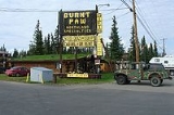
Tok, Alaska
Encyclopedia
Tok is a census-designated place
(CDP) in Southeast Fairbanks Census Area, Alaska
, United States. The population was 1,393 at the 2000 census
.
between the Tanana River
and the Alaska Range
at an important junction of the Alaska Highway
with the Glenn Highway
. According to the United States Census Bureau
, the CDP has a total area of 132.3 square miles (342.7 km²), all of it land.
of 2000, there were 1,393 people, 534 households, and 372 families residing in the census designated place (CDP). The population density was 10.5 people per square mile (6.1/km²). There were 748 housing units at an average density of 5.7 per square mile (2.2/km²). The racial makeup of the CDP was 78.03% White
, 0.14% Black
or African American
, 12.85% Native American
, 0.43% Asian
, 0.93% from other races
, and 7.61% from two or more races. Hispanic
or Latino
of any race were 2.08% of the population.
There were 534 households out of which 39.7% had children under the age of 18 living with them, 53.7% were married couples living together, 11.0% had a female householder with no husband present, and 30.3% were non-families. 24.7% of all households were made up of individuals and 5.4% had someone living alone who was 65 years of age or older. The average household size was 2.61 and the average family size was 3.12.
In the CDP the age distribution of the population shows 32.5% under the age of 18, 5.1% from 18 to 24, 29.5% from 25 to 44, 27.1% from 45 to 64, and 5.8% who were 65 years of age or older. The median age was 36 years. For every 100 females there were 102.2 males. For every 100 females age 18 and over, there were 102.6 males.
The median income for a household in the CDP was $37,941, and the median income for a family was $49,219. Males had a median income of $45,375 versus $30,268 for females. The per capita income
for the CDP was $18,521. About 9.5% of families and 10.5% of the population were below the poverty line, including 10.4% of those under age 18 and 7.7% of those age 65 or over.
 There have been Athabascan Indian settlements in the region of what is now Tok for many centuries.
The town at the present location of Tok began in 1942 as an Alaska Road Commission
camp used for construction and maintenance of the Alaska Highway
. So much money was spent in the camp's construction and maintenance that it earned the nickname "Million Dollar Camp" from those working on the highway. In 1947 the first school opened, and in 1958 a larger school was built to accommodate the many newcomers. In 1995 a new school was opened to provide for the larger community. A U.S. Customs
Office was located in Tok between 1947 and 1971, when it was moved to the Canadian border.
In one version, the name Tok is derived from the Athabascan word for "peaceful crossing." The U.S. Geological Survey notes that the name "Tok River" was in use for the nearby river around 1901, and the Athabasca
n name of "Tokai" had been reported for the same river by Lt. Allen in 1887. In another version the name is derived from the English words "Tokyo camp", although the major war benefit was supporting the transfer of airplanes to the Soviet Union. Another version claims the name was derived from the canine mascot for one of the Engineer units that built the highways.
In the 1940s and 1950s, another highway, the Tok Cut-Off
was constructed and connected Tok with the Richardson Highway
at Glennallen
. It was a "cut-off" because it allowed motor travelers from the lower United States to travel to Valdez
and Anchorage
in south-central Alaska without going further north to Delta Junction
and then traveling south on the Richardson Highway.
Between 1954 and 1979, an 8-inch U.S. Army fuel pipeline operated from the port of Haines
to Fairbanks
, with a pump station in Tok.
In July 1990 Tok faced extinction when a lightning-caused forest fire jumped two rivers and the Alaska Highway, putting both residents and buildings in peril. The town was evacuated and even the efforts of over a thousand firefighters could not stop the fire. At the last minute a "miracle wind" (so labeled by Tok's residents) came up, diverting the fire just short of the first building. The fire continued to burn the remainder of the summer, eventually burning more than 100000 acres (404.7 km²).
On January 10, 2009, Tok made headlines with an unconfirmed temperature reading of -80°F.
. Tok School, a K-12 campus, serves community students.
There is also a small University of Alaska office that provides distance and even some local classes for the small community.
Census-designated place
A census-designated place is a concentration of population identified by the United States Census Bureau for statistical purposes. CDPs are delineated for each decennial census as the statistical counterparts of incorporated places such as cities, towns and villages...
(CDP) in Southeast Fairbanks Census Area, Alaska
Southeast Fairbanks Census Area, Alaska
Southeast Fairbanks Census Area is a census area located in the state of Alaska, United States. As of the 2000 census, the population was 6,174. It is part of the unorganized borough and therefore has no borough seat...
, United States. The population was 1,393 at the 2000 census
United States Census, 2000
The Twenty-second United States Census, known as Census 2000 and conducted by the Census Bureau, determined the resident population of the United States on April 1, 2000, to be 281,421,906, an increase of 13.2% over the 248,709,873 persons enumerated during the 1990 Census...
.
Geography
Tok lies on a large, flat alluvial plain of the Tanana ValleyTanana Valley
The Tanana Valley is a lowland region in central Alaska in the United States, on the north side of the Alaska Range where the Tanana River emerges from the mountains.-Climate:...
between the Tanana River
Tanana River
The Tanana River is a tributary of the Yukon River in the U.S. state of Alaska. According to linguist and anthropologist William Bright, the name is from the Koyukon tene no, tenene, literally "trail river"....
and the Alaska Range
Alaska Range
The Alaska Range is a relatively narrow, 650-km-long mountain range in the southcentral region of the U.S. state of Alaska, from Lake Clark at its southwest end to the White River in Canada's Yukon Territory in the southeast...
at an important junction of the Alaska Highway
Alaska Highway
The Alaska Highway was constructed during World War II for the purpose of connecting the contiguous U.S. to Alaska through Canada. It begins at the junction with several Canadian highways in Dawson Creek, British Columbia and runs to Delta Junction, Alaska, via Whitehorse, Yukon...
with the Glenn Highway
Glenn Highway
-References:* Pasch, A. D., K. C. May. 2001. Taphonomy and paleoenvironment of hadrosaur from the Matanuska Formation in South-Central Alaska. In: Mesozioc Vertebrate Life. Ed.s Tanke, D. H., Carpenter, K., Skrepnick, M. W. Indiana University Press. Pages 219-236.-External links:**...
. According to the United States Census Bureau
United States Census Bureau
The United States Census Bureau is the government agency that is responsible for the United States Census. It also gathers other national demographic and economic data...
, the CDP has a total area of 132.3 square miles (342.7 km²), all of it land.
2000 Census data
As of the censusCensus
A census is the procedure of systematically acquiring and recording information about the members of a given population. It is a regularly occurring and official count of a particular population. The term is used mostly in connection with national population and housing censuses; other common...
of 2000, there were 1,393 people, 534 households, and 372 families residing in the census designated place (CDP). The population density was 10.5 people per square mile (6.1/km²). There were 748 housing units at an average density of 5.7 per square mile (2.2/km²). The racial makeup of the CDP was 78.03% White
Race (United States Census)
Race and ethnicity in the United States Census, as defined by the Federal Office of Management and Budget and the United States Census Bureau, are self-identification data items in which residents choose the race or races with which they most closely identify, and indicate whether or not they are...
, 0.14% Black
Race (United States Census)
Race and ethnicity in the United States Census, as defined by the Federal Office of Management and Budget and the United States Census Bureau, are self-identification data items in which residents choose the race or races with which they most closely identify, and indicate whether or not they are...
or African American
Race (United States Census)
Race and ethnicity in the United States Census, as defined by the Federal Office of Management and Budget and the United States Census Bureau, are self-identification data items in which residents choose the race or races with which they most closely identify, and indicate whether or not they are...
, 12.85% Native American
Race (United States Census)
Race and ethnicity in the United States Census, as defined by the Federal Office of Management and Budget and the United States Census Bureau, are self-identification data items in which residents choose the race or races with which they most closely identify, and indicate whether or not they are...
, 0.43% Asian
Race (United States Census)
Race and ethnicity in the United States Census, as defined by the Federal Office of Management and Budget and the United States Census Bureau, are self-identification data items in which residents choose the race or races with which they most closely identify, and indicate whether or not they are...
, 0.93% from other races
Race (United States Census)
Race and ethnicity in the United States Census, as defined by the Federal Office of Management and Budget and the United States Census Bureau, are self-identification data items in which residents choose the race or races with which they most closely identify, and indicate whether or not they are...
, and 7.61% from two or more races. Hispanic
Race (United States Census)
Race and ethnicity in the United States Census, as defined by the Federal Office of Management and Budget and the United States Census Bureau, are self-identification data items in which residents choose the race or races with which they most closely identify, and indicate whether or not they are...
or Latino
Race (United States Census)
Race and ethnicity in the United States Census, as defined by the Federal Office of Management and Budget and the United States Census Bureau, are self-identification data items in which residents choose the race or races with which they most closely identify, and indicate whether or not they are...
of any race were 2.08% of the population.
There were 534 households out of which 39.7% had children under the age of 18 living with them, 53.7% were married couples living together, 11.0% had a female householder with no husband present, and 30.3% were non-families. 24.7% of all households were made up of individuals and 5.4% had someone living alone who was 65 years of age or older. The average household size was 2.61 and the average family size was 3.12.
In the CDP the age distribution of the population shows 32.5% under the age of 18, 5.1% from 18 to 24, 29.5% from 25 to 44, 27.1% from 45 to 64, and 5.8% who were 65 years of age or older. The median age was 36 years. For every 100 females there were 102.2 males. For every 100 females age 18 and over, there were 102.6 males.
The median income for a household in the CDP was $37,941, and the median income for a family was $49,219. Males had a median income of $45,375 versus $30,268 for females. The per capita income
Per capita income
Per capita income or income per person is a measure of mean income within an economic aggregate, such as a country or city. It is calculated by taking a measure of all sources of income in the aggregate and dividing it by the total population...
for the CDP was $18,521. About 9.5% of families and 10.5% of the population were below the poverty line, including 10.4% of those under age 18 and 7.7% of those age 65 or over.
History
The town at the present location of Tok began in 1942 as an Alaska Road Commission
Alaska Road Commission
The Board of Road Commissioners for Alaska, more commonly known as the Alaska Road Commission or ARC, was created in 1905 as a board of the U.S. War Department...
camp used for construction and maintenance of the Alaska Highway
Alaska Highway
The Alaska Highway was constructed during World War II for the purpose of connecting the contiguous U.S. to Alaska through Canada. It begins at the junction with several Canadian highways in Dawson Creek, British Columbia and runs to Delta Junction, Alaska, via Whitehorse, Yukon...
. So much money was spent in the camp's construction and maintenance that it earned the nickname "Million Dollar Camp" from those working on the highway. In 1947 the first school opened, and in 1958 a larger school was built to accommodate the many newcomers. In 1995 a new school was opened to provide for the larger community. A U.S. Customs
United States Customs Service
Until March 2003, the United States Customs Service was an agency of the U.S. federal government that collected import tariffs and performed other selected border security duties.Before it was rolled into form part of the U.S...
Office was located in Tok between 1947 and 1971, when it was moved to the Canadian border.
In one version, the name Tok is derived from the Athabascan word for "peaceful crossing." The U.S. Geological Survey notes that the name "Tok River" was in use for the nearby river around 1901, and the Athabasca
Athabasca
Athabasca is an anglicized version of the Cree name for Lake Athabasca in Canada, āthap-āsk-ā-w , meaning “grass or reeds here and there”.Related to the lake are several other geographical and administrative features called Athabasca...
n name of "Tokai" had been reported for the same river by Lt. Allen in 1887. In another version the name is derived from the English words "Tokyo camp", although the major war benefit was supporting the transfer of airplanes to the Soviet Union. Another version claims the name was derived from the canine mascot for one of the Engineer units that built the highways.
In the 1940s and 1950s, another highway, the Tok Cut-Off
Tok Cut-Off
The Tok Cut-Off is a highway in the U.S. state of Alaska, running 125 miles from Gakona Junction on the Richardson Highway, 14 miles north of Glennallen, to Tok on the Alaska Highway....
was constructed and connected Tok with the Richardson Highway
Richardson Highway
The Richardson Highway is a highway in the U.S. state of Alaska, running 368 miles from Valdez to Fairbanks. It is marked as Alaska Route 4 from Valdez to Delta Junction and as Alaska Route 2 from there to Fairbanks. It is also connects segments of Alaska Route 1 between the Glenn Highway and the...
at Glennallen
Glennallen, Alaska
Glennallen is a census-designated place in the Valdez-Cordova Census Area in the Unorganized Borough of the U.S. state of Alaska. As of the 2000 census, the population of the CDP was 554.- Location :...
. It was a "cut-off" because it allowed motor travelers from the lower United States to travel to Valdez
Valdez, Alaska
Valdez is a city in Valdez-Cordova Census Area in the U.S. state of Alaska. According to 2005 Census Bureau estimates, the population of the city is 4,020. The city is one of the most important ports in Alaska. The port of Valdez was named in 1790 after the Spanish naval officer Antonio Valdés y...
and Anchorage
Anchorage, Alaska
Anchorage is a unified home rule municipality in the southcentral part of the U.S. state of Alaska. It is the northernmost major city in the United States...
in south-central Alaska without going further north to Delta Junction
Delta Junction, Alaska
Delta Junction is a city in the Southeast Fairbanks Census Area, Alaska, United States. According to 2005 Census Bureau estimates, the population of the city is 897. The city is located a short distance south of the confluence of the Delta River with the Tanana River, which is at Big Delta...
and then traveling south on the Richardson Highway.
Between 1954 and 1979, an 8-inch U.S. Army fuel pipeline operated from the port of Haines
Haines, Alaska
Haines is a census-designated place in Haines Borough, Alaska, United States. As of the 2000 census, the population of the area was 1,811. Haines was formerly a city but no longer has a municipal government...
to Fairbanks
Fairbanks, Alaska
Fairbanks is a home rule city in and the borough seat of the Fairbanks North Star Borough in the U.S. state of Alaska.Fairbanks is the largest city in the Interior region of Alaska, and second largest in the state behind Anchorage...
, with a pump station in Tok.
In July 1990 Tok faced extinction when a lightning-caused forest fire jumped two rivers and the Alaska Highway, putting both residents and buildings in peril. The town was evacuated and even the efforts of over a thousand firefighters could not stop the fire. At the last minute a "miracle wind" (so labeled by Tok's residents) came up, diverting the fire just short of the first building. The fire continued to burn the remainder of the summer, eventually burning more than 100000 acres (404.7 km²).
On January 10, 2009, Tok made headlines with an unconfirmed temperature reading of -80°F.
Education
Tok is part of the Alaska Gateway School DistrictAlaska Gateway School District
The Alaska Gateway School District is a public school district based in Tok, Alaska .The district covers approximately in the eastern interior of Alaska, extending north from the Alaska Range to the Yukon River and Canadian border...
. Tok School, a K-12 campus, serves community students.
There is also a small University of Alaska office that provides distance and even some local classes for the small community.