

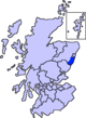
Kincardine and Mearns
Encyclopedia
Area committee
Many large local government councils in the United Kingdom have a system of area committees, with responsibility for services in a particular part of the area covered by the council....
s of the Aberdeenshire
Aberdeenshire
Aberdeenshire is one of the 32 unitary council areas in Scotland and a lieutenancy area.The present day Aberdeenshire council area does not include the City of Aberdeen, now a separate council area, from which its name derives. Together, the modern council area and the city formed historic...
council area
Council Area
A Council Area is one of the areas defined in Schedule 1 of the Local Government etc. Act 1994 and is under the control of one of the local authorities in Scotland created by that Act.-Legislation :1889...
in Scotland
Scotland
Scotland is a country that is part of the United Kingdom. Occupying the northern third of the island of Great Britain, it shares a border with England to the south and is bounded by the North Sea to the east, the Atlantic Ocean to the north and west, and the North Channel and Irish Sea to the...
. It has a population 38,506 (2001 Census). There are significant natural features in this district including river
River
A river is a natural watercourse, usually freshwater, flowing towards an ocean, a lake, a sea, or another river. In a few cases, a river simply flows into the ground or dries up completely before reaching another body of water. Small rivers may also be called by several other names, including...
s, forest
Forest
A forest, also referred to as a wood or the woods, is an area with a high density of trees. As with cities, depending where you are in the world, what is considered a forest may vary significantly in size and have various classification according to how and what of the forest is composed...
s, mountain
Mountain
Image:Himalaya_annotated.jpg|thumb|right|The Himalayan mountain range with Mount Everestrect 58 14 160 49 Chomo Lonzorect 200 28 335 52 Makalurect 378 24 566 45 Mount Everestrect 188 581 920 656 Tibetan Plateaurect 250 406 340 427 Rong River...
s and bog
Bog
A bog, quagmire or mire is a wetland that accumulates acidic peat, a deposit of dead plant material—often mosses or, in Arctic climates, lichens....
s (known locally as mosses).
Transport links with Aberdeen
Aberdeen
Aberdeen is Scotland's third most populous city, one of Scotland's 32 local government council areas and the United Kingdom's 25th most populous city, with an official population estimate of ....
have encouraged rapid population growth, especially in the north of this region. Existing settlements such as Portlethen
Portlethen
Portlethen is a town located approximately 7 miles south of Aberdeen, Scotland along the A90. The estimated population is currently 7,327.To the east of Portlethen lie three fishing villages: Findon, Downies and Portlethen Village .Although Portlethen has been granted official town status, it...
and Stonehaven
Stonehaven
Stonehaven is a town in Aberdeenshire, Scotland. It lies on Scotland's northeast coast and had a population of 9,577 in 2001 census.Stonehaven, county town of Kincardineshire, grew around an Iron Age fishing village, now the "Auld Toon" , and expanded inland from the seaside...
have greatly expanded, along with industrial activity. The southern part is more self-sufficient, with the fertile Mearns
Mearns
Mearns can refer to*Mearns Academy* Mearns, Alberta* Mearns Castle*Mearns Castle High School* Mearns FM* Mearns Primary School* Kincardineshire, the County of Kincardine, The Mearns in Scotland* Newton Mearnsin biology:...
area sustaining a strong agricultural economy. Small scale tourism activity occurs along its attractive coastline and former fishing villages.
Kincardine and Deeside district
Between 1975 and 1996 Kincardine and Deeside was a local government district within the Grampian region. Its area included all of the county of KincardineshireKincardineshire
The County of Kincardine, also known as Kincardineshire or The Mearns was a local government county on the coast of northeast Scotland...
apart from a small area in the northeast which was covered by the City of Aberdeen. As the name suggested, it also included the large geographical area of the watershed
Drainage basin
A drainage basin is an extent or an area of land where surface water from rain and melting snow or ice converges to a single point, usually the exit of the basin, where the waters join another waterbody, such as a river, lake, reservoir, estuary, wetland, sea, or ocean...
of the River Dee
River Dee, Aberdeenshire
The River Dee is a river in Aberdeenshire, Scotland. It rises in the Cairngorms and flows through Strathdee to reach the North Sea at Aberdeen...
from the southern section of Aberdeenshire. In 1996, this district became part of Aberdeenshire
Aberdeenshire
Aberdeenshire is one of the 32 unitary council areas in Scotland and a lieutenancy area.The present day Aberdeenshire council area does not include the City of Aberdeen, now a separate council area, from which its name derives. Together, the modern council area and the city formed historic...
unitary authority
Unitary authority
A unitary authority is a type of local authority that has a single tier and is responsible for all local government functions within its area or performs additional functions which elsewhere in the relevant country are usually performed by national government or a higher level of sub-national...
in the local government reorganisation.
History
In medieval times, the northern part of the area known as KincardineKincardine
Kincardine or Kincardine-on-Forth is a small town located on the north shore of the Firth of Forth, in Fife, Scotland. The town was given the status of a Burgh of barony in 1663. It was at one time a reasonably prosperous minor port...
was comprised by the Thanedom of Cowie and the Thanedom of Durris. The Mearns was described as an earldom. Each of these thanage
Thanage
A thanage was an area of land held by a thegn in Anglo-Saxon England.Thanage can also denote the rank held by such a thegn....
s was with the Crown as late as 1264 AD. In the Middle Ages
Middle Ages
The Middle Ages is a periodization of European history from the 5th century to the 15th century. The Middle Ages follows the fall of the Western Roman Empire in 476 and precedes the Early Modern Era. It is the middle period of a three-period division of Western history: Classic, Medieval and Modern...
the principal roadway connecting Stonehaven
Stonehaven
Stonehaven is a town in Aberdeenshire, Scotland. It lies on Scotland's northeast coast and had a population of 9,577 in 2001 census.Stonehaven, county town of Kincardineshire, grew around an Iron Age fishing village, now the "Auld Toon" , and expanded inland from the seaside...
to Aberdeen
Aberdeen
Aberdeen is Scotland's third most populous city, one of Scotland's 32 local government council areas and the United Kingdom's 25th most populous city, with an official population estimate of ....
was known as the Causey Mounth
Causey Mounth
The Causey Mounth is an ancient drovers' road over the coastal fringe of the Grampian Mountains in Aberdeenshire, Scotland. This route was developed as the main highway between Stonehaven and Aberdeen around the 12th century AD and it continued to function as the principal route connecting these...
; this drovers' road was constructed in some places with large boulders in order to span certain boggy stretches.
During the Scottish Enlightenment
Scottish Enlightenment
The Scottish Enlightenment was the period in 18th century Scotland characterised by an outpouring of intellectual and scientific accomplishments. By 1750, Scots were among the most literate citizens of Europe, with an estimated 75% level of literacy...
period, Lord Monboddo operated a large agricultural estate in the Mearns, at which location he conducted considerable research in agricultural improvement; Monboddo was best known as a jurist on the Court of Session
Court of Session
The Court of Session is the supreme civil court of Scotland, and constitutes part of the College of Justice. It sits in Parliament House in Edinburgh and is both a court of first instance and a court of appeal....
, as the father of modern historical linguistics and a pre-evolutionary thinker.
Notable architecture
- Dunnotar Castle, Muchalls CastleMuchalls CastleMuchalls Castle stands overlooking the North Sea in the countryside of Kincardine and Mearns, Aberdeenshire, Scotland. The lower course is a well preserved double groined 13th century towerhouse structure, built by the Frasers of Muchalls. Upon this structure, the 17th century castle was begun by...
and Fetteresso CastleFetteresso CastleFetteresso Castle is a 14th century towerhouse, rebuilt in 1761 as a Scottish gothic style Palladian manor, with clear evidence of prehistoric use of the site. It is situated immediately west of the town of Stonehaven in Kincardineshire slightly to the west of the A90 dual carriageway...
are located within this district. - In the village of MuchallsMuchallsMuchalls is a small coastal ex-fishing village in Kincardineshire, Scotland, south of Newtonhill and north of Stonehaven. Muchalls is situated slightly north of a smaller hamlet known as the Bridge of Muchalls. At the western edge of Muchalls is the historic Saint Ternan's Church...
at Victorian times there existed a large hotel, which fell into ruin in the latter 20th century. - There are numerous prehistoric stone circleStone circleA stone circle is a monument of standing stones arranged in a circle. Such monuments have been constructed across the world throughout history for many different reasons....
s, standing stoneStanding stoneStanding stones, orthostats, liths, or more commonly megaliths are solitary stones set vertically in the ground and come in many different varieties....
s and cairnCairnCairn is a term used mainly in the English-speaking world for a man-made pile of stones. It comes from the or . Cairns are found all over the world in uplands, on moorland, on mountaintops, near waterways and on sea cliffs, and also in barren desert and tundra areas...
s within this geographic unit.
Geography and landforms
Rivers and streams in Kincardine and Mearns include the Burn of ElsickBurn of Elsick
The Burn of Elsick is a coastal stream in Aberdeenshire, Scotland that discharges to the North Sea. This watercourse drains primarily agricultural lands and enters the North Sea at Newtonhill.-History:...
, Burn of Pheppie
Burn of Pheppie
The Burn of Pheppie is an easterly flowing coastal stream in Aberdeenshire, Scotland that discharges to the North Sea immediately north of the village of Muchalls. Draining chiefly agricultural lands, this stream has a notable lack of turbidity and a pH level of approximately 8.02...
, Burn of Muchalls
Burn of Muchalls
The Burn of Muchalls is an easterly flowing stream in Aberdeenshire, Scotland that discharges to the North Sea. Its point of discharge is on a rocky beach set with scenic sea stacks...
, Cowie Water
Cowie Water
The Cowie Water is a river rising in the Grampian Mountains in Aberdeenshire, Scotland that discharges to the North Sea in the northern part of Stonehaven. south of the ruined Cowie Castle...
, Carron Water
Carron Water, Aberdeenshire
Carron Water is a river in Aberdeenshire, Scotland.Carron Water rises in Fetteresso Forest on the eastern edge of the Grampians. It flows past Fetteresso Castle and discharges into the North Sea at Stonehaven Bay. Carron Water separates the Old Town from Stonehaven's new town , laid out in...
and Bervie Water
Bervie Water
Bervie Water is a river in Aberdeenshire, Scotland which rises in the Drumtochty Forest and flows across The Mearns to reach the North Sea at Inverbervie. Approximately two kilometres upstream of the North Sea, the Bervie Water flows through the grounds of Allardice Castle. The Bothenoth Burn ...
, all of which discharge to the North Sea
North Sea
In the southwest, beyond the Straits of Dover, the North Sea becomes the English Channel connecting to the Atlantic Ocean. In the east, it connects to the Baltic Sea via the Skagerrak and Kattegat, narrow straits that separate Denmark from Norway and Sweden respectively...
.