
Itcha Range
Encyclopedia
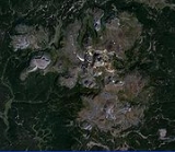
The Itcha Range is a mountain range
on the Chilcotin Plateau
of the West-Central Interior
of British Columbia
, Canada
. The range is located 25 miles (40 km) northeast of Anahim Lake. Its main peaks are Itcha Mountain
and Mount Downton
.
shield volcano
in the Anahim Volcanic Belt which includes other immediately nearby ranges, the Rainbow
and Ilgachuz Range
s. The shield has a diameter of 10 kilometers and is now eroded
by glacier
s carving into the volcanic rock
. The Itcha Range and its neighbours were formed when the North American Plate
moved over a stationary hotspot
, known as the Anahim hotspot
. The hotspot is considered similar to the one feeding the Hawaiian Islands
.
Most late-stage lavas capping the Itcha shield complex were erupted from cinder cones
, tuff rings, and fissures
in the eastern half of the complex. The Itcha shield complex contains at least 23 cinder cones, all of which were active during the Pleistocene
period.
Satah Mountain
occupies the high point of a long ridge
of trachytic lava dome
s, lava flow
s and basalt
ic and trachybasaltic pyroclastic cones, extending south from the felsic Itcha Range shield complex. The youngest cone is well preserved, and could be of comparable age to the 7200-year-old Nazko Cone
east of the Itcha Range. Like most volcanoes in British Columbia, it is part of the Pacific Ring of Fire
which includes over 160 active volcanoes.
, while the Rainbow Range lies partly in the Tweedsmuir South Provincial Park
.
Mountain range
A mountain range is a single, large mass consisting of a succession of mountains or narrowly spaced mountain ridges, with or without peaks, closely related in position, direction, formation, and age; a component part of a mountain system or of a mountain chain...
on the Chilcotin Plateau
Chilcotin Plateau
The Chilcotin Plateau is part of the Fraser Plateau, a major subdivision of the Interior Plateau of British Columbia. The Chilcotin Plateau is physically near-identical with the region of the same name, i.e...
of the West-Central Interior
British Columbia Interior
The British Columbia Interior or BC Interior or Interior of British Columbia, usually referred to only as the Interior, is one of the three main regions of the Canadian province of British Columbia, the other two being the Lower Mainland, which comprises the overlapping areas of Greater Vancouver...
of British Columbia
British Columbia
British Columbia is the westernmost of Canada's provinces and is known for its natural beauty, as reflected in its Latin motto, Splendor sine occasu . Its name was chosen by Queen Victoria in 1858...
, Canada
Canada
Canada is a North American country consisting of ten provinces and three territories. Located in the northern part of the continent, it extends from the Atlantic Ocean in the east to the Pacific Ocean in the west, and northward into the Arctic Ocean...
. The range is located 25 miles (40 km) northeast of Anahim Lake. Its main peaks are Itcha Mountain
Itcha Mountain
Itcha Mountain is one of the two main volcanic peaks of the Itcha Range, which is located in the Chilcotin District of the Central Interior of British Columbia, Canada. It is in the Anahim Volcanic Belt, which formed when the North American Plate moved over a hotspot, similar to the one feeding the...
and Mount Downton
Mount Downton
Mount Downton is the highest summit of the diameter Itcha Range, located northeast of Anahim Lake and east of Far Mountain in the Chilcotin District of the Central Interior of British Columbia, Canada. It lies within Itcha Ilgachuz Provincial Park....
.
Geology
The Itcha Range is a 2.5-million-year-old massive felsicFelsic
The word "felsic" is a term used in geology to refer to silicate minerals, magma, and rocks which are enriched in the lighter elements such as silicon, oxygen, aluminium, sodium, and potassium....
shield volcano
Shield volcano
A shield volcano is a type of volcano usually built almost entirely of fluid lava flows. They are named for their large size and low profile, resembling a warrior's shield. This is caused by the highly fluid lava they erupt, which travels farther than lava erupted from more explosive volcanoes...
in the Anahim Volcanic Belt which includes other immediately nearby ranges, the Rainbow
Rainbow Range (Coast Mountains)
The Rainbow Range, formerly known as the Rainbow Mountains, is a mountain range in British Columbia, Canada, located northwest of Anahim Lake...
and Ilgachuz Range
Ilgachuz Range
The Ilgachuz Range is a name given to an extinct shield volcano in British Columbia, Canada. It is not a mountain range in the normal sense, because it was formed as a single volcano that has been eroded for the past 5 million years. It lies on the Chilcotin Plateau, located some north-northwest...
s. The shield has a diameter of 10 kilometers and is now eroded
Erosion
Erosion is when materials are removed from the surface and changed into something else. It only works by hydraulic actions and transport of solids in the natural environment, and leads to the deposition of these materials elsewhere...
by glacier
Glacier
A glacier is a large persistent body of ice that forms where the accumulation of snow exceeds its ablation over many years, often centuries. At least 0.1 km² in area and 50 m thick, but often much larger, a glacier slowly deforms and flows due to stresses induced by its weight...
s carving into the volcanic rock
Volcanic rock
Volcanic rock is a rock formed from magma erupted from a volcano. In other words, it is an igneous rock of volcanic origin...
. The Itcha Range and its neighbours were formed when the North American Plate
North American Plate
The North American Plate is a tectonic plate covering most of North America, Greenland, Cuba, Bahamas, and parts of Siberia, Japan and Iceland. It extends eastward to the Mid-Atlantic Ridge and westward to the Chersky Range in eastern Siberia. The plate includes both continental and oceanic crust...
moved over a stationary hotspot
Hotspot (geology)
The places known as hotspots or hot spots in geology are volcanic regions thought to be fed by underlying mantle that is anomalously hot compared with the mantle elsewhere. They may be on, near to, or far from tectonic plate boundaries. There are two hypotheses to explain them...
, known as the Anahim hotspot
Anahim hotspot
The Anahim hotspot is a volcanic hotspot in central British Columbia, Canada. It is situated on the Interior Plateau, a large region that lies between the Cariboo and Monashee Mountains to the east, and the Hazelton Mountains, Coast Mountains and Cascade Range to the west...
. The hotspot is considered similar to the one feeding the Hawaiian Islands
Hawaiian Islands
The Hawaiian Islands are an archipelago of eight major islands, several atolls, numerous smaller islets, and undersea seamounts in the North Pacific Ocean, extending some 1,500 miles from the island of Hawaii in the south to northernmost Kure Atoll...
.
Most late-stage lavas capping the Itcha shield complex were erupted from cinder cones
Volcanic cone
Volcanic cones are among the simplest volcanic formations. They are built by ejecta from a volcanic vent, piling up around the vent in the shape of a cone with a central crater. Volcanic cones are of different types, depending upon the nature and size of the fragments ejected during the eruption...
, tuff rings, and fissures
Fissure vent
A fissure vent, also known as a volcanic fissure or simply fissure, is a linear volcanic vent through which lava erupts, usually without any explosive activity. The vent is usually a few meters wide and may be many kilometers long. Fissure vents can cause large flood basalts and lava channels...
in the eastern half of the complex. The Itcha shield complex contains at least 23 cinder cones, all of which were active during the Pleistocene
Pleistocene
The Pleistocene is the epoch from 2,588,000 to 11,700 years BP that spans the world's recent period of repeated glaciations. The name pleistocene is derived from the Greek and ....
period.
Satah Mountain
Satah Mountain
Satah Mountain is a cinder cone, located east-northeast of Nimpo Lake in central British Columbia, Canada. It areas to the south form a N-S-trending chain of cinder cones of Pleistocene and Holocene age. It lies on the Chilcotin Plateau....
occupies the high point of a long ridge
Ridge
A ridge is a geological feature consisting of a chain of mountains or hills that form a continuous elevated crest for some distance. Ridges are usually termed hills or mountains as well, depending on size. There are several main types of ridges:...
of trachytic lava dome
Lava dome
|250px|thumb|right|Image of the [[rhyolitic]] lava dome of [[Chaitén Volcano]] during its 2008–2009 eruption.In volcanology, a lava dome is a roughly circular mound-shaped protrusion resulting from the slow extrusion of viscous lava from a volcano...
s, lava flow
Lava
Lava refers both to molten rock expelled by a volcano during an eruption and the resulting rock after solidification and cooling. This molten rock is formed in the interior of some planets, including Earth, and some of their satellites. When first erupted from a volcanic vent, lava is a liquid at...
s and basalt
Basalt
Basalt is a common extrusive volcanic rock. It is usually grey to black and fine-grained due to rapid cooling of lava at the surface of a planet. It may be porphyritic containing larger crystals in a fine matrix, or vesicular, or frothy scoria. Unweathered basalt is black or grey...
ic and trachybasaltic pyroclastic cones, extending south from the felsic Itcha Range shield complex. The youngest cone is well preserved, and could be of comparable age to the 7200-year-old Nazko Cone
Nazko Cone
Nazko Cone is a small potentially active basaltic cinder cone in central British Columbia, Canada, located 75 km west of Quesnel and 150 kilometers southwest of Prince George. It is considered the easternmost volcano in the Anahim Volcanic Belt. The small tree-covered cone rises 120 m above...
east of the Itcha Range. Like most volcanoes in British Columbia, it is part of the Pacific Ring of Fire
Pacific Ring of Fire
The Pacific Ring of Fire is an area where large numbers of earthquakes and volcanic eruptions occur in the basin of the Pacific Ocean. In a horseshoe shape, it is associated with a nearly continuous series of oceanic trenches, volcanic arcs, and volcanic belts and/or plate movements...
which includes over 160 active volcanoes.
Itcha Ilgachuz Provincial Park
The Itcha and Ilgachuz Ranges form the core of the Itcha Ilgachuz Provincial ParkItcha Ilgachuz Provincial Park
Itcha Ilgachuz Provincial Park is a provincial park in the Chilcotin Country of British Columbia, Canada. The park is 111,977 hectares in size and contains Far Mountain and Mount Downton, its two most prominent peaks.-History and conservation:...
, while the Rainbow Range lies partly in the Tweedsmuir South Provincial Park
Tweedsmuir South Provincial Park
Tweedsmuir South Provincial Park is a provincial park in British Columbia, Canada. Formerly part of Tweedsmuir Provincial Park it was formed from the southern portion of that park, the northern portion being redesignated Tweedsmuir North Provincial Park and Protected Area in order to allow...
.
See also
- Anahim Volcanic BeltAnahim Volcanic BeltThe Anahim Volcanic Belt is a long volcanic belt, stretching from just north of Vancouver Island to near Quesnel, British Columbia, Canada. The Anahim Volcanic Belt has had three main magmatic episodes: 15–13 Ma, 9–6 Ma, and 3–1 Ma. The volcanoes generally become younger eastward at a rate of to ...
- Anahim hotspotAnahim hotspotThe Anahim hotspot is a volcanic hotspot in central British Columbia, Canada. It is situated on the Interior Plateau, a large region that lies between the Cariboo and Monashee Mountains to the east, and the Hazelton Mountains, Coast Mountains and Cascade Range to the west...
- Ilgachuz RangeIlgachuz RangeThe Ilgachuz Range is a name given to an extinct shield volcano in British Columbia, Canada. It is not a mountain range in the normal sense, because it was formed as a single volcano that has been eroded for the past 5 million years. It lies on the Chilcotin Plateau, located some north-northwest...
- Itcha Ilgachuz Provincial ParkItcha Ilgachuz Provincial ParkItcha Ilgachuz Provincial Park is a provincial park in the Chilcotin Country of British Columbia, Canada. The park is 111,977 hectares in size and contains Far Mountain and Mount Downton, its two most prominent peaks.-History and conservation:...
- Rainbow RangeRainbow Range (Coast Mountains)The Rainbow Range, formerly known as the Rainbow Mountains, is a mountain range in British Columbia, Canada, located northwest of Anahim Lake...
- Tweedsmuir South Provincial ParkTweedsmuir South Provincial ParkTweedsmuir South Provincial Park is a provincial park in British Columbia, Canada. Formerly part of Tweedsmuir Provincial Park it was formed from the southern portion of that park, the northern portion being redesignated Tweedsmuir North Provincial Park and Protected Area in order to allow...
- List of volcanoes in Canada
- Volcanism of Canada
- Volcanism of Western CanadaVolcanism of Western CanadaVolcanism of Western Canada produces lava flows, lava plateaus, lava domes, cinder cones, stratovolcanoes, shield volcanoes, submarine volcanoes, calderas, diatremes and maars, along with examples of more less common volcanic forms such as tuyas and subglacial mounds.-Volcanic belts:*Anahim...
- Geology of the Pacific NorthwestGeology of the Pacific NorthwestThe geology of the Pacific Northwest refers to the study of the composition , structure, physical properties and the processes that shape the Pacific Northwest region of the United States and Canada...