
Frederick, South Dakota
Encyclopedia
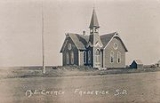
Frederick is a town in Brown County, South Dakota
, United States
. The population was 199 at the 2010 census. Home to the annual Frederick Finn Fest, the town is part of the Aberdeen Micropolitan Statistical Area.
 Frederick was a railway town
plat
ted and sold to pioneers by the Chicago, Milwaukee & St. Paul Railroad, which completed track into it on September 12, 1881. Its grid of blocks
was aligned by compass
, with numbered avenues running north-south, and numbered streets running east-west. Main Street and Railway Avenue intersect at the grid's core. Incorporated on June 21, 1882, Frederick was named after the railroad's Finnish immigration agent and sales clerk—Kustaa "Frederick" Bergstadius.
According to the United States Census Bureau
, the town has a total area of 0.4 square miles (1 km²), all of it land. Frederick is drained by the Maple River.
The town is connected by U.S. Route 281
.
Frederick has been assigned the ZIP code
57441 and the FIPS place code 22860.
of 2000, there were 255 people, 119 households, and 76 families residing in the town. The population density
was 699.7 people per square mile (273.5/km²). There were 140 housing units at an average density of 384.2 per square mile (150.2/km²). The racial makeup of the town was 97.65% White, 1.18% Native American, 0.39% from other races
, and 0.78% from two or more races. Hispanic or Latino of any race were 0.39% of the population. 45.2% were of German
, 22.6% Norwegian
and 7.5% Finnish ancestry according to Census 2000.
There were 119 households out of which 27.7% had children under the age of 18 living with them, 51.3% were married couples
living together, 8.4% had a female householder with no husband present, and 35.3% were non-families. 33.6% of all households were made up of individuals and 19.3% had someone living alone who was 65 years of age or older. The average household size was 2.14 and the average family size was 2.69.
In the town the population was spread out with 22.7% under the age of 18, 5.9% from 18 to 24, 23.9% from 25 to 44, 25.1% from 45 to 64, and 22.4% who were 65 years of age or older. The median age was 42 years. For every 100 females there were 91.7 males. For every 100 females age 18 and over, there were 95.0 males.
The median income for a household in the town was $31,500, and the median income for a family was $34,688. Males had a median income of $25,288 versus $18,214 for females. The per capita income
for the town was $13,881. About 11.1% of families and 11.4% of the population were below the poverty line, including 13.4% of those under the age of eighteen and 18.8% of those sixty five or over.
South Dakota
South Dakota is a state located in the Midwestern region of the United States. It is named after the Lakota and Dakota Sioux American Indian tribes. Once a part of Dakota Territory, South Dakota became a state on November 2, 1889. The state has an area of and an estimated population of just over...
, United States
United States
The United States of America is a federal constitutional republic comprising fifty states and a federal district...
. The population was 199 at the 2010 census. Home to the annual Frederick Finn Fest, the town is part of the Aberdeen Micropolitan Statistical Area.
History
Railway town
A railway town is a settlement that originated or was greatly developed because of a railway station or junction at its site.In Victorian Britain, the spread of railways greatly affected the fate of many small towns...
plat
Plat
A plat in the U.S. is a map, drawn to scale, showing the divisions of a piece of land. Other English-speaking countries generally call such documents a cadastral map or plan....
ted and sold to pioneers by the Chicago, Milwaukee & St. Paul Railroad, which completed track into it on September 12, 1881. Its grid of blocks
City block
A city block, urban block or simply block is a central element of urban planning and urban design. A city block is the smallest area that is surrounded by streets. City blocks are the space for buildings within the street pattern of a city, they form the basic unit of a city's urban fabric...
was aligned by compass
Compass
A compass is a navigational instrument that shows directions in a frame of reference that is stationary relative to the surface of the earth. The frame of reference defines the four cardinal directions – north, south, east, and west. Intermediate directions are also defined...
, with numbered avenues running north-south, and numbered streets running east-west. Main Street and Railway Avenue intersect at the grid's core. Incorporated on June 21, 1882, Frederick was named after the railroad's Finnish immigration agent and sales clerk—Kustaa "Frederick" Bergstadius.
Geography
Frederick is located at 45°49′58"N 98°30′25"W (45.832812, -98.507026).According to the United States Census Bureau
United States Census Bureau
The United States Census Bureau is the government agency that is responsible for the United States Census. It also gathers other national demographic and economic data...
, the town has a total area of 0.4 square miles (1 km²), all of it land. Frederick is drained by the Maple River.
The town is connected by
U.S. Route 281U.S. Route 281
U.S. Route 281 is a north–south United States highway. At 1,872 miles long it is the longest continuous three-digit U.S. Route....
.
Frederick has been assigned the ZIP code
ZIP Code
ZIP codes are a system of postal codes used by the United States Postal Service since 1963. The term ZIP, an acronym for Zone Improvement Plan, is properly written in capital letters and was chosen to suggest that the mail travels more efficiently, and therefore more quickly, when senders use the...
57441 and the FIPS place code 22860.
Demographics
As of the censusCensus
A census is the procedure of systematically acquiring and recording information about the members of a given population. It is a regularly occurring and official count of a particular population. The term is used mostly in connection with national population and housing censuses; other common...
of 2000, there were 255 people, 119 households, and 76 families residing in the town. The population density
Population density
Population density is a measurement of population per unit area or unit volume. It is frequently applied to living organisms, and particularly to humans...
was 699.7 people per square mile (273.5/km²). There were 140 housing units at an average density of 384.2 per square mile (150.2/km²). The racial makeup of the town was 97.65% White, 1.18% Native American, 0.39% from other races
Race (United States Census)
Race and ethnicity in the United States Census, as defined by the Federal Office of Management and Budget and the United States Census Bureau, are self-identification data items in which residents choose the race or races with which they most closely identify, and indicate whether or not they are...
, and 0.78% from two or more races. Hispanic or Latino of any race were 0.39% of the population. 45.2% were of German
Germans
The Germans are a Germanic ethnic group native to Central Europe. The English term Germans has referred to the German-speaking population of the Holy Roman Empire since the Late Middle Ages....
, 22.6% Norwegian
Norwegians
Norwegians constitute both a nation and an ethnic group native to Norway. They share a common culture and speak the Norwegian language. Norwegian people and their descendants are found in migrant communities worldwide, notably in United States, Canada and Brazil.-History:Towards the end of the 3rd...
and 7.5% Finnish ancestry according to Census 2000.
There were 119 households out of which 27.7% had children under the age of 18 living with them, 51.3% were married couples
Marriage
Marriage is a social union or legal contract between people that creates kinship. It is an institution in which interpersonal relationships, usually intimate and sexual, are acknowledged in a variety of ways, depending on the culture or subculture in which it is found...
living together, 8.4% had a female householder with no husband present, and 35.3% were non-families. 33.6% of all households were made up of individuals and 19.3% had someone living alone who was 65 years of age or older. The average household size was 2.14 and the average family size was 2.69.
In the town the population was spread out with 22.7% under the age of 18, 5.9% from 18 to 24, 23.9% from 25 to 44, 25.1% from 45 to 64, and 22.4% who were 65 years of age or older. The median age was 42 years. For every 100 females there were 91.7 males. For every 100 females age 18 and over, there were 95.0 males.
The median income for a household in the town was $31,500, and the median income for a family was $34,688. Males had a median income of $25,288 versus $18,214 for females. The per capita income
Per capita income
Per capita income or income per person is a measure of mean income within an economic aggregate, such as a country or city. It is calculated by taking a measure of all sources of income in the aggregate and dividing it by the total population...
for the town was $13,881. About 11.1% of families and 11.4% of the population were below the poverty line, including 13.4% of those under the age of eighteen and 18.8% of those sixty five or over.