
Brown County, South Dakota
Encyclopedia
Brown County is a county located in the U.S. state
of South Dakota
. As of the 2010 census, the population was 36,531. Its county seat
is Aberdeen
. The county is named after Alfred Brown, of Hutchinson County, South Dakota
, a Dakota Territory
legislator
in 1879.
Brown County is part of the Aberdeen, South Dakota, Micropolitan Statistical Area
.
, the county has a total area of 1731 square miles (4,483.3 km²), of which 1713 square miles (4,436.6 km²) is land and 18 square miles (46.6 km²) (1.05%) is water.
: Aberdeen
, Allison, Bates, Bath, Brainard, Cambria, Carlisle, Claremont, Columbia, East Hanson, East Rondell, Franklyn, Frederick, Garden Prairie, Garland, Gem, Greenfield, Groton, Hecla, Henry, Highland, Lansing, Liberty, Lincoln, Mercier, New Hope, North Detroit, Oneota, Ordway, Osceola, Palmyra, Portage, Prairiewood, Putney, Ravinia, Richland, Riverside, Savo, Shelby, South Detroit, Warner, West Hanson, Westport, West Rondell.
of 2000, there were 35,460 people, 14,638 households, and 9,324 families residing in the county. The population density
was 21 people per square mile (8/km²). There were 15,861 housing units at an average density of 9 per square mile (4/km²). The racial makeup of the county was 95.47% White
, 0.28% Black
or African American
, 2.72% Native American
, 0.40% Asian
, 0.09% Pacific Islander
, 0.18% from other races
, and 0.86% from two or more races. 0.67% of the population were Hispanic
or Latino
of any race. 55.0% were of German and 12.7% of Norwegian ancestry.
There were 14,638 households out of which 29.60% had children under the age of 18 living with them, 52.80% were married couples
living together, 7.90% had a female householder with no husband present, and 36.30% were non-families. 30.80% of all households were made up of individuals and 12.10% had someone living alone who was 65 years of age or older. The average household size was 2.32 and the average family size was 2.91.
In the county, the population was spread out with 23.60% under the age of 18, 11.60% from 18 to 24, 26.70% from 25 to 44, 21.90% from 45 to 64, and 16.20% who were 65 years of age or older. The median age was 37 years. For every 100 females there were 93.30 males. For every 100 females age 18 and over, there were 89.50 males.
The median income for a household in the county was $35,017, and the median income for a family was $44,788. Males had a median income of $29,592 versus $20,445 for females. The per capita income
for the county was $18,464. About 7.00% of families and 9.90% of the population were below the poverty line, including 10.30% of those under age 18 and 10.30% of those age 65 or over.
U.S. state
A U.S. state is any one of the 50 federated states of the United States of America that share sovereignty with the federal government. Because of this shared sovereignty, an American is a citizen both of the federal entity and of his or her state of domicile. Four states use the official title of...
of South Dakota
South Dakota
South Dakota is a state located in the Midwestern region of the United States. It is named after the Lakota and Dakota Sioux American Indian tribes. Once a part of Dakota Territory, South Dakota became a state on November 2, 1889. The state has an area of and an estimated population of just over...
. As of the 2010 census, the population was 36,531. Its county seat
County seat
A county seat is an administrative center, or seat of government, for a county or civil parish. The term is primarily used in the United States....
is Aberdeen
Aberdeen, South Dakota
Aberdeen is a city in and the county seat of Brown County, South Dakota, United States, about 125 mi northeast of Pierre. Settled in 1880, it was incorporated in 1882. The city population was 26,091 at the 2010 census. The American News is the local newspaper...
. The county is named after Alfred Brown, of Hutchinson County, South Dakota
Hutchinson County, South Dakota
As of the census of 2000, there were 8,075 people, 3,190 households, and 2,191 families residing in the county. The population density was 10 people per square mile . There were 3,517 housing units at an average density of 4 per square mile...
, a Dakota Territory
Dakota Territory
The Territory of Dakota was an organized incorporated territory of the United States that existed from March 2, 1861, until November 2, 1889, when the final extent of the reduced territory was split and admitted to the Union as the states of North and South Dakota.The Dakota Territory consisted of...
legislator
Legislator
A legislator is a person who writes and passes laws, especially someone who is a member of a legislature. Legislators are usually politicians and are often elected by the people...
in 1879.
Brown County is part of the Aberdeen, South Dakota, Micropolitan Statistical Area
Aberdeen micropolitan area
The Aberdeen Micropolitan Statistical Area, as defined by the United States Census Bureau, is an area consisting of two counties in South Dakota, anchored by the city of Aberdeen...
.
Geography
According to the U.S. Census BureauUnited States Census Bureau
The United States Census Bureau is the government agency that is responsible for the United States Census. It also gathers other national demographic and economic data...
, the county has a total area of 1731 square miles (4,483.3 km²), of which 1713 square miles (4,436.6 km²) is land and 18 square miles (46.6 km²) (1.05%) is water.
Townships
The county is divided into forty-four townshipsTownship (United States)
A township in the United States is a small geographic area. Townships range in size from 6 to 54 square miles , with being the norm.The term is used in three ways....
: Aberdeen
Aberdeen Township, South Dakota
Aberdeen Township is a township in Brown County, South Dakota, United States....
, Allison, Bates, Bath, Brainard, Cambria, Carlisle, Claremont, Columbia, East Hanson, East Rondell, Franklyn, Frederick, Garden Prairie, Garland, Gem, Greenfield, Groton, Hecla, Henry, Highland, Lansing, Liberty, Lincoln, Mercier, New Hope, North Detroit, Oneota, Ordway, Osceola, Palmyra, Portage, Prairiewood, Putney, Ravinia, Richland, Riverside, Savo, Shelby, South Detroit, Warner, West Hanson, Westport, West Rondell.
Major Highways
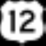
 U.S. Highway 12
 U.S. Highway 281
 South Dakota Highway 10
 South Dakota Highway 37South Dakota Highway 37South Dakota Highway 37 is a state route that runs across eastern South Dakota. It begins at the Nebraska border northeast of Niobrara, Nebraska, as a continuation of Nebraska Highway 14. It runs to the North Dakota border north of Hecla, where it continues as North Dakota Highway 1...
Adjacent Counties
- Dickey County, North DakotaDickey County, North Dakota-Major highways:* U.S. Highway 281* North Dakota Highway 1* North Dakota Highway 11* North Dakota Highway 56-National protected areas:*Dakota Lake National Wildlife Refuge*Maple River National Wildlife Refuge-Demographics:...
- north - Sargent County, North DakotaSargent County, North Dakota-National protected areas:*Storm Lake National Wildlife Refuge*Tewaukon National Wildlife Refuge*Wild Rice Lake National Wildlife Refuge-Demographics:...
- northeast - Marshall County, South DakotaMarshall County, South DakotaAs of the census of 2000, there were 4,576 people, 1,844 households, and 1,252 families residing in the county. The population density was 6 people per square mile . There were 2,562 housing units at an average density of 3 per square mile...
- east - Day County, South DakotaDay County, South DakotaAs of the census of 2000, there were 6,267 people, 2,586 households, and 1,688 families residing in the county. The population density was 6 people per square mile . There were 3,618 housing units at an average density of 4 per square mile...
- southeast - Spink County, South DakotaSpink County, South DakotaAs of the census of 2000, there were 7,454 people, 2,847 households, and 1,933 families residing in the county. The population density was 5 people per square mile . There were 3,352 housing units at an average density of 2 per square mile...
- south - Faulk County, South DakotaFaulk County, South DakotaAs of the census of 2000, there were 2,640 people, 1,014 households, and 708 families residing in the county. The population density was 3 people per square mile . There were 1,235 housing units at an average density of 1 per square mile...
- southwest - Edmunds County, South DakotaEdmunds County, South DakotaAs of the census of 2000, there were 4,367 people, 1,681 households, and 1,210 families residing in the county. The population density was 4 people per square mile . There were 2,022 housing units at an average density of 2 per square mile...
- southwest - McPherson County, South DakotaMcPherson County, South DakotaAs of the census of 2000, there were 2,904 people, 1,227 households, and 822 families residing in the county. The population density was 3 people per square mile . There were 1,465 housing units at an average density of 1 per square mile...
- northwest
Demographics
As of the censusCensus
A census is the procedure of systematically acquiring and recording information about the members of a given population. It is a regularly occurring and official count of a particular population. The term is used mostly in connection with national population and housing censuses; other common...
of 2000, there were 35,460 people, 14,638 households, and 9,324 families residing in the county. The population density
Population density
Population density is a measurement of population per unit area or unit volume. It is frequently applied to living organisms, and particularly to humans...
was 21 people per square mile (8/km²). There were 15,861 housing units at an average density of 9 per square mile (4/km²). The racial makeup of the county was 95.47% White
Race (United States Census)
Race and ethnicity in the United States Census, as defined by the Federal Office of Management and Budget and the United States Census Bureau, are self-identification data items in which residents choose the race or races with which they most closely identify, and indicate whether or not they are...
, 0.28% Black
Race (United States Census)
Race and ethnicity in the United States Census, as defined by the Federal Office of Management and Budget and the United States Census Bureau, are self-identification data items in which residents choose the race or races with which they most closely identify, and indicate whether or not they are...
or African American
Race (United States Census)
Race and ethnicity in the United States Census, as defined by the Federal Office of Management and Budget and the United States Census Bureau, are self-identification data items in which residents choose the race or races with which they most closely identify, and indicate whether or not they are...
, 2.72% Native American
Race (United States Census)
Race and ethnicity in the United States Census, as defined by the Federal Office of Management and Budget and the United States Census Bureau, are self-identification data items in which residents choose the race or races with which they most closely identify, and indicate whether or not they are...
, 0.40% Asian
Race (United States Census)
Race and ethnicity in the United States Census, as defined by the Federal Office of Management and Budget and the United States Census Bureau, are self-identification data items in which residents choose the race or races with which they most closely identify, and indicate whether or not they are...
, 0.09% Pacific Islander
Race (United States Census)
Race and ethnicity in the United States Census, as defined by the Federal Office of Management and Budget and the United States Census Bureau, are self-identification data items in which residents choose the race or races with which they most closely identify, and indicate whether or not they are...
, 0.18% from other races
Race (United States Census)
Race and ethnicity in the United States Census, as defined by the Federal Office of Management and Budget and the United States Census Bureau, are self-identification data items in which residents choose the race or races with which they most closely identify, and indicate whether or not they are...
, and 0.86% from two or more races. 0.67% of the population were Hispanic
Race (United States Census)
Race and ethnicity in the United States Census, as defined by the Federal Office of Management and Budget and the United States Census Bureau, are self-identification data items in which residents choose the race or races with which they most closely identify, and indicate whether or not they are...
or Latino
Race (United States Census)
Race and ethnicity in the United States Census, as defined by the Federal Office of Management and Budget and the United States Census Bureau, are self-identification data items in which residents choose the race or races with which they most closely identify, and indicate whether or not they are...
of any race. 55.0% were of German and 12.7% of Norwegian ancestry.
There were 14,638 households out of which 29.60% had children under the age of 18 living with them, 52.80% were married couples
Marriage
Marriage is a social union or legal contract between people that creates kinship. It is an institution in which interpersonal relationships, usually intimate and sexual, are acknowledged in a variety of ways, depending on the culture or subculture in which it is found...
living together, 7.90% had a female householder with no husband present, and 36.30% were non-families. 30.80% of all households were made up of individuals and 12.10% had someone living alone who was 65 years of age or older. The average household size was 2.32 and the average family size was 2.91.
In the county, the population was spread out with 23.60% under the age of 18, 11.60% from 18 to 24, 26.70% from 25 to 44, 21.90% from 45 to 64, and 16.20% who were 65 years of age or older. The median age was 37 years. For every 100 females there were 93.30 males. For every 100 females age 18 and over, there were 89.50 males.
The median income for a household in the county was $35,017, and the median income for a family was $44,788. Males had a median income of $29,592 versus $20,445 for females. The per capita income
Per capita income
Per capita income or income per person is a measure of mean income within an economic aggregate, such as a country or city. It is calculated by taking a measure of all sources of income in the aggregate and dividing it by the total population...
for the county was $18,464. About 7.00% of families and 9.90% of the population were below the poverty line, including 10.30% of those under age 18 and 10.30% of those age 65 or over.
Cities and towns
- AberdeenAberdeen, South DakotaAberdeen is a city in and the county seat of Brown County, South Dakota, United States, about 125 mi northeast of Pierre. Settled in 1880, it was incorporated in 1882. The city population was 26,091 at the 2010 census. The American News is the local newspaper...
- BathBath, South DakotaBath is an unincorporated community in Brown County, South Dakota, United States. Although not tracked by the Census Bureau, Bath has been assigned the ZIP code of 57427....
- BarnardBarnard, South DakotaBarnard is an unincorporated community in Brown County, South Dakota, United States. Although not tracked by the Census Bureau, Barnard has been assigned the ZIP Code of 57426....
- ClaremontClaremont, South DakotaClaremont is a town in Brown County, South Dakota, United States. The population was 127 at the 2010 census.-Geography:Claremont is located at ....
- ColumbiaColumbia, South DakotaColumbia is a city in Brown County, South Dakota, United States. The population was 136 at the 2010 census.-Geography:Columbia is located at ....
- FerneyFerney, South DakotaFerney is an unincorporated community in Brown County, South Dakota, United States. Although not tracked by the Census Bureau, Ferney has been assigned the ZIP code of 57439....
- FrederickFrederick, South DakotaFrederick is a town in Brown County, South Dakota, United States. The population was 199 at the 2010 census. Home to the annual Frederick Finn Fest, the town is part of the Aberdeen Micropolitan Statistical Area.-History:...
- GrotonGroton, South DakotaGroton is a city in Brown County, South Dakota, United States. The population was 1,458 at the 2010 census.-Geography:Groton is located at ....
- HeclaHecla, South DakotaHecla is a city in Brown County, South Dakota, United States, located only a few miles south of the North Dakota border. The population was 227 at the 2010 census...
- HoughtonHoughton, South DakotaHoughton is an unincorporated community in Brown County, South Dakota, United States. Although not tracked by the Census Bureau, Houghton has been assigned the ZIP code of 57449.-Notable natives:...
- Huffton
- James
- MansfieldMansfield, South DakotaMansfield is an unincorporated community in Brown County, South Dakota, United States. The population was 93 according to the 2010 census. Located just west of highway 281, it is approximately 18 miles south of Aberdeen, the third largest city in South Dakota. The James River Valley near which...
* - Ordway
- Putney
- Randolph
- Richmond
- StratfordStratford, South DakotaStratford is a town in Brown County, South Dakota, United States. The population was 72 at the 2010 census.-Geography:Stratford is located at ....
- VerdonVerdon, South DakotaVerdon is a town in Brown County, South Dakota, United States. The population was 5 at the 2010 census.- Geography :Verdon is located at .According to the United States Census Bureau, the town has a total area of , all of it land....
- WarnerWarner, South DakotaWarner is a town in Brown County, South Dakota, United States. The population was 457 at the 2010 census.-Geography:Warner is located at .According to the United States Census Bureau, the town has a total area of , all of it land....
- Winship
- WestportWestport, South DakotaWestport is a town in Brown County, South Dakota, United States. The population was 133 at the 2010 census.-Geography:Westport is located at ....
- Half of Mansfield is in Brown County and the other half is in Spink County.