

Fortified Region of Metz
Encyclopedia
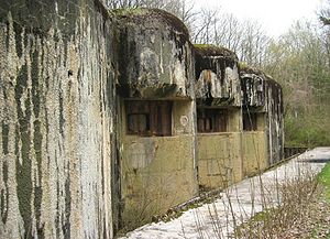
The Fortified Region of Metz comprised the central and most heavily-fortified portion of the Maginot Line
. The region was established in 1926 as a military organization for the French fortifications along the frontier with Luxembourg
and Germany
to the east of Longuyon
in northeastern France, forming a shield to the north of the industrialized areas of Metz
and Thionville
. The region was dissolved as a military organization on 18 March 1940, its command personnel moving to the 42nd Army Corps.
The region was divided into four sectors:
The region was given the highest priority in funding, manning and equipment of all Maginot regions.
. The 1919 study recommended the creation of a mobile army that could carry war to the territory of an enemy, supported by frontier defenses that would prevent an enemy from penetrating French territory. The second part of the recommendation was to involve the creation of fortified regions (regions fortifiés) in which an enemy could be confronted. The initially recommended fortified regions included:
The regions were to provide locations in which to confront an enemy and from which to launch an offensive to carry the battle onto enemy territory. The Metz region was considered a potential base for a counter-offensive should border defenses be pierced and Lorraine threatened, possibly using the former German fortifications of Metz and Strasbourg. The previous fortifications of the Séré de Rivières system
of the 1880s were designed to defend the frontiers of France that existed following the Franco-Prussian War
, in which France had lost Alsace
and Lorraine
. With the recovery of these territories following World War I, most of the Séré de Rivières forts were deep in the interior of northeastern France and not useful.
The Conseil Supérieure de la Guerre ("Supreme War Council") created a committee in March 1920 to study France's newly adjusted frontiers, with Marshal Joseph Joffre
as chairman. Disagreement arose between supporters of Pétain, who favored continuous light defenses covering concentrations of troops and construction materials for field fortifications, and supporters of Marshal Joseph Joffre
, who advocated fortified regions like the ring of forts around Verdun, that had performed well during the first world war. The committee dissolved without reaching any conclusions.
The RF Metz was again proposed in 1922 by the Territorial Defense Commission (commission de défense du territoire), which identified potential invasion routes from Germany into France at three locations: the Belfort Gap
, between the Vosges Mountains
and the Rhine, and across the Lorraine
plateau, the last two directly affecting the Metz industrial basin, home of much of France's coal and steel industry. The CDT recommended that the industrial area of Metz-Thionville-Longwy
be protected by new fortifications. The report noted that the frontier with Belgium would be difficult to fortify. The committee's final report proposed a continuous fortification from the Swiss border north to the Lauter, and west to Longwy, with the area of the Sarre, which faced the demilitarized area of the Saarland
, left unfortified. The final report recommended three fortified regions:
The CDT's report proposed that offensive operations into Germany should focus on an incursion to establish a line from Konz
to Trier
, then to Ottweiler
, Homburg
and Kaiserslautern
. No specific recommendations on the location or character of the defenses were made.
The Commission on Defense of the Frontiers (commission de défense des frontiers) was established on 31 December 1925 by Prime Minister Paul Painlevé
, to once again consider the question of the frontiers. The commissioned was charged with formulating specific recommendations for defenses and for the incorporation of the existing defenses of Metz and Belfort. The report again listed potential invasion routes, listing the area to the northeast of Hunsrück
in addition to the previously-identified routes. It reiterated the proposed fortified regions around Metz, Belfort and along the Lauter. The report formalized the concept of the fortified region, to be about 60 kilometres (37.3 mi) in depth, a distance dictated by the range of heavy artillery. The RF Metz-Thionville-Longwy was planned to provide a protected area from which to counter-attack an enemy moving into France along the Sarre, to protect the industrial regions, and to anchor the right flank of the northern armies. The German fortifications of Thionville and Metz were to be incorporated into the region, while the forts of Verdun, to the rear, were to be kept in reserve without renovation
The line of the fortifications was modified in 1927 to leave Longwy exposed, anchoring the right end of the region instead at Longuyon. This allowed optimal siting of fortifications on the heights behind Longwy, rather than contending with the town's basin and its close proximity to the border.
and Hackenberg
, with work beginning in 1929. A continuation of the construction campaign starting in 1930 resulted in the construction of three more large positions, six lesser artillery ouvrages, and seven infantry positions. Four interval casemates were built in 1930. At the same time, a program to provide the Line with long-range artillery was gradually dropped as costs mounted. By November 1930 the RF Metz had been allocated 2,298,000,000 francs.
From 1931 new projects were developed to extend the RF Metz to the west from Rochonvillers to Longuyon, and eastward to the Sarre. The left, or western wing was allocated an additional 400,000,000 francs. By the end of 1935, when CORF was disestablished, the sector's positions were being commissioned and garrisoned. However, budget cuts were felt in the eastern wing, where the expansion of several petit ouvrages was deferred to 1940, never started after war threatened.
The Fortified Region of Metz was organized as the 6th Military Region in peacetime. On 2 September 1939 a general mobilization of French forces was declared. Reserves were called up and the Maginot Line was fully manned. The Phoney War continued into 1940.
The Fortified Region of Metz was disestablished on 18 March 1940, two months before the Battle of France
, with Army command exercising a more direct control over the four sectors. At the time of its dissolution, the RF Metz was commanded by General Le Maignon de Kérengat from the Fort de Saint-Julien at Metz. After the dissolution of the fortified region, the staff was transferred to the 42nd Fortress Army Corps, formerly the SF Crusnes.
Maginot Line
The Maginot Line , named after the French Minister of War André Maginot, was a line of concrete fortifications, tank obstacles, artillery casemates, machine gun posts, and other defences, which France constructed along its borders with Germany and Italy, in light of its experience in World War I,...
. The region was established in 1926 as a military organization for the French fortifications along the frontier with Luxembourg
Luxembourg
Luxembourg , officially the Grand Duchy of Luxembourg , is a landlocked country in western Europe, bordered by Belgium, France, and Germany. It has two principal regions: the Oesling in the North as part of the Ardennes massif, and the Gutland in the south...
and Germany
Germany
Germany , officially the Federal Republic of Germany , is a federal parliamentary republic in Europe. The country consists of 16 states while the capital and largest city is Berlin. Germany covers an area of 357,021 km2 and has a largely temperate seasonal climate...
to the east of Longuyon
Longuyon
Longuyon is a commune in the Meurthe-et-Moselle department in north-eastern France.The apartment blocks on the southwestern edge of town, still called "La Cité Canadienne", were home to Royal Canadian Air Force staff and their families in the 1950s and 1960s, when the RCAF had an airbase at nearby...
in northeastern France, forming a shield to the north of the industrialized areas of Metz
Metz
Metz is a city in the northeast of France located at the confluence of the Moselle and the Seille rivers.Metz is the capital of the Lorraine region and prefecture of the Moselle department. Located near the tripoint along the junction of France, Germany, and Luxembourg, Metz forms a central place...
and Thionville
Thionville
Thionville , is a commune in the Moselle department in Lorraine in north-eastern France. The city is located on the left bank of the river Moselle, opposite its suburb Yutz.-Demographics:...
. The region was dissolved as a military organization on 18 March 1940, its command personnel moving to the 42nd Army Corps.
The region was divided into four sectors:
- Fortified Sector of the CrusnesFortified Sector of the CrusnesThe Fortified Sector of the Crusnes was the French military organization that in 1940 controlled the section of the Maginot Line extending eastwards approximately from Longuyon. The sector roughly follows the valley of the Crusnes river...
- Fortified Sector of ThionvilleFortified Sector of ThionvilleThe Fortified Sector of Thionville was the French military organization that in 1940 controlled the section of the Maginot Line immediately to the north of Thionville. The sector describes an arc of about , about halfway between the French border with Luxembourg and Thionville. The Thionville...
- Fortified Sector of BoulayFortified Sector of BoulayThe Fortified Sector of Boulay was the French military organization that in 1940 controlled the section of the Maginot Line to the north and east of Metz in northeastern France. The left wing of the Boulay sector was among the earliest and strongest portions of the Maginot Line...
- Fortified Sector of FaulquemontFortified Sector of FaulquemontThe Fortified Sector of Faulquemont was the French military organization that in 1940 controlled the section of the Maginot Line in the area of Faulquemont to the east of Metz. With five petit ouvrages the sector was poorly equipped with fortress artillery, limiting the ouvrages ability to provide...
The region was given the highest priority in funding, manning and equipment of all Maginot regions.
Creation
Following the First World War, French defense policy was re-examined at the order of Marshal Philippe PétainPhilippe Pétain
Henri Philippe Benoni Omer Joseph Pétain , generally known as Philippe Pétain or Marshal Pétain , was a French general who reached the distinction of Marshal of France, and was later Chief of State of Vichy France , from 1940 to 1944...
. The 1919 study recommended the creation of a mobile army that could carry war to the territory of an enemy, supported by frontier defenses that would prevent an enemy from penetrating French territory. The second part of the recommendation was to involve the creation of fortified regions (regions fortifiés) in which an enemy could be confronted. The initially recommended fortified regions included:
- The Rhine frontier, with two fortified regions, one to the south of MulhouseMulhouseMulhouse |mill]] hamlet) is a city and commune in eastern France, close to the Swiss and German borders. With a population of 110,514 and 278,206 inhabitants in the metropolitan area in 2006, it is the largest city in the Haut-Rhin département, and the second largest in the Alsace region after...
and a northern region defending the Alsace plain to the frontier on the LauterLauter (Rhine)The Lauter is a river in Germany and France, left tributary of the Rhine. Its length is 55 km. It is formed by the confluence of two headstreams north of Hinterweidenthal in the Pfälzerwald, Rhineland-Palatinate, Germany...
. - An area to the west of the Rhine to prevent an incursion across the land frontier with Germany onto the Alsace plain.
- An area in Lorraine to defend the coal-mining regions in the Sarre basin.
The regions were to provide locations in which to confront an enemy and from which to launch an offensive to carry the battle onto enemy territory. The Metz region was considered a potential base for a counter-offensive should border defenses be pierced and Lorraine threatened, possibly using the former German fortifications of Metz and Strasbourg. The previous fortifications of the Séré de Rivières system
Séré de Rivières system
The Séré de Rivières system was an ensemble of fortifications built from 1874 and first used at the beginning of the First World War along the frontiers and coasts of France...
of the 1880s were designed to defend the frontiers of France that existed following the Franco-Prussian War
Franco-Prussian War
The Franco-Prussian War or Franco-German War, often referred to in France as the 1870 War was a conflict between the Second French Empire and the Kingdom of Prussia. Prussia was aided by the North German Confederation, of which it was a member, and the South German states of Baden, Württemberg and...
, in which France had lost Alsace
Alsace
Alsace is the fifth-smallest of the 27 regions of France in land area , and the smallest in metropolitan France. It is also the seventh-most densely populated region in France and third most densely populated region in metropolitan France, with ca. 220 inhabitants per km²...
and Lorraine
Lorraine (région)
Lorraine is one of the 27 régions of France. The administrative region has two cities of equal importance, Metz and Nancy. Metz is considered to be the official capital since that is where the regional parliament is situated...
. With the recovery of these territories following World War I, most of the Séré de Rivières forts were deep in the interior of northeastern France and not useful.
The Conseil Supérieure de la Guerre ("Supreme War Council") created a committee in March 1920 to study France's newly adjusted frontiers, with Marshal Joseph Joffre
Joseph Joffre
Joseph Jacques Césaire Joffre OM was a French general during World War I. He is most known for regrouping the retreating allied armies to defeat the Germans at the strategically decisive First Battle of the Marne in 1914. His popularity led to his nickname Papa Joffre.-Biography:Joffre was born in...
as chairman. Disagreement arose between supporters of Pétain, who favored continuous light defenses covering concentrations of troops and construction materials for field fortifications, and supporters of Marshal Joseph Joffre
Joseph Joffre
Joseph Jacques Césaire Joffre OM was a French general during World War I. He is most known for regrouping the retreating allied armies to defeat the Germans at the strategically decisive First Battle of the Marne in 1914. His popularity led to his nickname Papa Joffre.-Biography:Joffre was born in...
, who advocated fortified regions like the ring of forts around Verdun, that had performed well during the first world war. The committee dissolved without reaching any conclusions.
The RF Metz was again proposed in 1922 by the Territorial Defense Commission (commission de défense du territoire), which identified potential invasion routes from Germany into France at three locations: the Belfort Gap
Belfort Gap
The Belfort Gap is a plateau located between the northern end of the Jura Mountains and the southernmost part of the Vosges mountains. Its altitude varies between 345 meters at its lowest and a little more than 400 meters in the area of the watershed between the catchment areas of the Rhine and...
, between the Vosges Mountains
Vosges mountains
For the department of France of the same name, see Vosges.The Vosges are a range of low mountains in eastern France, near its border with Germany. They extend along the west side of the Rhine valley in a northnortheast direction, mainly from Belfort to Saverne...
and the Rhine, and across the Lorraine
Lorraine (région)
Lorraine is one of the 27 régions of France. The administrative region has two cities of equal importance, Metz and Nancy. Metz is considered to be the official capital since that is where the regional parliament is situated...
plateau, the last two directly affecting the Metz industrial basin, home of much of France's coal and steel industry. The CDT recommended that the industrial area of Metz-Thionville-Longwy
Longwy
Longwy is a commune in the Meurthe-et-Moselle department in north-eastern France.The inhabitants are known as Longoviciens.-Economy:Longwy has historically been an industrial center of the Lorraine iron mining district. The town is known for its artistic glazed pottery.-History:Longwy initially...
be protected by new fortifications. The report noted that the frontier with Belgium would be difficult to fortify. The committee's final report proposed a continuous fortification from the Swiss border north to the Lauter, and west to Longwy, with the area of the Sarre, which faced the demilitarized area of the Saarland
Saarland
Saarland is one of the sixteen states of Germany. The capital is Saarbrücken. It has an area of 2570 km² and 1,045,000 inhabitants. In both area and population, it is the smallest state in Germany other than the city-states...
, left unfortified. The final report recommended three fortified regions:
- The Fortified Region of Metz-Thionville-Longwy
- The Fortified Region of the Lauter
- The Fortified Region of BelfortFortified region of BelfortThe fortified region of Belfort formed the first line of defense in the Séré de Rivières system of fortifications in the Belfort Gap...
The CDT's report proposed that offensive operations into Germany should focus on an incursion to establish a line from Konz
Konz
Konz is a town in the Trier-Saarburg district, in Rhineland-Palatinate, Germany. It is situated at the confluence of the rivers Saar and Moselle, approx. 8 km southwest of Trier....
to Trier
Trier
Trier, historically called in English Treves is a city in Germany on the banks of the Moselle. It is the oldest city in Germany, founded in or before 16 BC....
, then to Ottweiler
Ottweiler
Ottweiler is a municipality, former seat of the district of Neunkirchen, in Saarland, Germany. It is situated on the river Blies, approx. 7 km north of Neunkirchen, and 25 km northeast of Saarbrücken.The town is notable for the Ottweiler porcelain....
, Homburg
Homburg, Saarland
Homburg is a town in Saarland, Germany, the administrative seat of the Saarpfalz district. With a population of c. 44,000 inhabitants, is the third city in its federal state. The medical department of the University of Saarland is situated here. The city is also home to the Karlsberg beer brewery...
and Kaiserslautern
Kaiserslautern
Kaiserslautern is a city in southwest Germany, located in the Bundesland of Rhineland-Palatinate at the edge of the Palatinate forest . The historic centre dates to the 9th century. It is from Paris, from Frankfurt am Main, and from Luxembourg.Kaiserslautern is home to 99,469 people...
. No specific recommendations on the location or character of the defenses were made.
The Commission on Defense of the Frontiers (commission de défense des frontiers) was established on 31 December 1925 by Prime Minister Paul Painlevé
Paul Painlevé
Paul Painlevé was a French mathematician and politician. He served twice as Prime Minister of the Third Republic: 12 September – 13 November 1917 and 17 April – 22 November 1925.-Early life:Painlevé was born in Paris....
, to once again consider the question of the frontiers. The commissioned was charged with formulating specific recommendations for defenses and for the incorporation of the existing defenses of Metz and Belfort. The report again listed potential invasion routes, listing the area to the northeast of Hunsrück
Hunsrück
The Hunsrück is a low mountain range in Rhineland-Palatinate, Germany. It is bounded by the river valleys of the Moselle , the Nahe , and the Rhine . The Hunsrück is continued by the Taunus mountains on the eastern side of the Rhine. In the north behind the Moselle it is continued by the Eifel...
in addition to the previously-identified routes. It reiterated the proposed fortified regions around Metz, Belfort and along the Lauter. The report formalized the concept of the fortified region, to be about 60 kilometres (37.3 mi) in depth, a distance dictated by the range of heavy artillery. The RF Metz-Thionville-Longwy was planned to provide a protected area from which to counter-attack an enemy moving into France along the Sarre, to protect the industrial regions, and to anchor the right flank of the northern armies. The German fortifications of Thionville and Metz were to be incorporated into the region, while the forts of Verdun, to the rear, were to be kept in reserve without renovation
The line of the fortifications was modified in 1927 to leave Longwy exposed, anchoring the right end of the region instead at Longuyon. This allowed optimal siting of fortifications on the heights behind Longwy, rather than contending with the town's basin and its close proximity to the border.
Construction
The Commission d'Organisation des Régions Fortifiés, or CORF, was established on 30 September 1927 to oversee the design, financing and construction of the Maginot Line. Its first priorities were the Metz and Lauter regions. CORF built 14 gros ouvrages (large artillery positions) and 24 petit ouvrages (more lightly armed infantry works), as well as more than one hundred casemates and infantry shelters in the RF Metz. In 1929 an initial appropriation of 1,498,000,000 francs was allotted to the RF Metz, the most expensive region in the Maginot system. The highest-priority positions in the RF Metz were ouvrages RochonvillersOuvrage Rochonvillers
Ouvrage Rochonvillers is one of the largest of the Maginot Line fortifications. Located above the town of Rochonvillers in the French region of Lorraine, the gros ouvrage or large work was fully equipped and occupied in 1935 as part of the Fortified Sector of Thionville in the Moselle...
and Hackenberg
Ouvrage Hackenberg
Ouvrage Hackenberg, one of the largest of the Maginot Line fortifications, is part of the Fortified Sector of Boulay. It is situated twenty kilometers east of Thionville, in the Moselle département, near the village of Veckring, on the Hackenberg . It is located between gros ouvrage Billig and...
, with work beginning in 1929. A continuation of the construction campaign starting in 1930 resulted in the construction of three more large positions, six lesser artillery ouvrages, and seven infantry positions. Four interval casemates were built in 1930. At the same time, a program to provide the Line with long-range artillery was gradually dropped as costs mounted. By November 1930 the RF Metz had been allocated 2,298,000,000 francs.
From 1931 new projects were developed to extend the RF Metz to the west from Rochonvillers to Longuyon, and eastward to the Sarre. The left, or western wing was allocated an additional 400,000,000 francs. By the end of 1935, when CORF was disestablished, the sector's positions were being commissioned and garrisoned. However, budget cuts were felt in the eastern wing, where the expansion of several petit ouvrages was deferred to 1940, never started after war threatened.
Operations
- For operations during the Phoney War and after the dissolution of the RF Metz, see the articles on the individual sectors.
The Fortified Region of Metz was organized as the 6th Military Region in peacetime. On 2 September 1939 a general mobilization of French forces was declared. Reserves were called up and the Maginot Line was fully manned. The Phoney War continued into 1940.
The Fortified Region of Metz was disestablished on 18 March 1940, two months before the Battle of France
Battle of France
In the Second World War, the Battle of France was the German invasion of France and the Low Countries, beginning on 10 May 1940, which ended the Phoney War. The battle consisted of two main operations. In the first, Fall Gelb , German armoured units pushed through the Ardennes, to cut off and...
, with Army command exercising a more direct control over the four sectors. At the time of its dissolution, the RF Metz was commanded by General Le Maignon de Kérengat from the Fort de Saint-Julien at Metz. After the dissolution of the fortified region, the staff was transferred to the 42nd Fortress Army Corps, formerly the SF Crusnes.
See also
- Fortifications of MetzFortifications of MetzThe Fortifications of Metz, a city in northeastern France, are extensive, due to the city's strategic position near the border of France and Germany. After the Franco-Prussian War of 1870, the area was annexed by the newly created German Empire in 1871 by the Treaty of Frankfurt and became a...
for the French and German fortifications of the late 19th and early 20th century around Metz and Thionville
External links
- Maginot Line at darkplaces.org (in German)