
European route E42
Encyclopedia
Europe
Europe is, by convention, one of the world's seven continents. Comprising the westernmost peninsula of Eurasia, Europe is generally 'divided' from Asia to its east by the watershed divides of the Ural and Caucasus Mountains, the Ural River, the Caspian and Black Seas, and the waterways connecting...
and a part of the United Nations
United Nations
The United Nations is an international organization whose stated aims are facilitating cooperation in international law, international security, economic development, social progress, human rights, and achievement of world peace...
International E-road network
International E-road network
The international E-road network is a numbering system for roads in Europe developed by the United Nations Economic Commission for Europe . The network is numbered from E 1 up and its roads cross national borders...
. It connects Dunkerque, a major ferry
Ferry
A ferry is a form of transportation, usually a boat, but sometimes a ship, used to carry primarily passengers, and sometimes vehicles and cargo as well, across a body of water. Most ferries operate on regular, frequent, return services...
and container port
Port
A port is a location on a coast or shore containing one or more harbors where ships can dock and transfer people or cargo to or from land....
at the northern end of the French
France
The French Republic , The French Republic , The French Republic , (commonly known as France , is a unitary semi-presidential republic in Western Europe with several overseas territories and islands located on other continents and in the Indian, Pacific, and Atlantic oceans. Metropolitan France...
coast
Coast
A coastline or seashore is the area where land meets the sea or ocean. A precise line that can be called a coastline cannot be determined due to the dynamic nature of tides. The term "coastal zone" can be used instead, which is a spatial zone where interaction of the sea and land processes occurs...
with Aschaffenburg
Aschaffenburg
Aschaffenburg is a city in northwest Bavaria, Germany. The town of Aschaffenburg is not considered part of the district of Aschaffenburg, but is the administrative seat.Aschaffenburg is known as the Tor zum Spessart or "gate to the Spessart"...
on the north western tip of Bavaria
Bavaria
Bavaria, formally the Free State of Bavaria is a state of Germany, located in the southeast of Germany. With an area of , it is the largest state by area, forming almost 20% of the total land area of Germany...
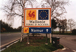
. Along the way it also passes through Wallonia in Belgium
Belgium
Belgium , officially the Kingdom of Belgium, is a federal state in Western Europe. It is a founding member of the European Union and hosts the EU's headquarters, and those of several other major international organisations such as NATO.Belgium is also a member of, or affiliated to, many...
and the German
Germany
Germany , officially the Federal Republic of Germany , is a federal parliamentary republic in Europe. The country consists of 16 states while the capital and largest city is Berlin. Germany covers an area of 357,021 km2 and has a largely temperate seasonal climate...
Länder
States of Germany
Germany is made up of sixteen which are partly sovereign constituent states of the Federal Republic of Germany. Land literally translates as "country", and constitutionally speaking, they are constituent countries...
of Rhineland-Palatinate
Rhineland-Palatinate
Rhineland-Palatinate is one of the 16 states of the Federal Republic of Germany. It has an area of and about four million inhabitants. The capital is Mainz. English speakers also commonly refer to the state by its German name, Rheinland-Pfalz ....
and Hessen. The full length of the route is approximately 680 kilometres (422.5 mi).
Language challenge
The western end of the route runs close to the FrancoFrance
The French Republic , The French Republic , The French Republic , (commonly known as France , is a unitary semi-presidential republic in Western Europe with several overseas territories and islands located on other continents and in the Indian, Pacific, and Atlantic oceans. Metropolitan France...
-Dutch
Netherland
Netherland is a critically acclaimed novel by Joseph O'Neill. It concerns the life of a Dutchman living in New York in the wake of the September 11 attacks who takes up cricket and starts playing at the Staten Island Cricket Club.-Plot summary:...
language border
Language border
A language border or language boundary is the line separating two language areas. The term is generally meant to imply a lack of mutual intelligibility between the two languages...
. As a consequence, traffic signs might use Dutch
Dutch language
Dutch is a West Germanic language and the native language of the majority of the population of the Netherlands, Belgium, and Suriname, the three member states of the Dutch Language Union. Most speakers live in the European Union, where it is a first language for about 23 million and a second...
exonyms for French or Walloon cities, and French
French language
French is a Romance language spoken as a first language in France, the Romandy region in Switzerland, Wallonia and Brussels in Belgium, Monaco, the regions of Quebec and Acadia in Canada, and by various communities elsewhere. Second-language speakers of French are distributed throughout many parts...
exonyms for Dutch-speaking places. When a city lies in France, both names will be displayed in Flanders
Flanders
Flanders is the community of the Flemings but also one of the institutions in Belgium, and a geographical region located in parts of present-day Belgium, France and the Netherlands. "Flanders" can also refer to the northern part of Belgium that contains Brussels, Bruges, Ghent and Antwerp...
(e.g. Rijsel will be followed by Lille in italics).
France
The western end between Dunkerque and Lille follows a four lane dual carriageway toll free highway. Much of this has recently been resurfaced, but parts remain of subautoroute standard in terms of such details as junction lay-out and speed limits. Lille itself is at the centre of a major industrial areaUrban Community of Lille Métropole
The Urban Community of Lille Métropole is the intercommunal structure gathering the commune of Lille and that part of the Lille metropolitan area that lies in France....
and is the meeting point of major routes. The passage of the E 42 along the urban highway is marked by several sharp bends and, especially for westbound traffic, unavoidable lane changes as well as speed cameras. Delays during peak commuting times are frequent.
Belgium
The route follows no fewer than six different autoroutes in succession during its passage through southern Belgium (Wallonia), linking all its major cites, from the provincial capital MonsMons
Mons is a Walloon city and municipality located in the Belgian province of Hainaut, of which it is the capital. The Mons municipality includes the old communes of Cuesmes, Flénu, Ghlin, Hyon, Nimy, Obourg, Baudour , Jemappes, Ciply, Harmignies, Harveng, Havré, Maisières, Mesvin, Nouvelles,...
, to Charleroi
Charleroi
Charleroi is a city and a municipality of Wallonia, located in the province of Hainaut, Belgium. , the total population of Charleroi was 201,593. The metropolitan area, including the outer commuter zone, covers an area of and had a total population of 522,522 as of 1 January 2008, ranking it as...
and Namur
Namur (city)
Namur is a city and municipality in Wallonia, in southern Belgium. It is both the capital of the province of Namur and of Wallonia....
, along with the major commercial and university city of Liège
Liège
Liège is a major city and municipality of Belgium located in the province of Liège, of which it is the economic capital, in Wallonia, the French-speaking region of Belgium....
and it's important cargo airport
Liège Airport
Liège Airport , also called Liège-Bierset, is an important cargo airport in Belgium. It was at the end of 2009 the 8th biggest cargo airport in Europe...
further to the east. The most easterly portion within Belgium was fully upgraded to autoroute standard only with the completion of the A27 at the end of the 20th century: before that happened the main road included (subject to diversions on race days) a brief stretch that used the Formula One
Formula One
Formula One, also known as Formula 1 or F1 and referred to officially as the FIA Formula One World Championship, is the highest class of single seater auto racing sanctioned by the Fédération Internationale de l'Automobile . The "formula" designation in the name refers to a set of rules with which...
racing circuit
Circuit de Spa-Francorchamps
The Circuit de Spa-Francorchamps is the venue of the Formula One Belgian Grand Prix and the Spa 24 Hours endurance race. It is also home to the all Volkswagen club event, 25 Hours of Spa, run by the Uniroyal Fun Cup. It is one of the most challenging race tracks in the world, mainly due to its...
at Spa
Spa, Belgium
Spa is a municipality of Belgium. It lies in the country's Walloon Region and Province of Liège. It is situated in a valley in the Ardennes mountain chain, some southeast of Liège, and southwest of Aachen. As of 1 January 2006, Spa had a total population of 10,543...
. The final kilometers before the German frontier include towns and villages transferred
Eupen-Malmedy
Eupen-Malmedy, or the East Cantons , is a group of cantons in Belgium, composed of the former Prussian districts of Malmedy and Eupen, together with the Neutral Moresnet...
from Germany
Germany
Germany , officially the Federal Republic of Germany , is a federal parliamentary republic in Europe. The country consists of 16 states while the capital and largest city is Berlin. Germany covers an area of 357,021 km2 and has a largely temperate seasonal climate...
to Belgium
Belgium
Belgium , officially the Kingdom of Belgium, is a federal state in Western Europe. It is a founding member of the European Union and hosts the EU's headquarters, and those of several other major international organisations such as NATO.Belgium is also a member of, or affiliated to, many...
under the provisions of the 1919 Treaty of Versailles
Treaty of Versailles
The Treaty of Versailles was one of the peace treaties at the end of World War I. It ended the state of war between Germany and the Allied Powers. It was signed on 28 June 1919, exactly five years after the assassination of Archduke Franz Ferdinand. The other Central Powers on the German side of...
endorsed in 1925 by a referendum process not universally regarded as fair: over three quarters of a century later sign boards showing place names in French and German frequently have the French versions deleted by graffiti artists.
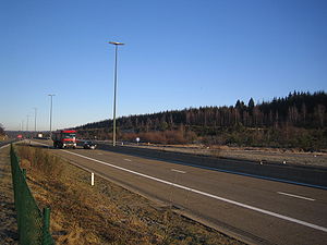
Germany
The eastern portion of the E 42 in Germany follows the BAB 60. Despite considerable progress in recent years, the building of the Autobahn was delayed during the final decade of the 20th century, and the road in this area is still missing several important doubled road viaducts, so that at various points the road is reduced to a single two lane road. The landscape here is relatively mountainous: a recent development has been the appearance on the surrounding horizons of modern windmillWind turbine
A wind turbine is a device that converts kinetic energy from the wind into mechanical energy. If the mechanical energy is used to produce electricity, the device may be called a wind generator or wind charger. If the mechanical energy is used to drive machinery, such as for grinding grain or...
groupings.
The route
| E 42 Dunkerque - Aschaffenburg | |||||
| State | National Road Number | Section | Junction (national numbering) | ||
  ..........Department ..........Department |
|||||
| 59 |  |
Dunkerque - Bergues Bergues Bergues is a commune in the Nord department in northern France.It is situated to the south of Dunkirk and from the Belgian border. Locally it is referred to as "the other Bruges in Flanders"... |
RN 225  RN 225 RN 225  20RN 225 19RN 225 18RN 225 17RN 225 16 Bergues 20RN 225 19RN 225 18RN 225 17RN 225 16 BerguesBergues Bergues is a commune in the Nord department in northern France.It is situated to the south of Dunkirk and from the Belgian border. Locally it is referred to as "the other Bruges in Flanders"... |
||
| 59 |  A25 autoroute The A25 is a motorway in northern France. It is also part of European Route E42.-Route:The road connects the English Channel port of Dunkerque with the major city of Lille.-Junctions:* 01 A1, N356 to A25.... |
Bergues Bergues Bergues is a commune in the Nord department in northern France.It is situated to the south of Dunkirk and from the Belgian border. Locally it is referred to as "the other Bruges in Flanders"... - Lille (Rijsel) Lille Lille is a city in northern France . It is the principal city of the Lille Métropole, the fourth-largest metropolitan area in the country behind those of Paris, Lyon and Marseille. Lille is situated on the Deûle River, near France's border with Belgium... |
A 25 15 Herzeele Herzeele Herzeele is a commune in the Nord department in northern France.-Heraldry:-References:*... A 25 14 WinnezeeleWinnezeele Winnezeele is a commune in the Nord department in northern France.-Heraldry:-References:*... , Hondschoote Hondschoote Hondschoote is a commune of the Nord département, in northern France.-Heraldry:-Geography:Hondschoote lies on the French side of the Franco-Belgian frontier, just inland from the North Sea.... A 25   St Eloi et St LaurentA 25 13 Steenvoorde St Eloi et St LaurentA 25 13 SteenvoordeSteenvoorde Steenvoorde is a commune in the Nord department in northern France. The Beeldenstorm iconoclasm started in Steenvoorde. Steenvoorde is a city of the giants -Heraldry:-References:* -External links:*... A 25 12 BailleulBailleul, Nord Bailleul is a commune in the Nord department in northern France.It is located in French Flanders near Lille.-Heraldry:-Media:... A 25 11 HazebrouckHazebrouck -Communications:The town enjoys excellent rail connections, with frequent daily services to Lille and Paris, some by High Speed Line. There is a small international airport, concentrating on business flights, at Merville-Calonne just 12 kilometre / 8 miles away... A 25 10 BailleulBailleul, Nord Bailleul is a commune in the Nord department in northern France.It is located in French Flanders near Lille.-Heraldry:-Media:... A 25 9 NieppeNieppe -Points of interests:*A local historic museum*Château de Nieppe - features a treasue legend, its part and a centennial tree*War cemeteries of the Commonwealth War Graves Commission:** Nieppe Communal Cemetery** Pont-D'Achelles Military Cemetery... A 25 8 ArmentièresArmentières Armentières is a commune in the Nord department in the Nord-Pas-de-Calais region in northern France. It is part of the Urban Community of Lille Métropole, and lies on the Belgian border, northwest of the city of Lille, on the right bank of the river Lys.... A 25 7 BéthuneBéthune Béthune is a city in northern France, sub-prefecture of the Pas-de-Calais department.-Geography:Béthune is located in the former province of Artois. It is situated South-East of Calais, West of Lille, and North of Paris.-Landmarks:... A 25 6 EnglosEnglos Englos is a commune in the Nord department in northern France.It is located near the city of Lille. In 2004, the population of Englos was 614.-Geography:... A 25 5 LilleLille Lille is a city in northern France . It is the principal city of the Lille Métropole, the fourth-largest metropolitan area in the country behind those of Paris, Lyon and Marseille. Lille is situated on the Deûle River, near France's border with Belgium... centreA 25 4 LilleLille Lille is a city in northern France . It is the principal city of the Lille Métropole, the fourth-largest metropolitan area in the country behind those of Paris, Lyon and Marseille. Lille is situated on the Deûle River, near France's border with Belgium... -Faubourg de BéthuneA 25 3 LilleLille Lille is a city in northern France . It is the principal city of the Lille Métropole, the fourth-largest metropolitan area in the country behind those of Paris, Lyon and Marseille. Lille is situated on the Deûle River, near France's border with Belgium... -WazemmesA 25 2 LilleLille Lille is a city in northern France . It is the principal city of the Lille Métropole, the fourth-largest metropolitan area in the country behind those of Paris, Lyon and Marseille. Lille is situated on the Deûle River, near France's border with Belgium... -Moulins A 25 1 |
||
| 59 | A27 autoroute The A27 autoroute is a toll free autoroute in North Western France. It forms part of European Route E42.-List of junctions:-External links:* on Saratlas... |
Lille (Rijsel) Lille Lille is a city in northern France . It is the principal city of the Lille Métropole, the fourth-largest metropolitan area in the country behind those of Paris, Lyon and Marseille. Lille is situated on the Deûle River, near France's border with Belgium... - Baisieux Baisieux Baisieux is a commune in the Nord department in northern France.It is part of the Urban Community of Lille Métropole.-Heraldry:-References:*... |
A 27 1 Ronchin Ronchin -References:*... A 27 2 LesquinLesquin Lesquin is a commune in the Nord department in northern France.-Heraldry:-Economy:When Flandre Air existed, it had its head office at Lille Airport and in Lesquin. On 30 March 2001 Flandre, Proteus Airlines, and Regional Airlines merged into Régional Compagnie Aérienne Européenne.-Sport:Lesquin is... A 27 A 23A27 autoroute The A27 autoroute is a toll free autoroute in North Western France. It forms part of European Route E42.-List of junctions:-External links:* on Saratlas... A 27 3 BaisieuxBaisieux Baisieux is a commune in the Nord department in northern France.It is part of the Urban Community of Lille Métropole.-Heraldry:-References:*... |
||
  ..........Province ..........Province |
|||||
| Hainaut | |
Baisieux Baisieux Baisieux is a commune in the Nord department in northern France.It is part of the Urban Community of Lille Métropole.-Heraldry:-References:*... - Tournai (Doornik) Tournai Tournai is a Walloon city and municipality of Belgium located 85 kilometres southwest of Brussels, on the river Scheldt, in the province of Hainaut.... |
A 8 35 BlandainA 8 Marquain A 8 A 8 34 Tournai (Doornik) West Tournai Tournai is a Walloon city and municipality of Belgium located 85 kilometres southwest of Brussels, on the river Scheldt, in the province of Hainaut.... A 8 33 Tournai (Doornik) NorthTournai Tournai is a Walloon city and municipality of Belgium located 85 kilometres southwest of Brussels, on the river Scheldt, in the province of Hainaut.... A 8 Tournai (Doornik)Tournai Tournai is a Walloon city and municipality of Belgium located 85 kilometres southwest of Brussels, on the river Scheldt, in the province of Hainaut.... |
||
| Hainaut | |
Tournai (Doornik) Tournai Tournai is a Walloon city and municipality of Belgium located 85 kilometres southwest of Brussels, on the river Scheldt, in the province of Hainaut.... - Saint-Ghislain Saint-Ghislain Saint-Ghislain is a Walloon municipality located in the Belgian province of Hainaut. On 1 January 2006 the municipality had 22,466 inhabitants. The total area is 70.18 km², giving a population density of 320 inhabitants per km².... |
A 16 32 Tournai (Doornik) East Tournai Tournai is a Walloon city and municipality of Belgium located 85 kilometres southwest of Brussels, on the river Scheldt, in the province of Hainaut.... A 16 31 AntoingAntoing Antoing is a Walloon municipality of Belgium located in the province of Hainaut. It consists of the former municipalities of Antoing, Maubray, Péronnes-lez-Antoing, Bruyelle, Calonne and Fontenoy.-History:... A 16 30 MaubrayAntoing Antoing is a Walloon municipality of Belgium located in the province of Hainaut. It consists of the former municipalities of Antoing, Maubray, Péronnes-lez-Antoing, Bruyelle, Calonne and Fontenoy.-History:... A 16 29 PéruwelzPéruwelz Péruwelz is a Walloon municipality located in the Belgian province of Hainaut. On January 1, 2006, Péruwelz had a total population of 16,843. The total area is 60.56 km² which gives a population density of 278 inhabitants per km².... A 16 28 BlatonBernissart Bernissart is a Walloon municipality located in the Belgian province of Hainaut. On January 1, 2006 Bernissart had a total population of 11,458. The total area is 43.42 km², which gives a population density of 264 inhabitants per km².... A 16 27 BernissartBernissart Bernissart is a Walloon municipality located in the Belgian province of Hainaut. On January 1, 2006 Bernissart had a total population of 11,458. The total area is 43.42 km², which gives a population density of 264 inhabitants per km².... A 16 26 Pommerœul A 16 Hautrage |
||
| Hainaut | |
Saint-Ghislain Saint-Ghislain Saint-Ghislain is a Walloon municipality located in the Belgian province of Hainaut. On 1 January 2006 the municipality had 22,466 inhabitants. The total area is 70.18 km², giving a population density of 320 inhabitants per km².... - La Louvière La Louvière La Louvière is a Walloon city and municipality located in the Belgian province of Hainaut. La Louvière's municipality includes the old communes of Haine-Saint-Paul, Haine-Saint-Pierre, Saint-Vaast, Trivières, Boussoit, Houdeng-Aimeries, Houdeng-Gœgnies, Maurage, and Strépy-Bracquegnies... |
A 7 A 7 25 Saint-Ghislain Saint-Ghislain Saint-Ghislain is a Walloon municipality located in the Belgian province of Hainaut. On 1 January 2006 the municipality had 22,466 inhabitants. The total area is 70.18 km², giving a population density of 320 inhabitants per km².... A 7 24 Mons (Bergen)Mons Mons is a Walloon city and municipality located in the Belgian province of Hainaut, of which it is the capital. The Mons municipality includes the old communes of Cuesmes, Flénu, Ghlin, Hyon, Nimy, Obourg, Baudour , Jemappes, Ciply, Harmignies, Harveng, Havré, Maisières, Mesvin, Nouvelles,... A 7 23 NimyNimy Nimy is a village near the Belgian town of Mons in the province of Hainaut. In 1914, it was the scene of heavy fighting during the Battle of Mons, the first action of the British Expeditionary Force in World War I.- Gallery :... , Maisières Maisières Maisières is a village near the Belgian town of Mons in the province of Hainaut.... A 7 22 ObourgObourg Obourg is a village near the Belgian town of Mons in the province of Hainaut. Obourg was known for its tobacco in the past.- Gallery :... A 7 A 7 21a ThieuA 7 21 Le RœulxA 7 Houdeng-Goegnies |
||
| HainautNamur Namur (province) Namur is a province of Wallonia, one of the three regions of Belgium. It borders on the Walloon provinces of Hainaut, Walloon Brabant, Liège and Luxembourg in Belgium, and on France. Its capital is the city of Namur... Liège Liège (province) Liège is the easternmost province of Belgium and belongs to the Walloon Region. It is an area of French and German ethnicity. It borders on the Netherlands, Germany, Luxembourg, and in Belgium the provinces of Luxembourg, Namur, Walloon Brabant , and those of Flemish Brabant and Limburg . Its... |
|
La Louvière La Louvière La Louvière is a Walloon city and municipality located in the Belgian province of Hainaut. La Louvière's municipality includes the old communes of Haine-Saint-Paul, Haine-Saint-Pierre, Saint-Vaast, Trivières, Boussoit, Houdeng-Aimeries, Houdeng-Gœgnies, Maurage, and Strépy-Bracquegnies... - Liège (Luik, Lüttich) Liège Liège is a major city and municipality of Belgium located in the province of Liège, of which it is the economic capital, in Wallonia, the French-speaking region of Belgium.... |
A 15 20 Houdeng La Louvière La Louvière is a Walloon city and municipality located in the Belgian province of Hainaut. La Louvière's municipality includes the old communes of Haine-Saint-Paul, Haine-Saint-Pierre, Saint-Vaast, Trivières, Boussoit, Houdeng-Aimeries, Houdeng-Gœgnies, Maurage, and Strépy-Bracquegnies... A 15 Bois-d'HaineManage Manage is a Walloon municipality located in the Belgian province of Hainaut. On January 1, 2006 Manage had a total population of 22,341. The total area is 19.60 km² which gives a population density of 1,140 inhabitants per km².... A 15 19 ManageManage Manage is a Walloon municipality located in the Belgian province of Hainaut. On January 1, 2006 Manage had a total population of 22,341. The total area is 19.60 km² which gives a population density of 1,140 inhabitants per km².... A 15 18 Chapelle-lez-HerlaimontChapelle-lez-Herlaimont Chapelle-lez-Herlaimont is a Walloon municipality located in the Belgian province of Hainaut. On January 1, 2006 Chapelle-lez-Herlaimont had a total population of 14,022. The total area is 18.10 km² which gives a population density of 775 inhabitants per km².... A 15 Gouy A 15 17 CourcellesCourcelles, Belgium Courcelles is a Walloon municipality located in the Belgian province of Hainaut. As of January 1, 2006 Courcelles had a total population of 29,626. The total area is 44.24 km² which gives a population density of 670 inhabitants per km².... A 15 Thiméon A 15 16 GosseliesCharleroi Charleroi is a city and a municipality of Wallonia, located in the province of Hainaut, Belgium. , the total population of Charleroi was 201,593. The metropolitan area, including the outer commuter zone, covers an area of and had a total population of 522,522 as of 1 January 2008, ranking it as... northA 15 15 FleurusFleurus Fleurus is a Walloon municipality located in the Belgian province of Hainaut. On January 1, 2006 Fleurus had a total population of 22,221. The total area is which gives a population density of 375 inhabitants per km²... A 15 14 SambrevilleSambreville Sambreville is a Walloon municipality located in the Belgian province of Namur. On January 1, 2006 Sambreville had a total population of 26,949. The total area is 34.20 km² which gives a population density of 788 inhabitants per km².-Villages and towns:... A 15 A 15 13 SpySpy, Belgium Spy is a village in the municipality of Jemeppe-sur-Sambre near Namur, Belgium.Here in 1886, in Betche aux Roches cavern, Maximin Lohest and Marcel de Puydt found two nearly perfect Neanderthal skeletons at the depth of 16 ft., with numerous implements of the Mousterian type. Recently Yves Saquet... A 15 12 NamurNamur (city) Namur is a city and municipality in Wallonia, in southern Belgium. It is both the capital of the province of Namur and of Wallonia.... westA 15 A 15 10a FernelmontFernelmont Fernelmont is a Walloon municipality located in the Belgian province of Namur. On June 1, 2011 Fernelmont had a total population of 7,205. The total area is 65.61 km² which gives a population density of 109.8 inhabitants per km².- Villages :* Bierwart... A 15 10 HingeonFernelmont Fernelmont is a Walloon municipality located in the Belgian province of Namur. On June 1, 2011 Fernelmont had a total population of 7,205. The total area is 65.61 km² which gives a population density of 109.8 inhabitants per km².- Villages :* Bierwart... A 15 9 AndenneAndenne Andenne is a Belgian municipality located in the Walloon province of Namur. On January 1, 2006 Andenne had a total population of 25,240. The total area is 86.17 km² which gives a population density of 292 inhabitants per km². The city extends on both sides of the river Meuse... A 15 8 HuyHuy Huy is a municipality of Belgium. It lies in the country's Walloon Region and Province of Liege. Huy lies along the river Meuse, at the mouth of the small river Hoyoux. It is in the sillon industriel, the former industrial backbone of Wallonia, home to about two-thirds of the Walloon population... -Couthuin A 15 7 HuyHuy Huy is a municipality of Belgium. It lies in the country's Walloon Region and Province of Liege. Huy lies along the river Meuse, at the mouth of the small river Hoyoux. It is in the sillon industriel, the former industrial backbone of Wallonia, home to about two-thirds of the Walloon population... -Fumal A 15 6 Villers-le-BouilletVillers-le-Bouillet Villers-le-Bouillet is a Walloon municipality of Belgium in Province of Liege. On January 1, 2006 Villers-le-Bouillet had a total population of 6,051. The total area is 32.71 km² which gives a population density of 185 inhabitants per km².... A 15 A 15 5 Saint-GeorgesSaint-Georges-sur-Meuse Saint-Georges-sur-Meuse is a municipality of Belgium. It lies in the country's Walloon Region and Province of Liege. On January 1, 2006 Saint-Georges-sur-Meuse had a total population of 6,613. The total area is 20.90 km² which gives a population density of 316 inhabitants per km².... A 15 4 FlémalleFlémalle Flémalle is a Walloon municipality located in the Belgian province of Liége. On January 1, 2006 Flémalle had a total population of 25,140. The total area is 36.68 km² which gives a population density of 685 inhabitants per km².-Subdivisions:... A 15 3 LiègeLiège Liège is a major city and municipality of Belgium located in the province of Liège, of which it is the economic capital, in Wallonia, the French-speaking region of Belgium.... airport Liège Airport Liège Airport , also called Liège-Bierset, is an important cargo airport in Belgium. It was at the end of 2009 the 8th biggest cargo airport in Europe... A 15 A 15 |
||
| Liège Liège (province) Liège is the easternmost province of Belgium and belongs to the Walloon Region. It is an area of French and German ethnicity. It borders on the Netherlands, Germany, Luxembourg, and in Belgium the provinces of Luxembourg, Namur, Walloon Brabant , and those of Flemish Brabant and Limburg . Its... |
|
Liège (Luik, Lüttich) Liège Liège is a major city and municipality of Belgium located in the province of Liège, of which it is the economic capital, in Wallonia, the French-speaking region of Belgium.... - Battice Herve Herve is a Walloon municipality of Belgium in Province of Liège. On January 1, 2006 Herve had a total population of 16,772. The total area is 56.84 km² which gives a population density of 295 inhabitants per km².... |
|||
| Liège Liège (province) Liège is the easternmost province of Belgium and belongs to the Walloon Region. It is an area of French and German ethnicity. It borders on the Netherlands, Germany, Luxembourg, and in Belgium the provinces of Luxembourg, Namur, Walloon Brabant , and those of Flemish Brabant and Limburg . Its... |
|
Battice Herve Herve is a Walloon municipality of Belgium in Province of Liège. On January 1, 2006 Herve had a total population of 16,772. The total area is 56.84 km² which gives a population density of 295 inhabitants per km².... - Sankt-Vith |
|||
  Land/District Land/District |
|||||
| BIT Bitburg-Prüm The Eifelkreis Bitburg-Prüm is a district in Rhineland-Palatinate, Germany. It is bounded by Luxembourg, Belgium and the districts of Euskirchen, Vulkaneifel, Bernkastel-Wittlich and Trier-Saarburg.- History :... WIL Bernkastel-Wittlich Bernkastel-Wittlich is a district in Rhineland-Palatinate, Germany. It is bounded by the districts of Vulkaneifel, Cochem-Zell, Rhein-Hunsrück, Birkenfeld, Trier-Saarburg and Bitburg-Prüm.- History :... |
|
Steinebrück (frontier) - Wittlich Wittlich The town of Wittlich is the seat of the Bernkastel-Wittlich district in Rhineland-Palatinate, Germany, and thereby the middle centre for a feeder area of 56 municipalities in the Eifel and Moselle area with its population of roughly 64,000... |
|||
| WIL Bernkastel-Wittlich Bernkastel-Wittlich is a district in Rhineland-Palatinate, Germany. It is bounded by the districts of Vulkaneifel, Cochem-Zell, Rhein-Hunsrück, Birkenfeld, Trier-Saarburg and Bitburg-Prüm.- History :... |
|
Wittlich Wittlich The town of Wittlich is the seat of the Bernkastel-Wittlich district in Rhineland-Palatinate, Germany, and thereby the middle centre for a feeder area of 56 municipalities in the Eifel and Moselle area with its population of roughly 64,000... |
|||
| WIL Bernkastel-Wittlich Bernkastel-Wittlich is a district in Rhineland-Palatinate, Germany. It is bounded by the districts of Vulkaneifel, Cochem-Zell, Rhein-Hunsrück, Birkenfeld, Trier-Saarburg and Bitburg-Prüm.- History :... SIM Rhein-Hunsrück Rhein-Hunsrück is a district in the middle of Rhineland-Palatinate, Germany. The neighbouring districts are Mayen-Koblenz, Rhein-Lahn, Mainz-Bingen, Bad Kreuznach, Birkenfeld, Bernkastel-Wittlich, Cochem-Zell.-History:... |
|
Wittlich Wittlich The town of Wittlich is the seat of the Bernkastel-Wittlich district in Rhineland-Palatinate, Germany, and thereby the middle centre for a feeder area of 56 municipalities in the Eifel and Moselle area with its population of roughly 64,000... - Rheinböllen Rheinböllen Rheinböllen is a town in the Rhein-Hunsrück-Kreis in Rhineland-Palatinate, Germany. It is the seat of the like-named Verbandsgemeinde, and also belongs to it.-Location:... |
|||
| SIM Rhein-Hunsrück Rhein-Hunsrück is a district in the middle of Rhineland-Palatinate, Germany. The neighbouring districts are Mayen-Koblenz, Rhein-Lahn, Mainz-Bingen, Bad Kreuznach, Birkenfeld, Bernkastel-Wittlich, Cochem-Zell.-History:... KH Bad Kreuznach (district) Bad Kreuznach is a district in Rhineland-Palatinate, Germany. It is bounded by the districts of Rhein-Hunsrück, Mainz-Bingen, Alzey-Worms, Donnersbergkreis, Kusel and Birkenfeld.- History :... MZ Mainz-Bingen Mainz-Bingen is a district in the east of Rhineland-Palatinate, Germany. Neighboring districts are Rheingau-Taunus, the district-free cities Wiesbaden and Mainz, the districts Groß-Gerau, Alzey-Worms, Bad Kreuznach, Rhein-Hunsrück.-History:During the French occupation under Napoleon the district... |
Bundesautobahn 61 is an autobahn in Germany that connects the border to the Netherlands near Venlo in the northwest to the interchange with A 6 near Hockenheim. In 1965, this required a re-design of the Hockenheimring.... |
Rheinböllen Rheinböllen Rheinböllen is a town in the Rhein-Hunsrück-Kreis in Rhineland-Palatinate, Germany. It is the seat of the like-named Verbandsgemeinde, and also belongs to it.-Location:... - Bingen Bingen am Rhein Bingen am Rhein is a town in the Mainz-Bingen district in Rhineland-Palatinate, Germany.The settlement’s original name was Bingium, a Celtic word that may have meant “hole in the rock”, a description of the shoal behind the Mäuseturm, known as the Binger Loch. Bingen was the starting point for the... |
|||
| MZ Mainz-Bingen Mainz-Bingen is a district in the east of Rhineland-Palatinate, Germany. Neighboring districts are Rheingau-Taunus, the district-free cities Wiesbaden and Mainz, the districts Groß-Gerau, Alzey-Worms, Bad Kreuznach, Rhein-Hunsrück.-History:During the French occupation under Napoleon the district... GG Groß-Gerau (district) Groß-Gerau is a Kreis in the south of Hesse , Germany. Neighboring districts are Main-Taunus, district-free Frankfurt, Darmstadt-Dieburg, Bergstraße, Alzey-Worms, Mainz-Bingen, and the district-free cities Mainz and Wiesbaden.... |
|
Bingen Bingen am Rhein Bingen am Rhein is a town in the Mainz-Bingen district in Rhineland-Palatinate, Germany.The settlement’s original name was Bingium, a Celtic word that may have meant “hole in the rock”, a description of the shoal behind the Mäuseturm, known as the Binger Loch. Bingen was the starting point for the... - Rüsselsheim Rüsselsheim Rüsselsheim is the largest town in the Groß-Gerau district in the Rhein-Main region of Germany. It is one of seven special status towns in Hesse and is located on the Main, only a few kilometres from its mouth in Mainz. The suburbs of Bauschheim and Königstädten are included in Rüsselsheim... |
|||
| GG Groß-Gerau (district) Groß-Gerau is a Kreis in the south of Hesse , Germany. Neighboring districts are Main-Taunus, district-free Frankfurt, Darmstadt-Dieburg, Bergstraße, Alzey-Worms, Mainz-Bingen, and the district-free cities Mainz and Wiesbaden.... |
|
Rüsselsheim Rüsselsheim Rüsselsheim is the largest town in the Groß-Gerau district in the Rhein-Main region of Germany. It is one of seven special status towns in Hesse and is located on the Main, only a few kilometres from its mouth in Mainz. The suburbs of Bauschheim and Königstädten are included in Rüsselsheim... - Mönchhof Raunheim Raunheim is a town in Groß-Gerau district in Hesse, Germany and a part of the Frankfurt Urban Region as well as the Frankfurt Rhein-Main Region.- Location :... |
|||
| GG Groß-Gerau (district) Groß-Gerau is a Kreis in the south of Hesse , Germany. Neighboring districts are Main-Taunus, district-free Frankfurt, Darmstadt-Dieburg, Bergstraße, Alzey-Worms, Mainz-Bingen, and the district-free cities Mainz and Wiesbaden.... F OF Offenbach (district) Offenbach is a Kreis in the south of Hesse, Germany and is part of the Frankfurt/Rhine-Main Metropolitan Region. Neighbourhood districts are Main-Kinzig, Aschaffenburg, Darmstadt-Dieburg, Groß-Gerau and the cities of Darmstadt, Frankfurt and Offenbach.-History:The district Offenbach was first... |
|
Mönchhof Raunheim Raunheim is a town in Groß-Gerau district in Hesse, Germany and a part of the Frankfurt Urban Region as well as the Frankfurt Rhein-Main Region.- Location :... - Aschaffenburg Aschaffenburg Aschaffenburg is a city in northwest Bavaria, Germany. The town of Aschaffenburg is not considered part of the district of Aschaffenburg, but is the administrative seat.Aschaffenburg is known as the Tor zum Spessart or "gate to the Spessart"... |
|||