
Edinburgh City Bypass
Encyclopedia
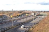
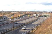
The Edinburgh City Bypass, designated as A720, is one of the most important trunk road
s in Scotland
. Circling around the south of Edinburgh
, as the equivalent of a ring road
for the coastal city, it links together the A1 towards north-east England
, the A702
towards north-west England, the M8 through the Central Belt
towards Glasgow
, the A7 through south-east Scotland and north-west England as well as the A8 leading to the M9 for Stirling
and the Forth Road Bridge
.
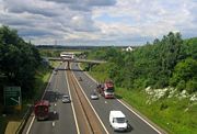
The road is dual carriageway
standard throughout, including emergency laybys and hard shoulders in areas. The road is classed as a special road in legal terms. Every motorway in the UK is termed a special road in that specific regulations govern its use. Not every special road is signed as a motorway and this bypass is one of those roads.
Between Gogar and Sheriffhall junctions (see below) the A720 forms part of European route E15
, which runs from Inverness
, in northern Scotland, to Algeciras
, in southern Spain
. North of Gogar, the E15 runs towards the A90
and the Forth Road Bridge
; and south of Sheriffhall along the A68
.
and Haddington
on the way to England
.
. This is a crucial route for traffic to south-east Scotland.
, the Sheriffhall location was deemed unsuitable for a flyover due to extensive mine workings underneath.
 The junction is hence a simple traffic-light controlled roundabout
and the evident traffic problems of forcing all through A720 traffic to halt is evident, worsened by the importance of the roads which intersect here - the A7 which leads north to the city centre and south to Carlisle, the former A68
which now leads to the town of Dalkeith and also has access to the A68, and a minor A-road, the A6106. Traffic jams at the roundabout are common at most times of day.
junction.
. This road is important for access to the southern suburbs.
as well as being a scenic route to Glasgow, avoiding the M8.
on the bypass. Local roads including the B701, and Dreghorn Barracks
are also accessed from this junction.
meets the bypass at a roundabout over the carriageway, and the M8 terminates at a roundabout under the carriageway, along with access to Hermiston Gait retail park. The slip roads to the separate roundabouts interweave with each other resulting in a tangle of curves and carriageways which is at one point 15 lanes wide.
The A71 provides one of the main routes into Edinburgh via Calder Road, and west to Livingston and Kilmarnock. The M8 runs to Glasgow and provides direct access to M9 for Stirling, and via the A90 to the Forth Road Bridge
.
, or can head west out to Edinburgh Airport
and the M9 for Stirling, with connecting roads leading to all places north.
Trunk road
A trunk road, trunk highway, or strategic road is a major road—usually connecting two or more cities, ports, airports, and other things.—which is the recommended route for long-distance and freight traffic...
s in Scotland
Scotland
Scotland is a country that is part of the United Kingdom. Occupying the northern third of the island of Great Britain, it shares a border with England to the south and is bounded by the North Sea to the east, the Atlantic Ocean to the north and west, and the North Channel and Irish Sea to the...
. Circling around the south of Edinburgh
Edinburgh
Edinburgh is the capital city of Scotland, the second largest city in Scotland, and the eighth most populous in the United Kingdom. The City of Edinburgh Council governs one of Scotland's 32 local government council areas. The council area includes urban Edinburgh and a rural area...
, as the equivalent of a ring road
Ring road
A ring road, orbital motorway, beltway, circumferential highway, or loop highway is a road that encircles a town or city...
for the coastal city, it links together the A1 towards north-east England
England
England is a country that is part of the United Kingdom. It shares land borders with Scotland to the north and Wales to the west; the Irish Sea is to the north west, the Celtic Sea to the south west, with the North Sea to the east and the English Channel to the south separating it from continental...
, the A702
A702 road
The A702 is a major road in Scotland, that runs from Edinburgh to St. John's Town of Dalry in Dumfries and Galloway. It is the last section of a sometimes recommended route between London and Edinburgh, the English and Scottish capitals, which now follows the M1, M6, A74 and A702 roads, rather than...
towards north-west England, the M8 through the Central Belt
Central Belt
The Central Belt of Scotland is a common term used to describe the area of highest population density within Scotland. Despite the name, it is not geographically central but is nevertheless situated at the 'waist' of Scotland on a conventional map and the term 'central' is used in many local...
towards Glasgow
Glasgow
Glasgow is the largest city in Scotland and third most populous in the United Kingdom. The city is situated on the River Clyde in the country's west central lowlands...
, the A7 through south-east Scotland and north-west England as well as the A8 leading to the M9 for Stirling
Stirling
Stirling is a city and former ancient burgh in Scotland, and is at the heart of the wider Stirling council area. The city is clustered around a large fortress and medieval old-town beside the River Forth...
and the Forth Road Bridge
Forth Road Bridge
The Forth Road Bridge is a suspension bridge in east central Scotland. The bridge, opened in 1964, spans the Firth of Forth, connecting the capital city Edinburgh, at South Queensferry, to Fife, at North Queensferry...
.
The road is dual carriageway
Dual carriageway
A dual carriageway is a class of highway with two carriageways for traffic travelling in opposite directions separated by a central reservation...
standard throughout, including emergency laybys and hard shoulders in areas. The road is classed as a special road in legal terms. Every motorway in the UK is termed a special road in that specific regulations govern its use. Not every special road is signed as a motorway and this bypass is one of those roads.
Between Gogar and Sheriffhall junctions (see below) the A720 forms part of European route E15
European route E15
The European route E 15 is part of the United Nations international E-road network. It is a north-south "reference road", running from Inverness, Scotland south through England and France to Algeciras, Spain...
, which runs from Inverness
Inverness
Inverness is a city in the Scottish Highlands. It is the administrative centre for the Highland council area, and is regarded as the capital of the Highlands of Scotland...
, in northern Scotland, to Algeciras
Algeciras
Algeciras is a port city in the south of Spain, and is the largest city on the Bay of Gibraltar . Port of Algeciras is one of the largest ports in Europe and in the world in three categories: container,...
, in southern Spain
Spain
Spain , officially the Kingdom of Spain languages]] under the European Charter for Regional or Minority Languages. In each of these, Spain's official name is as follows:;;;;;;), is a country and member state of the European Union located in southwestern Europe on the Iberian Peninsula...
. North of Gogar, the E15 runs towards the A90
A90 road
The A90 road is a major north to south road in eastern Scotland, running from Edinburgh to Fraserburgh in Aberdeenshire.From Edinburgh, it travels west and over the Forth Road Bridge, before turning into the M90 motorway. At Perth, the M90 again becomes the A90, now running north east to Dundee...
and the Forth Road Bridge
Forth Road Bridge
The Forth Road Bridge is a suspension bridge in east central Scotland. The bridge, opened in 1964, spans the Firth of Forth, connecting the capital city Edinburgh, at South Queensferry, to Fife, at North Queensferry...
; and south of Sheriffhall along the A68
A68 road
The A68 is a major road in the United Kingdom, running from Darlington in England to the A720 in Scotland.From Darlington, the road runs north, bypassing Bishop Auckland, and running through West Auckland, Toft Hill and Tow Law, past Consett and Corbridge...
.
Junctions
The A720 starts at the Old Craighall junction in the east where it meets the A1, from which traffic can approach Edinburgh city centre from the east, or run past MusselburghMusselburgh
Musselburgh is the largest settlement in East Lothian, Scotland, on the coast of the Firth of Forth, six miles east of Edinburgh city centre.-History:...
and Haddington
Haddington, East Lothian
The Royal Burgh of Haddington is a town in East Lothian, Scotland. It is the main administrative, cultural and geographical centre for East Lothian, which was known officially as Haddingtonshire before 1921. It lies about east of Edinburgh. The name Haddington is Anglo-Saxon, dating from the 6th...
on the way to England
England
England is a country that is part of the United Kingdom. It shares land borders with Scotland to the north and Wales to the west; the Irish Sea is to the north west, the Celtic Sea to the south west, with the North Sea to the east and the English Channel to the south separating it from continental...
.
Junction 1: Millerhill
This junction comes shortly after the eastern start of the A720, which was completed in 2008 as the Dalkeith Northern Bypass of the A68A68 road
The A68 is a major road in the United Kingdom, running from Darlington in England to the A720 in Scotland.From Darlington, the road runs north, bypassing Bishop Auckland, and running through West Auckland, Toft Hill and Tow Law, past Consett and Corbridge...
. This is a crucial route for traffic to south-east Scotland.
Junction 2: Sheriffhall Roundabout
About 1.5 miles further is the most congested junction located on the bypass. Whereas all the other junctions on the bypass are grade separatedGrade separation
Grade separation is the method of aligning a junction of two or more transport axes at different heights so that they will not disrupt the traffic flow on other transit routes when they cross each other. The composition of such transport axes does not have to be uniform; it can consist of a...
, the Sheriffhall location was deemed unsuitable for a flyover due to extensive mine workings underneath.
Roundabout
A roundabout is the name for a road junction in which traffic moves in one direction around a central island. The word dates from the early 20th century. Roundabouts are common in many countries around the world...
and the evident traffic problems of forcing all through A720 traffic to halt is evident, worsened by the importance of the roads which intersect here - the A7 which leads north to the city centre and south to Carlisle, the former A68
A68 road
The A68 is a major road in the United Kingdom, running from Darlington in England to the A720 in Scotland.From Darlington, the road runs north, bypassing Bishop Auckland, and running through West Auckland, Toft Hill and Tow Law, past Consett and Corbridge...
which now leads to the town of Dalkeith and also has access to the A68, and a minor A-road, the A6106. Traffic jams at the roundabout are common at most times of day.
Junction 3: Gilmerton
This is a small junction which is for the A772, that used to be the A7 until the mid 1990s. This road leads to Cameron Toll shopping centre as well as the A701 and the city centre. There is evidence that western slip-roads were considered at the roundabout to join the A772.Junction 4: Lasswade
Just shortly after the Gilmerton junction, comes the LasswadeLasswade
Lasswade is a civil parish and village in Midlothian, Scotland, on the River North Esk, nine miles south of Edinburgh city centre, between Dalkeith and Loanhead...
junction.
Junction 5: Straiton
This junction includes access to Straiton Retail Park, Costco and IKEA, this junction also provides access to the A701A701 road
-Route:The A701 leaves Dumfries and travels north to meet the A74 at Beattock. It thens joins the A74 for a short spell before branching off to the north-east towards Moffat and ultimately Edinburgh....
. This road is important for access to the southern suburbs.
Junction 6: Lothianburn
This junction was the original eastern terminus of the road. This is a major junction with the A702, which provides access to western England, via Abington and the A74(M) to Carlisle and the M6M6 motorway
The M6 motorway runs from junction 19 of the M1 at the Catthorpe Interchange, near Rugby via Birmingham then heads north, passing Stoke-on-Trent, Manchester, Preston, Carlisle and terminating at the Gretna junction . Here, just short of the Scottish border it becomes the A74 which continues to...
as well as being a scenic route to Glasgow, avoiding the M8.
Junction 7: Dreghorn
This junction primarily provides access to the only servicesRest area
A rest area, travel plaza, rest stop, or service area is a public facility, located next to a large thoroughfare such as a highway, expressway, or freeway at which drivers and passengers can rest, eat, or refuel without exiting on to secondary roads...
on the bypass. Local roads including the B701, and Dreghorn Barracks
Dreghorn Barracks
Dreghorn Barracks are located in Edinburgh, Scotland. The barracks are situated at the southern edge of the city, south of Colinton, and adjacent to the Edinburgh City Bypass. The present barracks complex was largely built in 1937–1939 to designs by William Alexander Ross. The barracks were...
are also accessed from this junction.
Junction 8: Baberton
This junction was the original western terminus of the road. It provides direct access to the suburb of Baberton and indirect access to the A70, for Lanark, or the centre of Edinburgh.Junction 9 & 10: Calder and Hermiston Gait
The centre of these junctions are within half a mile of each other, with a tangle of inter-weaving slips roads, flyovers, and underpasses between and either side of them. The A71A71 road
The A71 is a major road in Scotland linking Edinburgh with Lanarkshire and Ayrshire. It adjoins the Livingston Bypass A899.It runs south west from Edinburgh for approximately 70 miles, through Saughton, Wilkieston and south of Livingston, Whitburn and Wishaw, then by way of the Garrion Bridge,...
meets the bypass at a roundabout over the carriageway, and the M8 terminates at a roundabout under the carriageway, along with access to Hermiston Gait retail park. The slip roads to the separate roundabouts interweave with each other resulting in a tangle of curves and carriageways which is at one point 15 lanes wide.
The A71 provides one of the main routes into Edinburgh via Calder Road, and west to Livingston and Kilmarnock. The M8 runs to Glasgow and provides direct access to M9 for Stirling, and via the A90 to the Forth Road Bridge
Forth Road Bridge
The Forth Road Bridge is a suspension bridge in east central Scotland. The bridge, opened in 1964, spans the Firth of Forth, connecting the capital city Edinburgh, at South Queensferry, to Fife, at North Queensferry...
.
Junction 11: Gogar Junction
Finally the road swings north to finish on the A8 at Gogar Roundabout. The original junction was a simple roundabout connecting both roads, and access to South Gyle and Edinburgh Park. The roundabout now has an underpass for traffic on the A8. From this junction there, traffic can proceed into Edinburgh City Centre by an alternative route through CorstorphineCorstorphine
Corstorphine was originally a village to the west of—and separate from—Edinburgh, Scotland, and is now a suburb of that city.Corstorphine retains a busy main street with many independent small shops, although a number have closed in recent years since the opening of several retail parks...
, or can head west out to Edinburgh Airport
Edinburgh Airport
Edinburgh Airport is located at Turnhouse in the City of Edinburgh, Scotland, and was the busiest airport in Scotland in 2010, handling just under 8.6 million passengers in that year. It was also the sixth busiest airport in the UK by passengers and the fifth busiest by aircraft movements...
and the M9 for Stirling, with connecting roads leading to all places north.